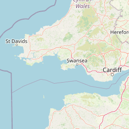
Why Exmoor National Park stands out
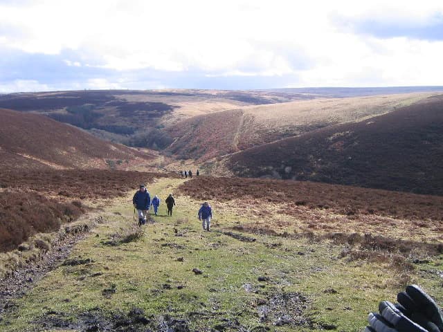
Exmoor is best known for its extensive heather moorland, which covers approximately a quarter of the park and transforms into a sea of purple bloom each August. The park is famous for its population of Exmoor ponies, a landrace that may be the closest living descendant of wild horses in Europe and is now classified as endangered. The dramatic coastline features towering cliffs, hidden coves, and the highest sea cliffs on mainland Britain, while the inland areas contain ancient woodlands, river valleys, and the remains of prehistoric settlements. Exmoor gained international recognition in 2011 when it became Europe's first International Dark Sky Reserve, designated by the International Dark-Sky Association, making it one of the best places in Britain for stargazing.
Exmoor National Park history and protected-area timeline
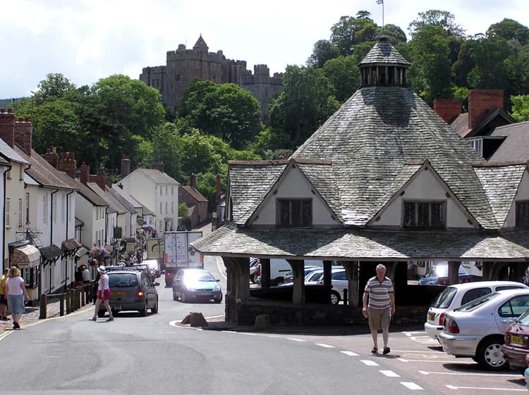
Exmoor's history as a protected landscape stretches back to its designation as a royal forest in the medieval period, with the first recorded wardens named in the Domesday Book of 1086 as foresters of Widepolla, with Withypool serving as the ancient capital of the forest. The royal forest originally covered 18,810 acres and was officially surveyed between 1815 and 1818 before being sold off in sections in the early 19th century, with John Knight purchasing a quarter of the forest including Simonsbath House for £50,000 in 1818. Prior to the medieval period, the area shows evidence of continuous human occupation from Mesolithic times through the Neolithic, Bronze Age, and Iron Ages, with remains of standing stones, cairns, and settlements still visible across the moor. The prehistoric Tarr Steps, a clapper bridge across the River Barle dating from around 1000 BC and made from stone slabs weighing up to five tonnes, represents one of the most significant ancient monuments in the park. During the Middle Ages, sheep farming for the wool trade became dominant, with the wool being spun on isolated farms and processed in thriving towns such as Dunster, where the historic Yarn Market still stands as testimony to this commercial heritage. The 1954 designation as a National Park marked the beginning of formal protection, though the landscape had already been shaped by centuries of traditional farming practices and the unique cultural traditions of the moorland communities.
Exmoor National Park landscape and geographic character
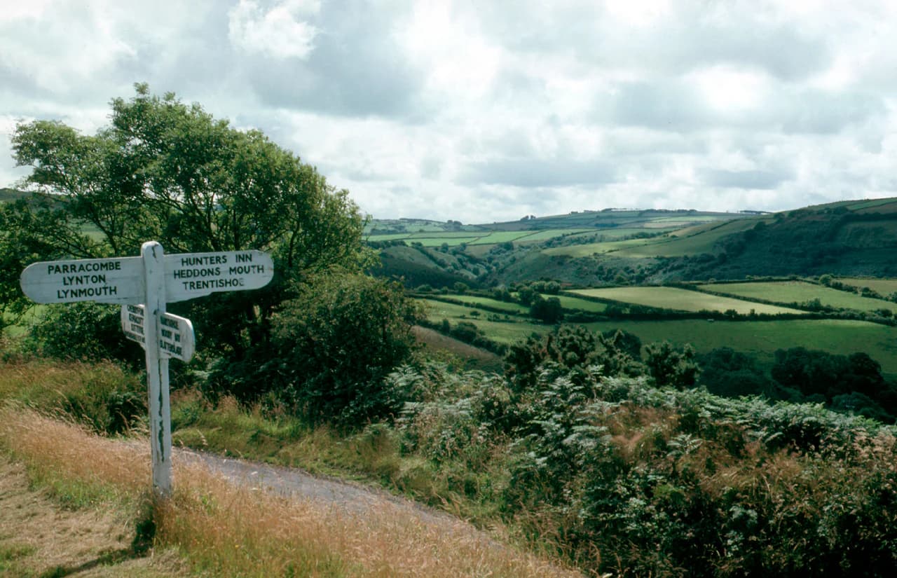
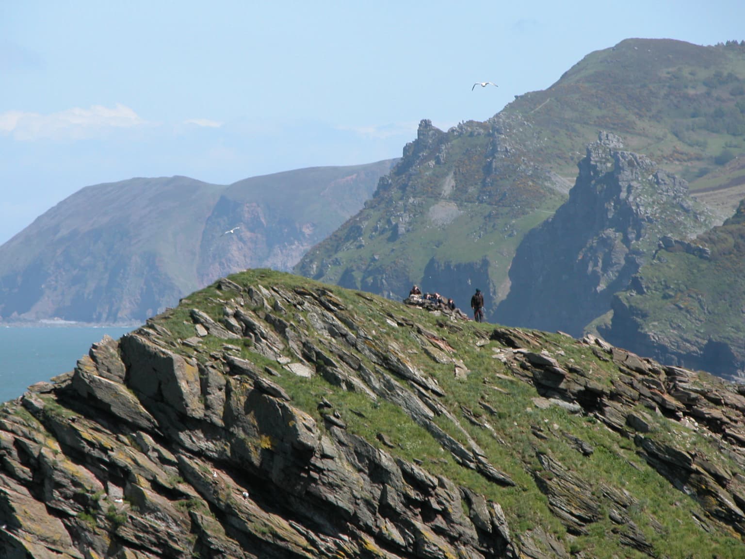
The landscape of Exmoor presents a dramatic tapestry of contrasts, from the open heather-dominated moors of the high ground to the lush, tree-lined valleys and the rugged coastline of the Bristol Channel. The plateau-like uplands are among the oldest landforms in Britain, having escaped the glaciation that shaped much of the rest of the country, resulting in a landscape that retains features from earlier geological periods. The coastline stretches for 55 kilometres and features some of the most spectacular sea cliffs in England, with Great Hangman near Combe Martin rising to 318 metres and holding the distinction of being the highest sea cliff on mainland Britain. The coastal hills reach their maximum height at Culbone Hill at 414 metres, while between Porlock and Foreland Point, the woodlands descend to the shoreline, forming the longest stretch of coastal woodland in England and Wales. The deeply incised valleys, such as the East Lyn Valley and the Barle Valley, carve through the moors, creating intimate landscapes of cascading waterfalls, ancient woodlands, and grassy lanes that represent some of the most picturesque scenery in the park. The Valley of Rocks beyond Lynton is a particularly striking landscape feature, a dry valley running parallel to the sea and capped on its seaward side by dramatic rock formations.

Exmoor National Park ecosystems, habitats, and plant life
Exmoor's ecological character is defined by a complex mosaic of habitats that support an exceptional diversity of flora and fauna, reflecting the variety of terrain, soil types, and climatic conditions within the park. The heath communities, classified as south-western lowland heath in the British National Vegetation Classification system, dominate the open moors and represent some of the finest examples of this habitat type in Britain. Where these heaths transition to ancient woodlands through the upland heath, they give way to areas of blanket mire, a peat-forming habitat that has developed over thousands of years in the wet, cool conditions of the high ground. The park contains around 3,000 hectares of Forestry Commission woodland, comprising a mixture of broad-leaved species including oak, ash, and hazel alongside coniferous plantations, with Horner Woodlands and the woodlands around Tarr Steps representing some of the finest examples of semi-natural woodland. The Exmoor Coastal Heaths have been recognised as a Site of Special Scientific Interest due to the exceptional diversity of plant species present, while the park's rivers including the Barle support submerged aquatic plants such as alternate water-milfoil and provide important habitats for migratory fish.
Exmoor National Park wildlife and species highlights
The wildlife of Exmoor is remarkably diverse, with the park providing habitats for numerous species that are rare or declining elsewhere in Britain. The Exmoor pony represents the most iconic wildlife symbol of the park, a landrace that has roamed the moors for centuries and may be the closest living descendant of wild horses remaining in Europe. These sturdy ponies are rounded up annually to be marked and checked, with the Acland Herd, also known as the Anchor Herd, still containing direct descendants of the thirty ponies taken by Sir Thomas Acland in 1818. The moorland supports significant populations of red deer, with the Emperor of Exmoor, a red stag, once holding the title of Britain's largest known wild land animal before being killed in 2010. Birdlife is particularly rich, with species such as merlin, peregrine falcon, Eurasian curlew, Dartford warbler, and ring ouzel breeding on the moors, while the river valleys support dipper and grey wagtail. The Chains area supports an exceptional population of the heath fritillary butterfly, one of Britain's rarest butterflies, while the ancient woodlands host important populations of lichens, mosses, and ferns, including species unique to Exmoor such as the Devon whitebeam.

Exmoor National Park conservation status and protection priorities
Exmoor holds significant conservation importance at both national and international levels, with multiple designations reflecting the exceptional natural and geological value of the area. Several areas within the park have been declared Sites of Special Scientific Interest, including the Exmoor Coastal Heaths, North Exmoor covering over 12,000 hectares, and South Exmoor, each recognised for their outstanding flora, fauna, or geological features. The Chains site has been designated as a Geological Conservation Review site and is nationally important for its lowland heath communities, transitions from ancient woodland through upland heath to blanket mire, and its exceptional woodland lichen flora. In 1993, an environmentally sensitive area was established within Exmoor to provide additional protection and support for the traditional farming practices that maintain the landscape character. The designation as Europe's first International Dark Sky Reserve in 2011 by the International Dark-Sky Association further recognises Exmoor's exceptional dark skies, with the low light pollution allowing views of the Milky Way and thousands of stars that are rarely visible in more densely populated parts of Britain.
Exmoor National Park cultural meaning and human context
The cultural heritage of Exmoor is deeply intertwined with the landscape, reflecting centuries of human activity that have shaped and been shaped by the terrain. The area shows evidence of continuous occupation from Mesolithic times, with the remains of prehistoric settlements, standing stones, and burial cairns scattered across the moor providing tangible connections to the ancient past. The medieval period saw the establishment of the royal forest, with wardens and foresters managing the area from at least the time of the Domesday Book, and the system of agistment that allowed outside farmers to graze their livestock on the commons shaped both the economy and the landscape. The wool trade dominated the medieval economy, with sheep farming transforming the moor into a productive agricultural landscape and towns such as Dunster becoming important centres for the trade. The park has inspired numerous works of literature, most famously R.D. Blackmore's novel Lorna Doone, which romanticised the landscape and its history, while the poet Samuel Taylor Coleridge walked the hills and valleys that now form part of the Coleridge Way footpath. The traditional farming practices, including the annual rounding up of Exmoor ponies and the continued use of traditional sheep breeds such as Exmoor Horn, maintain living connections to the cultural traditions that have defined the area for generations.
Top sights and standout views in Exmoor National Park
Exmoor offers an exceptional range of attractions, from the sweeping heather moors that turn purple in late summer to the dramatic coastline where cliffs reach heights unmatched on mainland Britain. The walking opportunities are outstanding, with the South West Coast Path, Britain's longest National Trail, starting at Minehead and following the entire 55-kilometre coastline, while the Two Moors Way and Coleridge Way provide inland routes through the most scenic valleys and woodlands. The wildlife is remarkable, with the chance to see Exmoor ponies roaming freely, red deer on quiet hillsides, and rare birds such as Dartford warbler and peregrine falcon. The dark sky designation makes Exmoor one of the best places in Britain for astronomy, while the historic features including the prehistoric Tarr Steps, the medieval hunting forest, and the Victorian railways tell stories of human ingenuity and adaptation to this challenging landscape.
Best time to visit Exmoor National Park
Exmoor offers distinct experiences throughout the year, with each season revealing different aspects of the park's character. Late summer, particularly August, sees the heather in full bloom across the moors, creating one of the most spectacular displays of purple in the British countryside and drawing visitors specifically to witness this annual transformation. Spring brings snowdrops to Snowdrop Valley near Wheddon Cross, carpeting the valley in white flowers from February, followed by bluebells in the woodlands and nesting birds throughout the moors. Autumn offers golden colours in the woodlands and the rutting season for red deer, while winter, though often wet and windy, can produce dramatic snow scenes on the higher ground and offers the chance to see the landscape in its most elemental mood. The dark skies are particularly spectacular in autumn and winter when the longer nights and clearer conditions combine to reveal the full richness of the night sky, though the International Dark Sky Reserve designation ensures excellent stargazing throughout the year.