
Lakes
Park geography
Detailed analysis of regional context, spatial spans, and terrain characteristics
Comprehensive Geographic Profile and Mapped Boundaries of Hamra National Park, Sweden
Examine the physical geography and spatial dimensions of Hamra National Park in Gävleborg County. This structured profile maps the park landscape, covering its 13.83 square kilometer area and the distribution of local natural features including boreal wetlands, forest ecosystems, and river systems such as the Voxnan.
Old-growth coniferous forest and vast mires in central Sweden's Dalarna region
Hamra National Park
Hamra National Park is a protected area in Ljusdal Municipality, Gävleborg County, in central Sweden. The park is situated in the Dalarna region, within the Orsa Finnmark area, and lies at an elevation of approximately 410 to 415 meters above sea level. Established in 1909 as one of Sweden's earliest national parks, it originally covered just 28 hectares. A major expansion in 2011 increased the park to 1,383 hectares, making it a significant conservation area in the country. The park protects a landscape of old-growth coniferous forest surrounding a distinctive moraine hill, together with extensive interconnected mire systems that have never been drained or subjected to timber floating operations.
- Location
- Sweden
- Park type
- National park
- Established
- 1909
- Area
- 13.8 km²
Location overview
Regional Placement within Gävleborg County and Ljusdal Municipality
Geographic Location and Regional Setting of Hamra National Park
Hamra National Park sits within Ljusdal Municipality inside Gävleborg County, Sweden. Factual regional mapping highlights a terrestrial, non-transboundary profile within Swedish borders.
- Countries
- Sweden
- Regions
- Gävleborg County, Ljusdal Municipality
- Primary location
- Gävleborg County
- Geographic setting
- Inland
Boundary and coordinates
Measuring the 13.83 square kilometer land area and spatial limits
Mapping the Boundaries and Spatial Extent of Hamra National Park
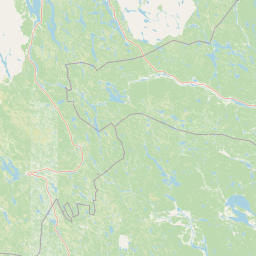
Interactive geographic mapping traces the protected boundary to offer clear spatial context. Accompanying spatial facts outline the total land area, coordinates, geographic centre, and regional span.
- Boundary area
- 13.8 km²
- Boundary perimeter
- 30.1 km
- Northernmost point
- 61.7806° N
- Southernmost point
- 61.7323° N
- Easternmost point
- 14.9312° E
- Westernmost point
- 14.7294° E
- Geographic centre
- 61.7569° N, 14.808° E
- North–south span
- 5.4 km
- East–west span
- 10.7 km
Terrain and natural features
Lowland landscape classification and recorded water systems
Hamra National Park Terrain and Mapped Natural Features
Hamra National Park features a lowland relief classification alongside recorded lakes, rivers, and wetlands within its boundaries. Linked feature cards supply specific names, types, and spatial relationships for each mapped natural element.
Selected named natural features
Rivers
Svartån
Lakes
Ormtjärnen
Lakes
Hälltjärnen
Wetlands
Brunnstjärnsmyran
Lakes
Bäverdammstjärnarna
Environmental setting
Boreal forest cover, lowland relief, and major water systems
Hamra National Park Environmental Classification and Physical Setting
Recorded classifications frame the physical setting of Hamra National Park through complementary landscape and climate categories. Stored data points connect individual environmental traits to relevant atlas destinations across the region.
- Relief
- Lowland
- Climate
- Boreal
- Water
- Major water bodies
- Forest cover
- Mostly forested
- Seasonality
- Year-round
Landscape features
Forest · Wetland · Lakes · Rivers · Hills
Habitat types
Boreal forest · Wetland · Riverine habitat · Peatland
Park atlas
Browse surrounding protected landscapes and compare park geography across Gävleborg County, Sweden
Explore Other National Parks and Protected Areas Near Hamra National Park
Browse national parks and protected areas near Hamra National Park, tracing their mapped extent across central Sweden's varied forest and mire landscapes. Compare different conservation landscapes, understand regional protected area spread, and discover more of Gävleborg County's unique natural terrain and waterways.
National parkSweden
77 km away#1 closest
Northwest

Sonfjället National Park: Mapped Alpine Terrain and Protected Landscape in Sweden
Explore the glacial geography and subalpine transition zones.
Sonfjället National Park is a key protected area in central Sweden, offering a unique glimpse into an alpine environment shaped by glacial forces. The park's landscape is characterized by the prominent Sånfjället mountain, steep glacial valleys, mires, and small lakes, showcasing raw, natural terrain. As a southern outpost for subalpine ecosystems, it presents a distinct ecological transition zone valuable for geographic discovery and understanding protected nature.
- IUCN
- II
National parkDalarna County
99 km away#2 closest
West
Fulufjället National Park: Protected Plateau Landscape and Transboundary Conservation in Dalarna County
Sweden's southernmost alpine plateau, mapped geography, and natural wonders.
Fulufjället National Park in Dalarna County, Sweden, protects a significant high plateau landscape, notable for its ancient sandstone geology and unique lichen-heath environments. This national park is home to Njupeskär, Sweden's tallest waterfall, and is part of a transboundary protected area with Norway. Explore the mapped terrain and distinct natural features of this important conservation area within the Scandinavian Mountains.
- Area
- 385 km²
- Established
- 2002
- IUCN
- II
- Visitors
- 53K annual
National parkNorway
About 114 km away#3 closest
West

Fulufjellet National Park: Protected Boreal Forest Landscape and Regional Geography
Explore mapped boundaries, rolling terrain, and transboundary conservation.
Fulufjellet National Park offers a detailed look at a protected boreal forest ecosystem in southeastern Norway. This page details the park's gently rolling hills, dominated by Norway spruce and Scots pine, interspersed with lakes and peat bogs. It highlights the park's designation as a national park, its establishment in 2012, and its contiguous protected status with Sweden's Fulufjället National Park, contributing to a significant transboundary conservation area. Users can explore its geographic features and protected landscape context within Scandinavia.
- Area
- 82.5 km²
- Established
- 2012
- IUCN
- II
- Relief
- Mountain
National parkDalarna County
122 km away#4 closest
West
Töfsingdalen National Park: Ancient Old-Growth Forest in Rugged Terrain
Remote protected landscape within Dalarna County, Sweden.
Töfsingdalen National Park showcases a rare example of an ancient, up-to-500-year-old pine forest thriving in extremely rugged, boulder-strewn valley terrain. This protected area, located in Sweden's Dalarna County, offers a glimpse into a near-wilderness landscape shaped by glacial forces and defined by its remoteness and ecological integrity. Discover the mapped park boundaries and the unique geographic context of this remarkably untouched natural reserve.
- Area
- 16.15 km²
- Established
- 1930
- IUCN
- II
- Relief
- Lowland
National parkInnlandet
About 137 km away#5 closest
West
Gutulia National Park: Protected Southernmost Mountain Birch Forest Landscape Atlas
Explore Norway's unique subarctic forest geography and park boundaries.
Gutulia National Park stands as a key protected area within Norway's Innlandet region, distinguished by its role in preserving the country's southernmost mountain birch forest ecosystem. Covering approximately 23 square kilometers, this national park provides critical insights into subarctic forest ecology at the southern extent of its natural range. MoriAtlas enables detailed exploration of its mapped terrain and geographic context, offering a valuable resource for understanding this significant protected landscape.
- Area
- 23 km²
- Established
- 1968
- IUCN
- II
- Scope
- Terrestrial
National parkInnlandet
About 145 km away#6 closest
West
Femundsmarka National Park: Exploring Norway's Distinctive Wetland and Boreal Protected Landscape
Mapped boundaries and regional geography in Innlandet.
Femundsmarka National Park in Innlandet, Norway, offers a profound look into a preserved wetland wilderness characterized by vast marshlands, numerous lakes, and scattered boreal forests. As a designated national park, its ecological significance is tied to the surrounding water systems and the unique landscape stretching towards the Swedish border. This entry provides detailed geographic context, mapping information, and an understanding of its protected area status, inviting exploration of its remote boreal terrain and notable wildlife habitats.
- Area
- 573 km²
- Established
- 1971
- IUCN
- II
- Relief
- Mixed relief
National parkVästmanland County
191 km away#7 closest
Southeast
Färnebofjärden National Park: Protected River Landscape and Birdlife Atlas
Explore Västmanland County's unique riverine protected area and mapped terrain.
Färnebofjärden National Park offers a unique geographic perspective as a protected national park situated in Sweden's Västmanland County. This page details the park's distinct riverine landscape, characterized by the Dalälven River's intricate network of channels, wetlands, and islands, and its position at a critical ecological frontier. Discover the mapped boundaries and regional context of this important protected area, renowned for its exceptional bird populations and diverse natural habitats.
- Area
- 101 km²
- Established
- 1998
- IUCN
- II
- Relief
- Lowland
National parkNorway
212 km away#8 closest
Northwest
Forollhogna National Park: Norway's Gently Rolling Alpine Protected Landscape Atlas
Explore unique terrain and vital wild reindeer habitat in Central Norway.
MoriAtlas provides structured geographic context for Forollhogna National Park, Norway's nineteenth national park. This area is best known for its distinctively gentle, rolling alpine terrain, a contrast to other Norwegian mountain ranges, and as a critical habitat for wild reindeer. Discover the park's unique landscape character, its role as a protected area, and the ongoing cultural traditions tied to its mountain pastures, all visualized within a comprehensive atlas framework.
- Area
- 1,062 km²
- Established
- 2001
- IUCN
- II
- Relief
- Mountain
MoriAtlas Explorer
Continue Your Atlas Exploration of Hamra National Park's Unique Landscape
Delve deeper into the geography and protected landscape of Hamra National Park. Understand its position within Gävleborg County and its significance as a preserved mire and old-growth forest ecosystem. MoriAtlas provides the structured data to trace the mapped boundaries and appreciate the distinct natural terrain of this vital Swedish national park.
Browse next
Global natural geography
Explore related park routes
Explore MoriAtlas Global ParksBrowse All MoriAtlas ParksGlobal Park Map DiscoveryMoriAtlas: Browse All CountriesBrowse All MoriAtlas ContinentsNational Park Environment AtlasGrand Canyon National Park AtlasYellowstone National Park AtlasYosemite National Park Atlas and GeographySerengeti National Park AtlasGalápagos National Park Protected LandscapeBanff National Park Geography and AtlasKruger National Park Atlas EntryUluṟu-Kata Tjuṯa National Park AtlasExplore Uluru-Kata Tjuta National Park GeographyPlitvice Lakes National Park AtlasFiordland National Park Protected LandscapeGreat Smoky Mountains National Park AtlasAfghanistan National Parks and Protected AreasAlbania National Parks and Protected AreasAlgeria National Parks and Protected AreasAmerican Samoa National Parks and Protected AreasAndorra National Parks and Protected AreasAngola National Parks and Protected AreasAntarctica National Parks and Protected AreasAntigua and Barbuda Park List