Mori Atlas logo
National parkHirkan National Park

Discover the mapped boundaries and geographic context of Azerbaijan's unique temperate rainforest.

Hirkan National Park: Ancient Hyrcanian Forests and Protected Landscape in Lankaran Rayon

(Hirkan Milli Parkı)

Hirkan National Park, a designated national park in southeastern Azerbaijan's Lankaran Rayon, preserves vast expanses of ancient, old-growth Hyrcanian forest. This protected area represents a crucial part of the Caspian Hyrcanian mixed forests ecoregion, safeguarding invaluable Tertiary relicts. Spanning diverse terrain from the Lankaran Lowland to the Talysh Mountains, the park's geography supports exceptional biodiversity and unique climate zones, making it a significant focus for atlas-based natural landscape discovery.

National ParkHyrcanian ForestsOld-Growth ForestTemperate RainforestEndemic SpeciesTertiary Relicts
Stylized illustration showing a lake surrounded by mountains and forest with a setting sun

Hirkan National Park

National park

Park overview

Structured park overview, official facts, and landscape profile for Hirkan National Park

Hirkan National Park park facts, protected area profile, and essential visitor context
Review the core facts for Hirkan National Park, including designation, size, terrain, visitor scale, habitats, and operating context in one park-focused overview.

About Hirkan National Park

Hirkan National Park protects the most significant remaining example of Caspian Hyrcanian forests in Azerbaijan, an ecosystem of global conservation importance. The park straddles the Talysh Mountains and the Lankaran Lowland in the country's southeastern corner, encompassing a remarkable gradient from subtropical lowland plains to subalpine zones. The Talysh region represents a biodiversity hotspot where species from the Caucasus, Hyrcanian, and Caspian basins meet and interact, creating a unique ecological tapestry. The park's forests have never been cleared for agriculture or interrupted by settlements, representing one of the most intact forest landscapes in the Caucasus region. The protected area was created to preserve complex natural ecosystems, protect Tertiary relicts and endemic plant species, conserve typical flora and fauna species listed in Azerbaijan's Red Book, conduct environmental monitoring, support scientific research, and provide controlled ecotourism opportunities. The park forms part of a transboundary forest complex extending into Iran, representing one of the most significant remaining blocks of Hyrcanian forest in the world.

Quick facts and research context for Hirkan National Park

Hirkan National Park occupies the southeastern Caspian slope region of Azerbaijan in the Talysh Mountains corridor. The park is 99 percent forested, with forests unbroken by settlements or pastures, representing one of Azerbaijan's largest intact forest complexes. Elevation ranges from the Lankaran Lowland up through montane zones to approximately 1,600 meters. The park experiences Azerbaijan's highest precipitation, with annual rainfall between 1,400 mm and 1,800 mm depending on elevation. It was established in 2004, superseding the former Hirkan State Reserve, and enlarged in 2008. The park belongs to the Caspian Hyrcanian mixed forests ecoregion and became part of the UNESCO World Heritage listing in 2019.

Park context

Deeper park guide and search-rich context for Hirkan National Park

Hirkan National Park history, landscape, wildlife, and travel context
Explore Hirkan National Park through its history, landscape character, ecosystems, wildlife, conservation priorities, cultural context, and seasonal travel timing in a structured park guide built for atlas discovery and search intent.

Why Hirkan National Park stands out

Hirkan National Park is best known for its ancient Hyrcanian forests, which represent one of the few remaining temperate rainforests in the world and preserve species dating to the Tertiary period. The park contains exceptional biodiversity with approximately 150 endemic tree and shrub species, making it a global center for relict flora. The vertical forest zonation is particularly notable, with distinct vegetation bands transitioning from chestnut-leaved oak and ironwood forests in the lower slopes to oriental beech forests at higher elevations. The park also supports significant populations of large mammals including the Caucasian leopard, brown bear, and lynx, with the leopard confirmed by camera trap in 2007 after questions about the species' regional extinction. The Moscow Forest area represents the last remaining fragment of the lowland Hyrcanian forests that once covered the entire Lankaran Lowland before agricultural conversion.

A flock of flamingos flying over tall golden reeds against a clear blue sky
Flamingos in flight over reeds at Hirkan National Park

Hirkan National Park history and protected-area timeline

Hirkan National Park was established on February 9, 2004, by decree of the President of Azerbaijan, created on the territory of the former Hirkan State Reserve which it superseded. The initial protected area covered 29,760 hectares. On April 23, 2008, the park was significantly expanded by presidential decree to its current extent of 40,358 hectares. The expansion reflected growing recognition of the park's importance within the broader Hyrcanian forest ecosystem and the need for more comprehensive protection. The park's establishment followed decades of conservation efforts in the Talysh region, where the Hirkan State Reserve had provided baseline protection for the forest ecosystem since the Soviet era. The park's management falls under the Republic of Azerbaijan's Ministry of Ecology and Natural Resources. Documentation has been prepared for UNESCO World Heritage inscription, with the park now included as part of the Hyrcanian Forests World Heritage listing approved in 2019.

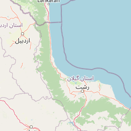
Hirkan National Park landscape and geographic character

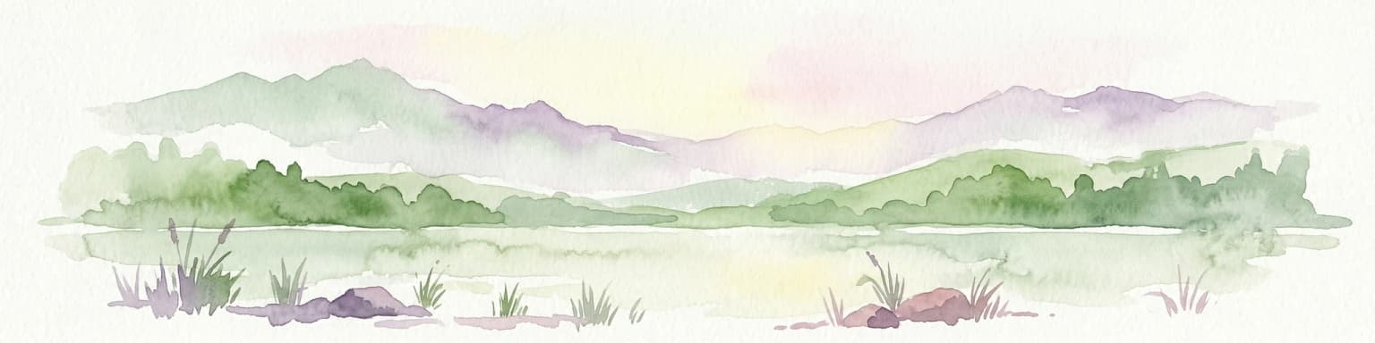
The landscape of Hirkan National Park encompasses the Talysh Mountains, a complex mountain system forming part of the Caspian basin watershed, descending to the Lankaran Lowland along the Caspian Sea coast. The terrain is predominantly mountainous with elevations ranging from near sea level in the lowland Moscow Forest area up to approximately 1,600 meters. The park lies in a region of exceptional orographic complexity where the Talysh range creates multiple microclimates and habitat niches. The Moscow Forest represents the only preserved portion of the original lowland Hyrcanian forest that once covered the entire Lankaran Lowland before extensive agricultural development. The park contains no settlements or pastures, with forests forming a contiguous, unbroken canopy across the entire protected area. The landscape is characterized by steep slopes, narrow valleys, and the characteristic lush green appearance created by the extremely high humidity and precipitation throughout the year.

Hirkan National Park ecosystems, habitats, and plant life

The nature of Hirkan National Park is defined by the Caspian Hyrcanian mixed forests ecoregion, one of the most distinctive and biodiversity-rich forest ecosystems in the temperate zone. These forests represent the southernmost extent of temperate broadleaved forests and include both subtropical and temperate rainforest types. The park contains approximately 435 tree and shrub species, of which 150 are endemic to the Hyrcanian forest region. The vegetation displays clear vertical zonation: lower slopes feature chestnut-leaved oak, ironwood, and Lenkoran acacia; middle elevations are dominated by Oriental beech and mixed oak-beech forests; higher zones transition to subalpine communities. The ecosystem preserves numerous Tertiary relict species that survived here because the region was not affected by the Pliocene and Pleistocene glaciations that eliminated similar forests elsewhere. This makes the park a living repository of ancient plant lineages. The extremely high humidity and precipitation, combined with old-growth forest structure, create unusually rich biota with exceptional species density.

Hirkan National Park wildlife and species highlights

The wildlife of Hirkan National Park is exceptionally diverse, with significant populations of large mammals and important bird communities. The Caucasian leopard, once thought extinct in Azerbaijan, was confirmed by camera trap in 2007 and remains the park's most iconic species. Other large mammals include lynx, brown bear, wild boar, wolf, golden jackal, jungle cat, red fox, roe deer, European badger, and Eurasian otter. The bird fauna includes endemic subspecies such as the Caspian tit and the Talysh Mountains subspecies of common pheasant. Waterfowl and wetland birds are found in the lowland areas, with flamingos among the notable species recorded. The park supports approximately 117 bird species, with 68 species breeding within the park boundaries. The mammalian fauna includes 40 species across six orders, with the Iranian leopard, brown bear, lynx, and forest cat among the species protected under Azerbaijan's Red Book.

Hirkan National Park conservation status and protection priorities

Hirkan National Park holds exceptional conservation significance as one of the most important protected areas in the Caucasus and Caspian region. The park protects the only remaining examples of lowland Hyrcanian forests and preserves an extraordinary concentration of endemic and relict species. The inclusion of the Hyrcanian Forests, including Hirkan, on the UNESCO World Heritage List in 2019 recognizes the site's outstanding universal value. The ecosystem is recognized as a global biodiversity hotspot, with species found nowhere else on Earth. Several reforestation programs are underway in the lowland areas, notably in designated non-forested lots within the Lankaran Lowland, aiming to restore portions of the original forest cover. The park serves as a critical refuge for endangered species including the Caucasian leopard and supports important populations of other protected mammals and birds. Conservation challenges include the need to balance protection with sustainable use and managing the park's relationship with surrounding agricultural lands in the productive Lankaran Lowland.

Hirkan National Park cultural meaning and human context

Hirkan National Park is located in the Talysh region of Azerbaijan, an area with a distinctive cultural identity influenced by its position along the Caspian coast and at the crossroads of Persian and Caucasian cultural spheres. The Talysh Mountains have historically supported communities whose relationship with the forest environment has shaped local traditions and land use patterns. While the park itself contains no settlements, the surrounding region has been inhabited for centuries, with agricultural terraces and traditional land use practices visible in the broader landscape. The park's Azerbaijani name, Hirkan Milli Parkı, reflects its national importance within Azerbaijan's system of protected areas. The region has also been noted for its philatelic significance, with Azerbaijani postal stamps issued featuring the park's landscapes and biodiversity.

Top sights and standout views in Hirkan National Park

The ancient Hyrcanian forest ecosystem, preserving Tertiary-era species that survived millions of years of climate change. The remarkable vertical forest zonation from subtropical lowland to subalpine zones within a single protected area. The confirmed presence of the Caucasian leopard, a flagship species confirmed by camera trap in 2007. The spectacular biodiversity with 150 endemic tree and shrub species and numerous relict plants found nowhere else on Earth. The UNESCO World Heritage recognition as part of the transboundary Hyrcanian Forests listing. The Moscow Forest, representing the last remnant of the original lowland forest that covered the Lankaran region. The exceptional precipitation and humidity creating one of the wettest environments in Azerbaijan and supporting temperate rainforest conditions.

Best time to visit Hirkan National Park

The park can be visited year-round, though the humid subtropical climate means precipitation is high in all seasons. The spring and summer months offer the most lush forest scenery with full canopy cover and active wildlife activity. Autumn brings colorful foliage as the deciduous forests change, while winter at higher elevations provides a different character. The high year-round humidity should be anticipated by visitors planning any season of travel.

Park location guide

Geography guide, regional context, and park location map for Hirkan National Park

Hirkan National Park park geography, regions, and map view in Azerbaijan
Understand where Hirkan National Park sits in Azerbaijan through a broader geographic reading of the surrounding landscape, nearby location context, and its mapped position within the national park landscape.

How Hirkan National Park fits into Azerbaijan

Azerbaijan is a unitary semi-presidential republic and one of six independent Turkic states. It declared independence from the Soviet Union in 1991 after nearly seven decades of Soviet rule. The country occupies 86,600 km² and has a population of approximately 10.3 million. It is known for its strategic location at the crossroads of Europe and Asia, its oil industry heritage, and its diverse cultural influences from Persian, Russian, and Turkic traditions.

Wider geography shaping Hirkan National Park in Azerbaijan

Azerbaijan occupies the eastern portion of the Caucasus region, situated between the Caspian Sea to the east and the Greater Caucasus mountains to the north. The terrain is diverse, featuring lowlands along the Caspian coast, mountainous areas in the north and west, and semi-desert plains in the central regions. The Kura and Aras rivers are major waterways draining into the Caspian Sea.

Map view of Hirkan National Park

Use this park location map to pinpoint Hirkan National Park in Azerbaijan, understand its exact geographic position, and read its mapped placement within the surrounding landscape more clearly.

Pigeon | © OpenStreetMap contributors

Location context for Hirkan National Park

Astara RayonLankaran Rayon

Visually explore Hirkan National Park's ancient Hyrcanian forests, diverse landscapes, and unique protected habitats.

Hirkan National Park Photos: Visualizing Ancient Hyrcanian Forest Landscapes and Habitats
Explore a visual atlas of Hirkan National Park through high-quality photography, showcasing its ancient Hyrcanian forests, diverse terrain, and distinct vertical vegetation zones. Understanding these protected landscapes provides essential insight into the park's relict ecosystems, unique habitats, and significant conservation value.

A flock of flamingos flying over tall golden reeds against a clear blue sky

Calm water with a small lush green island, clear blue sky, and scattered clouds

Park atlas

Map the surrounding protected landscapes of Lankaran Rayon and compare diverse natural ecosystems across Azerbaijan's southeastern region.

Explore Other National Parks Near Hirkan National Park: Discover Connected Protected Areas
Browse a curated selection of national parks and protected areas located near Hirkan National Park, extending your discovery into the unique landscapes of Azerbaijan's southeastern region. This geographic overview allows for direct comparison of diverse forest ecosystems, highlighting connected conservation landscapes and the regional spread of Hyrcanian relict flora.
National parkAzerbaijan

Shirvan National Park: Azerbaijan's Unique Protected Semi-Desert Ecosystem and Geography

Discover the mapped landscape, gazelle habitats, and wetland geography.

Shirvan National Park, located in Azerbaijan's Shirvan Lowland, safeguards a remarkable semi-desert environment situated on a former Caspian Sea floor. This protected area is distinguished by its low-lying terrain, ancient coastal ridges, and dune formations, providing essential habitat for the world's largest concentration of goitered gazelles. Wetlands around Çala Lake also support significant migratory bird populations, making Shirvan a crucial protected landscape for both terrestrial and avian wildlife and a key site for regional geographic study.

Area
543.735 km²
Established
2003
Relief
Lowland
Climate
Arid
National parkAzerbaijan

Ag-Gel National Park

Azerbaijan Protected Wetland & Bird Sanctuary

Ag-Gel National Park is a protected wetland significant for migratory birds. Its landscape features a complex lake system and extensive reed beds, making it a vital conservation area in the Caspian region.

Area
179.24 km²
Established
2003
Relief
Lowland
Climate
Arid
National parkSyunik Province

Arevik National Park: Syunik Province's Protected Mountain Landscape and Biodiversity Atlas

Explore mapped boundaries, terrain, and ecosystems.

Arevik National Park offers a detailed look into the geography and protected landscape of Armenia's Syunik Province. This park is defined by the rugged Zangezur mountains and its remarkable vertical ecological zoning, transitioning from semi-desert to alpine environments. Examine its mapped terrain, significant butterfly and bird habitats, and the presence of key mammal species, providing a comprehensive atlas-style understanding of this protected area's natural identity.

Area
344 km²
Established
2009
IUCN
II
Relief
Mountain
Watercolor painting of rolling hills, a body of water, and vegetation
National parkBaku

Absheron National Park: Coastal Azerbaijan National Park with Caspian Seal Habitats

Explore mapped geography and semi-desert terrain near Baku.

Absheron National Park, located near Baku on the Absheron Peninsula, is a significant national park safeguarding coastal Caspian Sea environments. Its protected landscapes feature semi-arid terrain and are vital for the conservation of Caspian seals and migratory waterbirds. MoriAtlas provides a structured overview of this unique protected area, focusing on its geographic features, ecological importance, and its role as a key national park within Azerbaijan's atlas of natural reserves.

Area
7.83 km²
Established
2005
Relief
Lowland
Climate
Arid
National parkOrdubad District

Zangezur National Park: National Park and Protected Mountain Wilderness in Ordubad District

Explore dramatic glacial terrain and the highest Lesser Caucasus peaks.

Zangezur National Park encompasses a significant portion of the Zangezur mountain range, presenting a striking high-altitude protected landscape within Ordubad District, Azerbaijan. Its geography is characterized by rugged alpine features, extensive glacial formations, and dramatic elevation changes culminating in the Gemiqaya summit. This park serves as a vital refuge for diverse ecosystems and is distinguished by its role in preserving the highest mountain terrain in Azerbaijan's Lesser Caucasus, offering a unique focal point for geographic and protected-area exploration.

Area
427.97 km²
Established
2003
Relief
Mountain
Climate
Temperate
National parkAzerbaijan

Altyaghach National Park: Azerbaijan's Protected Natural Area & Forested Geography

Explore the mapped boundaries and temperate deciduous forests.

Altyaghach National Park is a key protected area in Azerbaijan, safeguarding a significant portion of the Greater Caucasus's temperate deciduous broadleaved forest ecosystems. Covering over 11,000 hectares, the park is instrumental in preserving biodiversity and restoring natural habitats, notably providing refuge for the rare East Caucasian tur and other protected species. Its landscape, characterized by rolling to steep terrain and diverse forest cover reaching approximately 941 meters in elevation, makes it a representative example of Caucasus mountain conservation within the country.

Area
110.35 km²
Established
2004
Relief
Mixed relief
Climate
Temperate
Watercolor painting of layered mountains with green, yellow, and pink hues.
National parkAzerbaijan

Shahdag National Park: Azerbaijan's Largest National Park and Highest Mountain Landscape

Explore the Greater Caucasus protected area and its unique ecosystems.

Shahdag National Park is the largest protected area in Azerbaijan, encompassing a significant portion of the Greater Caucasus mountain range. This national park is renowned for its dramatic elevation changes, creating diverse ecosystems that transition from dense, old-growth montane forests to high-alpine meadows and rugged, rocky summits. The park's landscape is defined by its towering peaks, including Mount Bazardüzü, the nation's highest point, and provides critical habitat for endemic species like the East Caucasian tur. Use this page to begin your atlas-based exploration of Shahdag National Park's protected geography and its distinctive natural terrain.

Area
1,305.08 km²
Established
2006
Relief
Mountain
Scope
Terrestrial
National parkAzerbaijan

Göygöl National Park: Iconic Alpine Lakes and Protected Caucasus Forest Landscape

Explore Azerbaijan's most visited national park and its rich geographic context.

Göygöl National Park is a key protected area in Azerbaijan, renowned for the crystal-clear alpine Lake Göygöl and its surrounding dense forests within the Lesser Caucasus mountains. This national park showcases over 420 plant species, significant wildlife populations, and dramatic mountainous terrain, making it a prime destination for understanding regional landscape diversity and protected land value. Use MoriAtlas to explore its mapped boundaries and connect it to the broader geographic context of Azerbaijan.

Area
127.55 km²
Established
2008
Relief
Mountain
Climate
Temperate

Common questions about visiting, size, designation, and location context for Hirkan National Park

Hirkan National Park FAQs for park facts, access, geography, and protected area context
Find quick answers about Hirkan National Park, including protected-area facts, park geography, trail and visitor context, and how the park fits into its surrounding country and regional landscape.
MoriAtlas Explorer

Continue Your Protected Areas Search Across the Global Atlas

Deepen your exploration by continuing the structured search for national parks and protected areas worldwide. Utilize the comprehensive filtering capabilities to compare different conservation landscapes and refine your understanding of global park geography. Discover more about the distribution and characteristics of protected natural areas.

Global natural geography