
Lakes
Park geography
Analyze the spatial distribution, terrain relief, and physical environmental characteristics
Comprehensive Geographic Profile and Mapped Boundaries of Hortobágy National Park, Hungary
This geographic profile details the physical scope and mapped spatial data of Hortobágy National Park, spanning 748.2 square kilometers across Jász-Nagykun-Szolnok, Borsod-Abaúj-Zemplén, Heves, and Hajdú-Bihar counties. The documentation covers the park's lowland relief, extensive wetland and grassland habitat classifications, and identifies various natural landmarks and water features within its primary boundaries.

Europe's largest semi-natural steppe grassland and Hungary's first national park
Hortobágy National Park
Hortobágy National Park is Hungary's premier protected area and the first national park established in the country in 1973. Located in the eastern portion of the Great Hungarian Plain (Alföld), this vast grassland covers approximately 74,820 hectares and represents the largest semi-natural grassland in Europe. The park was inscribed on the UNESCO World Heritage List in 1999 in recognition of its extraordinary cultural landscape that has been shaped by over four millennia of pastoral traditions. The distinctive puszta ecosystem, characterized by its alkaline steppe soils, sweeping horizons, and traditional Hungarian herding culture, creates a landscape unlike any other on the continent. Beyond its ecological significance, the park holds profound cultural importance as a living repository of Hungarian pastoral heritage, featuring traditional sweep wells, the iconic Nine-holed Bridge, and the continued presence of traditional animal breeds such as Hungarian Grey cattle and Racka sheep.
- Location
- Hungary
- Park type
- National park
- Established
- 1973
- Area
- 748.2 km²
Location overview
Regional administrative relationships across four major Hungarian counties
Geographic Positioning of Hortobágy National Park within Hungary
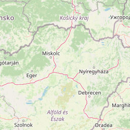
Hortobágy National Park spans Hungary's Hajdú-Bihar, Borsod-Abaúj-Zemplén, Heves, and Jász-Nagykun-Szolnok counties. Map data confirms its status as an entirely inland, non-transboundary terrestrial reserve.
- Countries
- Hungary
- Regions
- Borsod-Abaúj-Zemplén County, Hajdú-Bihar County, Heves County, Jász-Nagykun-Szolnok County
- Primary location
- Hungary
- Geographic setting
- Inland
Boundary and coordinates
Mapping the 748.2 square kilometers of protected spatial area
Hortobágy National Park Geographic Boundary Map and Spatial Limits
Interactive spatial boundaries outline the geographic shape and regional limits of Hortobágy National Park. Accompanying data details the estimated coordinates, center points, and total protected area of 748.2 square kilometers.
- Boundary area
- 792.5 km²
- Boundary perimeter
- 497.2 km
- Northernmost point
- 47.8472° N
- Southernmost point
- 47.3179° N
- Easternmost point
- 21.3786° E
- Westernmost point
- 20.6326° E
- Geographic centre
- 47.563° N, 21.059° E
- North–south span
- 58.8 km
- East–west span
- 56.1 km
Terrain and natural features
Mapped lowland terrain classification and recorded internal water bodies
Hortobágy National Park Terrain, Rivers, Lakes, and Natural Features
Recorded lowland terrain classifications encompass multiple protected lakes, rivers, viewpoints, and wetland environments. Structured feature cards detail individual names, types, and spatial relationships across the protected landscape.
Selected named natural features
Viewpoints
Madármegyfigyelő torony
4 m high
Lakes
Fényes-tó
Bays
Poroszlói-medence
Rivers
Hortobágy–Berettyó-főcsatorna
Viewpoints
Madár megyfigyelő torony
5 m high
Environmental setting
Temperate lowland terrain, extensive grasslands, and major aquatic networks
Hortobágy National Park Environmental Classifications and Physical Setting
Recorded landscape features and habitat types outline the temperate lowland conditions defining the physical setting of Hortobágy National Park. Stored classifications connect recorded environmental categories directly to related atlas destinations where available.
- Relief
- Lowland
- Climate
- Temperate
- Water
- Major water bodies
- Forest cover
- No forest cover
Landscape features
Grassland · Wetland · Rivers · Lakes
Habitat types
Grassland · Steppe · Wetland · Riverine habitat · Lacustrine habitat
Park atlas
Trace the geographic spread of protected landscapes surrounding Hortobágy National Park
Discover Other Protected Areas and National Parks Near Hortobágy National Park
Browse a curated selection of national parks and protected areas found in the vicinity of Hortobágy National Park, tracing the regional geography of Hungary's expansive Great Plain. This view facilitates direct comparison of diverse protected landscapes and unique conservation zones, deepening your understanding of Central European park contexts.
National parkBorsod-Abaúj-Zemplén County
25 km away#1 closest
Northwest

Bükk National Park: Hungary's Largest National Park with Karst Terrain
Explore mapped boundaries and unique protected landscapes.
Bükk National Park, a protected national park located in Borsod-Abaúj-Zemplén County, Hungary, is recognized for its immense karst landscape. This park offers a significant focus for atlas exploration, with its extensive cave systems, limestone plateaus, and ancient forests providing a unique geographic context for understanding protected areas. Discover the diverse terrain and geological features that define this expansive Hungarian national park.
- Area
- 431.3 km²
- Established
- 1977
- IUCN
- II
- Relief
- Mixed relief
Protected landscapeBihor County
About 65 km away#2 closest
Southeast

Cefa Natural Park Protected Landscape: Atlas and Geographic Context
Mapped wetland habitats and European bird migration routes.
Cefa Natural Park, designated as a protected landscape in Bihor County, Romania, offers significant insight into European wetland ecosystems and migratory bird patterns. Spanning 5,002 hectares, it features critical habitats such as marshes, floodplains, and the Rădvani Forest, positioned directly on the Pannonian, Bulgarian migration corridor. This park is a landmark for understanding regional geography and conservation efforts focused on migratory waterfowl and specialized halophytic vegetation. MoriAtlas provides the structured geographic data and mapped context necessary for detailed atlas-based discovery of this important protected area.
- Area
- 50.02 km²
- Established
- 2010
- IUCN
- V
- Relief
- Lowland
National parkHungary
71 km away#3 closest
Northwest
Aggtelek National Park
Karst Landscape & Cave Systems
Explore the protected area of Aggtelek National Park, a UNESCO World Heritage site known for its extensive karst landscapes and significant cave systems. Understand its geographic setting and protected land status.
- Area
- 198.92 km²
- Established
- 1985
- IUCN
- II
- Relief
- Mixed relief

Natural monumentHungary
About 82 km away#4 closest
Northwest
Baradla Cave: Karst Geography and Protected Subterranean Landscapes in Northern Hungary
A mapped overview of the Aggtelek Karst subterranean systems.
Baradla Cave functions as a protected natural monument, offering a comprehensive look at the geological processes within the Aggtelek Karst. The system is defined by its seven-kilometer main passage, giant chambers, and extraordinary variety of stalactite and stalagmite formations, revealing how climate and water have shaped the underground landscape over millennia.
- Established
- 1549
- Relief
- Upland
- Climate
- Temperate
- Access
- Easy access
National parkBékés County
About 83 km away#5 closest
South
Körös-Maros National Park: National Park Identity and Békés County Landscape Context
Explore its mapped protected areas, wetlands, and steppe grasslands.
Körös-Maros National Park is a designated national park located in Békés County, Hungary, recognized for its expansive wetland ecosystems and steppe grassland habitats. This protected area plays a critical role in the geography of the Southern Great Plain, serving as a vital migration corridor for diverse bird populations. Users can explore the park's distinct landscape features, mapped protected boundaries, and its significance as a hub for avian conservation.
- Area
- 501.34 km²
- Established
- 1997
- IUCN
- V
- Relief
- Lowland
National parkKošice Region
84 km away#6 closest
North

Slovak Karst National Park: Premier Central European Karst Landscape and Cave Systems
Explore protected terrain and mapped underground wonders in Košice Region.
Slovak Karst National Park offers an unparalleled glimpse into a dynamic karst environment. As a designated national park and UNESCO Biosphere Reserve, it preserves a significant concentration of caves, dramatic limestone formations, and rugged canyons within its territory in southeastern Slovakia. This atlas-focused presentation highlights the park's distinctive geology, mapped landscape features, and its importance as a protected natural area within the broader geography of the Košice Region. Understand the park's surface topography and its world-renowned subterranean realms.
- Area
- 346.11 km²
- Established
- 2002
- IUCN
- II
- Relief
- Mountain
National parkHungary
112 km away#7 closest
Southwest
Kiskunság National Park: Explore Hungary's Puszta Grassland and Unique Sand Dune Terrain
Discover protected landscapes, alkaline lakes, and bird habitats.
Kiskunság National Park in Hungary offers a rare glimpse into the traditional puszta grassland ecosystem, featuring dynamic sand dunes and numerous alkaline lakes. This protected area is vital for migratory bird populations and showcases a distinctive lowland geography shaped by natural processes and pastoral heritage. Explore its scattered territorial units to understand the unique landscape context of the Great Hungarian Plain.
- Area
- 530 km²
- Established
- 1975
- IUCN
- II
- Relief
- Lowland
National parkPest County
115 km away#8 closest
West
Danube-Ipoly National Park: Protected Landscape and Geographic Atlas
Mapping Hungary's diverse terrain and protected natural areas.
Delve into Danube-Ipoly National Park, a significant protected area renowned for its extraordinary ecological diversity. This page explores the park's distinct landscapes, from the volcanic formations of the Börzsöny Mountains to the deep karst cave systems of the Pilis, set against the backdrop of the Danube and Ipoly river floodplains. Understand its geographic placement within Pest County and its role as a vital protected landscape for conservation and atlas-based discovery.
- Area
- 603.14 km²
- Established
- 1997
- IUCN
- V
- Relief
- Mixed relief
MoriAtlas Explorer
Continue Exploring Hortobágy National Park's Mapped Geography and Protected Landscape
Delve deeper into the geographic identity of Hortobágy National Park, a premier example of a semi-natural grassland and a vital protected landscape. Understand its position within the broader regional geography and discover the mapped contours of its unique puszta ecosystem. This exploration helps build a structured atlas view of Hungary's protected areas, revealing the interconnectedness of its natural and cultural heritage.
Browse next
Global natural geography
Explore related park routes
Explore MoriAtlas Global ParksBrowse All MoriAtlas ParksGlobal Park Map DiscoveryMoriAtlas: Browse All CountriesBrowse All MoriAtlas ContinentsNational Park Environment AtlasGrand Canyon National Park AtlasYellowstone National Park AtlasYosemite National Park Atlas and GeographySerengeti National Park AtlasGalápagos National Park Protected LandscapeBanff National Park Geography and AtlasKruger National Park Atlas EntryUluṟu-Kata Tjuṯa National Park AtlasExplore Uluru-Kata Tjuta National Park GeographyPlitvice Lakes National Park AtlasFiordland National Park Protected LandscapeGreat Smoky Mountains National Park AtlasAfghanistan National Parks and Protected AreasAlbania National Parks and Protected AreasAlgeria National Parks and Protected AreasAmerican Samoa National Parks and Protected AreasAndorra National Parks and Protected AreasAngola National Parks and Protected AreasAntarctica National Parks and Protected AreasAntigua and Barbuda Park List