
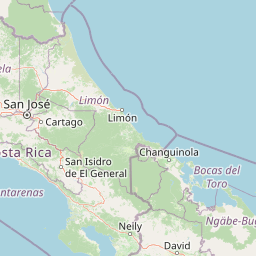
Volcanoes
Park geography
Explore detailed mountain terrain, mapped boundaries, and regional natural features.
Geography and Physical Landscape of Irazú Volcano National Park in Cartago Province
Examine the geographic characteristics of Irazú Volcano National Park, spanning twenty square kilometers within Costa Rica. This profile details the mountain relief, volcanic features, and hydrological systems defining this protected landscape across Cartago Province.
Related tags
active volcanocrater lakevolcanic landscapehighland forestwatershed protection
Active Costa Rican volcano with strikingly colored crater lakes
Irazú Volcano National Park
Irazú Volcano National Park is a protected area in central Costa Rica that encompasses the volcanic landscape surrounding Irazú Volcano, one of the country's most active and historically significant volcanoes. Located in Cartago Province within the Central Conservation Area, the park covers approximately 20 square kilometers and was established in 1955 to protect this ecologically and geologically significant highland environment. The park incorporates what was formerly known as the Ruben Torres Rojas Forest Reserve, now called the Prusia Forest Reserve, which forms an important component of the protected landscape. The volcano itself remains active, with its most recent major eruptions occurring between 1963 and 1965. Since then, occasional minor eruptions and small lava flows have continued to reshape the terrain and remind visitors of the dynamic geological forces at work beneath this region. The park features two notable volcanic craters: the Crater Principal, which contains a lake with unusual coloring caused by mineral dissolution, and the smaller Diego de la Haya crater to the east, which is dry and filled with volcanic ash. Beyond its volcanic significance, the park serves as a critical watershed protection area for the Reventado River and has been the focus of major reforestation efforts to restore forest cover lost during the eruption period. The combination of ongoing volcanic activity, unique crater lake features, and ecological restoration makes Irazú a distinctive destination for understanding Costa Rica's volcanic landscapes and conservation efforts.
- Location
- Costa Rica
- Park type
- National park
- Established
- 1955
- Area
- 20 km²
Location overview
Regional placement and administrative boundaries in Cartago Province
Geographic Location of Irazú Volcano National Park in Costa Rica
Irazú Volcano National Park is located within Cartago Province in the Central American nation of Costa Rica. Official records detail its administrative placement and non-coastal, mainland designation.
- Countries
- Costa Rica
- Regions
- Cartago Province
- Primary location
- Cartago Province
- Geographic setting
- Inland
Boundary and coordinates
Analyzing the 20 square kilometer terrestrial footprint and coordinates
Geographic Boundary Map and Spatial Limits of Irazú Volcano National Park
Mapped boundary outlines clarify the spatial position and physical layout of the protected territory. Structured data panels supplement the geometry with recorded land area, central coordinates, and geographic spans.
- Boundary area
- 20 km²
- Boundary perimeter
- 23.6 km
- Northernmost point
- 10.0007° N
- Southernmost point
- 9.9493° N
- Easternmost point
- 83.831° W
- Westernmost point
- 83.8996° W
- Geographic centre
- 9.9748° N, 83.8602° W
- North–south span
- 5.7 km
- East–west span
- 7.5 km
Terrain and natural features
Explore recorded mountain terrain classifications and associated natural features.
Irazú Volcano National Park Terrain and Named Natural Features
Stored mountain terrain classifications define the primary relief characteristics across the protected landscape. Individual feature cards present recorded names, types, measurements, and spatial relationships.
Selected named natural features
Volcanoes
Irazú Volcano
3,432 m
Forests
Bosque de Prusia
Rivers
Río Retes
Peaks
Cerro Cabeza de Vaca
3,082 m
Lakes
Cráter Diego de La Haya
Environmental setting
Interpreting alpine relief, forest cover, and habitat classifications across terrain
Irazú Volcano National Park Environmental Classifications and Physical Setting
Recorded classifications frame the physical setting through complementary landscape features, habitat types, and relief categories. Associated components connect these recorded data points directly to relevant atlas destinations across the protected geography.
- Relief
- Mountain
- Climate
- Alpine
- Water
- Major water bodies
- Forest cover
- Mostly forested
Landscape features
Mountains · Volcano · Forest · Woodland · Lakes · Rivers
Habitat types
Temperate coniferous forest · Temperate broadleaf forest · Riverine habitat · Montane forest
Park atlas
Browse nearby volcanic landscapes, highland forests, and diverse protected areas in central Costa Rica.
Explore Other National Parks and Protected Areas Near Irazú Volcano National Park
Discover additional national parks and protected areas near Irazú Volcano National Park, showcasing diverse volcanic landscapes, high-elevation forest ecosystems, and critical watershed protection zones. Compare these protected areas to understand regional ecological connections, trace distinct geological heritage, and broaden your atlas-based exploration of Costa Rica's conservation efforts.
National parkCosta Rica
6.1 km away#1 closest
Northeast

Turrialba Volcano National Park: Mapped Geography and Protected Landscape Context in Costa Rica
Explore the protected area's natural terrain and regional atlas placement
Turrialba Volcano National Park is a key protected landscape in Costa Rica, offering distinct geographic features and environmental context for atlas exploration. This page details the park's mapped boundaries and its significance as a national park, providing a foundation for understanding its place within the country's diverse natural terrain. Discover the unique geographic identity of this protected area and its role in the regional landscape.
- Area
- 16 km²
- Established
- 1955
- IUCN
- II
- Relief
- Mountain
National parkHeredia Province
7 km away#2 closest
Northwest
Braulio Carrillo National Park: Costa Rica's Protected Landscape in Heredia Province
National Park Boundaries and Regional Geography Exploration
Braulio Carrillo National Park represents a vital protected area, offering deep insights into its geographic setting within Heredia Province. This entry provides a focused view on the park's mapped boundaries and its identity as a national park, contributing essential data for regional geography and landscape atlas exploration. Understand the character of its protected terrain and its place within the broader mapped context.
- Area
- 475.8 km²
- Established
- 1978
- IUCN
- II
- Relief
- Mountain
National parkCosta Rica
22 km away#3 closest
South
Tapantí National Park: Costa Rica National Park Atlas and Mapped Landscape Exploration
Explore protected boundaries and natural terrain within its geographic setting.
Tapantí National Park is a designated national park in Costa Rica, offering specific insights into the country's protected natural landscapes. This page provides an atlas-style view of its geographic placement, the extent of its protected area, and the character of its natural terrain. Users can investigate the park's mapped context and understand its significance within the broader geography of Costa Rica, facilitating focused exploration of protected lands and regional landscape features.
- Area
- 583.2 km²
- Established
- 1982
- IUCN
- II
- Relief
- Mountain
National parkCosta Rica
34 km away#4 closest
South
Los Quetzales National Park: Costa Rica National Park Landscape and Mapped Geography
Explore protected area boundaries and regional terrain context.
Los Quetzales National Park, a designated national park within Costa Rica, offers a focused entry point for exploring protected landscapes. This page provides detailed insight into the park's geographic setting, emphasizing its mapped boundaries and its role within the national atlas. Users can discover the specific landscape characteristics and regional terrain that define Los Quetzales National Park, enriching their understanding of Costa Rican protected areas.
- Area
- 50 km²
- Established
- 2006
- IUCN
- II
- Relief
- Mountain
National parkAlajuela Province
40 km away#5 closest
Northwest
Poás Volcano National Park: National Park Protected Landscape in Alajuela Province
Mapped park boundaries and regional terrain context.
Poás Volcano National Park represents a vital protected landscape within Costa Rica's Alajuela Province. This detail page offers an atlas-centric view, emphasizing the park's geographic identity, its specific mapped boundaries, and its significance as a national park. Explore the natural terrain and understand the regional context of this protected area, ideal for geographic discovery and landscape exploration.
- Area
- 65 km²
- Established
- 1971
- IUCN
- II
- Relief
- Mountain
National parkLimón Province
About 45 km away#6 closest
East
Barbilla National Park: National Park Atlas Exploration and Geographic Context
Mapped protected landscape in Limón Province, Costa Rica
Barbilla National Park offers a focused view into Costa Rica's protected natural areas, specifically within the Limón Province. This entry provides an atlas-centric understanding of its geographic footprint and the character of its protected landscape. Explore the mapped boundaries and regional setting of this national park to enhance your structured geographic discovery.
- Area
- 119 km²
- Established
- 1982
- IUCN
- II
- Relief
- Mountain
National parkCartago Province
45 km away#7 closest
Southeast
Chirripó National Park: A Protected Landscape within Cartago Province's Geography
Explore its mapped boundaries and natural terrain.
This page provides detailed geographic context for Chirripó National Park, a designated national park located in the Cartago Province of Costa Rica. It focuses on the park's protected landscape identity, its position within the regional geography, and its distinct mapped boundaries. Understanding Chirripó National Park through its geographic and atlas-centric attributes offers a foundational insight into its natural significance.
- Area
- 508.49 km²
- Established
- 1975
- IUCN
- II
- Climate
- Alpine
National parkAlajuela Province
52 km away#8 closest
Northwest
Juan Castro Blanco National Park: National Park Boundaries and Alajuela Province Geography
Explore the protected landscape within north-central Costa Rica.
Juan Castro Blanco National Park offers a distinct protected landscape for geographic study within Alajuela Province. This national park serves as a key entity for exploring mapped boundaries, understanding local terrain, and situating its protected area within the broader atlas of Costa Rica. Delve into the specific geographic context and natural landscape features that define this important park.
- Area
- 145 km²
- Established
- 1992
- IUCN
- II
- Relief
- Mountain
MoriAtlas Explorer
Continue Exploring Irazú Volcano National Park's Geographic Context
Delve deeper into the atlas representation of Irazú Volcano National Park to understand its precise mapped boundaries and its role as a protected national park. Gain insights into its volcanic terrain and its relationship with the broader geography of Cartago Province, enhancing your geographic discovery.
Browse next
Global natural geography
Explore related park routes
Explore MoriAtlas Global ParksBrowse All MoriAtlas ParksGlobal Park Map DiscoveryMoriAtlas: Browse All CountriesBrowse All MoriAtlas ContinentsNational Park Environment AtlasGrand Canyon National Park AtlasYellowstone National Park AtlasYosemite National Park Atlas and GeographySerengeti National Park AtlasGalápagos National Park Protected LandscapeBanff National Park Geography and AtlasKruger National Park Atlas EntryUluṟu-Kata Tjuṯa National Park AtlasExplore Uluru-Kata Tjuta National Park GeographyPlitvice Lakes National Park AtlasFiordland National Park Protected LandscapeGreat Smoky Mountains National Park AtlasAfghanistan National Parks and Protected AreasAlbania National Parks and Protected AreasAlgeria National Parks and Protected AreasAmerican Samoa National Parks and Protected AreasAndorra National Parks and Protected AreasAngola National Parks and Protected AreasAntarctica National Parks and Protected AreasAntigua and Barbuda Park List