
Mori Atlas logo
National parkKomandorsky Islands National Park

A detailed geographic atlas of remote island terrain, basalt sea stacks, and vast Bering Sea marine boundaries.

Komandorsky Islands National Park: Mapping Russia's Massive Marine and Volcanic Wilderness

(Komandorsky Islands National Park named after S. V. Marakov)

Komandorsky Islands National Park forms a remote volcanic archipelago in the far northwestern Pacific Ocean, extending across the Aleutian arc toward the Kamchatka Krai region. This sprawling protected area encompasses both jagged island tundra and thousands of square kilometers of maritime territory, creating a vital corridor between the Bering Sea and the North Pacific. The geography features steep basalt cliffs, wave-cut platforms, and major marine mammal haul-outs that provide an essential refuge for seabird colonies and cetacean populations.

islandsmarine protected areavolcanic archipelagoseabird coloniespinniped haul-outscetacean monitoring
A flat-design digital illustration showing a view of rocky cliffs and green mountains meeting the sea under a soft sunset sky with stylized clouds.

Komandorsky Islands National Park

National park

Park overview

Structured park overview, official facts, and landscape profile for Komandorsky Islands National Park

Komandorsky Islands National Park park facts, protected area profile, and essential visitor context

Review the core facts for Komandorsky Islands National Park, including designation, size, terrain, visitor scale, habitats, and operating context in one park-focused overview.

About Komandorsky Islands National Park

Komandorsky Islands National Park occupies a singular position in Russian and Pacific conservation. It lies on the Commander Islands, an isolated archipelago at the western tip of the Aleutian arc where the volcanic spine of the North Pacific begins to descend toward the Kamchatka Peninsula. The park includes four principal islands, Bering Island, Medny Island, Toporkov Island and Ariy Kamen, along with more than 60 smaller islands and rocks and a vast surrounding marine belt.

The land area of the park is small in comparison with its maritime territory, but it carries extraordinary ecological weight. Wave-cut cliffs, headlands and tundra meadows support enormous seabird colonies, including species that nest in their thousands along the coastal belt. The surrounding waters of the Bering Sea and the North Pacific host spawning grounds for salmonids, feeding areas for migratory cetaceans, and major haul-out sites for pinnipeds. Because of this, the park functions as one of the most significant marine and island conservation areas in the Russian Far East.

Its identity is also historical. The Commander Islands were explored during Vitus Bering's second Kamchatka expedition in 1741 to 1742, and Bering himself is buried on Bering Island. The presence of Bering's expedition campsite, his grave and a number of geological monuments such as Steller's Arch on Bering Island give the park a notable cultural and exploratory heritage that complements its ecological profile. The administrative headquarters of the park is located on Bering Island in the village of Nikolskoye, the only permanent settlement in the archipelago.

The park's climate is relatively mild by Far Eastern standards, with comparatively cool summers, soft winters and a frost-free season that lasts roughly four to five months. Vegetation on the islands reflects this oceanic climate, supporting 383 species and subspecies of vascular plants along with isolated populations of Arctic and Beringian species. The combination of geographic isolation, harsh maritime weather and limited human footprint has produced a refuge-like ecosystem where endemic and relict species can persist far from the mainland.

Quick facts and research context for Komandorsky Islands National Park

Komandorsky Islands National Park lies in the Aleutsky District of Kamchatka Krai, in the Russian Federation, and covers a total area exceeding 36,000 square kilometres, the great majority of which is marine. It was originally established as the Komandorsky State Nature Biosphere Reserve on 23 April 1993 and was redesignated as a national park in 2022, taking on the official name honouring the naturalist S. V. Marakov.

The park protects four large islands, Bering Island and Medny Island being the principal landmasses, together with more than 60 smaller islets and a vast surrounding maritime zone. It is classified as an IUCN Category II protected landscape and serves as a site of year-round cetacean observation, large seabird colonies and roaming populations of pinnipeds along the coastline.

Protection and recognition

Documented protection history and management scope details

Komandorsky Islands National Park Protection Status and Designation

Komandorsky Islands National Park maintains a documented mixed protection status established in 2022. Official records outline the designation timeline and management framework governing the protected area.

Protection details

Protection scope
Mixed
Designated year
2022
Transboundary protection
No
Park context

Deeper park guide and search-rich context for Komandorsky Islands National Park

Komandorsky Islands National Park history, landscape, wildlife, and travel context

Explore Komandorsky Islands National Park through its history, landscape character, ecosystems, wildlife, conservation priorities, cultural context, and seasonal travel timing in a structured park guide built for atlas discovery and search intent.

Why Komandorsky Islands National Park stands out

Komandorsky Islands National Park is best known for the enormous marine territory it safeguards around one of the most isolated inhabited archipelagos on Earth. Its coastal cliffs and tundra slopes host some of the largest seabird breeding concentrations in the North Pacific, and its shoreline is fringed by major pinniped rookeries that bring together hundreds of thousands of animals. The park is likewise distinguished as the only protected area in Russia where year-round observations of whales are carried out, recording a substantial share of all known cetacean species. Together with its position as part of the Aleutian volcanic arc and its legacy as a refuge explored during Vitus Bering's second expedition, this combination of oceanic scale, endemic island biology and exploration history gives the park a distinctly multi-layered identity.
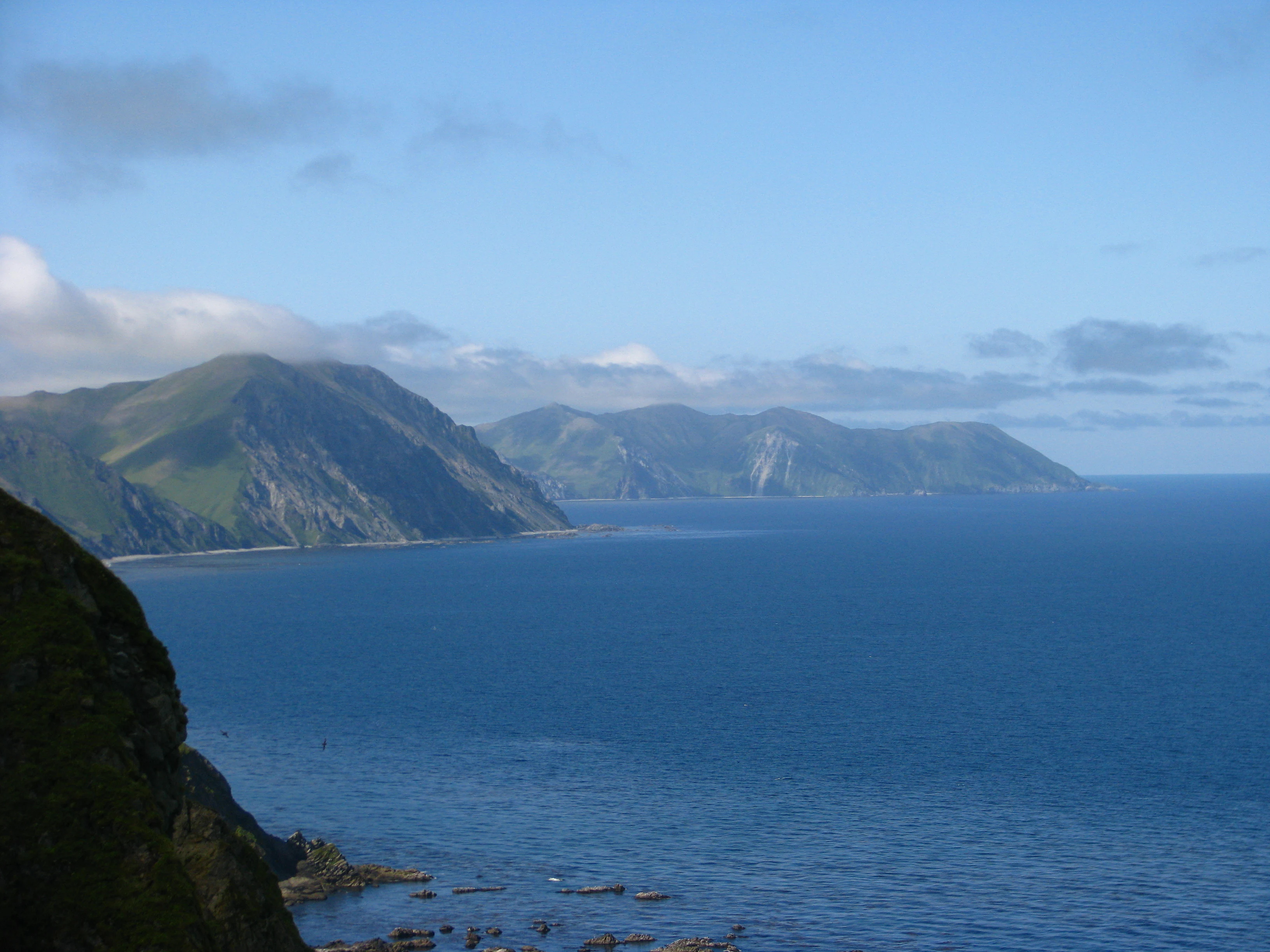
A wide angle view of a mountainous green island coastline meeting the blue ocean under a partly cloudy sky.
The rugged coastline of Medny Island, part of the Komandorsky Islands.

Komandorsky Islands National Park history and protected-area timeline

The protected status of the Commander Islands began with the creation of the Komandorsky State Nature Biosphere Reserve on 23 April 1993. For nearly three decades the reserve was managed as a federal strictly protected area under the classical Russian zapovednik model, focusing on scientific research, ecological monitoring and habitat preservation.

In 2010, the reserve was officially named after the Soviet naturalist and long-standing defender of the islands, Sergey Vladimirovich Marakov, whose 1972 monograph on the natural environment and animal life of the Commander Islands remains a foundational reference. In 2022 the reserve was reorganised and elevated into Komandorsky Islands National Park, broadening its mandate to include environmental education and regulated visitor use while retaining its strictly protected zonal framework. The national park today combines the original reserve's strict ecological protection with the more openly communicative identity typical of Russia's national parks.

Komandorsky Islands National Park landscape and geographic character

The Commander Islands rise as the visible tops of an underwater volcanic ridge that continues westward from the Aleutian arc toward Kamchatka. Their highest point, Mount Steller on Bering Island, reaches roughly 755 metres, but most of the relief is much lower and shaped by constant oceanic weather. The terrain consists of rolling tundra, deeply indented coastlines, steep sea cliffs, basalt headlands and wave-cut platforms that descend abruptly into the cold waters of the Bering Sea and the North Pacific.

The smaller islands include Toporkov Island and Ariy Kamen, the latter a steep rocky islet that doubles as a salmon spawning ground and pinniped haul-out. Along the southern coast of Medny Island, geomorphological curiosities such as Steller's Arch rise as a basalt sea stack, while Bukhta Buyan preserves a varied assemblage of semi-precious stones including jasper, carnelian and chalcedony. The coast of Bering Island carries the deep bay of Bukhta Komandor, identified as a combined landscape and historical natural monument.

The maritime landscape is the dominant feature of the park. The protected waters extend across tens of thousands of square kilometres of open ocean and nearshore zones, creating a buffer around the islands that is vital for marine species travelling between the Pacific and the Bering Sea. Together, these elements form a remote, rugged and visually dramatic setting whose atmosphere is shaped less by altitude or forest cover than by wind, sea, fog and volcanic rock.

Komandorsky Islands National Park ecosystems, habitats, and plant life

The Commander Islands form an ecological island system where Beringian, Okhotsk-Kamchatkan and even North American biological influences meet. Their flora includes 383 species and 37 subspecies of vascular plants, and the island chain marks the eastern or western range boundary for roughly one hundred plant species.

Vegetation on the islands is dominated by low-growing tundra, meadow and coastal plant communities. Treeless landscapes prevail because of the windy maritime climate and short growing season, but dense thickets of dwarf shrubs, herbs and grasses cover the more sheltered slopes. Botanical rarities recorded here include marine quillwort, the true lady's slipper orchid, the related Yatabe lady's slipper and lungwort lichen, the last of which is considered a sensitive indicator of clean-air boreal environments.

The marine and coastal vegetation is equally important for the park's ecological character. Seaweed forests line the nearshore waters, supporting rich invertebrate communities, while the intertidal zones and seabird cliffs together form tightly linked nutrient cycles that feed everything from fish to foxes to migrating cetaceans.

Komandorsky Islands National Park wildlife and species highlights

The wildlife profile of Komandorsky Islands National Park is dominated by marine and coastal species, reflecting the overwhelmingly maritime character of the protected area. The waters support around 250 species of fish, including commercially and ecologically important salmonids whose spawning runs underpin much of the island food web.

The Commander Islands host some of the most significant seabird aggregations in the Russian Far East, with a checklist of roughly 213 bird species recorded, including extinct forms. Coastal cliffs and tundra slopes serve as breeding habitat for colonial seabirds, while coastal wetlands and shoreline flats attract migratory waterfowl. Among the species of conservation concern are Cackling Goose, Emperor Goose, Beringian Dunlin, the Pacific Puffin complex and the Aleutian Tern.

Marine mammal life is one of the park's most distinctive features. The shoreline hosts enormous haul-outs, and aggregated populations along the coast reach on the order of three hundred thousand animals. The waters around the islands are frequented by cetaceans and the Commander Islands Reserve remains the only site in Russia where formal cetacean monitoring continues throughout the year. Twenty-one cetacean species have been registered in these waters, collectively representing a significant share of the world's recorded whale and dolphin diversity.

Among the mammals, the park is known for the Commander Islands Arctic fox, a recognised endemic subspecies, and for sea otters, the Commander Islands beaked whale, the island seal known locally as the antur and the minke whale. On land, terrestrial mammal diversity is modest, but the polar-bear-attended coastal fringe and tundra juxtaposition create a distinctive fauna mixing Arctic-adapted island forms with steep-cliff-nesting marine birds.

Komandorsky Islands National Park conservation status and protection priorities

Komandorsky Islands National Park is a keystone conservation area for the Russian North Pacific. By combining strict nature protection with the larger-scale national park framework, it safeguards an enormous marine belt, a chain of largely uninhabited islands and their associated biological corridors. Its IUCN Category II designation reflects its dual role as a protected landscape and a reservoir of biodiversity.

The park supports populations of several species that are recognised at national and international levels. The Russian Red Data Book lists species such as the Commander Islands Arctic fox, Cackling Goose, Emperor Goose, Beringian Dunlin, Pacific Puffin and Aleutian Tern, while the IUCN Red List records sea otters, the Commander Islands beaked whale, the island seal, minke whale, Bald Eagle, Gyrfalcon and Peregrine Falcon among the species whose regional status depends heavily on this protected area.

The park's ecological importance is amplified by the isolation of the Commander Islands. Because the archipelago sits far from major centres of population and industry, it acts as a relatively undisturbed reference site for studying North Pacific ecosystems. Its marine territory is large enough that it can buffer coastal species against disturbance, while its isolation means that endemic island subspecies have been able to persist with comparatively limited human interference. Together these factors place the park at the heart of regional conservation strategies for the Bering Sea and the western Aleutian region.

Komandorsky Islands National Park cultural meaning and human context

The Commander Islands carry a layered human history. They were explored during Vitus Bering's second Kamchatka expedition in 1741 to 1742, and Bering himself died on Bering Island during the expedition's return voyage. The park protects the remains of that historic expedition campsite along with Bering's grave, giving the protected area a tangible early-modern exploration heritage.

The modern Aleut community on Bering Island, centred on the village of Nikolskoye, reflects a later settlement phase. Its presence gives the park a real but small human footprint whose interaction with the marine environment is integral to the archipelago's identity. Natural monuments in the park, including Steller's Arch and the historical landscapes of Bukhta Komandor, also document the early European scientific exploration of the islands, particularly the work of the German naturalist Georg Wilhelm Steller, who accompanied Bering and gave his name to many of the region's most iconic species and landmarks.

Top sights and standout views in Komandorsky Islands National Park

Standout features of Komandorsky Islands National Park include one of the largest seabird breeding landscapes in the Russian Far East, extraordinary marine mammal haul-outs along the island coastline, and the country's only year-round cetacean monitoring site. The park also embraces an unusual concentration of volcanic and geological monuments, from basalt sea stacks to gemstone-bearing bays, and it preserves the historic expedition site and grave of Vitus Bering on Bering Island.

What distinguishes the park from many other Russian protected areas is the sheer dominance of its marine component. Few protected areas in the country allocate such a large fraction of their territory to ocean, and the combination of this marine scale with island endemism, Beringian wildlife and exploration history gives the park a uniquely Pacific character.

Best time to visit Komandorsky Islands National Park

Because the Commander Islands have a relatively mild maritime climate, seasonal contrasts are less extreme than on mainland Kamchatka. Summer, broadly from late spring to early autumn, is the most comfortable period, with longer daylight, a frost-free interval of roughly four to five months and the highest biological activity along the coasts and on the cliffs.

Winter is cool and wet rather than severely cold, and access to the remote archipelago can become difficult outside the summer shipping season. Migratory bird activity, salmonid spawning concentrations and pinniped breeding cycles are concentrated in the warmer months, which is also when wildlife observation and landscape viewing are most rewarding.
Monthly climate preview

Long-term representative temperature and monthly precipitation averages for Kamchatka Krai

Komandorsky Islands National Park Climate Normals and Annual Weather Patterns

Representative coordinate measurements trace the multi-year monthly temperature and precipitation rhythm recorded across Komandorsky Islands National Park between 1991 and 2020. Detailed month-by-month climate profile records provide complete baseline data for studying long-term meteorological averages at this protected location.
Annual mean3 °C
-2 °C11 °C
Jan-2°
Feb-2°
Mar-1°
Apr
May
Jun
Jul
Aug11°
Sep10°
Oct
Nov
Dec-1°
Warmest month
August

11.4 °C

Coolest month
February

-2 °C

Wettest month
November

3.2 mm/day

Driest month
May

1.7 mm/day

Park location guide

Geography guide, regional context, and park location map for Komandorsky Islands National Park

Komandorsky Islands National Park park geography, regions, and map view in Russia

Understand where Komandorsky Islands National Park sits in Russia through a broader geographic reading of the surrounding landscape, nearby location context, and its mapped position within the national park landscape.

How Komandorsky Islands National Park fits into Russia

Russia is a transcontinental nation spanning eleven time zones, bordered by fourteen countries. It is the world's largest country by area, covering 17,098,246 km². Moscow is the capital and largest city, while Saint Petersburg is the second-largest and a major cultural centre.

Wider geography shaping Komandorsky Islands National Park in Russia

Russia spans Eastern Europe and North Asia, covering 17,098,246 km². It shares land borders with fourteen countries, more than any other nation, and spans eleven time zones. The landscape includes vast plains, mountain ranges such as the Urals and Caucasus, and extensive coastlines along the Arctic Ocean, Pacific Ocean, Baltic Sea, Black Sea, and Caspian Sea.

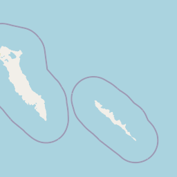
Map view of Komandorsky Islands National Park

Use this park location map to pinpoint Komandorsky Islands National Park in Russia, understand its exact geographic position, and read its mapped placement within the surrounding landscape more clearly.

Pigeon | © OpenStreetMap contributors

Location context for Komandorsky Islands National Park

Kamchatka Krai

Visual reference collection showcasing remote tundra slopes, sea stacks, and marine habitats.

Komandorsky Islands National Park Photos and Volcanic Landscape Scenery

Visual records reveal the dramatic terrain of rugged basalt sea cliffs, rolling tundra, and expansive marine waters surrounding the remote Commander Islands. Examination of these protected landscapes provides clear insight into oceanic habitats, coastal rookeries, and volcanic geography.

A wide angle view of a mountainous green island coastline meeting the blue ocean under a partly cloudy sky.

Park atlas

Compare nearby marine reserves, volcanic archipelagos, and regional protected landscapes

Other Parks Like Komandorsky Islands National Park and Surrounding Protected Areas

Continue exploring remote marine environments and rugged island archipelagos adjacent to Komandorsky Islands National Park. Comparing these related protected areas reveals broader geographic patterns across northern Pacific and Bering Sea ecosystems.
Protected areaKamchatka Krai
About 20 km away#1 closest

Northwest

Commander Islands Protected Area: Detailed Map and Regional Geographic Context

Explore protected landscapes in Kamchatka Krai.

Delve into the Commander Islands Protected Area, a significant protected landscape located within the vast geography of Kamchatka Krai. This detailed entry provides essential atlas-level context, focusing on the park's mapped boundaries and its position within the regional landscape. Understand the protected area's geographic identity and its role in the natural terrain of the Russian Far East through our structured exploration tools.

Area
1,846 km²
IUCN
Ia
Relief
Mixed relief
Climate
Subpolar
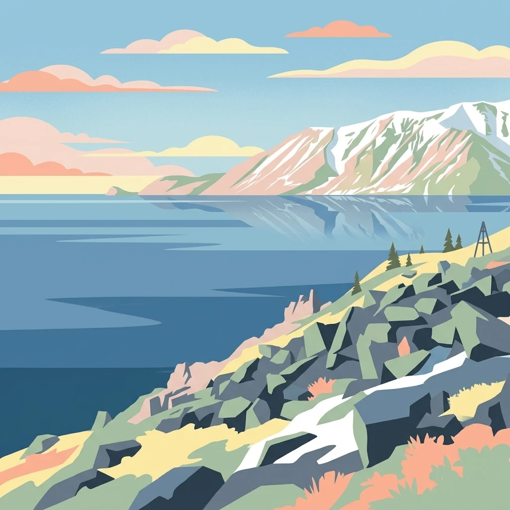
Stylized illustration of a mountainous coastline with rocky shore, calm water, and snow-capped peaks under a sky with clouds
National parkChukotka Autonomous Okrug
About 1,520 km away#2 closest

North

Beringia National Park: Arctic Tundra and Mountain Landscape Discovery in Chukotka

Explore protected boundaries and subarctic geographic features

Beringia National Park offers an expansive look at the subarctic ecosystems of the Chukchi Peninsula. This protected area preserves a unique terrain characterized by low-lying tundra plains and dramatic mountain ridges. Its position along the Bering Strait provides significant geographic context for understanding northern land connections and the remnants of ice age migrations within the Russian Arctic wilderness.

Area
30,532 km²
Established
2013
IUCN
II
Relief
Mixed relief
A horizontal watercolor painting depicting a pale, calm body of water in the foreground, with a grassy shoreline and rolling mountain silhouettes in the distance under a soft sky.
National parkChukotka Autonomous Okrug
About 1,544 km away#3 closest

Northeast

Beringia National Park: Arctic Tundra and Coastal Protected Area in Chukotka

Geography of the Russian Far East and Bering Strait

Beringia National Park protects a sprawling network of Arctic tundra, dramatic shoreline, and isolated islands within the Chukotka Autonomous Okrug. The area maps the unique environmental transition between Siberia and the Bering Strait, highlighting a complex landscape of river basins and coastal cliffs that support diverse Arctic wildlife and migratory populations.

Area
18,194.5 km²
Established
1993
IUCN
II
Relief
Lowland
National parkKhabarovsk Krai
About 1,849 km away#4 closest

West

Shantar Islands National Park: Remote Archipelago Atlas with Rugged Terrain

Mapping protected marine and island geography in Khabarovsk Krai.

Shantar Islands National Park represents a significant protected landscape within Khabarovsk Krai, notable for its dramatic coastal geography, mountainous terrain, and rich marine ecosystems. This national park, encompassing a chain of islands in the Sea of Okhotsk, is a vital habitat for marine mammals and seabird colonies. Explore its mapped boundaries and unique regional atlas context, understanding its role as a protected coastal area in the Russian Far East.

Area
5,155 km²
Established
2013
IUCN
II
Relief
Mountain
National parkHokkaido
About 1,911 km away#5 closest

Southwest

Shiretoko National Park: Hokkaido's Protected Natural Landscape and Geography

Explore mapped boundaries and regional park context.

Shiretoko National Park, designated as a national park in Hokkaido, Japan, serves as a vital point for understanding regional geography and protected landscape exploration. This entry offers a structured view of the park's geographic scope, focusing on its mapped boundaries and natural terrain. Discover how Shiretoko National Park contributes to the broader atlas of conservation lands in the Hokkaido region, providing context for its unique ecological and geographic significance.

Area
386.36 km²
Established
1964
IUCN
II
Relief
Mountain
National parkSakha Republic
About 2,003 km away#6 closest

North

Kytalyk National Park: Arctic Tundra Geography and Protected Siberian Wilderness

Exploration of permafrost terrain in the Sakha Republic

Situated in the Sakha Republic, Kytalyk National Park protects nearly 1.9 million hectares of low-lying Arctic coastal tundra. The park provides an essential look at intact polar environments, featuring thermokarst landforms, extensive peat bogs, and critical nesting grounds for migratory bird species across the Siberian landscape.

Area
18,856 km²
Established
2020
IUCN
II
Relief
Lowland
National parkHokkaido
About 2,036 km away#7 closest

Southwest

Akan Mashu National Park: Hokkaido National Park Geography and Protected Landscape

Mapped protected area boundaries and regional landscape context.

Delve into the distinct geographic identity of Akan Mashu National Park, a protected national park located in Hokkaido, Japan. This page provides detailed atlas-level information focusing on its mapped boundaries, regional landscape context, and the broader geographical significance of this protected natural area. Understand the park's terrain and its role within the Hokkaido region's natural geography for informed discovery.

Area
914.13 km²
Established
1934
IUCN
V
Relief
Mountain
Watercolor painting of a wetland landscape with reeds, trees, and distant hills
National parkHokkaido
About 2,065 km away#8 closest

Southwest

Kushiro-Shitsugen National Park: Protected Wetland Ecosystems and Landscape

Explore the mapped terrain of eastern Hokkaido's vital peatlands.

Kushiro-Shitsugen National Park is a national park in eastern Hokkaido, Japan, safeguarding the nation's largest wetland and peatland. The park encompasses the expansive Kushiro Wetlands, characterized by vast reedbeds and a network of meandering rivers, making it a critical habitat for species like the endangered red-crowned crane. This protected area offers a unique landscape for understanding Japan's freshwater ecosystems and their geographic distribution within the region.

Area
268.61 km²
Established
1987
IUCN
II
Visitors
460K annual

Common questions about visiting, size, designation, and location context for Komandorsky Islands National Park

Komandorsky Islands National Park FAQs for park facts, access, geography, and protected area context

Find quick answers about Komandorsky Islands National Park, including protected-area facts, park geography, trail and visitor context, and how the park fits into its surrounding country and regional landscape.
MoriAtlas Explorer

Continue Your Protected Areas Search Across the Global Atlas

Deepen your exploration by continuing the structured search for national parks and protected areas worldwide. Utilize the comprehensive filtering capabilities to compare different conservation landscapes and refine your understanding of global park geography. Discover more about the distribution and characteristics of protected natural areas.

Global natural geography