Mori Atlas logo
National parkKremenets Mountains National Nature Park

Discover the mapped boundaries and regional setting of this protected area in Ternopil Oblast.

Kremenets Mountains National Nature Park: National Park Protected Landscape and Geographic Context

Kremenets Mountains National Nature Park stands as a significant protected landscape within Ukraine's Ternopil Oblast. This national park designation signifies its importance for conservation and offers a unique point of discovery for understanding regional geography. MoriAtlas provides detailed atlas-style insights into the park's geographic scope, its mapped boundaries, and its place within the broader natural terrain of western Ukraine, enabling structured exploration of its protected area status.

protected areabroadleaf forestendemic specieschalk landscapelimestone formationscultural heritage
Illustration showing mountains with a waterfall, river, forest, and small settlement under a pink sky with sun and clouds

Kremenets Mountains National Nature Park

National park

Park overview

Structured park overview, official facts, and landscape profile for Kremenets Mountains National Nature Park

Kremenets Mountains National Nature Park park facts, protected area profile, and essential visitor context
Review the core facts for Kremenets Mountains National Nature Park, including designation, size, terrain, visitor scale, habitats, and operating context in one park-focused overview.

About Kremenets Mountains National Nature Park

Kremenets Mountains National Nature Park protects a unique landscape of erosional ridges and valleys in western Ukraine's Podolian Upland. The park was established to preserve both natural and cultural heritage, combining multiple smaller protected areas including botanical reserves, zoological reserves, and natural monuments within its boundaries. The terrain consists of low ridges and plateaus cut by ravines and stream valleys, with rocky chalk and marl formations creating distinctive terraces and ledges. The park's forests are predominantly oak, elm, and pine, while the surrounding plains support well-developed agriculture. The area's location at the transition between marine and continental zones, as well as between different geographic regions, contributes to exceptionally high biodiversity. Seven ecological-tourist routes and four bicycle routes have been developed for visitor exploration, along with educational programs for local schoolchildren.

Quick facts and research context for Kremenets Mountains National Nature Park

The park covers approximately 16,215 hectares of terrain within the Holohory-Kremenets Ridge system. Established in 1999, it protects the southern edge of the Central European mixed forests with elements of the forest steppe zone. The area is notable for its high biodiversity, with over 1,200 plant species documented and 16 species endemic to the Kremenets Mountains. The critically endangered Klokov birch grows on only two mountain peaks within the park. The territory encompasses multiple protected botanical and zoological reserves, including oak-hornbeam-ash forests over a century old and geological monuments featuring limestone pillars and conical peaks.

Park context

Deeper park guide and search-rich context for Kremenets Mountains National Nature Park

Kremenets Mountains National Nature Park history, landscape, wildlife, and travel context
Explore Kremenets Mountains National Nature Park through its history, landscape character, ecosystems, wildlife, conservation priorities, cultural context, and seasonal travel timing in a structured park guide built for atlas discovery and search intent.

Why Kremenets Mountains National Nature Park stands out

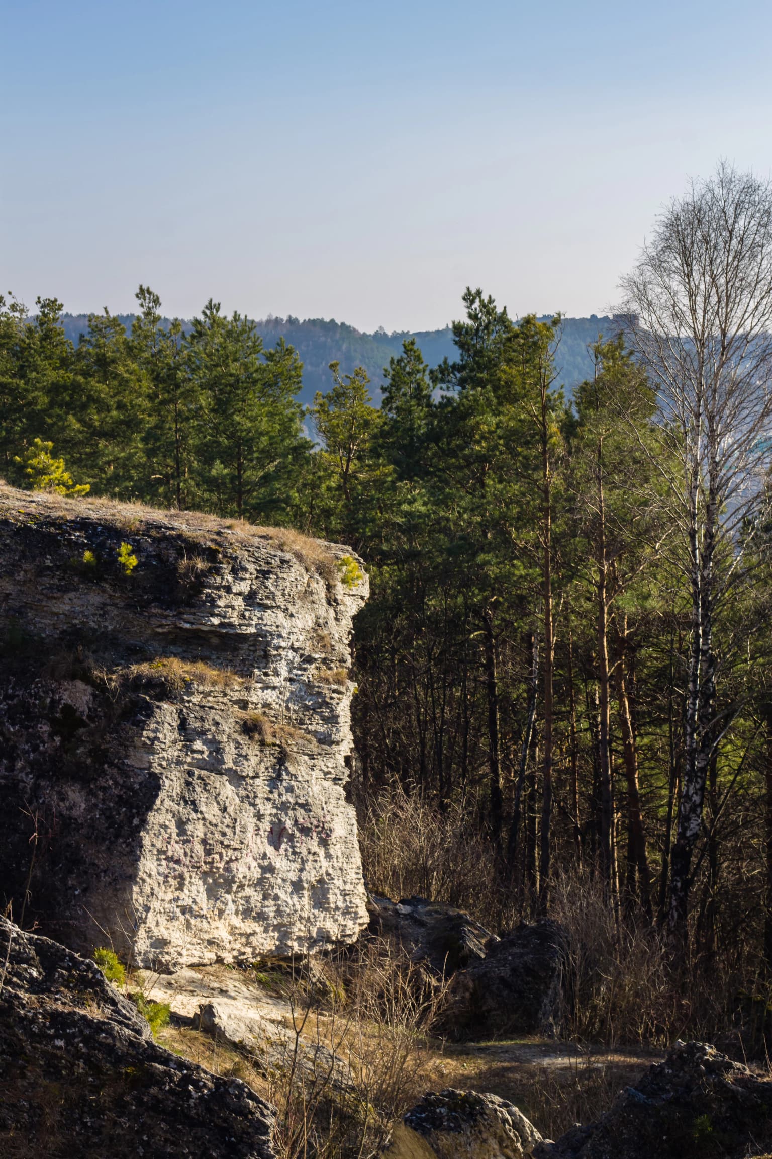
The park is best known for its Klokov birch, a critically endangered tree species that occurs nowhere else in the world except on two mountain peaks within the Kremenets Mountains. The distinctive chalk and limestone ridge landscape features dramatic rocky outcrops, including the famous Słowacki's Rock, a group of limestone pillars that was a favorite visiting spot of the Polish poet Juliusz Słowacki. The area preserves significant old-growth oak-hornbeam-ash forests and serves as a refuge for 16 endemic plant species, making it a center of botanical significance in Ukraine. The park also contains cultural landmarks such as Danylova Mountain, where the Holy Trinity Church of the 12th century still stands.

Three Japanese deer standing on snow-covered ground with bare trees in the background.
Japanese deer (Cervus nippon) standing in a snowy forest within Kremenets Mountains National Nature Park.

Kremenets Mountains National Nature Park history and protected-area timeline

The Kremenets Mountains have been a culturally significant landscape for centuries, with the area containing ancient archaeological sites, historic fortresses, and religious monuments. The park was officially established in 1999 as a national park under the governance of Ukraine's Ministry of Ecology and Natural Resources. Its creation followed the Ukrainian tradition of combining multiple smaller protected areas, both natural and cultural, within a single national park structure. The subsidiary units retain their original legal designations while being incorporated into the larger protected area. Historical sites within the park include the ruins of Kremenets Castle, ancient burial sites including Cossack and Jewish cemeteries, and the medieval Holy Trinity Church on Danylova Mountain.

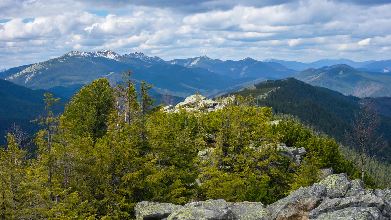
Kremenets Mountains National Nature Park landscape and geographic character

The Kremenets Mountains present a distinctive landscape of highly eroded chalk, clay, and limestone formations creating a terrain of low ridges, plateaus, and isolated peaks. Individual hills are separated where erosion has worn away softer rock layers, exposing white chalk foundations and creating dramatic rocky outcrops. The average ridge height rises 100 to 200 meters above the surrounding territory, with the highest point reaching approximately 408 meters above sea level. The geological structure includes a base layer of white chalk up to 100 meters thick, overlain by sandy deposits from the ancient Galician Sea, capped with sandstone and limestone. A covering of Quaternary yellow loess and loam, 10 to 30 meters thick, tops the sequence. The northern slopes descend steeply to the valley of the Little Polisia plains.

Mountain landscape with snow-capped peaks, forested foreground, rocky outcrops, and partly cloudy sky
Snow-capped Gorgany and Dovzhanka peaks visible on the horizon with forested foreground

Kremenets Mountains National Nature Park ecosystems, habitats, and plant life

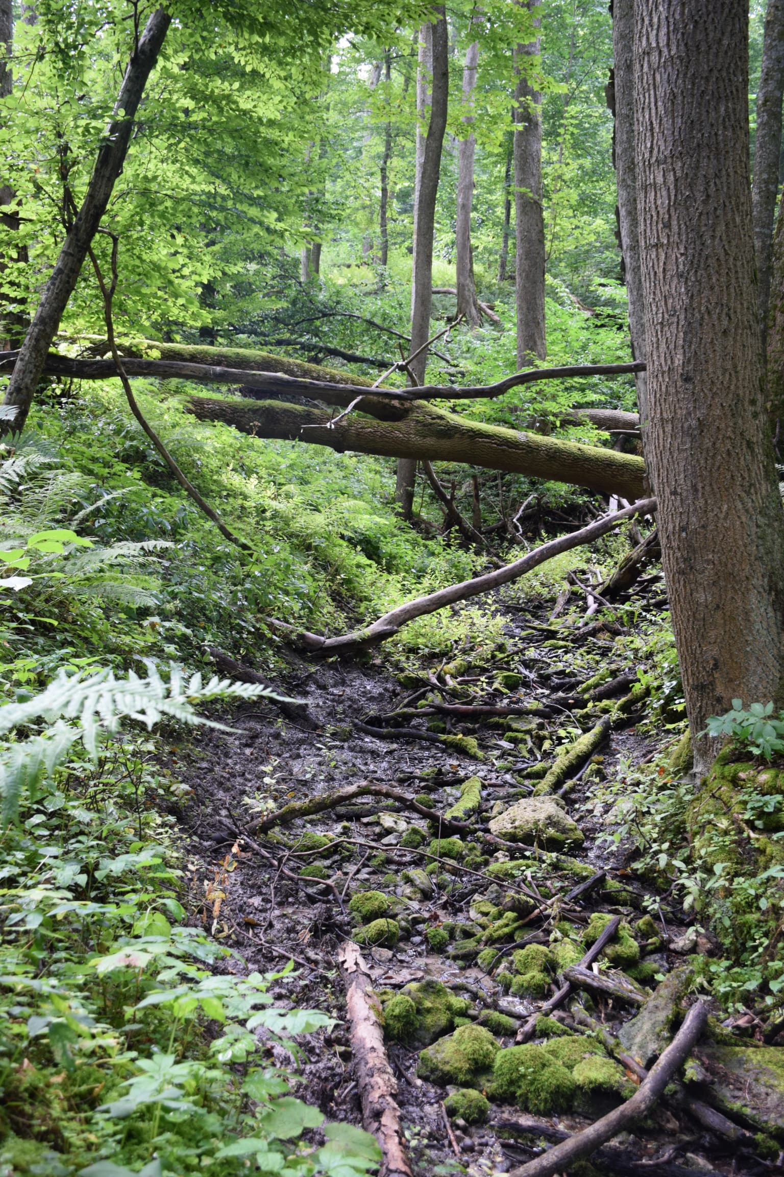
The park occupies a botanically significant position at the southern edge of the Central European mixed forests ecoregion, with elements of the northern Forest steppe zone. Forest types are predominantly oak, elm, and pine, with well-developed oak-hornbeam-ash communities in the older preserves. The flora is exceptionally rich, with over 1,200 plant species documented and 16 species endemic specifically to the Kremenets Mountains. The most famous endemic species is the Klokov birch, a critically endangered tree that grows only on two mountain tops within the park. The park also supports steppe and rock-dwelling plant communities on exposed limestone and chalk substrates, hosting numerous Volhyn-Podillia endemics and relict species.

A landscape view featuring a large mountain in the background, with a yellow flowering field, green agricultural fields, and residential houses surrounded by trees in the foreground
View of God's Mountain from Pochaiv, spring 2017

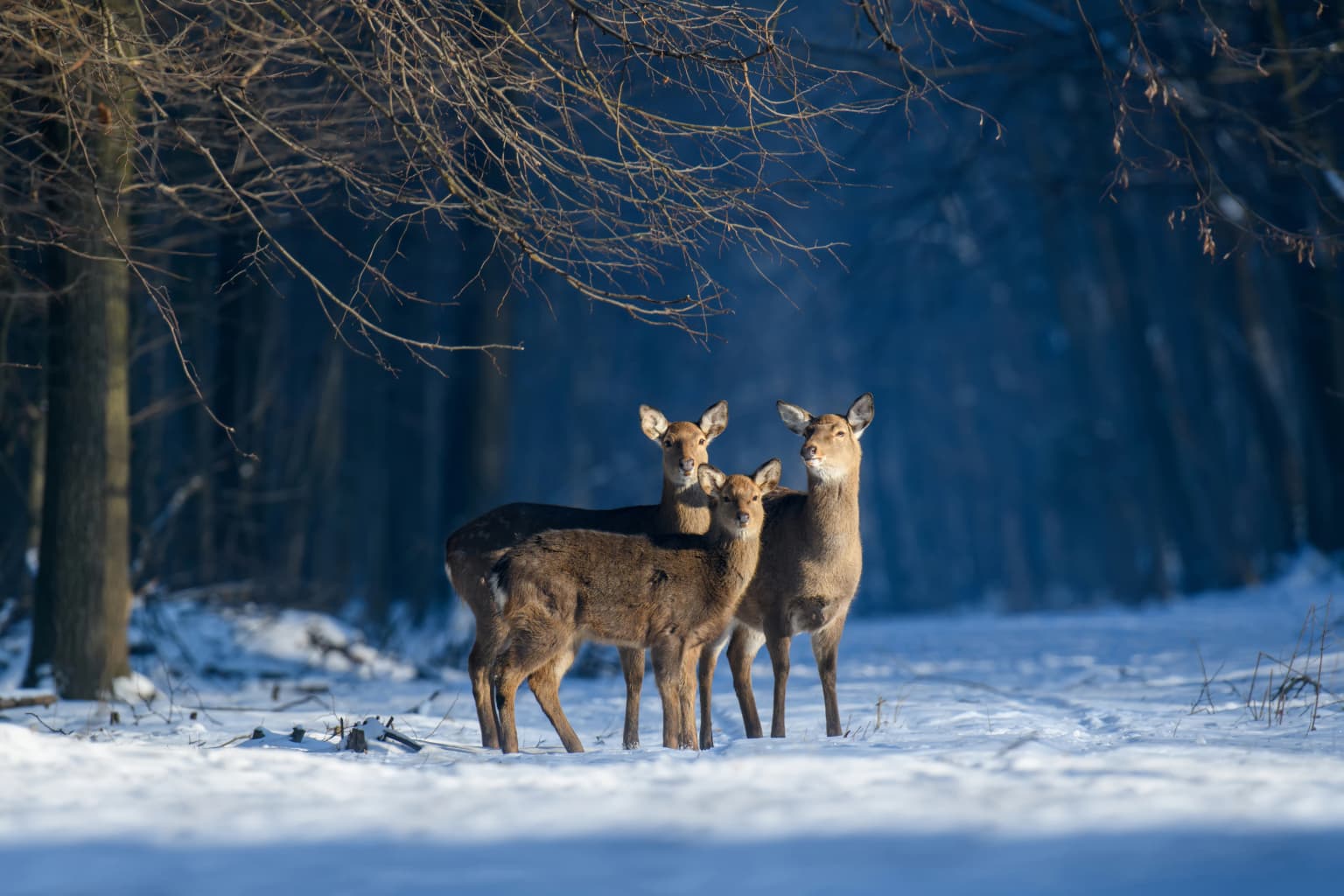
Kremenets Mountains National Nature Park wildlife and species highlights

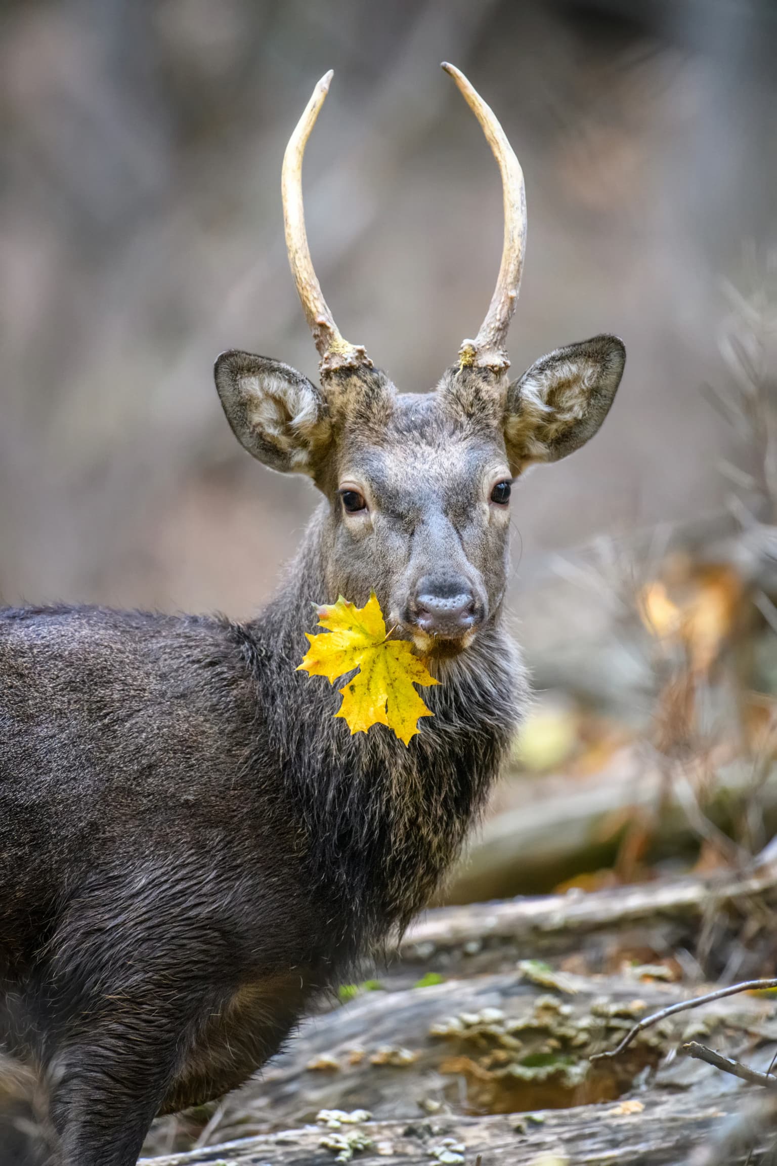
The park supports diverse wildlife communities typical of western Ukrainian broadleaf forests. Birdlife is particularly diverse, with 151 bird species recorded, including 15 species protected under Ukraine's Red Book. The mammal population includes 47 species, with common species including red deer, roe deer, wild boar, and European badger. Smaller mammals such as squirrels, dormice, and various rodent species are обиs widespread. The park also supports populations of European beaver in the northwestern sections. Reptiles and amphibians are represented by nine and fifteen species respectively, including the green lizard on meadow-steppe areas and common adder in suitable habitats.

A large white rock cliff with layered sedimentary structure, surrounded by pine forest and scattered trees, with distant hills under a clear sky
Maidens' Rocks formation in Kremenets Mountains National Nature Park with layered white rock cliff and surrounding pine forest

Kremenets Mountains National Nature Park conservation status and protection priorities

The park plays a critical role in conserving Ukraine's botanical heritage, particularly the Klokov birch, which is listed as critically endangered and exists only within the park boundaries. The protected area incorporates multiple reserves specifically designated for oak-hornbeam-ash forest protection, including the Veselivka Botanical Reserve and Dovzhok Botanical Preserve. Zoological reserves protect populations of hunted animals and vulnerable species such as the European badger. The park is part of the national ecological network and serves as a key territory within the Halych-Slobozhansky ecological corridor, representing the landscapes of Northern Podillia.

Kremenets Mountains National Nature Park cultural meaning and human context

The Kremenets Mountains region has been inhabited since ancient times, with archaeological evidence of settlements, fortified positions, and defensive structures throughout the area. The park contains the ruins of Kremenets Castle, ancient burial sites, and the 12th-century Holy Trinity Church on Danylova Mountain. The area was historically significant in regional defenses, with chains of fortifications and observation points positioned on the ridge peaks. The cultural landscape reflects centuries of human interaction with the terrain, including traditional land use and settlement patterns that shaped both the natural and built environment.

A deer with antlers holding a yellow maple leaf in its mouth, standing in a forested area with fallen logs and dry vegetation
Sika deer holding a yellow maple leaf in its mouth within the Kremenets Mountains National Nature Park

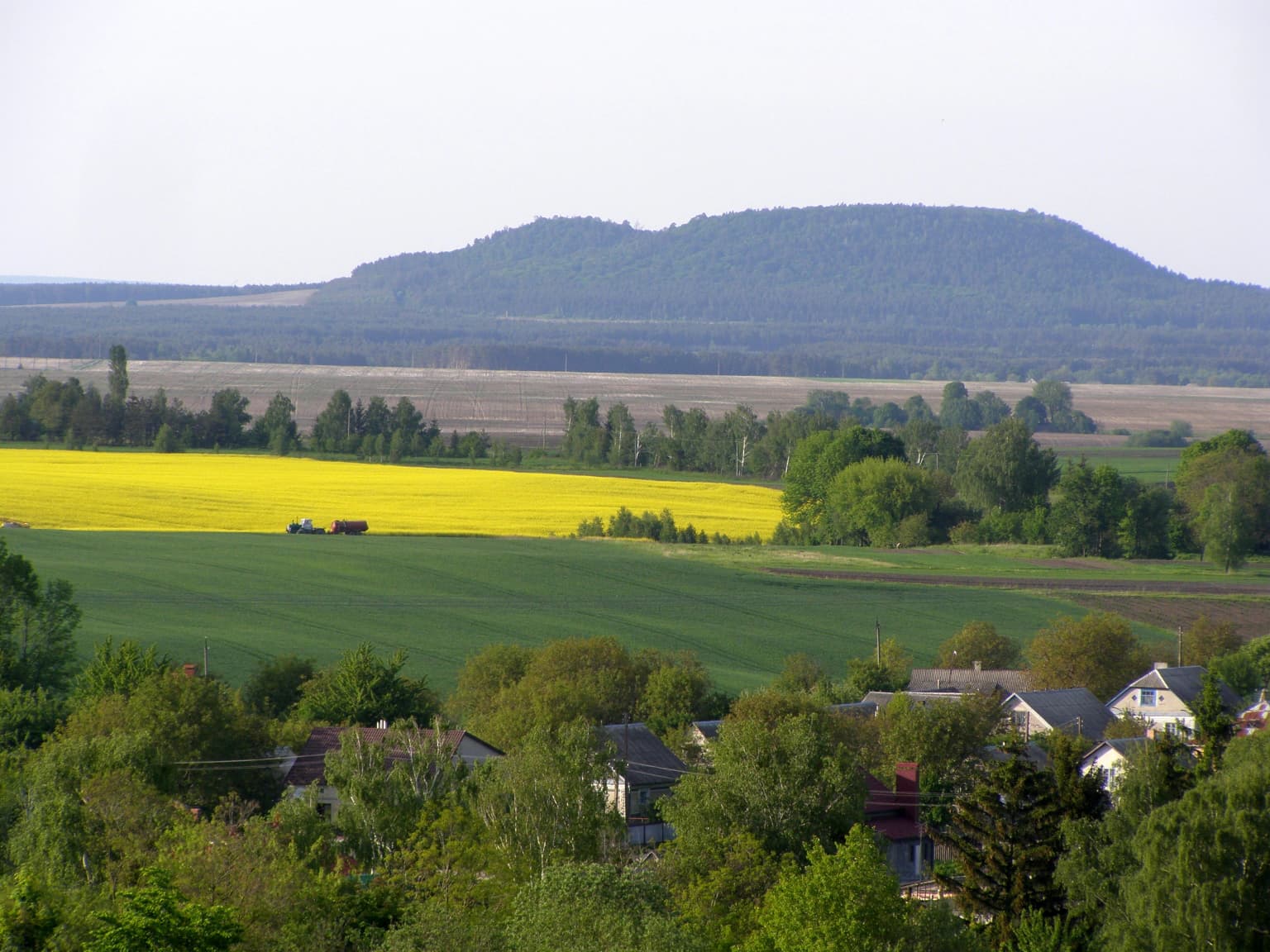
Top sights and standout views in Kremenets Mountains National Nature Park

The park's most distinctive features include the dramatic limestone pillars of Słowacki's Rock, the ancient forests of the Veselivka and Dovzhok botanical reserves, and the rare Klokov birch growing only on the peaks of Mount Strakhova and Mount Maslyatyn. Visitors can explore seven ecological-tourist trails, including routes to Danylova Mountain with its medieval church, the panoramic viewpoints of Boga Mountain, and the rock formations of the Maiden's Cliffs. The four bicycle routes, ranging from 20 to 90 kilometers, traverse the ridge and surrounding countryside. The area's combination of geological, botanical, and cultural heritage makes it a significant destination for nature tourism in western Ukraine.

A narrow forest trail covered in moss and fallen branches surrounded by tall trees and lush green vegetation
Ecological tourist route through dense forest with moss-covered ground and fallen trees

Best time to visit Kremenets Mountains National Nature Park

The park can be visited throughout the year, with each season offering different experiences. Summer provides the best conditions for hiking and exploring the trail network, with warm temperatures and full foliage showcasing the forest landscapes. Spring and early summer are ideal for observing the diverse flora in bloom, particularly in the steppe and rock-dwelling plant communities. Autumn offers colorful forest scenery and is a good time for wildlife observation as animals become more active before winter. Winter provides opportunities for cross-country skiing and experiencing the quiet, snow-covered landscape, though some trails may be less accessible. The transitional seasons of spring and autumn often present the most comfortable conditions for extended hikes.

Park location guide

Geography guide, regional context, and park location map for Kremenets Mountains National Nature Park

Kremenets Mountains National Nature Park park geography, regions, and map view in Ukraine
Understand where Kremenets Mountains National Nature Park sits in Ukraine through a broader geographic reading of the surrounding landscape, nearby location context, and its mapped position within the national park landscape.

How Kremenets Mountains National Nature Park fits into Ukraine

Ukraine is a sovereign nation in Eastern Europe, bordered by Russia, Belarus, Poland, Slovakia, Hungary, Romania, Moldova, and the Black Sea. It is the second-largest country in Europe by area. Kyiv is the capital and largest city, followed by Kharkiv, Odesa, and Dnipro. The official language is Ukrainian. Ukraine has a population of approximately 32.9 million and operates as a unitary semi-presidential republic.

Wider geography shaping Kremenets Mountains National Nature Park in Ukraine

Ukraine occupies 603,628 km² in Eastern Europe, making it the second-largest country in Europe. It shares borders with Russia, Belarus, Poland, Slovakia, Hungary, Romania, and Moldova. The country has a southern coastline along the Black Sea and Sea of Azov. The terrain includes plains, steppes, and the Carpathian Mountains in the west.

Map view of Kremenets Mountains National Nature Park

Use this park location map to pinpoint Kremenets Mountains National Nature Park in Ukraine, understand its exact geographic position, and read its mapped placement within the surrounding landscape more clearly.

Pigeon | © OpenStreetMap contributors

Location context for Kremenets Mountains National Nature Park

Kremenets RaionTernopil Oblast

Visual reference for the park's distinctive chalk formations, ancient forests, and endemic plant habitats within Ukraine's protected mountain terrain.

Kremenets Mountains National Nature Park Photos: Explore Protected Landscapes and Unique Scenery
Browse an image gallery showcasing the dramatic limestone pillars, ancient old-growth forests, and unique chalk landscapes that define Kremenets Mountains National Nature Park. These park photos provide essential visual context for understanding its distinctive terrain, endemic species habitats, and rich protected-area character within western Ukraine.

Three Japanese deer standing on snow-covered ground with bare trees in the background.

Two brown and white owls with orange eyes perched on a tree branch.

Mountain landscape with snow-capped peaks, forested foreground, rocky outcrops, and partly cloudy sky

A landscape view featuring a large mountain in the background, with a yellow flowering field, green agricultural fields, and residential houses surrounded by trees in the foreground

A large white rock cliff with layered sedimentary structure, surrounded by pine forest and scattered trees, with distant hills under a clear sky

Wide landscape view of forested hills and valleys under a clear blue sky, with sparse trees in the foreground and dense green forests extending into the distance

A deer with antlers holding a yellow maple leaf in its mouth, standing in a forested area with fallen logs and dry vegetation

A narrow forest trail covered in moss and fallen branches surrounded by tall trees and lush green vegetation

Rock formations on Devi Skeli mountain, forested landscape, distant town under clear sky

Wide landscape view of Zamkova Hora mountain with the town of Kremenets below, surrounded by autumn-colored trees and rolling hills under a bright sky

Lush green forested hills overlooking a valley with distant buildings under a clear blue sky

Landscape view of layered rock formations with green vegetation under a partly cloudy sky

Park atlas

Discover connected protected landscapes and regional park geography within Ternopil Oblast, Ukraine.

Explore Related Protected Areas: Kremenets Mountains National Nature Park and Surrounding Ukrainian Landscapes
After exploring Kremenets Mountains National Nature Park, continue your discovery by browsing other protected areas and national parks across the Holohory-Kremenets Ridge and wider Ternopil Oblast. Compare these diverse chalk, limestone, and ancient forest landscapes to understand the regional context and conservation priorities within western Ukraine's ecoregions.
National parkRivne Oblast

Derman, Ostroh National Nature Park: Geographic Atlas of a Ukrainian National Park

Explore its protected boundaries and landscape context.

Delve into the detailed atlas information for Derman, Ostroh National Nature Park, a designated national nature park located in Ukraine's Rivne Oblast. This resource illuminates the park's specific geographic footprint, its protected land status, and its contribution to the regional landscape. Understand its terrain and mapped features, offering a clear point of discovery for those interested in the geography of Ukrainian protected areas.

Area
16 km²
Established
2009
IUCN
II
Relief
Mixed relief
Watercolor painting showing green hills, pink fields, and purple mountains under a pale sky
National parkLviv Oblast

Northern Podillia National Nature Park: Protected Area Mapping and Regional Geography

Explore unique karst features and ancient forests in Lviv Oblast.

Northern Podillia National Nature Park is a protected national park in Lviv Oblast, Ukraine, safeguarding a significant area of the Podolian Upland. The park is distinguished by its ancient beech forests, rare karst lakes known as the Blue Windows, and geological formations reflecting ancient sea reefs. This page serves as a dedicated atlas entry for understanding the park's mapped boundaries, its ecological significance, and its place within the regional geography of western Ukraine.

Area
156 km²
Established
2009
IUCN
II
Relief
Highland
Watercolor painting showing a lake surrounded by trees with distant hills under a colorful sky
National parkUkraine

Lower Polissia National Nature Park: Ukraine's Mapped Protected Wetland Landscape

National Park in Ukraine's Polissia region.

The Lower Polissia National Nature Park is a crucial protected area covering 8,762 hectares in western Ukraine. This park offers a detailed geographic profile, showcasing its extensive wetland habitats, forest complexes, and the Horyn, Viliia, and Hnylyi Rih river valleys. As a key component of the Polissia landscape zone, the park provides essential context for understanding the protected natural terrain and regional ecology of Eastern Europe through structured map exploration.

Area
87.62 km²
Established
2013
IUCN
II
Relief
Lowland
National parkVolyn Oblast

Tsumanska Pushcha National Nature Park: Protected Landscape and Regional Geography in Volyn Oblast

UA National Park with Mapped Boundaries and Terrain Context

Delve into Tsumanska Pushcha National Nature Park, a designated national park in Volyn Oblast, Ukraine. This entry provides detailed atlas-style information on the park's protected landscape identity, its mapped geographic setting, and its significance within the regional geography of Northwestern Ukraine. Understand the park's boundaries and its place in the natural terrain.

Area
334.75 km²
Established
2010
IUCN
II
Relief
Lowland
National parkIvano-Frankivsk Oblast

Halych National Nature Park: Ivano-Frankivsk Oblast National Park Atlas & Geography

Mapped protected boundaries and landscape context.

Halych National Nature Park is a vital protected area situated in the Ivano-Frankivsk Oblast of Ukraine, characterized by its transitional landscape where Carpathian foothills merge with the East European Plain. This national park offers a rich tapestry of environments, including oak-hornbeam and oak-beech forests, vital wetlands, and scarce steppe remnants, creating a mosaic of habitats mapped meticulously within the MoriAtlas platform. Explore the park's geographic identity, its diverse terrain, and its significance as a conservation landscape for understanding regional biodiversity.

Area
147 km²
Established
2004
IUCN
II
Relief
Lowland
National parkLviv Oblast

Yavoriv National Nature Park: Protected Landscape and Regional Geography in Lviv Oblast

Mapped protected area boundaries and natural terrain context.

Yavoriv National Nature Park is a designated national park within Lviv Oblast, Ukraine. This page provides detailed geographic information, focusing on the park's protected landscape identity and its mapped terrain. Understanding its location in Western Ukraine, near the Carpathian gateway, offers valuable context for atlas-based exploration of protected areas and natural features within the region.

Area
71.08 km²
Established
1998
IUCN
II
Relief
Highland
Watercolor illustration of a winding river through rolling green hills with distant mountains under a soft sky
National parkTernopil Oblast

Dniester Canyon National Nature Park: National Park Protected Landscape and Geographic Context

Mapped boundaries and regional geography in Ternopil Oblast

Delve into the protected landscape of Dniester Canyon National Nature Park, a designated national park in Ukraine. This entry offers a structured view of the park's geographic setting within Ternopil Oblast, focusing on its mapped boundaries and its role as a significant protected natural area. Understand its placement within the broader atlas of Ukrainian natural landscapes and regional geography, offering a factual basis for exploration.

Area
108 km²
Established
2010
IUCN
II
Relief
Mixed relief
Watercolor illustration of a mountainous landscape with green hills, trees, and a river valley
National parkUkraine

Khotyn National Nature Park: Ukraine's National Park Atlas and Protected Landscape

Explore geographic boundaries and natural terrain.

Delve into the details of Khotyn National Nature Park, a protected national park situated within Ukraine. This entry offers precise geographic insights, focusing on the park's mapped terrain and its role as a significant protected landscape. Discover the regional context and understand its distinct natural features, providing a structured view for atlas-based exploration of Ukrainian protected areas.

Area
94 km²
Established
2010
IUCN
II
Relief
Mixed relief

Common questions about visiting, size, designation, and location context for Kremenets Mountains National Nature Park

Kremenets Mountains National Nature Park FAQs for park facts, access, geography, and protected area context
Find quick answers about Kremenets Mountains National Nature Park, including protected-area facts, park geography, trail and visitor context, and how the park fits into its surrounding country and regional landscape.
MoriAtlas Explorer

Continue Your Protected Areas Search Across the Global Atlas

Deepen your exploration by continuing the structured search for national parks and protected areas worldwide. Utilize the comprehensive filtering capabilities to compare different conservation landscapes and refine your understanding of global park geography. Discover more about the distribution and characteristics of protected natural areas.

Global natural geography