

Mori Atlas logo
National parkLake Frome National Park

Explore the mapped boundaries and regional terrain of this Australian National Park.

Lake Frome National Park: Protected Landscape and Geographic Context in South Australia

Lake Frome National Park represents a significant protected area within the expansive geography of South Australia. As a designated National Park, it offers a unique focal point for understanding regional landscape context and mapped natural terrain. This entry serves as a gateway to exploring the park's specific protected boundaries and its place within the broader atlas of Australian conservation lands, providing essential geographic discovery for those interested in its mapped features and regional setting.

salt lakeFlinders Rangesarid landscapeephemeral lakeendorheic basinoutback

Lake Frome National Park

National park

Park overview

Structured park overview, official facts, and landscape profile for Lake Frome National Park

Lake Frome National Park park facts, protected area profile, and essential visitor context

Review the core facts for Lake Frome National Park, including designation, size, terrain, visitor scale, habitats, and operating context in one park-focused overview.

About Lake Frome National Park

Lake Frome National Park represents one of South Australia's most significant protected areas, conserving an entire salt lake system within the dramatic landscape of the Northern Flinders Ranges. The park's creation and subsequent upgrade from regional reserve to national park status in 2021 reflects the growing recognition of the ecological and geological importance of these arid lake systems. Lake Frome itself is an endorheic basin, meaning it has no natural outlet and its waters are lost through evaporation, leaving behind concentrated salt deposits that create the characteristic white crust visible on the lake surface. This ephemeral nature means the lake fills only during periods of above-average rainfall, transforming the normally dry saltpan into a temporary wetland that attracts waterbirds and supports adapted ecological communities. The surrounding landscape of the Northern Flinders Ranges provides a rugged backdrop of ancient mountains, gorges, and arid woodland that contributes to the park's visual and ecological significance.

Quick facts and research context for Lake Frome National Park

Lake Frome National Park covers 2,582.40 square kilometres making it a substantial protected area in the South Australian outback. It is classified as an IUCN Category VI protected area, reflecting its status as a protected area with sustainable use of natural resources. The lake itself is endorheic, meaning it has no outlet and represents a closed drainage system. As an ephemeral salt lake, it fills only during periods of significant rainfall and remains dry for extended periods, creating a dynamic and rare desert wetland environment. The park is managed by the South Australian Department for Environment and Water.

Protection and recognition

Documenting terrestrial boundaries, establishment history, and global conservation designations.

Lake Frome National Park Protection Status and Conservation Designation

Lake Frome National Park represents a dedicated terrestrial protected area established in 2021 to preserve regional landscape integrity. Analyzing documented designation history and protection boundaries provides essential geographic context for understanding regional conservation frameworks.

Protection details

Protection scope
Terrestrial
Designated year
2021
Park context

Deeper park guide and search-rich context for Lake Frome National Park

Lake Frome National Park history, landscape, wildlife, and travel context

Explore Lake Frome National Park through its history, landscape character, ecosystems, wildlife, conservation priorities, cultural context, and seasonal travel timing in a structured park guide built for atlas discovery and search intent.

Why Lake Frome National Park stands out

Lake Frome National Park is best known for protecting one of Australia's largest endorheic salt lakes within a dramatic desert mountain setting. The park preserves a rare and little-understood arid salt lake ecosystem that stands alongside other significant South Australian salt lakes including Kati Thanda-Lake Eyre, Lake Torrens, and Lake Gairdner. The stark contrast between the glistening white salt crust of the lake floor and the rugged red terrain of the surrounding Flinders Ranges creates a distinctive and memorable landscape. The ephemeral nature of the lake, which fills only intermittently, adds to its ecological significance and makes it a unique habitat for specialized adapted species.

Lake Frome National Park history and protected-area timeline

Lake Frome National Park was originally proclaimed as Lake Frome Regional Reserve on 19 December 1991. The regional reserve was established with the specific purpose of extending conservation management of the adjoining Vulkathunha-Gammon Ranges National Park and conserving a large arid salt lake system of regional geological significance. The dominant land use of the reserve was designated as biological and cultural conservation. On 26 November 2021, the protected area's status was upgraded to a national park in recognition of its significance as a large salt lake, giving it the same status as other major South Australian salt lakes. This upgrade reflects increased understanding of the ecological value of these desert lake systems and their importance for biodiversity conservation in Australia's arid interior.

Lake Frome National Park landscape and geographic character

The landscape of Lake Frome National Park is defined by the vast salt lake at its centre, surrounded by the ancient terrain of the Northern Flinders Ranges. Lake Frome presents a striking visual contrast when filled with water, with its pale salt crust and the reflection of the sky creating an almost mirror-like surface, or when dry revealing the intricate patterns of the dried lake bed. The surrounding terrain features the characteristic red and orange hues of the Flinders Ranges, with rocky ridges, steep gorges, and undulating hills supporting sparse vegetation adapted to arid conditions. The Flinders Ranges represent one of Australia's most significant mountain ranges, with geological formations that record billions of years of Earth's history. This combination of mountain and lake environments creates a landscape of exceptional natural beauty and scientific importance.

Lake Frome National Park ecosystems, habitats, and plant life

The nature of Lake Frome National Park centres on its unique arid salt lake ecosystem, one of the least understood environments in Australia. As an ephemeral lake system, it experiences cycles of filling and drying that create dynamic conditions supporting specialized flora and fauna. The lake represents a rare habitat type within the Australian landscape, with its combination of extreme salinity, intermittent water presence, and desert setting creating conditions for uniquely adapted organisms. When water does fill the lake, it becomes an important habitat for waterbirds including various species of ducks, grebes, and shorebirds that utilize the temporary wetlands for feeding and breeding. The surrounding arid woodlands and shrublands support a range of reptiles, mammals, and birds adapted to the harsh desert environment.

Lake Frome National Park wildlife and species highlights

Wildlife in Lake Frome National Park is adapted to the harsh conditions of the arid interior, with the lake system providing crucial habitat when filled with water. Waterbirds are the most notable wildlife presence during the brief periods when the lake holds water, with species attracted to the temporary wetland conditions. The surrounding Flinders Ranges environment supports a diversity of reptiles including various lizard and snake species, mammals such as kangaroos and small marsupials, and an assortment of bird species including parrots, honeyeaters, and birds of prey. The adapted nature of this wildlife reflects millions of years of evolution in Australia's arid zones, with species developing remarkable tolerances to heat, drought, and limited water availability.

Lake Frome National Park conservation status and protection priorities

Lake Frome National Park was upgraded from regional reserve to national park status in 2021 in recognition of its conservation significance as a large salt lake ecosystem. The park conserves a rare and little-known environment that is considered to be of national significance within Australia's protected area network. The upgrade places Lake Frome alongside other major South Australian salt lakes including Kati Thanda-Lake Eyre, Lake Torrens, and Lake Gairdner, acknowledging the ecological importance of these endorheic basin systems. Conservation of this landscape protects both the lake system itself and the surrounding arid woodland and mountain environments of the Flinders Ranges, creating a comprehensive protected area that preserves the natural character of this remote region.

Lake Frome National Park cultural meaning and human context

Lake Frome National Park lies within the traditional lands of Aboriginal peoples who have lived in the Flinders Ranges region for tens of thousands of years. The lake and surrounding landscape hold cultural significance for local Indigenous communities, with the Flinders Ranges containing numerous sites of Aboriginal heritage and traditional connections to country. The park's establishment as a protected area recognizes the ongoing cultural importance of the landscape while also contributing to the preservation of natural values. The name Frome itself honors Sir Charles Frome, an early surveyor and explorer of the South Australian interior.

Top sights and standout views in Lake Frome National Park

The defining highlight of Lake Frome National Park is the salt lake itself, a vast ephemeral system that transforms dramatically between dry and filled states. The visual impact of the white salt crust against the red Flinders Ranges terrain creates one of Australia's most distinctive desert landscapes. The park's upgrade to national park status in 2021 reflects its recognition as a significant conservation area protecting rare arid salt lake environments. The park's position adjoining Vulkathunha-Gammon Ranges National Park creates a larger contiguous protected landscape. The Flinders Ranges setting provides additional scenic value through its ancient mountain landscapes, rugged ridges, and historic geological formations.

Best time to visit Lake Frome National Park

The best time to visit Lake Frome National Park is during the cooler months of autumn and spring when temperatures are more moderate for outdoor exploration. As an ephemeral lake system, the optimal visiting experience often follows periods of rainfall when the lake may hold water, creating the unique wetland environment and attracting wildlife. The arid interior experiences extreme temperatures in summer, making the cooler months far more comfortable for visitors. The Flinders Ranges region is a year-round destination, though summer heat can be intense and limit outdoor activities. Visitors should be aware that access to remote outback areas requires appropriate preparation and self-sufficiency.
Monthly climate preview

Long-term temperature profiles and historical monthly precipitation trends in South Australia

Lake Frome National Park Average Temperatures and Monthly Climate Normals

Extremely low average daily precipitation alongside high summer maximums exceeding forty degrees Celsius characterize the climate of Lake Frome National Park in South Australia. Accessing the comprehensive twelve-month profile reveals detailed monthly fluctuations in average temperatures and rain patterns based on historical data.
Annual mean21 °C
11 °C30 °C
Jan30°
Feb29°
Mar25°
Apr20°
May15°
Jun12°
Jul11°
Aug13°
Sep17°
Oct21°
Nov25°
Dec28°
Warmest month
January

30.2 °C

Coolest month
July

11.1 °C

Wettest month
February

1.1 mm/day

Driest month
August

0.3 mm/day

Park location guide

Geography guide, regional context, and park location map for Lake Frome National Park

Lake Frome National Park park geography, regions, and map view in Australia

Understand where Lake Frome National Park sits in Australia through a broader geographic reading of the surrounding landscape, nearby location context, and its mapped position within the national park landscape.

How Lake Frome National Park fits into Australia

Australia is a constitutional monarchy and federal parliamentary democracy comprising six states and ten territories. With a population of nearly 28 million, it is one of the world's most urbanised countries, with most people concentrated on the eastern seaboard. The country has a high Human Development Index and is known for its cultural diversity, ancient Aboriginal heritage, and unique wildlife.

Wider geography shaping Lake Frome National Park in Australia

Australia occupies the entire Australian continent, the island of Tasmania, and numerous smaller islands. It is the world's flattest and driest inhabited continent, featuring vast deserts in the interior (the Outback), tropical rainforests along the eastern coast, and a coastline bordering the Indian and Pacific Oceans.

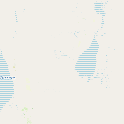
Map view of Lake Frome National Park

Use this park location map to pinpoint Lake Frome National Park in Australia, understand its exact geographic position, and read its mapped placement within the surrounding landscape more clearly.

Pigeon | © OpenStreetMap contributors

Location context for Lake Frome National Park

South Australia
Park atlas

Browse surrounding protected landscapes and compare regional park geography across the Northern Flinders Ranges.

Discover Other National Parks and Protected Areas Near Lake Frome National Park

Continue your exploration of Australia's arid landscapes by browsing other national parks and protected areas geographically adjacent to Lake Frome National Park. Compare protected-area features and trace the regional spread of conservation efforts across the unique salt lake systems of South Australia.
National parkSouth Australia
About 21 km away#1 closest

Northwest

Vulkathunha-Gammon Ranges National Park: South Australia National Park Atlas Exploration

Mapped boundaries and regional geographic context.

Dive into the specifics of Vulkathunha-Gammon Ranges National Park, a designated national park situated in South Australia. This detailed resource focuses on its role as a protected landscape, providing users with critical geographic information. Understand the park's mapped boundaries and its relation to the broader regional geography, perfect for anyone engaged in atlas-based exploration of Australia's natural areas.

Area
1,257.23 km²
Established
1970
IUCN
II
Relief
Mountain
National parkAustralia
About 130 km away#2 closest

Southwest

Ikara-Flinders Ranges National Park: Mapped Boundaries and Regional Geography

Australia's protected landscape and national park terrain.

Investigate the geographic characteristics and protected-area identity of Ikara-Flinders Ranges National Park. This entry highlights its mapped boundaries and landscape context, offering a foundational understanding of this Australian national park for atlas-based discovery. Users can explore the natural terrain and regional setting that define Ikara-Flinders Ranges National Park.

National parkSouth Australia
About 152 km away#3 closest

West

Nilpena Ediacara National Park: South Australia National Park and Protected Landscape Identity

Mapped protected area within the regional geography of South Australia.

Nilpena Ediacara National Park represents a significant protected landscape within South Australia. This entry provides a detailed geographic context for the park, focusing on its role as a national park and its mapped boundaries. Delve into the specific atlas-driven understanding of this protected area, its landscape context, and its significance within the broader geographic framework of the Australian state.

Area
606.17 km²
Established
2021
IUCN
VI
Relief
Mountain
Nature reserveSouth Australia
About 153 km away#4 closest

Southeast

Boolcoomatta Reserve Nature Reserve: Geography and Protected Landscape Mapping in South Australia

Arid outback landscapes and conservation terrain in South Australia.

Boolcoomatta Reserve represents a significant protected area within the arid South Australian interior, featuring a mosaic of rocky ridges, open saltbush plains, and tussock grasslands. Once managed as a sheep station, this nature reserve now serves as a dedicated site for habitat restoration and the protection of native wildlife. This atlas entry provides essential geographic context on its terrain, vegetation zones, and role within the regional outback ecosystem.

Area
644.57 km²
Established
2006
IUCN
II
Relief
Mixed relief
National parkSouth Australia
About 169 km away#5 closest

West

Lake Torrens National Park: Explore South Australia's Remarkable Inland Salt Lake Geography

A unique protected landscape of arid plains and expansive salt flats.

Lake Torrens National Park offers an unparalleled exploration of Australia's remote outback, centered around a vast, ancient salt lake basin. This national park in South Australia provides a canvas of stark, minimalist terrain, featuring shimmering saltpans, arid gibber plains, and rocky outcrops. Understand the park's unique geographic identity, its ecological significance as a temporary wetland habitat, and its dramatic visual appeal for landscape photography and geological interest. It is a key protected area showcasing the extreme environment of Australia's interior.

Area
5,676.68 km²
Established
1991
IUCN
VI
Relief
Lowland
National parkNew South Wales
About 193 km away#6 closest

Northeast

Sturt National Park National Park: Discover Protected Landscape and Regional Geography in New South Wales

Explore the mapped boundaries and natural terrain of this Australian protected area.

Sturt National Park in New South Wales stands as a key national park within Australia's network of protected landscapes. This page offers detailed geographic context, focusing on the park's mapped boundaries and its role as a distinct natural area. Users can explore how Sturt National Park fits into the broader regional geography of New South Wales, providing an atlas-level view of conservation within the state and continent.

Area
3,253.29 km²
Established
1972
IUCN
II
Relief
Mixed relief
Nature reserveSouth Australia
About 221 km away#7 closest

Southwest

Buckaringa Sanctuary: Geographic Atlas and Protected Landscape Overview

Nature reserve terrain in the southern Flinders Ranges

Buckaringa Sanctuary serves as a key case study in arid landscape conservation within South Australia. This entry examines the reserve's unique geological features, including the deeply incised gorges and rocky ridges that define the Flinders Ranges. Through a focus on mapped boundaries and regional ecology, the content provides a clear understanding of the sanctuary's position in the Australian landscape, highlighting its role as a protected refuge of sandstone formations and native scrubland.

Area
20 km²
Established
1990
Relief
Mountain
Climate
Arid
National parkNew South Wales
About 234 km away#8 closest

East

Mutawintji National Park: New South Wales Protected Area for Atlas Exploration

Mapping rugged outback terrain, gorges, and ancient rock art.

Mutawintji National Park in New South Wales offers a profound exploration of Australia's outback geography, significant Indigenous heritage, and protected landscapes. Discover the park's unique terrain, defined by the Byngnano Range, vibrant gorges, and river red gum-lined creeks, all rich with ancient Aboriginal rock art. This national park is a prime example of mapped protected area discovery, highlighting both natural beauty and critical conservation achievements.

Area
689.12 km²
Established
1998
IUCN
II
Relief
Mountain

Common questions about visiting, size, designation, and location context for Lake Frome National Park

Lake Frome National Park FAQs for park facts, access, geography, and protected area context

Find quick answers about Lake Frome National Park, including protected-area facts, park geography, trail and visitor context, and how the park fits into its surrounding country and regional landscape.
MoriAtlas Explorer

Continue Your Protected Areas Search Across the Global Atlas

Deepen your exploration by continuing the structured search for national parks and protected areas worldwide. Utilize the comprehensive filtering capabilities to compare different conservation landscapes and refine your understanding of global park geography. Discover more about the distribution and characteristics of protected natural areas.

Global natural geography