
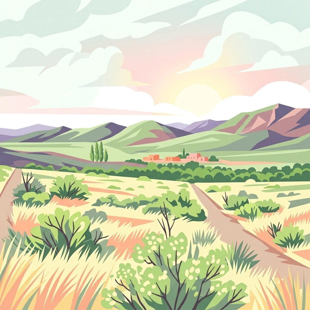

Why Lihué Calel National Park stands out
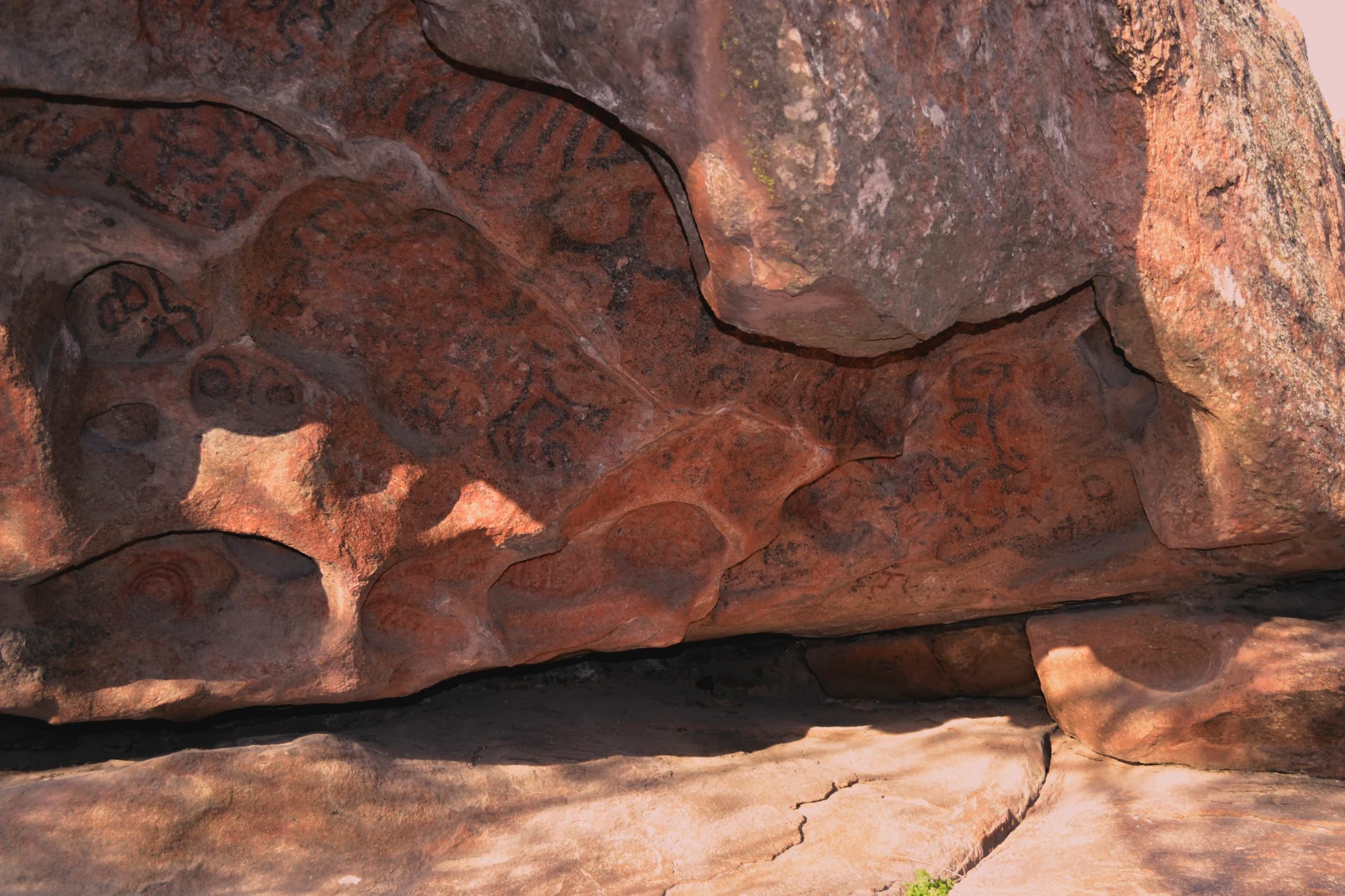
Lihué Calel is best known for its dramatic contrast: a rugged mountain range rising abruptly from the flat, semi-arid pampean plains, creating a biodiversity hotspot in the middle of a grassland ecosystem. The park contains significant archaeological sites with rock art in the Valle de las Pinturas, featuring geometric motifs in red and black dating back 2,000 years. It protects one of the few remaining areas of caldén forest in the region, an endemic tree species of the espinal, and supports populations of guanacos, pumas, and over 150 bird species. The park also preserves the cultural heritage of indigenous peoples including the prehistorical hunters and gatherers, the guenaken or puelche, and later the ranculche.

Lihué Calel National Park history and protected-area timeline
The establishment of Lihué Calel National Park evolved through a series of legislative steps spanning from the early 1970s through the 1980s. In October 1973, the provincial government of La Pampa donated the land to the national state for the creation of a national park through Decree 1301/1973, with a subsequent correction in May 1974 addressing a minor surface area discrepancy. The national government accepted this donation through military Decree 609/1976 signed by President Jorge Rafael Videla, and formal possession of the lands was taken on June 8, 1977. While no specific creation law was passed, the park's legal status was ultimately confirmed when Law 22351 was promulgated in November 1980, which modified the protected areas regime and explicitly listed Lihué Calel National Park in Article 32. A significant expansion occurred in the late 1990s and early 2000s, with a 1996 agreement between La Pampa Province and the national government to enlarge the park by approximately 12,586 hectares. This expansion was approved through provincial Law 1899 in 2000 and national Law 25755 in 2003, incorporating additional parcels into the park and establishing complementary strict nature reserves within its boundaries.
Lihué Calel National Park landscape and geographic character
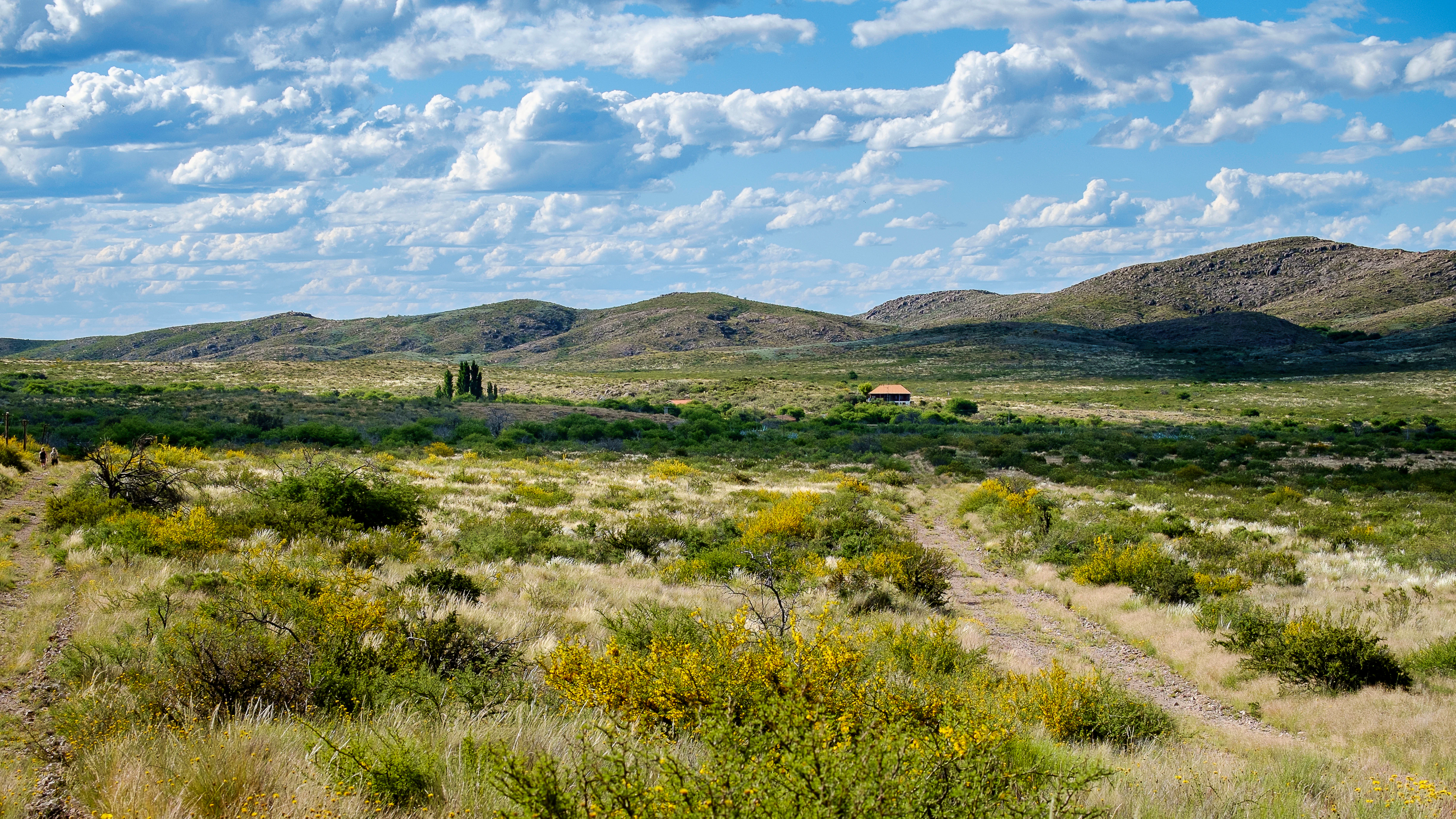
The landscape of Lihué Calel National Park is defined by the Sierra de Lihué Calel, an ancient mountain range that rises dramatically from the flat, semi-arid plains of central Argentina. These mountains originated from volcanic lava eruptions approximately 240 million years ago during the Permian period, though modern volcanic or plutonic activity no longer occurs in the region. The highest summits reach 589 meters above sea level, with the mountains displaying asymmetric slopes: gentle inclines on their northern faces and steeper, more abrupt descents on their southern flanks. The terrain surrounding the mountains consists of the broad plateaus and plains characteristic of the Monte ecoregion, a semi-arid landscape where the park's mountain ranges create localized zones of higher moisture and ecological diversity. Small seasonal streams flow during autumn and spring, their waters infiltrating into the sandy soils that dominate the lower elevations. The combination of these ancient mountains rising from the extensive flat plains creates a landscape of striking visual contrast and ecological significance.
Lihué Calel National Park ecosystems, habitats, and plant life
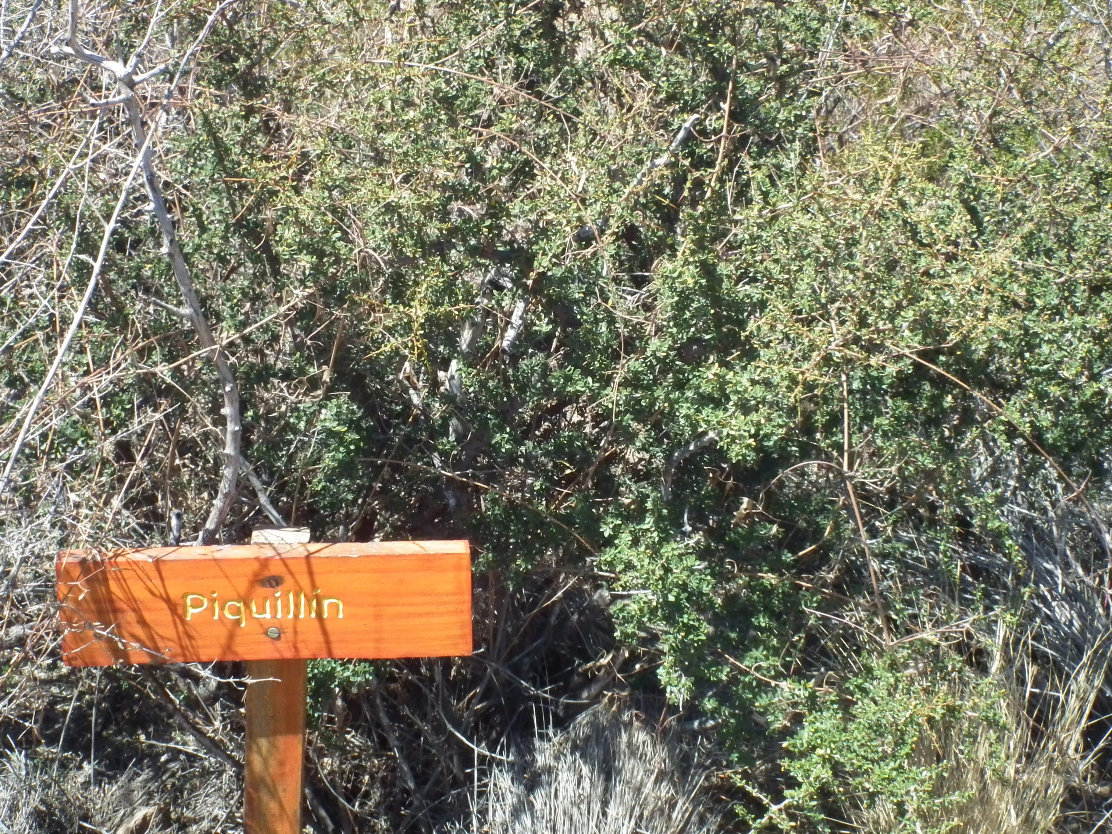
The nature of Lihué Calel National Park reflects a unique ecological situation where mountain forest and scrub habitats exist within the larger context of the Monte ecoregion's semi-arid grasslands. The park's vegetation transitions from dry tussock grasslands at lower elevations through the sparse thorn forest known as monte, characterized by jarilla shrubs, up to small woodlands of caldén trees and pockets of piquillín. Themonte forest becomes denser and more developed in the moister areas near the mountain crests, creating conditions that support species typically found in the espinal phytogeographic province. Several plant species are endemic to these mountains, including two daisy species and one legume that exist nowhere else on Earth. Rocky outcrops support a distinct flora including ferns, epiphytic air plants growing on stones, and various cacti such as the puelchana and cardon species. The rock faces also display colorful lichen communities in circular patterns of yellow, orange, and black. The park's water availability creates a microclimate that supports this ecological diversity, with small seasonal streams and the relative impermeability of certain soil areas maintaining moisture levels that allow these communities to persist in what would otherwise be an inhospitable environment.
Lihué Calel National Park wildlife and species highlights
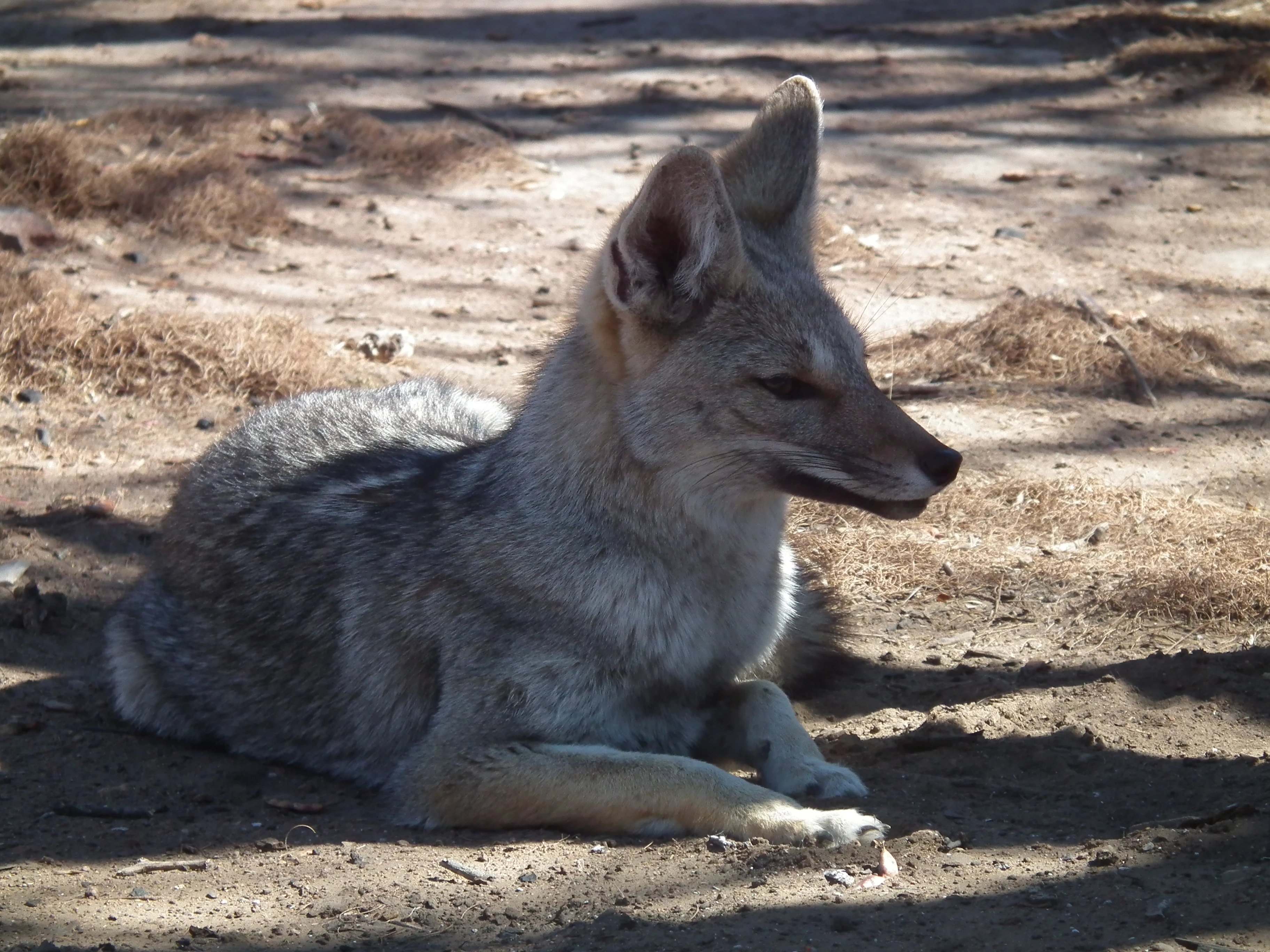
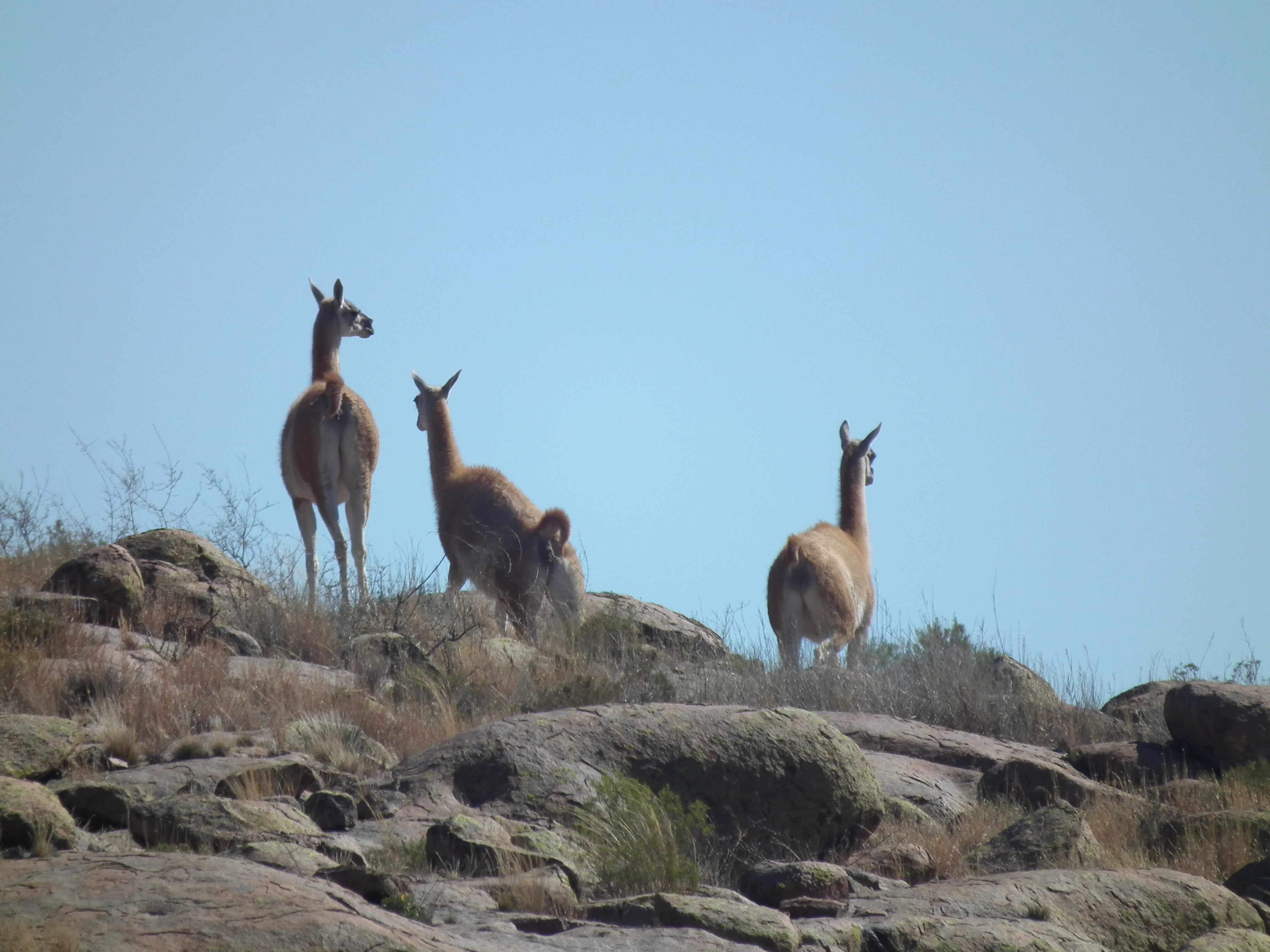
Lihué Calel National Park supports a diverse mammalian fauna adapted to both the mountain forests and the surrounding grassland plains. Guanacos roam the area in visible populations, while pumas maintain a presence as apex predators. The small mammal community includes vizcachas, cuises, and the tuco-tuco, a subterranean rodent that excavates extensive burrow systems to escape the intense daytime heat. Predatory species include the pampean fox, Geoffroy's cat, and the pajonal cat. The park also supports populations of maras, also known as Patagonian hares, as well as armadillos including peludos and piches. The avifauna is particularly diverse, with approximately 150 native bird species recorded. Notable species include the martineta and copetón gallito, the gray falconcion, the endangered yellow cardinal whose populations are threatened by capture for the pet trade, various buteos, turkey vultures, caranchos, chimangos, calandrias, and the choique, a smaller relative of the rhea. Condors are occasionally observed soaring over the mountains. When the caldén trees fruit, flocks of barranquera parrots arrive to feed on their seeds, adding to the park's seasonal wildlife displays.
Lihué Calel National Park conservation status and protection priorities
Lihué Calel National Park serves as a critical conservation refuge for the Monte ecoregion's unique biodiversity and for the cultural heritage of the region. The park protects one of the few remaining areas of caldén forest, an ecosystem type that has been significantly reduced by agricultural expansion across the pampean plains. The mountain environment preserves endemic plant species found nowhere else in the world, including two daisy species and one legume that are restricted to these specific mountain habitats. The park's designation includes a strict nature reserve zone where human activity is minimized to preserve core ecological processes. The archaeological sites with prehistoric rock art represent an irreplaceable cultural heritage that the park protects alongside its natural values. The conservation of this mountainous island within the surrounding grassland plains maintains ecological processes and species populations that could not survive in the transformed agricultural landscape that dominates the surrounding region.
Lihué Calel National Park cultural meaning and human context
The Sierra de Lihué Calel has been a significant site for human occupation and cultural expression for thousands of years, with archaeological evidence of prehistoric hunter-gatherer groups who lived in the area and created the rock art found in the Valle de las Pinturas. These late prehistoric rock art sites feature geometric motifs in red and black pigments, dating to approximately 2000 years before the present. The indigenous peoples utilized the mountain environment for its resources, including seeds and fruits from caldén and chañar trees, hunting guanacos, choiques, and armadillos, and using local stones for tools and pigments for painting. In historical times, the region was inhabited by the guenaken people, also known as puelche, who were eventually displaced by Mapuche groups arriving from Chile in the 18th century. The resulting transculturation produced the ranculche people, who used the area as a crossing point between the Andes and the Buenos Aires province plains. The valley and quebrada of the park bear the name of one notable historical figure, Chief Manuel Namuncurá, who attempted to reorganize his warriors in the mountains to resist the military campaigns of the late 19th century. European settlement began in the late 1800s, with the remains of La Casa de Piedra from the post-Desert Campaign period. The former Estancia Santa María de Lihué Calel, owned by Luis Gallardo until 1964, represents the colonial period before the land was acquired for protection.
Top sights and standout views in Lihué Calel National Park
The Sierra de Lihué Calel rising from the pampean plains creates one of the most distinctive landscapes in central Argentina, a mountain island of biodiversity in a sea of grassland. The Valle de las Pinturas archaeological site preserves prehistoric rock art with geometric motifs in red and black, a tangible connection to the region's ancient inhabitants. Over 150 bird species have been recorded in the park, including the endangered yellow cardinal and occasional condors. The caldén forests represent one of the last remaining examples of this once-widespread ecosystem. The hiking trails, particularly the Sendero del Huitru ascending to the Cerro Sociedad Científica Argentina and the Sendero Valle de las Pinturas to the rock art shelters, provide access to the park's natural and cultural highlights. The cultural heritage spans from prehistoric hunter-gatherer rock art through indigenous ranculche history to colonial-era ranching, with the name itself reflecting Mapudungun origins meaning mountains of life.
Best time to visit Lihué Calel National Park
Lihué Calel National Park can be visited throughout the year, though spring and autumn generally offer the most comfortable conditions for exploring the trails and observing wildlife. The summer months of December through February bring higher temperatures typical of the continental climate, while winter from June to August can be cold with nighttime temperatures dropping significantly. The mountain environment creates its own microclimate, typically somewhat more humid and less extreme than the surrounding plains. Wildlife viewing opportunities are consistent throughout the year, though animal activity may be more concentrated near water sources during drier periods. The park's facilities and trails remain accessible in all seasons, though visitors should check current conditions before planning their trip.

