
Mori Atlas logo
Nature reserveLoevestein, Pompveld & Kornsche Boezem

A composite ecological network preserving rare floodplain and wetland habitats across the central Dutch delta.

Loevestein, Pompveld & Kornsche Boezem: Mapping the Protected Riverine Landscapes of the Netherlands

Loevestein, Pompveld & Kornsche Boezem functions as a strategic network of protected habitat patches spread across the confluence of the Waal and Maas river systems. Spanning the provinces of Gelderland and North Brabant, this nature reserve integrates historic fortress surroundings, riparian meadows, and remnants of older polder landscapes. Through this detailed atlas record, discover how these fragmented riverine environments collectively safeguard unique lowland marsh and wetland ecosystems in one of Europe's most managed agricultural corridors.

Natura 2000riverlandfloodplainwet grasslandmarshlandDutch river delta
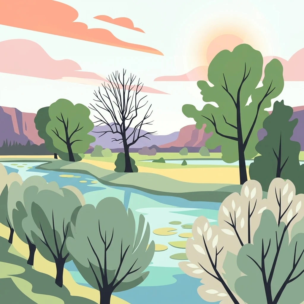
A flat-style digital illustration showing a winding river through a natural landscape with green and light-colored trees, lily pads on the water, and pinkish clouds in the sky.

Loevestein, Pompveld & Kornsche Boezem

Nature reserve

Park overview

Structured park overview, official facts, and landscape profile for Loevestein, Pompveld & Kornsche Boezem

Loevestein, Pompveld & Kornsche Boezem park facts, protected area profile, and essential visitor context

Review the core facts for Loevestein, Pompveld & Kornsche Boezem, including designation, size, terrain, visitor scale, habitats, and operating context in one park-focused overview.

About Loevestein, Pompveld & Kornsche Boezem

Loevestein, Pompveld & Kornsche Boezem belongs to the network of Dutch Natura 2000 sites that protect habitats listed under the European Union Habitats Directive. It is one of many Dutch sites where protection focuses on the ecological value of fragmented riverland rather than on a single large reserve. The site consists of natural areas clustered around the historically famous Slot Loevestein and extends southward to include the Pompveld and the Kornsche Boezem, giving the protected area a distinctive elongated string of components rather than a single core.

The Loevestein component covers parts of the Bommelerwaard and Munnikenland managed by Staatsbosbeheer. Although Slot Loevestein itself is the well known medieval fortress where Hugo Grotius famously escaped in a book chest, the Natura 2000 site deliberately excludes the castle and focuses on the surrounding natural areas, recognising that the broader river landscape is itself a significant ecological habitat. The Pompveld component lies south of the provincial roads N322 and N267 and forms part of the same general riverland system. The Kornsche Boezem contributes a small but characteristic fragment of older local hydrology near the hamlet of Korn in the municipality of Altena.

The site is embedded in a region defined by the dikes, polders, and former stream channels of the Waal and Maas rivers. Despite the heavily engineered character of the surrounding landscape, the protected fragments maintain habitats that have become uncommon elsewhere in the Netherlands, including soft floodplain transitions, marshy zones, and successional grasslands that depend on the river's seasonal dynamics. The designation of the site in 2013 fits within the broader Dutch Natura 2000 programme of systematically identifying the river delta as a priority for Habitats Directive protection.

Quick facts and research context for Loevestein, Pompveld & Kornsche Boezem

Loevestein, Pompveld & Kornsche Boezem is a Dutch Natura 2000 site designated under the European Habitats Directive and registered as site NL3004001. It lies in the provinces of Gelderland and North Brabant, within the municipalities of Altena and Zaltbommel, near the confluence-zone landscapes of the Waal and Maas rivers.

The site covers roughly seven and a half square kilometres across three distinct sub-areas. It is managed by Staatsbosbeheer together with Brabants Landschap, two of the largest Dutch nature management organisations, and represents the Dutch model of designating fragmented riverland habitats collectively under one EU-level protection framework.

Park context

Deeper park guide and search-rich context for Loevestein, Pompveld & Kornsche Boezem

Loevestein, Pompveld & Kornsche Boezem history, landscape, wildlife, and travel context

Explore Loevestein, Pompveld & Kornsche Boezem through its history, landscape character, ecosystems, wildlife, conservation priorities, cultural context, and seasonal travel timing in a structured park guide built for atlas discovery and search intent.

Why Loevestein, Pompveld & Kornsche Boezem stands out

The site is known for protecting fragments of riverine and wet-grassland habitat in one of the busiest river corridors of the Netherlands. Its three named components, Loevestein, Pompveld, and Kornsche Boezem, each represent a different facet of the cultural and ecological history of the Bommelerwaard and Land van Heusden en Altena region. Around Slot Loevestein, the area is recognised for combining a site of major Dutch historical memory with ecologically valuable floodplain and marshland habitats. The Kornsche Boezem is recognised as a remnant of an older, largely drained polder and stream landscape, while the Pompveld contributes additional river-connected habitat south of the main dike lines. Together the components illustrate how small, strategically chosen fragments can contribute meaningfully to the conservation of lowland river ecosystems.
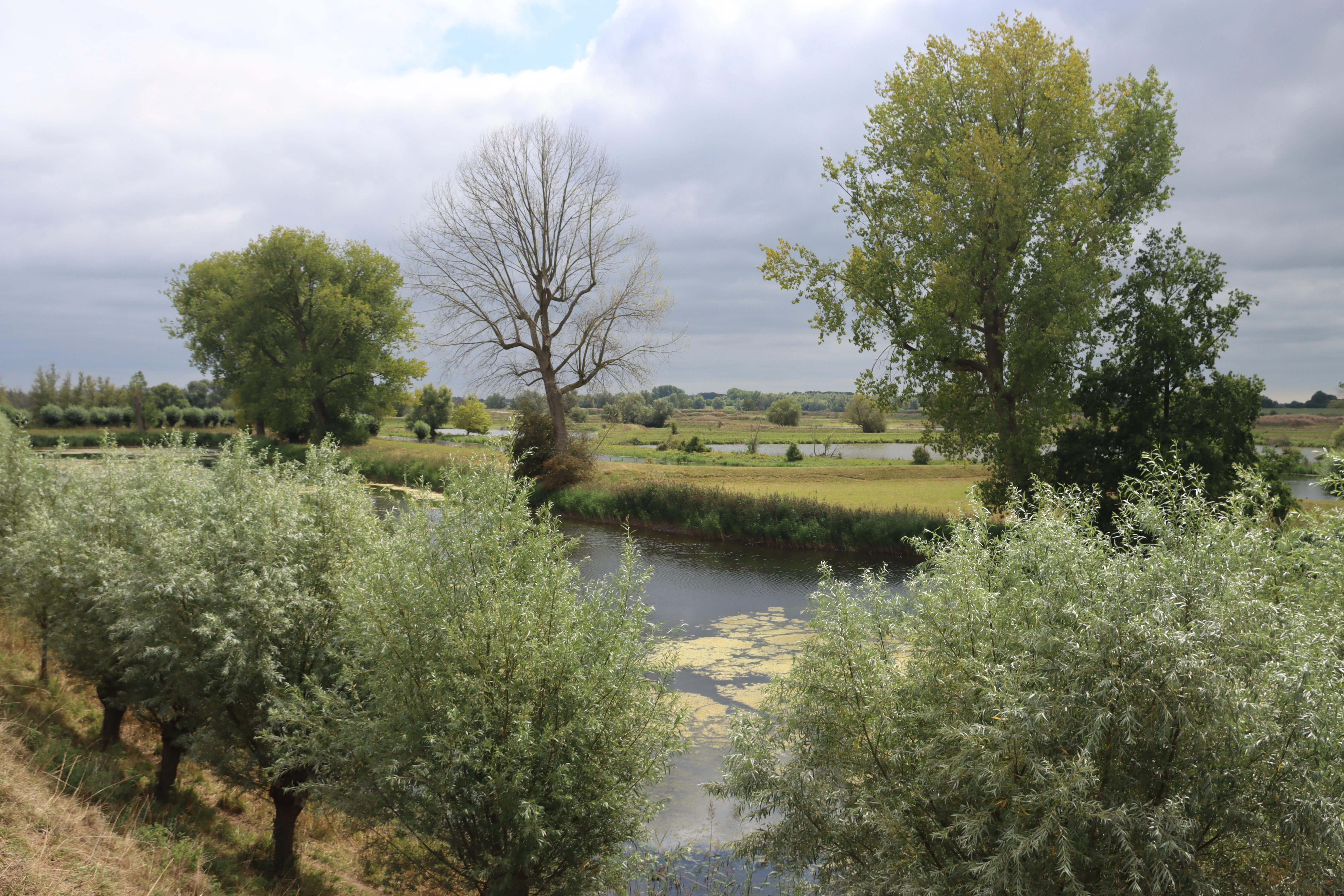
A peaceful landscape view over a small river or ditch with trees and shrubs along the banks under a cloudy sky.
A view across the wetland landscape of the Loevestein, Pompveld and Kornsche Boezem area.

Loevestein, Pompveld & Kornsche Boezem history and protected-area timeline

The Natura 2000 designation for Loevestein, Pompveld & Kornsche Boezem was formally established on 4 June 2013. Like many Dutch Natura 2000 sites, it resulted from a national process of identifying habitat areas meeting the criteria of the European Habitats Directive and binding them to a single official site code, in this case NL3004001, and a sequential Dutch area number of 71 within the national Natura 2000 list.

The natural areas that make up the site are, however, far older than the designation itself. The lands around Slot Loevestein have been shaped by centuries of interaction between the Waal river and the dikes, forts, and reclaimed floodplains of the Bommelerwaard. The Kornsche Boezem reflects an older hydrological layer of the region, connected to historic water management systems that long predated modern ecological planning. The Pompveld similarly sits within a landscape whose present land use reflects many generations of agrarian and hydraulic adaptation.

The current management of the site is shared between Staatsbosbeheer, the national forest and nature organisation, and Brabants Landschap, the regional society for nature conservation in North Brabant. Their joint involvement underscores that the protected area spans two provinces and depends on cooperation between national and regional stewardship bodies to maintain coherence across its scattered components.

Loevestein, Pompveld & Kornsche Boezem landscape and geographic character

The landscape of Loevestein, Pompveld & Kornsche Boezem is dominated by the flat, low-lying character of the central Dutch river delta. It lies in the broad alluvial plain where the Waal and Maas rivers have shaped the terrain over many centuries, producing a mosaic of dikes, floodplains, former stream beds, reclaimed agricultural land, and small patches of natural vegetation. There are no hills or dramatic relief; instead, the area's landscape character comes from subtle transitions in elevation, soil moisture, and water dynamics.

The Loevestein sub-area occupies a strategic position in the Bommelerwaard, where historic fortress grounds meet remnants of natural floodplain. The Pompveld, accessed via the N322 and N267 provincial roads, sits in a more open agricultural setting where riverine habitats can develop along the edges of cultivated land. The Kornsche Boezem, near the hamlet of Korn, reflects an older wet landscape where historic drainage patterns have left characteristic low-lying terrain.

Across the three components, the visual character is shaped by open skies, long views across flat polder land, lines of dike and waterway, and the contrast between built infrastructure and the remaining small natural fragments. Although the individual protected areas are modest in size, together they illustrate the layered history of a landscape where natural processes and human water management have long interacted.

Loevestein, Pompveld & Kornsche Boezem ecosystems, habitats, and plant life

The habitats protected within Loevestein, Pompveld & Kornsche Boezem reflect the ecological character of the central Dutch river delta. Although the site is heavily fragmented, its components together maintain examples of riverine, marshy, and wet-grassland habitats that are otherwise scarce in this heavily cultivated region. The Habitats Directive focus of the site, rather than the Birds Directive, indicates an emphasis on habitat types rather than specific bird features.

The natural surroundings of Slot Loevestein are valuable for their position within the broader floodplain system. Even small portions of relatively undisturbed riverine land here can support distinctive moisture-dependent vegetation and wildlife communities. The Pompveld extends this pattern south of the main dike lines, while the Kornsche Boezem preserves a fragment of older wet landscape that retains hydrological features disappearing elsewhere in the area.

The site's ecological significance lies less in large continuous habitat blocks than in the persistence of characteristic small-scale habitat fragments in a heavily engineered river landscape. By grouping such fragments under one designation, Dutch conservation planning recognises that the future of lowland river habitats depends on maintaining networks of small, suitable areas connected by the river system itself.

Loevestein, Pompveld & Kornsche Boezem wildlife and species highlights

The protected area's fauna is shaped by the riverine and wet-grassland habitats it preserves. The combination of open water, marshy zones, floodplain transitions, and surrounding agricultural land supports a range of wildlife typical of the central Dutch river corridor, including waterbirds, waders, and species that depend on seasonally varying water levels.

Although the source material does not enumerate specific species in detail, the ecological setting around Loevestein, in the broad Waal floodplain, and along the Kornsche Boezem is widely associated in the Netherlands with habitat for wetland birds and other river-edge wildlife. The persistent presence of even small fragments of natural habitat within the otherwise intensively managed Bommelerwaard and Land van Altena supports this local biodiversity and contributes to regional ecological networks.

Loevestein, Pompveld & Kornsche Boezem conservation status and protection priorities

Loevestein, Pompveld & Kornsche Boezem was designated under the European Habitats Directive on 4 June 2013, giving its constituent habitats formal protection status within the broader Natura 2000 framework. Its designation as site NL3004001 reflects its recognition as a meaningful contributor to the conservation of habitat types listed under the directive, particularly in the central Dutch river delta.

The site's conservation importance lies in its location within one of the most altered river landscapes in Europe. Where intensive agriculture, urbanisation, and dike management have reduced natural habitat to scattered fragments, this site preserves examples of the riverine and wet habitats that once characterised the region. The joint management by Staatsbosbeheer and Brabants Landschap ensures that both national and regional conservation priorities are addressed.

By grouping several distinct fragments under a single Natura 2000 designation, the area also illustrates a key Dutch conservation strategy: the recognition that a series of small, ecologically related sites can collectively achieve conservation outcomes that no single reserve of comparable size could provide on its own in such a densely modified landscape.

Loevestein, Pompveld & Kornsche Boezem cultural meaning and human context

The site is closely associated with one of the most storied locations in Dutch history. Slot Loevestein, where Hugo Grotius famously escaped imprisonment in 1621 hidden inside a book chest, lies at the heart of the protected area's geographic identity. While the castle itself is not part of the Natura 2000 site, the surrounding natural areas carry the cultural resonance of this broader riverland landscape.

The Bommelerwaard and Land van Altena are historic regions shaped by centuries of flood, dike construction, land reclamation, and small-scale settlement. The Kornsche Boezem in particular reflects the long-standing interaction between local communities and the hydrological systems that once defined this part of the river delta. The protected area thus carries both ecological and cultural-historical meaning, even if the formal Natura 2000 designation is driven by habitat protection rather than heritage.

Top sights and standout views in Loevestein, Pompveld & Kornsche Boezem

The most distinctive features of Loevestein, Pompveld & Kornsche Boezem include its composite structure across three separate but ecologically related fragments, its position in the Bommelerwaard riverland between the Waal and Maas, and its dual management by Staatsbosbeheer and Brabants Landschap. Its recognition as Natura 2000 site NL3004001 reflects both national and European-level importance of its remaining riverine habitats.

Another highlight is the site's identity as a model of Dutch fragmented-riverland conservation. Rather than preserving one large reserve, it combines habitats around Slot Loevestein, the Pompveld, and the Kornsche Boezem into a coherent protected network. This approach is particularly notable in a region where centuries of dike construction and agricultural intensification have left little room for large contiguous nature areas.

Best time to visit Loevestein, Pompveld & Kornsche Boezem

The site is best appreciated when the riverland is most visually and ecologically expressive. Spring brings fresh growth to floodplain vegetation and active birdlife along the wet grasslands, while summer offers long open views across the flat polder landscape and stable conditions for walking or cycling between the scattered components.

Autumn and winter also have their own character, with quieter conditions, migratory waterbirds in the broader river delta, and a more atmospheric quality along dikes and remnant stream beds. Because the protected area is fragmented and partly bordered by busy provincial roads, any visit is best undertaken during daylight hours with attention to local access conditions around the Natura 2000 fragments themselves.
Monthly climate preview

Long term temperature ranges and monthly precipitation rhythm for Gelderland protected terrain

Loevestein, Pompveld & Kornsche Boezem Climate Normals and Average Temperature Patterns

Representative coordinates record measured monthly temperature swings from sub-zero winter minimums to warm summer maximums alongside consistent daily precipitation averages. Detailed monthly climate records provide a complete twelve month breakdown of temperature and precipitation normals for this protected area.
Annual mean10 °C
2 °C18 °C
Jan
Feb
Mar
Apr
May13°
Jun16°
Jul18°
Aug18°
Sep15°
Oct11°
Nov
Dec
Warmest month
July

18.2 °C

Coolest month
January

2.5 °C

Wettest month
December

2.6 mm/day

Driest month
April

1.4 mm/day

Park location guide

Geography guide, regional context, and park location map for Loevestein, Pompveld & Kornsche Boezem

Loevestein, Pompveld & Kornsche Boezem park geography, regions, and map view in Netherlands

Understand where Loevestein, Pompveld & Kornsche Boezem sits in Netherlands through a broader geographic reading of the surrounding landscape, nearby location context, and its mapped position within the national park landscape.

How Loevestein, Pompveld & Kornsche Boezem fits into Netherlands

The Netherlands is a low-lying coastal country in Northwestern Europe, famous for its extensive dike and canal systems that reclaim land from the sea. It consists of twelve provinces and is known for tulips, windmills, and cycling culture. The country is a founding member of the European Union with Amsterdam as its capital and The Hague as the seat of government.

Wider geography shaping Loevestein, Pompveld & Kornsche Boezem in Netherlands

The Netherlands is located in Northwestern Europe along the North Sea coastline to the north and west. It borders Germany to the east and Belgium to the south. The country is notably flat, with a significant portion of its territory lying below sea level, protected by dikes and dune systems. It consists of twelve provinces and also includes overseas municipalities in the Caribbean.

Map view of Loevestein, Pompveld & Kornsche Boezem

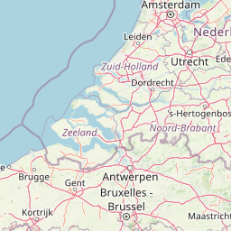
Use this park location map to pinpoint Loevestein, Pompveld & Kornsche Boezem in Netherlands, understand its exact geographic position, and read its mapped placement within the surrounding landscape more clearly.

Pigeon | © OpenStreetMap contributors

Location context for Loevestein, Pompveld & Kornsche Boezem

GelderlandNoord-Brabant
Recorded earthquake history

Review Recorded Earthquake History near Loevestein, Pompveld & Kornsche Boezem

Access a structured collection of historical seismic events associated with the terrain of Loevestein, Pompveld & Kornsche Boezem. Utilize MoriAtlas to examine recorded event dates, magnitudes, and proximity metrics for this protected river delta landscape.

Loevestein, Pompveld & Kornsche Boezem Earthquake History

Catalogued events

1 event

Strongest magnitude

Magnitude 3.7

Most recent event

Sep 11, 1999

This history includes earthquakes recorded inside the park or within 50 km of its borders

Visualizing the riverine habitats, floodplains, and wetland terrain of the Dutch delta

Loevestein, Pompveld & Kornsche Boezem Photos and Landscape Scenery

Visual documentation reveals the distinct lowland terrain, expansive wetlands, and riverine habitats that define Loevestein, Pompveld & Kornsche Boezem. Examining photographic records provides a deeper understanding of how protected floodplains and water management shape the regional ecosystem.

A peaceful landscape view over a small river or ditch with trees and shrubs along the banks under a cloudy sky.

Park atlas

Compare adjacent riverland habitats and connected protected areas across the central delta.

Parks Near Loevestein, Pompveld & Kornsche Boezem and Regional Protected Landscapes

Browsing other protected areas near Loevestein, Pompveld & Kornsche Boezem reveals the wider network of riverine and wetland reserves shaping the central Dutch lowland. Extending the regional comparison highlights similar floodplain fragments and ancient polder ecosystems preserved across the delta.
Nature reserveGelderland
About 5.2 km away#1 closest

North

Lingegebied & Diefdijk-Zuid: Protected Nature Reserve in Central Netherlands

A fragmented river landscape spanning three provinces

Lingegebied & Diefdijk-Zuid is a designated Natura 2000 nature reserve characterized by its scattered parcels of protected land. The area is deeply integrated into the Dutch river landscape, following the path of the Linge river and the historic Diefdijk. Its unique geography across four municipalities showcases the complex relationship between regional water management and protected European habitat types.

Area
7.5 km²
Established
2013
Relief
Lowland
Climate
Temperate
Watercolor illustration showing a network of rivers, trees, and hills in a wetland landscape
National parkNetherlands
5.2 km away#2 closest

West

De Biesbosch National Park: A Dutch National Park Mapping Tidal Wetlands and Flood Forests

Explore mapped waterways and diverse protected landscapes.

Delve into the geography of De Biesbosch National Park, a remarkable protected area in the Netherlands renowned for its extensive freshwater tidal wetlands. This national park showcases a unique landscape defined by intricate river systems, dominant willow flood forests, and vital reed beds, serving as a critical habitat for migratory birds and a prime example of wetland restoration. Understand its place within the regional geography through our atlas-driven approach to protected land discovery.

Area
90 km²
Established
1994
IUCN
II
Relief
Lowland
Watercolor illustration of rolling hills, a winding river, and fields with distant mountains
National parkNorth Brabant
9.2 km away#3 closest

South

Van Gogh National Park: National Park in North Brabant with Dune Landscapes

Explore mapped protected areas and regional geography.

Van Gogh National Park is a significant protected landscape in North Brabant, Netherlands, covering approximately 1,200 square kilometers. This national park is distinguished by its extensive drift sand dune systems, notable heathlands, and wooded valleys, offering a diverse terrain within the Dutch context. Named in tribute to Vincent van Gogh, it merges rich natural landscapes with cultural heritage, serving as a model for collaborative conservation and regional development, all mapped for detailed atlas exploration.

Area
1,200 km²
Established
2024
IUCN
II
Relief
Lowland
Watercolor artwork showing sand dunes, scattered trees, distant mountains, and soft sky
National parkNetherlands
9.8 km away#4 closest

South

De Loonse en Drunense Duinen National Park: Explore Dutch Protected Sand Drift Landscapes and Heathlands

National Park with unique living sand drift and dune terrain.

Navigate the geographic contours and protected land boundaries of De Loonse en Drunense Duinen National Park, a premier Dutch natural area. This national park is celebrated for its extensive living sand drift, one of the largest in Northern Europe, alongside significant heathlands and coniferous forests. Gain a structured understanding of its landscape character and its role within regional geography through detailed map context and atlas exploration tools.

Area
35 km²
Established
2002
IUCN
II
Relief
Lowland
Watercolor painting of a lush, green landscape with ferns and grasses in the foreground and a soft, hazy forest line in the background.
Protected areaNetherlands
About 27 km away#5 closest

Northeast

Kolland en Overlangbroek: Mapping the Rare Ash Floodplain Forest of the Netherlands

Historic estate landscape and protected woodland habitat.

Located between Wijk bij Duurstede and the Utrechtse Heuvelrug, Kolland en Overlangbroek preserves a vital fragment of alluvial ash forest. This protected area offers deep insight into Dutch floodplain geography, featuring a distinct mosaic of sandy ridges, silty backswamps, and centuries-old woodland managed for its unique bryophyte flora and groundwater-fed ecosystem.

Area
1.1 km²
Relief
Lowland
Climate
Temperate
Scope
Terrestrial
Watercolor landscape showing green hills, forests, and a small stream with grassy patches
National parkUtrecht Province
About 33 km away#6 closest

Northeast

Utrechtse Heuvelrug National Park: Mapped Protected Landscape and Geographic Atlas

Discover Utrecht Province's glacial ridge and diverse natural terrain.

Utrechtse Heuvelrug National Park is a significant protected natural area located in Utrecht Province, renowned for its unique glacial ridge topography. This entry provides detailed information about its mapped boundaries, diverse landscapes including heathlands and forests, and its importance as an ecological corridor within the Netherlands. Explore the park's distinct geography and its role in regional conservation through our structured atlas view.

Area
100 km²
Established
2003
IUCN
II
Visitors
1M annual
A watercolor painting showing a soft, idyllic landscape with rolling hills in the background, a winding path or stream in the middle ground, and grasses and trees in the foreground.
Nature reserveGelderland
About 40 km away#7 closest

Northeast

Binnenveld Nature Reserve: Protected Wetland and Meadowland in Gelderland

Rare blue grasslands and stream valley quaking bogs

Located in the Gelderse Vallei, Binnenveld stands as a vital nature reserve representing the complex history of Dutch polder landscapes. The area combines traditional meadowland with strictly protected habitats like the Bennekomse Meent, serving as a haven for meadow birds and an important site for ecological restoration and wetland preservation.

Area
1.11 km²
Established
2014
Relief
Lowland
Climate
Temperate
Protected areaNetherlands
45 km away#8 closest

Northeast

Veluwe: A Comprehensive Geographic Atlas of the Central Netherlands Protected Area

Glacial moraines, heathlands, and inland sand systems

Investigate the Veluwe, a premier protected area in the Gelderland province characterized by its historic push moraines and extensive ecological zones. The region encompasses significant sand drift complexes, dense woodlands, and vital spring-fed streams, offering a clear view of the diverse natural terrain found throughout the central Netherlands.

Area
1,000 km²
Relief
Upland
Climate
Temperate
Access
Easy access

Common questions about visiting, size, designation, and location context for Loevestein, Pompveld & Kornsche Boezem

Loevestein, Pompveld & Kornsche Boezem FAQs for park facts, access, geography, and protected area context

Find quick answers about Loevestein, Pompveld & Kornsche Boezem, including protected-area facts, park geography, trail and visitor context, and how the park fits into its surrounding country and regional landscape.
MoriAtlas Explorer

Continue Your Protected Areas Search Across the Global Atlas

Deepen your exploration by continuing the structured search for national parks and protected areas worldwide. Utilize the comprehensive filtering capabilities to compare different conservation landscapes and refine your understanding of global park geography. Discover more about the distribution and characteristics of protected natural areas.

Global natural geography