
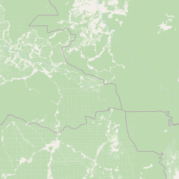
Rivers
Park geography
Detailed spatial analysis of regional administrative bounds and landscape features
Comprehensive Geographic Profile and Mapped Terrain of Lomami National Park in the Congo
This geographic profile examines the 8879 square kilometer expanse of Lomami National Park, located across the Tshopo and Maniema regions of the Democratic Republic of the Congo. It provides structured insights into the tropical forest and savanna terrain, incorporating major river systems such as the Lomami, Mombu, and Lwidjo.
Related tags
Lowland tropical rainforestBonobo habitatOkapi conservationCongo BasinCentral African protected area
DRC's newest protected wilderness, safeguarding Central Africa's lowland rainforests and iconic apes
Lomami National Park
Lomami National Park is a vast protected area in the heart of the Democratic Republic of the Congo, established in July 2016 as the country's ninth national park and the first new national park created since 1992. Spanning approximately 8,879 square kilometers of lowland tropical rainforest, the park occupies a strategic position in the central basin of the Lomami River, straddling the provinces of Tshopo and Maniema in Central Africa. This relatively recent designation followed years of consultation with local communities, including traditional Tambiko ceremonies in which ancestral approval was sought for the park's boundaries. The park represents a significant conservation milestone for the DRC, adding substantial protected territory to the nation's network of national parks while also creating a buffer against wildlife depletion in a region facing intense hunting pressure.
- Location
- Democratic Republic of the Congo
- Park type
- National park
- Established
- 2016
- Area
- 8,879 km²
Location overview
Administrative alignment within the Tshopo and Maniema regions
Geographic Location and Regional Setting of Lomami National Park
Lomami National Park sits within the Democratic Republic of the Congo, spanning Tshopo and Maniema. Verified records detail its inland, non-transboundary status as a terrestrial protected landscape.
- Countries
- Democratic Republic of the Congo
- Regions
- Maniema, Tshopo
- Primary location
- Democratic Republic of the Congo
Boundary and coordinates
Explore mapped protected area geometry and derived spatial measurements
Lomami National Park Boundary Map and Spatial Extent Analysis
Spatial mapping outlines the protected perimeter and geographic footprint for spatial context. Derived area measurements and coordinate limits accompany the interactive boundary view.
- Boundary area
- 8,863.5 km²
- Boundary perimeter
- 903.6 km
- Northernmost point
- 0.9204° S
- Southernmost point
- 3.0768° S
- Easternmost point
- 25.4402° E
- Westernmost point
- 24.4479° E
- Geographic centre
- 1.7477° S, 25.0497° E
- North–south span
- 238.4 km
- East–west span
- 110.4 km
Terrain and natural features
Mixed relief classifications and internal river networks across protected terrain
Lomami National Park Terrain and Named Natural Feature Geography
Mixed relief classifications govern the landscape while recorded river systems including the Lomami, Mombu, and Lwidjo flow directly within the protected area. Linked feature cards supply specific types and spatial relationships for each registered natural landmark.
Selected named natural features
Rivers
Lwidjo
Rivers
Lomami River
Environmental setting
Tropical climate zones, dominant forest cover, and mixed terrain profiles
Lomami National Park Environmental Classifications and Physical Setting
Recorded habitat types and landscape features serve as interpretive categories for reading the physical setting of Lomami National Park. Connected atlas destinations link each classification to related regional geography within the protected area.
- Relief
- Mixed relief
- Climate
- Tropical
- Water
- Major water bodies
- Forest cover
- Dense forest cover
Landscape features
Forest · Grassland · Hills · Rivers · Wetland
Habitat types
Tropical forest · Savanna · Riverine habitat · Wetland
Park atlas
Map the regional spread of protected landscapes across the Congo Basin, exploring areas adjacent to Lomami National Park.
Discover Other National Parks and Protected Areas Near Lomami National Park
After exploring Lomami National Park, compare its unique lowland tropical rainforest and bonobo habitat with other national parks and protected areas across the Democratic Republic of the Congo. Discover how connected conservation landscapes contribute to biodiversity preservation and geographic understanding in Central Africa.
National parkDemocratic Republic of the Congo
170 km away#1 closest
Northeast

Maiko National Park National Park: Map and Protected Landscape Exploration
Discover primary forest terrain and endemic species sanctuary.
Maiko National Park, situated in the Democratic Republic of the Congo, is a cornerstone of central African conservation, protecting over 10,000 square kilometers of pristine tropical rainforest. This national park is recognized globally for its critical role in harboring endemic species such as Grauer's gorilla and the okapi, alongside significant populations of forest elephants and chimpanzees. Its extensive river systems and varied terrain within the Ituri Rainforest ecosystem provide essential habitat, establishing Maiko as a key area for understanding and preserving central African biodiversity and landscape context.
- Area
- 10,885 km²
- Established
- 1970
- IUCN
- II
- Relief
- Mixed relief
National parkDemocratic Republic of the Congo
202 km away#2 closest
West
Salonga National Park: Africa's Largest Tropical Rainforest Protected Landscape
Discover its vast mapped boundaries and riverine geography.
Salonga National Park is recognized as Africa's largest tropical rainforest, a UNESCO World Heritage Site vital for the conservation of bonobos and other endemic species. Its protected landscape is defined by extensive lowland forests and intricate river networks, with access primarily through waterways. This park offers profound insights into the geography of the Congo Basin and the conservation of endangered primates within a vast, remote wilderness.
- Area
- 36,000 km²
- Established
- 1970
- IUCN
- II
- Relief
- Lowland
National parkSouth Kivu Province
228 km away#3 closest
East
Kahuzi-Biéga National Park: Protected Mountain and Rainforest Geography in South Kivu
Mapped terrain from volcanic summits to equatorial forest basins.
Kahuzi-Biéga National Park represents a significant protected area within the South Kivu Province. The geography features two distinct sectors connected by a narrow ecological corridor, encompassing everything from high-altitude subalpine heather zones to dense tropical lowland environments. This dataset provides a detailed look at the park boundaries, volcanic topography, and the regional landscape context that defines this essential habitat.
- Area
- 6,000 km²
- Established
- 1970
- IUCN
- II
- Relief
- Mixed relief
National parkDemocratic Republic of the Congo
About 371 km away#4 closest
East
Kahuzi-Biega National Park: Protected Volcanic and Rainforest Landscapes in the Congo
Geographic atlas of the Mitumba Mountains and lowland rainforest transition
Kahuzi-Biega National Park occupies a significant expanse in the eastern Democratic Republic of the Congo, connecting mountainous volcanic terrain with sprawling tropical lowland forests. The area supports an unparalleled diversity of vegetation, tracking from subalpine summits down to rare swamp and riparian habitats. This site acts as a key reference for understanding the ecological richness of the Albertine Rift and the broader Congo Basin landscape.
- Area
- 6,000 km²
- Established
- 1970
- IUCN
- II
- Relief
- Mixed relief

National parkDemocratic Republic of the Congo
402 km away#5 closest
East
Virunga National Park: Democratic Republic of the Congo's Premier Protected Landscape
Mapped boundaries and diverse Albertine Rift endemic geography.
Virunga National Park represents a pivotal protected area within the Democratic Republic of the Congo, characterized by an exceptional range of geographic features and vital ecosystems. Its protected landscape includes active volcanoes like Nyiragongo with its lava lake, the towering Rwenzori Mountains, and diverse lowland savannas. This atlas-focused entry highlights the park's unique position in the Albertine Rift, crucial for numerous endemic species and offering significant insight into regional geography and protected land context.
- Area
- 7,800 km²
- Established
- 1925
- IUCN
- II
- Relief
- Mountain
National parkRwanda
About 431 km away#6 closest
East

Nyungwe Forest National Park: Protected Landscape in Rwanda's Geography
National park mapping and regional context discovery.
Understand Nyungwe Forest National Park as a distinct protected landscape within the atlas of Rwanda. This page details its status as a national park, focusing on its geographic positioning and mapped protected boundaries. Explore the park's integral role in the regional geography of East Africa, providing a foundation for structured discovery of its natural terrain and conservation importance.
National parkRwanda
About 431 km away#7 closest
East
Nyungwe National Park: Rwanda's Protected National Park for Geographic Discovery
Explore its mapped natural landscape and protected terrain.
Nyungwe National Park represents a vital protected area within Rwanda, contributing a unique landscape to the nation's geographic atlas. This national park offers a specific focus for understanding protected lands, their mapped boundaries, and the natural terrain they encompass. By examining Nyungwe National Park, users gain insight into Rwanda's regional geography and the significance of its conservation efforts within the broader context of East African natural landscapes.
National parkBurundi
About 438 km away#8 closest
East

Rusizi National Park: National Park in Burundi's Geographic Landscape Context
Explore mapped protected area boundaries and regional geography.
Rusizi National Park stands as a significant protected area within Burundi, contributing to the nation's conservation atlas. This national park offers a distinct geographic profile, showcasing its specific landscape and terrain features within the East African context. Users can delve into the mapped boundaries of Rusizi National Park to understand its protected status and its role in the regional geography, facilitating detailed geographic discovery.
- Area
- 90 km²
- Established
- 1980
- IUCN
- II
- Climate
- Tropical
MoriAtlas Explorer
Continue Exploring Lomami National Park's Geography and Protected Landscape Context
Deepen your understanding of Lomami National Park's unique role as a protected landscape in Central Africa. Examine its mapped boundaries, diverse forest terrain, and the geographic factors that shape its critical habitat for bonobos and other endemic species. Discover the atlas significance of this crucial national park within the Democratic Republic of the Congo.
Browse next
Global natural geography
Explore related park routes
Explore MoriAtlas Global ParksBrowse All MoriAtlas ParksGlobal Park Map DiscoveryMoriAtlas: Browse All CountriesBrowse All MoriAtlas ContinentsNational Park Environment AtlasGrand Canyon National Park AtlasYellowstone National Park AtlasYosemite National Park Atlas and GeographySerengeti National Park AtlasGalápagos National Park Protected LandscapeBanff National Park Geography and AtlasKruger National Park Atlas EntryUluṟu-Kata Tjuṯa National Park AtlasExplore Uluru-Kata Tjuta National Park GeographyPlitvice Lakes National Park AtlasFiordland National Park Protected LandscapeGreat Smoky Mountains National Park AtlasAfghanistan National Parks and Protected AreasAlbania National Parks and Protected AreasAlgeria National Parks and Protected AreasAmerican Samoa National Parks and Protected AreasAndorra National Parks and Protected AreasAngola National Parks and Protected AreasAntarctica National Parks and Protected AreasAntigua and Barbuda Park List