
Rivers
Park geography
Structured data on regional administrative placement, land coverage, and environmental classification
Los Quetzales National Park: Comprehensive Geographic Boundaries, Terrain, and Natural Features
The geography of Los Quetzales National Park centers on its 50 square kilometer protected boundary within the Pérez Zeledón Canton of Costa Rica. This profile details the mountain-dominated landscape, including essential waterways like the Río Savegre and Río Blanco, alongside diverse habitats ranging from montane forests to wetlands and peatlands.
Related tags
cloud forestCentral Americahighland protected areabirdwatching destinationCosta Rica national parks
Cloud forest sanctuary of the Resplendent Quetzal in Costa Rica's Talamanca highlands
Los Quetzales National Park
Los Quetzales National Park is a protected area in the Talamanca mountain range of southern Costa Rica, established in 2006 through decree 32981-MINAE. The park encompasses approximately 50 square kilometers of rugged highland terrain and protects one of the most significant cloud forest ecosystems in Central America. It is named for the Resplendent Quetzal, a strikingly plumed bird considered sacred in pre-Columbian Mesoamerican cultures and today regarded as one of the world's most sought-after birdwatching species. The park lies within the broader Central Conservation Area managed by Costa Rica's National System of Conservation Areas and is part of the transboundary Turberas de Talamanca Ramsar wetland site. Access is limited, with a single mountainous road and a small ranger station serving visitors.
- Location
- Costa Rica
- Park type
- National park
- Established
- 2006
- Area
- 50 km²
Location overview
Regional positioning inside Costa Rica and Pérez Zeledón Canton
Los Quetzales National Park: Geographic Placement and Regional Setting
Los Quetzales National Park sits within Costa Rica, positioned inside the Pérez Zeledón Canton. Regional mapping confirms its non-transboundary status as a fully self-contained national reserve.
- Countries
- Costa Rica
- Regions
- Pérez Zeledón Canton
- Primary location
- Costa Rica
Boundary and coordinates
Interactive protected boundary geometry and derived area facts
Los Quetzales National Park Boundary Map and Spatial Extent
Mapped geographic outlines provide clear spatial context for the protected territory. Accompanying facts detail the recorded area measurements, coordinate limits, and geographic spans without claiming legal survey precision.
- Boundary area
- 41 km²
- Boundary perimeter
- 53.2 km
- Northernmost point
- 9.6396° N
- Southernmost point
- 9.5308° N
- Easternmost point
- 83.7905° W
- Westernmost point
- 83.8712° W
- Geographic centre
- 9.5856° N, 83.8317° W
- North–south span
- 12 km
- East–west span
- 8.9 km
Terrain and natural features
Stored terrain classifications and recorded river networks within the park boundaries.
Los Quetzales National Park Mountain Terrain and Natural Features
Mountain terrain classifications define the physical geography of Los Quetzales National Park. Linked feature cards supply names, types, measurements, and spatial relationships for recorded rivers.
Selected named natural features
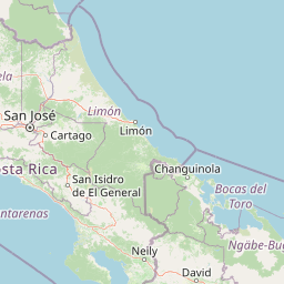
Rivers
Río Brujo
Rivers
Río Blanco
Rivers
Quebrada Ojo de Agua
Rivers
Quebrada Seca
Rivers
Savegre River
Environmental setting
Tropical montane forest, wetland, and mountain relief profiles
Los Quetzales National Park Environmental Classifications and Physical Setting
Recorded landscape features, habitat types, and dominant forest cover combine to outline the physical setting of Los Quetzales National Park. Associated classification records connect these environmental categories directly to related protected area destinations across the atlas.
- Relief
- Mountain
- Climate
- Tropical
- Water
- Major water bodies
- Forest cover
- Dense forest cover
Landscape features
Mountains · Forest · Wetland · Bog
Habitat types
Tropical forest · Montane forest · Wetland · Peatland
Park atlas
Map Adjacent Protected Areas and Regional Cloud Forest Ecosystems Surrounding Los Quetzales National Park
Continue Park Discovery: Explore National Parks and Protected Areas Near Los Quetzales National Park
Explore other national parks and protected areas geographically close to Los Quetzales National Park, tracing the spread of conservation landscapes across Costa Rica's Talamanca mountains. Comparing these protected areas reveals their regional context, offering deeper insights into interconnected cloud forest habitats, highland terrain, and broader conservation efforts.
National parkCosta Rica
Park boundaries overlap#1 closest
Northeast

Tapantí National Park: Costa Rica National Park Atlas and Mapped Landscape Exploration
Explore protected boundaries and natural terrain within its geographic setting.
Tapantí National Park is a designated national park in Costa Rica, offering specific insights into the country's protected natural landscapes. This page provides an atlas-style view of its geographic placement, the extent of its protected area, and the character of its natural terrain. Users can investigate the park's mapped context and understand its significance within the broader geography of Costa Rica, facilitating focused exploration of protected lands and regional landscape features.
- Area
- 583.2 km²
- Established
- 1982
- IUCN
- II
- Relief
- Mountain
National parkCartago Province
14 km away#2 closest
East
Chirripó National Park: A Protected Landscape within Cartago Province's Geography
Explore its mapped boundaries and natural terrain.
This page provides detailed geographic context for Chirripó National Park, a designated national park located in the Cartago Province of Costa Rica. It focuses on the park's protected landscape identity, its position within the regional geography, and its distinct mapped boundaries. Understanding Chirripó National Park through its geographic and atlas-centric attributes offers a foundational insight into its natural significance.
- Area
- 508.49 km²
- Established
- 1975
- IUCN
- II
- Climate
- Alpine
National parkPuntarenas Province
27 km away#3 closest
Southwest
Manuel Antonio National Park: Protected Landscape and Geographic Detail
Mapped boundaries and regional atlas context.
Delve into the protected landscape of Manuel Antonio National Park, a notable national park located in Puntarenas Province. This detail entry provides essential geographic context, focusing on mapped park boundaries and regional terrain. Understand its protected-area identity and its contribution to the natural atlas through detailed exploration tools designed for geographic discovery.
- Area
- 275.87 km²
- Established
- 1972
- IUCN
- II
- Visitors
- 438.8K annual
National parkCartago Province
34 km away#4 closest
North
Irazú Volcano National Park: National Park Protected Area Atlas
Mapped Boundaries and Volcanic Terrain
Irazú Volcano National Park stands as a distinct protected area within the landscape of Cartago Province, Costa Rica. This page provides an atlas-centric view, detailing the park's mapped boundaries and its identity as a national park. Explore the volcanic geography and regional context, understanding its contribution to the protected lands of Central America.
- Area
- 20 km²
- Established
- 1955
- IUCN
- II
- Relief
- Mountain
National parkCosta Rica
41 km away#5 closest
North
Turrialba Volcano National Park: Mapped Geography and Protected Landscape Context in Costa Rica
Explore the protected area's natural terrain and regional atlas placement
Turrialba Volcano National Park is a key protected landscape in Costa Rica, offering distinct geographic features and environmental context for atlas exploration. This page details the park's mapped boundaries and its significance as a national park, providing a foundation for understanding its place within the country's diverse natural terrain. Discover the unique geographic identity of this protected area and its role in the regional landscape.
- Area
- 16 km²
- Established
- 1955
- IUCN
- II
- Relief
- Mountain
Marine protected areaCosta Rica
About 42 km away#6 closest
South
Ballena National Marine Park: Mapping a Protected Marine Area's Geographic Identity in Costa Rica
Explore coastal landscape and protected marine boundaries.
Ballena National Marine Park stands as a significant marine protected area along Costa Rica's Pacific coast. This page provides an atlas-focused exploration of its unique geographic identity, detailing its mapped marine boundaries and the distinctive coastal landscapes it encompasses. Understand how this protected area fits into the broader regional geography of Costa Rica, offering a valuable resource for anyone seeking structured information on conservation landscapes and natural terrain.
- Area
- 53.31 km²
- Established
- 1992
- IUCN
- II
- Relief
- Lowland
National parkHeredia Province
46 km away#7 closest
North
Braulio Carrillo National Park: Costa Rica's Protected Landscape in Heredia Province
National Park Boundaries and Regional Geography Exploration
Braulio Carrillo National Park represents a vital protected area, offering deep insights into its geographic setting within Heredia Province. This entry provides a focused view on the park's mapped boundaries and its identity as a national park, contributing essential data for regional geography and landscape atlas exploration. Understand the character of its protected terrain and its place within the broader mapped context.
- Area
- 475.8 km²
- Established
- 1978
- IUCN
- II
- Relief
- Mountain
National parkSan José Province
54 km away#8 closest
West
La Cangreja National Park: Costa Rican National Park with Distinct Protected Landscape Identity
Explore its mapped boundaries and regional geographic context in San José Province.
La Cangreja National Park serves as a key protected area within the geography of San José Province, Costa Rica. This page facilitates a deeper understanding of its specific landscape character and mapped terrain, crucial for users interested in the structured discovery of national parks and their geographic significance. Examine the park's identity as a protected national park and its placement within the broader atlas of natural landscapes.
- Area
- 19 km²
- Established
- 1987
- IUCN
- II
- Relief
- Mountain
MoriAtlas Explorer
Continue Exploring Los Quetzales National Park's Mapped Geography and Atlas Context
Deepen your understanding of Los Quetzales National Park by continuing to explore its specific geographic features and protected landscape identity. This park offers a valuable point of reference for understanding conservation areas within Costa Rica and their mapped distribution. Engage with detailed atlas information and regional geography to gain comprehensive insight into the protected terrain and its ecological significance.
Browse next
Global natural geography
Explore related park routes
Explore MoriAtlas Global ParksBrowse All MoriAtlas ParksGlobal Park Map DiscoveryMoriAtlas: Browse All CountriesBrowse All MoriAtlas ContinentsNational Park Environment AtlasGrand Canyon National Park AtlasYellowstone National Park AtlasYosemite National Park Atlas and GeographySerengeti National Park AtlasGalápagos National Park Protected LandscapeBanff National Park Geography and AtlasKruger National Park Atlas EntryUluṟu-Kata Tjuṯa National Park AtlasExplore Uluru-Kata Tjuta National Park GeographyPlitvice Lakes National Park AtlasFiordland National Park Protected LandscapeGreat Smoky Mountains National Park AtlasAfghanistan National Parks and Protected AreasAlbania National Parks and Protected AreasAlgeria National Parks and Protected AreasAmerican Samoa National Parks and Protected AreasAndorra National Parks and Protected AreasAngola National Parks and Protected AreasAntarctica National Parks and Protected AreasAntigua and Barbuda Park List