Mori Atlas logo
Protected landscapeLunca Joasă a Prutului Inferior Natural Park

Discover the mapped boundaries and regional geographic context of this vital Romanian protected area.

Lunca Joasă a Prutului Inferior Natural Park: A Protected Landscape of Wetland Ecosystems and Bird Migration

(Parcul Natural Lunca Joasă a Prutului Inferior)

Lunca Joasă a Prutului Inferior Natural Park represents a significant protected landscape situated in Galați County, Romania. This park, spanning approximately 8,247 hectares, is defined by a complex system of wetlands, including canals, lakes, and floodplains, situated in the lower course of the Prut River. As a critical ecological corridor and a gateway to the Danube Delta, its mapped geography is vital for understanding regional biodiversity and its role along major bird migration flyways.

wetlandsbird migrationprotected landscapeNatura 2000floodplain forestswaterfowl habitat
Illustration of a mountain valley with a winding river, waterfalls, and forested areas under a sunlit sky

Lunca Joasă a Prutului Inferior Natural Park

Protected landscape

Park overview

Structured park overview, official facts, and landscape profile for Lunca Joasă a Prutului Inferior Natural Park

Lunca Joasă a Prutului Inferior Natural Park park facts, protected area profile, and essential visitor context
Review the core facts for Lunca Joasă a Prutului Inferior Natural Park, including designation, size, terrain, visitor scale, habitats, and operating context in one park-focused overview.

About Lunca Joasă a Prutului Inferior Natural Park

Lunca Joasă a Prutului Inferior Natural Park represents one of Romania's most significant wetland conservation areas, protecting a substantial portion of the lower Prut River floodplain in Galați County. The park was established through Government Decision 2152 in November 2004 and officially came into force in January 2005, marking Romania's commitment to preserving this critical ecological corridor. The protected area spans the administrative territories of eight communes, creating a mosaic of communities whose traditional livelihoods are closely tied to the river and its floodplain. What makes this park particularly important is its strategic position at the interface between the Prut River system and the Danube Delta, functioning as a transitional zone that connects two of Europe's most significant wetland ecosystems. The park's wetland character is defined by a complex network of natural water bodies, artificially created fish pools, and seasonal flooding that creates dynamic habitat conditions throughout the year. The area supports a rich diversity of both aquatic and terrestrial ecosystems, with floodplain forests, marshes, reed beds, and open water providing the foundation for the park's ecological significance. Management of the park is handled by the Lunca Joasă a Prutului Inferior Natural Park Administration, established in 2010 and operating within the framework of the Galați County Sport Fishermen's Association.

Quick facts and research context for Lunca Joasă a Prutului Inferior Natural Park

This protected area covers 8,247 hectares along 122 kilometers of the Prut River, forming part of the European Natura 2000 network as both a Site of Community Importance (ROSCI0105) and a Special Protection Area for Birds. The park includes several key protected zones such as Lacul Brateș, Ostrovul Prut, Pochina Lake, and Vlășcuța Lake. The terrain ranges from near sea level at the confluence with the Danube to approximately 200 meters on surrounding hills. The area experiences a temperate-continental climate with strong excessive influences. Administered from Galați, the park encompasses eight communes with a total of eighteen villages, combining traditional agricultural and fishing communities with significant conservation value.

Park context

Deeper park guide and search-rich context for Lunca Joasă a Prutului Inferior Natural Park

Lunca Joasă a Prutului Inferior Natural Park history, landscape, wildlife, and travel context
Explore Lunca Joasă a Prutului Inferior Natural Park through its history, landscape character, ecosystems, wildlife, conservation priorities, cultural context, and seasonal travel timing in a structured park guide built for atlas discovery and search intent.

Why Lunca Joasă a Prutului Inferior Natural Park stands out

This park is best known for its role as a major European wetland and bird migration hub. The floodplain serves as a critical passage point along the East Elbic, Carpathian, and Pontic migration flyways, supporting over 239 bird species, of which fifty are listed in Romania's Red Book of Vertebrates as vulnerable, threatened, or critically threatened. The park is particularly famous for its waterfowl populations, colonial nesting birds including herons, egrets, and storks, and seasonal flocks of migratory waterbirds that pass through in spring and autumn. Lacul Brateș, the largest lake in the complex, is often called Romania's Baltic Sea for its significant size and ecological importance.

Wide view of a river with boats on calm water, grassy riverbanks, and a road on the right side of the image
Pruth River at Giurgiulesti showing the border between Moldova and Romania with boats on the water

Lunca Joasă a Prutului Inferior Natural Park history and protected-area timeline

The protection of the Lunca Joasă a Prutului Inferior area evolved through Romania's modern conservation framework, with formal designation as a natural park occurring in 2005. The park's establishment followed growing recognition of the area's international ecological importance, particularly for migratory birds and wetland biodiversity. Prior to formal protection, the region had long been known for its fishing and fish farming activities, with extensive pond complexes developed for aquaculture. The inclusion of the territory within the European Natura 2000 network followed Romania's accession preparations, with the area designated as a Site of Community Importance in December 2007 and as a Special Protection Area in October 2007. The administrative structure for managing the park was created in March 2010, housed within the Galați County Sport Fishermen's Association. The park contains several older protected reserves including Lunca Joasă a Prutului (81 hectares), Lacul Pochina (75 hectares), Lacul Vlășcuța (42 hectares), and Ostrovul Prut (62 hectares), which were incorporated into the larger protected area framework.

Lunca Joasă a Prutului Inferior Natural Park landscape and geographic character

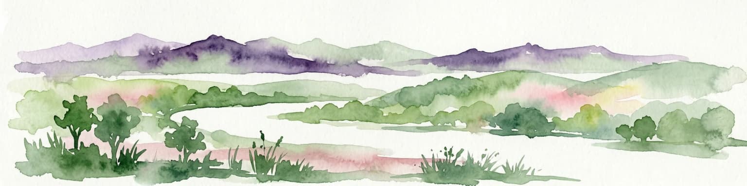
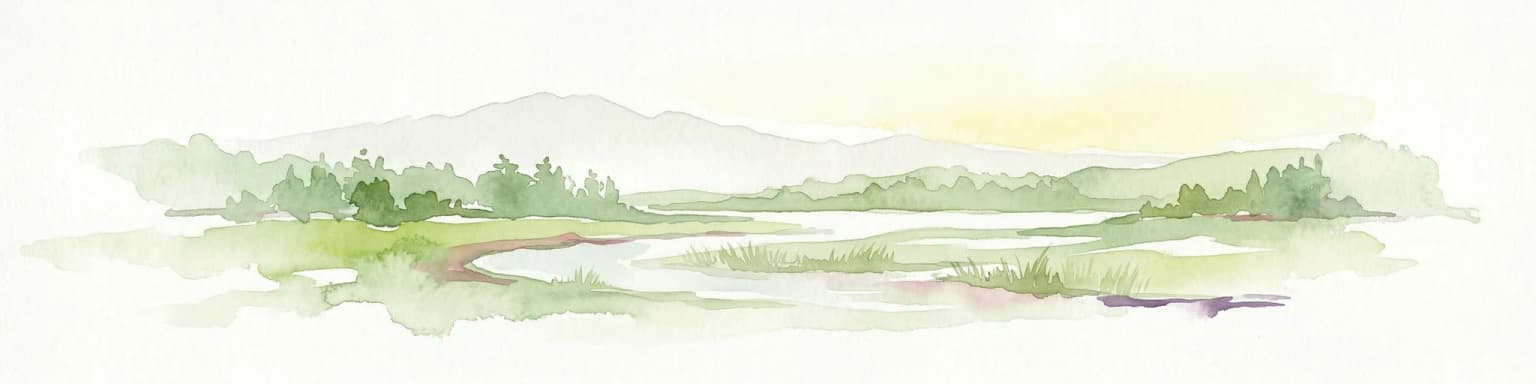
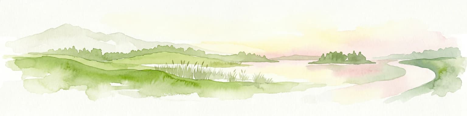
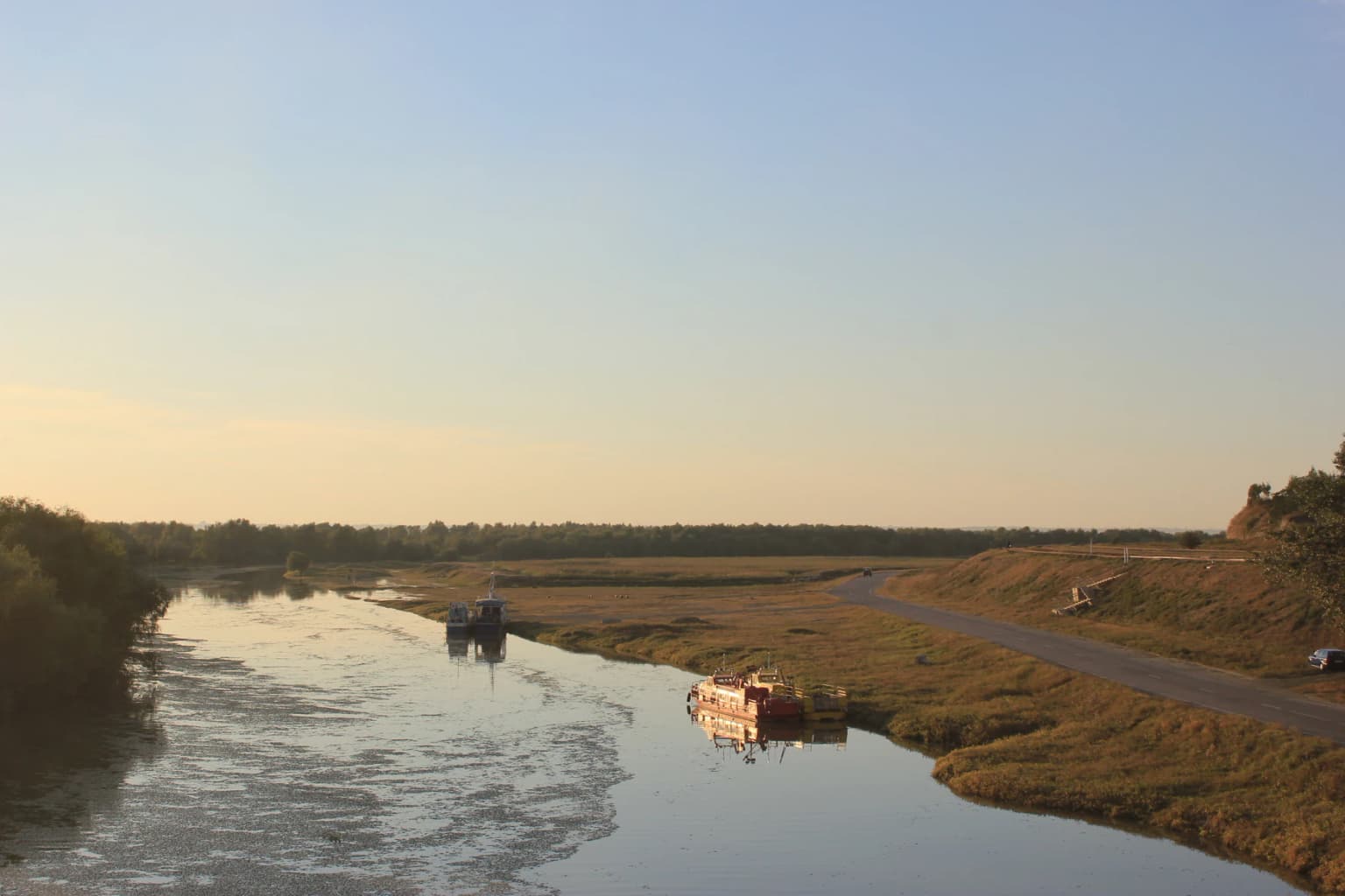
The physical landscape of Lunca Joasă a Prutului Inferior Natural Park is defined by the broad floodplain of the lower Prut River as it approaches its confluence with the Danube. The terrain is predominantly flat, with elevations ranging from just 3 meters above sea level at the southern extent near the Danube confluence to approximately 209 meters on elevated grounds such as Dealul Cocoșului. The Prut River flows through the park from north to south, creating a complex pattern of channels, oxbow lakes, and wetlands. The floodplain is flanked by the Covurlui Hills to the west, while the eastern boundary follows the state border with the Republic of Moldova along the river for 122 kilometers. Microrelief within the floodplain includes natural levees, abandoned river channels, and marshy depressions that flood seasonally. The hydrological network consists of the main Prut channel, its tributaries including Horincea, Oancea, Seaca, Stoeneasca, and Brănești, as well as the Chineja channel that flows into Lacul Brateș. The geological foundation consists of crystalline schists and Paleozoic sediments overlain by more recent formations including loess deposits from the Pleistocene and Holocene alluvium in the river valley.

Lunca Joasă a Prutului Inferior Natural Park ecosystems, habitats, and plant life

The ecological character of the park is fundamentally defined by its extensive wetland systems and floodplain forests. Approximately 62 percent of the protected area consists of aquatic environments including the river channel, natural lakes, and fish ponds, while floodplain forests cover about 25 percent of the territory. The aquatic habitats include oligotrophic to eutrophic standing waters, natural eutrophic lakes, dystrophic ponds, and rivers with muddy banks, supporting diverse plant and animal communities. The floodplain forests grow on recent alluvial deposits within the major river course and are dominated by hardwood species including oak, elm, and ash. Willow-poplar zăvoaie forests occur in periodically flooded areas with high groundwater levels. The wetland vegetation includes extensive reed beds, bulrush stands, and floating aquatic vegetation, while the surrounding grasslands include both wet meadow communities and drier steppe-like formations on loess soils. The park lies at the crossroads of three major bird migration corridors, making it ecologically significant for both breeding and migratory bird populations across Europe.

Lunca Joasă a Prutului Inferior Natural Park wildlife and species highlights

The wildlife of Lunca Joasă a Prutului Inferior Natural Park is exceptionally rich, particularly for birds. Researchers have documented 239 bird species within the park, with fifty of these appearing in Romania's Red Book as species requiring protection due to their vulnerable, threatened, or critically threatened conservation status. The waterfowl communities include both nesting species and vast numbers of migratory birds that use the area as a staging ground. Notable species include the little grebe, red-crested pochard, goosander, corn crake, great snipe, and black-tailed godwit, with several species considered globally threatened. Herons and egrets are particularly well represented, with squacco heron, great white egret, purple heron, little egret, and glossy ibis all breeding in the area. The park also supports significant populations of the white stork and black stork, as well as birds of prey including the lesser spotted eagle and saker falcon. The fish community includes economically important species such as catfish, tench, pike, carp, and pike-perch, alongside smaller species like bitterling and weatherfish. Mammals include the wildcat, European otter, steppe polecat, roe deer, wild boar, and racoon dog, while amphibians and reptiles include the marsh frog, common toad, European pond turtle, and several snake and lizard species.

Lunca Joasă a Prutului Inferior Natural Park conservation status and protection priorities

The conservation significance of Lunca Joasă a Prutului Inferior Natural Park extends far beyond Romania's borders, with the area recognized as part of the Pan-European ecological network through its Natura 2000 designation. The park's classification as both a Site of Community Importance and a Special Protection Area for Birds reflects its exceptional value for biodiversity conservation, particularly for waterfowl and migratory bird populations. The wetland habitats within the park qualify for inclusion under the EU Birds Directive and Habitat Directive, ensuring protection for the diverse ecosystems found here. The park serves a critical ecological function as a gateway and buffer zone for the Danube Delta Biosphere Reserve, helping to maintain ecological connectivity across the broader Black Sea region. Conservation efforts focus on maintaining the hydrological regime that sustains the wetland ecosystems, protecting nesting and foraging habitats for colonial waterbirds, and managing the fish populations that form the base of the food web supporting many species. The presence of fifteen bat species, including the Daubenton's bat and pond bat which serve as indicators of water quality, further underscores the ecological health of the area.

Lunca Joasă a Prutului Inferior Natural Park cultural meaning and human context

The human context of Lunca Joasă a Prutului Inferior Natural Park reflects centuries of traditional interaction between local communities and the wetland landscape. The park encompasses eight communes with eighteen villages, where agricultural and fishing activities have shaped both the landscape and local culture. The communities maintain traditional occupations centered on agriculture, livestock farming, viticulture, and particularly fishing and fish farming. The region has archaeological significance with evidence of human occupation dating to the Paleolithic period, including traces of Monteoru and Gumelnița cultures. Several medieval and modern churches dot the surrounding villages, with the oldest dating to 1796 in Comănești. Traditional crafts including willow and reed weaving, wool processing, and linen production continue in the area. The nearby town of Galați serves as the administrative center, while the border crossing at Giurgiulești marks the interface between Romania and the Republic of Moldova, reflecting the transboundary nature of the Prut River ecosystem.

Top sights and standout views in Lunca Joasă a Prutului Inferior Natural Park

Lunca Joasă a Prutului Inferior Natural Park stands out as one of Romania's premier wetland conservation areas, combining significant biodiversity with crucial ecological functions as a migration corridor. The park's 239 bird species include globally threatened species, making it a destination of international importance for birdwatching and ornithological research. The extensive reed beds and open waters of Lacul Brateș, Pochina Lake, and Vlășcuța Lake provide exceptional opportunities to observe colonial nesting birds, migrating waterfowl, and predatory species. The floodplain forests represent some of the last remaining riparian woodlands in the region, while the complex of fish ponds supports both wildlife and traditional aquaculture. The park's position at the gateway to the Danube Delta creates a unique ecological bridge between two of Europe's most important wetland systems. Visitor facilities including birdwatching platforms at key locations allow for close observation of wildlife while minimizing disturbance to sensitive habitats.

Best time to visit Lunca Joasă a Prutului Inferior Natural Park

The optimal seasons for experiencing Lunca Joasă a Prutului Inferior Natural Park are spring and autumn, when the park comes alive with migratory bird movements. Spring migration, particularly from March through May, brings vast numbers of waterfowl moving northward toward breeding grounds, with concentrations particularly impressive at Lacul Brateș and the floodplain lakes. Autumn migration from August through November offers another spectacular display as birds move south, often in large flocks that provide memorable viewing opportunities. Summer months support breeding activity for many bird species, with herons, egrets, and warblers active throughout the wetlands, though the heat and insect activity can be challenging. Winter brings reduced but still notable bird diversity, with species adapted to colder conditions present throughout the frozen wetlands. The park can be visited year-round, though spring and autumn offer the most dynamic wildlife viewing experiences and the most comfortable outdoor conditions for exploration.

Park location guide

Geography guide, regional context, and park location map for Lunca Joasă a Prutului Inferior Natural Park

Lunca Joasă a Prutului Inferior Natural Park park geography, regions, and map view in Romania
Understand where Lunca Joasă a Prutului Inferior Natural Park sits in Romania through a broader geographic reading of the surrounding landscape, nearby location context, and its mapped position within the national park landscape.

How Lunca Joasă a Prutului Inferior Natural Park fits into Romania

Romania is a unitary semi-presidential republic located in Southeast and Central Europe. It borders Ukraine, Hungary, Serbia, Bulgaria, Moldova, and the Black Sea. The country has a population of approximately 19 million and covers an area of 238,397 km². Bucharest is the capital and largest city. Romania joined the European Union in 2007.

Wider geography shaping Lunca Joasă a Prutului Inferior Natural Park in Romania

Romania lies on the lower course of the Danube River, north of the Balkan Peninsula, and on the northwestern shore of the Black Sea. The terrain is varied, featuring the Carpathian Mountains in the center, the Transylvanian Plateau, the Moldavian Plateau, and plains along the Danube and in the south. The country has a diverse landscape that includes forests, meadows, and wetland areas.

Map view of Lunca Joasă a Prutului Inferior Natural Park

Use this park location map to pinpoint Lunca Joasă a Prutului Inferior Natural Park in Romania, understand its exact geographic position, and read its mapped placement within the surrounding landscape more clearly.

Pigeon | © OpenStreetMap contributors

Location context for Lunca Joasă a Prutului Inferior Natural Park

Galați County

Visually understand the diverse habitats, floodplain ecosystems, and crucial bird migration routes within this Romanian protected area.

Lunca Joasă a Prutului Inferior Natural Park Photos: Explore Wetland Scenery and Protected Landscapes
Discover captivating images that reveal the unique wetland scenery and rich ecological character of Lunca Joasă a Prutului Inferior Natural Park. These visual references offer a deeper understanding of its extensive floodplain forests, vital aquatic habitats, and significance as a European bird migration hub, enriching your geographic exploration of this protected landscape.

Wide view of a river with boats on calm water, grassy riverbanks, and a road on the right side of the image

Park atlas

Expand your discovery to nearby national parks and protected landscapes, comparing similar wetland ecosystems and regional conservation efforts.

Explore Nearby National Parks and Protected Landscapes Near Lunca Joasă a Prutului Inferior Natural Park
Browse national parks and protected landscapes that share similar wetland ecosystems or lie within the broader regional geography surrounding Lunca Joasă a Prutului Inferior Natural Park. Compare diverse conservation efforts, trace interconnected waterways, and explore significant protected-area habitats across Eastern Europe's vital ecological corridors.
Protected landscapeVrancea County

Putna-Vrancea Natural Park: A Protected Landscape in Vrancea County's Carpathian Mountains

Explore mapped terrain, natural park boundaries, and regional geography.

Putna-Vrancea Natural Park, designated as a protected landscape, offers detailed geographic insights into the Vrancea Mountains in Romania. Users can explore the park's mapped terrain, understand its protected boundaries, and contextualize its natural park status within Vrancea County and the broader Eastern Carpathians region. This atlas-focused view highlights the unique landscape features and regional geographic significance of this Romanian protected area.

Area
302.04 km²
Established
2005
IUCN
V
Relief
Mountain
Watercolor illustration of a wetland landscape with lakes, reeds, and distant mountains under a light sky
Protected landscapeBrăila County

Balta Mică a Brăilei Natural Park: Protected Landscape & Lower Danube Wetland Geography

Discover mapped boundaries and critical waterfowl habitats.

Balta Mică a Brăilei Natural Park is a vital protected landscape located in Brăila County, Romania, recognized for its extensive wetland ecosystems and importance for migratory bird populations. Situated within the Lower Danube floodplain, this park serves as a critical habitat and staging area for waterfowl traveling along major flyways. Its designation as a protected landscape highlights its significance for conservation and offers users a rich opportunity for geographic discovery, focusing on its unique riparian and steppe landscape interface, mapped terrain, and ecological value within the regional context.

Area
175.29 km²
Established
2000
IUCN
V
Relief
Lowland
Protected area

Danube Delta Protected Area: Mapping Europe's Largest River Delta Geography and Wetland Landscape

Explore the mapped protected area, its unique terrain, and regional landscape context.

The Danube Delta, a protected area in Romania, presents a remarkable geography defined by its extensive wetland terrain, intricate waterways, and significant biodiversity. As Europe's largest and best-preserved river delta, it offers a unique landscape for atlas-based exploration, focusing on its mapped boundaries, regional geographic context, and its role as a critical ecological zone where the Danube River merges with the Black Sea. Understand the delta's horizontal expanse, its network of channels, and its evolving landforms within a protected landscape of global importance.

Area
4,152 km²
Established
1998
Relief
Lowland
Climate
Temperate
Watercolor illustration of a winding river through a landscape with hills and trees
National parkOrhei District

Orhei National Park: Explore Moldova's Inaugural National Park Landscape

Mapped protected boundaries and regional geography in Orhei District.

As Moldova's first national park, Orhei National Park offers a rich exploration of the Codri region's characteristic hilly terrain and extensive deciduous forests. Situated within Orhei District, this protected area encompasses the meandering Răut River valley and notable landscape reserves. Its designation highlights a crucial commitment to preserving both the natural beauty and the significant cultural heritage, including the UNESCO candidate site of Old Orhei, making it a key destination for understanding Moldova's protected lands and regional geography.

Area
337.92 km²
Established
2013
IUCN
II
Relief
Highland
National parkBilhorod-Dnistrovskyi Raion

Tuzly Lagoons National Nature Park: National Park Atlas and Geographic Context

Mapped protected landscape within Bilhorod-Dnistrovskyi Raion, Ukraine.

Navigate the protected landscape of Tuzly Lagoons National Nature Park through a detailed geographic lens. This national park entry within MoriAtlas provides structured information on its mapped boundaries and regional context within Bilhorod-Dnistrovskyi Raion, part of Ukraine's Bessarabia region. Understand its position and significance as a protected natural area, facilitating a deeper exploration of its geographical attributes and its place in the broader atlas of Ukrainian protected lands.

Area
278.65 km²
Established
2010
IUCN
II
Relief
Lowland
Watercolor illustration of a landscape with hills, a river, and green vegetation
National parkOdesa Oblast

Lower Dniester National Nature Park: National Park Map and Protected Landscape Atlas

Explore Odesa Oblast's protected natural geography and park boundaries.

The Lower Dniester National Nature Park is a vital component of Ukraine's protected lands, situated within the expansive Odesa Oblast. This page offers detailed geographic context, focusing on the park's mapped boundaries and its contribution to the regional landscape. Dive into an atlas-style exploration that highlights the park's protected terrain and its significance within the natural geography of southwestern Ukraine, offering structured discovery beyond basic park facts.

Area
213 km²
Established
2008
IUCN
II
Relief
Lowland
Protected landscapeNeamț County

Vânători-Neamț Natural Park: Protected Landscape within Neamț County, Romania

Mapped protected area and regional landscape context.

Vânători-Neamț Natural Park is a designated protected landscape located in Romania's Neamț County. This MoriAtlas entry provides detailed geographic information, focusing on the park's mapped boundaries and its role within the regional atlas of protected natural areas. Understand the park's specific landscape context and its place within the wider geography of Western Moldavia, essential for any structured exploration of Romanian protected lands.

Area
306.31 km²
Established
2003
IUCN
V
Scope
Terrestrial
National park

Cheile Bicazului-Hășmaș National Park: Protected Area Geography and Mapped Landscape Identity

Discover Romania's National Park mapped boundaries and regional context.

Cheile Bicazului-Hășmaș National Park represents a vital component of Romania's protected natural areas, offering rich geographic detail for atlas enthusiasts. This national park's mapped landscape and defined protected boundaries provide essential context for understanding regional geography and conservation efforts. Explore the specific identity of this protected terrain and its significance within the broader Romanian atlas.

Area
65.75 km²
Relief
Mountain
Scope
Mixed
Water
Minor water

Common questions about visiting, size, designation, and location context for Lunca Joasă a Prutului Inferior Natural Park

Lunca Joasă a Prutului Inferior Natural Park FAQs for park facts, access, geography, and protected area context
Find quick answers about Lunca Joasă a Prutului Inferior Natural Park, including protected-area facts, park geography, trail and visitor context, and how the park fits into its surrounding country and regional landscape.
MoriAtlas Explorer

Continue Your Protected Areas Search Across the Global Atlas

Deepen your exploration by continuing the structured search for national parks and protected areas worldwide. Utilize the comprehensive filtering capabilities to compare different conservation landscapes and refine your understanding of global park geography. Discover more about the distribution and characteristics of protected natural areas.

Global natural geography