
Mori Atlas logo
National parkParc national de Macédoine-Orientale-et-Thrace

Mapping the extensive river delta, coastal lagoon networks, and riparian forest habitats in Greece

Parc national de Macédoine-Orientale-et-Thrace Protected Landscape and Regional Wetland Atlas

(Ethniko Parko Anatolikis Makedonias-Thakis (National Park of Eastern Macedonia and Thrace))

Parc national de Macédoine-Orientale-et-Thrace represents a major protected wetland complex along the northern Aegean coastline. This geography-focused profile traces the park boundaries from the Nestos Delta through Lake Vistonida and Lake Ismarida. Discover how riverine, brackish, and saline habitats converge to create one of the most important bird-supporting wetland corridors in the Eastern Mediterranean.

wetlandslagoonsriver deltariparian forestmigratory birdsbirdwatching
A stylized flat illustration depicting a serene wetland landscape with a lake, mountains in the distance, a waterfall, and flamingos wading in the water.

Parc national de Macédoine-Orientale-et-Thrace

National park

Park overview

Structured park overview, official facts, and landscape profile for Eastern Macedonia and Thrace National Park

Eastern Macedonia and Thrace National Park park facts, protected area profile, and essential visitor context

Review the core facts for Eastern Macedonia and Thrace National Park, including designation, size, terrain, visitor scale, habitats, and operating context in one park-focused overview.

About Eastern Macedonia and Thrace National Park

The Eastern Macedonia and Thrace National Park is one of the most significant protected natural areas in Greece, both for its sheer size and for the concentration of internationally important wetland habitats it preserves. Spread across roughly 930 square kilometres, it follows the Thrace coastline for more than a hundred kilometres from the eastern Gulf of Kavala in the west to the area south of Komotini in the east. Inland, the park's boundary is shaped by the Lekani mountain range and the agricultural plains of Xanthi and Komotini, while coastal settlements and farmland remain outside the protected perimeter.

At its core, the park is a system of three distinct but ecologically linked zones. In the west, the Nestos River forms a major delta where it meets the Aegean Sea, marking the natural border between Macedonia and western Thrace. The western part of the mouth features a chain of coastal lagoons used for fish farming, while the eastern side retains a famous riparian forest, the Kotza Orman, that once extended far more widely across the Balkans. In the centre, Lake Vistonida, the fourth-largest lake in Greece, creates a brackish lagoon complex rich in salinity gradients, reedbeds, and halophytic vegetation. To the east, the freshwater Lake Ismarida and the connected Rhodope lagoons complete the system, providing additional habitats for wetland species between the coast and the agricultural hinterland.

The protected area is internationally recognized for its biodiversity, especially for birds. It hosts one of the highest counts of bird species of any Greek national park, including numerous migrants, wintering waterfowl, and several globally threatened or near-threatened species. Beyond birds, the park shelters mammals such as the European otter and the golden jackal, a wide range of reptiles and amphibians, and at least two endemic fish species in Lake Vistonida. While the dramatic expansion of aquaculture, irrigation, and hydroelectric infrastructure has placed pressure on the wetlands, the establishment of the national park in 2008 brought these disparate sites under a single coordinated framework, with a dedicated management body overseeing conservation, restoration, and public engagement.

Today the park represents a major node in the network of European wetland conservation. It combines Ramsar, Natura 2000, and Important Bird Area designations, and its name is closely associated with initiatives to protect migratory birds and freshwater biodiversity in the Eastern Mediterranean. The surrounding region continues to support traditional activities like lagoon fisheries, livestock grazing, and agriculture, but the protected status has helped anchor a long-term effort to balance these uses with ecological preservation.

Quick facts and research context for Eastern Macedonia and Thrace National Park

The Eastern Macedonia and Thrace National Park is located in the region of Eastern Macedonia and Thrace in northeastern Greece, with its nearest city being Xanthi. Created by ministerial decision in 2008, it covers approximately 930 square kilometres and contains the largest Ramsar-listed wetland surface in the country.

The park combines three main zones: the Nestos Delta, the Lake Vistonida lagoon system, and the freshwater Lake Ismarida with the Rhodope lagoons. Its wetlands are protected under the Ramsar Convention since 1975, recognized under the EU Natura 2000 network as both Special Protection Areas for birds and Sites of Community Importance for habitats, and are listed among BirdLife International's Important Bird Areas. The site is administered by a dedicated management body based in Lagos.

Protection and recognition

Examining documented protection scope, management frameworks, and official records

Parc national de Macédoine-Orientale-et-Thrace Protection Status and Governance Data

Consolidated protection metrics outline the mixed management scope and baseline status recorded for Parc national de Macédoine-Orientale-et-Thrace within official databases. Structured administrative records provide clear verification for conservation researchers evaluating regional protected areas.

Protection details

Protection scope
Mixed
Transboundary protection
No
WDPA ID
349973
Park context

Deeper park guide and search-rich context for Eastern Macedonia and Thrace National Park

Eastern Macedonia and Thrace National Park history, landscape, wildlife, and travel context

Explore Eastern Macedonia and Thrace National Park through its history, landscape character, ecosystems, wildlife, conservation priorities, cultural context, and seasonal travel timing in a structured park guide built for atlas discovery and search intent.

Why Eastern Macedonia and Thrace National Park stands out

The park is best known for being one of the most important wetland complexes in Greece and the broader Eastern Mediterranean, a meeting point for freshwater river ecosystems, brackish lagoons, coastal dunes, and a remnant riparian forest. It is especially recognized for its extraordinary birdlife, with more than 300 recorded species including globally threatened waterbirds such as the Dalmatian pelican, white-headed duck, and red-breasted goose, and for hosting the only nesting population of spur-winged lapwing in mainland Europe. It is equally well known for the Kotza Orman, a fragment of what was historically the largest floodplain forest in the Balkans along the Nestos River. The lake systems surrounding Vistonida and Ismarida, with their shifting gradients of salinity and freshwater habitats, add to the park's distinctive ecological identity and make it a reference site for wetland research and conservation in Greece.
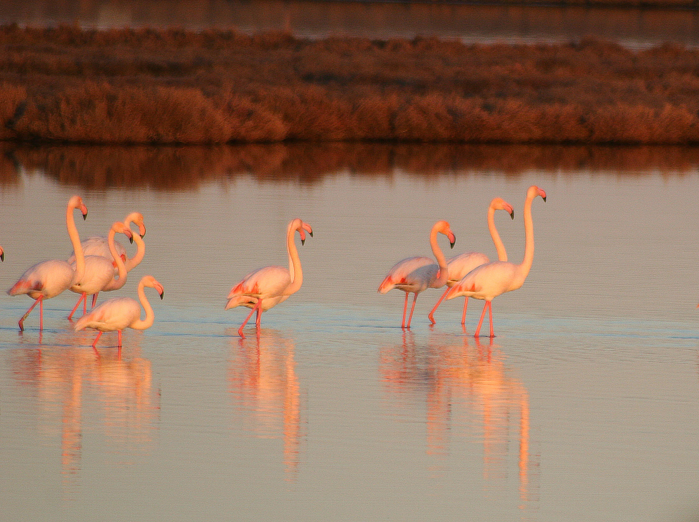
Several pink flamingos standing in calm water during golden hour, with soft warm light reflecting off the surface.
A flock of flamingos wading in the shallow, reflective waters of Lake Vistonis.

Eastern Macedonia and Thrace National Park history and protected-area timeline

Although the Eastern Macedonia and Thrace National Park as a unified entity was formally established in 2008, the conservation history of its component wetlands stretches back several decades. In 1975, a substantial portion of what is now the park, covering roughly 46,000 hectares of nested deltas, lakes, and lagoons, was inscribed on the list of Wetlands of International Importance under the Ramsar Convention. This early recognition anchored the area within the global wetland protection framework.

Throughout the late twentieth century, the region faced mounting pressures from urban expansion, industrial fisheries, agricultural development, and hydroelectric construction. By 1990, these pressures had become severe enough that Greece requested the registration of the area in the Montreux Record of the Ramsar Convention, an alert mechanism that flags Ramsar sites whose ecological character has changed or is at risk. The same period saw the gradual identification of the area within the European Union's Natura 2000 network, both as Special Protection Areas for birds and as Sites of Community Importance for habitat conservation.

In response, riparian reforestation campaigns were launched along the Nestos River to combat soil erosion, and a wastewater treatment plant in Komotini helped to reduce effluents entering Lake Ismarida. The management body for the delta of Nestos, Lake Vistonida, Lake Ismarida, and the island of Thasos was created in 2003 as a private-law, non-profit entity, laying the institutional groundwork for the unified park. Finally, in 2008, a joint ministerial decision brought together the previously separate Ramsar and Natura 2000 zones into a single national park, with a peripheral zone that respects the surrounding agricultural and residential areas.

Eastern Macedonia and Thrace National Park landscape and geographic character

The landscape of the Eastern Macedonia and Thrace National Park is overwhelmingly shaped by water. The park follows the northern Aegean coastline of Thrace, incorporating both the marine strip close to the shore and the inland wetlands that drain into it. In the far west, the Lekani mountains and the A2 motorway form part of the inland boundary, while the agricultural plains of Xanthi and Komotini push the protected area closer to the coast in the central and eastern sections.

The Nestos Delta is the most visually dramatic part of the park. The river approaches the sea through a 27-kilometre stretch that still preserves the largest fragment of the once-vast Kotza Orman riparian forest, traditionally the largest floodplain forest in the Balkans. The mouth itself fans out into a delta dotted with lagoons, sandbars, and salt pans, especially along the coast west of the river. To the east of the Nestos mouth, several freshwater and brackish lagoons stretch towards the Ionian-style coast south of Xanthi.

Central to the landscape is Lake Vistonida, a large, shallow lake with a mean depth of around 2.5 metres. Its northern parts are fed by freshwater rivers, while the southern sections are influenced by marine intrusion through channels near the village of Lagos, producing a mosaic of fresh, brackish, and saline waters. Around it lie tamarisk and reed formations, halophytic vegetation, and a chain of smaller lagoons.

To the east, the freshwater Lake Ismarida, also known as Lake Mitrikou, sits slightly inland from the coast. It is surrounded by a small but ecologically valuable forest of willows, alders, poplars, and elms along the Vosvozis stream, and is bordered by extensive reedbeds. South of Ismarida, a series of small coastal lagoons, including Xirolimni, Arog, Alyki, Ptelea, and Elos, form a transitional zone between freshwater wetlands and the open sea.
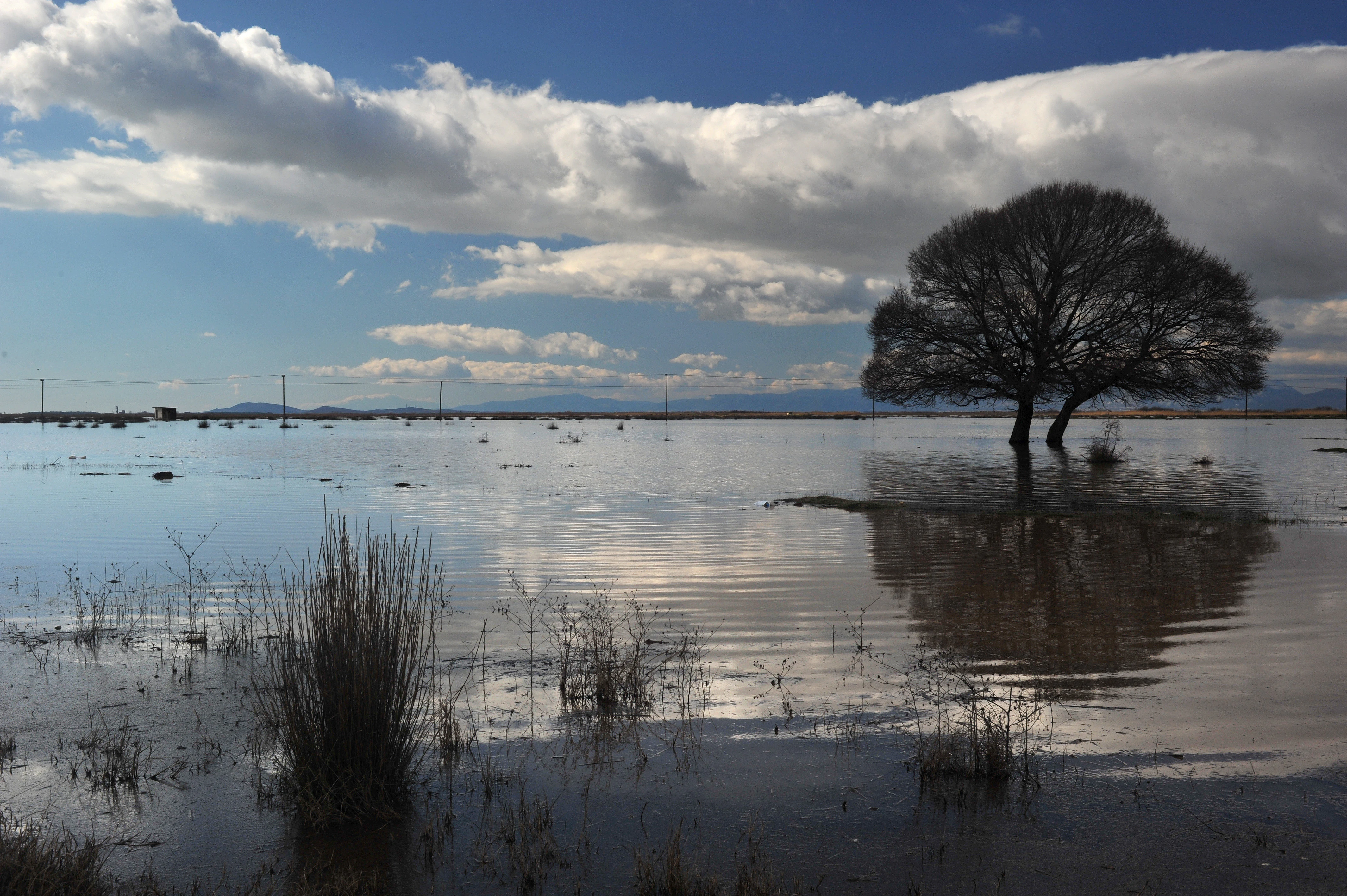
A wide, eye-level view of a calm, flooded wetland area with a prominent solitary tree in the middle ground, reflected in the water under a cloudy sky.
A solitary tree stands in the calm, flooded waters of Vistonida Lake within the East Macedonia and Thrace National Park.

Eastern Macedonia and Thrace National Park ecosystems, habitats, and plant life

The ecological identity of the park is built on the wide variety of wetland habitats it unites. Freshwater rivers and lakes, brackish lagoons, saltmarsh, reedbeds, sand dunes, and fragments of floodplain forest together create an unusually rich habitat mosaic. This diversity stems from the differing salinity regimes, the freshwater inputs from rivers like the Nestos, Kompsatos, Kosynthos, Travos, and Vosvozis, and the proximity of the southern Balkan mountains to the coast.

The riparian forest along the Nestos Delta, the Kotza Orman, is one of the most emblematic habitats in the park. Once a continuous stretch covering around 125,000 stremma, only a small residual area remains and is now under active protection. Around Lake Vistonida, halophytic scrub, tamarisk thickets, Phragmites reedbeds, and submerged meadows form a layered vegetation pattern adapted to the variable salinity of the lake. Lake Ismarida is partially covered in summer by white water lilies, water chestnuts, and duckweed, and surrounded by wet woodland and dense reedbeds, producing a more strictly freshwater environment.

Although the park's flora does not include species endemic to Greece at the country level, several plants found here are rare within the country and are targets of conservation efforts, including Posidonia seagrass meadows, the sea daffodil, and the dense pondweed. The mosaic of dune vegetation, coastal scrub, riverine forest, and wetland plant communities makes the park an important reservoir for Mediterranean wetland flora, even where individual species are not strictly endemic.
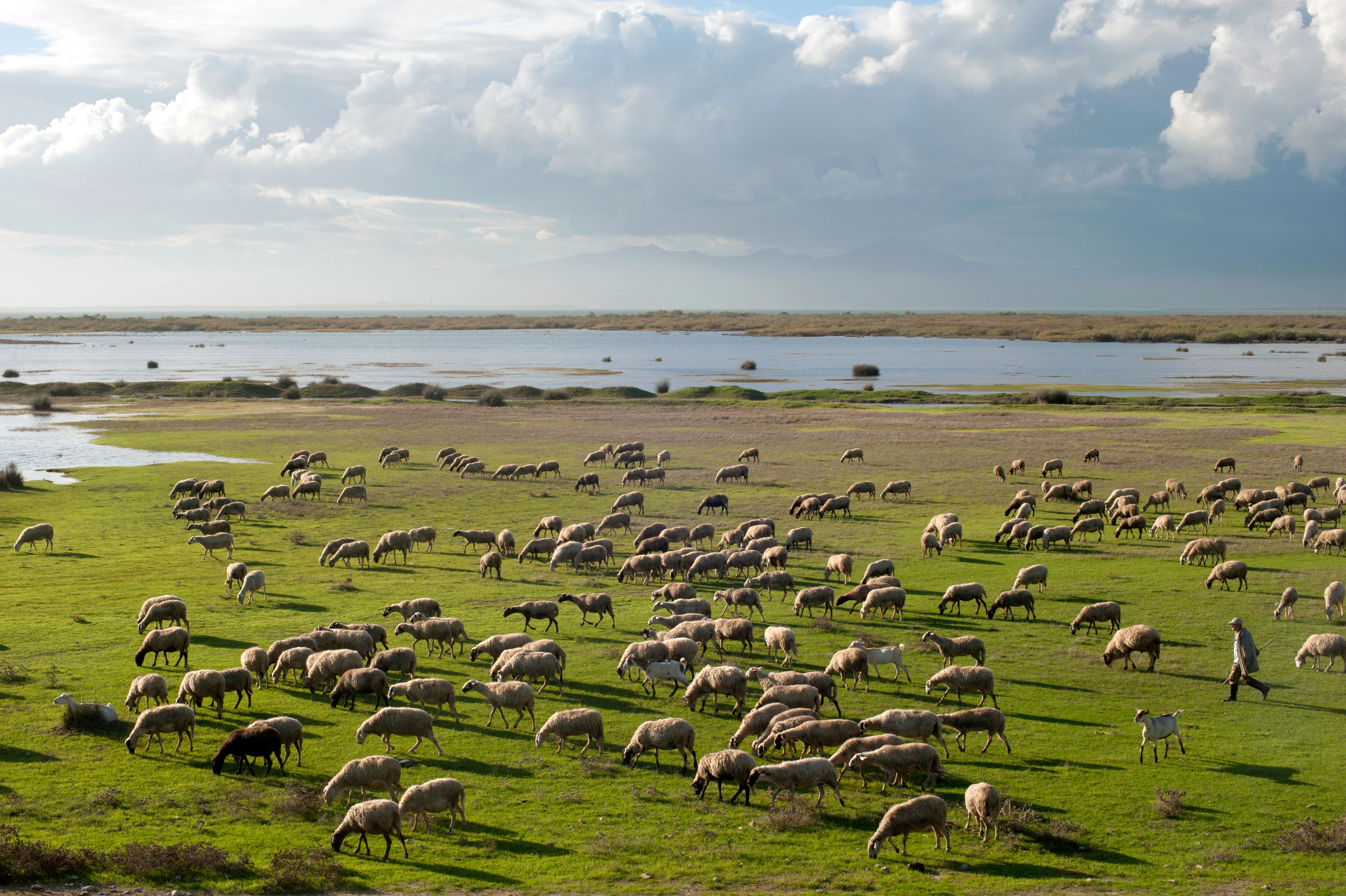
A wide view of a large flock of sheep and goats grazing on lush green grass by the edge of a still lake under a cloudy sky, with a shepherd walking on the right.
A shepherd tending a large flock of sheep and goats along the marshy shores of Lake Vistonida.

Eastern Macedonia and Thrace National Park wildlife and species highlights

The park's wildlife is dominated by birds. With more than 300 recorded species, including approximately 180 migratory species in the Nestos Delta area alone, the protected zone is one of the most ornithologically significant in Greece. The mosaic of shallow lakes, reedbeds, lagoons, coastal dunes, and remnant forest supports breeding, wintering, and staging populations of waterfowl, waders, pelicans, herons, and birds of prey.

Several globally threatened and near-threatened species depend on the park. White-headed ducks, red-breasted geese, and Dalmatian pelicans are recorded in the Vistonida area, while the Nestos Delta hosts one of only two known wild, non-domesticated populations of Caucasian pheasant in Europe. The park, together with the nearby Evros Delta, is the only area in mainland Europe where the spur-winged lapwing nests. Greater flamingos, glossy ibises, spoonbills, and avocets are among the more visible species on the lagoons, especially during migration.

Mammals, reptiles, amphibians, and fish also play important roles in the park's biodiversity. The European otter is present in the eastern zones, the golden jackal maintains one of its largest Greek populations in the Nestos Delta, and Hermann's and Caspian turtles occur in protected habitats. Lake Vistonida is particularly notable for two fish species, Alburnus vistonicus and Alosa vistonica, which are endemic to the lake system and assessed as critically endangered, along with the European eel, which benefits from the variable salinity of the coastal waters.
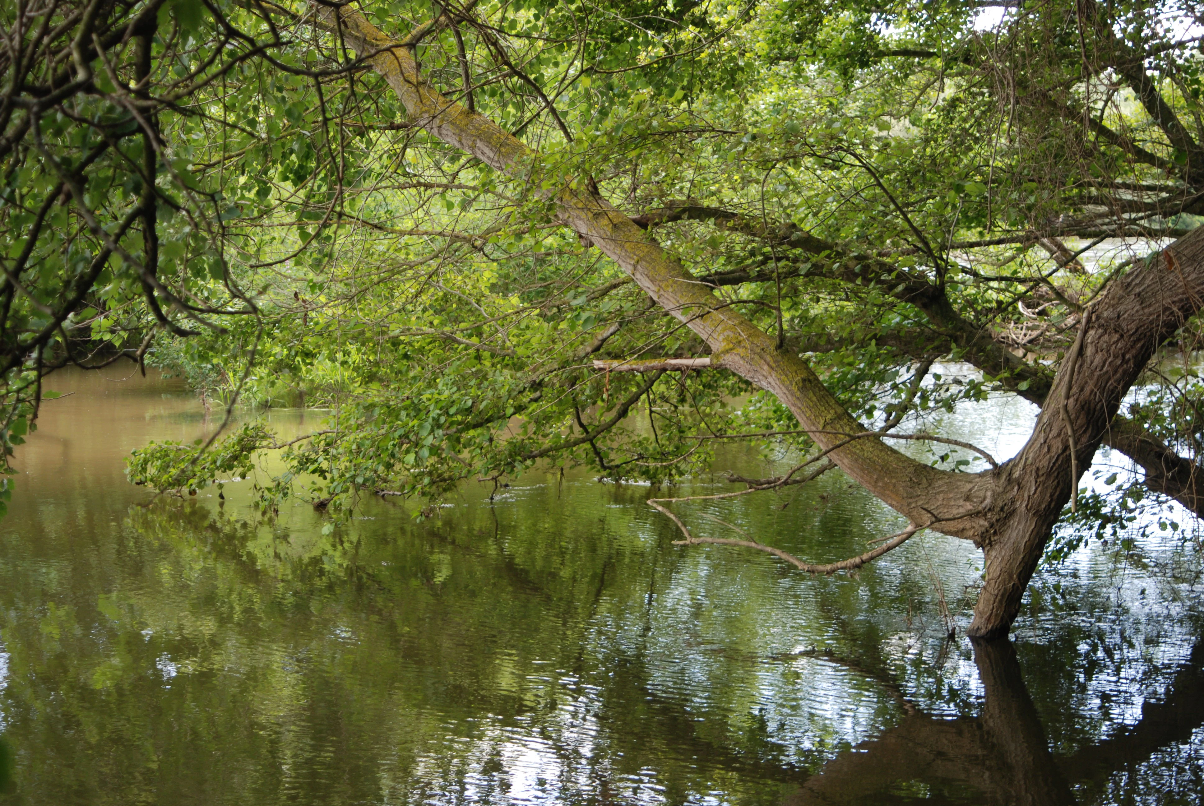
A thick tree branch leans over a calm, brown-toned river, with dense green foliage arching over the water surface.
A view of the Nestos River Delta within the park, featuring riparian vegetation overhanging the water.

Eastern Macedonia and Thrace National Park conservation status and protection priorities

From a conservation standpoint, the Eastern Macedonia and Thrace National Park represents the consolidation of decades of fragmented efforts to protect one of Greece's most important wetland systems. Originally inscribed under the Ramsar Convention in 1975 and later added to the Montreux Record in 1990 as a Ramsar site of concern, the area has long been recognized as both ecologically valuable and ecologically threatened. The park is also part of the EU Natura 2000 network, with overlapping designations as Special Protection Areas for birds and Sites of Community Importance for habitats, and is included in BirdLife International's Important Bird Areas inventory.

The park's conservation significance lies in its role as a major refuge for migratory waterbirds along the eastern Mediterranean flyway, in its function as a breeding and wintering area for threatened species, and in its preservation of a remnant fragment of Balkan floodplain forest. It also acts as a refugium for endemic fish of Lake Vistonida and for freshwater biodiversity more broadly, and as a laboratory for understanding how brackish and freshwater ecosystems interact with the sea.

Management challenges remain substantial. Aquaculture in the lagoons, agricultural water use, urban pressure around Xanthi and Komotini, sedimentation in Lake Vistonida, marine intrusion in the delta aquifer, and the impact of upstream hydroelectric dams on the Nestos all continue to shape the environmental condition of the park. The unified 2008 designation and the dedicated Nestos-Vistonida-Ismarida management body were designed in part to address these pressures, alongside restoration work such as the riparian reforestation along the Nestos and the construction of wastewater treatment infrastructure in the wider region.

Eastern Macedonia and Thrace National Park cultural meaning and human context

The park's geography overlaps with a region of long-standing human settlement that has historically depended on wetland resources. The delta and lagoon systems have supported fishing and aquaculture for generations, with Lake Vistonida once accounting for a significant share of Greek lagoon fish production. Agriculture on the coastal plains around Xanthi and Komotini, and pastoralism in areas near Lake Vistonida, have shaped the visual and economic landscape adjoining the park. The Kotza Orman forest itself carries deep local resonance as a geographic and cultural landmark along the historic boundary between Macedonia and Thrace, while the Nestos River remains a key reference point in regional identity. The park's management body operates from Lagos and maintains visitor information centres that link conservation with regional education and ecotourism initiatives.
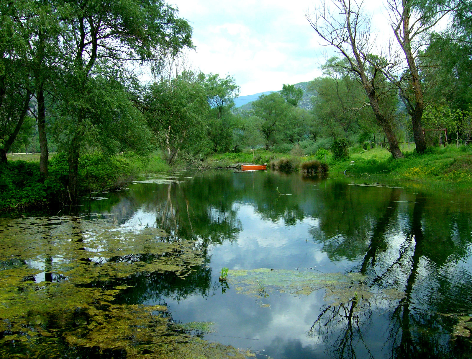
A calm section of the Nestos River reflecting trees and a cloudy sky, with a small orange boat docked near the far bank.
A peaceful view of the Nestos River lined with lush riparian vegetation.

Top sights and standout views in Eastern Macedonia and Thrace National Park

Of the many features that define this protected area, three stand out. First, the park's sheer wetland scale makes it the largest Ramsar site in Greece, encompassing a nearly continuous chain of river deltas, lakes, lagoons, and coastal dunes along the northern Thrace coastline. Second, its ornithological richness is among the highest in the country, anchoring it in international bird conservation networks and supporting threatened species such as the Dalmatian pelican and the white-headed duck. Finally, the Kotza Orman fragment along the Nestos River preserves a tangible link to one of the most important historic floodplain forests of the Balkans, lending the park a strong identity that goes beyond typical lagoon-related wetland protection.
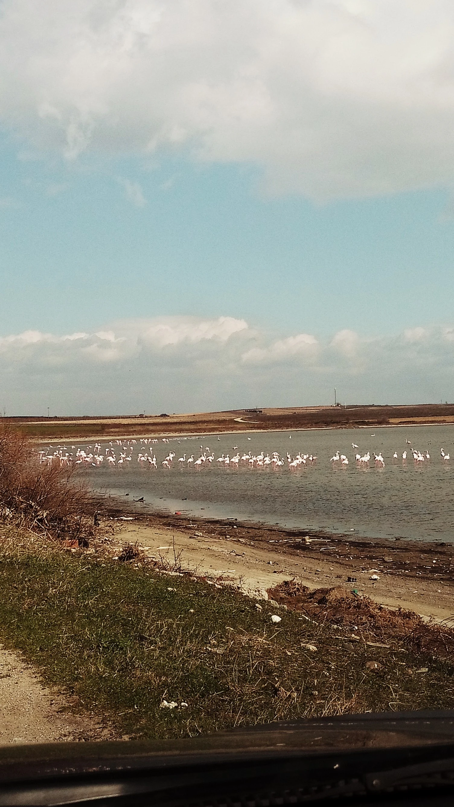
A wide view of a shallow wetland lake with a large flock of pink flamingos wading in the middle distance under a cloudy sky.
A flock of flamingos in the wetlands of the Xirolimni protected area.

Best time to visit Eastern Macedonia and Thrace National Park

The park's varied wetland mosaic shifts character markedly with the seasons. Spring and early summer are particularly rewarding for birdwatching, as migrants pass through and breeding colonies become active across the lagoons and lakes. Late summer and early autumn can bring flamingos and other waterbirds to the brackish lagoons. Winter brings large numbers of waterfowl, including red-breasted geese, white-headed ducks, and cormorants, taking advantage of the milder Thrace climate. Warm summer months also reveal the freshwater flora of Lake Ismarida and the open-water landscapes of Lake Vistonida, while river levels along the Nestos are typically at their lowest, making delta viewpoints more accessible. Visitors should be aware that wetland conditions can be highly variable across years and that wildlife sightings depend on water levels, weather, and seasonal migrations.
Monthly climate preview

Long-term monthly temperature averages and precipitation measurements for the protected area

Parc national de Macédoine-Orientale-et-Thrace Climate Normals and Temperature Rhythms

Historical climate data reveals the measured annual temperature and precipitation rhythm recorded at a representative coordinate within Parc national de Macédoine-Orientale-et-Thrace. Exploring the complete twelve-month climatology profile provides deeper insight into long-term averages across all seasons.
Annual mean15 °C
5 °C26 °C
Jan
Feb
Mar
Apr12°
May18°
Jun23°
Jul26°
Aug26°
Sep21°
Oct16°
Nov11°
Dec
Warmest month
August

26 °C

Coolest month
January

4.6 °C

Wettest month
December

2.4 mm/day

Driest month
August

0.6 mm/day

Park location guide

Geography guide, regional context, and park location map for Eastern Macedonia and Thrace National Park

Eastern Macedonia and Thrace National Park park geography, regions, and map view in Greece

Understand where Eastern Macedonia and Thrace National Park sits in Greece through a broader geographic reading of the surrounding landscape, nearby location context, and its mapped position within the national park landscape.

How Eastern Macedonia and Thrace National Park fits into Greece

Greece, officially the Hellenic Republic, is a country in Southeast Europe occupying the southern Balkans. It borders Albania, North Macedonia, Bulgaria, and Turkey, with coastlines on the Aegean, Ionian, and Mediterranean seas. The country has over 10 million people and is renowned for its ancient Greek heritage, philosophy, democracy, and the Olympic Games.

Wider geography shaping Eastern Macedonia and Thrace National Park in Greece

Greece occupies the southern tip of the Balkan peninsula in Southeast Europe. It shares land borders with Albania to the northwest, North Macedonia and Bulgaria to the north, and Turkey to the east. The Aegean Sea lies to the east of the mainland, the Ionian Sea to the west, and the Sea of Crete and Mediterranean Sea to the south. The country spans thousands of islands across nine traditional geographic regions and has the longest coastline in the Mediterranean basin.

Map view of Eastern Macedonia and Thrace National Park

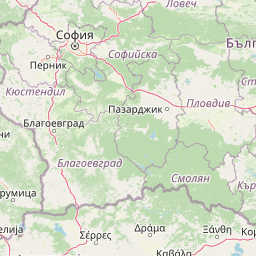
Use this park location map to pinpoint Eastern Macedonia and Thrace National Park in Greece, understand its exact geographic position, and read its mapped placement within the surrounding landscape more clearly.

Pigeon | © OpenStreetMap contributors

Location context for Eastern Macedonia and Thrace National Park

Eastern Macedonia and Thrace

Explore photographic records of coastal lagoons, river deltas, and floodplain forest terrain.

Visualizing Parc national de Macédoine-Orientale-et-Thrace Photos, Landscapes, and Protected Habitats

Visual documentation of Parc national de Macédoine-Orientale-et-Thrace reveals complex wetland habitats, brackish lagoons, and riparian forest terrain along the Aegean coast. Examining these protected landscapes provides clear insight into the ecological character and varied scenery defining the Greek reserve.

Several pink flamingos standing in calm water during golden hour, with soft warm light reflecting off the surface.

Wide landscape shot of a calm lake with marshy reeds in the foreground and a mountain range in the background under a blue sky.

A wide, eye-level view of a calm, flooded wetland area with a prominent solitary tree in the middle ground, reflected in the water under a cloudy sky.

A wide view of a large flock of sheep and goats grazing on lush green grass by the edge of a still lake under a cloudy sky, with a shepherd walking on the right.

A thick tree branch leans over a calm, brown-toned river, with dense green foliage arching over the water surface.

A wide view of the Nestos River delta featuring sandy shores in the foreground and golden reeds along the calm water under a cloudy sky.

A calm section of the Nestos River reflecting trees and a cloudy sky, with a small orange boat docked near the far bank.

A wide view of a shallow wetland lake with a large flock of pink flamingos wading in the middle distance under a cloudy sky.

A calm river scene with dense green trees and reeds lining the bank, reflecting in the still water.

A lone white and pink greater flamingo stands in calm, dark water.

A wide shot of a wetland landscape with a shallow lake or pond in the midground and a field of purple wildflowers in the foreground under a cloudy sky.

An information sign for the Delta Nestos Lakes Vistonida-Ismarida agency stands outdoors in a grassy area.

A purple heron flying against a plain, overcast sky with wings fully extended.

A group of flamingos standing in the shallow water of a lake under a clear blue sky, with a dark shoreline in the foreground.

Park atlas

Explore nearby protected areas and regional conservation landscapes

Other Parks Near Parc national de Macédoine-Orientale-et-Thrace

Continue browsing adjacent protected areas and regional wetland reserves after exploring Parc national de Macédoine-Orientale-et-Thrace. Compare connected ecosystems and broader geographic contexts across the surrounding protected terrain.
Watercolor illustration showing mountains, river, and forested area
National parkGreece
About 75 km away#1 closest

Northwest

Rodopi Mountain Range National Park: Greece's Largest Protected Forest Landscape Explorer

Mapped boundaries, old-growth ecosystems, and Balkan geography.

Rodopi Mountain Range National Park is a critical protected forest area in Greece, safeguarding one of Europe's last primeval forests, the Frakto Virgin Forest. As the nation's largest woodland conservation site, it showcases remarkable biodiversity and complex mountain terrain, from low-lying forests to subalpine meadows. This page provides detailed mapping context and geographic specifics for understanding this unique protected landscape and its ecological significance within the Rhodope Mountains.

Area
1,731.5 km²
Established
2009
IUCN
VI
Relief
Mountain
Watercolor illustration of green fields, clusters of trees, distant mountains, and a light yellow sky
National parkEastern Macedonia and Thrace
About 94 km away#2 closest

East

Dadia-Lefkimi-Soufli Forest National Park: Protected Landscape Atlas and Raptor Habitat

Mapped terrain and protected area context in Eastern Macedonia and Thrace.

This canonical entry for Dadia-Lefkimi-Soufli Forest National Park provides a structured atlas view of its protected landscape. Understand the park's geographic setting within Eastern Macedonia and Thrace, its mapped boundaries, and its significance as a critical sanctuary for raptors across Europe. Explore the diverse natural terrain that defines this protected area and its ecological importance.

Area
428 km²
Established
2006
IUCN
VI
Visitors
50K annual
National parkTurkey
About 94 km away#3 closest

East

Lake Gala National Park: A Key Protected Wetland Landscape in Turkey's Maritsa Delta

Discover its bird habitats and mapped geographic context.

Lake Gala National Park is a nationally significant protected area, designated in 2005 to conserve the unique wetland ecosystem of the Maritsa Delta. Encompassing the shallow lakes Pamuklu and Küçük Gala, this park spans approximately 6,090 hectares of diverse wetland and forest habitats. It is internationally recognized as a Ramsar site and serves as a critical sanctuary for over 160 bird species, making it a premier birdwatching destination in Turkey and an important locus for understanding protected landscapes within a regional geographic framework.

Area
60.9 km²
Established
2005
IUCN
II
Relief
Lowland
Watercolor illustration of green mountains and a lake with trees
National parkBlagoevgrad Province
About 146 km away#4 closest

Northwest

Pirin National Park: Protected Area and Regional Geographic Context in Bulgaria

Explore Pirin National Park's mapped boundaries and landscape.

Pirin National Park serves as a vital national park entity within the atlas of Blagoevgrad Province, Bulgaria. This page details its protected landscape, offering a structured view of its geographic setting and mapped terrain. Users can investigate the park's specific identity and its relation to the surrounding regional geography, providing essential context for understanding protected areas and natural landscapes within a comprehensive map-driven framework.

Area
403.56 km²
Established
1962
IUCN
II
Relief
Mountain
Watercolor illustration of a landscape featuring rolling hills, trees, and a small body of water
Protected areaTurkey
About 151 km away#5 closest

Southeast

Ancient Troya National Park: A Mapped Protected Landscape with Deep Historical Significance

Explore the terrain and protected boundaries of this key Turkish heritage site.

Ancient Troya National Park offers a unique window into history, preserving the layers of the ancient city of Troy within its protected boundaries. Situated in Turkey, this park encompasses a significant archaeological site on a commanding hilltop, overlooking rolling Mediterranean terrain and coastal plains. Its landscape, characterized by fortified walls, gates, and the remnants of ancient structures, provides a rich context for understanding its mythological and historical importance. MoriAtlas provides detailed mapping and geographic context for this vital protected area, enhancing its atlas exploration value.

Established
1996
IUCN
II
Relief
Lowland
Climate
Mediterranean
A soft watercolor illustration featuring a winding river flowing through green wetlands towards gentle rolling hills under a pale pink and light orange sky.
National parkGreece
About 155 km away#6 closest

West

Parc national des lacs Korónia, Vólvi et du Témpi macédonien: Landscape and Map Atlas

Protected wetland basins and river gorge terrain in northern Greece

Spanning 159 square kilometers, this national park protects essential Mediterranean wetland habitats. Examine the unique intersection of Lake Korónia, the expansive Lake Vólvi, and the Richios River gorge that shapes the ecological character of this prominent Macedonian protected area.

Area
159.28 km²
Established
2004
IUCN
VI
Relief
Lowland
Watercolor painting of a mountainous landscape with a lake and green fields
National parkBulgaria
About 162 km away#7 closest

Northwest

Rila National Park: Bulgaria's Largest National Park with Alpine Terrain and Glacial Lakes

Explore mapped boundaries and protected landscape features.

Rila National Park, situated in Bulgaria's Rila mountain range, stands as the country's largest national park and a vital protected landscape. Its territory is characterized by dramatic glacial topography, including the iconic Seven Rila Lakes, and ascends to Musala Peak, the highest summit in the Balkan Peninsula. This atlas entry details the park's extensive mapped boundaries and unique ecosystems, emphasizing its importance for understanding regional geography and protected area networks.

Area
810.46 km²
Established
1992
IUCN
II
Relief
Mountain
Watercolor painting of a lake landscape with marshy foreground reeds, distant hills, and soft pastel colors.
Protected areaCentral Macedonia
About 168 km away#8 closest

West

Lake Kerkini Protected Area: Geography and Wetland Mapping in Central Macedonia

A significant reservoir within a mountain-framed basin

Lake Kerkini functions as a vital wetland habitat in the Central Macedonia region of Greece. Created as a reservoir along the Strymon River, it serves as a central waypoint for migratory species while providing a structured landscape of water, reed beds, and riverside forest. This atlas entry covers its geographic boundaries and its character as a working ecosystem shaped by both natural features and agricultural heritage.

Area
75 km²
Established
1932
Relief
Mixed relief
Climate
Mediterranean

Common questions about visiting, size, designation, and location context for Eastern Macedonia and Thrace National Park

Eastern Macedonia and Thrace National Park FAQs for park facts, access, geography, and protected area context

Find quick answers about Eastern Macedonia and Thrace National Park, including protected-area facts, park geography, trail and visitor context, and how the park fits into its surrounding country and regional landscape.
MoriAtlas Explorer

Continue Your Protected Areas Search Across the Global Atlas

Deepen your exploration by continuing the structured search for national parks and protected areas worldwide. Utilize the comprehensive filtering capabilities to compare different conservation landscapes and refine your understanding of global park geography. Discover more about the distribution and characteristics of protected natural areas.

Global natural geography