Mori Atlas logo
National parkMagura National Park

Explore unique sandstone formations and diverse Carpathian terrain within this significant Polish national park.

Magura National Park: A Protected Carpathian Landscape in Subcarpathian Voivodeship

(Magurski Park Narodowy)

Magura National Park represents a core protected landscape within Poland's Subcarpathian Voivodeship, offering an unparalleled opportunity for atlas-based geographic discovery. Spanning the heart of the Beskid Niski mountain range, this national park is defined by its rolling, forested ridges and striking sandstone rock formations. Users can delve into the mapped boundaries of Magura National Park to understand its terrain, natural features, and its critical role as a biogeographical transition zone connecting Eastern and Western Carpathian ecosystems.

Carpathian MountainsNational ParkOld-growth ForestsSandstone FormationsBrown BearsWolf Habitat
Stylized illustration of a waterfall surrounded by green trees and rocky cliffs with a valley in the background

Magura National Park

National park

Park overview

Structured park overview, official facts, and landscape profile for Magura National Park

Magura National Park park facts, protected area profile, and essential visitor context
Review the core facts for Magura National Park, including designation, size, terrain, visitor scale, habitats, and operating context in one park-focused overview.

About Magura National Park

Magura National Park protects one of the most ecologically significant landscapes in the Polish Carpathians. Located in the southeastern corner of Poland, close to the Slovak border, the park encompasses the upper basin of the Wisłoka River and the core of the Beskid Niski mountain range. The landscape is dominated by forested ridges with elevations ranging from roughly 300 meters to 847 meters at Wątkowa, the highest peak. Unlike the more celebrated high Carpathian ranges, Beskid Niski offers a more intimate landscape of rounded peaks, hidden valleys, and dense forests that have been shaped by centuries of human presence and natural processes alike. The park's creation in 1995 marked recognition of this region's ecological significance, though its boundaries were slightly reduced from the original 199.62 km² designation due to land ownership complications. Today, the park maintains about 185 km² of forest coverage, representing one of the largest continuous forest areas in the Polish Carpathians. The park serves as a vital ecological bridge connecting protected areas of both Western and Eastern Carpathian mountain systems, making it essential for maintaining wildlife corridors and biodiversity in Central Europe.

Quick facts and research context for Magura National Park

Magura National Park covers 194.39 km² of Carpathian forest and mountain landscape in southeastern Poland. The park was established in 1995 and is managed by Poland's Ministry of Climate and Environment. About 95% of the park is covered by forest, with natural beech woodlands dominating the higher elevations and pine forests predominant in lower areas. The park contains three strict nature reserves: Magura Wątkowska, Kamień, and Zimna Woda, protecting unique ecological habitats. The park's location at the crossroads of Western and Eastern Carpathian ecosystems gives it exceptional biodiversity significance.

Park context

Deeper park guide and search-rich context for Magura National Park

Magura National Park history, landscape, wildlife, and travel context
Explore Magura National Park through its history, landscape character, ecosystems, wildlife, conservation priorities, cultural context, and seasonal travel timing in a structured park guide built for atlas discovery and search intent.

Why Magura National Park stands out

Magura National Park is best known for its distinctive sandstone rock formations, particularly the mysterious Devil's Rock (Diabli Kamień) and the Kornuty nature reserve with its fantastically eroded sandstone constellations. The park is also renowned for its significant population of large predators including brown bears, wolves, lynx, and wildcats that roam freely between Poland and Slovakia. Its position as a biogeographical transition zone between Eastern and Western Carpathians gives it exceptional ecological importance, with one of Poland's highest densities of breeding birds of prey including the common buzzard and the critically important eagle species.

Waterfall cascading over rocks in a forested area with a person standing on a rock in the background
Magurski Waterfall within Magura National Park, Poland

Magura National Park history and protected-area timeline

Magura National Park was established by government decree on November 24, 1994, and officially began functioning on January 1, 1995. The park was originally designated with an area of 199.62 km² but was subsequently reduced to 194.39 km² due to ongoing complications with private land ownership within the proposed boundaries. The park's founding followed decades of advocacy, with initial concepts for protected area status emerging as early as the mid-1970s. The park's headquarters are located in the village of Krempna, which has served as a center for human settlement in this region for centuries. The park's establishment was part of Poland's broader expansion of national park coverage in the 1990s, reflecting growing recognition of the Carpathian forests' ecological importance. The boundary configuration remains complex due to the pattern of private lands, municipal forests, and agricultural parcels that create enclaves and irregular boundary extensions throughout the park area.

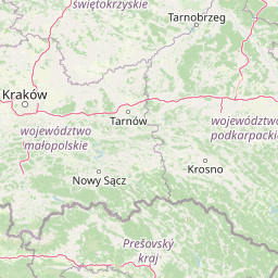
Magura National Park landscape and geographic character

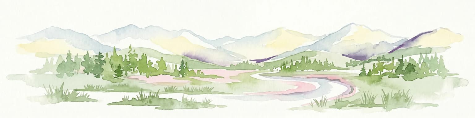
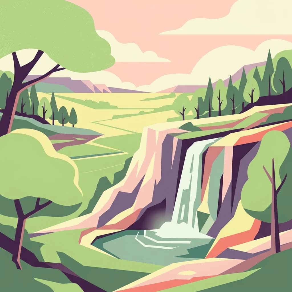
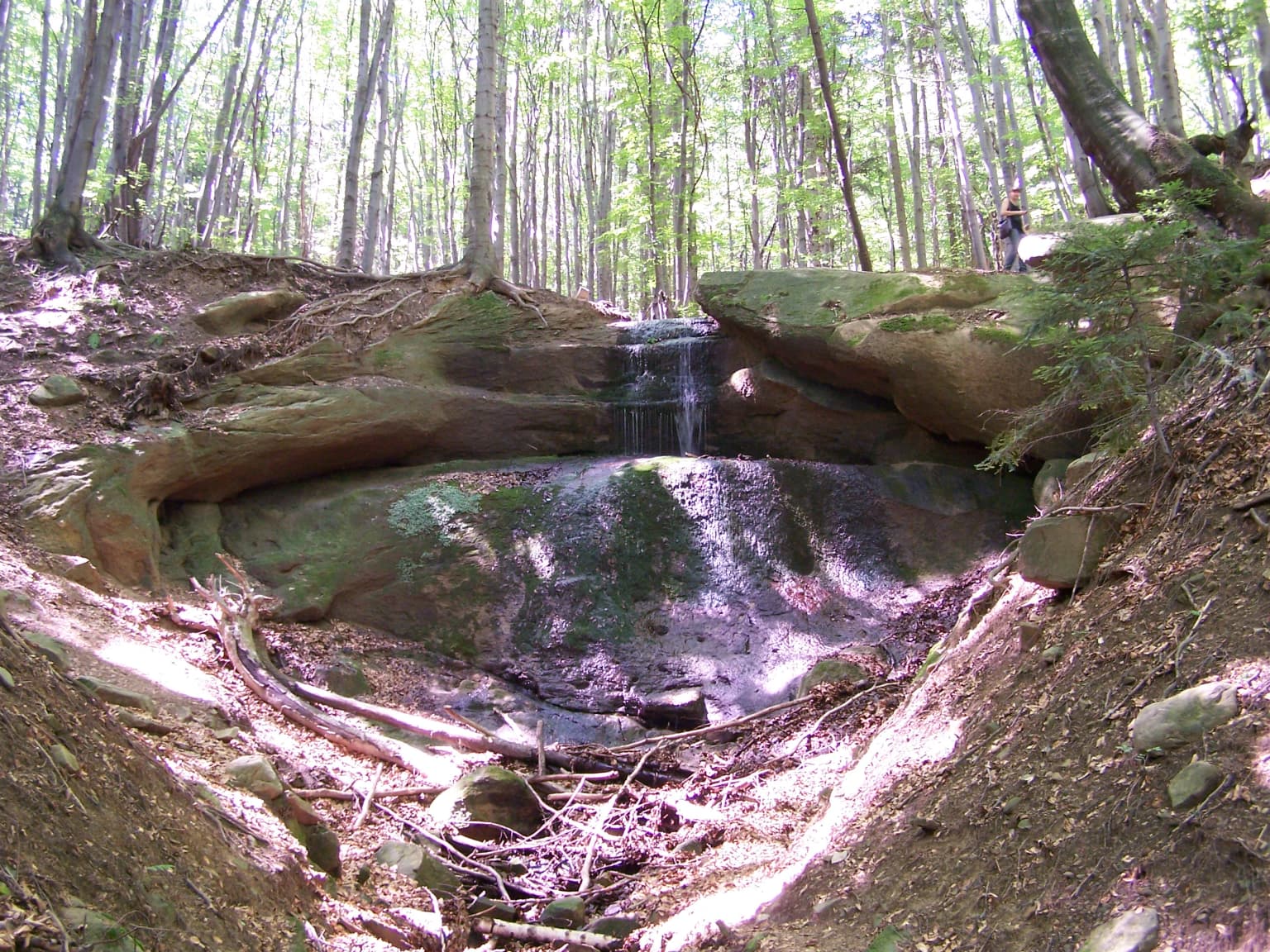
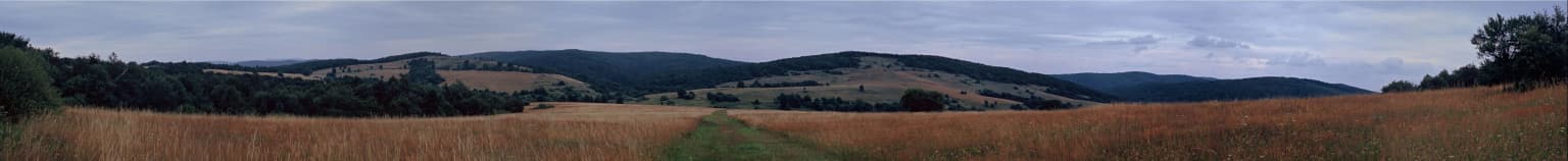
The landscape of Magura National Park is characteristic of the Beskid Niski, a Carpathian mountain range known for its relatively gentle, forested ridges rather than dramatic alpine peaks. The terrain consists primarily of heavily forested low and medium-height mountains with rounded profiles. The park's centerpiece is the Magura Wątkowska massif, containing the park's highest point at Wątkowa (847m), with other significant peaks including Magura (842m), Wielka Góra (719m), and Nad Tysowym (713m). The Wisłoka River and its tributaries form the hydrological backbone of the park, creating typical mountain river characteristics including picturesque ravines and frequently shifting courses. One of the park's most distinctive features is the Kornuty nature reserve, which protects remarkable clusters of fantastically sculpted sandstone formations. These unusual rock shapes result from differential erosion of sandstone bedrock, creating pillars, caves, and dramatic formations that attract both scientists and visitors. The most famous of these is Devil's Rock (Diabli Kamień), a prominent sandstone formation wrapped in local legend and mystery. The park also contains the Mroczna Cave, whose corridors extend approximately 200 meters, one of the more significant cave systems in the region.

Panoramic view of Ciechania Valley showing golden agricultural fields, a narrow path, and forested hills under a cloudy sky
Ciechania Valley in Beskid Niski with golden fields and rolling hills under an overcast sky

Magura National Park ecosystems, habitats, and plant life

Magura National Park occupies a critically important biogeographical position at the intersection of Western and Eastern Carpathian ecosystems. This transitional character is reflected in both the park's flora and fauna, making it a unique ecological laboratory. Over 90% of the park's surface is covered by forest, representing one of the most extensive forest complexes in the Polish Carpathians. The vegetation divides into two distinct altitudinal zones: the foothills zone (pogórze) up to approximately 530 meters, characterized by artificial pine-dominated stands, meadows, pastures, and peat bogs; and the lower forest zone (regiel dolny) extending from 530 meters upward, where natural beech forests dominate with fir additions and rare Carpathian maple groves. The park supports nearly 800 plant species, with 59 under strict protection and 11 under partial protection. Notable species include spring flower (Cebulica dwulistna), bear's garlic, various orchids including the fragrant orchid and early spider orchid, golden lily, and the Carpathian saxifrage. The fungal diversity is equally remarkable with 463 species documented, 17 of which are strictly protected including the giant puffball and larch mushroom.

Magura National Park wildlife and species highlights

The wildlife population of Magura National Park is exceptionally rich for a Carpathian forest park, with approximately 200 endangered animal species estimated within its boundaries. The park supports significant populations of large carnivores that move freely across the Polish-Slovak border, including brown bears, wolves, lynx, and European wildcats. The mammalian fauna includes 57 species total, with 10 bat species representing an important component of the nocturnal fauna. Other notable mammals include the European elk, European beaver, Eurasian otter, and the racoon dog. The avian community is particularly significant, with 137 bird species documented including several endangered raptors. The park supports one of the highest breeding densities of common buzzard in Poland, while the scops owl population reaches record levels nationally and ranks among the highest in Europe. Other notable bird species include the golden eagle, eagle owl, black stork, Ural owl, and the honey buzzard. The park also hosts 6 reptile species, 10 amphibian species, 12 fish species, and numerous insect species, making it one of the most biodiverse protected areas in the Polish Carpathians.

Magura National Park conservation status and protection priorities

Magura National Park plays a fundamental role in the conservation network of the Polish Carpathians by serving as an ecological corridor connecting Western and Eastern Carpathian protected areas. The park contains three strict nature reserves (Magura Wątkowska at 1,189 ha, Kamień at 378 ha, and Zimna Woda at 841 ha) that provide complete protection for representative ecosystems. The park is designated as a Special Area of Conservation (Ostoja Magurska) under the European Union's Natura 2000 network, recognizing its importance for preserving European wildlife habitats. The protection regime includes strict protection covering 2,408 hectares, active management on 16,940 hectares, and landscape protection on 52 hectares, with an additional buffer zone (otulina) of 229.69 hectares surrounding the core area. The park's conservation significance is amplified by its position at the western edge of the Eastern Carpathians, preserving forest communities and species that reach their western range limits in this area. Large predator populations, particularly brown bears and wolves, maintain viable populations partly because the park provides connected habitat extending across the border into Slovakia.

Magura National Park cultural meaning and human context

The region surrounding Magura National Park carries rich human heritage dating back to the early medieval period. The oldest evidence of human settlement within the park area is a 9th-century stronghold at Brzezowa on Walik mountain, part of a system of defensive fortifications built by the Vistulans tribal group to protect their southern frontier. The area was historically inhabited by the Lemkos, an Eastern Slavic ethnic group who built numerous small wooden Orthodox churches throughout the region. Several of these historic wooden churches survive in villages surrounding the park, including examples in Bartne, Chyrowa, Kwiaton, and Krempna, representing important elements of traditional Carpathian wooden architecture. One farmer's house in Kolonia Olchowiec contains a small private museum of Lemko culture, preserving artifacts of this displaced community. The landscape also bears witness to more recent turbulent history, with numerous World War I cemeteries dotting the area as this region was long contested between Russian and Austro-German armies. A poignant reminder of World War II is the cemetery at Halbów pass containing the remains of 1,250 Jews murdered by Nazis in 1942.

Top sights and standout views in Magura National Park

Magura National Park offers visitors a distinctive Carpathian experience centered on forest-covered ridges, dramatic sandstone formations, and exceptional wildlife watching opportunities. The park's network of marked trails includes sections of the main Beskid trail and European long-distance hiking path E3, providing access to viewpoints, rock formations, and the Wisłoka valley. The Kornuty nature reserve showcases the park's most impressive sandstone sculpting, while the Devil's Rock formation near Folusz is one of the most photographed sites. The educational center in Krempna provides visitor orientation and hosts a museum. The numerous wooden Orthodox churches in surrounding villages represent a unique cultural heritage. The park's position as a cross-border wilderness for brown bears, wolves, and lynx makes it a destination for wildlife enthusiasts, though sighting these elusive animals requires patience and luck. The spring and summer months bring wildflower displays in the forest clearings and meadows, while autumn offers mushroom foraging opportunities in the beech forests.

Best time to visit Magura National Park

The best time to visit Magura National Park depends on interests, though late spring through early autumn offers the most comfortable conditions for outdoor exploration. May and June bring forest wildflowers, bird activity peaks, and comfortable temperatures for hiking. July and August are the warmest months but also see the highest visitor numbers. September and October offer pleasant hiking weather, autumn foliage colors, and fewer crowds, making this an excellent time for those seeking a quieter experience. Winter visits are possible but the park's lower elevation means snow conditions can be variable and some trails may be difficult. The park experiences moderate precipitation year-round, with annual rainfall averaging 800-900mm, and visitors should be prepared for changeable mountain weather in any season. Spring and early summer provide the best conditions for viewing waterfalls and river features, while late summer and early autumn offer the most reliable weather for longer backcountry hikes.

Park location guide

Geography guide, regional context, and park location map for Magura National Park

Magura National Park park geography, regions, and map view in Poland
Understand where Magura National Park sits in Poland through a broader geographic reading of the surrounding landscape, nearby location context, and its mapped position within the national park landscape.

How Magura National Park fits into Poland

Poland, officially the Republic of Poland, is a Central European country spanning from the Baltic Sea in the north to the Carpathian Mountains in the south. It borders Germany, Czech Republic, Slovakia, Ukraine, Belarus, Lithuania, and Kaliningrad Oblast. The country has a temperate climate, diverse landscapes, and is known for its rich history, cultural heritage, and strong economic position within the EU.

Wider geography shaping Magura National Park in Poland

Poland occupies 312,696 km2 in Central Europe, extending from the Baltic Sea coast in the north to the Sudetes and Carpathian Mountains in the south. It borders Germany to the west, Czech Republic and Slovakia to the south, Ukraine and Belarus to the east, and Lithuania and Kaliningrad Oblast to the northeast. The landscape includes lowland plains, uplands, and mountain ranges.

Map view of Magura National Park

Use this park location map to pinpoint Magura National Park in Poland, understand its exact geographic position, and read its mapped placement within the surrounding landscape more clearly.

Pigeon | © OpenStreetMap contributors

Location context for Magura National Park

Lesser Poland VoivodeshipSubcarpathian Voivodeship

Mapped Scenery and Habitat Views: Understanding the Beskid Niski's Forested Terrain and Unique Rock Formations

Magura National Park: Visual Exploration of Carpathian Landscapes and Sandstone Formations
Visually explore the diverse landscapes of Magura National Park, featuring its heavily forested low mountain ridges, distinctive sandstone formations like Devil's Rock, and critical wildlife habitats in the Carpathian Mountains. These images provide essential context for understanding the park's protected-area character, its unique ecological corridor role, and the rugged, scenic terrain of the Beskid Niski region.

Waterfall cascading over rocks in a forested area with a person standing on a rock in the background

Grassy field with a winding dirt path and scattered trees viewed from an elevated position

Panoramic view of Ciechania Valley showing golden agricultural fields, a narrow path, and forested hills under a cloudy sky

Park atlas

Trace the regional spread of protected landscapes, comparing mountain geography and conservation efforts around Magura National Park

Explore Nearby National Parks and Protected Areas Around Magura National Park
Discover other national parks and protected areas across the Carpathian Mountain region, identifying additional landscapes, diverse wildlife habitats, and significant conservation zones. Compare their unique geology, forest compositions, and cross-border ecological importance to gain a broader geographic understanding of protected areas surrounding Magura National Park.
National parkSubcarpathian Voivodeship

Bieszczady National Park: A Protected Landscape of the Eastern Carpathians

Explore mapped terrain, alpine meadows, and old-growth forests.

Discover Bieszczady National Park, a significant national park located in the Subcarpathian Voivodeship of Poland, within the Eastern Carpathian mountain range. This protected area is renowned for its vast expanses of old-growth beech forests, the characteristic połoniny alpine meadows, and its status as a UNESCO World Heritage Site, underscoring its global conservation importance. The park's wild character and dramatic mountain geography make it a key destination for atlas-driven exploration of protected landscapes.

Area
292.02 km²
Established
1973
IUCN
II
Relief
Mountain
Watercolor illustration of a river flowing through a forested valley with rolling hills and scattered trees
National parkPrešov Region

Pieniny National Park: Slovakia's Distinctive Protected Landscape and Dunajec River Gorge

Explore mapped boundaries, regional geography, and protected karst terrain.

Pieniny National Park offers a focused exploration of dramatic limestone gorges and unique Carpathian mountain geography within Slovakia's Prešov Region. This national park is celebrated for the spectacular Dunajec River Gorge, a feature that defines its protected landscape and provides a profound example of natural terrain shaping. Understanding Pieniny National Park involves appreciating its specific mapped boundaries and its role as a significant protected area within the broader atlas of European natural wonders and conservation territories.

Area
37.5 km²
Established
1967
IUCN
II
Relief
Mountain
Watercolor illustration of a mountainous landscape with forests, lakes, and rolling hills under a light sky
National parkUkraine

Uzh National Nature Park: Primeval Beech Forests and Protected Landscape in Ukraine

Explore its mapped boundaries and Carpathian geography.

Uzh National Nature Park, a protected national park in Ukraine's Carpathian Mountains, safeguards a crucial segment of the Primeval Beech Forests of the Carpathians, a UNESCO World Heritage site. This atlas-focused exploration reveals the park's mapped terrain, defined by river valleys and ancient forest ecosystems, offering essential geographic context for this significant protected landscape. Discover the natural heritage preserved within its boundaries, showcasing exceptional biodiversity and the unique character of the Eastern Carpathians.

Area
391.593 km²
Established
1999
IUCN
II
Watercolor illustration of a winding river through rolling green hills with trees in the foreground
National parkKošice Region

Slovak Paradise National Park: Protected Area Mapping & Geographic Context in Košice Region

Explore the boundaries and terrain of this national park.

Investigate Slovak Paradise National Park, a designated national park situated within Slovakia's Košice Region. This detailed entry provides essential context for understanding its protected landscape features, mapped geographic distribution, and role within regional atlas exploration. Discover its unique terrain and boundaries to build a comprehensive view of Slovak conservation areas.

Area
197.63 km²
Established
1988
IUCN
II
Relief
Mountain
Watercolor painting showing rolling green hills, forests, and distant mountains under a pale sky
National parkLesser Poland Voivodeship

Gorce National Park: Carpathian Forest Ecosystems and Mapped Terrain in Lesser Poland

Protected landscape discovery within the Western Beskids.

Delve into the protected landscape of Gorce National Park, a key national park situated in Poland's Lesser Poland Voivodeship. This atlas entry focuses on its mapped geography, highlighting the characteristic Carpathian mountain terrain, extensive old-growth forests, and unique alpine meadows. Understand the park's protected boundaries and its significance within the regional landscape context of the Western Beskids, providing a foundation for structured geographic exploration.

Area
70.3 km²
Established
1981
IUCN
II
Visitors
80K annual
Watercolor illustration of green and purple mountains with pine trees and flowering shrubs in the foreground
National parkLviv Oblast

Boikivshchyna National Nature Park: National Park Protected Landscape Exploration

Lviv Oblast geographic context and mapped terrain

Dive into the protected landscape of Boikivshchyna National Nature Park, a key national park located in Lviv Oblast. MoriAtlas facilitates structured discovery of its mapped boundaries, regional geography, and the unique natural terrain it encompasses. This entry is designed for users interested in the specific park identity, its geographic setting within Ukraine, and detailed atlas-based understanding of protected natural areas.

Area
317 km²
Established
2019
IUCN
II
Relief
Mountain
Watercolor painting of mountain ranges, forests, and a winding river
National parkLesser Poland Voivodeship

Tatra National Park: Poland's Premier Alpine National Park and Protected Landscape

Explore dramatic glacial terrain, mountain lakes, and regional geography.

Tatra National Park is the definitive Alpine protected area in Poland, located in Lesser Poland Voivodeship. It showcases unique glacial landforms, including over 30 mountain lakes and dramatic peaks like Rysy. This national park serves as a crucial habitat for endemic species and offers unparalleled opportunities for atlas exploration of its rugged, mapped terrain. Understand its geographic significance as part of the Carpathian Mountains and its role as a protected landscape.

Area
211.64 km²
Established
1954
IUCN
II
Visitors
3.9M annual
National parkLublin Voivodeship

Roztocze National Park: Ancient Forested Landscape and Protected Area Geography

Discover its role in Lublin Voivodeship's natural atlas.

Roztocze National Park stands as a remarkable example of a heavily forested protected area, showcasing some of Poland's largest fir trees and ancient forest ecosystems. Located in Lublin Voivodeship, this national park offers a distinct upland landscape characterized by rolling hills and river valleys. Explore its mapped boundaries, ecological significance, and geographic context as a key component of the regional natural atlas, providing deep insights into its protected terrain.

Area
84.83 km²
Established
1974
IUCN
II
Visitors
134K annual

Common questions about visiting, size, designation, and location context for Magura National Park

Magura National Park FAQs for park facts, access, geography, and protected area context
Find quick answers about Magura National Park, including protected-area facts, park geography, trail and visitor context, and how the park fits into its surrounding country and regional landscape.
MoriAtlas Explorer

Continue Your Protected Areas Search Across the Global Atlas

Deepen your exploration by continuing the structured search for national parks and protected areas worldwide. Utilize the comprehensive filtering capabilities to compare different conservation landscapes and refine your understanding of global park geography. Discover more about the distribution and characteristics of protected natural areas.

Global natural geography