Mori Atlas logo
National parkMarmaris National Park

Discover mapped boundaries, unique flora, and Carian history within this Turkish national park.

Marmaris National Park: A Protected Mediterranean Forest Landscape in Muğla Province

(Marmaris Milli Parkı)

Marmaris National Park represents a significant protected coastal wilderness, spanning 33,350 hectares of rugged Mediterranean terrain in Turkey's Muğla Province. Established in 1996, this national park is a critical component of the Mediterranean Forests ecoregion, renowned for its dense Turkish pine forests, unique Sweetgum trees, and remarkable biodiversity including 54 endemic plant species. Its dramatic geography where forested hills meet the sea, combined with ancient archaeological sites, offers a rich context for atlas-based exploration and geographic discovery.

Mediterranean forestsCoastal national parkEndemic speciesArchaeological sitePine forestsBiodiversity hotspot

Marmaris National Park

National park

Park overview

Structured park overview, official facts, and landscape profile for Marmaris National Park

Marmaris National Park park facts, protected area profile, and essential visitor context
Review the core facts for Marmaris National Park, including designation, size, terrain, visitor scale, habitats, and operating context in one park-focused overview.

About Marmaris National Park

Marmaris National Park occupies a striking position along Turkey's Mediterranean coastline, protecting a mountainous and forested landscape that descends sharply to the sea. The park encompasses territory within both Marmaris and Köyceğiz districts, creating a protective corridor through one of Turkey's most scenically dramatic coastal regions. The establishment in 1996 reflected recognition that this area harbored exceptional natural values requiring formal protection, with the park later integrated into Turkey's national network of nature conservation areas under the Ministry of Forest and Water Management. The park's significance extends well beyond Turkey's borders, as its inclusion in the WWF's Mediterranean Forests ecoregion places it among the world's priority areas for biodiversity conservation. This global recognition stems from the Mediterraneanbasin's status as a climate-relict ecosystem containing extraordinary plant and animal diversity accumulated over millions of years. The park provides habitat for numerous species, some of which face conservation pressures across their ranges, including the wild goat and bear. Beyond its ecological credentials, the park contains tangible evidence of human presence spanning millennia, with ancient Carian settlements offering glimpses into civilizations that once thrived along these shores. The sheer volume of visitors the park receives, numbering in the millions annually, speaks to its accessibility and the powerful appeal of its landscapes, forests, and archaeological treasures.

Quick facts and research context for Marmaris National Park

Marmaris National Park spans roughly 33,350 hectares along Turkey's southwestern Mediterranean coast in Muğla Province. The protected area was established in 1996 and forms part of the WWF-designated Mediterranean Forests ecoregion, recognized as globally significant for biodiversity conservation. The landscape features Turkish pine-dominated forests, mixed deciduous vegetation in valleys, and diverse Mediterranean plant communities. The park supports substantial wildlife including endangered wild goats, bears, caracals, and more than 100 bird species. Ancient Carian settlements within the park, notably Amos with its amphitheatre and Physcus with Hellenistic fortifications, add historical depth to the natural landscape.

Park context

Deeper park guide and search-rich context for Marmaris National Park

Marmaris National Park history, landscape, wildlife, and travel context
Explore Marmaris National Park through its history, landscape character, ecosystems, wildlife, conservation priorities, cultural context, and seasonal travel timing in a structured park guide built for atlas discovery and search intent.

Why Marmaris National Park stands out

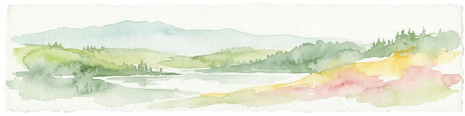
Marmaris National Park is best known for its exceptional Mediterranean forest ecosystem, which represents one of the world's 25 biodiversity hotspots. The park is distinguished by its dense Turkish pine forests, endemic Sweetgum trees in moist valley areas, and remarkable plant diversity with 54 endemic species. Its dramatic coastal scenery where forested hills meet the Mediterranean Sea creates a striking visual identity. The ancient archaeological sites of Amos and Physcus, providing a window into Carian civilization with a remarkably intact Roman amphitheatre, offer a unique cultural dimension rarely found within national parks. The combination of ecological significance, archaeological heritage, and recreational versatility makes this park a standout destination on Turkey's southwestern coast.

Marmaris National Park history and protected-area timeline

Marmaris National Park was officially established on 30 January 1996 through a decision of Turkey's Cabinet of Ministers, with the declaration published in the Official Gazette of the Republic of Turkey. This formal protection came after recognition of the area's outstanding natural values, which had been progressively understood through scientific surveys and ecological assessments conducted in the preceding decades. The park's creation represented part of a broader expansion of Turkey's protected area network during the 1990s, a period when the country sought to formalize conservation of its most significant landscapes and ecosystems. The region underlying the park carries much older heritage, as the landforms and valleys have been inhabited continuously since antiquity. The ancient Carian civilization, which gave this region its historical identity, established settlements here, with Amos and Physcus emerging as notable urban centers. The park preserves physical remnants of these ancient communities, including the well-preserved amphitheatre at Amos that still stands as a testament to the architectural achievements of the region's classical period. These archaeological sites, declared protected cultural heritage zones, add historical layers to the park's identity and provide visitors with tangible connections to the human past.

Marmaris National Park landscape and geographic character

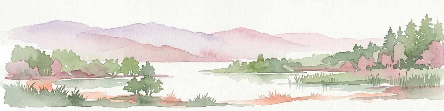
The landscape of Marmaris National Park presents a dramatic interplay between mountainous terrain and the Mediterranean Sea. The park's terrain rises steeply from the coastline, with elevations varying from sea level to substantial heights in the interior hills. The geological foundation consists of peridotite and limestones, with Cretaceous-aged magmatic rocks in the northwest exhibiting characteristic red coloration from oxidation. Limestone formations dominate the eastern portions of the park, where they appear in massive outcrops, while western limestone layers show more distinct bedding. The park contains numerous valleys where drainage patterns have created deeper soils supporting more lush vegetation. Turkish pine forms the dominant forest type across most of the park, creating the characteristic Mediterranean forest silhouette. In valley bottoms and areas with moister conditions, deciduous species including oak, plane tree, and alder create mixed forest stands of considerable beauty. The coastline features coves, small beaches, and rocky headlands where the forest meets the sea, while several islands off the coast fall within or near the park boundaries.

Marmaris National Park ecosystems, habitats, and plant life

The ecological character of Marmaris National Park reflects its position within the Mediterranean Basin, one of the world's most significant biodiversity hotspots. The park's vegetation conforms to the Mediterranean forest, woodland, and scrub biome, with Turkish pine serving as the primary forest-forming species across much of the protected area. This conifer creates extensive mono-specific stands on drier sites while mixing with deciduous species in valleys and areas with deeper soil moisture. The endemic Sweetgum tree, known scientifically as Liquidambar, occupies specialized habitat in deep, moist, and heavily-soiled locations, representing one of the park's most botanically significant species. Beyond the forested areas, the park supports diverse Mediterranean scrub vegetation including holly oak, kermes oak, wild olive, Arbutus, bladdernuts, sumac, carob, terebinth, oleander, and laurel. These species create layered vegetation communities adapted to the region's summer drought and mild winters. The plant diversity is remarkable, with over 500 species documented, including 54 endemic to Turkey, 9 locally endemic, 5 classified as endangered, and 74 considered rare. This botanical wealth reflects the complex topography, variety of habitats, and the region's position as a crossroads for different floristic influences.

Marmaris National Park wildlife and species highlights

Marmaris National Park supports a rich and diverse fauna reflecting the Mediterranean ecosystem's productivity and the park's varied habitats. Mammal populations include several species of conservation significance, most notably the wild goat, an endangered species that maintains populations in the park's rugged terrain. Larger mammals include bears, which persist in the forested interior, as well as caracals, foxes, weasels, badgers, wild boars, and rabbits. The squirrel and other small mammals round out the mammalian community. Birdlife is particularly diverse, with 112 species documented within the park. The avifauna includes birds of prey such as hawks, eagles, kestrels, and falcons, alongside numerous songbirds and water-associated species. The reptile community is well-represented with 29 species, while amphibians account for 7 species. Fish populations in the park's streams and coastal waters include 35 species, and the invertebrate community features at least 213 insect species. This assemblage of wildlife, combined with the park's botanical diversity, underlines its significance as an ecological sanctuary within the Mediterranean region.

Marmaris National Park conservation status and protection priorities

Marmaris National Park represents one of Turkey's most significant conservation areas, recognized both nationally and internationally for its ecological importance. Its inclusion in the WWF's Mediterranean Forests ecoregion, one of 200 global priority ecological regions, reflects the area's exceptional biodiversity values that transcend national boundaries. The park is situated within the Mediterranean Region, identified as one of the world's 25 biodiversity hotspots due to its extraordinary concentration of endemic species and the threats it faces from human activity and climate change. The conservation framework for the park addresses multiple dimensions of protection, from preserving the forest ecosystems and their constituent species to maintaining the archaeological heritage sites embedded within the landscape. The presence of endangered species including the wild goat and the documented populations of threatened plants reinforces the park's role as a sanctuary for biodiversity. The high visitor numbers, while indicating the park's success in providing accessible nature experiences, also create management challenges around balancing recreational use with conservation objectives.

Marmaris National Park cultural meaning and human context

The region encompassed by Marmaris National Park lies within the historical territory of Caria, an ancient region of southwestern Anatolia that developed its own distinctive cultural identity in classical antiquity. Within the park boundaries lie the remains of two significant Carian settlements: Amos and Physcus. The city of Amos, located near the modern settlement of Turunç on Asarcık Cape, preserves substantial remains including an amphitheatre, temple, statue bases, and city walls dating primarily to the Hellenistic period. The amphitheatre remains in notably good condition, offering visitors a tangible connection to the performing arts traditions of antiquity. Physcus, representing the ancient port city that preceded modern Marmaris, features fortifications constructed during the Hellenistic era. Both sites have been designated as archaeological protected zones, with Amos declared a first-degree archaeological site in 1978. The park also contains Gavur Sancağı, another Hellenistic-period site near Turunç. These ancient settlements demonstrate that the landscape's appeal to human communities extends back thousands of years, with the combination of natural harbor opportunities, fertile valleys, and access to maritime routes making this coast attractive to successive civilizations.

Top sights and standout views in Marmaris National Park

Marmaris National Park offers visitors a compelling combination of natural and cultural highlights that distinguish it among Turkey's protected areas. The Turkish pine forests covering the mountain slopes create a quintessential Mediterranean landscape, while the presence of endemic Sweetgum trees in valley areas provides botanical interest for those seeking specialized flora. The ancient amphitheatre at Amos stands as one of the park's most remarkable features, a well-preserved Roman-era structure offering both architectural interest and panoramic views over the surrounding landscape. The diversity of recreational activities available, from hiking and mountain biking to diving and rock climbing, ensures visitors can engage with the park in ways matching their interests and abilities. The park's islands, including Bedir, Keçi, and Nimara, add maritime dimensions to the protected area and support additional biodiversity. The 54 endemic plant species, including the famous Sığla tree along the coast, provide botanical highlights for those exploring the park's varied habitats.

Best time to visit Marmaris National Park

Marmaris National Park can be visited throughout the year, though the optimal time for most visitors coincides with the spring and autumn months when temperatures are moderate and the landscape displays seasonal color. Spring brings blooming vegetation and comfortable hiking conditions, with wildflowers adding color to the forests and meadows. Autumn offers pleasant temperatures and the opportunity to witness the deciduous species in their seasonal transition. Summer months bring higher temperatures that may limit strenuous daytime activities, though the coastal location provides opportunities for swimming and water-based recreation. Winter visitation offers solitude and the chance to experience the park's quieter character, though some facilities and services may operate on reduced schedules. The Mediterranean climate means rainfall concentrates in the cooler months, with summer typically being dry and warm. Visitors seeking to avoid the largest crowds might consider timing their visit outside the peak summer holiday period, when the park's 8.5 million annual visitors are most concentrated.

Park location guide

Geography guide, regional context, and park location map for Marmaris National Park

Marmaris National Park park geography, regions, and map view in Turkey
Understand where Marmaris National Park sits in Turkey through a broader geographic reading of the surrounding landscape, nearby location context, and its mapped position within the national park landscape.

How Marmaris National Park fits into Turkey

Turkey, officially the Republic of Türkiye, is a transcontinental country located mainly in Anatolia (West Asia) with a smaller portion in East Thrace (Southeast Europe). It borders the Black Sea to the north, several countries to the east and south, and the Aegean Sea and European countries to the west. The country has a population of over 86 million and operates as a secular, Muslim-majority presidential republic with Ankara as capital and Istanbul as its largest city.

Wider geography shaping Marmaris National Park in Turkey

Turkey is a transcontinental country with the majority of its territory (about 97%) located in Anatolia (West Asia) and a smaller portion called East Thrace in Southeast Europe. It borders the Black Sea to the north, Georgia, Armenia, Azerbaijan, and Iran to the east, Iraq and Syria to the south, and the Mediterranean Sea to the southwest. To the west, Turkey borders the Aegean Sea, Greece, and Bulgaria. The terrain includes mountains, plateaus, and coastal plains, with the Taurus Mountains running along the southern coast.

Map view of Marmaris National Park

Use this park location map to pinpoint Marmaris National Park in Turkey, understand its exact geographic position, and read its mapped placement within the surrounding landscape more clearly.

Pigeon | © OpenStreetMap contributors

Location context for Marmaris National Park

Muğla Province
Park atlas

Trace the geographic spread of national parks and protected areas across Turkey's compelling Mediterranean region.

Marmaris National Park: Explore Surrounding Protected Areas and Connected Mediterranean Landscapes
Browse national parks and protected areas near Marmaris National Park, tracing Turkey's scenic Mediterranean coastline and diverse inland landscapes. Compare their distinct ecosystems, geological formations, and ancient sites to understand the regional conservation context and broader protected-area geography.
Watercolor painting of a river flowing through green hills and mountains under a soft sky.
National parkMuğla Province

Saklıkent National Park: Explore Turkey's Deepest Gorge, Limestone Formations, and Protected Terrain

A remarkable national park showcasing dramatic canyon geography and karst landscapes.

Saklıkent National Park presents an extraordinary example of a protected landscape dominated by a deep limestone canyon in Muğla Province, Turkey. This national park invites exploration of its striking geological features, including towering cliffs and flowing karstic springs that form a spectacular gorge. Users engaging with Saklıkent National Park gain insight into the mapped boundaries of protected areas and the unique natural terrain sculpted by water over millennia, offering a rich geographic context for atlas discovery.

Area
16.43 km²
Established
1996
Visitors
200K annual
Relief
Mountain
National parkAydın Province

Dilek Peninsula-Büyük Menderes Delta National Park: Protected Landscape and Geographic Context

Aydın Province's unique national park with diverse ecosystems.

Investigate Dilek Peninsula-Büyük Menderes Delta National Park, a key protected area in Turkey's Aydın Province. This page provides detailed geographic context, highlighting the park's remarkable coexistence of mountainous terrain and essential wetland habitats. Understand the mapped boundaries and landscape characteristics that define this significant national park.

Area
275.98 km²
Established
1966
IUCN
II
Watercolor painting showing a lake, mountains, trees, and grassy shoreline
National parkIsparta Province

Lake Kovada National Park: Mapped Protected Landscape in Isparta Province

Discover the geography and lake ecosystem of this Turkish national park.

Lake Kovada National Park offers a detailed look at a protected natural area within Turkey's Isparta Province. This page provides insights into the park's protected landscape, focusing on the central freshwater lake and its surrounding montane terrain. Explore its geographic context, mapped boundaries, and status as a significant protected area within the Taurus Mountain region, ideal for atlas-based discovery of Anatolian natural environments.

Area
65.51 km²
Established
1970
Scope
Terrestrial
Water
Major water bodies
Protected areaTurkey

Commander-in-Chief National Historic Park: Historic Battlefield Landscape in Turkey

Protected Area preserving pivotal geography and military history.

Commander-in-Chief National Historic Park is a designated protected area in Turkey, preserving the historic terrain of the decisive Battle of Dumlupınar. This site offers a unique glimpse into the geography and landscape that were instrumental in a key moment of the Turkish War of Independence. Explore the mapped context of this significant battlefield, understanding its role within the broader Anatolian geography and its importance as a preserved historic site.

Area
409.48 km²
Established
1981
Relief
Mixed relief
Climate
Temperate
Watercolor illustration showing a mountainous landscape with a lake and greenery
National parkAntalya Province

Altınbeşik Cave National Park: A Karst Landscape with Turkey's Largest Subterranean Lake

Protected lands and mapped geological formations in Antalya Province.

Altınbeşik Cave National Park represents a significant protected karst landscape within Antalya Province, Turkey. The park's primary feature is the renowned Altınbeşik Cave, home to Turkey's largest subterranean lake and exceptional travertine formations. Explore the mapped geography of this unique national park, understanding its role as a critical discharge point for one of the world's longest karst aquifer systems.

Area
11.47 km²
Established
1994
Relief
Mixed relief
Climate
Mediterranean
National parkTurkey

Derebucak Çamlık Caves National Park: Turkey's Protected Karst Caves and Landscape

Explore Konya Province's longest cave system and its unique geological context.

Derebucak Çamlık Caves National Park is a vital protected landscape in central Turkey, celebrated for its extensive karst topography and significant cave formations. This national park encompasses thirteen unique caves and sinkholes, with Balatini Cave holding the distinction of being Konya Province's longest. The park's rugged terrain, characterized by pine forests and the Balat Stream feeding its underground systems, offers a profound look into Turkey's geological heritage and the conservation of its unique subterranean environments. MoriAtlas helps you navigate this mapped protected area.

Area
11.47 km²
Established
2022
Watercolor illustration of green hills, pine trees, and distant mountains under a light sky
National parkIsparta Province

Kızıldağ National Park: Protected Taurus Mountain Landscape and Atlas Context

Mapped boundaries, alpine terrain, and unique cedar forests.

Kızıldağ National Park offers a detailed look into Turkey's protected natural heritage, specifically highlighting the dramatic mountainous terrain of the Taurus Ranges. This page provides atlas-level geographic information about its mapped boundaries, the significant Dedegöl Mountain, and the rare blue-leaf cedar forests unique to this region. Understand its role as a vital conservation area within Isparta Province and the broader Mediterranean mountain ecosystem.

Area
551.06 km²
Established
1969
Relief
Mountain
Scope
Terrestrial
Watercolor painting of colorful rowboats on a lake with distant mountains
National parkKonya Province

Lake Beyşehir National Park: Protected Landscape Geography and Mapped Boundaries

Discover the geography and mapped context of this national park in Konya.

Lake Beyşehir National Park is a major protected area in Turkey's Central Anatolia region, celebrated for its immense freshwater lake and diverse wetland habitats. The park's identity is strongly tied to its mapped boundaries that protect critical ecosystems, islands, and surrounding forested terrain. This page provides a detailed look at the park's geographic setting within Konya Province, serving as a valuable resource for atlas-based discovery of its unique natural and cultural landscape.

Area
868.55 km²
Established
1993
Relief
Lowland
Climate
Temperate

Common questions about visiting, size, designation, and location context for Marmaris National Park

Marmaris National Park FAQs for park facts, access, geography, and protected area context
Find quick answers about Marmaris National Park, including protected-area facts, park geography, trail and visitor context, and how the park fits into its surrounding country and regional landscape.
MoriAtlas Explorer

Continue Your Protected Areas Search Across the Global Atlas

Deepen your exploration by continuing the structured search for national parks and protected areas worldwide. Utilize the comprehensive filtering capabilities to compare different conservation landscapes and refine your understanding of global park geography. Discover more about the distribution and characteristics of protected natural areas.

Global natural geography