

Mori Atlas logo
National parkMornington Peninsula National Park

Discover Victoria's dramatic cliff-top terrain and sculpted dunes on the peninsula's coast.

Mornington Peninsula National Park: Protected Landscape, Map Boundaries & Coastal Geography

Mornington Peninsula National Park offers a significant protected landscape along the southern coast of Victoria, Australia. This national park preserves a striking variety of coastal terrain, from dramatic cliff edges overlooking Bass Strait to expansive sandy beaches and sculpted dune systems. Its mapped boundaries encompass vital ecosystems, providing a vital natural corridor that contrasts with the surrounding regional development, making it a key destination for understanding Australia's coastal geography and protected area distribution.

Coastal national parksVictoria protected areasWalking and hikingHeritage lighthouse sitesCoastal cliffs and rock platformsAustralian coastal ecosystems

Mornington Peninsula National Park

National park

Park overview

Structured park overview, official facts, and landscape profile for Mornington Peninsula National Park

Mornington Peninsula National Park park facts, protected area profile, and essential visitor context
Review the core facts for Mornington Peninsula National Park, including designation, size, terrain, visitor scale, habitats, and operating context in one park-focused overview.

About Mornington Peninsula National Park

Mornington Peninsula National Park protects a significant portion of Victoria's southern coastal environment, forming a continuous protected corridor along the western and southern edges of the Mornington Peninsula. The park's landscape is characterized by dramatic sandstone and limestone cliffs that drop sharply to the Southern Ocean, interspersed with long sandy beaches and areas of sculpted dunes. The coastal vegetation ranges from dense heathland and scrub to more sheltered pockets of woodland, creating varied visual textures throughout the park. The park sits within the traditional lands of the Bunurong people, though the Wikipedia source provides limited detail on indigenous cultural connections to the landscape. Positioned within the Greater Melbourne region, the park serves as a critical green space for the metropolitan population while also preserving ecological communities of statewide significance. The park's establishment reflected growing recognition of the need to protect Victoria's coastal landscapes from development pressure, with the gradual expansion from initial coastal park designations to the comprehensive national park status achieved in 1995.

Quick facts and research context for Mornington Peninsula National Park

Mornington Peninsula National Park occupies 2,686 hectares along the southern and western coastline of the Mornington Peninsula in Victoria, Australia. The park is situated about 90 kilometres south of Melbourne, making it one of the most accessible coastal national parks for the Melbourne metropolitan area. The park was formally established in 1995, though its protected origins trace back to 1975 when Cape Schanck Coastal Park was created, followed by the addition of Point Nepean National Park in 1988. The park features the Cape Schanck Lighthouse, a historic structure built from 1859 that stands as a notable landmark and example of nineteenth-century Australian coastal architecture. Together with the adjacent Arthurs Seat State Park, the park was listed on the now-defunct Register of the National Estate in recognition of its outstanding natural and heritage values.

Park context

Deeper park guide and search-rich context for Mornington Peninsula National Park

Mornington Peninsula National Park history, landscape, wildlife, and travel context
Explore Mornington Peninsula National Park through its history, landscape character, ecosystems, wildlife, conservation priorities, cultural context, and seasonal travel timing in a structured park guide built for atlas discovery and search intent.

Why Mornington Peninsula National Park stands out

Mornington Peninsula National Park is best known for its spectacular coastal landscapes and extensive walking opportunities. The Coast Walk, a challenging two-day 30-kilometre trail spanning from Cape Schanck to London Bridge, is one of Victoria's premier coastal hiking experiences, offering nearly continuous traversal of the park's dramatic cliff-top terrain, beach sections, and dune systems. The Cape Schanck Lighthouse and its associated nineteenth-century buildings represent significant heritage architecture and serve as an iconic visual landmark. Greens Bush, situated between Arthurs Seat and Cape Schanck, stands as the largest remaining patch of native bushland on the peninsula, providing crucial habitat within a landscape increasingly dominated by agricultural and residential development. The park's diverse coastal environments, including tidal rock pools, sandy beaches, and sculpted dunes, support distinctive vegetation communities and create rich opportunities for nature observation.

Mornington Peninsula National Park history and protected-area timeline

Mornington Peninsula National Park has a relatively recent establishment history reflecting the evolution of protected area management in Victoria. The park's origins trace to December 1, 1975, when Cape Schanck Coastal Park was declared, protecting the dramatic coastline around the Cape Schanck area including the historic lighthouse. In 1988, Point Nepean National Park was established, adding another significant coastal section to the protected area network. The current Mornington Peninsula National Park was formally established in 1995 through the amalgamation and expansion of these earlier protected areas, creating a unified national park that encompassed the majority of the peninsula's western and southern coastal strips. This phased approach to protection reflected increasing understanding of the ecological and scenic values of Victoria's coastlines and the desire to create more comprehensive conservation outcomes. The park is managed by Parks Victoria, the state agency responsible for managing Victoria's terrestrial national parks and other protected areas.

Mornington Peninsula National Park landscape and geographic character

The landscape of Mornington Peninsula National Park is defined by its position on the southern coast of Victoria, where the Mornington Peninsula extends into the waters separating Port Phillip Bay from the Bass Strait. The park protects a varied coastal terrain dominated by steep sandstone and limestone cliffs that range from ten to thirty metres in height along many sections, creating dramatic ocean vistas and providing habitat for specialized plant and animal species. Between the cliff sections, long sandy beaches extend, particularly along the western coastline facing Port Phillip Bay. The park also includes areas of coastal dune formation, with sculpted sand dunes providing distinctive landforms and supporting specialized vegetation communities. The interior sections of the park, particularly around Greens Bush, feature more undulating terrain with remnants of native vegetation standing in contrast to the surrounding agricultural and rural residential landscapes that dominate much of the peninsula. The Cape Schanck area features distinctive rock formations and the historic lighthouse perched on the cliff top, adding cultural landmark value to the natural landscape.

Mornington Peninsula National Park ecosystems, habitats, and plant life

Mornington Peninsula National Park protects important examples of Victoria's coastal ecosystems and vegetation communities. The coastal heath and scrub communities that dominate many areas are adapted to the harsh maritime conditions, including salt-laden winds and relatively poor sandy soils. These heathland communities support a diversity of flowering plants and provide important habitat for small mammals and birds. Greens Bush, the largest remaining intact bushland area on the peninsula, contains several distinct vegetation communities within its boundaries, making it particularly significant for biodiversity conservation. The park's position on a peninsula creates a transitional character between Port Phillip Bay and the more exposed Southern Ocean environments, supporting species from both marine contexts. The tidal rock pools along the coast provide specialized habitat for marine invertebrates and are popular locations for education and nature observation. While the Wikipedia source provides limited specific detail on flora species, the park clearly functions as a refuge for coastal biodiversity within an increasingly developed landscape.

Mornington Peninsula National Park wildlife and species highlights

While the Wikipedia source does not provide detailed wildlife listings, Mornington Peninsula National Park clearly supports significant wildlife values within its coastal and woodland habitats. The park's diverse environments, ranging from cliff-top heathland through to sheltered woodland pockets, provide habitat for various bird species, small mammals, and reptiles adapted to coastal Victoria. The extensive walking tracks, particularly in the Greens Bush area, offer opportunities for visitors to observe wildlife, with the surrounding farmland creating strong contrast that highlights the conservation value of the protected area. The coastal position of the park means that seabirds and shorebirds are likely to be encountered along the beaches and cliff areas, though specific species are not detailed in the source material. The preservation of substantial native vegetation remnants, particularly Greens Bush, provides crucial habitat continuity for wildlife moving through the peninsula landscape.

Mornington Peninsula National Park conservation status and protection priorities

Mornington Peninsula National Park represents important conservation outcomes for Victoria's coastal environments. The park protects significant remnants of coastal ecosystems that would otherwise face pressure from development along Melbourne's expanding southern fringe. The listing of the park together with adjacent Arthurs Seat State Park on the now-defunct Register of the National Estate recognized both the outstanding natural values and the heritage significance of the protected area. The park's establishment and gradual expansion through the 1970s, 1980s, and 1990s reflected evolving conservation priorities in Victoria and recognition that coastal landscapes require formal protection to maintain their ecological integrity. The preservation of Greens Bush as the largest remaining bushland remnant on the peninsula is particularly significant, providing a core conservation area within a landscape that has been extensively cleared for agriculture and more recent residential development.

Mornington Peninsula National Park cultural meaning and human context

Mornington Peninsula National Park sits within the traditional Country of the Bunurong people, though the Wikipedia source provides limited detail on indigenous connections to the landscape. The Cape Schanck Lighthouse represents the most visible cultural heritage element within the park, with the lighthouse and its associated buildings constructed from 1859 demonstrating nineteenth-century approaches to coastal navigation infrastructure. These structures remain substantially intact and form a heritage element that adds historical depth to the park experience. The park's landscapes have also been shaped by more recent human activity, with surrounding areas used for agriculture and increasingly for residential purposes as Melbourne's urban area has expanded southward. The protection of the coastal strip as national park has preserved landscapes that retain relatively natural character despite their proximity to the metropolitan region.

Top sights and standout views in Mornington Peninsula National Park

Mornington Peninsula National Park offers several standout features that distinguish it within Victoria's protected area network. The Coast Walk represents the park's signature experience, a 30-kilometre two-day trail that follows nearly the entire coastline from Cape Schanck to London Bridge, offering spectacular ocean views, diverse terrain, and immersion in coastal vegetation. The Cape Schanck Lighthouse provides a tangible connection to Victoria's maritime heritage and serves as an iconic landmark visible from many parts of the park. Greens Bush offers a contrasting experience to the coastal sections, preserving the largest remnant of native bushland on the peninsula and providing excellent opportunities for walking and wildlife observation in a more sheltered woodland setting. The Farnsworth Track, Coppins Track, and other walking options provide shorter alternatives for visitors with different fitness levels or time constraints. The park's accessibility from Melbourne makes it a popular destination for day visitors and overnight hikers alike.

Best time to visit Mornington Peninsula National Park

Mornington Peninsula National Park can be visited throughout the year, though different seasons offer distinct experiences. The summer months of December through February typically bring the warmest conditions and are popular for beach activities, though the park can become quite busy during this peak period. Autumn and spring generally offer more moderate temperatures and fewer visitors, making these seasons particularly appealing for walking and nature observation. Winter brings cooler conditions but can still provide rewarding visits, particularly for those interested in observing coastal landscapes in their more dramatic, moody character. The park is exposed to coastal weather conditions, so visitors should be prepared for changeable weather regardless of season. The Cape Schanck Lighthouse and trail network can be enjoyed in any season, though some tracks may be affected by seasonal conditions such as wet weather or vegetation growth.
Park location guide

Geography guide, regional context, and park location map for Mornington Peninsula National Park

Mornington Peninsula National Park park geography, regions, and map view in Australia
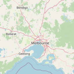
Understand where Mornington Peninsula National Park sits in Australia through a broader geographic reading of the surrounding landscape, nearby location context, and its mapped position within the national park landscape.

How Mornington Peninsula National Park fits into Australia

Australia is a constitutional monarchy and federal parliamentary democracy comprising six states and ten territories. With a population of nearly 28 million, it is one of the world's most urbanised countries, with most people concentrated on the eastern seaboard. The country has a high Human Development Index and is known for its cultural diversity, ancient Aboriginal heritage, and unique wildlife.

Wider geography shaping Mornington Peninsula National Park in Australia

Australia occupies the entire Australian continent, the island of Tasmania, and numerous smaller islands. It is the world's flattest and driest inhabited continent, featuring vast deserts in the interior (the Outback), tropical rainforests along the eastern coast, and a coastline bordering the Indian and Pacific Oceans.

Map view of Mornington Peninsula National Park

Use this park location map to pinpoint Mornington Peninsula National Park in Australia, understand its exact geographic position, and read its mapped placement within the surrounding landscape more clearly.

Pigeon | © OpenStreetMap contributors
Park atlas

Compare coastal national parks and significant protected areas within Victoria's wider geographic context.

Explore More National Parks and Protected Areas Near Mornington Peninsula, Victoria
Browse a curated list of other national parks and protected areas located within Victoria, Australia, including various coastal, bushland, and mountain environments. This expanded geographic view supports comparative exploration of different conservation landscapes, helping you trace their unique features and regional spread.
National park

French Island National Park: Protected Island National Park with Coastal Wetland Habitats

Explore mapped boundaries and diverse terrain of this unique park.

French Island National Park preserves a vital island ecosystem in Victoria, Australia, featuring extensive mangrove forests, salt marshes, and open woodland. As one of Australia's most accessible island national parks, it offers a distinctive wilderness experience primarily reached by boat, showcasing coastal conservation and unique wetland habitats. The park's geography is defined by its low-lying terrain and tidal influences, creating a rich environment for mapped landscape exploration.

Area
111 km²
Established
1998
IUCN
II
Relief
Lowland
National park

Point Addis Marine National Park: Victoria's Protected Coastal Atlas

Mapped marine park and coastal landscape context.

Point Addis Marine National Park is a significant protected marine area situated along the renowned Surf Coast of Victoria, Australia. This park safeguards the coastal waters and shoreline around iconic locations like Bells Beach, preserving vital marine habitats including extensive rocky reefs and kelp forests. Its geography is defined by dramatic sandstone cliffs and the influence of the Southern Ocean, making it a crucial site for understanding temperate marine ecosystems within a popular recreational region. Discover its mapped boundaries and ecological significance for regional geography.

Area
46 km²
Established
2002
IUCN
II
Climate
Temperate
National park

Churchill National Park: Remnant Woodland and Industrial Heritage in Victoria, Australia

Mapped protected area with notable bird diversity and historical quarry sites.

Churchill National Park offers a unique glimpse into Victoria's remnant woodland ecosystems and early twentieth-century industrial history. As a national park, it protects critical habitats for a variety of bird species and preserves the landscape features of historical quarrying operations, including the Scoresby Tramway ruins. The park's mapped geography and accessible walking tracks, like the Channel Track, provide opportunities for exploration and understanding its role as a protected natural and historical asset near Melbourne.

Area
2.71 km²
Established
1941
IUCN
II
Relief
Upland
National park

Bunurong Marine National Park: Protected Marine Area with Diverse Reefs and Coastal Landscapes

Explore unique rock formations and rich marine biodiversity off Victoria's coast.

Bunurong Marine National Park in Victoria, Australia, is a designated national park safeguarding remarkable marine ecosystems. Its protected geography features striking coastal features like Eagles Nest and a wealth of subtidal and intertidal rocky reefs teeming with life. This area is renowned for its high marine invertebrate diversity, significant fossil sites such as the Cape Paterson Claw discovery, and provides exceptional opportunities for mapped landscape exploration of its underwater terrains.

Area
21 km²
Established
2002
IUCN
II
Visitors
250K annual
National park

Dandenong Ranges National Park: A Protected National Park Landscape

Explore its mapped terrain and regional geographic context.

Dandenong Ranges National Park represents a significant protected area near Melbourne, Australia, characterized by its steep, undulating ridges and deep gullies supporting tall, wet forests. As a national park, it safeguards a vital natural landscape, providing context for regional geography and offering insights into its terrain. This entry facilitates detailed exploration of the park's protected boundaries and its place within the Australian protected-area atlas.

Area
35.4 km²
Established
1987
IUCN
II
Visitors
1M annual
National park

Organ Pipes National Park: Victoria National Park Featuring Columnar Basalt and Volcanic Geology

Explore unique mapped terrain and ancient protected landscapes near Melbourne.

Organ Pipes National Park stands as a crucial protected area in Victoria, Australia, celebrated for its exceptional columnar basalt formations and deep geological heritage. This national park preserves a striking landscape where ancient Silurian marine sediments meet relatively recent Pleistocene volcanic basalt, offering a profound glimpse into regional geography and land formation. Discover the park's mapped boundaries, the dramatic geological features along Jacksons Creek, and the ecological restoration efforts that highlight its value as a natural monument.

Area
1.21 km²
Established
1972
IUCN
III
Visitors
50K annual
National park

Great Otway National Park: Discover Its Mapped Boundaries and Unique Temperate Rainforest Geography

Explore the diverse terrain and protected landscape of Victoria's coastal ranges.

Great Otway National Park represents a vital protected natural area, distinguished by its dramatic confluence of coastal features and lush inland temperate rainforests. Situated within the Otway Ranges, the park's mapped landscape includes rugged coastlines, V-shaped valleys, and numerous waterfalls that cascade through ancient fern gullies. Understanding the park's geographic setting and protected area status is central to appreciating its ecological significance and its place within the broader Australian conservation landscape. This detailed view allows for in-depth exploration of its unique terrain and protected natural resources.

Area
1,032 km²
Established
2005
IUCN
II
Relief
Mountain
National park

Kinglake National Park: Protected Mountain Ash Forests and Geological Heritage

Explore the mapped landscape and regional geography of this Australian National Park.

Kinglake National Park is a significant protected natural area in Victoria, Australia, distinguished by its mountainous terrain dominated by eucalyptus forests, including towering mountain ash trees. The park's unique geology features sedimentary layers with marine fossils, offering a glimpse into its ancient submerged history. This National Park provides a rich environment for exploring diverse landscapes, understanding fire ecology, and appreciating the mapped boundaries of a resilient natural area.

Area
232.1 km²
Established
1928
IUCN
II
Relief
Upland

Common questions about visiting, size, designation, and location context for Mornington Peninsula National Park

Mornington Peninsula National Park FAQs for park facts, access, geography, and protected area context
Find quick answers about Mornington Peninsula National Park, including protected-area facts, park geography, trail and visitor context, and how the park fits into its surrounding country and regional landscape.
MoriAtlas Explorer

Continue Your Protected Areas Search Across the Global Atlas

Deepen your exploration by continuing the structured search for national parks and protected areas worldwide. Utilize the comprehensive filtering capabilities to compare different conservation landscapes and refine your understanding of global park geography. Discover more about the distribution and characteristics of protected natural areas.

Global natural geography