Mori Atlas logo
National parkMount Kop Defense National Historic Park

Discover mapped terrain and unique high-altitude biodiversity in Bayburt Province, Turkey.

Mount Kop Defense National Historic Park: Protected Landscape & WWI Battlefield Atlas

(Kop Dağı Müdafaası Tarihî Millî Parkı)

Mount Kop Defense National Historic Park represents a significant protected area within Turkey's Eastern Anatolia region, specifically anchored in the geography of Bayburt Province. This national park offers a dual discovery of preserved World War I battlefield landscapes and extraordinary high-altitude natural heritage, including exceptional butterfly diversity across its rugged, mountainous terrain. Explore the mapped boundaries and unique protected land context of Mount Kop Defense National Historic Park to understand its place in both military history and conservation geography.

WWI BattlefieldEastern AnatoliaMountain Protected AreaButterfly HabitatEndemic SpeciesHistorical Park

Mount Kop Defense National Historic Park

National park

Park overview

Structured park overview, official facts, and landscape profile for Mount Kop Defense National Historic Park

Mount Kop Defense National Historic Park park facts, protected area profile, and essential visitor context
Review the core facts for Mount Kop Defense National Historic Park, including designation, size, terrain, visitor scale, habitats, and operating context in one park-focused overview.

About Mount Kop Defense National Historic Park

Mount Kop Defense National Historic Park occupies a significant place in both Turkey's natural and military heritage. Located between the Kop village of Bayburt and Altıntaş village in Erzurum's Aşkale district, the park lies approximately 45 kilometers from Bayburt city and 75 kilometers from Erzurum. The protected area was formally established on 31 October 2016, marking exactly one hundred years since the Ottoman Army's defensive stand at this strategic mountain pass.

The park's establishment as Turkey's 42nd national park reflects a growing recognition that historical landscapes can serve multiple conservation purposes. The Mount Kop area represents a rare case where a significant military history site has been formally protected not only for its commemorative value but also for its ecological importance. The park preserves tangible evidence of the 1916 defensive campaign within the Çoruh Defensive Front, where Ottoman forces under the command of Fevzi Çakmak's V Corps successfully halted the Russian advance that had already captured Erzurum in February 1916.

The landscape itself is characterized by harsh mountainous terrain typical of the Eastern Anatolian highlands, with the battlefield situated at elevations between 2,400 and 2,980 meters above sea level. This high-altitude environment, while challenging for military operations a century ago, has proven to be a remarkable refuge for specialized biodiversity, particularly the extraordinary butterfly communities that have earned Mount Kop its reputation as one of Turkey's most important lepidoptera habitats.

Quick facts and research context for Mount Kop Defense National Historic Park

Mount Kop Defense National Historic Park occupies a strategic position in northeastern Turkey's Eastern Anatolia region, spanning the boundary between Bayburt Province (55% of the park area) and Erzurum Province (45%). The site was established in 2016 as Turkey's 42nd national park, coinciding with the centennial of the 1916 defensive battle. The park preserves authentic WWI battlefield remnants including trenches, artillery positions, and scattered war materials. Its high-altitude setting (2,400–2,980m) supports unique ecological communities, most notably an extraordinary butterfly fauna with 134 species—remarkable for a continental mountain environment. The park is operated by Turkey's General Directorate of Nature Conservation and National Parks.

Park context

Deeper park guide and search-rich context for Mount Kop Defense National Historic Park

Mount Kop Defense National Historic Park history, landscape, wildlife, and travel context
Explore Mount Kop Defense National Historic Park through its history, landscape character, ecosystems, wildlife, conservation priorities, cultural context, and seasonal travel timing in a structured park guide built for atlas discovery and search intent.

Why Mount Kop Defense National Historic Park stands out

The park is uniquely distinguished by its dual identity as both a preserved World War I battlefield and a significant biodiversity conservation area. The Mount Kop pass represents one of the best-preserved WWI battlefield sites in Turkey, where original trenches remain visible even in satellite imagery and where artillery gun carriage traces and war material remnants have been documented. The mountain is celebrated for its extraordinary butterfly diversity, 134 species in a high-altitude mountain setting is exceptional for Turkey, with 10 species being endemic and 37 considered rare. The site also preserves the 1963 monument honoring Ottoman soldiers who defended this strategic pass during the 1916 campaign.

Mount Kop Defense National Historic Park history and protected-area timeline

The historical significance of Mount Kop stems from its role during World War I as a critical defensive point along the Ottoman Empire's Eastern Front. Following the Russian capture of Erzurum on 16 February 1916, the Ottoman Third Army faced the urgent task of defending the approaches to central Anatolia through the mountainous terrain of the Çoruh region. The defensive campaign that unfolded between 20 March and 15 July 1916 at Mount Kop and the surrounding Bayburt area proved decisive in halting the Russian advance.

The V Corps, commanded by the future Turkish military leader Fevzi Çakmak, organized the defense across the rugged high-altitude terrain. The engagement resulted in significant casualties on both sides, with the Turkish side recording approximately 9,700 dead and 15,000 wounded. Despite these losses, the Ottoman forces successfully forced the Russian Army to retreat, fundamentally altering the course of the Eastern Front in this sector.

The battlefield has remained remarkably intact, with original trench lines, artillery positions, and gun carriage traces surviving largely unchanged except for natural weathering. Archaeological surveys using ground-penetrating radar have identified both individual and mass burial sites. A monument to the fallen Ottoman soldiers, constructed of ashlar, concrete, and marble, was erected on the summit in 1963. The area received initial tourism designation in 1993 before achieving full national park status in 2016. Recent conservation efforts include restoration of war graves and battle positions, construction of a visitor center and museum, and development of interpretation facilities.

Mount Kop Defense National Historic Park landscape and geographic character

Mount Kop rises within the Pontide tectonic belt, a significant geological zone that runs along the southern Black Sea coast of Turkey. The mountain's foundation consists of ancient pre-Jurassic metamorphic masses that have been extensively studied for their geological composition. These basement rocks include a diverse assemblage of gneiss, schist, and amphibolites, with associated ultramafic formations such as dunite, harzburgite, lherzolite, wehrlite, and pyroxenite that outcrop prominently across the landscape.

The terrain is characterized by steep mountainous slopes, high passes, and the rugged topography that made this location strategically significant during the 1916 campaign. The elevation range of 2,400 to 2,980 meters places the park squarely in a subalpine to alpine environment, with harsh winter conditions and a short growing season. The landscape lacks significant forest cover at these altitudes, instead featuring alpine meadows, rocky exposures, and the sparse vegetation that characterizes high-elevation Eastern Anatolia. The geological complexity, with its diverse metamorphic and ultramafic rock types, contributes to the site's scientific interest beyond its historical and ecological values.

Mount Kop Defense National Historic Park ecosystems, habitats, and plant life

The ecological significance of Mount Kop centers on its remarkable butterfly fauna, which ranks among the richest in Turkey. The mountain supports 134 documented butterfly species—a remarkable diversity for a high-altitude continental mountain site. Of particular conservation importance are the 10 endemic species found nowhere else on Earth, representing specialized lineages adapted to this particular mountain environment. An additional 37 species are classified as rare, underscoring the site's conservation significance within the regional context.

The park also protects the endemic plant species Stachys bayburtensis, named for the Bayburt region where it is found. This endangered plant represents a unique component of the local flora that depends on the specific ecological conditions of the Mount Kop area. The high-altitude setting creates a challenging environment for both flora and fauna, yet the mountain's position within the Pontide biodiversity corridor has facilitated the accumulation of species from multiple biogeographic origins, resulting in this unusual concentration of endemic and rare forms.

Mount Kop Defense National Historic Park wildlife and species highlights

While the park's invertebrate fauna, particularly butterflies, has been most thoroughly documented, Mount Kop also supports populations of larger mammals characteristic of Eastern Anatolia's mountainous environments. The area provides habitat for lynx, a species of conservation concern across Turkey's highland regions, as well as bears, foxes, and wolves. These predators occupy the broader landscape surrounding the alpine meadows and rocky terrain, with the park's protected status helping to maintain ecological connections across this mountainous landscape.

The butterfly communities deserve particular attention given their extraordinary diversity. The 134 species documented from the area represent a significant portion of Turkey's lepidoptera fauna, with the mix of endemic, rare, and more common species creating a complex ecological community. The high-altitude butterfly fauna includes species adapted to the short summer growing season, alpine meadow habitats, and the rocky terrain that characterizes much of the park. This invertebrate diversity, combined with the presence of the endemic Stachys bayburtensis plant, establishes the park as a significant conservation area for Eastern Anatolia's unique biodiversity.

Mount Kop Defense National Historic Park conservation status and protection priorities

Mount Kop Defense National Historic Park represents an innovative approach to protected area management that integrates historical heritage conservation with biodiversity protection. The park's dual designation as both a national park and a historic site acknowledges that cultural and natural values often coexist within significant landscapes. The World War I battlefield at Mount Kop is among the best-preserved sites from that conflict in Turkey, with original trench positions remaining visible and significant archaeological deposits still present in the landscape.

The biodiversity conservation values center on the mountain's extraordinary butterfly fauna. Recognition that this high-altitude site supports 134 butterfly species, including 10 endemics and 37 rare species, elevates its conservation importance within Turkey's protected area network. The presence of Stachys bayburtensis, an endemic and endangered plant species, adds another dimension to the site's biological significance. The park's location within the Pontide tectonic belt also offers potential for geological conservation, with its diverse metamorphic and ultramafic rock formations representing a rare exposure of deep crustal materials.

Mount Kop Defense National Historic Park cultural meaning and human context

The cultural landscape of Mount Kop reflects the intersection of military history and regional identity in eastern Turkey. The 1916 defensive battle became a significant event in local memory and national history, commemorated through the 1963 monument at the summit. The park's establishment in 2016, precisely on the centennial of the battle, represents a formal recognition of this historical importance within Turkey's system of protected areas.

The site is known locally as the "Kop Geçidi" (Kop Pass), a traditional crossing point through the mountainous terrain connecting Bayburt and Erzurum provinces. This role as a passage and strategic point has given the location its historical importance across different periods. The Ottoman military legacy is particularly prominent in local heritage, with the defense against the Russian advance forming a key chapter in the region's 20th-century history.

Top sights and standout views in Mount Kop Defense National Historic Park

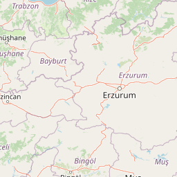
Mount Kop Defense National Historic Park uniquely combines preserved World War I battlefield archaeology with exceptional high-altitude biodiversity. The trenches and artillery positions from the 1916 battle remain largely intact, offering a rare opportunity to experience a near-pristine WWI landscape. The butterfly fauna—134 species including 10 endemics—makes this mountain one of Turkey's most significant lepidoptera habitats. The 1963 memorial monument at the summit commemorates the Ottoman soldiers who defended this strategic pass, while the ongoing development of visitor facilities will enhance interpretation of both the historical and natural values. The park spans two provinces (55% Bayburt, 45% Erzurum) and sits at elevations of 2,400–2,980 meters in the heart of Eastern Anatolia.

Best time to visit Mount Kop Defense National Historic Park

The high-altitude setting of Mountkop Defense National Historic Park means that visit timing is strongly influenced by seasonal conditions. Summer months (June through August) offer the most accessible conditions, with snow-free trails and the full emergence of the park's butterfly fauna. The short alpine growing season means that July and August provide the best opportunities to observe the full diversity of flowering plants and associated insect life. Autumn can offer clear skies and fewer visitors, though conditions deteriorate rapidly as winter approaches. Winter visits are not practical due to heavy snowfall and extreme cold at these elevations. Spring arrival is delayed by snow cover that often persists until May or even June at the higher elevations.

Park location guide

Geography guide, regional context, and park location map for Mount Kop Defense National Historic Park

Mount Kop Defense National Historic Park park geography, regions, and map view in Turkey
Understand where Mount Kop Defense National Historic Park sits in Turkey through a broader geographic reading of the surrounding landscape, nearby location context, and its mapped position within the national park landscape.

How Mount Kop Defense National Historic Park fits into Turkey

Turkey, officially the Republic of Türkiye, is a transcontinental country located mainly in Anatolia (West Asia) with a smaller portion in East Thrace (Southeast Europe). It borders the Black Sea to the north, several countries to the east and south, and the Aegean Sea and European countries to the west. The country has a population of over 86 million and operates as a secular, Muslim-majority presidential republic with Ankara as capital and Istanbul as its largest city.

Wider geography shaping Mount Kop Defense National Historic Park in Turkey

Turkey is a transcontinental country with the majority of its territory (about 97%) located in Anatolia (West Asia) and a smaller portion called East Thrace in Southeast Europe. It borders the Black Sea to the north, Georgia, Armenia, Azerbaijan, and Iran to the east, Iraq and Syria to the south, and the Mediterranean Sea to the southwest. To the west, Turkey borders the Aegean Sea, Greece, and Bulgaria. The terrain includes mountains, plateaus, and coastal plains, with the Taurus Mountains running along the southern coast.

Map view of Mount Kop Defense National Historic Park

Use this park location map to pinpoint Mount Kop Defense National Historic Park in Turkey, understand its exact geographic position, and read its mapped placement within the surrounding landscape more clearly.

Pigeon | © OpenStreetMap contributors

Location context for Mount Kop Defense National Historic Park

Bayburt ProvinceErzurum Province
Park atlas

Compare diverse protected landscapes and historical sites, tracing regional park geography around Eastern Anatolia.

Discover Related National Parks and Protected Areas Near Mount Kop Defense National Historic Park
Discover other national parks and protected areas in Eastern Anatolia, providing geographic context and comparative insights beyond Mount Kop Defense National Historic Park. Trace the regional spread of similar high-altitude landscapes, historical sites, and significant butterfly habitats across Turkey's diverse protected lands.
Watercolor illustration showing a valley landscape with a lake, mountains, and grassy foreground
National parkTrabzon Province

Altındere Valley National Park: Discover its Dramatic Protected Landscape and Geography in Trabzon

Explore the unique cliff-side monastery and mountain terrain of this national park.

Altındere Valley National Park is a significant protected area within Turkey's Trabzon Province, renowned for its breathtaking geography. The park encompasses a dramatic valley in the Pontic Mountains, where the historic Sümela Monastery is famously situated on a sheer cliff face. Users can explore the mapped boundaries, distinct landscape features, and the regional context of this unique protected natural and cultural heritage site. This destination offers a compelling focus for understanding protected landscapes and their integration with the surrounding geography.

Area
44.68 km²
Established
1987
Relief
Mountain
Climate
Mediterranean
National parkTunceli Province

Munzur Valley National Park: Tunceli Province's Vast Protected Alpine Landscape

Discover Turkey's largest national park and its unique mountain geography.

Munzur Valley National Park stands as a monumental protected area within Tunceli Province, Turkey. Its expansive territory encompasses approximately 420 square kilometers of dramatic mountain ranges, deep river valleys, and high-altitude glacial lakes. The park's complex geological makeup, shaped by tectonic forces and glacial activity, contributes to its unique terrain. This atlas entry highlights the park's role as a major biodiversity hotspot and a significant feature within eastern Anatolia's regional geography, offering rich context for landscape exploration.

Area
420 km²
Established
1971
IUCN
II
Watercolor illustration of a winding river through green hills with pink flowers in the foreground
National parkArtvin Province

Hatila Valley National Park: Dramatic V-Shaped Valley and Volcanic Terrain in Artvin Province

Explore protected landscape, waterfalls, and botanical diversity.

Hatila Valley National Park represents a significant protected area within Artvin Province, Turkey, notable for its exceptionally steep, V-shaped river valley. This national park features a striking volcanic landscape characterized by deep gorges, numerous waterfalls, and unique geomorphological structures. Its rich botanical diversity, with 769 documented plant species including many endemics, positions it as a key site for understanding protected landscapes and regional flora. The park's geographic setting at the eastern end of the Kaçkar Mountains provides context for its Mediterranean climate and varied terrain.

Area
169 km²
Established
1994
Relief
Mountain
Climate
Mediterranean
National parkTurkey

Sarıkamış-Allahuekber Mountains National Park: High-Altitude Protected Forest and WWI Memorial Landscape in Turkey

Explore the distinct protected terrain and historical geography of Turkey's eastern highlands.

Sarıkamış-Allahuekber Mountains National Park offers a unique exploration of high-altitude protected lands in Turkey. This national park is characterized by its remarkable pure Caucasian pine forests that thrive at elevations typically above the tree line, showcasing a rare alpine ecosystem. The park's rugged mountain terrain, marked by significant historical sites from the Battle of Sarikamish, provides a profound connection between natural landscape and human history within its mapped boundaries. Discover the geographic setting and protected status of this distinctive area.

Area
225.19 km²
Established
2004
Relief
Mountain
Scope
Terrestrial
National parkAdjara

Machakhela National Park: Adjara's Colchic Forest Protected Landscape

Explore Georgia's unique Caucasus mountain geography and mapped park boundaries.

Machakhela National Park represents a crucial protected area in Georgia's Adjara region, safeguarding the integrity of ancient Colchic broadleaf forests. This park's landscape is characterized by the steep Machakhelistsqali River valley, carved into the lower Caucasus mountains, offering a distinct geographic profile for atlas exploration. Discover the park's specific terrain, mapped boundaries, and its ecological significance as a vital component of the regional natural heritage.

Area
130.7 km²
Established
2012
IUCN
II
Relief
Mixed relief
Watercolor painting showing mountains, trees, and a lake in soft green and blue tones
National parkArtvin Province

Karagöl-Sahara National Park: Mapped Highland Lake and Plateau Protected Area

Discover Artvin Province's unique landslide lake and alpine terrain.

Karagöl-Sahara National Park presents a compelling protected landscape in Artvin Province, Turkey, renowned for its dramatic landslide lake, Karagöl, and the expansive Sahara plateau. This national park provides a unique map of highland geography, featuring dense conifer forests that give way to alpine meadows at elevations around 1,800 meters. Examine the geological character, including active landslide zones and sedimentary formations, that shape this distinctive terrain and contribute to its protected ecological value within the Black Sea Region.

Area
32.51 km²
Established
1994
Relief
Mountain
Climate
Boreal
Watercolor illustration of a landscape with green hills, trees, and a body of water
National parkAdjara

Mtirala National Park: Protected Colchic Rainforest Landscape & Geographic Atlas

Explore Adjara's unique terrain and mapped protected boundaries.

Mtirala National Park, located in Georgia's Adjara region, is a protected national park renowned for its exceptionally high rainfall and ancient Colchic relict forests. This atlas-focused profile details the park's unique topography, its watershed between the Chakvistskali and Khoristskali rivers, and its significance as a vital ecosystem. Understand the geographic context of this protected landscape and its role in the broader Caucasus geography.

Area
281.26 km²
Established
2006
IUCN
II
Relief
Mixed relief
Watercolor illustration of a landscape with rolling hills, forests, and a winding river.
National parkAdjara

Kintrishi National Park: Protected Colchic Forest Canyon Landscape in Adjara

Explore the mapped geographic boundaries of this unique Georgian national park.

Kintrishi National Park, located in Georgia's Adjara region, is a protected landscape renowned for its exceptionally intact Colchic deciduous forests within a steep river gorge. This area showcases dense woodland, dramatic terrain, and the unique Colchican willow species, offering rich geographic context. As a key protected area, Kintrishi National Park provides a valuable focus for atlas-based exploration of southwestern Georgia's natural heritage.

Area
186.84 km²
Established
2007
IUCN
II
Scope
Terrestrial

Common questions about visiting, size, designation, and location context for Mount Kop Defense National Historic Park

Mount Kop Defense National Historic Park FAQs for park facts, access, geography, and protected area context
Find quick answers about Mount Kop Defense National Historic Park, including protected-area facts, park geography, trail and visitor context, and how the park fits into its surrounding country and regional landscape.
MoriAtlas Explorer

Continue Your Protected Areas Search Across the Global Atlas

Deepen your exploration by continuing the structured search for national parks and protected areas worldwide. Utilize the comprehensive filtering capabilities to compare different conservation landscapes and refine your understanding of global park geography. Discover more about the distribution and characteristics of protected natural areas.

Global natural geography