Why Mount William National Park stands out
Mount William National Park is best known for its accessible coastal scenery along Tasmania's northeast coast, featuring long sandy beaches and dune systems that contrast with the extensive heath and scrubland covering much of the reserve. The park provides protected habitat for several iconic Tasmanian mammal species including eastern grey kangaroos, wombats, Bennetts wallabies, Tasmanian pademelons, and the endangered Tasmanian devil. The relatively undeveloped nature of the coastline and the presence of Mount William as a modest viewpoints add to the park's identity as a wilderness area close to Tasmania's more populated northern regions.
Mount William National Park history and protected-area timeline
Mount William National Park was established in 1973 as an initial reserve covering 8,640 hectares. The park underwent significant expansion in 1980, growing to 13,806 hectares, and received another substantial addition in 1999 to reach its current extent of 18,439 hectares. The park is named after Mount William, a prominent hill within the reserve that rises to 216 meters above sea level. In 2016, the official naming of this geographic feature was updated to recognize its Indigenous heritage, with the mountain now bearing the dual name wukalina or Mount William. The park came under the management of the Tasmania Parks and Wildlife Service, which continues to oversee its protection and visitor facilities.
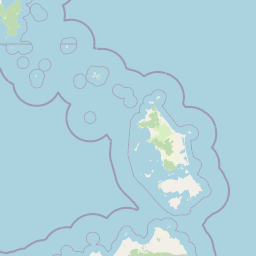
Mount William National Park landscape and geographic character
The landscape of Mount William National Park encompasses a range of coastal and sub-coastal terrain typical of northeastern Tasmania. The eastern boundary features sandy beaches and coastal dunes that face Bass Strait, with Stumpys Bay Beach being one of the more accessible and recognizable shoreline areas. Moving inland, the terrain rises gently into heathlands and eucalyptus woodlands that dominate the park's interior. The park's highest point is Mount William at 216 meters above sea level, a modest elevation that nonetheless provides views across the surrounding coastal plain and out toward the strait. The combination of beach, dune, heath, and woodland creates a visually varied landscape within a relatively compact protected area.
Mount William National Park ecosystems, habitats, and plant life
The park protects important examples of Tasmanian coastal heath and woodland ecosystems. The heath communities dominate much of the park's inland areas, characterized by diverse shrubs and low vegetation adapted to the relatively nutrient-poor soils of the region. These heathlands support a range of plant species and provide important habitat structure for the park's vertebrate fauna. The eucalypt woodlands that occur in patches throughout the reserve add structural diversity and provide canopy cover for many species. The coastal zone with its dunes and beach systems represents a distinct habitat type within the park, supporting specialized plant communities adapted to salt-laden winds and mobile sandy substrates.
Mount William National Park wildlife and species highlights
Mount William National Park provides protected habitat for several mammalian species that are characteristic of Tasmanian forests and woodlands. Eastern grey kangaroos are commonly encountered throughout the park, often seen grazing in open areas particularly around dawn and dusk. Wombats are present throughout the heathlands and woodlands, with their burrows frequently visible on slopes and in cleared areas. Bennetts wallabies and Tasmanian pademelons add to the macropod diversity within the reserve. The park also supports populations of echidnas, brush-tailed possums, and the endangered Tasmanian devil, which remains a flagship conservation species for Tasmania. This combination of marsupial species makes the park a meaningful location for observing Tasmania's distinctive mammalian fauna.
Mount William National Park conservation status and protection priorities
The national park status of Mount William provides formal protection for the coastal and heathland ecosystems of northeastern Tasmania. The park represents one of the more accessible coastal protected areas in the northern part of the state, offering conservation value while also supporting visitor use. The presence of the Tasmanian devil population adds particular conservation significance, as this species faces significant threats from a transmissible facial tumor disease that has devastated wild populations across Tasmania. Habitat protection within the national park contributes to broader landscape connectivity for Tasmanian wildlife and helps preserve representative examples of the region's natural communities.
Mount William National Park cultural meaning and human context
The dual naming of Mount William as wukalina, formalized in 2016, reflects the recognition of Indigenous heritage associated with this landscape. The traditional name connects the geographic feature to Aboriginal cultural heritage and represents broader efforts in Tasmania to incorporate Indigenous perspectives into place naming and park management. The coastal location of the park places it within the traditional Country of Tasmanian Aboriginal people, and the naming recognition acknowledges the long history of human connection to this landscape predating European settlement.
Top sights and standout views in Mount William National Park
The park's sandy beaches, particularly Stumpys Bay Beach, provide the most visually distinctive and accessible features for visitors. The heathland and woodland landscapes support prolific wildlife viewing opportunities, with kangaroos and wallabies commonly seen. The modest climb to Mount William or wukalina offers panoramic views across the coastal landscape. The combination of beach access, wildlife observation, and relatively easy accessibility from Launceston or Scottsdale makes Mount William National Park a practical option for travelers seeking Tasmanian wilderness without extensive travel into more remote regions.
Best time to visit Mount William National Park
The Tasmanian summer months from December through February generally offer the most comfortable conditions for visiting Mount William National Park, with warmer temperatures and longer daylight hours supporting outdoor exploration. Winter visits can be rewarding but bring cooler conditions and shorter days. The heathland landscapes maintain their character throughout the year, though spring and early summer bring flowering of various shrub species. Wildlife viewing can be productive throughout the year, though dawn and dusk remain the most reliable times for observing kangaroos and other macropods regardless of season.