
Islands
Park geography
A detailed atlas exploration of coastal habitats, marine environments, and terrain.
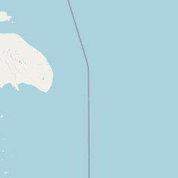
Geographic Profile and Mapped Boundaries of Ninginganiq National Wildlife Area, Nunavut
Examine the structured geographic data for Ninginganiq National Wildlife Area in Nunavut, Canada. This profile details the 3362 square kilometer recorded boundary, encompassing a subpolar landscape dominated by coastal and marine features, including various islands, bays, and peninsulas located within the reserve.
Related tags
Arctic coastlinemarine wildlifebowhead whaletundraisland
Canada's first sanctuary dedicated to the bowhead whale, on the fog-shrouded coast of Baffin Island.
Ninginganiq National Wildlife Area
Ninginganiq National Wildlife Area is a Canadian protected area in the territory of Nunavut, set along the eastern shore of Baffin Island in the High Arctic. The reserve was established specifically to safeguard one of the most important seasonal gathering areas for the bowhead whale in Canadian waters, making it the first sanctuary in the country dedicated to the conservation of this species. The reserve centres on Isabella Bay, a coastal inlet that supports close to a hundred bowhead whales at peak season and around three hundred individuals across the broader season. It is widely recognized as the principal late-summer and autumn feeding ground where bowheads aggregate before the onset of winter. Beyond its significance for cetaceans, the area also supports a classic Arctic marine and tundra fauna, including polar bears, ringed seals, and narwhals, along with seabirds that use the productive inshore waters. The protection of Ninginganiq is also a story of long-standing partnership. Local Inuit communities near Clyde River, along with conservation organizations, sought formal safeguards for the bay for decades before the Canadian government and Inuit negotiators concluded agreements that allowed the reserve to be legally created. The result is a protected area that reflects both the ecological importance of the bay and the continuing role of Inuit communities in its stewardship.
- Location
- Canada
- Park type
- Wildlife reserve
- Established
- 2010
- Area
- 3,362 km²
Location overview
Canada, Nunavut, and coastal marine status overview
Ninginganiq National Wildlife Area Geography and Regional Context
Recorded country and regional memberships place this protected territory within Canada and Nunavut. Administrative facts confirm coastal, island, and marine designations without transboundary status.
- Countries
- Canada
- Regions
- Nunavut
- Primary location
- Nunavut
- Geographic setting
- Coastal · Island · Marine
Boundary and coordinates
Interactive boundary geometry and calculated spatial measurements
Ninginganiq National Wildlife Area Boundary Map and Geographic Extent
Mapped geographic outlines provide clear spatial context for the protected territory. Accompanying boundary facts detail total area measurements, coordinate limits, and regional spans.
- Boundary area
- 3,278.4 km²
- Boundary perimeter
- 286.8 km
- Northernmost point
- 69.8308° N
- Southernmost point
- 69.2798° N
- Easternmost point
- 66.1257° W
- Westernmost point
- 68.6719° W
- Geographic centre
- 69.579° N, 67.2314° W
- North–south span
- 61.5 km
- East–west span
- 99.3 km
Terrain and natural features
Explore recorded lowland classifications, bays, islands, and peninsulas
Ninginganiq National Wildlife Area Terrain and Named Natural Features
Recorded terrain classifications for Ninginganiq National Wildlife Area outline lowland geographic features spanning multiple bays, islands, and peninsulas. Associated feature cards catalog individual names, types, measurements, and spatial relationships within the protected area.
Selected named natural features
Peaks
Ukkuannguaq
Peninsulas
Henry Kater Peninsula
Islands
Baffin Island
Capes
Niviaqsiujaq
Bays
McBeth Fiord
Environmental setting
Subpolar coastal and marine habitat profiles across lowland island terrain
Ninginganiq National Wildlife Area Environmental Setting and Geography Classifications
Recorded classifications group coastal and marine features into subpolar lowland zones with dominant water presence. Individual categories connect physical settings to broader atlas destinations.
- Relief
- Lowland
- Climate
- Subpolar
- Water
- Water-dominated
- Forest cover
- No forest cover
- Seasonality
- Year-round
Landscape features
Coast · Islands
Habitat types
Coastal habitat · Marine habitat
Park atlas
Compare adjacent High Arctic protected areas, coastal marine habitats, and regional tundra landscapes.
Exploring Parks Near Ninginganiq National Wildlife Area and Surrounding Arctic Reserves
Browsing other parks near Ninginganiq National Wildlife Area reveals broader ecological patterns across the eastern coast of Baffin Island. Comparing these adjacent protected landscapes provides essential geographic context for understanding Arctic marine reserves and regional wildlife habitats.
National parkNunavut
107 km away#1 closest
Southeast

Auyuittuq National Park: Nunavut National Park and Protected Landscape Atlas
Explore Arctic protected area geography and mapped boundaries.
Auyuittuq National Park is a key protected area within Nunavut, Canada, serving as a vital component of the national park system. This entry provides the essential geographic and atlas context for understanding Auyuittuq National Park, highlighting its status as a mapped protected landscape. Examine its role within the regional geography of Nunavut and its contribution to the broader atlas of Canadian conservation lands.
- Area
- 21,470 km²
- Established
- 1972
- IUCN
- II
- Visitors
- 256 annual
Wildlife reserveQikiqtaaluk
260 km away#2 closest
Southeast
Qaqulluit National Wildlife Area: Protected Marine Geography and Arctic Cliff Landscapes
A remote wildlife reserve along the eastern Arctic coastline.
Qaqulluit National Wildlife Area is a strictly protected reserve in Nunavut, recognized for its concentration of seabird nesting cliffs at Cape Nuvuttiq. The geography is defined by the sharp transition between towering rock walls and cold marine waters, creating a unique coastal environment that supports significant Arctic breeding colonies and marine mammals.
- Area
- 398.21 km²
- Established
- 2010
- IUCN
- Ib
National parkNunavut
About 579 km away#3 closest
Northwest
Sirmilik National Park: Nunavut National Park Atlas and Protected Landscape Map
Explore the geographic boundaries and regional context of Sirmilik National Park.
This entry provides detailed insights into Sirmilik National Park, a designated national park situated in Nunavut, Canada. It serves as a focal point for understanding the park's specific geography, its mapped protected landscape, and its role within the regional atlas. Users can explore the park's defined boundaries and its contribution to the broader landscape context of Nunavut, making it an essential destination for detailed geographic discovery.
- Area
- 22,200 km²
- Established
- 2001
- IUCN
- II
- Visitors
- 6 annual
Wildlife reserveNunavut
824 km away#4 closest
Southwest
Refuge d'oiseaux de la baie Est: Protected Coastal Landscapes on Southampton Island
Wildlife reserve in the Nunavut territory of Canada
Refuge d'oiseaux de la baie Est functions as a federally protected sanctuary within the Hudson Strait ecosystem. The terrain is characterized by broad intertidal flats, coastal saltmarshes, and low-lying tundra that supports migratory birds at the edge of their Arctic breeding range. This site maps as a cornerstone of conservation in the Kivalliq region, safeguarding seasonal habitats from the coast to the inland wetlands.
- Area
- 1,128.11 km²
- Established
- 1959
- IUCN
- Ib
- Relief
- Lowland
National parkGreenland
850 km away#5 closest
Northeast

Northeast Greenland National Park: Arctic Wilderness and Protected Landscape Atlas
Explore the world's largest national park and its mapped terrain.
Northeast Greenland National Park represents an extraordinary expanse of Arctic wilderness, renowned as the largest protected area globally. This national park protects a diverse landscape, from the interior Greenland Ice Sheet to dramatic glacial fjords and ice-free polar desert regions. Discover its extensive mapped boundaries and its significance as a sanctuary for vital Arctic megafauna, offering a profound case study in large-scale protected landscape geography.
- Area
- 972,000 km²
- Established
- 1974
- IUCN
- II
- Relief
- Mixed relief
National parkNunavut
899 km away#6 closest
West
Ukkusiksalik National Park: Nunavut Protected Area Geography and Map Context
Explore the protected landscape and mapped terrain of this Canadian National Park.
Ukkusiksalik National Park serves as a protected national park within Nunavut, offering a distinct geographic identity. This entry provides structured insights into the park's mapped boundaries and its surrounding regional landscape, facilitating a deeper understanding of its place within the broader atlas of protected areas. Examine the geographic context and discover the unique attributes of Ukkusiksalik National Park's protected territory.
- Area
- 20,885 km²
- Established
- 2003
- IUCN
- II
- Relief
- Mixed relief
National parkNewfoundland and Labrador
996 km away#7 closest
South
Torngat Mountains National Park: National Park Atlas and Protected Landscape Exploration
Explore the mapped geography and protected status of this Canadian national park.
Gain a structured understanding of Torngat Mountains National Park, a protected national park in Newfoundland and Labrador. This destination focuses on its geographic identity, mapped boundaries, and place within the broader regional landscape of the Canadian Arctic. Discover the park's terrain and conservation context, essential for anyone exploring Canada's protected areas and natural geography.
- Area
- 9,700 km²
- Established
- 2008
- IUCN
- II
- Visitors
- 599 annual
National parkNunavut
1,192 km away#8 closest
Northwest
Qausuittuq National Park: Explore Nunavut's Protected National Park Landscape and Geography
Mapped protected area boundaries and regional geographic context.
Delve into Qausuittuq National Park, a key protected area in Nunavut offering rich opportunities for geographic exploration. This destination provides detailed mapping of its protected boundaries and a comprehensive overview of its landscape context within the Arctic region. Discover how Qausuittuq National Park contributes to the mapped protected lands of Canada, ideal for users seeking structured geographic data and atlas-style discovery.
- Area
- 11,000 km²
- Established
- 2015
- IUCN
- II
- Relief
- Upland
MoriAtlas Explorer
Continue Exploring the Geography of Ninginganiq National Wildlife Area
Deepen your understanding of this Arctic sanctuary by exploring the mapped terrain and protected boundaries of Ninginganiq National Wildlife Area. MoriAtlas provides a comprehensive view of how this Baffin Island reserve integrates into the broader geography of the Canadian Arctic and its vital marine ecosystems.
Browse next
Global natural geography
Explore related park routes
Explore MoriAtlas Global ParksBrowse All MoriAtlas ParksGlobal Park Map DiscoveryMoriAtlas: Browse All CountriesBrowse All MoriAtlas ContinentsNational Park Environment AtlasGrand Canyon National Park AtlasYellowstone National Park AtlasYosemite National Park Atlas and GeographySerengeti National Park AtlasGalápagos National Park Protected LandscapeBanff National Park Geography and AtlasKruger National Park Atlas EntryUluṟu-Kata Tjuṯa National Park AtlasExplore Uluru-Kata Tjuta National Park GeographyPlitvice Lakes National Park AtlasFiordland National Park Protected LandscapeGreat Smoky Mountains National Park AtlasAfghanistan National Parks and Protected AreasAlbania National Parks and Protected AreasAlgeria National Parks and Protected AreasAmerican Samoa National Parks and Protected AreasAndorra National Parks and Protected AreasAngola National Parks and Protected AreasAntarctica National Parks and Protected AreasAntigua and Barbuda Park List