Mori Atlas logo
National parkOleshky Sands National Nature Park

Mapping expansive sand dunes, steppe terrain, and conservation areas within southern Ukraine's unique geography.

Oleshky Sands National Nature Park: A Unique Semi-Arid Protected Landscape in Kherson Oblast

Oleshky Sands National Nature Park in Kherson Oblast represents one of Europe's most remarkable semi-arid environments, defined by vast sand dunes and sandy steppe that contrast sharply with traditional Ukrainian landscapes. As a designated National Park, it preserves a distinct geographic identity with unique microhabitats, specialized flora and fauna, and a notable semi-arid character. This page offers an atlas-style exploration of Oleshky Sands National Nature Park, providing context for its mapped boundaries, surrounding terrain, and its significance within the Pontic-Caspian steppe ecoregion.

semi-arid landscapesandy steppedunesPontic-Caspian steppeprotected forestpine stands
Sand dunes with grasses, trees, and a sunny sky

Oleshky Sands National Nature Park

National park

Park overview

Structured park overview, official facts, and landscape profile for Oleshky Sands National Nature Park

Oleshky Sands National Nature Park park facts, protected area profile, and essential visitor context
Review the core facts for Oleshky Sands National Nature Park, including designation, size, terrain, visitor scale, habitats, and operating context in one park-focused overview.

About Oleshky Sands National Nature Park

Oleshky Sands National Nature Park represents a unique conservation challenge and opportunity in Ukraine's protected areas network. The park protects a landscape that defies easy categorization, combining elements of desert, steppe, forest, and wetland within a relatively compact territory. Located in the historical lower Dnieper region, the park encompasses two main areas that offer contrasting ecological experiences. The larger Radensk zone covers the majority of the protected area and features the characteristic sand dunes and sparse vegetation that give the park its name, while the Burkut section provides tree cover and more typical meadow habitats. The geological setting places the park on the ancient East European Platform's southern edge, with deep sedimentary deposits that have created the sandy conditions over millennia. The area has been recognized for its scientific value since the early twentieth century, when proposals first emerged to protect these unique sandy steppe ecosystems. Today, the park serves multiple conservation functions, preserving rare species, protecting soil and vegetation from degradation, and maintaining ecological processes that would be lost without active management. The park's location in territory currently outside Ukrainian government control presents significant challenges for ongoing conservation efforts.

Quick facts and research context for Oleshky Sands National Nature Park

Oleshky Sands National Nature Park covers approximately 8,000 to 11,700 hectares depending on the source, located in the Pontic-Caspian steppe ecoregion of southern Ukraine. The park features two primary zones: the vast Radensk sector with its distinctive sand dunes and sparse vegetation, and the smaller Burkut area characterized by pine forest, meadows, and small lakes. The climate is humid continental with hot summers (Köppen Dfa classification), featuring large seasonal temperature variations and limited precipitation. The park sits on the north slope of the Black Sea Basin within the southern portion of the ancient East European Platform. As a Category II protected area under IUCN classification, it serves as a national park preserving unique sandy steppe ecosystems that are rare in Ukraine and Europe more broadly.

Park context

Deeper park guide and search-rich context for Oleshky Sands National Nature Park

Oleshky Sands National Nature Park history, landscape, wildlife, and travel context
Explore Oleshky Sands National Nature Park through its history, landscape character, ecosystems, wildlife, conservation priorities, cultural context, and seasonal travel timing in a structured park guide built for atlas discovery and search intent.

Why Oleshky Sands National Nature Park stands out

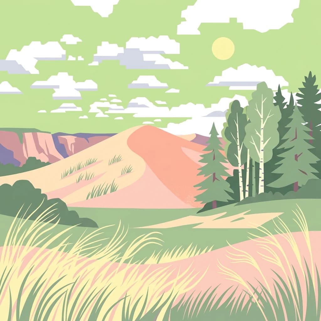
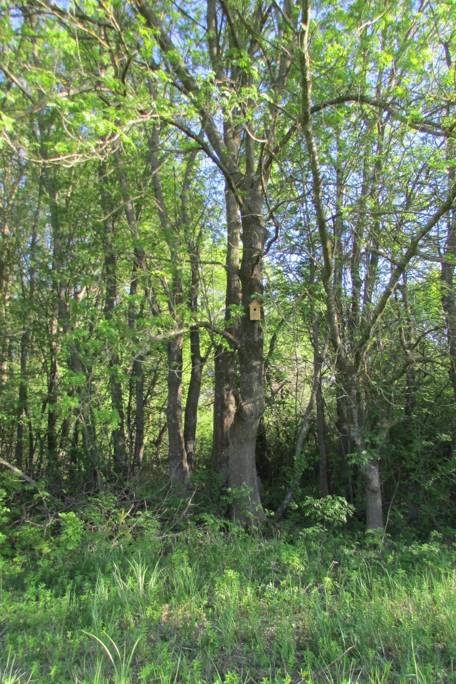
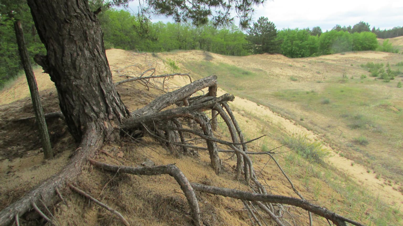
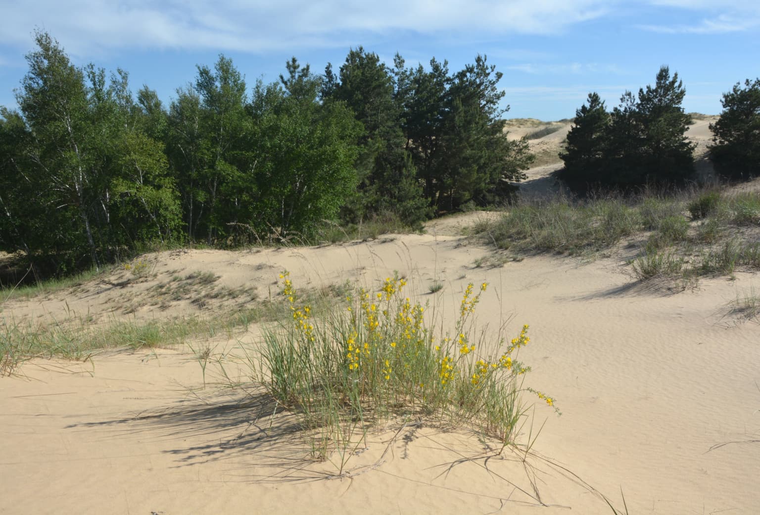
The park is best known for its distinctive semi-arid sandy landscape, which represents one of the most unusual environmental settings in Ukraine. The Radensk sector contains large sand dunes interspersed with shrub patches, birch groves, and small lakes, creating a landscape that resembles a desert more than typical European steppe. The Burkut zone contrasts sharply with its pine forest stands, meadows, and wetland areas surrounded by sandy terrain. The park preserves rare and endangered species including steppe flora such as feather grass (Stipa species), and provides habitat for specialized desert and steppe fauna. The extreme summer conditions, with sand temperatures reaching 70°C and sparse vegetation, create microhabitats found nowhere else in Ukraine's protected area network.

A calm lake surrounded by tall grasses and trees under a clear blue sky.
Dovge Lake within Oleshky Sands National Nature Park, Ukraine, showcasing a calm water body surrounded by natural vegetation under a clear sky.

Oleshky Sands National Nature Park history and protected-area timeline

The conservation history of Oleshky Sands spans nearly a century and reflects the broader evolution of nature protection in Ukraine. Initial proposals to protect the area emerged in 1928, when the Ukrainian Committee for the Protection of Natural Monuments established a commission to examine creating a "Sandy Reserve of the Dnieper Lowlands." At that time, experts recognized the scientific importance of preserving these rare sandy steppe ecosystems, noting that such areas were extremely uncommon in Ukraine and provided unique opportunities to study soil-vegetation dynamics and natural sand stabilization processes. The Soviet government established "Sandy Reserves of the Dnieper Lowlands" in July 1928, covering approximately 15,000 hectares including what is now the Burkut area. However, these early reserves were soon integrated into other protected areas, with Burkut becoming part of the Askania-Nova steppe reserve. The Burkut area remained under Askania-Nova administration until 1957, when it was transferred to Kherson regional forestry management, effectively losing its protected status for decades. The modern national park was finally established by Presidential Decree on February 23, 2010, representing a major victory for Ukrainian conservationists and scientists who had advocated for formal protection of this unique landscape. The park covers territory of two historically significant lower Dnieper sand arenas: the Kozachelahirska and Chalbaska areas.

Oleshky Sands National Nature Park landscape and geographic character

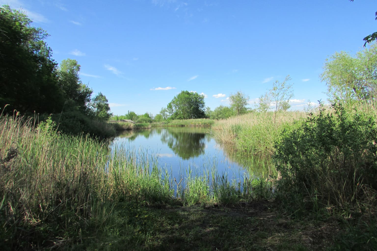
The physical landscape of Oleshky Sands National Nature Park presents a striking contrast to typical Ukrainian terrain. The park sits on the north slope of the Black Sea Basin, within a region characterized by relatively flat topography and sandy deposits. The terrain is divided into two distinct zones that offer markedly different scenery. The Radensk sector, occupying the majority of the protected area, features extensive sand dunes in its central portions, with the landscape characterized by low vegetation cover and large expanses of bare sand. Scattered throughout this zone are patches of shrubs, small birch groves, and numerous lakes that provide ecological variety within the sandy matrix. The Burkut zone presents a different character, with pine forest stands providing canopy cover, meadows offering more typical grassland habitat, and small lakes adding wetland diversity. The geological foundation consists of sandy deposits over deep bedrock, with the crystalline basement rock lying at depths ranging from 1,200 meters on the northern boundary to 1,500 meters in the Burkut area. These sandy soils are of extremely low fertility, lacking nutrients and structure, making them challenging for most plant species and contributing to the semi-arid character of the landscape.

Close-up of a purple orchid flower with striped petals and green stem against blurred grass background
Purple orchid flower (Anacamptis) in the grassy landscape of Oleshky Sands National Nature Park

Oleshky Sands National Nature Park ecosystems, habitats, and plant life

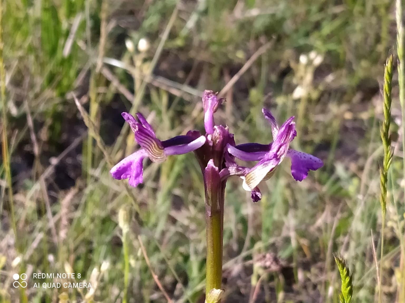
The ecological character of Oleshky Sands reflects the intersection of multiple habitat types within a relatively small area. The park contains a remarkable diversity of microhabitats despite its relatively uniform geological setting, including sandy steppe, semi-arid grasslands, meadows, reed beds, and forest stands. The vegetation reflects this variety, with steppe species dominating the open areas while birch, aspen, ash, and pine occur in the forest patches. The plant community includes approximately 500 vascular plant species, of which about 24 are considered rare or relict elements. Twelve of these rare species are listed in the Red Book of Ukraine, reflecting the conservation significance of the park's flora. The terrain's extreme conditions, including summer temperatures reaching 70°C on the sand surface and limited moisture availability, have selected for specialized plant adaptations. Despite these challenging conditions, the park supports complex plant communities including feather grasses, steppe forbs, and species adapted to both sandy and more stable soils. The soil conditions are extremely challenging, with sandy soils lacking organic matter, nutrients, and structure, creating an environment where only specially adapted species can survive.

Silver commemorative coin showing a lizard silhouette above engraved sand dunes with Ukrainian text "ОЛЕШКІВСЬКІ ПІСКИ"
Commemorative coin reverse side featuring a lizard and inscription for Oleshky Sands National Nature Park

Oleshky Sands National Nature Park wildlife and species highlights

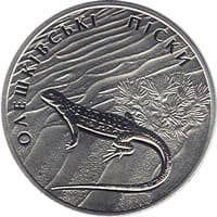
The fauna of Oleshky Sands National Nature Park is exceptionally diverse given the seemingly harsh environmental conditions. The park supports approximately 958 animal species, with 57 of these listed in the Red Book of Ukraine, indicating significant conservation value. The insect community is particularly rich and includes specialized species such as the sand mantis (Empusa pennicornis) and the parasitic wasp Larra anathema. Butterflies and moths are well represented, with species including the swallowtail butterfly (Papilio machaon) and various owlet moths. The reptile community includes the Caspian whipsnake (Dolichophis caspius) and the steppe viper (Vipera renardi), both species of conservation concern. Bird species include the white-tailed eagle (Haliaeetus albicilla), the marsh harrier (Circus cyaenus), and the stone curlew (Burhinus oedicnemus). Mammals such as the sandy mole-rat (Spalax arenarius) and the thick-toed gecko (Stylodipus telum) are specialized for the sandy environment, while wolves maintain populations throughout the park. The combination of sandy steppe, forest, and wetland habitats within the park creates diverse ecological niches that support this remarkable biodiversity.

A birdhouse mounted on a tree trunk in a dense forest with green foliage and undergrowth
Birdhouse mounted on a tree trunk in the forest of Oleshky Sands National Nature Park

Oleshky Sands National Nature Park conservation status and protection priorities

Oleshky Sands National Nature Park holds significant conservation importance for Ukraine and Europe as a whole. The park preserves the largest remaining area of sandy steppe ecosystem in Ukraine, representing a habitat type that has been largely eliminated from the continent through agricultural development. The semi-arid conditions and sandy soils create ecological conditions that are unique within Ukraine's protected areas network, supporting species assemblages found nowhere else in the country. The park protects twelve plant and fifty-seven animal species listed in Ukraine's Red Book, demonstrating its role as a refuge for rare and endangered biodiversity. Additionally, the park preserves the Pontic-Caspian steppe ecoregion, which once covered vast areas from the Black Sea to Kazakhstan but now exists only in fragmented remnants. The conservation value extends to scientific research opportunities, as the park provides a living laboratory for studying ecosystem processes in sandy environments, including sand stabilization, vegetation dynamics, and adaptation to extreme conditions. However, the park faces significant challenges, including its location in territory currently outside Ukrainian control and damage from military activity, with preliminary estimates suggesting biodiversity damage of approximately 1.31 billion hryvnias as of early 2024.

Oleshky Sands National Nature Park cultural meaning and human context

The cultural context of Oleshky Sands extends beyond ecological considerations to encompass historical human relationships with this distinctive landscape. The park's name derives from the town of Oleshky (historically Oleshshia), which itself represents an ancient regional identity dating back to Kievan Rus times. The sand deposits and surrounding area were historically known by various names, including Alekhovsks in pre-revolutionary sources, Oleshkivska during the Soviet period until the 1950s, and occasionally as Nizhnodniprovski or Tsyurupynski. These naming variations reflect the changing administrative and cultural contexts over time. The region has supported human communities for centuries, with traditional land use patterns that included grazing and limited agriculture adapted to the challenging sandy conditions. The creation of the national park in 2010 represented recognition that these lands have value beyond economic exploitation, preserving both natural heritage and historical connections to the landscape. The park's administrative center is located in the town of Oleshky, maintaining the historical link between the protected area and its regional identity.

Exposed pine tree roots on sandy soil in a dune landscape with sparse vegetation
Exposed pine roots on sandy terrain in Oleshky Sands National Nature Park

Top sights and standout views in Oleshky Sands National Nature Park

The most distinctive highlight of Oleshky Sands is its unexpected desert-like landscape in the heart of Europe, where expansive sand dunes and semi-arid conditions create an environment more typical of Central Asian or North African terrain. The Radensk sector's large dunes, reaching impressive heights and creating a constantly shifting landscape, represent the park's most visually striking feature. The contrast between the Burkut pine forests and the open sandy steppe provides remarkable ecological variety within a single protected area. The park preserves the Pontic-Caspian steppe ecoregion, an ecosystem that once covered vast territories but now exists primarily in protected remnants. The exceptional biodiversity, with nearly 1,000 animal species and 500 plant species in a relatively small area, demonstrates the ecological productivity of these seemingly harsh conditions. The historical significance of the area, with conservation proposals dating to 1928, adds depth to the park's value beyond its ecological attributes.

Sandy dunes with patches of grass and yellow flowering plants, with a line of trees in the background under a partly cloudy sky
Sandy dunes with sparse vegetation and trees in Oleshky Sands National Nature Park

Best time to visit Oleshky Sands National Nature Park

Visiting Oleshky Sands presents challenges due to the extreme seasonal conditions and restricted access policies. The summer months bring the most dramatic landscape conditions, with sand surface temperatures reaching 70°C creating genuinely desert-like atmosphere, though this also means the most challenging visitor conditions. Spring and autumn offer more moderate temperatures and better opportunities for exploring the park's various habitats. The park has historically restricted unaccompanied public access due to the proximity of military training grounds, and visitors should check current access conditions before planning trips. The winter period provides a different experience entirely, with mild but snowy conditions offering the opportunity to see the landscape under seasonal snow cover, though this may limit access to some areas. For wildlife viewing, the spring and early summer months coincide with maximum species activity, while birdwatching opportunities are particularly good during migration periods.

Park location guide

Geography guide, regional context, and park location map for Oleshky Sands National Nature Park

Oleshky Sands National Nature Park park geography, regions, and map view in Ukraine
Understand where Oleshky Sands National Nature Park sits in Ukraine through a broader geographic reading of the surrounding landscape, nearby location context, and its mapped position within the national park landscape.

How Oleshky Sands National Nature Park fits into Ukraine

Ukraine is a sovereign nation in Eastern Europe, bordered by Russia, Belarus, Poland, Slovakia, Hungary, Romania, Moldova, and the Black Sea. It is the second-largest country in Europe by area. Kyiv is the capital and largest city, followed by Kharkiv, Odesa, and Dnipro. The official language is Ukrainian. Ukraine has a population of approximately 32.9 million and operates as a unitary semi-presidential republic.

Wider geography shaping Oleshky Sands National Nature Park in Ukraine

Ukraine occupies 603,628 km² in Eastern Europe, making it the second-largest country in Europe. It shares borders with Russia, Belarus, Poland, Slovakia, Hungary, Romania, and Moldova. The country has a southern coastline along the Black Sea and Sea of Azov. The terrain includes plains, steppes, and the Carpathian Mountains in the west.

Map view of Oleshky Sands National Nature Park

Use this park location map to pinpoint Oleshky Sands National Nature Park in Ukraine, understand its exact geographic position, and read its mapped placement within the surrounding landscape more clearly.

Pigeon | © OpenStreetMap contributors

Location context for Oleshky Sands National Nature Park

Kherson Oblast

Explore its distinctive semi-arid landscapes, dynamic sand dunes, and diverse microhabitats visually.

Oleshky Sands National Nature Park Photography: Visualizing Ukraine's Unique Semi-Arid Landscapes
The image gallery offers a deep visual understanding of Oleshky Sands National Nature Park, showcasing its expansive semi-arid landscapes, shifting sand dunes, and contrasting pine forest areas. Explore detailed photography to grasp the unique terrain, diverse microhabitats, and the critical conservation significance of this protected region in Ukraine.

A calm lake surrounded by tall grasses and trees under a clear blue sky.

Black and red spotted insect resting on a green leaf with serrated edges

Close-up of a purple orchid flower with striped petals and green stem against blurred grass background

Silver commemorative coin showing a lizard silhouette above engraved sand dunes with Ukrainian text "ОЛЕШКІВСЬКІ ПІСКИ"

A birdhouse mounted on a tree trunk in a dense forest with green foliage and undergrowth

Circular drinking bowl filled with water on sandy ground in a desert landscape

Exposed pine tree roots on sandy soil in a dune landscape with sparse vegetation

Sandy dunes with patches of grass and yellow flowering plants, with a line of trees in the background under a partly cloudy sky

Close-up of green Euphorbia stepposa flowers with green leaves in Oleshky Sands National Nature Park

Green grassy field with white flowering feather grass and dense trees under a blue sky

Wooden signpost with multiple directional arrows displaying text in Cyrillic script, situated in a sandy landscape with sparse vegetation and dunes under a cloudy sky

Common comfrey with purple flowers and large green leaves in a natural setting

Panoramic view of snow-capped mountain peaks in the distance, with forested hills and rocky terrain in the foreground under a partly cloudy sky.

Sandy valley with dunes and sparse vegetation under a blue sky with scattered clouds

A wide view of sandy dunes with sparse vegetation under a blue sky with scattered clouds

Green and brown moth with patterned wings resting on a person's hand

Park atlas

Compare Protected Areas and Steppe Ecosystems in the Surrounding Kherson Oblast and Pontic-Caspian Region

Explore Other National Parks Near Oleshky Sands National Nature Park, Ukraine's Unique Semi-Arid Landscape
Continue exploring Ukraine's protected areas by browsing other national parks and natural reserves near Oleshky Sands National Nature Park, discovering similar semi-arid landscapes or contrasting forest and wetland zones. Delve into detailed park geography and conservation efforts across the Pontic-Caspian steppe ecoregion, comparing unique natural features and understanding the distribution of protected landscapes.
Watercolor illustration of rolling hills, a winding river, and patches of vegetation
National parkKherson Oblast

Dzharylhach National Nature Park: Protected Landscape Atlas & Regional Geography

Explore the mapped protected area in Kherson Oblast, Ukraine.

Delve into the geographic details and protected landscape characteristics of Dzharylhach National Nature Park. As a designated national park within Kherson Oblast, this entry provides vital information for understanding its mapped boundaries and its place in the regional geography. MoriAtlas enables a structured approach to discovering and contextualizing protected areas like Dzharylhach, offering a unique perspective for atlas exploration.

Area
100 km²
Established
2009
IUCN
II
Relief
Lowland
National parkMykolaiv Oblast

Ivory Coast of Sviatoslav National Nature Park: National Park Identity and Regional Geography

Mapped protected area in Mykolaiv Oblast, Ukraine.

Gain a structured understanding of Ivory Coast of Sviatoslav National Nature Park, a designated national park in the Mykolaiv Oblast region of Ukraine. This entry focuses on its protected landscape identity and its position within the broader regional geography. Explore the mapped outlines and discover its significance as a key protected territory for atlas-based research and geographic context.

Area
352 km²
Established
2009
IUCN
II
Relief
Lowland
National parkAutonomous Republic of Crimea

Charming Harbor National Nature Park: National Park Map and Protected Landscape Identity

Explore its mapped boundaries and regional geography.

Charming Harbor National Nature Park is a key protected area contributing to the natural landscape of the Autonomous Republic of Crimea. This page details its specific geographic scope and mapped boundaries, functioning as an atlas entry to understand its role within regional conservation efforts. Discover the park's distinct protected land context and its contribution to the mapped terrain of Ukraine.

Area
109 km²
Established
2009
IUCN
II
Relief
Lowland
National park

Azov, Syvash National Nature Park: National Park Protected Landscape and Geography

Explore mapped boundaries and regional landscape context.

Azov, Syvash National Nature Park stands as a notable protected area, offering a distinct geographic identity within Ukraine's atlas of natural landscapes. This national park's mapped boundaries provide a foundation for understanding its landscape context and regional significance. MoriAtlas enables detailed exploration of its protected terrain and its place within the country's conservation geography, serving as a gateway to structured geographic information and detailed park data for researchers and explorers.

Area
525.8 km²
Established
1993
IUCN
II
Relief
Lowland
Watercolor illustration of a landscape with rolling hills, a body of water, and greenery
National parkZaporizhzhia Oblast

Grand Meadow National Nature Park: National Park Protected Landscape and Regional Geography

Explore the mapped boundaries and natural terrain.

Grand Meadow National Nature Park represents a distinct protected landscape within Zaporizhzhia Oblast, Ukraine. As a national park, its designation signifies an area managed for conservation and geographic study. This entry on MoriAtlas details the park's physical presence, offering users the opportunity to explore its mapped terrain, understand its role in regional geography, and place it within the broader atlas of Ukrainian protected areas. It is ideal for users seeking concrete landscape context and precise geographic data.

Area
168 km²
Established
2006
IUCN
II
Relief
Lowland
National parkZaporizhzhia Oblast

Pryazovia National Nature Park: National Park Protected Landscape Atlas

Explore the mapped boundaries and regional geography of Pryazovia National Nature Park.

Pryazovia National Nature Park represents a key protected area within Zaporizhzhia Oblast, Ukraine. This MoriAtlas entry provides detailed atlas-style information, emphasizing the park's mapped boundaries and its integration into the regional geography. Understand the park's character as a protected natural landscape situated in the southeastern Ukrainian coastal zone near the Sea of Azov, offering valuable context for geographic exploration.

Area
781 km²
Established
2010
IUCN
II
Relief
Lowland
Watercolor illustration of a landscape with hills, a river, and green vegetation
National parkOdesa Oblast

Lower Dniester National Nature Park: National Park Map and Protected Landscape Atlas

Explore Odesa Oblast's protected natural geography and park boundaries.

The Lower Dniester National Nature Park is a vital component of Ukraine's protected lands, situated within the expansive Odesa Oblast. This page offers detailed geographic context, focusing on the park's mapped boundaries and its contribution to the regional landscape. Dive into an atlas-style exploration that highlights the park's protected terrain and its significance within the natural geography of southwestern Ukraine, offering structured discovery beyond basic park facts.

Area
213 km²
Established
2008
IUCN
II
Relief
Lowland
National parkMykolaiv Oblast

Bug Gard National Nature Park: Mapped Protected Landscape in Mykolaiv Oblast

Explore National Park Geography and Boundaries

Delve into Bug Gard National Nature Park, a designated national park situated in Mykolaiv Oblast, Ukraine. This detailed view highlights the park's protected landscape, offering insights into its geographic distribution and mapped boundaries. Understand its place within the regional terrain and access structured information for atlas-based exploration of this significant natural area.

Area
61.38 km²
Established
2009
IUCN
II
Relief
Mixed relief

Common questions about visiting, size, designation, and location context for Oleshky Sands National Nature Park

Oleshky Sands National Nature Park FAQs for park facts, access, geography, and protected area context
Find quick answers about Oleshky Sands National Nature Park, including protected-area facts, park geography, trail and visitor context, and how the park fits into its surrounding country and regional landscape.
MoriAtlas Explorer

Continue Your Protected Areas Search Across the Global Atlas

Deepen your exploration by continuing the structured search for national parks and protected areas worldwide. Utilize the comprehensive filtering capabilities to compare different conservation landscapes and refine your understanding of global park geography. Discover more about the distribution and characteristics of protected natural areas.

Global natural geography