Mori Atlas logo
National parkPleshcheyevo Ozero National Park

Explore the mapped boundaries and regional natural landscape of this Russian national park.

Pleshcheyevo Ozero National Park: Protected Landscape and Geographic Context in Yaroslavl Oblast

(National Park Pleshcheyevo Ozero)

Pleshcheyevo Ozero National Park stands as a protected national park within the expansive geography of Yaroslavl Oblast, Russia. This dedicated space offers a focus for understanding the specific natural landscape and mapped terrain that define this protected area. As a key component of Russia's network of conservation areas, the park provides valuable context for regional atlas exploration and detailed geographic study.

Lake ecosystemGlacial landscapeWetlandsEastern EuropeHistorical siteProtected area

Pleshcheyevo Ozero National Park

National park

Park overview

Structured park overview, official facts, and landscape profile for Pleshcheyevo Ozero National Park

Pleshcheyevo Ozero National Park park facts, protected area profile, and essential visitor context
Review the core facts for Pleshcheyevo Ozero National Park, including designation, size, terrain, visitor scale, habitats, and operating context in one park-focused overview.

About Pleshcheyevo Ozero National Park

Pleshcheyevo Ozero National Park was established in 1997 to protect Lake Pleshcheyevo and its surrounding natural and cultural landscapes in the Zalesye region of Yaroslavl Oblast. The park occupies a prominent position on the central East European Plain, an area shaped by the retreat of glaciers during the last ice age, leaving behind the characteristic moraine topography that defines the region. The lake itself, spanning 9 kilometers in diameter with a 28-kilometer shoreline, represents a significant glacial remnant and serves as the ecological heart of the protected area. The surrounding landscape includes gravelly ridged formations, extensive wetlands, meandering rivers, and isolated hills, with the Berendeyevskoye swamp covering over 5,000 hectares of the park's territory. The southeastern shore of the lake is home to Pereslavl-Zalessky, an ancient Russian city that forms part of the famed Golden Ring tourist route, creating a unique integration of natural protection and cultural heritage. The park functions as both an ecological sanctuary and a recreation area, drawing visitors to experience its combination of natural landscapes, historical sites, and outdoor activities.

Quick facts and research context for Pleshcheyevo Ozero National Park

Pleshcheyevo Ozero National Park covers 23,790 hectares in Yaroslavl Oblast, protecting Lake Pleshcheyevo, a 9-kilometer diameter glacial lake with 28 kilometers of shoreline and maximum depth of 25 meters. The park lies on the East European Plain in the Upper Volga basin, with the town of Pereslavl-Zalessky on its southeastern shore, making it accessible from Moscow as a day-trip destination. The protected area encompasses moraine terrain with gravelly ridges, extensive wetlands including the Berendeyevskoye swamp spanning over 5,000 hectares, and river valleys with terraces. The park supports 790 species of vascular plants and 300 vertebrate species, with the endemic Ryapushka whitefish representing a unique aquatic resident.

Park context

Deeper park guide and search-rich context for Pleshcheyevo Ozero National Park

Pleshcheyevo Ozero National Park history, landscape, wildlife, and travel context
Explore Pleshcheyevo Ozero National Park through its history, landscape character, ecosystems, wildlife, conservation priorities, cultural context, and seasonal travel timing in a structured park guide built for atlas discovery and search intent.

Why Pleshcheyevo Ozero National Park stands out

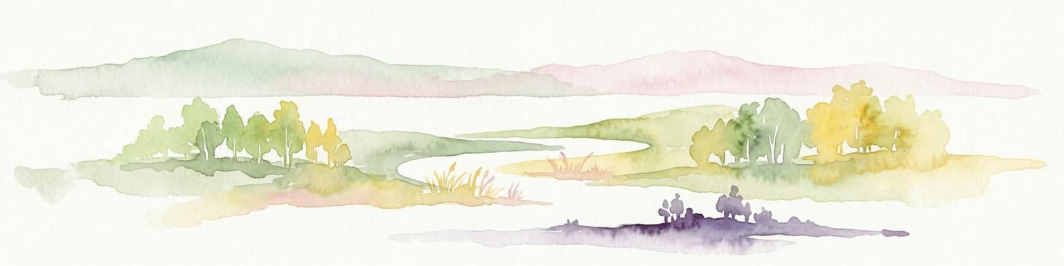
The park is best known for Lake Pleshcheyevo itself, a glacially formed lake of significant ecological and historical importance. The lake's endemic Ryapushka whitefish has been monitored since 1645 and was the subject of one of Russia's earliest conservation measures in 1668, when a ban on catching small whitefish was imposed. The park's proximity to Pereslavl-Zalessky, a historic town included in the Golden Ring of Russia, combines natural protection with cultural tourism. The area's glacial landscape features distinctive moraine formations, extensive peat bogs, and wetlands that characterize the Sarmatic mixed forests ecoregion.

Pleshcheyevo Ozero National Park history and protected-area timeline

The lake region has been inhabited for millennia, with the area around Lake Pleshcheyevo showing the long interplay of natural and human forces that have shaped both the landscape and its cultural significance. Pereslavl-Zalessky, located on the southeastern shore of the lake, developed as an important historic center and became a favored resort location for Russian tsars, establishing the area's connection to the Russian royal court. The ecological significance of the lake's fish populations was recognized early, with records of fish catches and deliveries to the royal court maintained since 1645. In 1668, one of the Russian government's first public conservation acts was enacted when a ban was imposed on catching small whitefish, demonstrating an early recognition of the need to protect the lake's unique aquatic resources. This long history of royal attention and conservation awareness helped establish the precedent for modern protection of the area, culminating in the establishment of Pleshcheyevo Ozero National Park in 1997. The early 1960s saw the limiting of large-scale commercial fishing in the lake, further protecting the endemic fish populations.

Pleshcheyevo Ozero National Park landscape and geographic character

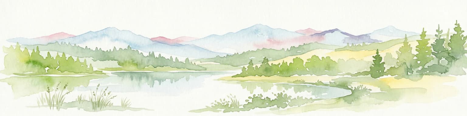
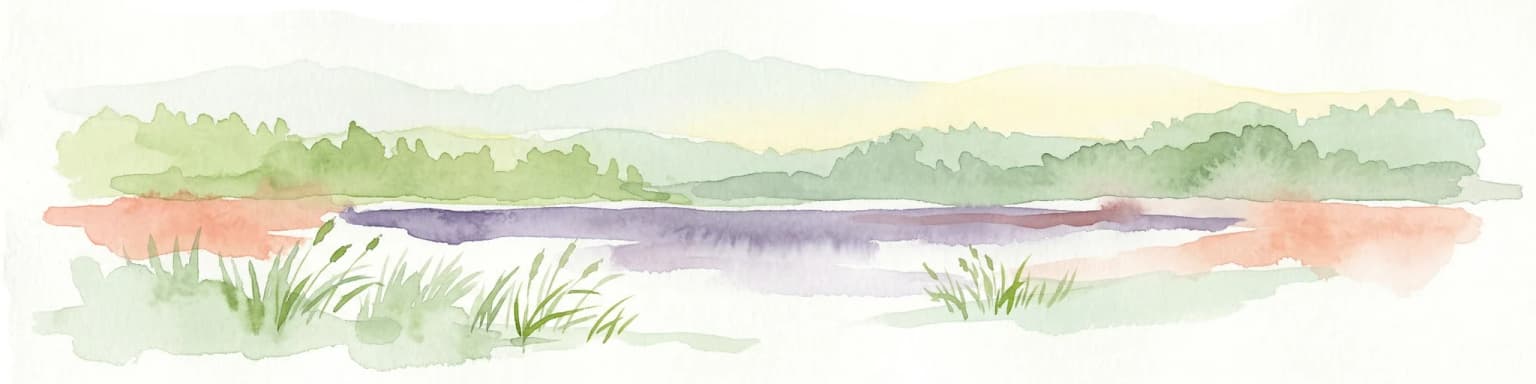
The landscape of Pleshcheyevo Ozero National Park is fundamentally shaped by glacial processes, with the terrain representing the legacy of the last ice age's retreat across the East European Plain. The lake itself occupies a glacial basin, measuring 9 kilometers in diameter with a shoreline stretching 28 kilometers, and reaching a maximum depth of 25 meters while remaining shallow around its edges. The surrounding terrain features the characteristic moraine formations left by retreating glaciers, including gravelly ridges, extensive wetlands, and meandering river valleys. The higher ground above the lake contains river valleys with well-developed terraces, while the middle regions of the park encompass significant wetland areas including peat bogs, with the Berendeyevskoye swamp covering 5,007 hectares. The park also contains occasional isolated hills that punctuate the otherwise gently rolling terrain, creating visual variety in the landscape. The combination of the lake's open waters, the surrounding wetlands, and the forested ridges creates a diverse visual landscape representative of the Sarmatic mixed forests region.

Pleshcheyevo Ozero National Park ecosystems, habitats, and plant life

The park occupies a position within the Sarmatic mixed forests ecoregion, a strip of low forests, lakes, and wetlands that extends from the Baltic Sea eastward to the Urals. Forest cover in the region consists typically of mixed conifer and deciduous trees, with large unbroken tracts of forest now under pressure from agricultural development. Within the park, the vegetation includes stands of artificially introduced Scots Pine planted along the shore 130 to 150 years ago, as well as areas of spruce and aspen forest. Some mixed broadleaf forests with oak trees reach their northern limit within the park's boundaries. The park has recorded 790 species of vascular plants across 93 different families, demonstrating significant botanical diversity. For aquatic ecosystems, the park falls within the Volga-Ural freshwater ecoregion, characterized by a relatively high number of fish species despite disruption from dam and reservoir development along the Volga River system.

Pleshcheyevo Ozero National Park wildlife and species highlights

Pleshcheyevo Ozero National Park supports substantial biodiversity with 300 recorded vertebrate species, including 60 mammal species, 210 bird species, 10 reptile and amphibian species, 109 insect species, and 19 fish species. The park's most notable wildlife resident is the Ryapushka, a large-sized vendace freshwater whitefish endemic to Lake Pleshcheyevo, which some authors classify as a distinct subspecies Coregonus albus Pereslavicus. This endemic fish has historical significance dating to 1645 and was the subject of one of Russia's earliest conservation measures in 1668, making it both ecologically and culturally important. While the Ryapushka population is not considered threatened, the fish remains a local delicacy when smoked, and the health of the population has historically served as an indicator of the overall ecological health of the lake. The diverse bird populations utilize the lake's waters and the surrounding wetlands and forests, while the mammal population includes species adapted to the mixed forest and wetland habitats of the East European Plain.

Pleshcheyevo Ozero National Park conservation status and protection priorities

Pleshcheyevo Ozero National Park holds IUCN Category II status as a national park, reflecting its primary purpose of protecting natural ecosystems while allowing for sustainable recreation and environmental education. The park's conservation significance is underscored by its protection of the endemic Ryapushka whitefish population, one of Russia's oldest protected aquatic species given the 1668 royal decree banning the capture of small whitefish. The park protects representative examples of the Sarmatic mixed forests ecoregion and the Volga-Ural freshwater ecoregion, both of which face pressures from agricultural development and infrastructure modifications elsewhere in their ranges. The extensive wetland systems within the park, particularly the Berendeyevskoye swamp, provide important ecosystem services including water filtration, flood control, and biodiversity habitat. The protected area also serves as a buffer for the historic town of Pereslavl-Zalessky, helping to preserve the visual and ecological integrity of the cultural landscape that forms part of the Golden Ring of Russia.

Pleshcheyevo Ozero National Park cultural meaning and human context

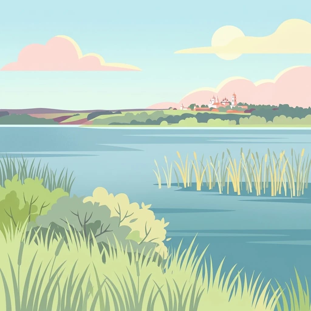
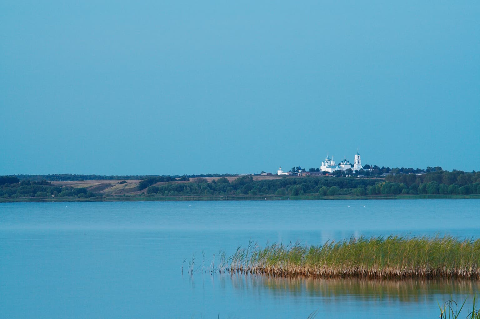
The cultural context of Pleshcheyevo Ozero National Park is deeply intertwined with the history of Pereslavl-Zalessky, an ancient city located on the southeastern shore of Lake Pleshcheyevo that draws hundreds of thousands of visitors annually to its historic buildings and sites. The area holds significance as part of the Golden Ring of Russia, a circular tourist route connecting historic northeastern Russian cities known for their architectural heritage and cultural importance. The lake and surrounding region were historically associated with Russian tsars, who used the area as a resort destination, establishing a tradition of royal attention that contributed to the area's historical prominence. The Ryapushka fish appears on the coat of arms of Pereslavl-Zalessky, symbolizing the deep connection between the local community and the lake's ecological resources. This integration of natural and cultural elements creates a landscape where ecological protection supports cultural preservation and vice versa.

Top sights and standout views in Pleshcheyevo Ozero National Park

Lake Pleshcheyevo serves as the centerpiece of the park, a glacially formed lake of 9-kilometer diameter with historical significance dating to the tsarist era. The endemic Ryapushka whitefish represents one of Russia's oldest protected species and continues to thrive in the lake's waters. The extensive wetlands, including the Berendeyevskoye swamp, provide critical habitat within the Sarmatic mixed forests ecoregion. The park's location adjacent to Pereslavl-Zalessky allows visitors to combine natural exploration with cultural tourism along the Golden Ring of Russia. The glacial moraine landscape offers distinctive terrain features including gravelly ridges, river terraces, and wetland systems.

Best time to visit Pleshcheyevo Ozero National Park

The park can be visited throughout the year, with each season offering distinct experiences shaped by the continental climate. Summer brings mild temperatures averaging around 23 degrees Celsius, making it the most popular time for outdoor recreation and water activities on the lake. The warm summer months of June through August offer the most comfortable conditions for exploring the park's trails and wetland areas. Winter transforms the landscape with cold, snowy conditions typical of the humid continental climate, with snow cover typically ranging from 30 to 40 centimeters and temperatures well below freezing. The shoulder seasons of spring and autumn offer fewer visitors and the opportunity to observe seasonal changes in the forest and wetland environments. Given its proximity to Moscow, the park sees increased visitation during Russian holidays and peak periods when accommodation in Pereslavl-Zalessky can fill quickly.

Park location guide

Geography guide, regional context, and park location map for Pleshcheyevo Ozero National Park

Pleshcheyevo Ozero National Park park geography, regions, and map view in Russia
Understand where Pleshcheyevo Ozero National Park sits in Russia through a broader geographic reading of the surrounding landscape, nearby location context, and its mapped position within the national park landscape.

How Pleshcheyevo Ozero National Park fits into Russia

Russia is a transcontinental nation spanning eleven time zones, bordered by fourteen countries. It is the world's largest country by area, covering 17,098,246 km². Moscow is the capital and largest city, while Saint Petersburg is the second-largest and a major cultural centre.

Wider geography shaping Pleshcheyevo Ozero National Park in Russia

Russia spans Eastern Europe and North Asia, covering 17,098,246 km². It shares land borders with fourteen countries, more than any other nation, and spans eleven time zones. The landscape includes vast plains, mountain ranges such as the Urals and Caucasus, and extensive coastlines along the Arctic Ocean, Pacific Ocean, Baltic Sea, Black Sea, and Caspian Sea.

Map view of Pleshcheyevo Ozero National Park

Use this park location map to pinpoint Pleshcheyevo Ozero National Park in Russia, understand its exact geographic position, and read its mapped placement within the surrounding landscape more clearly.

Pigeon | © OpenStreetMap contributors

Location context for Pleshcheyevo Ozero National Park

Yaroslavl Oblast
Park atlas

Trace the regional geography and discover other protected landscapes across the East European Plain.

Browse National Parks and Protected Areas Surrounding Pleshcheyevo Ozero National Park
Continue your discovery from Pleshcheyevo Ozero National Park by exploring other national parks and protected areas found throughout central Russia's surrounding landscapes and watersheds. Compare the regional spread of diverse protected areas, including glacial moraines, extensive wetlands, and mixed forests, for deeper geographic and conservation understanding.
Watercolor illustration of a winding river, trees, and hills in the background
National parkMoscow Oblast

Losiny Ostrov National Park: National Park Protected Landscape in Moscow Oblast

Mapped boundaries and regional geographic context for this protected area.

Uncover the geographic specifics of Losiny Ostrov National Park, a national park situated within the Moscow Oblast. This entry provides detailed insights into the park's protected area designation, its mapped natural landscape, and its position within the regional geography. It serves as a focused point for understanding the protected land's specific features and its atlas value for exploring Russia's diverse natural territories.

Area
116 km²
Established
1983
IUCN
II
Relief
Lowland
Watercolor painting of a lake surrounded by trees and distant hills
National parkVladimir Oblast

Meshchyora National Park: A Premier Wetland Protected Area in Vladimir Oblast

Explore its mapped boundaries and intricate floodplain geography.

Meshchyora National Park is a key protected landscape in central Russia, renowned for its expansive wetland ecosystems across the Meshchera Lowlands of Vladimir Oblast. Covering nearly 119,000 hectares, the park preserves a unique glacial terrain of peatlands, lakes, and meandering rivers, supporting remarkable biodiversity. Its role as a vital component of the Oka River basin and its conservation focus on restoring degraded peatlands make it a significant site for atlas-based geographic discovery and understanding protected area landscapes.

Area
1,189 km²
Established
1992
IUCN
II
Relief
Lowland
Watercolor illustration of a lake surrounded by forests and mountains under a light sky
National parkTver Oblast

Zavidovo National Park: Exploring its Protected Landscape and Geographic Identity

Mapped protected areas within Tver Oblast's regional geography.

Delve into the specifics of Zavidovo National Park, a designated national park situated within the Tver Oblast. This detailed page provides a geographic lens, allowing for exploration of its protected landscape, mapped boundaries, and its regional context. Understand how this protected area contributes to the larger atlas of Russia's natural environments and discover its unique geographic features through structured, searchable data.

Area
1,329 km²
Established
2015
IUCN
II
Relief
Lowland
National parkRyazan Oblast

Meshchyorsky National Park: Ryazan Oblast Protected Landscape Exploration

National park geography and mapped terrain.

Investigate Meshchyorsky National Park, a key protected area situated in Ryazan Oblast, Russia. This page provides detailed atlas-level context, focusing on the park's geographic identity, its mapped boundaries, and its role as a national park within the regional landscape. Explore the natural terrain and discover the protected land's place in Central Russia's geography through structured data and mapping.

Area
66 km²
Established
1992
IUCN
II
Relief
Lowland
National park

Ugra National Park: Explore Russia's Protected Landscape and National Park Atlas

Mapped boundaries and regional geographic context.

Ugra National Park represents a crucial protected area within Russia, offering detailed geographic context for atlas-based exploration. This entry details the park's specific identity as a national park, highlighting its mapped boundaries and landscape character. Engage with the structured data to understand Ugra National Park's position within Russia's geography and its significance as a protected natural landscape, facilitating comprehensive map exploration.

Area
986,245 km²
Established
1997
IUCN
II
Relief
Lowland
Watercolor illustration of a landscape with trees, hills, and water
National parkVologda Oblast

Russky Sever National Park: National Park Protected Landscape and Regional Geography

Explore mapped boundaries and natural terrain context.

Delve into the specifics of Russky Sever National Park, a key protected area situated in the Vologda Oblast region of Northwestern Russia. This page serves as a geographic anchor, detailing the park's protected landscape and its mapped presence within the regional atlas. Understand the natural terrain and boundaries that define this significant national park, providing a focused perspective for atlas-based exploration and geographic discovery.

Area
1,664 km²
Established
1992
IUCN
II
Relief
Highland
Watercolor illustration of a lake with green forests and grassy foreground, distant hills, and purple and orange water tones
National park

Valdaysky National Park: Russia's National Park & Protected Landscape Explorer

Discover its mapped boundaries and regional geographic context.

Valdaysky National Park represents a significant protected area, offering a focused entry into Russia's natural landscapes. This MoriAtlas page provides detailed geographic context, mapping the park's protected boundaries and its position within the regional terrain. Use this resource to understand the park's unique landscape identity and its value for structured atlas-based discovery of protected lands.

Area
1,585 km²
Established
1990
IUCN
II
Visitors
60K annual
National parkOryol Oblast

Orlovskoye Polesye National Park: National Park Geographic Discovery

Explore protected area maps and regional landscape context.

Delve into the protected landscape of Orlovskoye Polesye National Park, situated within Russia's Oryol Oblast. This page provides detailed geographic information, focusing on its mapped boundaries and its role as a key national park. Understand the unique regional context and how this protected area contributes to the atlas of Russia's natural landscapes. It's an essential resource for exploring the specific geography and mapped terrain of this important conservation area.

Area
777.45 km²
Established
1994
Relief
Lowland
Climate
Temperate

Common questions about visiting, size, designation, and location context for Pleshcheyevo Ozero National Park

Pleshcheyevo Ozero National Park FAQs for park facts, access, geography, and protected area context
Find quick answers about Pleshcheyevo Ozero National Park, including protected-area facts, park geography, trail and visitor context, and how the park fits into its surrounding country and regional landscape.
MoriAtlas Explorer

Continue Your Protected Areas Search Across the Global Atlas

Deepen your exploration by continuing the structured search for national parks and protected areas worldwide. Utilize the comprehensive filtering capabilities to compare different conservation landscapes and refine your understanding of global park geography. Discover more about the distribution and characteristics of protected natural areas.

Global natural geography