

Mori Atlas logo
Wildlife reservePoint Calimere Wildlife and Bird Sanctuary

A rare mosaic of salt swamps, tidal mudflats, and tropical dry evergreen forest along the Bay of Bengal

Point Calimere Wildlife and Bird Sanctuary: Mapping the Coastal Protected Landscapes of Tamil Nadu

Point Calimere Wildlife and Bird Sanctuary occupies a low lying coastal promontory where the Palk Strait meets the Bay of Bengal in Tamil Nadu. This protected wildlife reserve preserves a complex mosaic of ecosystems, including sand dunes, salt pans, and mangroves that support vast populations of migratory waterbirds and indigenous blackbuck. By analyzing its distinct terrain and hydrological boundaries, the sanctuary serves as a critical node in the broader geography of South Indian wetland conservation.

coastal sanctuarybird sanctuarymigratory waterbirdsflamingosblackbuckmangroves
An illustration showing a red and white striped lighthouse standing on a cliff near a small river and waterfall, with mountains in the background under a pale sky.

Point Calimere Wildlife and Bird Sanctuary

Wildlife reserve

Park overview

Structured park overview, official facts, and landscape profile for Point Calimere Wildlife and Bird Sanctuary

Point Calimere Wildlife and Bird Sanctuary park facts, protected area profile, and essential visitor context

Review the core facts for Point Calimere Wildlife and Bird Sanctuary, including designation, size, terrain, visitor scale, habitats, and operating context in one park-focused overview.

About Point Calimere Wildlife and Bird Sanctuary

Point Calimere Wildlife and Bird Sanctuary occupies a low, sandy promontory at the far southeastern edge of Tamil Nadu, where the long curve of the Bay of Bengal meets the Palk Strait. Although small in area, the sanctuary captures an unusually full cross-section of coastal South Indian landscapes: stabilised sand dunes along the eastern shore, dense dry evergreen forest on higher dunes to the west, and a broad matrix of tidal mudflats, shallow seasonal ponds, salt pans, and backwater channels in between. The terrain is exceptionally flat, with the highest point in the sanctuary, Ramar Padam in the northwest, reaching only a few metres above sea level.

The protected area was created in 1967 primarily to safeguard the local blackbuck population, one of the few surviving wild herds of this Indian antelope in the coastal Tamil landscape. Over the following decades it has grown in significance for bird conservation, and today it is the anchor of a much larger Ramsar Site that links it to the Great Vedaranyam Swamp, Panchanadikulam Wetland, Thalainayar Reserved Forest, and the Muthupet Mangroves. Together these wetlands form a continuous migratory waterbird landscape along India's southeast coast.

Because Point Calimere sits on an environmental and cultural boundary, between flat agricultural hinterland and open sea, between Hindu, Muslim, and ancient Tamil holy sites, it feels like a place where ecological and human history meet. A working lighthouse at Kodaikorai Beach, a medieval Chola lighthouse ruin nearby on the beach, and a string of small forest temples give the sanctuary a layered identity that distinguishes it from purely wilderness-focused reserves.

Quick facts and research context for Point Calimere Wildlife and Bird Sanctuary

Point Calimere Wildlife and Bird Sanctuary is a coastal Tamil Nadu protected area covering roughly 21 square kilometres in Nagapattinam District. It was established in 1967 with the conservation of blackbuck as its original mandate and is managed by the Tamil Nadu Forest Department.

The sanctuary sits within Ramsar Site no. 1210, designated on 19 August 2002, and is classified as an Important Bird Area. It is recognized as supporting the second largest congregation of migratory waterbirds in India and contains some of the best-preserved tropical dry evergreen forest fragments in the country.

Protection and recognition

Designation history, mixed protection scope, and Ramsar site recognition

Point Calimere Wildlife and Bird Sanctuary Protection Status and Recognition

Point Calimere Wildlife and Bird Sanctuary maintains a documented protection status established in 2002 alongside official Ramsar site recognition. Structured records assemble the designated history and management scope for this protected area.

International recognition

Protection details

Protection scope
Mixed
Designated year
2002
Transboundary protection
No
Park context

Deeper park guide and search-rich context for Point Calimere Wildlife and Bird Sanctuary

Point Calimere Wildlife and Bird Sanctuary history, landscape, wildlife, and travel context

Explore Point Calimere Wildlife and Bird Sanctuary through its history, landscape character, ecosystems, wildlife, conservation priorities, cultural context, and seasonal travel timing in a structured park guide built for atlas discovery and search intent.

Why Point Calimere Wildlife and Bird Sanctuary stands out

Point Calimere is best known as the seasonal gathering point of tens of thousands of migratory waterbirds along India's southern coast, with spectacular flocks of greater flamingos among the most photographed scenes. It is also the original stronghold of an isolated blackbuck population that has more than doubled since the sanctuary's establishment in 1967. The sanctuary is equally recognized for its unusual mosaic of coastal ecosystems. Sand dunes, salt pans, tidal mudflats, mangroves, backwaters, and dry evergreen forest patches all occur within its boundaries, creating a compressed landscape where grassland and marine-influenced habitats sit side by side. Its Ramsar designation and Important Bird Area status underscore its importance for waterbird conservation along the central Asian flyway.
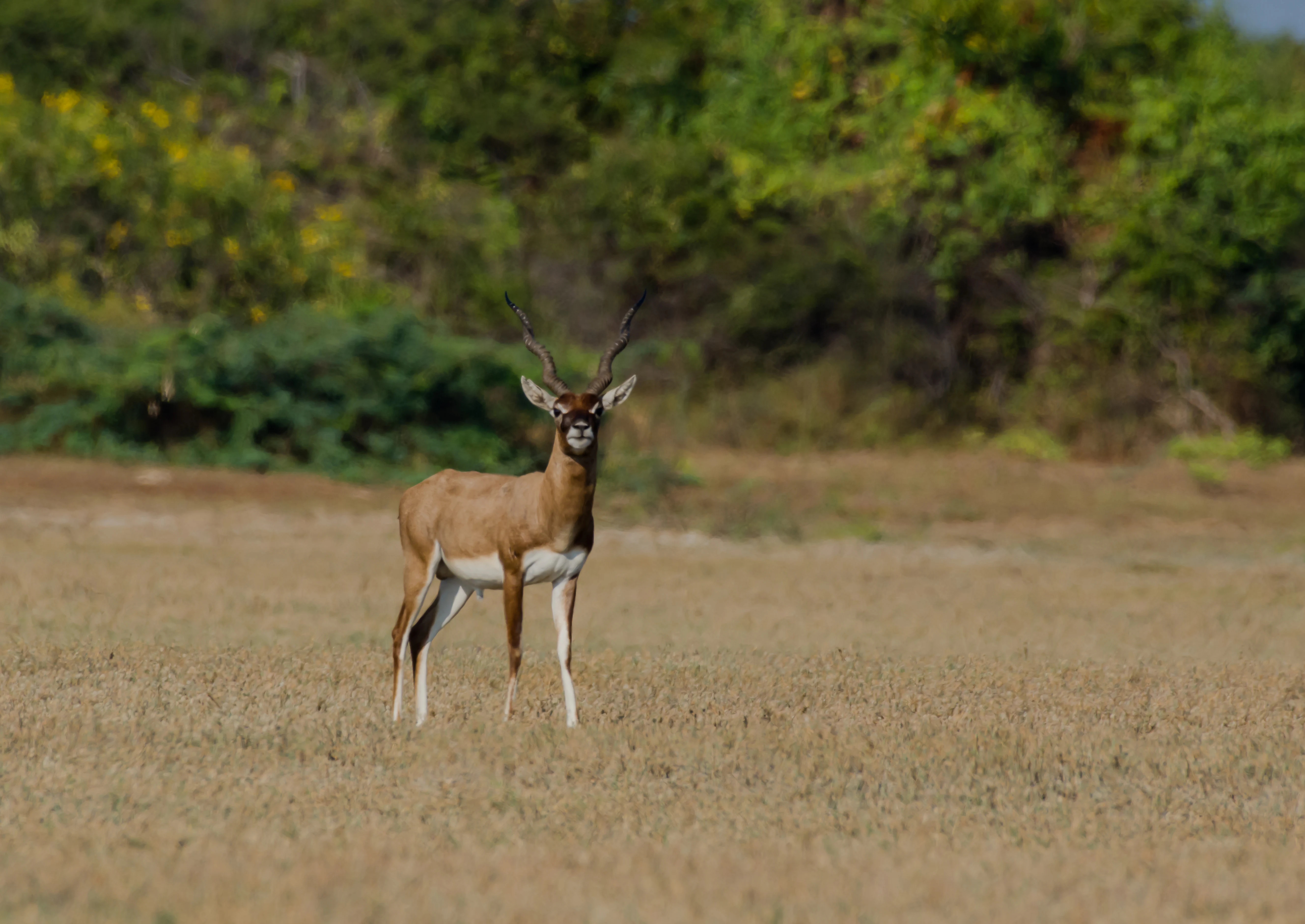
A male blackbuck with spiraled horns standing in a dry, open grassy field with green bushes in the background.
A blackbuck standing in the grasslands of Point Calimere Wildlife and Bird Sanctuary.

Point Calimere Wildlife and Bird Sanctuary history and protected-area timeline

Point Calimere was formally designated a wildlife sanctuary in 1967 to protect a coastal population of blackbuck that had survived in this isolated corner of Nagapattinam District. In the early years of its management, the priority was straightforward: control poaching of antelope and other wildlife, and ensure a year-round supply of fresh water for animals living in this saline, drought-prone environment. Poaching was gradually brought under control, while providing water, first by bullock-cart delivery to open wells and troughs from 1979, and later through piped bore wells and elevated tanks beginning around 2001, has remained an ongoing concern.

Scientific attention to the sanctuary stretches back to the late 1950s, when the Bombay Natural History Society began conducting systematic bird migration studies here. The sanctuary itself grew in administrative and conservation importance over the following decades. By the early 1990s, an annual wildlife census was established, and in 1998 a modern 45-metre lighthouse was commissioned near the coast to support safe navigation along this historically treacherous stretch.

A transformative event in the sanctuary's recent history was the 2004 Indian Ocean tsunami, which sent seawater several metres deep across the entire site. Despite fears of major ecological damage, the sanctuary's animals, birds, and habitats largely survived. The disaster underscored both the resilience of coastal ecosystems here and the vulnerability of neighbouring communities, thousands of whom lost their lives elsewhere in Nagapattinam District. The documentary film Point Calimere: Little Kingdom by the Coast later brought wider public attention to the site.

Point Calimere Wildlife and Bird Sanctuary landscape and geographic character

The landscape of Point Calimere is a study in subtle coastal topography. Nowhere does the land rise more than a few metres above sea level, yet within this low relief the sanctuary holds a remarkable variety of terrain. The eastern side is fringed by stabilised sand dunes running parallel to the Bay of Bengal, while higher dunes to the west support patches of dry evergreen forest. Between these dune zones lie tidal mudflats, shallow brackish ponds, salt pans, swampy backwaters, and stretches of mangrove.

This pattern results from the merging of three very different physical influences: the open ocean to the east, the Palk Strait channel to the south, and a network of saline and brackish backwaters backed by agricultural and salt-extraction landscapes to the north and west. The eventual effect is that Point Calimere reads less like a unified forest block than a mosaic of small coastal habitats stitched together by water and tidal movement.

The sanctuary's position on an island of land, ringed by sea and swamp, contributes to its biological and visual character. Visitors tend to encounter flat horizons, reed-edged channels, scattered tree clumps, and dunes that catch the prevailing sea breeze, a landscape far removed from the mountainous or forested protected areas elsewhere in South India.
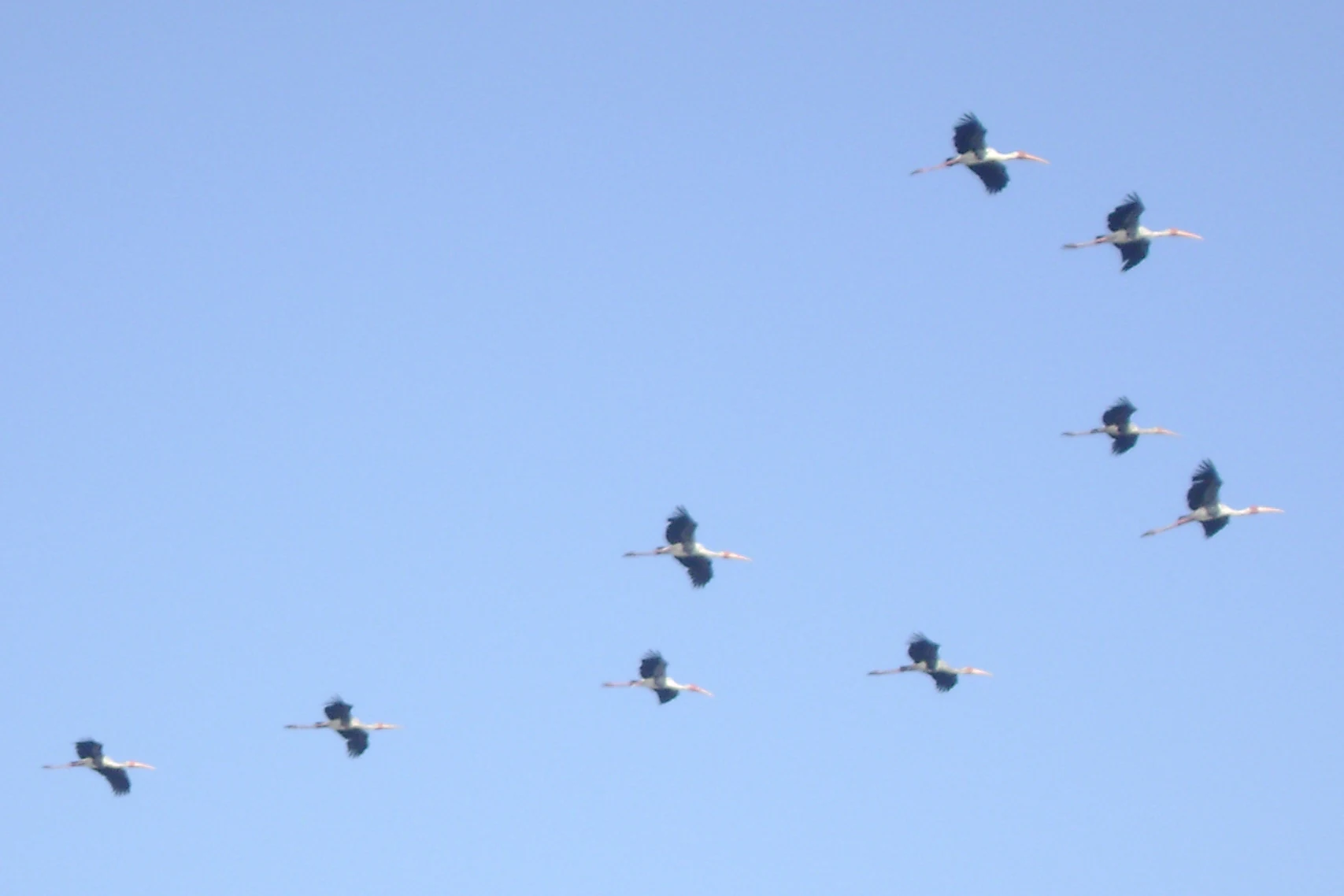
A small flock of painted storks flying in formation against a clear blue sky.
A flock of painted storks in flight at Point Calimere Wildlife and Bird Sanctuary.

Point Calimere Wildlife and Bird Sanctuary ecosystems, habitats, and plant life

Point Calimere shelters a layered patchwork of vegetation arising directly from its coastal geography. Mangroves fringe the backwaters and tidal channels, while salt-tolerant grasslands, herb-dominated flats, and scrub fill the open interior. The sanctuary's higher dunes support some of the most intact examples of East Deccan dry evergreen forest in India, with Manilkara hexandra acting as a keystone dry evergreen species and an important food source for fruit-eating birds.

Tree diversity is high for such a small area. Roughly 360 species of flowering plants have been recorded, with herbs making up about half and the remainder split among climbers, shrubs, and trees. About 60 percent of the recorded flora is reported to have medicinal value, reflecting the long overlap between wild habitats and local Ayurvedic and folk uses. The most abundant understorey species is the small tree Memecylon umbellatum, while Prosopis juliflora, an aggressive invasive, dominates the middle canopy where it has encroached on disturbed dune forest.

Mangrove communities are a defining ecological element, particularly around the edges of Muthupet and along the tidal channels linking the sanctuary to the broader Vedaranyam swamp system. These mangroves support doves and other mangrove-loving birdlife, while also serving as a nursery for marine species further offshore.
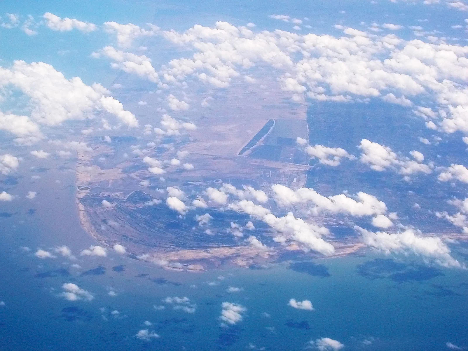
An aerial view from an aircraft looking down at a coastal landscape with sandy shoreline, wetlands, and open water, partially obscured by scattered clouds.
Aerial perspective of the coastal region at Point Calimere.

Point Calimere Wildlife and Bird Sanctuary wildlife and species highlights

Wildlife is the main reason Point Calimere has earned national and international recognition. The sanctuary's flagship mammal is the blackbuck, one of four antelope species in India and the original reason for the protected area's creation. From an estimated 750 to 800 individuals in 1967, the local herd grew to more than 1,900 by the late 1990s, a recovery widely attributed to decades of anti-poaching work and the local traditional belief that eating blackbuck meat causes leprosy, which historically reduced local hunting pressure.

Other mammals recorded include chital, wild boar, golden jackal, bonnet monkey, jungle cat, black-naped hare, Indian grey mongoose, small Indian civet, and feral horse. Reptiles and amphibians are also well represented: monitor lizards, Indian star tortoises, and a variety of snakes share the landscape. Offshore, the sanctuary's waters host bottlenose dolphins and olive ridley sea turtles, and beached Bryde's whales have occasionally been recorded, including an early successful rescue-and-release operation.

It is, however, birds that put Point Calimere on the global conservation map. The sanctuary hosts the second largest congregation of migratory waterbirds in India, with peak populations exceeding 100,000 individuals across roughly 100 species. Greater flamingos are the most visible seasonal visitors, joined by threatened species such as spot-billed pelican, Nordmann's greenshank, spoonbill sandpiper, and black-necked stork, along with near-threatened species like Asian dowitcher, painted stork, darter, and spoonbill.

Resident and migratory landbirds fill the dry evergreen forest and mangroves, from white-browed bulbul and brahminy kite to rose-ringed parakeet, blue-tailed bee-eater, and spotted dove. The result is a sanctuary where a casual observer might encounter antelope, dolphin-adjacent marine life, and flamingo flocks within the same visit.
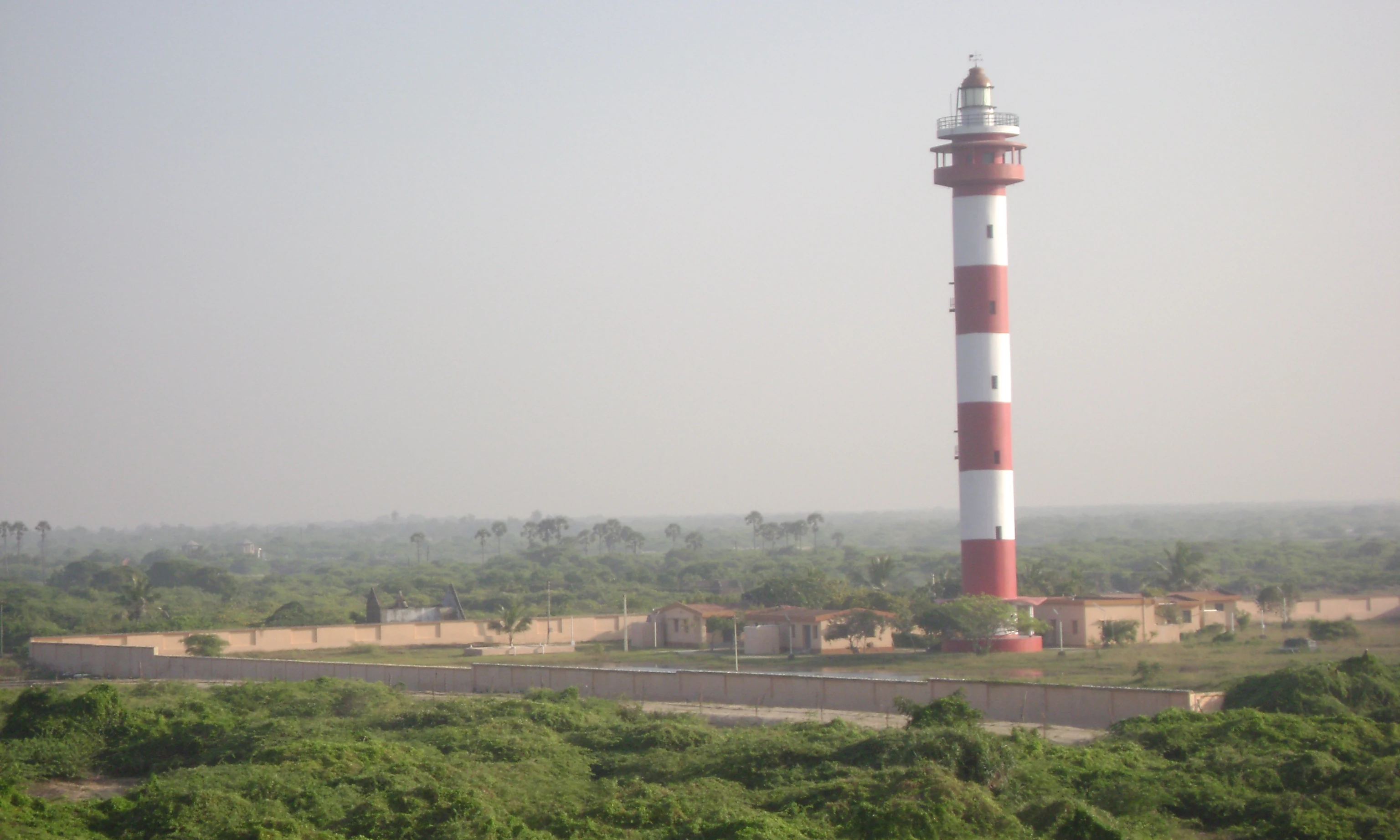
A tall, red and white striped lighthouse standing behind a perimeter wall in a coastal landscape with green vegetation under a hazy sky.
The Kodaikarai Lighthouse rising above the coastal scrub forest of Point Calimere Wildlife and Bird Sanctuary.

Point Calimere Wildlife and Bird Sanctuary conservation status and protection priorities

Point Calimere's conservation importance operates at several scales simultaneously. At the local level, the sanctuary protects one of India's last coastal blackbuck populations and a complex of saltpan, mangrove, and dune-forest habitats that have largely vanished elsewhere on the Tamil Nadu coast. At the regional level, it anchors the Great Vedaranyam Swamp and the Muthupet Mangroves, a chain of wetlands that supports both resident and long-distance migratory species.

Recognition as Ramsar Site no. 1210 in 2002 confirmed its international significance for waterbird conservation, and designation as an Important Bird Area reinforced its role along the central Asian flyway. Conservation work has included annual wildlife censuses since 1991, long-running bird migration studies by the Bombay Natural History Society since 1959, vehicle speed management on the access road, boundary demarcation, and active control of the invasive Prosopis juliflora.

Major ongoing threats include habitat loss for waterbirds, salinisation of soils and freshwater sources caused by adjacent salt pans, continued spread of Prosopis juliflora, grazing pressure from domestic and feral cattle, and limited freshwater availability. The 2004 tsunami provided an unexpected stress test: although seawater inundated the sanctuary, the ecosystem largely recovered, suggesting both the site's resilience and the importance of protecting its mosaic structure rather than any single habitat type.

Point Calimere Wildlife and Bird Sanctuary cultural meaning and human context

Point Calimere carries an unusually dense layer of cultural and religious significance for a small coastal reserve. Ancient Tamil maritime and temple traditions intersect here with later Hindu, Islamic, and folk practices, and several shrines sit within sanctuary boundaries. The most prominent is Ramar Padam, a small temple on the district's highest dune that marks the legendary footprint of Lord Rama and draws thousands of devotees for the Ram Navami festival each April.

Other shrines within the sanctuary include Mattumunian Kovil in the south, active throughout the year and hosting a major festival in September, the Avulaiganni Dargah to a Muslim saint celebrated in late November, and the deep-forest Shevrayan Kovil to deities associated with local folk religion. A small village near this last shrine was relocated after the creation of the reserve forest, leaving the temple as a remnant of earlier settlement patterns.

The coast itself carries additional historical depth. The remains of a brick-and-mortar lighthouse traditionally ascribed to the medieval Chola kingdom lie in the intertidal zone near Point Calimere, weathered but still visible, offering a tangible link between today's coastal Tamil Nadu and its maritime past.
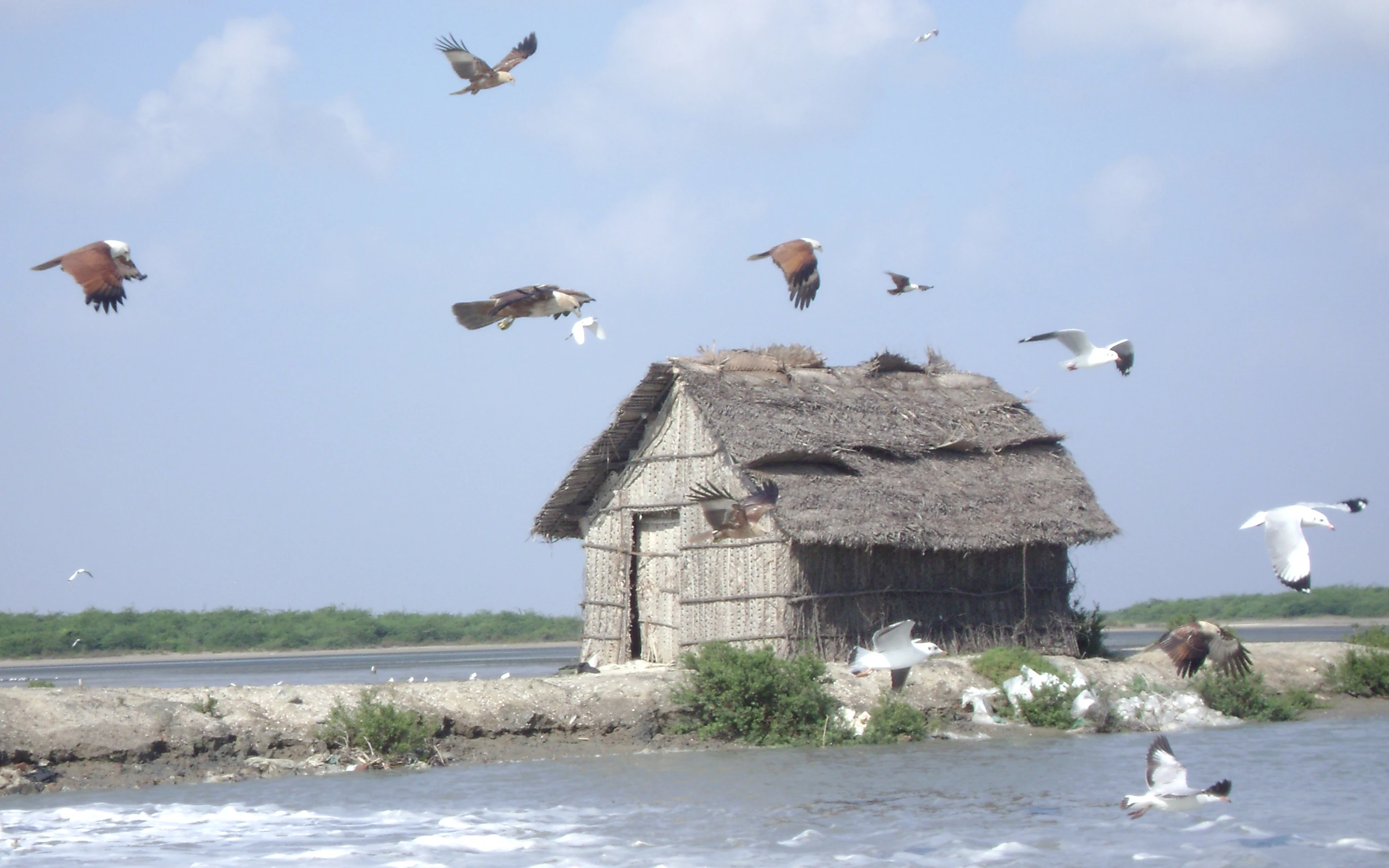
A rustic, thatched-roof hut sits on a narrow strip of land beside a body of water, with multiple birds, including kites and gulls, flying in the air around it.
A traditional hut surrounded by birds, including kites and gulls, within the Point Calimere Wildlife and Bird Sanctuary.

Top sights and standout views in Point Calimere Wildlife and Bird Sanctuary

Point Calimere's defining strength is the way it compresses wildly different habitats and wildlife phenomena into a small coastal footprint. Within a single visit one can move from flamingo-filled tidal mudflats to dry evergreen forest fragment, blackbuck herds to mangrove-lined channels, and ancient religious shrines to a working lighthouse, all framed by the open horizons of the Bay of Bengal.

The sanctuary's other quietly distinguishing features are its track record of long-term conservation, from the 1967 blackbuck recovery to today, its place within an internationally recognised Ramsar wetland complex, and its unusually rich cultural heritage for a site of this ecological character.

A group of people gathering at a small white stone shrine with a domed roof in a forested area.
Visitors at the Ramar Padam shrine, a notable pilgrimage site within the sanctuary.

Best time to visit Point Calimere Wildlife and Bird Sanctuary

The sanctuary's seasonal rhythm is shaped largely by the arrival and departure of migratory waterbirds. Each year, starting around October, large flocks begin arriving from breeding grounds as far away as the Rann of Kutch, Eastern Siberia, Central Asia, Northern Russia, and parts of Europe to feed in the sanctuary's mudflats and shallow waters. Numbers are typically highest in the cooler months, after which the birds gradually return to their breeding areas in January and the early months of the year.

For visitors focused on birds, cooler-weather months tend to offer the richest viewing conditions, when flamingo and other waterbird congregations are at their peak and the landscape is at its most biologically active. The dry season also brings clearer access along the coastal road and around the lagoon edges, though the sanctuary's flat, exposed terrain means that even the cooler months remain warm by global standards.

Monthly climate preview

Long-term representative temperature and precipitation patterns across the year

Point Calimere Wildlife and Bird Sanctuary Climate Normals and Weather by Month

Point Calimere Wildlife and Bird Sanctuary experiences measured long-term temperature variations alongside distinct seasonal shifts in monthly precipitation averages. Reviewing the complete twelve-month climate normals provides deeper context for examining the local environmental rhythm at a representative coordinate.
Annual mean28 °C
26 °C30 °C
Jan26°
Feb27°
Mar28°
Apr30°
May30°
Jun30°
Jul29°
Aug29°
Sep29°
Oct28°
Nov27°
Dec26°
Warmest month
May

30 °C

Coolest month
January

25.7 °C

Wettest month
November

8.6 mm/day

Driest month
February

0.5 mm/day

Park location guide

Geography guide, regional context, and park location map for Point Calimere Wildlife and Bird Sanctuary

Point Calimere Wildlife and Bird Sanctuary park geography, regions, and map view in India

Understand where Point Calimere Wildlife and Bird Sanctuary sits in India through a broader geographic reading of the surrounding landscape, nearby location context, and its mapped position within the national park landscape.

How Point Calimere Wildlife and Bird Sanctuary fits into India

India is a South Asian country bordered by the Indian Ocean, Arabian Sea, and Bay of Bengal. It shares land borders with Pakistan, China, Nepal, Bhutan, Bangladesh, and Myanmar. The country has a population of over 1.4 billion people and operates as a federal parliamentary republic with its capital in New Delhi.

Wider geography shaping Point Calimere Wildlife and Bird Sanctuary in India

India occupies the Indian subcontinent in South Asia, bordered by the Arabian Sea to the southwest, the Bay of Bengal to the southeast, and the Indian Ocean to the south. It shares land borders with Pakistan to the west, China, Nepal, and Bhutan to the north, and Bangladesh and Myanmar to the east. The territory also includes the Andaman and Nicobar Islands in the Indian Ocean.

Map view of Point Calimere Wildlife and Bird Sanctuary

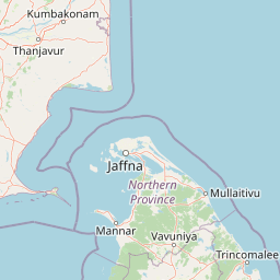
Use this park location map to pinpoint Point Calimere Wildlife and Bird Sanctuary in India, understand its exact geographic position, and read its mapped placement within the surrounding landscape more clearly.

Pigeon | © OpenStreetMap contributors

Location context for Point Calimere Wildlife and Bird Sanctuary

Tamil Nadu

Visualizing coastal dunes, tidal mudflats, and migratory bird habitats

Point Calimere Wildlife and Bird Sanctuary Photos and Scenic Landscape Views

Visual documentation captures the unique coastal terrain, tidal mudflats, and sand dunes defining Point Calimere Wildlife and Bird Sanctuary. Photographic archives reveal the intricate mosaic of habitats supporting large flocks of waterbirds and isolated blackbuck herds across the southern Indian coastline.

A male blackbuck with spiraled horns standing in a dry, open grassy field with green bushes in the background.

A calm, shallow lagoon shoreline fringed with dense green mangrove vegetation and exposed prop roots at low tide.

A small flock of painted storks flying in formation against a clear blue sky.

An aerial view from an aircraft looking down at a coastal landscape with sandy shoreline, wetlands, and open water, partially obscured by scattered clouds.

A tall, red and white striped lighthouse standing behind a perimeter wall in a coastal landscape with green vegetation under a hazy sky.

A high-angle, wide shot of expansive salt pans with shallow water, divided by earthen embankments and sparse desert-like vegetation.

A rustic, thatched-roof hut sits on a narrow strip of land beside a body of water, with multiple birds, including kites and gulls, flying in the air around it.

A group of people gathering at a small white stone shrine with a domed roof in a forested area.

Park atlas

Compare coastal sanctuaries, wetland ecosystems, and regional protected landscapes

Other Parks Like Point Calimere Wildlife and Bird Sanctuary and Regional Protected Areas

Browsing other parks near Point Calimere Wildlife and Bird Sanctuary reveals related coastal sanctuaries, tidal mudflat habitats, and wetland reserves across the surrounding region. Extending the geographic comparison helps trace broader protected-area patterns and regional conservation networks.
National parkNorthern Province
About 92 km away#1 closest

South

Delft National Park: Exploring Its Protected Landscape and Geographic Setting in Northern Province

Mapped boundaries and regional atlas context for this national park.

Delft National Park is a protected natural area situated in Sri Lanka's Northern Province, designated as a national park. This page offers an atlas-focused view of its protected boundaries, helping to contextualize its geographic setting and landscape character. Understanding Delft National Park involves exploring its specific location within the Northern Province and its role as a distinct entity in the study of mapped natural environments and regional geography.

Area
18.46 km²
Established
2015
IUCN
II
Relief
Lowland
National parkNorthern Province
About 114 km away#2 closest

Southeast

Chundikkulam National Park: Protected Landscape Identity and Geographic Atlas

Mapped park boundaries within Northern Province's regional geography.

Chundikkulam National Park stands as a protected landscape within Sri Lanka's Northern Province. This atlas entry provides structured details on its protected area status, allowing for a clear understanding of its geographic position and mapped boundaries. Explore the contextual geography and natural landscape features that define this significant national park, offering a factual basis for discovery.

Area
196 km²
Established
2015
IUCN
II
Relief
Lowland
National parkTamil Nadu
About 135 km away#3 closest

South

Gulf of Mannar Marine National Park: Protected Island Archipelago and Marine Atlas

Explore India's vital marine national park and its coral reef ecosystems.

Gulf of Mannar Marine National Park is a designated national park located in Tamil Nadu, India, protecting a chain of 21 islands and their surrounding marine environments. This protected area is renowned for its extensive coral reefs, crucial seagrass meadows supporting dugongs, and diverse fish species, making it a key site for marine conservation and geographic exploration. The park's unique island landscape and intertidal zones offer a distinct perspective on coastal protected areas within the Indian Ocean, providing rich material for atlas-style discovery and understanding regional marine geography.

Area
560 km²
Established
1986
IUCN
II
Relief
Lowland
National parkNorthern Province
About 139 km away#4 closest

South

Adam's Bridge Marine National Park: Protected Coastal Landscape and Geographic Significance

Mapped marine geography and protected island ecosystems.

Adam's Bridge Marine National Park is a protected national park in Sri Lanka's Northern Province, notable for encompassing the legendary Adam's Bridge. This marine protected area safeguards critical shallow-water habitats, including seagrass meadows and sand dunes, which are vital for migratory birds, dugongs, and sea turtles. The park's unique geographic identity as a chain of limestone shoals and islands offers a distinct landscape for atlas-based discovery and understanding of coastal conservation significance.

Area
190 km²
Established
2015
IUCN
II
Relief
Lowland
National parkNorthern Province
About 157 km away#5 closest

South

Madhu Road National Park: Sri Lanka's Northern Province Dry Zone National Park

Explore protected landscapes and mapped geography.

Madhu Road National Park, situated in Sri Lanka's Northern Province, is a significant protected area defined by its dry zone ecosystems, including forests, grasslands, and wetlands. As one of the island's larger national parks, it offers critical habitat for diverse wildlife and represents an important component of northern Sri Lanka's conservation efforts. This page provides detailed atlas-style insights into the park's geography, mapped boundaries, and its ecological context within the region.

Area
631 km²
Established
2015
IUCN
II
Climate
Tropical
Watercolor illustration of a landscape with a lake, grassy areas, trees, and distant hills under a pale sky
National parkSri Lanka
About 182 km away#6 closest

South

Wilpattu National Park: Sri Lanka's Largest National Park and Unique Willu Landscape

Explore mapped boundaries and high leopard density geography.

Wilpattu National Park, located in Sri Lanka's northwest coastal lowland dry zone, is the country's largest and one of its oldest national parks. Its landscape is defined by a unique system of nearly 106 natural sand-rimmed water basins, or willu, creating a distinctive wetland environment. The park is globally recognized for its substantial leopard population, representing one of the highest densities recorded in Sri Lanka. Discover the mapped terrain and protected area context of this ecologically vital landscape.

Area
1,316.67 km²
Established
1938
IUCN
II
Relief
Lowland
National parkNorth Central Province
About 215 km away#7 closest

Southeast

Horowpathana National Park: Protected Landscape within North Central Province's Dry Zone

Explore its mapped boundaries and vital wildlife habitat.

Horowpathana National Park is a designated national park in Sri Lanka's North Central Province, covering 2,570 hectares of dry zone forest. Established to protect critical habitats for endangered species like the Sri Lankan elephant and leopard, it plays a vital role in regional wildlife conservation and managing human-wildlife conflict. Its landscape is characterized by dry forest ecosystems situated near the Tawalamham Hammillewa reservoir system, presenting a unique environmental context within the broader mapped geography of the island.

Area
25.7 km²
Established
2011
IUCN
II
Climate
Tropical
National parkEastern Province
About 230 km away#8 closest

Southeast

Pigeon Island National Park National Park: Eastern Province Protected Landscape Atlas

Mapped geographic context and park boundaries.

Dive into the protected area details of Pigeon Island National Park, a national park situated in Sri Lanka's Eastern Province. This entry provides essential context for understanding its mapped landscape and geographic significance within a regional atlas framework, facilitating discovery of its specific protected area identity.

Area
4.714 km²
Established
2003
IUCN
II
Relief
Lowland

Common questions about visiting, size, designation, and location context for Point Calimere Wildlife and Bird Sanctuary

Point Calimere Wildlife and Bird Sanctuary FAQs for park facts, access, geography, and protected area context

Find quick answers about Point Calimere Wildlife and Bird Sanctuary, including protected-area facts, park geography, trail and visitor context, and how the park fits into its surrounding country and regional landscape.
MoriAtlas Explorer

Continue Your Protected Areas Search Across the Global Atlas

Deepen your exploration by continuing the structured search for national parks and protected areas worldwide. Utilize the comprehensive filtering capabilities to compare different conservation landscapes and refine your understanding of global park geography. Discover more about the distribution and characteristics of protected natural areas.

Global natural geography