
Lakes
Park geography
Structured data covering mountain relief, spatial dimensions, and internal natural features.
Comprehensive Geographic Profile and Mapped Boundaries of Queulat National Park in Aysén
Analyze the spatial characteristics of Queulat National Park located in the Aysén del General Carlos Ibáñez del Campo Region. This profile details the 1541 square kilometer protected area, including its glacier, river systems, and mountainous terrain, offering insight into the regional geography through mapped data points.
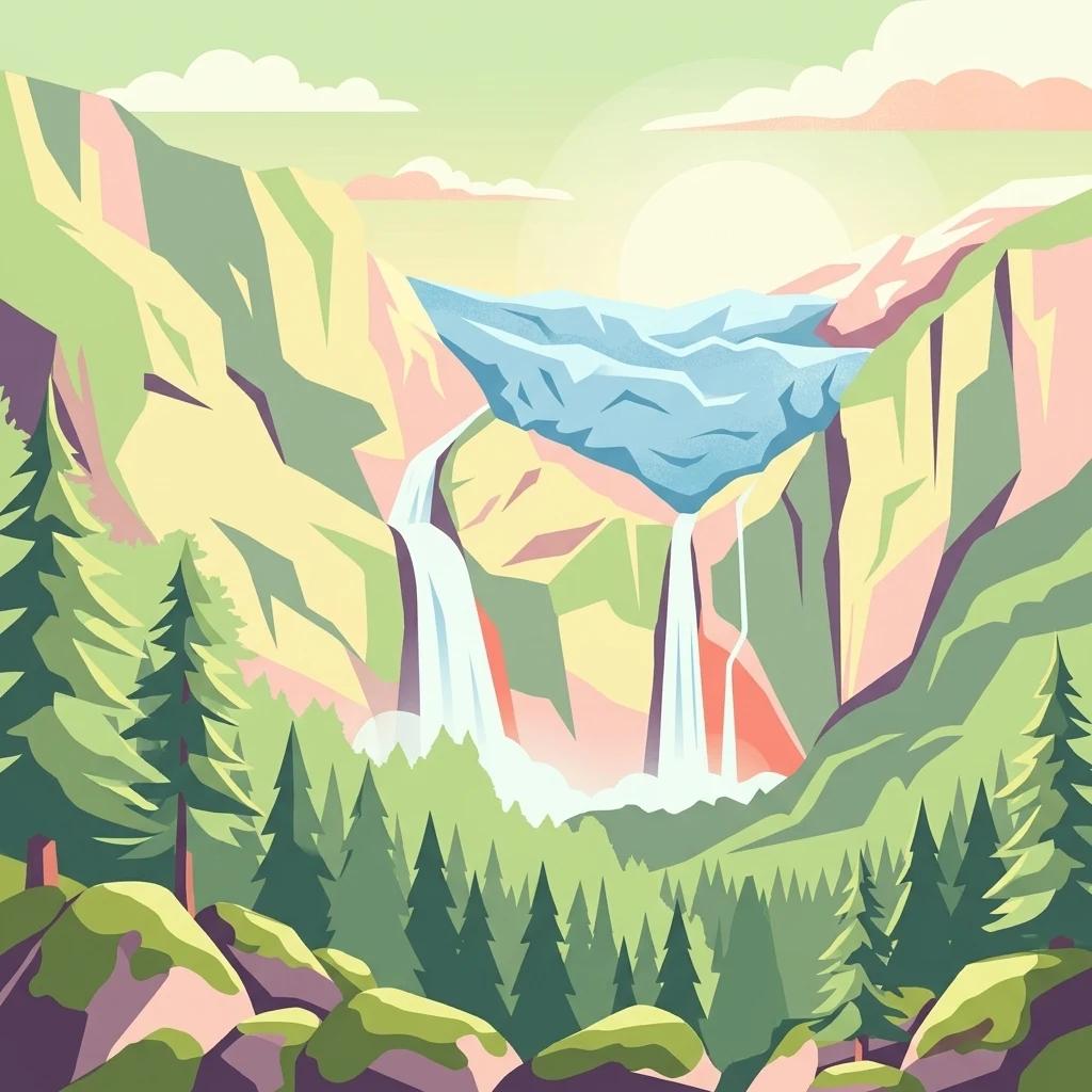
Glacier-crowned forests and waterfalls of Chilean Patagonia
Queulat National Park
Queulat National Park is a protected wilderness area in southern Chilean Patagonia, situated in the Aysén del General Carlos Ibáñez del Campo Region. The park encompasses 1,541 square kilometers of dramatic Andean landscape where glacier-capped peaks rise above virgin evergreen forests. Established in 1983 and administered by Chile's National Forest Corporation (CONAF), the park represents one of the most emblematic natural areas of Patagonia, containing some of the region's least human-altered ecosystems. The park is bordered by the Cisnes River to the south and shares boundaries with Lago Rosselot National Reserve, forming a contiguous protected zone in this remote corner of Chile.
- Location
- Chile
- Park type
- National park
- Established
- 1983
- Area
- 1,541 km²
Location overview
Regional context inside Chile and the Aysén administrative zone
Geographic Overview of Queulat National Park in Chile
Queulat National Park is located entirely within Chile, specifically in the Aysén del General Carlos Ibáñez del Campo Region. The interior reserve has no transboundary, coastal, or marine status.
- Countries
- Chile
- Regions
- Aysén del General Carlos Ibáñez del Campo Region
- Primary location
- Aysén del General Carlos Ibáñez del Campo Region
- Geographic setting
- Inland
Boundary and coordinates
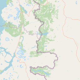
Queulat National Park’s mapped boundary covers 1,541 km²
Queulat National Park mapped boundary and 1,541 km² area
Queulat National Park has stored boundary geometry portraying its expansive 1,541 km² protected extent. The record gives one total area and contains neither separate land and marine figures nor a perimeter measurement.
- Boundary area
- 1,590 km²
- Boundary perimeter
- 379.7 km
- Northernmost point
- 44.0414° S
- Southernmost point
- 44.7314° S
- Easternmost point
- 72.0529° W
- Westernmost point
- 72.639° W
- Geographic centre
- 44.4036° S, 72.4031° W
- North–south span
- 76.7 km
- East–west span
- 46.7 km
Elevation and terrain
Vertical range profile and recorded natural features
Queulat National Park Elevation and Mountain Terrain Geography
Recorded park elevation reaches up to two thousand two hundred fifty-five meters across rugged mountain terrain. Associated feature records detail rivers, peaks, lakes, and streams located within protected boundaries.
- Maximum elevation
- 2,255 m
Selected named natural features
Streams
Arroyo Santana
Waterfalls
Salto Padre García
Streams
Arroyo Seco
Viewpoints
Mirador Ventisquero Colgante
Rivers
Río Ventisqueros
Environmental setting
Temperate climate zones, forest cover, and glacial mountain relief profiles
Queulat National Park Environmental Classifications and Physical Setting
Recorded landscape features and habitat types frame the physical setting of Queulat National Park across diverse mountain terrain. Stored environmental categories connect directly to relevant atlas destinations for structured geographic analysis.
- Relief
- Mountain
- Climate
- Temperate
- Water
- Major water bodies
- Forest cover
- Mostly forested
- Seasonality
- Seasonal
Landscape features
Mountains · Glacier · Rivers · Waterfalls · Forest · Lakes · Valleys
Habitat types
Temperate broadleaf forest · Montane forest · Riverine habitat · Lacustrine habitat
Park atlas
Trace the Patagonian Andes, discovering adjacent glacier landscapes and temperate rainforests across the Aysén region.
Explore More National Parks and Protected Areas Beyond Queulat National Park
Expand your atlas exploration from Queulat National Park to find other national parks and protected areas across the diverse Patagonian Andes and Aysén region. Compare glacier-capped peaks, ancient forests, and unique landscapes to understand the broader conservation geography of southern Chile and its significant protected zones.
National parkAysén Region
Park boundaries overlap#1 closest
Northwest

Melimoyu National Park: A Key Protected National Park within Chile's Aysén Region
Explore Melimoyu National Park's mapped boundaries and regional geography.
Melimoyu National Park stands as a distinct protected natural area, offering a focused lens for geographic discovery. As a national park situated in the Aysén Region, its mapped boundaries and regional landscape context are crucial for understanding its atlas significance. This entry provides specific details about the park's protected status and its contribution to the mapped terrain of southern Chile, enabling detailed exploration for atlas enthusiasts.
- Area
- 1,055 km²
- Established
- 2018
- IUCN
- II
- Relief
- Mixed relief
National parkAysén del General Carlos Ibáñez del Campo Region
6.3 km away#2 closest
Southwest
Isla Magdalena National Park: Protected Area and Regional Geography Context
Discover the mapped landscape of this national park.
Delve into the protected landscape of Isla Magdalena National Park, a key national park situated in the Aysén del General Carlos Ibáñez del Campo Region of Chile. This entry provides essential geographic context, focusing on the park's mapped boundaries and its role within the Patagonian environment. Understand its distinct identity as a protected area for structured atlas exploration.
- Area
- 1,576 km²
- Established
- 1983
- IUCN
- II
- Relief
- Mountain
National parkChile
7.3 km away#3 closest
North
Corcovado National Park, Chile: Protected Volcanic Landscapes and Glacial Wilderness Atlas
Detailed geography of Chile's remote coastal wilderness and marine estuaries
Corcovado National Park stands as a significant protected area in southern Chile, encompassing dramatic volcanic peaks and an extensive collection of glacial lakes. Its mapped boundaries reveal a remote wilderness where pristine temperate rainforests transition into the brackish estuaries of the Gulf of Corcovado, supporting vital marine ecosystems and critical blue whale populations.
- Area
- 2,096 km²
- Established
- 2005
- IUCN
- II
- Relief
- Mixed relief
National parkArgentina
112 km away#4 closest
North

Los Alerces National Park: Ancient Alerce Forests and Glacial Terrain in Argentina
Discover the park's protected landscape and regional geography.
Los Alerces National Park in Argentina is a globally significant protected area, celebrated for its ancient alerce forests, some of the longest-living trees on Earth. This national park showcases a dramatic landscape shaped by glaciers, featuring a series of interconnected lakes and rugged Andean terrain. Explore the unique ecosystem and mapped geography of this UNESCO World Heritage site to understand its profound natural and conservation value.
- Area
- 2,599 km²
- Established
- 1937
- IUCN
- II
- Relief
- Mountain
National parkAysén del General Carlos Ibáñez del Campo Region
117 km away#5 closest
South
Cerro Castillo National Park: Dramatic Granite Peaks and Patagonian Protected Landscape
Mapped geography and huemul conservation in Chile's Aysén Region.
Cerro Castillo National Park is a premier protected area in southern Chile, celebrated for its iconic Cerro Castillo granite mountain that dominates the landscape. This national park, spanning over 1,700 square kilometers in the Aysén del General Carlos Ibáñez del Campo Region, showcases a dynamic Patagonian terrain shaped by glaciers and rivers. Its significance extends to being a vital corridor for endangered huemul, offering critical habitat within a broader regional conservation strategy and the famous Route of Parks.
- Area
- 1,795.5 km²
- Established
- 1970
- IUCN
- II
- Relief
- Mountain
National parkAysén del General Carlos Ibáñez del Campo Region
188 km away#6 closest
Southwest
Laguna San Rafael National Park: Explore its Mapped Boundaries and Patagonian Landscape
A National Park within Aysén del General Carlos Ibáñez del Campo Region.
Laguna San Rafael National Park stands as a key protected area within the vast geography of the Aysén del General Carlos Ibáñez del Campo Region. This entry provides an atlas-focused perspective, detailing the park's geographic significance, mapped natural landscapes, and its role as a vital conservation territory. Understand how this national park fits into the broader context of Patagonia's unique terrain and protected areas.
- Area
- 17,420 km²
- Established
- 1959
- IUCN
- II
- Relief
- Mountain
National parkChile
About 194 km away#7 closest
West
Isla Guamblin National Park: A Protected Landscape Within Chile's Geography
Explore the mapped terrain and boundaries of this national park.
Isla Guamblin National Park provides essential context for understanding protected lands in Chile. This detail page offers a focused view on its geographic features and mapped natural landscape, crucial for atlas-based exploration and regional conservation studies. Discover the specific identity of this national park and its contribution to the mapped protected areas of South America.
- Area
- 106.25 km²
- Established
- 1967
- Relief
- Lowland
- Climate
- Temperate
National parkLos Lagos Region
199 km away#8 closest
Northwest
Chiloé National Park: National Park Discovery and Mapped Boundaries in Los Lagos Region
Explore its unique protected landscape and regional geography.
Chiloé National Park represents a significant protected natural area within the Los Lagos Region of Chile. This detailed page offers an atlas-centric view, focusing on the park's mapped boundaries, its place in the regional geography, and the overall protected landscape character. Gain structured insight into this important component of southern Chile's conservation lands, ideal for geographic exploration and atlas context.
- Area
- 430.57 km²
- Established
- 1983
- IUCN
- II
- Visitors
- 33.6K annual
MoriAtlas Explorer
Continue Exploring Queulat National Park's Mapped Geography and Protected Landscape
Delve deeper into the geographic context and protected landscape features of Queulat National Park. Understanding its unique terrain, from hanging glaciers to ancient forests, provides critical insight into Patagonia's natural atlas. Discover the mapped boundaries and regional setting that define this significant protected area within the Aysén Region.
Browse next
Global natural geography
Explore related park routes
Explore MoriAtlas Global ParksBrowse All MoriAtlas ParksGlobal Park Map DiscoveryMoriAtlas: Browse All CountriesBrowse All MoriAtlas ContinentsNational Park Environment AtlasGrand Canyon National Park AtlasYellowstone National Park AtlasYosemite National Park Atlas and GeographySerengeti National Park AtlasGalápagos National Park Protected LandscapeBanff National Park Geography and AtlasKruger National Park Atlas EntryUluṟu-Kata Tjuṯa National Park AtlasExplore Uluru-Kata Tjuta National Park GeographyPlitvice Lakes National Park AtlasFiordland National Park Protected LandscapeGreat Smoky Mountains National Park AtlasAfghanistan National Parks and Protected AreasAlbania National Parks and Protected AreasAlgeria National Parks and Protected AreasAmerican Samoa National Parks and Protected AreasAndorra National Parks and Protected AreasAngola National Parks and Protected AreasAntarctica National Parks and Protected AreasAntigua and Barbuda Park List