
Mori Atlas logo
Nature reserveRéserve naturelle nationale du Platier d'Oye

A vital migratory bird sanctuary and coastal habitat system along the Opal Coast of northern France

Réserve naturelle nationale du Platier d'Oye: Coastal Landscape and Protected Nature Reserve Geography

(Réserve naturelle nationale du Platier d'Oye (RNN86))

The Réserve naturelle nationale du Platier d'Oye encompasses 391 hectares of diverse coastal terrain in the Pas-de-Calais department. This protected landscape weaves together mobile dune systems, estuarine mudflats, and managed inland polders, serving as a critical corridor for migratory bird populations. Within the broader context of the North Sea coastline, the reserve represents a key study in habitat connectivity and integrated conservation, characterized by low-lying salt meadows and intricate drainage patterns.

coastal reservedune ecosystemestuarine mudflatssalt marshpolder meadowsmigratory birds
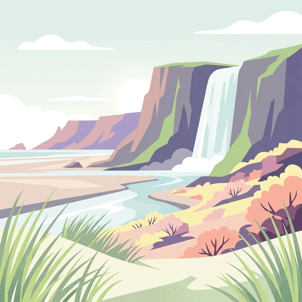
A flat-design digital illustration of a coastal nature reserve with tall cliffs, a waterfall cascading into a river, sandy dunes, and coastal grasses.

Réserve naturelle nationale du Platier d'Oye

Nature reserve

Park overview

Structured park overview, official facts, and landscape profile for Réserve naturelle nationale du Platier d'Oye

Réserve naturelle nationale du Platier d'Oye park facts, protected area profile, and essential visitor context

Review the core facts for Réserve naturelle nationale du Platier d'Oye, including designation, size, terrain, visitor scale, habitats, and operating context in one park-focused overview.

About Réserve naturelle nationale du Platier d'Oye

The Réserve naturelle nationale du Platier d'Oye is a coastal protected area on the French North Sea shoreline, stretching across the commune of Oye-Plage in the Pas-de-Calais between Calais and Dunkirk and reaching the border of the Nord department along the left bank of the Aa estuary. The reserve occupies about 391 hectares of coastal terrain, of which roughly 141 hectares lie on land, never rising above two meters except where the dune ridge lifts the surface above the surrounding plain. Another 250 hectares extend onto the maritime public domain, blending terrestrial and marine protection.

The defining characteristic of the site is the combination of three strongly contrasting coastal environments within a relatively small area. Along the sea, a 3.5-kilometer frontage of foreshore and shifting dunes forms a dynamic edge constantly reshaped by tides, currents, and winds. Inland, the Aa estuary system supports extensive mudflats, schorre-type salt marshes, and salt meadows adapted to brackish and saline conditions. Behind the dune ridge, the polder holds damp meadows and shallow ponds isolated from the sea, creating a quieter inland habitat that complements the more exposed coastal zones.

The reserve is administered by Eden 62, the mixed syndicate responsible for protected natural areas in the Pas-de-Calais, and is supported by conservation grazing with Highland cattle and ponies, which keeps the meadows open and welcoming for breeding and resting birds. Its combination of habitat diversity, long-standing ornithological interest, and integration into broader European ecological networks, including Natura 2000 and the Birds Directive, gives the Platier d'Oye an identity rooted in both coastal landscape preservation and bird migration conservation.

Quick facts and research context for Réserve naturelle nationale du Platier d'Oye

The Réserve naturelle nationale du Platier d'Oye is a national nature reserve in northern France, on the coast of the Pas-de-Calais department within the Hauts-de-France region, near the town of Gravelines and the commune of Oye-Plage. It was officially created by decree on 9 July 1987, while the Conservatoire du littoral had already begun acquiring parcels of the site from 1979 onward. The reserve spans about 391 hectares, of which roughly 141 hectares are terrestrial, plus 250 hectares on the maritime public domain, and is registered as IUCN Category IV (habitat and species management area). Eden 62, a mixed syndicate, administers the site, which is also designated as a Natura 2000 Special Protection Area (ZPS FR3110039) and a ZNIEFF of type I.

Protection and recognition

Examine the official protection scope, established year, and international recognition details

Réserve naturelle nationale du Platier d'Oye Protection Status and Designation History

Historical protection records for Réserve naturelle nationale du Platier d'Oye outline a mixed management scope established in 1987. Official database metrics trace conservation status and registry entries without assuming external recognition programs.

Protection details

Protection scope
Mixed
Designated year
1987
Transboundary protection
No
WDPA ID
39797
Park context

Deeper park guide and search-rich context for Réserve naturelle nationale du Platier d'Oye

Réserve naturelle nationale du Platier d'Oye history, landscape, wildlife, and travel context

Explore Réserve naturelle nationale du Platier d'Oye through its history, landscape character, ecosystems, wildlife, conservation priorities, cultural context, and seasonal travel timing in a structured park guide built for atlas discovery and search intent.

Why Réserve naturelle nationale du Platier d'Oye stands out

The reserve is best known for the exceptional concentration of migratory birdlife that passes through or breeds within its coastal habitats. Positioned along a major migration corridor, it supports roughly 230 recorded bird species, including significant breeding populations of pied avocet, common redshank, sandwich tern, little tern, common tern, lapwing, Kentish plover, and ringed plover. Outside the breeding season, it becomes a staging and wintering site for egrets, ospreys, spoonbills, white and black storks, snowy buntings, golden and grey plovers, and peregrine falcons. The diversity comes from the reserve's mosaic of habitats. Mudflats, salt marshes, salt meadows, dunes, and wet polder meadows each appeal to different species, creating a layered landscape where waders, waterfowl, raptors, and passerines all coexist across the seasons. This combination of habitat variety and strategic coastal location gives the Platier d'Oye its reputation as one of the most rewarding birdwatching sites in the Hauts-de-France region.
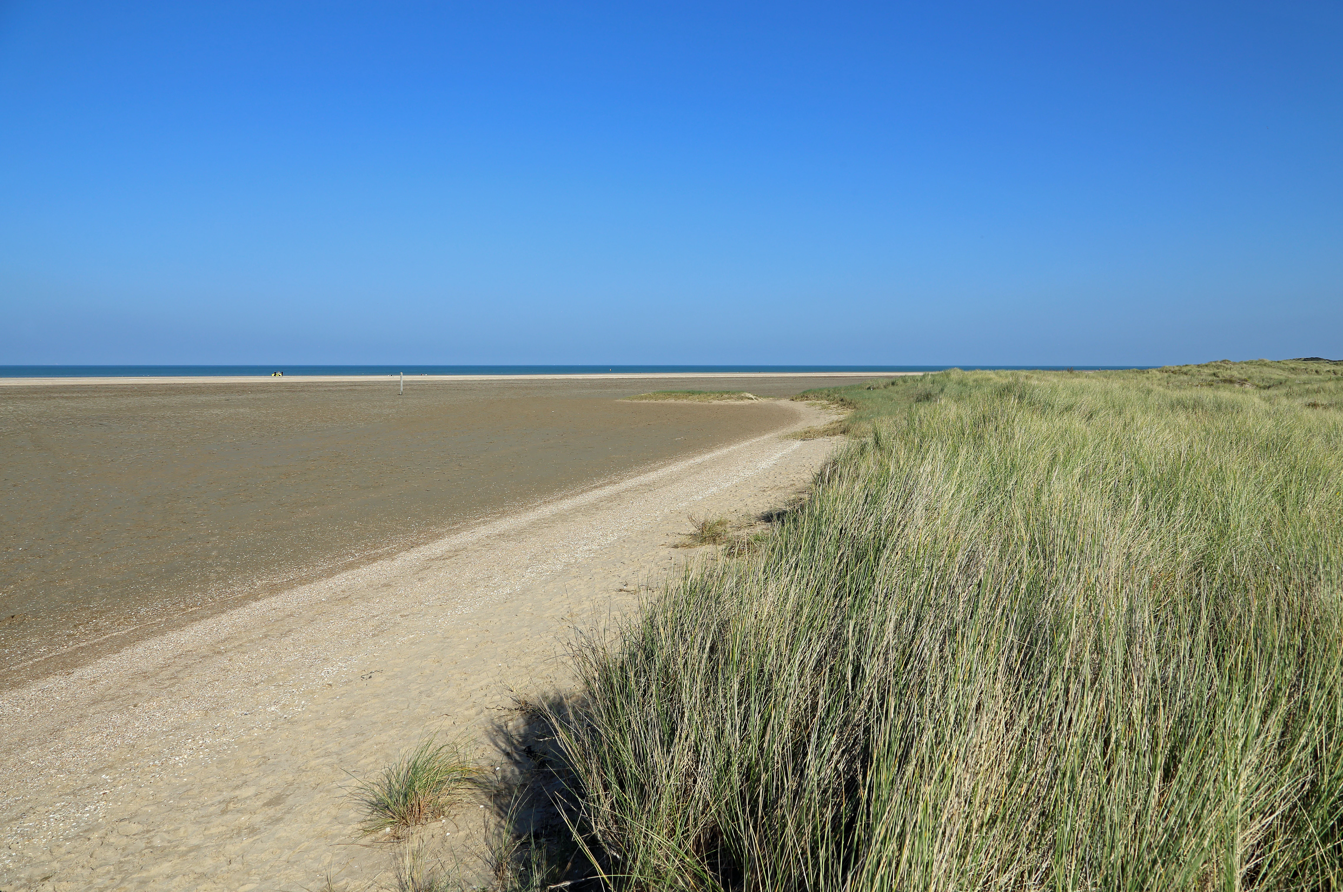
Wide shot of a flat sandy beach meeting the sea under a clear blue sky, with a foreground of dune grasses.
A view of the sandy coastline and dunes at the Réserve naturelle nationale du Platier d'Oye.

Réserve naturelle nationale du Platier d'Oye history and protected-area timeline

The history of the Platier d'Oye as a protected site begins before its formal designation. From 1979 onward, the Conservatoire du littoral began acquiring parcels of the coastal land that would eventually form the reserve, gradually assembling more than 200 hectares into public ownership. This early intervention set the foundation for stronger protection along a stretch of coast that was already recognized for its ecological value.

The reserve itself was officially created by decree on 9 July 1987, giving it the status of a national nature reserve, the strictest category of French nature protection. The classification followed the long-running concern that the area's dunes, salt marshes, mudflats, and wet meadows required durable protection against fragmentation and disturbance.

Since its creation, the reserve has been shaped by ongoing tensions. Initial conflicts emerged over hunting, as the area had long included man-made hunting ponds with observation hides, creating friction between conservation goals and long-standing hunting traditions. In more recent decades, new pressures have emerged, notably from coastal erosion and marine submersion risk to an enclave of residential housing within the reserve. These pressures continue to complicate the realization of some of the reserve's main objectives, blending ecological management with coastal risk challenges.

Réserve naturelle nationale du Platier d'Oye landscape and geographic character

The landscape of the Platier d'Oye is a classic low-lying North Sea coastal mosaic, where flat tidal ground meets shifting sand dunes, salt-influenced marshes, and a sheltered agricultural polder. The terrain never rises significantly above sea level; outside the dunes, elevations remain at or below two meters, giving the reserve an open, expansive, almost horizon-bound quality.

At the seaward edge, a continuous strip of foreshore and dune extends for about 3.5 kilometers. These dunes are mobile, shaped continually by tidal currents and prevailing winds, and form the first line of the reserve's landscape identity. Between the dune ridge and the estuary lies the second key element: the Aa estuary system on the left bank of the river, where mudflats dominated by schorre vegetation grade into salt meadows shaped by tidal influence.

Behind the dune barrier, the polder reveals a quieter agricultural-influenced landscape. Damp meadows, drainage channels, and shallow managed ponds occupy a flat area isolated from direct marine influence, but ecologically connected to the coastal habitats by migrating birds, water movement, and shared atmospheric conditions. The result is a layered scenery in which wind-shaped dunes, tidal flats, and wet meadows together form a recognizable stretch of Opal Coast.
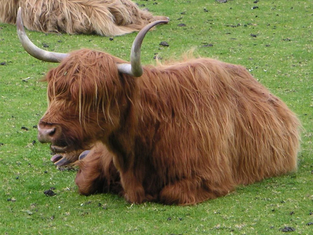
A ginger Highland cow with long, shaggy hair and horns rests on green grass, with part of another cow visible in the background.
Highland cattle grazing in the Réserve naturelle nationale du Platier d'Oye.

Réserve naturelle nationale du Platier d'Oye ecosystems, habitats, and plant life

Ecologically, the Platier d'Oye is distinguished by the unusual proximity of dune, estuarine, and polder habitats within a single protected site. Each environment brings its own vegetation and soil conditions, and the transitions between them amplify biodiversity. Plant surveys have documented approximately 361 plant species across the reserve, of which 86 are considered of heritage or conservation interest, including several protected at either national or regional level.

The dune system supports coastal specialists adapted to salt spray, mobile sand, and dry, nutrient-poor substrates. Salt-tolerant species such as sea holly and pyramidal orchid colonize the dune slopes, while scurvygrass and other halophytes occupy damper dune slacks. In the estuary, the schorre and salt meadows harbor halophytic vegetation tolerant of regular tidal inundation, in environments shaped by fluctuating salinity and sediment deposition.

The inland polder offers a third ecological register. Here, wet meadows dominated by grasses and sedges host a different suite of plants, including peat- and moisture-loving species around the shallow ponds and drainage channels. The contrast between coastal halophytic vegetation, estuarine pioneer communities, and inland wetland flora gives the reserve a layered botanical character that reflects its position at the meeting of land, river, and sea.

Réserve naturelle nationale du Platier d'Oye wildlife and species highlights

The Platier d'Oye is overwhelmingly defined in wildlife terms by its ornithological richness. The reserve sits along a major migratory corridor on the southern North Sea coast, and its combination of mudflats, salt meadows, dunes, and wet inland meadows creates a sequence of habitats that suit birds at every stage of their annual cycle. About 230 bird species have been recorded in the reserve, of which 85 are considered of heritage or conservation interest.

During the breeding season, the reserve hosts important populations of ground-nesting and wading species. Lapwing, pied avocet, common redshank, Kentish plover, little ringed plover, common snipe, Mediterranean gull, and marsh harrier are among the species associated with the meadows, mudflats, and shingle margins. Tern species, including sandwich, little, and common tern, contribute to the seabird presence along the coast in late spring and summer.

Outside the breeding season, the reserve transforms into a major staging and wintering area. Little egret, osprey, white and black storks, spoonbill, snowy bunting, grey plover, golden plover, and peregrine falcon are among the species that use the site during passage or winter. The diversity of birdlife is closely tied to habitat management, including conservation grazing that maintains open meadow conditions and the maintenance of shallow ponds in the polder that attract ducks and other waterfowl.

Réserve naturelle nationale du Platier d'Oye conservation status and protection priorities

The Platier d'Oye holds a strong conservation profile on both national and European scales. As a national nature reserve, the strictest category of French nature protection, it benefits from a long-term protection regime supervised by the state and managed at ground level by Eden 62. The site is also classified under the European Natura 2000 network as a Special Protection Area (ZPS FR3110039), placing it within the Birds Directive framework, in force here since 1988. It is also recorded as a ZNIEFF of type I under the designation Platier d'Oye et Plage du Fort Vert.

Conservation management at the reserve has historically combined habitat protection with active stewardship. Grazing by Highland cattle and ponies maintains the open structure of the wet meadows, a habitat preference for nesting and resting birds. In the polder, the creation and maintenance of shallow water bodies has been used to encourage waterfowl presence and improve breeding conditions. Land acquisition by the Conservatoire du littoral, beginning in 1979, has been a long-term strategy to consolidate public ownership over sensitive portions of the coastal landscape.

Conservation work continues to face pressures that go beyond traditional ecological management. Rising coastal erosion risk, marine submersion concerns, and the existence of an enclaved residential subdivision within the reserve introduce socio-environmental challenges that complicate the site's ecological objectives. These ongoing tensions underline the site's broader value as a case study in balancing nature protection, coastal risk, and historical land use in a dynamic shoreline environment.

Réserve naturelle nationale du Platier d'Oye cultural meaning and human context

The cultural dimension of the Platier d'Oye is closely tied to its role in the rural and coastal life of the Opal Coast. The reserve lies within a region historically shaped by polder agriculture, salt-tolerant pastoralism, and small-scale coastal land management, traditions that have shaped both the landscape and the way human communities interact with it.

Long-standing local hunting practice, particularly the use of dug hunting ponds with observation hides, is part of the site's human history. This heritage is closely tied to the reserve's territorial identity and continues to influence how the area is managed and perceived locally, contributing to the conflicts that accompanied the reserve's creation in 1987.

Today, the reserve also plays a role in regional environmental education. Guided visits managed by Eden 62, along with a self-guided trail with observation points, integrate the site into the broader regional network of nature discovery in the Pas-de-Calais, linking ecological protection with public awareness of coastal natural heritage.

Top sights and standout views in Réserve naturelle nationale du Platier d'Oye

The Platier d'Oye stands out for the concentration of three classic coastal habitats, mobile dunes, estuarine mudflats with schorre and salt meadows, and a wet inland polder, within a single protected site of just under 400 hectares. Its position on a major North Sea migratory flyway supports around 230 recorded bird species and gives the reserve a national reputation for birdwatching, particularly for breeding waders and terns and for migratory staging in spring and autumn.

Equally distinctive is the integration of habitat management with ecological outcomes. Highland cattle and pony grazing, along with managed polder ponds, maintain open meadow conditions that directly benefit nesting and resting birds. Combined with multiple layers of protection, including national nature reserve status, Natura 2000 Special Protection Area designation, and ZNIEFF recognition, the reserve offers one of the most complete examples of integrated coastal conservation in the Hauts-de-France region.

Best time to visit Réserve naturelle nationale du Platier d'Oye

The reserve offers different ecological and scenic experiences across the year, largely shaped by bird migration cycles. Spring passage, roughly from March through May, brings intense movement of waders, waterfowl, and passerines, alongside the establishment of breeding populations of plovers, terns, and avocets. This is one of the most rewarding periods for ornithological observation, when the meadows, mudflats, and dune margins are at their busiest.

Late summer and autumn, especially August through October, bring a second wave of migratory activity, with juveniles, post-breeding flocks, and early winter visitors passing through. Winter transforms the site into a calmer but still rich birding environment, with waterfowl, raptors, and cold-season specialties such as snowy bunting occupying the open habitats. Because the reserve is coastal and exposed, weather conditions strongly influence the experience, with milder, clearer days generally offering the best visibility for observing both birds and the dune-and-estuary landscape.

Monthly climate preview

Long-term representative point measurements tracking monthly temperature and precipitation rhythm

Réserve naturelle nationale du Platier d'Oye Climate Normals and Annual Weather Patterns

Representative coordinate records show average monthly temperatures ranging from 5.32 degrees Celsius to 17.64 degrees Celsius alongside varying daily precipitation rates across the year. Exploring the complete twelve-month climatology dataset reveals detailed normals for monitoring long-term environmental conditions.
Annual mean11 °C
5 °C18 °C
Jan
Feb
Mar
Apr
May12°
Jun15°
Jul17°
Aug18°
Sep16°
Oct13°
Nov
Dec
Warmest month
August

17.6 °C

Coolest month
February

5.3 °C

Wettest month
November

2.9 mm/day

Driest month
April

1.5 mm/day

Park location guide

Geography guide, regional context, and park location map for Réserve naturelle nationale du Platier d'Oye

Réserve naturelle nationale du Platier d'Oye park geography, regions, and map view in France

Understand where Réserve naturelle nationale du Platier d'Oye sits in France through a broader geographic reading of the surrounding landscape, nearby location context, and its mapped position within the national park landscape.

How Réserve naturelle nationale du Platier d'Oye fits into France

France is a unitary semi-presidential republic and one of the world's largest economies. It borders Belgium, Luxembourg, Germany, Switzerland, Italy, Monaco, Andorra, and Spain, with a maritime border to the United Kingdom. The country is known for its cultural influence, art, cuisine, and political history spanning centuries.

Wider geography shaping Réserve naturelle nationale du Platier d'Oye in France

France is located in Western Europe. Metropolitan France extends from the Rhine to the Atlantic Ocean and from the Mediterranean Sea to the English Channel and North Sea. The country borders Belgium, Luxembourg, Germany, Switzerland, Italy, Monaco, Andorra, Spain, and has a maritime border with the United Kingdom.

Map view of Réserve naturelle nationale du Platier d'Oye

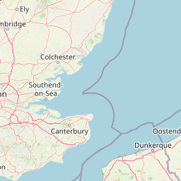
Use this park location map to pinpoint Réserve naturelle nationale du Platier d'Oye in France, understand its exact geographic position, and read its mapped placement within the surrounding landscape more clearly.

Pigeon | © OpenStreetMap contributors

Location context for Réserve naturelle nationale du Platier d'Oye

Pas-de-Calais
Recorded earthquake history

Examine Historical Earthquake Records for Réserve naturelle nationale du Platier d'Oye

Review the comprehensive catalogue of recorded seismic events associated with the Réserve naturelle nationale du Platier d'Oye landscape. Explore historical event magnitudes and epicentre proximity within this curated MoriAtlas resource to understand the seismic history of this unique coastal habitat.

Réserve naturelle nationale du Platier d'Oye Earthquake History

Catalogued events

6 events

Strongest magnitude

Magnitude 4

Most recent event

Jul 2, 2001

This history includes earthquakes recorded inside the park or within 50 km of its borders

Visual exploration of coastal dunes, estuarine mudflats, and wetland habitats along the Opal Coast

Réserve naturelle nationale du Platier d'Oye Photos and Protected Landscape Scenery

Visual documentation reveals the diverse coastal terrain, mobile sand dunes, and tidal marshes defining the Réserve naturelle nationale du Platier d'Oye environment. Photographic coverage helps researchers and visitors analyze the intricate mosaic of protected habitats across this North Sea migratory corridor.

Wide shot of a flat sandy beach meeting the sea under a clear blue sky, with a foreground of dune grasses.

An expansive, slightly elevated view of low-lying coastal shrubs, grasses, and marshy terrain under a clear blue sky, looking across the nature reserve.

A ginger Highland cow with long, shaggy hair and horns rests on green grass, with part of another cow visible in the background.

Park atlas

Compare nearby protected landscapes and regional coastal habitats across northern France

Exploring Parks Near Réserve naturelle nationale du Platier d'Oye and Surrounding Coastal Reserves

Browsing other protected areas near Réserve naturelle nationale du Platier d'Oye reveals interconnected coastal ecosystems and migrating bird corridors along the Opal Coast. Expanding the geographical comparison allows visitors to evaluate similar wetland reserves, dune formations, and estuarine habitats throughout the surrounding region.
Nature reserveHauts-de-France
12 km away#1 closest

East

Réserve naturelle régionale de Grande-Synthe: Protected Geography and Regional Mapping

Nature reserve landscapes in the Hauts-de-France coastal plain

Spanning 174 hectares on the edge of the Dunkirk urban zone, this protected area serves as a model for ecological restoration. Examine the patchwork of sandy grasslands, wetlands, and mature hedgerows that define the reserve, and see its position as a link in the regional green and blue ecological corridor of northern France.

Area
1.74 km²
Established
2015
Relief
Lowland
Climate
Temperate
Nature reserveHauts-de-France
13 km away#2 closest

Southwest

Réserve naturelle régionale de Pont d'Ardres: Mapped Wetland Geography and Protected Lands

A restored industrial landscape in the Hauts-de-France coastal hinterland.

Situated southeast of Calais, this reserve represents a rare success in ecological restoration. The former sugar factory basins now provide vital habitats for shorebirds and nesting species, maintaining an essential wetland presence in an otherwise cultivated landscape of northern France.

Area
0.663 km²
Established
2012
IUCN
IV
Relief
Lowland
Nature reserveHauts-de-France
About 25 km away#3 closest

Southwest

Réserve naturelle régionale de la forteresse de Mimoyecques: Regional Nature Reserve Geography

Protected subterranean habitat and wartime heritage in Hauts-de-France.

Located in the rolling lowlands of the Pas-de-Calais, the Réserve naturelle régionale de la forteresse de Mimoyecques is a uniquely managed protected area. Its landscape integrates historical military architecture with modern biodiversity conservation, focusing on the protection of rare underground roosting environments for diverse bat species within the regional Hauts-de-France terrain.

Area
0.016 km²
Established
2012
Relief
Lowland
Climate
Temperate
A horizontal watercolor painting showing a soft landscape with green vegetation, pink accents, and a winding body of water leading towards distant hills.
Nature reserveFrance
About 27 km away#4 closest

Southwest

Réserve naturelle régionale du mont de Couple: Protected Chalk Escarpment and Coastal Viewpoint

A limestone ridge sanctuary in the northern French Boulonnais region

Spanning a rare chalk cuesta in northern France, this protected area balances ecological conservation with distinct geological features. The reserve provides critical habitat for orchids and protected flora while serving as a strategic viewpoint across the Straits of Dover and the surrounding Opal Coast terrain.

Area
0.136 km²
Established
1997
Relief
Upland
Climate
Temperate
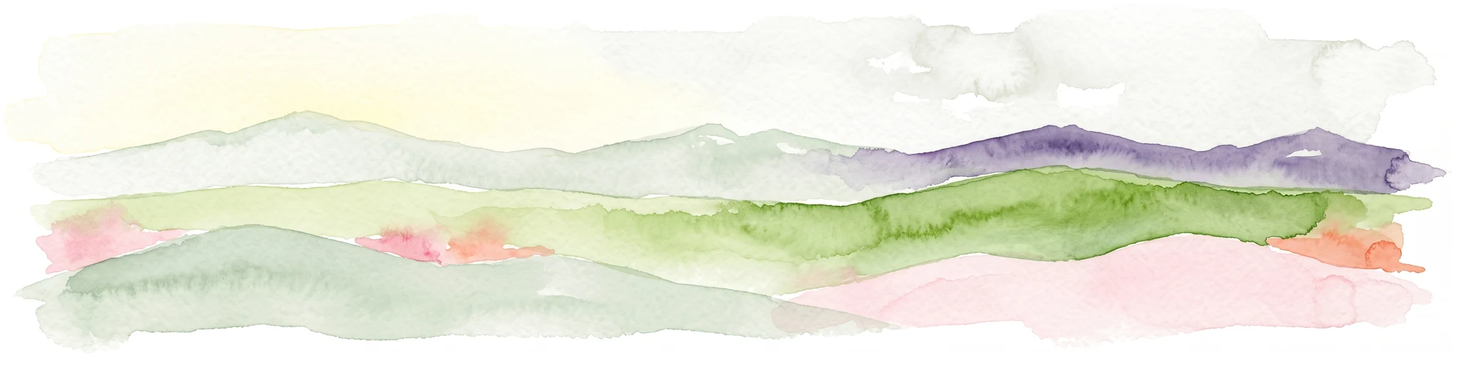
Watercolor painting showing layered rolling hills or dunes in shades of green, purple, and pale pink against a white background.
Nature reserveHauts-de-France
About 29 km away#5 closest

East

Réserve naturelle nationale de la dune Marchand: Protected Coastal Dune Landscapes

Coastal Flemish dunes and North Sea protected geography

Located in the Hauts-de-France region, the Réserve naturelle nationale de la dune Marchand is a protected area defined by its rare continuity of dune habitats. From wind-scoured slacks to established grey dunes and wetland pockets, the reserve provides a critical study of coastal topography and endemic species preservation within an active maritime border landscape.

Area
1.13 km²
Established
1974
IUCN
IV
Relief
Lowland
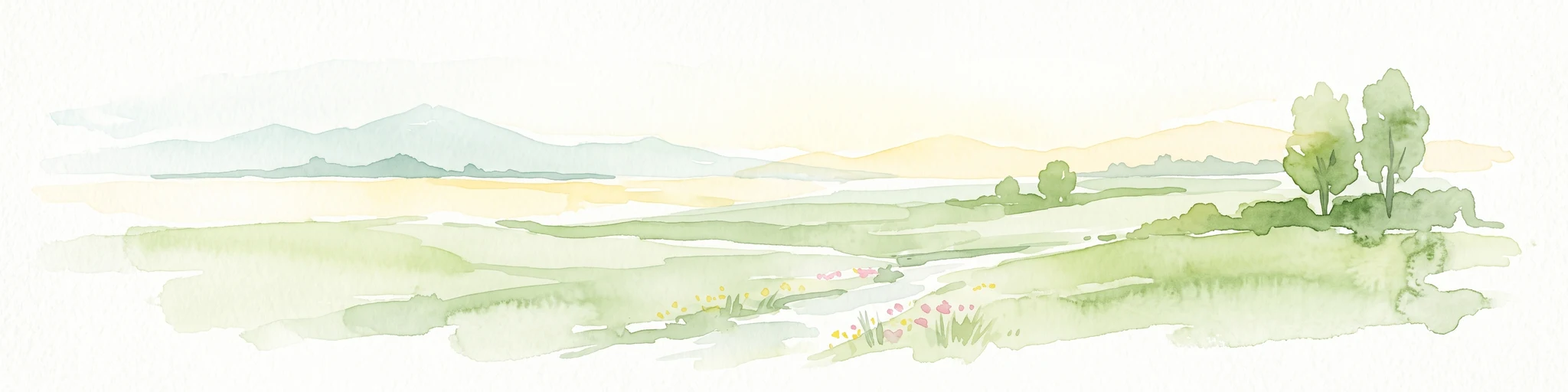
A soft watercolor painting of a green meadow, featuring gentle hills in the distance, a small stream flowing through the center, and a few scattered trees, all set against a white background.
Nature reserveHauts-de-France
About 30 km away#6 closest

Southeast

Réserve naturelle régionale des prairies du Schoubrouck: Geography and Protected Area Overview

Wet-meadow habitats and historic watergang networks in northern France.

Located in the Hauts-de-France region, Réserve naturelle régionale des prairies du Schoubrouck provides a focused look at the cultural and ecological heritage of Flemish lowland landscapes. This site preserves an essential mosaic of wet grasslands and traditional drainage systems, serving as a key example of habitat-specific conservation stewardship within the rural fabric of the Nord department.

Area
0.102 km²
Established
2012
IUCN
IV
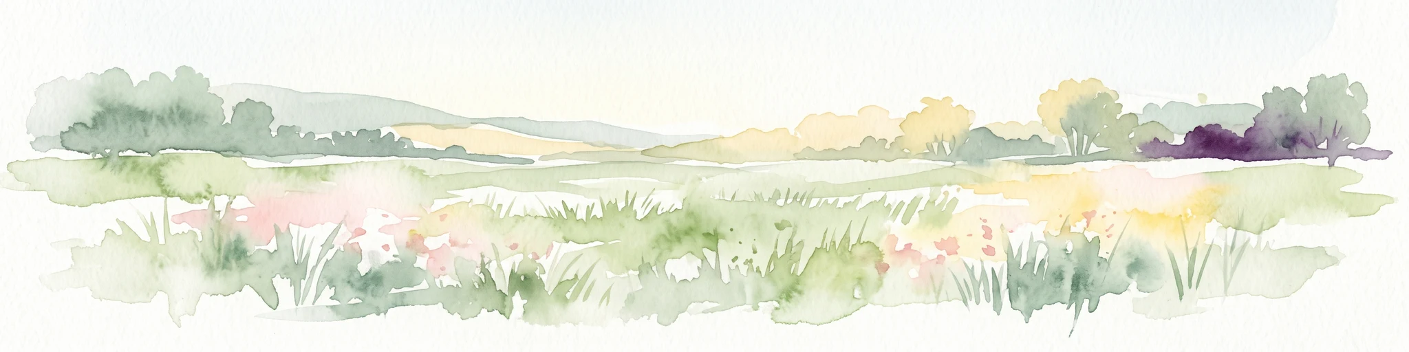
A horizontal watercolor illustration depicting a soft, impressionistic landscape of wetland meadows, grassy patches, and distant trees in pastel shades of green, yellow, and soft purple.
Nature reserveHauts-de-France
About 34 km away#7 closest

East

Réserve naturelle régionale du vallon de la Petite Becque: Protected Area Map and Geography

Flemish Houtland wetland conservation and regional green infrastructure

This protected area in Hauts-de-France functions as a compact, high-value laboratory for habitat restoration within the modernized Flemish countryside. It provides essential sanctuary for relict marsh flora, orchid-rich meadows, and specialized invertebrate communities, effectively acting as an ecological island amidst a vast expanse of intensively cultivated arable farmland.

Area
0.009 km²
Established
2010
IUCN
IV
Relief
Lowland
Nature reserveHauts-de-France
35 km away#8 closest

Southeast

Réserve naturelle régionale du plateau des landes: Regional Nature Reserve Landscape Profile

Protected heathland geography in the Pas-de-Calais corridor.

Understand the ecological structure of the Réserve naturelle régionale du plateau des landes. This protected area features a unique crescent shape and mosaic of heathland sectors spread across several communes, offering a focused study of low-elevation inland conservation management in the heart of northern France.

Area
1.811 km²
Established
2009
IUCN
IV

Common questions about visiting, size, designation, and location context for Réserve naturelle nationale du Platier d'Oye

Réserve naturelle nationale du Platier d'Oye FAQs for park facts, access, geography, and protected area context

Find quick answers about Réserve naturelle nationale du Platier d'Oye, including protected-area facts, park geography, trail and visitor context, and how the park fits into its surrounding country and regional landscape.
MoriAtlas Explorer

Continue Your Protected Areas Search Across the Global Atlas

Deepen your exploration by continuing the structured search for national parks and protected areas worldwide. Utilize the comprehensive filtering capabilities to compare different conservation landscapes and refine your understanding of global park geography. Discover more about the distribution and characteristics of protected natural areas.

Global natural geography