Why Rundle Range National Park stands out
Rundle Range National Park is best known for its protection of brigalow belt ecosystems, which represent one of Australia's most modified bioregions. The park provides crucial habitat for two notable threatened bird species: the glossy black-cockatoo and the southern squatter pigeon. These species depend on the intact woodland remnants within the park, making it an important conservation asset in Central Queensland's fragmented landscape.
Rundle Range National Park history and protected-area timeline
Rundle Range National Park was established in 1993 as part of Queensland's expanding protected area network. The creation of the park represented recognition of the conservation values present in this section of the Brigalow Belt, a bioregion that had suffered significant habitat loss through the twentieth century. The Brigalow Belt, once covered in extensive brigalow acacia woodlands, has been heavily cleared for agriculture, leaving remaining patches of intact vegetation as critical refuges for native species. The park's establishment provided formal protection for these woodland communities and the wildlife habitats they contain.
Rundle Range National Park landscape and geographic character
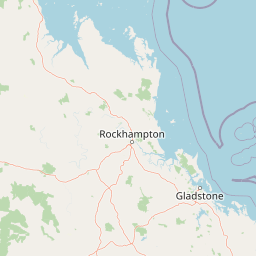
The landscape of Rundle Range National Park consists of rolling terrain within the broader Brigalow Belt bioregion of Central Queensland. The area falls within the drainage basins of both the Calliope River and Fitzroy River systems, indicating its position within Queensland's extensive river network. The terrain supports brigalow woodland communities, with the vegetation structure reflecting the park's location in a transitional zone between Queensland's coastal and inland environments. The landscape represents a relatively undulating setting compared to the more dramatic mountain ranges found elsewhere in Queensland.
Rundle Range National Park ecosystems, habitats, and plant life
The Brigalow Belt bioregion, within which Rundle Range National Park is situated, represents one of Australia's most ecologically modified landscapes, making the protected areas within it particularly significant. The park preserves representative examples of brigalow woodland, a vegetation type dominated by Acacia harpophylla (brigalow) that once covered extensive areas of inland Queensland. These woodlands provide important habitat structure and resources for a range of native species, particularly bird communities. The protection of these remnants within the park contributes to the broader conservation of the bioregion's biodiversity, even though the overall area protected is relatively small.
Rundle Range National Park wildlife and species highlights
Rundle Range National Park provides habitat for two rare or threatened bird species that highlight its conservation significance. The glossy black-cockatoo (Calyptorhynchus lathami) is a distinctive Australian parrot that depends on suitable woodland habitat for nesting and feeding. The southern squatter pigeon (Geophaps scripta) is a ground-dwelling bird species that inhabits grassy woodland environments. The presence of these species within the park underscores the importance of preserving intact woodland remnants in the Brigalow Belt, where much of the original habitat has been cleared. These threatened birds represent the park's most significant wildlife values, serving as indicators of broader ecosystem health.
Rundle Range National Park conservation status and protection priorities
Rundle Range National Park contributes to the conservation of the Brigalow Belt bioregion, one of Australia's most endangered ecosystems. The park preserves woodland habitat in a region where the majority of the original vegetation has been removed for agricultural purposes. Its role in protecting habitat for the glossy black-cockatoo and southern squatter pigeon, both species of conservation concern, gives the park significance beyond its modest area. The protected area functions as a conservation remnant that maintains ecological connections and supports biodiversity in a heavily modified landscape.
Rundle Range National Park cultural meaning and human context
The park does not have prominent documented cultural context in the available source material regarding indigenous heritage or historical human use. The Brigalow Belt region has been subject to European pastoral expansion and subsequent agricultural development, but specific historical details related to the Rundle Range area are limited in the current source.
Top sights and standout views in Rundle Range National Park
The park's standout features include its protection of intact brigalow woodland in a bioregion that has lost most of its original vegetation, habitat for two threatened bird species, and its position spanning two major river drainage basins. The glossy black-cockatoo and southern squatter pigeon represent the park's most notable wildlife values, drawing attention from birdwatchers and conservation interests. The park offers a representative example of Central Queensland woodland ecosystems that would otherwise be absent from the protected area estate in this region.