Mori Atlas logo
National parkSalamanca Island Road Park

Discover the vast mangrove ecosystems and abundant birdlife of this key Caribbean coastal wetland.

Salamanca Island Road Park National Park: Protected Landscape and Geographic Context in Magdalena Department

Salamanca Island Road Park, a national park within Colombia's Magdalena Department, offers a remarkable example of a protected coastal wetland ecosystem. Established to safeguard vital bird populations and expansive mangrove forests, its unique location at the convergence of the Magdalena River and the Caribbean Sea creates a dynamic estuarine environment. This park, recognized globally as a UNESCO Biosphere Reserve, provides critical habitat and serves as a significant area for atlas-style exploration of coastal geography and natural landscapes.

Mangrove ecosystemsCoastal wetlandsBirdwatchingUNESCO Biosphere ReserveCaribbean coastEstuarine environment

Salamanca Island Road Park

National park

Park overview

Structured park overview, official facts, and landscape profile for Salamanca Island Road Park

Salamanca Island Road Park park facts, protected area profile, and essential visitor context

Review the core facts for Salamanca Island Road Park, including designation, size, terrain, visitor scale, habitats, and operating context in one park-focused overview.

About Salamanca Island Road Park

Salamanca Island Road Park occupies a distinctive place in Colombia's protected area system as a coastal national park that safeguards a complex estuarine ecosystem. The park's landscape is defined by the interaction between the Magdalena River, Colombia's principal river system, and the Caribbean Sea, creating a dynamic environment of mangroves, tidal channels, and coastal flats. The road that gives the park its name serves as the primary access through this wetland area, allowing visitors to traverse a landscape that might otherwise be inaccessible. The park was created specifically to preserve the exceptional bird life that inhabits this coastal region, as well as the mangrove forests that provide critical habitat for numerous species. The importance of the area was further recognized when UNESCO designated it as a Biosphere Reserve in 2000, acknowledging its role in maintaining ecological processes and biodiversity at a regional and global scale.

Quick facts and research context for Salamanca Island Road Park

Salamanca Island Road Park spans 562 square kilometers along Colombia's Caribbean coast near Ciénaga. The park protects a complex ecosystem shaped by the confluence of the Magdalena River and Caribbean Sea. Established in 1964, it holds IUCN Category III protection status as a natural monument. The area features extensive mangrove forests covering approximately 12,000 hectares, representing about one-third of the total park area. The park supports exceptional biodiversity including 199 bird species, over 140 fish species, 33 mammal species, and diverse reptile and invertebrate populations.

Protection and recognition

Documented designation history, management scope, and geographic protection boundaries

Salamanca Island Road Park Protection Status and Protected Area Framework

National park registry data outlines the official protection status and management scope established for Salamanca Island Road Park. Verifying formal conservation records helps researchers and visitors understand the geographic boundaries and legal frameworks governing the territory.

Protection details

Protection scope
Mixed
Transboundary protection
No
Park context

Deeper park guide and search-rich context for Salamanca Island Road Park

Salamanca Island Road Park history, landscape, wildlife, and travel context

Explore Salamanca Island Road Park through its history, landscape character, ecosystems, wildlife, conservation priorities, cultural context, and seasonal travel timing in a structured park guide built for atlas discovery and search intent.

Why Salamanca Island Road Park stands out

Salamanca Island Road Park is best known for its extensive mangrove forests that form one of the most significant coastal wetland ecosystems in the Colombian Caribbean. The park protects a critical area at the confluence of the Magdalena River and Caribbean Sea, creating a unique estuarine environment that supports remarkable biodiversity. It is particularly recognized for its bird populations, with nearly 200 species including many migratory, endemic, and resident birds. The park's designation as a UNESCO Biosphere Reserve in 2000 underscores its importance as a conservation area of international significance.

Salamanca Island Road Park history and protected-area timeline

Salamanca Island Road Park was established in 1964 as a protected area dedicated to preserving the exceptional natural values of Colombia's Caribbean coastal wetlands. The creation of the park reflected growing recognition of the ecological importance of mangrove ecosystems and the need to protect critical bird habitats along migration routes. The decision to establish the park was prompted by the abundance of bird species found in the area and the extensive coastal mangrove forests that characterized the region. In 2000, the park received additional recognition when it was designated as a Biosphere Reserve under UNESCO's Man and the Biosphere Programme, acknowledging its significance as a model of sustainable development and conservation. The park is managed under Colombia's National System of Protected Areas, which oversees the management and conservation of the country's protected natural areas.

Salamanca Island Road Park landscape and geographic character

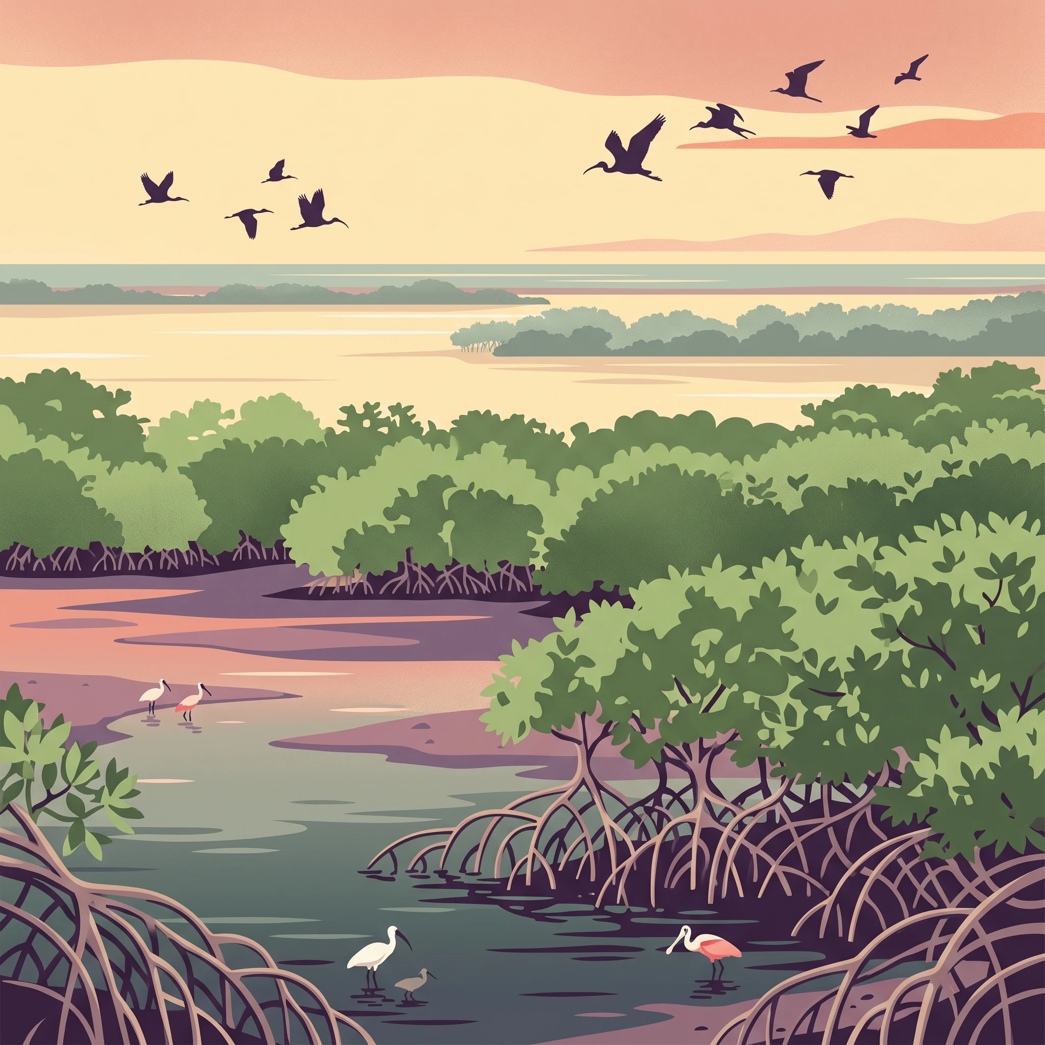
The landscape of Salamanca Island Road Park is characterized by extensive mangrove forests, tidal wetlands, and coastal flats where fresh and salt water meet. The terrain is predominantly flat and low-lying, typical of coastal wetland environments. The mangrove forests dominate the visual character of the park, with dense stands of trees adapted to tidal inundation and saline conditions. The interplay between river and sea creates a dynamic landscape where channels, ponds, and mangrove islands shift and change with tidal cycles. The road that runs through the park, connecting Santa Marta to Barranquilla, provides the primary traversable route through this otherwise water-dominated landscape, offering views of the mangrove-covered terrain on both sides.

Salamanca Island Road Park ecosystems, habitats, and plant life

The nature of Salamanca Island Road Park is defined by its position at the intersection of two major water systems, creating an estuarine environment of exceptional ecological complexity. The park's ecosystems include mangrove forests, tropical dry forests, and riparian forests, each supporting distinct communities of plants and animals. Mangrove forests cover approximately one-third of the park's total area, with red mangrove, black mangrove, white mangrove, and buttonwood being the predominant tree species. These mangrove forests provide critical ecosystem services including shoreline stabilization, carbon storage, and habitat provision for numerous species. The tropical dry forests and riparian areas add additional habitat diversity, creating a complex mosaic of environments that supports the park's high biodiversity.

Salamanca Island Road Park wildlife and species highlights

Salamanca Island Road Park supports remarkable wildlife diversity despite the environmental challenges affecting the broader ecosystem. The park is home to 199 bird species, many of which are migratory, endemic, or year-round residents, making it a significant area for birdwatching and ornithological study. The fish population exceeds 140 species, reflecting the richness of the estuarine and coastal waters. Mammal diversity includes 33 species, while reptiles are represented by 35 species and amphibians by 9 species. Invertebrates total 98 species, demonstrating the invertebrate abundance in these productive waters. Many of these species are endangered, underscoring the conservation importance of the park's protected status and the critical role it plays in maintaining biodiversity in the Colombian Caribbean.

Salamanca Island Road Park conservation status and protection priorities

Salamanca Island Road Park represents a critical conservation area in Colombia's Caribbean region, protecting one of the most important mangrove ecosystems along the Caribbean coast. The park's designation as a Biosphere Reserve by UNESCO in 2000 reflects international recognition of its ecological significance and the need for coordinated conservation efforts. The protection of this area ensures the preservation of biodiversity hotspots, migratory bird routes, and critical habitat for endangered species. The park's management under Colombia's National System of Protected Areas provides the framework for conservation activities and sustainable use of natural resources. The mangroves within the park also provide important ecosystem services that benefit surrounding communities, including coastal protection, water filtration, and support for fisheries.

Top sights and standout views in Salamanca Island Road Park

The most distinctive highlights of Salamanca Island Road Park include the extensive mangrove forests visible from the road that traverses the park, the exceptional bird diversity with nearly 200 species, and the unique position at the confluence of the Magdalena River and Caribbean Sea. The UNESCO Biosphere Reserve designation underscores the park's international significance. The park offers a rare opportunity to experience a major coastal wetland ecosystem from a road that passes through the heart of the protected area, providing access to scenery that would otherwise require boat transportation to explore.

Best time to visit Salamanca Island Road Park

The best time to visit Salamanca Island Road Park is during the dry season, typically from December through April, when rainfall is minimal and conditions are more comfortable for exploration. The climate is consistently hot year-round, with temperatures averaging between 28 and 30 degrees Celsius, but the dry season offers slightly more pleasant conditions for outdoor activities. Visitors should be prepared for the arid and dry conditions, with evaporation exceeding rainfall throughout the year, creating a water deficit in the ecosystem. The dry season also provides better opportunities for wildlife observation as animals concentrate around remaining water sources.
Monthly climate preview

Historical temperature and precipitation records measured at a representative park coordinate

Monthly Climate Normals and Average Temperatures for Salamanca Island Road Park

Long-term data from a representative coordinate shows sustained high temperatures throughout the year coupled with distinct shifts from dry conditions to wetter months. Examining the complete twelve-month profile reveals detailed monthly averages for minimum and maximum temperatures alongside daily precipitation variations.
Annual mean27 °C
27 °C28 °C
Jan27°
Feb27°
Mar27°
Apr28°
May28°
Jun28°
Jul28°
Aug28°
Sep27°
Oct27°
Nov27°
Dec27°
Warmest month
June

27.7 °C

Coolest month
January

26.6 °C

Wettest month
October

5.1 mm/day

Driest month
January

0.1 mm/day

Park location guide

Geography guide, regional context, and park location map for Salamanca Island Road Park

Salamanca Island Road Park park geography, regions, and map view in Colombia

Understand where Salamanca Island Road Park sits in Colombia through a broader geographic reading of the surrounding landscape, nearby location context, and its mapped position within the national park landscape.

How Salamanca Island Road Park fits into Colombia

Colombia is a presidential republic located in the northern part of South America. It spans approximately 1.14 million km² and has a population of around 52 million. The country features the Andes mountain range, extensive Amazon rainforest, and coastal regions on both the Caribbean and Pacific. Spanish is the official language, and Bogotá serves as the capital and largest city.

Wider geography shaping Salamanca Island Road Park in Colombia

Colombia is located in the northwestern part of South America, bordering the Caribbean Sea to the north and the Pacific Ocean to the west. Its mainland neighbors are Venezuela to the east, Brazil to the southeast, Peru and Ecuador to the south and southwest, and Panama to the northwest. The terrain is diverse, featuring the Andes mountain range in the west, Amazon rainforest in the south and east, and coastal plains along both oceans.

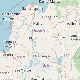
Map view of Salamanca Island Road Park

Use this park location map to pinpoint Salamanca Island Road Park in Colombia, understand its exact geographic position, and read its mapped placement within the surrounding landscape more clearly.

Pigeon | © OpenStreetMap contributors

Location context for Salamanca Island Road Park

Magdalena Department
Park atlas

Browse related protected landscapes and coastal wetland ecosystems across Colombia's Caribbean region.

Explore National Parks and Protected Areas Near Salamanca Island Road Park in Colombia

Continue your exploration from Salamanca Island Road Park by tracing other national parks and protected areas across Colombia's vital Caribbean coastal region. Compare diverse protected landscapes, mapped wetlands, and conservation efforts, understanding their regional context and ecological connections.
Illustration of a waterfall in a mountainous landscape with pine trees and colorful rock formations
Protected areaColombia
About 8.2 km away#1 closest

Southeast

Ciénaga Grande de Santa Marta Protected Area: Detailed Geographic and Atlas Exploration

Explore the mapped boundaries and protected landscape of this Colombian conservation area.

Gain a deeper understanding of the Ciénaga Grande de Santa Marta, a vital protected area in Colombia. This detailed view focuses on its geographic setting, mapping its protected boundaries and contributing to a broader atlas perspective of South American natural landscapes. It serves as an essential resource for exploring the park's unique regional geography and its role as protected land.

Area
4,280 km²
Relief
Lowland
Scope
Terrestrial
Water
Water-dominated
National parkColombia
About 57 km away#2 closest

Northeast

Tayrona National Natural Park: Protected Landscape and Biodiversity Atlas

Explore its unique geography, mapped terrain, and vital ecosystems.

Tayrona National Natural Park serves as a prime example of a protected natural landscape at the confluence of major geographic features. Situated in Colombia's Caribbean coast, it is defined by the foothills of the Sierra Nevada de Santa Marta rising towards the sea, creating a distinct regional geography. Users can explore its mapped boundaries, understand its ecological gradient from coastal zones to montane forests, and appreciate its significance as a vital conservation area with rich biodiversity.

Area
180 km²
Established
1964
IUCN
II
Visitors
545.8K annual
Watercolor painting showing mountain range with green forests and colorful landforms
National parkColombia
About 80 km away#3 closest

East

Sierra Nevada de Santa Marta National Park: Colombia's Iconic Coastal Mountain Geography

Witness dramatic elevation changes and unique protected ecosystems.

Sierra Nevada de Santa Marta National Park is a distinctive protected landscape located in northern Colombia. This isolated mountain range, a UNESCO Biosphere Reserve, features an unparalleled elevational gradient from sea level to nearly 5,700 meters. The park's geography encompasses a stunning diversity of ecosystems, including tropical dry forests, Andean cloud forests, unique páramo habitats, and glacial peaks, making it a vital area for atlas-based geographic discovery and conservation.

Area
3,830 km²
Established
1964
IUCN
II
Relief
Mountain
National parkColombia
About 148 km away#4 closest

Southwest

Rosario and San Bernardo Corals National Natural Park: Colombia's National Natural Park Protected Landscape

Explore the mapped geography and protected natural areas of this Colombian national park.

Delve into the geographical details and protected landscape identity of Rosario and San Bernardo Corals National Natural Park, a significant national park within Colombia. This resource provides a structured atlas view of its mapped boundaries and natural terrain, contributing essential context to the broader Colombian geography and its protected areas.

Area
1,200 km²
Established
1977
IUCN
II
Visitors
318.5K annual
Wildlife reserveColombia
About 154 km away#5 closest

East

Los Flamencos Sanctuary Wildlife Reserve: Geographic Context and Protected Landscape

Mapped boundaries within Colombia's natural geography.

Los Flamencos Sanctuary is a designated wildlife reserve contributing to the protected landscapes of Colombia. This entry provides a detailed look at its geographic setting and mapped features, crucial for understanding its ecological significance and atlas placement. Explore the protected area's context within the diverse geography of South America, offering a structured perspective for landscape discovery.

Area
0.077 km²
Established
1977
Relief
Lowland
Climate
Tropical
National parkVenezuela
About 222 km away#6 closest

Southeast

Sierra de Perijá National Park: Protected Area in Venezuela's Geographic Atlas

Explore its national park boundaries and regional landscape context.

Sierra de Perijá National Park is a designated national park in Venezuela, representing a significant protected landscape within the country. This entry facilitates detailed atlas exploration, allowing users to understand the park's precise geographic scope, its mapped boundaries, and its connection to the surrounding regional geography. Discover the core identity of this protected area and its value for geographic study and mapped landscape analysis.

Area
2,952.88 km²
Established
1978
IUCN
II
Relief
Mountain
National parkZulia
About 281 km away#7 closest

Southeast

Parque Nacional Ciénagas del Catatumbo: Wetland Protected Area and Regional Geography

Expansive marshland terrain in the Zulia state of Venezuela

Parque Nacional Ciénagas del Catatumbo represents an extensive, flat mosaic of freshwater marshes, herbaceous grasslands, and gallery forests along the Catatumbo River delta. As a primary protected area in Zulia, it offers critical insights into lowland wetland ecosystems and the dynamic transition zones bordering Lake Maracaibo.

Area
2,694 km²
Established
1991
IUCN
II
Relief
Lowland
National parkVenezuela
About 281 km away#8 closest

Southeast

Ciénagas del Catatumbo National Park: Venezuela's Freshwater Marsh Protected Landscape

Mapped wetland geography and diverse tropical savanna ecosystems.

Ciénagas del Catatumbo National Park is a vital protected area safeguarding extensive marshland and savanna ecosystems in northwestern Venezuela, specifically within the Lake Maracaibo basin. This national park is recognized for its significant freshwater marsh complex, which supports a rich diversity of bird species and plays a crucial role in the watershed's ecological health. Exploring this park offers a focused discovery of tropical wetland geography and protected landscape features.

IUCN
II
Water
Major water bodies

Common questions about visiting, size, designation, and location context for Salamanca Island Road Park

Salamanca Island Road Park FAQs for park facts, access, geography, and protected area context

Find quick answers about Salamanca Island Road Park, including protected-area facts, park geography, trail and visitor context, and how the park fits into its surrounding country and regional landscape.
MoriAtlas Explorer

Continue Your Protected Areas Search Across the Global Atlas

Deepen your exploration by continuing the structured search for national parks and protected areas worldwide. Utilize the comprehensive filtering capabilities to compare different conservation landscapes and refine your understanding of global park geography. Discover more about the distribution and characteristics of protected natural areas.

Global natural geography