Mori Atlas logo
Nature reserveSerra da Estrela Natural Park

Discover the dramatic geography and protected terrain of this alpine nature reserve in central Portugal.

Serra da Estrela Natural Park: Portugal's Highest Peaks and Glacial Landscapes

(Parque Natural da Serra da Estrela)

Serra da Estrela Natural Park represents the vast protected landscape encompassing Portugal's highest mountain range, a dramatic granite and schist massif in the Central Region. This park, covering approximately 891 square kilometers, is home to the country's highest point at Torre and is a crucial source of major Portuguese rivers, shaped by ancient glacial activity. As an IUCN Category V protected landscape, it preserves unique alpine habitats, endemic species, and distinctive landforms, offering a rich context for geographic and map-based discovery within the Iberian Peninsula.

mountain protected areaglacial landscapeRamsar siteNatura 2000 siteendemic floraPortuguese highest peak
Illustration of a waterfall, mountains, and river with trees

Serra da Estrela Natural Park

Nature reserve

Park overview

Structured park overview, official facts, and landscape profile for Serra da Estrela Natural Park

Serra da Estrela Natural Park park facts, protected area profile, and essential visitor context
Review the core facts for Serra da Estrela Natural Park, including designation, size, terrain, visitor scale, habitats, and operating context in one park-focused overview.

About Serra da Estrela Natural Park

Serra da Estrela Natural Park occupies the heart of Portugal's central mountain range, protecting a landscape of extraordinary topographic and ecological diversity. The park's central plateau, dominated by the iconic Torre and the Cântaros formation, contains the glacial valley of the Zêzere River, one of the most visually striking landscape features in the Iberian Peninsula. Below this alpine core, the park descends through distinct landscape zones: the Videmonte plateau with its isolated farms scattered among rye fields and cattle pastures, the southwestern valleys decorated with agricultural terraces and framed by the dramatic Penha dos dos Abutres cliffs, and the northwestern slopes stretching from Seia to the historic castle of Linhares where maize cultivation and vine growing extend upslope to the broom-covered uplands. The park's importance extends beyond its scenic beauty. It serves as a critical watershed, feeding rivers that flow across much of central Portugal. The combination of high altitude, granite and schist bedrock, and exposure to Atlantic weather systems creates one of the wettest environments in mainland Portugal, supporting vegetation zones that range from oak forests through juniper shrubland to subalpine pastures. The park's 375 kilometers of marked hiking trails, interpretive center at Manteigas, and the only ski resort in Portugal make it a destination for both nature enthusiasts and those seeking mountain recreation.

Quick facts and research context for Serra da Estrela Natural Park

Serra da Estrela Natural Park covers approximately 891 square kilometers in central Portugal, making it the country's largest natural protected area. The park spans the districts of Guarda (85%) and Castelo Branco (15%), with elevations ranging from 291 meters to 1,991 meters at Torre, the highest point in Continental Portugal. Established on July 16, 1976 through Decree-Law 557/76, the park is managed by ICNF and contains a Ramsar-designated wetland area at the upper plateau and upper Zêzere River, designated in December 2005. More than half of the park lies above 700 meters altitude, and the region experiences one of the highest occurrences of rain, snow, hail, and dew in mainland Portugal due to its elevation and geographic position.

Park context

Deeper park guide and search-rich context for Serra da Estrela Natural Park

Serra da Estrela Natural Park history, landscape, wildlife, and travel context
Explore Serra da Estrela Natural Park through its history, landscape character, ecosystems, wildlife, conservation priorities, cultural context, and seasonal travel timing in a structured park guide built for atlas discovery and search intent.

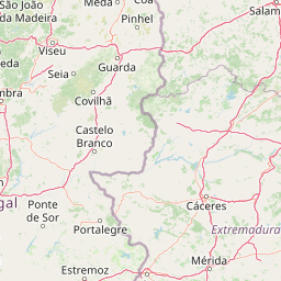
Why Serra da Estrela Natural Park stands out

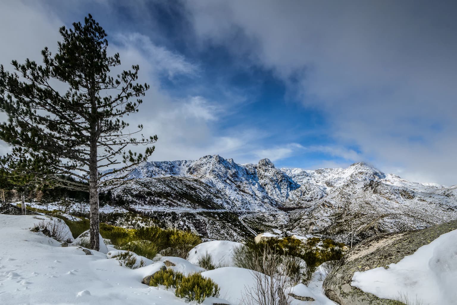
Serra da Estrela is best known for containing the highest peak in Continental Portugal and the only ski resort in the country, creating a unique alpine character within Portugal's landscape. The park preserves exceptional Quaternary glacial formations including horseshoe-shaped valleys, polished rocks, ravines, and glacial lakes that demonstrate the powerful role of ice and snow in shaping the mountain terrain. The upper plateau and Zêzere River wetlands hold Ramsar designation, recognizing their international importance as a biogenetic reserve. The park is also famous for its traditional shepherd communities and the world-renowned Serra da Estrela cheese, produced from the milk of indigenous sheep breeds that graze the mountain pastures throughout the year.

A serene lake reflecting tall trees with lush green foliage, surrounded by a forested area with a wooden bench in the background
Summer at Covão d'Ametade, a serene lake reflecting tall trees in Serra da Estrela Natural Park

Serra da Estrela Natural Park history and protected-area timeline

Serra da Estrela Natural Park was officially established on July 16, 1976 through Decree-Law 557/76, created to protect Portugal's most significant mountain landscape and its unique ecological and cultural values. The park boundaries were refined on November 20, 1997 through Decree Regulation 50/97, clarifying the protected area's extent. On July 7, 2000, the Serra da Estrela site was designated as a Natura 2000 site through Council of Ministers Resolution 76/00, integrating the park into Europe's comprehensive ecological network. The central plateau area was subsequently incorporated into the Council of Europe's Biogenetic Reserve Network, recognizing its exceptional biodiversity value. Human occupation of the Serra da Estrela region extends far beyond the modern protected area designation. Medieval villages dot the mountain valleys, but earlier cultures left their mark throughout the landscape. Roman road remains at Famalicão and Folgosinho document the route connecting Mérida to Braga across the mountain, while Arab influence is visible in the irrigation systems and fruit orchard traditions that persist in the region. The Visigothic culture organized rural space according to their legal code, establishing land use patterns that evolved into the present-day pastoral economy centered on sheep and goat herding and the production of traditional Serra da Estrela cheese.

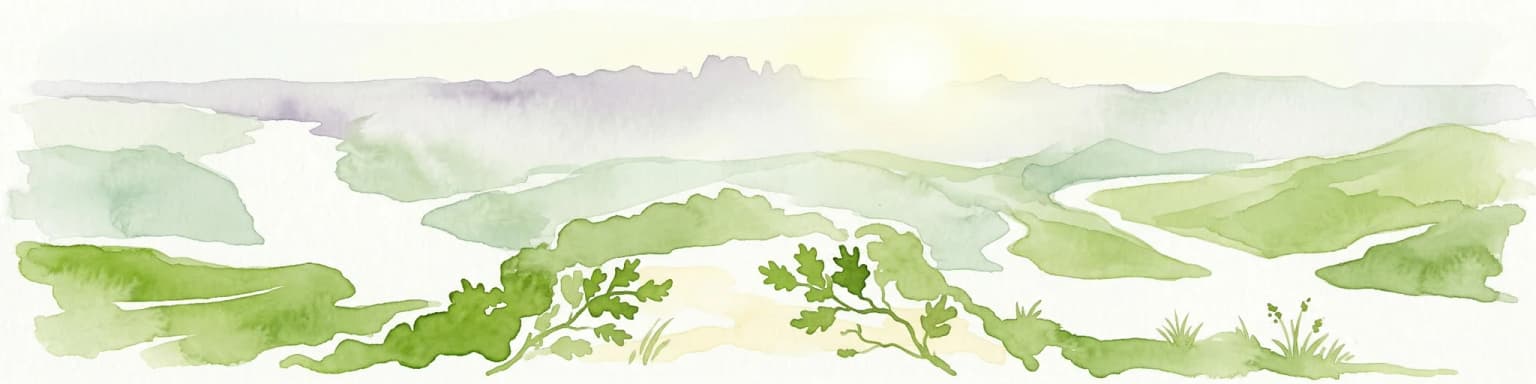
Serra da Estrela Natural Park landscape and geographic character

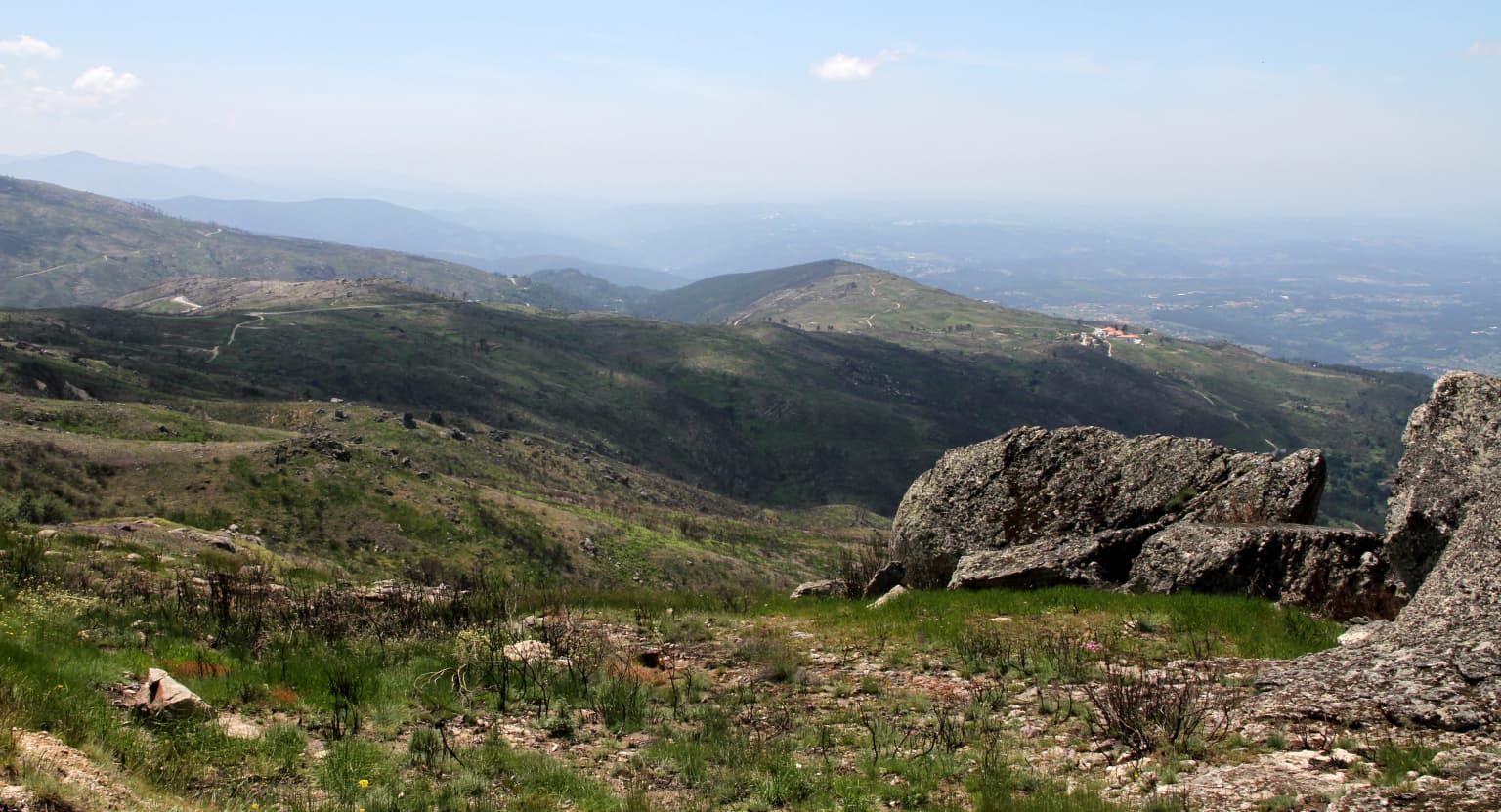
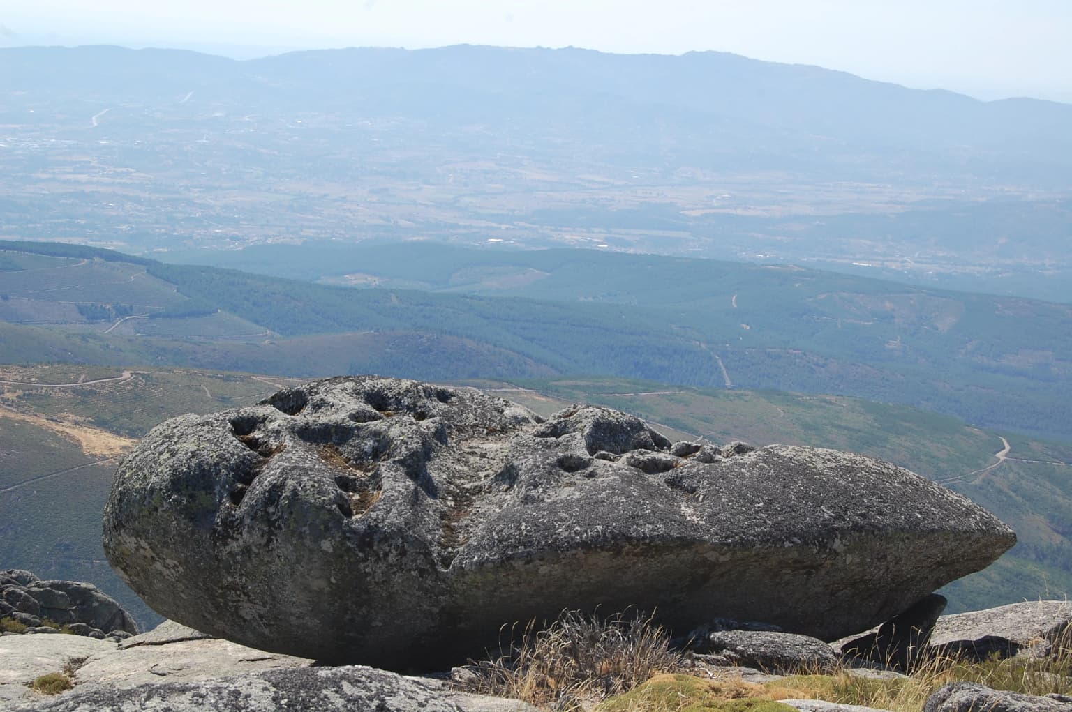
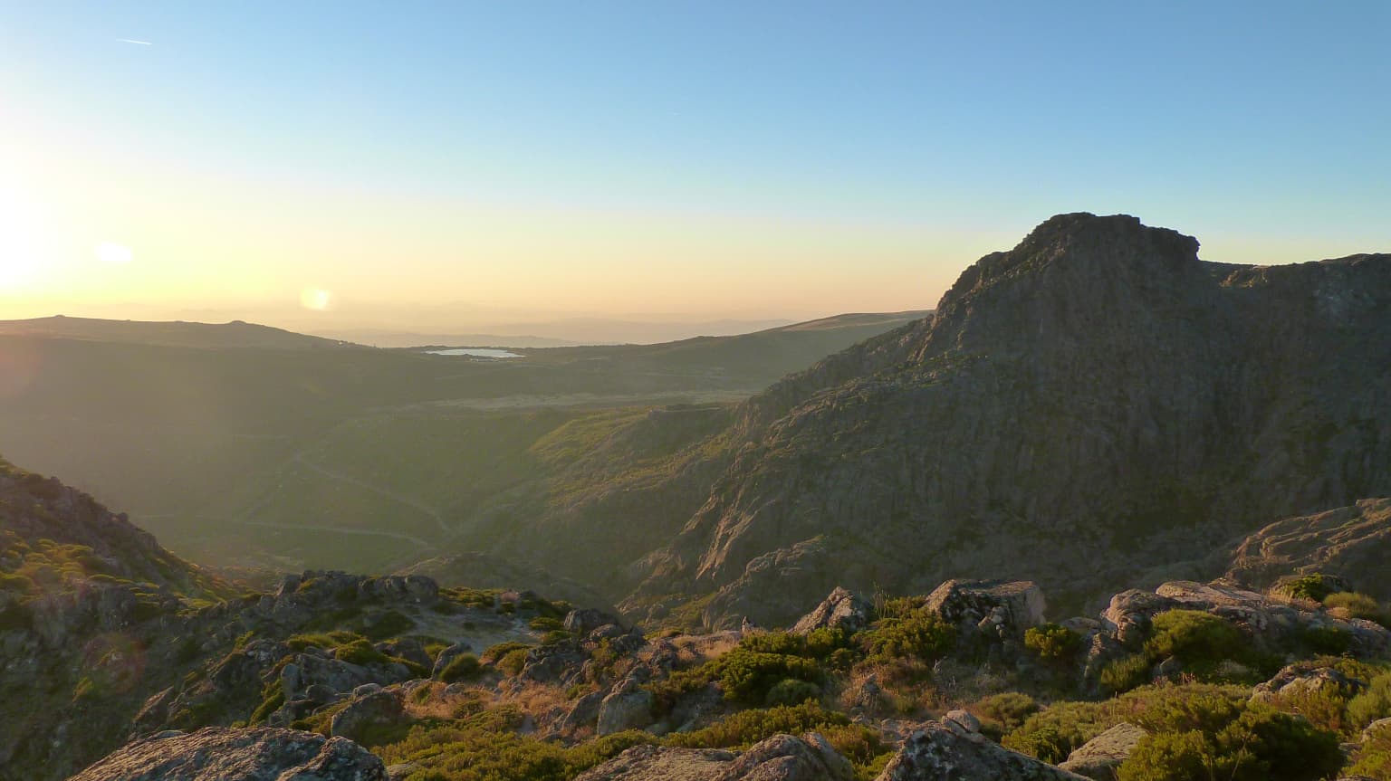
The physical landscape of Serra da Estrela Natural Park displays the dramatic results of Quaternary glacial processes acting on a granite and schist mountain mass. The central plateau, centered around the Torre and Cântaros peaks, presents a stark alpine environment where glacial action carved the spectacular Zêzere valley, leaving behind horseshoe-shaped cirques, polished rock surfaces, and moraine deposits. The park contains numerous glacial lakes, some still holding water throughout the year, while others have evolved into peat bogs and wet meadows. The surrounding mountain slopes descend through distinct terrain types: the Vidomonde plateau represents an early phase of valley development with isolated farmsteads set among cultivated fields; the southwestern valleys feature dramatic terraced agriculture and dramatic rock spires at Penha dos Abutres; and the northwestern slopes transition from the town of Seia through the historic castle at Linhares into cultivated fields and vineyards that climb to broom-covered hillsides. The contrast between the exposed, windswept central plateau and the sheltered valley villages creates a landscape of remarkable visual diversity within a relatively compact area.

Mountain landscape with rocky formations, rolling green valleys, and distant hills under a clear sky
Scenic view of Serra da Estrela mountain range with rocky outcrops and green valleys

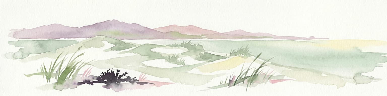
Serra da Estrela Natural Park ecosystems, habitats, and plant life

The ecological character of Serra da Estrela Natural Park is defined by clear altitudinal zonation of vegetation, with three distinct belts reflecting the temperature and moisture gradients across the mountain. Below approximately 900 meters, the lower slopes support Mediterranean-influenced vegetation adapted to warmer, drier conditions. Between 800 and 1,600 meters, the black oak (Quercus pyrenaica) dominates the forest cover, forming extensive woodlands that provide habitat for numerous species and play a critical role in water retention and soil protection on the mountain slopes. Above 1,600 meters, the environment transitions to juniper shrubland and subalpine pastures where the endangered yellow gentian (Gentiana lutea) grows in the limited areas of deeper soil. The park's position at the transition between Atlantic and Mediterranean climatic influences, combined with its elevation range, creates conditions suitable for numerous endemic species that occur nowhere else in Portugal. The wetlands of the upper plateau and Zêzere catchment hold Ramsar designation, recognizing their importance for water regulation and biodiversity.

Mountain slope with yellow flowering plants, scattered trees, and a bright blue sky with clouds
Mountain slope with yellow flowering plants in Serra da Estrela Natural Park

Serra da Estrela Natural Park wildlife and species highlights

The mammalian fauna of Serra da Estrela reflects both the park's forested habitats and its position as a corridor for species moving between northern and southern Portugal. While brown bears have disappeared from the region and wolves appear only sporadically, the park supports populations of otters along the river courses, genets in the woodland areas, badgers in the forest understory, and wild cats that maintain territories in the more remote terrain. Smaller mammals include water voles that inhabit the wetland areas. The bird community is particularly diverse, with species adapted to the various habitat zones. The wall lizard (Lacerta monticola monticola) is a distinctive mountain species found on rocky outcrops throughout the park. The red-breasted bullfinch occupies the forest edge and shrubland zones, while the midwife toad breeds in the temporary water bodies that form in glacial depressions during the spring melt. The park also supports populations of the Serra da Estrela mountain dog, a historic breed developed by the shepherd communities for guarding flocks against predators.

Snow-covered mountain landscape with a single pine tree in the foreground, rocky peaks in the background, and a partly cloudy sky
Snow-covered peaks of Serra da Estrela Natural Park under a partly cloudy sky

Serra da Estrela Natural Park conservation status and protection priorities

Serra da Estrela Natural Park holds significant conservation status at both national and international levels. The Ramsar designation of the upper plateau and upper Zêzere River area in December 2005 (Reference No. 1614) recognizes the wetlands' international importance under the Convention on Wetlands of International Importance. The park is included in the Natura 2000 network as the Serra da Estrela site, designated in 2000 through Council of Ministers Resolution 76/00, integrating it into Europe's coordinated approach to biodiversity conservation. The central plateau has been recognized as a Biogenetic Reserve by the Council of Europe, acknowledging the presence of rare and endemic species that require active protection. The park's conservation value is enhanced by the traditional pastoral land use practices that have maintained open habitats suitable for species dependent on meadow and pasture environments, creating a cultural landscape where biodiversity and human activity have co-evolved over centuries.

Serra da Estrela Natural Park cultural meaning and human context

The cultural identity of Serra da Estrela Natural Park is inseparable from centuries of pastoral tradition that has shaped both the landscape and the communities who inhabit it. The villages scattered throughout the park date primarily to medieval origins, but the region's cultural layers run deeper. Roman road fragments at Famalicão and Folgosinho document the ancient route linking Mérida to Braga across the mountains, while Arab influences survive in the irrigation systems and orchard cultivation patterns maintained by local farmers. The traditional mountain economy centers on sheep and goat herding, particularly the indigenous breeds whose milk produces the famous Serra da Estrela cheese, one of Portugal's most prized culinary products. Local craftsmanship includes chestnut and wicker basket weaving, embroidered cotton work, and the production of smoked meats. The aging population of the park has increasingly turned to tourism as a means of sustaining both the economy and the cultural traditions, with the interpretation center at Manteigas serving as a gateway for visitors to understand the mountain's natural and cultural heritage.

A large, uniquely shaped rock formation with holes sits on a mountain peak with panoramic views of valleys and distant mountains.
A large rock formation with holes overlooks the mountainous landscape of Serra da Estrela Natural Park under a clear sky.

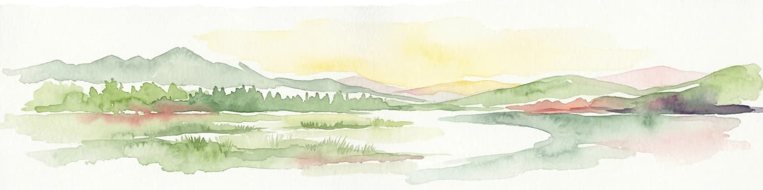
Top sights and standout views in Serra da Estrela Natural Park

The defining highlights of Serra da Estrela Natural Park combine exceptional natural features with cultural heritage that gives the landscape its distinctive character. The Torre at 1,993 meters provides the highest point in Continental Portugal and offers panoramic views across the mountain range and beyond. The glacial valley of the Zêzere, with its dramatic horseshoe cliffs and hanging valleys, represents one of the most impressive glacial landscapes in Iberia. The 25 lagoas circuit through the park's high country showcases the chain of glacial lakes that dot the upper terrain. The traditional villages of Loriga and Alvoco, built on rocky spurs above terraced valleys, preserve architectural and cultural traditions dating to medieval times. The park contains Portugal's only ski resort, providing winter recreation opportunities unique in the country. The marked trail network of approximately 375 kilometers offers access to all parts of the park for hikers of varying abilities, while the interpretation center at Manteigas provides educational context for understanding the mountain's ecology and cultural history.

Mountain plateau at dawn with rocky terrain, sparse vegetation, and a river valley under a clear sky
Dawn view of Serra da Estrela plateau and river valley

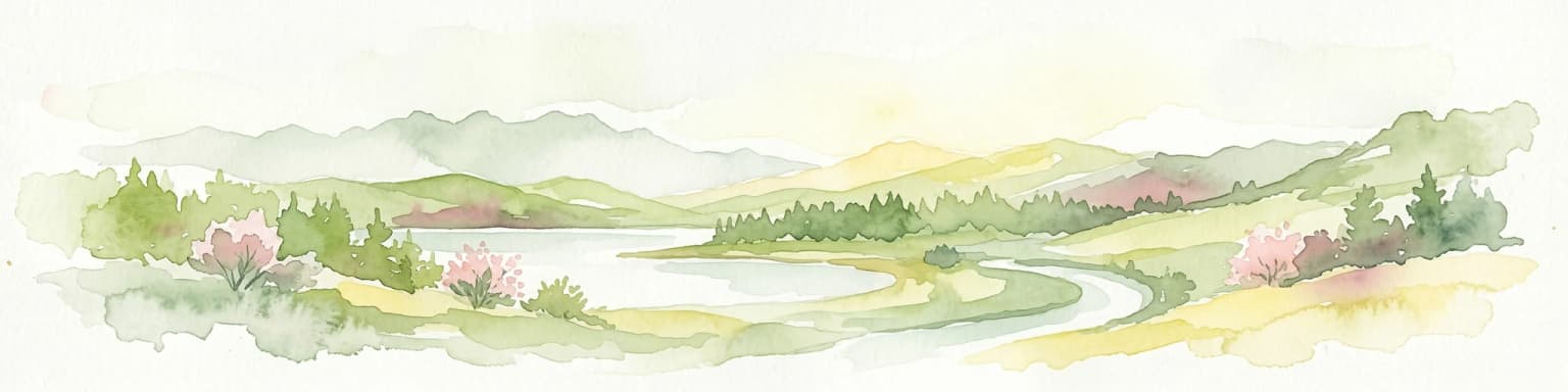
Best time to visit Serra da Estrela Natural Park

The best time to visit Serra da Estrela Natural Park depends on the experiences sought, as the mountain offers distinct seasonal characters. The summer months of July and August bring warm conditions ideal for hiking the high plateau and exploring the glacial valleys, though afternoon thunderstorms are common. This period coincides with the traditional transhumance as shepherd families move their flocks to the high pastures, offering opportunities to observe pastoral traditions. Autumn in September and October brings the first autumn colors to the oak forests and typically stable weather conditions. Winter transforms the landscape, with snow cover on the upper reaches creating the conditions for the ski resort's operation, though access to higher trails may be restricted. Spring in May and June sees wildflower displays in the meadows and the running of glacial streams at their peak flow. The shoulder seasons of spring and autumn generally offer the most pleasant conditions for hiking, while winter appeals to those seeking the unique experience of skiing in Portugal.

Park location guide

Geography guide, regional context, and park location map for Serra da Estrela Natural Park

Serra da Estrela Natural Park park geography, regions, and map view in Portugal
Understand where Serra da Estrela Natural Park sits in Portugal through a broader geographic reading of the surrounding landscape, nearby location context, and its mapped position within the national park landscape.

How Serra da Estrela Natural Park fits into Portugal

Portugal is a developed European country on the western Iberian Peninsula. It features a coastline along the Atlantic Ocean, includes the autonomous regions of the Azores and Madeira, and is known for its maritime history during the Age of Discovery. The country has a population of over 10.7 million and operates as a semi-presidential republic with Portuguese as its official language.

Wider geography shaping Serra da Estrela Natural Park in Portugal

Portugal occupies the western portion of the Iberian Peninsula in Southwestern Europe. The mainland borders Spain to the north and east, while the autonomous regions of Madeira and the Azores are situated in the Atlantic Ocean. The country includes Cabo da Roca, the westernmost point in continental Europe. The terrain varies from plains in the south to mountainous regions in the north.

Map view of Serra da Estrela Natural Park

Use this park location map to pinpoint Serra da Estrela Natural Park in Portugal, understand its exact geographic position, and read its mapped placement within the surrounding landscape more clearly.

Pigeon | © OpenStreetMap contributors

Location context for Serra da Estrela Natural Park

Central Region

Visually trace the dramatic glacial terrain, high-altitude habitats, and alpine character of Portugal's largest natural conservation area.

Serra da Estrela Natural Park Photos: Explore Mountain Landscapes, Glacial Scenery, and Unique Habitats
Explore comprehensive imagery revealing the majestic mountain landscapes, distinctive glacial formations, and diverse protected environments of Serra da Estrela Natural Park. These photographs provide essential visual context for understanding the park's alpine scenery, unique habitats, and the significant conservation value of this Portuguese highest peak region.

A serene lake reflecting tall trees with lush green foliage, surrounded by a forested area with a wooden bench in the background

Close-up of various mosses and lichens growing on rocky surface with different colors including red, green, and white

Mountain landscape with rocky formations, rolling green valleys, and distant hills under a clear sky

Mountain slope with yellow flowering plants, scattered trees, and a bright blue sky with clouds

Snow-covered mountain landscape with a single pine tree in the foreground, rocky peaks in the background, and a partly cloudy sky

Grassy field with scattered shrubs, rocky hills in the background under a blue sky with light clouds

A large, uniquely shaped rock formation with holes sits on a mountain peak with panoramic views of valleys and distant mountains.

Mountain plateau at dawn with rocky terrain, sparse vegetation, and a river valley under a clear sky

Snow-covered mountain road with yellow and black marker pole, winding through snow-covered hills under partly cloudy sky

Calm lake reflecting rocky hills and green vegetation under a clear sky

Wide view of a mountain village with white buildings and red roofs surrounded by green hills and rocky terrain

Large boulders scattered across a grassy hillside with purple wildflowers and a person sitting under an umbrella.

A large body of water surrounded by rocky hills and green vegetation under a partly cloudy sky

Abandoned stone building covered in ice and snow with missing windows and doors in a snowy mountain landscape

Park atlas

Trace the regional spread of protected areas; compare unique mountain, glacial, and pastoral landscapes surrounding Serra da Estrela Natural Park.

Continue Your Park Discovery: Explore National Parks Near Serra da Estrela Natural Park
Explore other national parks and protected areas near Serra da Estrela Natural Park, discovering a wider array of mountain ranges, glacial formations, and traditional pastoral landscapes. This geographic comparison provides valuable context for understanding regional conservation efforts and the varied protected-area geography beyond a single park.
Watercolor landscape illustration featuring mountains, forests, fields, and trees
Protected areaNorte Region

Alvão Natural Park: Protected Area Discovery and Regional Geographic Context

Explore its mapped boundaries and landscape within the Norte Region.

Alvão Natural Park is recognized as a protected area offering unique opportunities for geographic study and atlas exploration. This detail page provides an in-depth look at its protected landscape, mapping its precise boundaries and situating it within the diverse geography of Portugal's Norte Region. Understand the park's intrinsic value as a mapped natural area and discover its contribution to the regional conservation landscape.

Area
72.03 km²
Established
1983
IUCN
V
Visitors
29.6K annual
Watercolor illustration of a landscape with green hills, scattered trees, and distant mountains under a pink and yellow sky
Protected landscapePortalegre District

Serra de São Mamede Natural Park: A Protected Landscape Defined by Ecological Transition

Explore the unique mountain terrain and ecosystems of Portalegre District.

Delve into the geographic and ecological identity of Serra de São Mamede Natural Park, a significant protected landscape situated in Portugal's Portalegre District. This area is renowned for its dramatic quartzite ridges and its role as a crucial meeting point for Atlantic and Mediterranean plant communities, offering a unique atlas perspective on regional biodiversity. Examining its mapped boundaries and diverse terrain provides essential context for understanding its ecological importance and its distinct position within the Alentejo region's geography.

Area
560.6 km²
Established
1989
IUCN
V
Visitors
4.5K annual
National park

Monfragüe National Park: Protected Landscape Atlas of Spanish Raptor Colonies

Explore mapped terrain and regional geography within this Spanish National Park.

As a national park in Spain's Extremadura region, Monfragüe National Park offers a distinct protected landscape shaped by the Tagus River and dramatic limestone cliffs. It is globally recognized for its exceptional birdlife, especially its large griffon vulture colonies and populations of Spanish imperial eagles, making it a significant site for ecological study and atlas-based exploration of protected areas. The park's landscape, characterized by Mediterranean woodlands and rugged terrain, provides crucial habitat and a unique geographic context for understanding Iberian Peninsula conservation.

Scope
Terrestrial
Watercolor illustration of rolling green hills, a winding river, and a distant horizon with a soft sun
National parkExtremadura

Monfragüe National Park: Dramatic Cliffs, Raptor Haven, and Extremadura's Protected Landscape

Discover its mapped terrain and unique geography in Spain.

Monfragüe National Park, situated in Extremadura, Spain, offers a compelling study in protected landscape geography. The park's identity is shaped by its formidable cliffs and river valleys carved by the Tagus, providing critical nesting grounds for European raptors. This MoriAtlas entry details the park's mapped boundaries and its significance as a vital protected area within the region. Users can explore the specific natural terrain and regional context that establish Monfragüe as a unique protected territory.

Area
179 km²
Established
2007
IUCN
II
Visitors
331.8K annual
Watercolor illustration of a landscape with rolling hills, a body of water, and vegetation
Protected landscapePortugal

Aire and Candeeiros Ranges Natural Park: Protected Landscape and Regional Geographic Context

Explore the mapped boundaries and natural landscape of this Portuguese protected area.

Understand the Aire and Candeeiros Ranges Natural Park as a key protected landscape in Portugal. This page offers detailed geographic information, focusing on the park's mapped boundaries and its intrinsic connection to the surrounding regional geography. It serves as a portal for atlas exploration, providing structured data for users interested in the specific protected area and its landscape characteristics within the Iberian Peninsula.

Area
383.93 km²
Established
1979
IUCN
V
Visitors
31.9K annual
National park

Peneda-Gerês National Park: A Distinct Protected Landscape in Northern Portugal

Granite peaks, glacial valleys, and cultural heritage mapped.

Peneda-Gerês National Park represents a cornerstone of protected landscapes in Portugal, celebrated for its rugged granite mountains and deep glacial valleys sculpted over millennia. This national park showcases a rare ecological transition zone with unique endemic species and features dramatic waterfalls and pristine river systems. The park's rich cultural tapestry, interwoven with its natural environment, offers a compelling subject for atlas-based geographic discovery and landscape exploration.

Area
695.93 km²
Established
1971
IUCN
II
Visitors
92.8K annual
Protected landscapeEsposende

Northern Littoral Natural Park Protected Landscape: Geographic Discovery and Atlas Context

Mapped protected areas and regional landscape discovery near Esposende.

Uncover the geographic identity of Northern Littoral Natural Park, a key protected landscape situated near Esposende. This MoriAtlas entry focuses on its mapped boundaries and regional significance, providing a factual basis for understanding its role within Portugal's network of protected areas. Explore the park's natural terrain and its context within the broader geography of the Norte region for comprehensive atlas-based discovery.

Area
87.62 km²
Established
1987
IUCN
V
Relief
Lowland
Protected landscapeBragança District

Montesinho Natural Park: Protected Landscape in Bragança District, Portugal

Explore mapped boundaries and regional landscape context.

Montesinho Natural Park is designated as a protected landscape in northeastern Portugal, located within the administrative region of Bragança District. This page serves as an entry point to understanding the park's protected area characteristics, its mapped geographic footprint, and its role in the broader natural landscape of the Trás-os-Montes region. Discover the atlas value of this significant protected territory and its relation to surrounding geography.

Area
742.25 km²
Established
1979
IUCN
V
Relief
Mountain

Common questions about visiting, size, designation, and location context for Serra da Estrela Natural Park

Serra da Estrela Natural Park FAQs for park facts, access, geography, and protected area context
Find quick answers about Serra da Estrela Natural Park, including protected-area facts, park geography, trail and visitor context, and how the park fits into its surrounding country and regional landscape.
MoriAtlas Explorer

Continue Your Protected Areas Search Across the Global Atlas

Deepen your exploration by continuing the structured search for national parks and protected areas worldwide. Utilize the comprehensive filtering capabilities to compare different conservation landscapes and refine your understanding of global park geography. Discover more about the distribution and characteristics of protected natural areas.

Global natural geography