Mori Atlas logo
National parkShorsky National Park

Explore the protected landscape and mapped boundaries of Shorsky National Park.

Shorsky National Park: National Park in Tashtagolsky District, Southern Siberia

(Шорский национальный парк (Shorsky National Park))

Shorsky National Park represents a significant protected area within the Tashtagolsky District of Russia's Kemerovo Oblast. Situated in Southern Siberia, this national park offers a unique perspective on the region's natural geography and mapped landscapes. MoriAtlas provides detailed geographic context for Shorsky National Park, enabling users to understand its protected area status and its place within the broader atlas of Russian natural reserves.

Dark taiga forestsKarst landscapeSiberian mountainsShor indigenous cultureProtected wildernessCave systems

Shorsky National Park

National park

Park overview

Structured park overview, official facts, and landscape profile for Shorsky National Park

Shorsky National Park park facts, protected area profile, and essential visitor context
Review the core facts for Shorsky National Park, including designation, size, terrain, visitor scale, habitats, and operating context in one park-focused overview.

About Shorsky National Park

Shorsky National Park occupies a distinctive ecological position at the interface between the West Siberian Plain and the South Siberian Mountains in southwestern Siberia. The park's territory consists primarily of medium-sized mountains with elevations averaging 500 to 800 meters above sea level, rising to a maximum of 1,555 meters at Kubez Mountain. Deep river valleys dissect the mountainous terrain, creating a diverse landscape of forested slopes, rock outcrops, and river corridors. The Mrassu River, whose name translates from the Shor language as 'Siberian Pine River,' serves as the principal watercourse traversing the park from north to south. The western boundary of the park touches a spur of the higher Altai Mountains, while the Abakan Range rises along the eastern border. This positioning at a mountain crossroads contributes to the park's ecological diversity and its significance as a representative protected area of southern Siberian mountain forests.

Quick facts and research context for Shorsky National Park

Shorsky National Park occupies over 418,000 hectares in the Tashtagolsky District at the southern end of Kemerovo Oblast, approximately 300 kilometers south of Kemerovo city. The park stretches 110 kilometers north to south and 90 kilometers east to west, covering more than a third of the district. Ninety-two percent of the park is forested, primarily with dark taiga vegetation. The Mrassu River, meaning 'Siberian Pine River' in the Shor language, is the main watercourse flowing through the park from north to south. The park lies at the ecological crossroads between the Altai Mountains to the west and the Abakan Range to the east.

Park context

Deeper park guide and search-rich context for Shorsky National Park

Shorsky National Park history, landscape, wildlife, and travel context
Explore Shorsky National Park through its history, landscape character, ecosystems, wildlife, conservation priorities, cultural context, and seasonal travel timing in a structured park guide built for atlas discovery and search intent.

Why Shorsky National Park stands out

Shorsky National Park is best known for its extensive dark taiga forests, which cover 92 percent of the park and represent some of the most intact southern Siberian conifer woodland. The park is particularly renowned for its populations of sable, a commercially valuable marten species for which the area has long been known. The landscape features notable karst topography with over 60 named caves, including the Moonlight Cave with its 200-meter length and decorative stalactites and stalagmites. The park also preserves the cultural heritage of the Shor people, whose traditional homeland encompasses this mountainous forest region.

Shorsky National Park history and protected-area timeline

The Shorsky National Park was established on December 27, 1989, creating formal protection for a mountainous forest region that had long been associated with human activity. The indigenous Shor people have traditionally considered this area their ancestral homeland, maintaining settlements along the river banks that continue to exist within the park boundaries today. Historically, the Shor people developed expertise in iron smelting that earned them recognition throughout Russia, and they maintained cultural practices including traditional shamanism. Prior to the park's establishment, the region experienced active logging and mining industries that shaped the landscape. Following the creation of the protected area, commercial logging operations ceased, allowing the mature forest to regenerate. The park was formally designated and began functioning as a protected area in 1999.

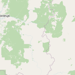
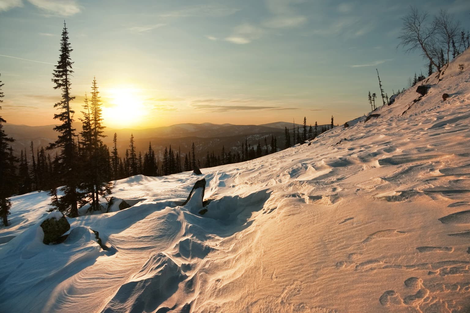
Shorsky National Park landscape and geographic character

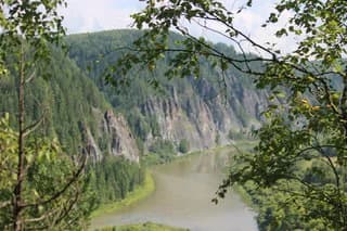
The topography of Shorsky National Park is characterized by mountainous terrain of medium elevation with deeply incised river valleys. The mountains typically range from 500 to 800 meters in height, with Kubez Mountain reaching the park's highest point at 1,555 meters above sea level. A notable geological feature of the park is its extensive karst landscape, where soluble limestone bedrock has created conditions for springs, caves, and unusual rock formations. The park contains over 60 named caves and rock formations of interest. Notable features include the Saga Waterfall, a multi-tier cascade dropping 15 meters to a pool and grotto, and the Tsar's Gate rocks, a large formation with a natural arch overlooking the Mrassu River. The Moonlight Cave extends 200 meters underground and features impressive stalactite and stalagmite formations, while the Azasskoy Cave boasts a large underground gallery.

Shorsky National Park ecosystems, habitats, and plant life

Shorsky National Park falls within the Sayan montane conifer forests ecoregion, representing a transitional zone between the higher Altai mountains and the lower Siberian plains. The park's vegetation consists predominantly of southern Siberian taiga, characterized by dark coniferous forests where Siberian pine and Siberian fir dominate as the most common tree species. Additional tree species include spruce, pine, and aspen, while willow populations occur along lowland floodplains. The biodiversity of plants within the park reflects its position as a forested transition zone, with records showing 51 species of trees and bushes, over 600 vascular plant species, approximately 300 moss species, and more than 200 mushroom species documented within the park boundaries.

Shorsky National Park wildlife and species highlights

The mammal population of Shorsky National Park includes 61 recorded species, with large mammals such as brown bear, red deer, roe deer, mink, and particularly sable being notable inhabitants. The park is especially known for its sable populations, a commercially valuable marten species that has historically been important to the region's economy. Other predatory mammals present include wolf, fox, wolverine, weasel, ermine, otter, badger, and lynx. The bird fauna comprises 183 species, while 14 species of fish inhabit the park's waters. Relatively few species associated with steppe and forest-steppe landscapes are found in the park, reflecting its position within the taiga forest zone.

Shorsky National Park conservation status and protection priorities

Shorsky National Park functions as a Category II protected area under the IUCN classification system, providing formal protection for representative examples of southern Siberian mountain and taiga ecosystems. The park conserves an extensive tract of dark taiga forest that has been allowed to regenerate following the cessation of commercial logging after park establishment. Its karst landscape with numerous caves and geological formations represents a distinct habitat type requiring protection. The park also preserves habitat for significant wildlife populations including sable, brown bear, and ungulate species, maintaining ecological connectivity in a region where natural landscapes have been altered by human activity.

Shorsky National Park cultural meaning and human context

Shorsky National Park encompasses the ancestral homeland of the Shor people, an indigenous Turkic-speaking group whose traditional territories extend across this mountainous forest region of southern Siberia. The Shor have historically been known throughout Russia for their skilled iron-smelting practices, a craft that developed due to the region's mineral resources. Traditional shamanic practices also formed an important part of Shor cultural identity. Today, small Shor villages continue to exist along the river banks within the park boundaries, maintaining connections to this ancestral landscape. The park's name itself derives from the Shor people, reflecting their deep historical association with this territory.

Top sights and standout views in Shorsky National Park

The park offers exceptional opportunities for exploration of karst landscapes with over 60 caves including the notable Moonlight Cave and Azasskoy Cave. The Saga Waterfall provides a scenic cascade dropping 15 meters to a natural grotto, while the Tsar's Gate rocks present a dramatic natural arch formation overlooking the Mrassu River. Visitors can experience the dark taiga forest on hiking or horseback riding routes through mountainous terrain, with the opportunity to observe wildlife including sable, brown bear, and red deer. The cultural heritage of the Shor people adds historical depth to the park experience, with traditional villages accessible along the river valleys.

Best time to visit Shorsky National Park

The park experiences a humid continental climate with warm summers and cold, snowy winters, featuring significant temperature variations both diurnally and seasonally. Summer months offer the most comfortable conditions for outdoor activities including hiking, horseback riding, and caving, with average rainfall of 950 millimeters annually distributed throughout the year. Winter visits allow for snow-based activities and winter wildlife viewing, though the cold temperatures require appropriate preparation. The park maintains visitor facilities including three wooden shelters accessible throughout all seasons.

Park location guide

Geography guide, regional context, and park location map for Shorsky National Park

Shorsky National Park park geography, regions, and map view in Russia
Understand where Shorsky National Park sits in Russia through a broader geographic reading of the surrounding landscape, nearby location context, and its mapped position within the national park landscape.

How Shorsky National Park fits into Russia

Russia is a transcontinental nation spanning eleven time zones, bordered by fourteen countries. It is the world's largest country by area, covering 17,098,246 km². Moscow is the capital and largest city, while Saint Petersburg is the second-largest and a major cultural centre.

Wider geography shaping Shorsky National Park in Russia

Russia spans Eastern Europe and North Asia, covering 17,098,246 km². It shares land borders with fourteen countries, more than any other nation, and spans eleven time zones. The landscape includes vast plains, mountain ranges such as the Urals and Caucasus, and extensive coastlines along the Arctic Ocean, Pacific Ocean, Baltic Sea, Black Sea, and Caspian Sea.

Map view of Shorsky National Park

Use this park location map to pinpoint Shorsky National Park in Russia, understand its exact geographic position, and read its mapped placement within the surrounding landscape more clearly.

Pigeon | © OpenStreetMap contributors

Location context for Shorsky National Park

Kemerovo OblastTashtagolsky District
Park atlas

Compare Shorsky National Park with surrounding protected areas, tracing regional conservation landscapes and mountainous forest ecosystems across Siberia.

Explore Related Protected Areas and National Parks Near Shorsky National Park, Siberia
Expand your exploration beyond Shorsky National Park by browsing other national parks and protected areas across Southern Siberia. Comparing protected landscapes in this region reveals interconnected dark taiga forests, karst topography, and mountain river valleys, offering a broader atlas perspective on Siberian conservation.
Watercolor painting showing a river flowing through a forested area with distant hills, using soft green, blue, and yellow tones
National parkAltai Krai

Salair National Park: Mapped Protected Landscape and Geographic Features in Altai Krai

Discover the unique dark taiga terrain and relict flora.

Salair National Park is a significant protected area in Altai Krai, Russia, renowned for its exceptionally biodiverse dark taiga forests, often called the "rainforest of Siberia." Established in 2020, the park spans the western slopes of the Salair Ridge, covering about 161,000 hectares of gentle low mountain terrain. Its landscape is characterized by rounded mountains, a network of ravines, and the preservation of pre-glacial relict plant species. This national park offers a vital contrast to the surrounding agricultural areas, highlighting its role in conserving unique Siberian forest ecosystems and their historic flora.

Area
1,612 km²
Established
2020
IUCN
II
Relief
Upland
Watercolor painting of green trees, rolling hills, a pink and yellow sunset sky, and a single tree on the right
National parkKrasnoyarsk Krai

Shushensky Bor National Park: Mapped Geography of a Siberian Protected Forest

Explore the protected landscape and regional context of Krasnoyarsk Krai.

Shushensky Bor National Park serves as a critical protected area within the vast geography of Krasnoyarsk Krai, Russia, offering detailed insights into Siberia's ecological transition zones. This national park meticulously maps the shift from the Minusinsk basin forest-steppe to the dramatic mountain taiga of the Western Sayan range. Users can explore its varied terrain, from gentler northern steppe-influenced lands to the rugged slopes of the Borus Massive, all within a defined protected landscape. The proximity to the Sayano-Shushenskoye Reservoir further defines its unique geographic setting, providing context for its conservation importance and natural beauty.

Area
392 km²
Established
1995
IUCN
II
Relief
Mountain
National parkAltai Republic

Saylyugemsky National Park: Discover its Protected Landscape and Geographic Significance in Altai Republic

Mapped boundaries and regional landscape context within the Altai Republic.

Delve into Saylyugemsky National Park, a designated national park situated within the vast geographic expanse of Russia's Altai Republic. This canonical page provides detailed insights into its protected landscape, meticulously mapped boundaries, and its contribution to the regional geography. MoriAtlas focuses on structured geographic discovery, enabling a deeper understanding of Saylyugemsky National Park's place within the atlas of protected areas and natural landscapes.

Area
1,183.8 km²
Established
2012
IUCN
II
Relief
Mountain
National parkEast Kazakhstan Region

Katon-Karagay National Park: Discover Kazakhstan's Largest Protected Mountain Landscape

Explore the geography and park boundaries of East Kazakhstan's premier national park.

Katon-Karagay National Park, the largest national park in Kazakhstan, offers a deep dive into the protected landscapes of the Southern Altai Mountains. This page provides essential geographic context, detailing the park's terrain, its significance as a protected area within East Kazakhstan Region, and its role in mapping the natural contours of this ecologically diverse mountain system. Understand the park's boundaries and its contribution to regional conservation.

Area
6,435 km²
Established
2001
IUCN
II
Relief
Mountain
National parkKrasnoyarsk Krai

Krasnoyarsk Pillars National Park: Geographic Atlas and Protected Landscape Exploration

Discover mapped terrain and regional park context in Siberia.

This detailed entry for Krasnoyarsk Pillars National Park offers an in-depth look at its identity as a protected landscape within Krasnoyarsk Krai. It provides structured geographic information, focusing on mapped boundaries and the park's position within the vast Siberian terrain. Users can leverage this data for atlas exploration, gaining a clear understanding of the park's physical dimensions and its role in the regional geography of Russia. Explore the unique landscape character and mapped context of this significant national park.

Area
471.54 km²
Established
2019
IUCN
II
Visitors
200K annual
National parkEast Kazakhstan Region

Tarbagatai National Park: Protected Landscape and Wild Fruit Tree Forests in East Kazakhstan Region

Explore the mapped boundaries and ecosystem of this national park.

Tarbagatai National Park is a protected area in East Kazakhstan recognized for its unique role in conserving wild fruit tree forests that have maintained genetic isolation. This national park provides a detailed view of a mountain-steppe ecosystem across the Tarbagatai mountain range, Karabas Mountains, and Arkaly Mountains, along with the Urzhar and Emel river valleys. Its establishment in 2018 highlights its importance for biodiversity and the study of natural forest genetics, offering significant geographic context for regional protected land exploration.

Area
1,364 km²
Established
2018
IUCN
II
Relief
Mountain
National parkKazakhstan

Bayanaul National Park: Kazakhstan's First National Park Mapped Landscape

Explore granite mountains, unique lakes, and striking rock formations.

Bayanaul National Park, situated in Kazakhstan's Pavlodar Province, represents a significant protected area renowned for its extraordinary granite mountain landscape. Established as the country's first national park, it showcases unique erosion-shaped rock formations, diverse vegetation including rare pines, and four significant freshwater lakes. This park offers a distinct visual tapestry of mountainous terrain and geological wonders within the broader Central Asian geography, making it a key destination for atlas-based discovery.

Area
684.53 km²
Established
1985
IUCN
II
National parkBuryatia

Tunkinsky National Park National Park: Protected Landscape and Geographic Context in Buryatia

Discover mapped park boundaries and regional terrain.

Delve into Tunkinsky National Park, a significant protected national park situated in the Buryatia region of Russia. This detail page provides a geographic overview, highlighting the park's mapped boundaries and its place within the surrounding natural landscape. Understand its designation as a protected area, offering a focused entry point for atlas-based discovery of its specific terrain and regional importance.

Area
11,837 km²
IUCN
II
Relief
Mountain
Climate
Boreal

Common questions about visiting, size, designation, and location context for Shorsky National Park

Shorsky National Park FAQs for park facts, access, geography, and protected area context
Find quick answers about Shorsky National Park, including protected-area facts, park geography, trail and visitor context, and how the park fits into its surrounding country and regional landscape.
MoriAtlas Explorer

Continue Your Protected Areas Search Across the Global Atlas

Deepen your exploration by continuing the structured search for national parks and protected areas worldwide. Utilize the comprehensive filtering capabilities to compare different conservation landscapes and refine your understanding of global park geography. Discover more about the distribution and characteristics of protected natural areas.

Global natural geography