Mori Atlas logo
National parkSierra Nevada National Park

Discover the dramatic glaciated terrain, endemic biodiversity, and regional geography of Andalusia's premier national park.

Sierra Nevada National Park: Spain's Highest Alpine Protected Landscape and Geographic Atlas Entry

(Parque Nacional de Sierra Nevada)

Sierra Nevada National Park, located in Andalusia, Spain, represents a monumental alpine protected landscape and a key entry in the geographic atlas. This national park safeguards the highest mountain range on mainland Spain, featuring dramatic terrain shaped by ancient glacial activity, including U-shaped valleys and nearly fifty high-altitude lakes. Its unique position at the southernmost edge of continental Europe fosters an extraordinary concentration of endemic plant species and provides critical habitat for wildlife, all mapped within its protected boundaries for detailed discovery.

Alpine EnvironmentsMountain ParksEndemic SpeciesGlacial LakesBiosphere ReserveMediterranean Mountains

Sierra Nevada National Park

National park

Park overview

Structured park overview, official facts, and landscape profile for Sierra Nevada National Park

Sierra Nevada National Park park facts, protected area profile, and essential visitor context
Review the core facts for Sierra Nevada National Park, including designation, size, terrain, visitor scale, habitats, and operating context in one park-focused overview.

About Sierra Nevada National Park

Sierra Nevada National Park occupies a remarkable position at the southern extreme of Europe's alpine systems, representing both the highest terrain in mainland Spain and one of the continent's most biologically significant mountain ecosystems. The park stretches from the Alpujarra region through El Marquesado to the Lecrín Valley, encompassing an extraordinary altitudinal range that descends from the icy summits above 3,400 meters down to Mediterranean landscapes below 1,000 meters. This vertical gradient creates a succession of distinct ecological zones, from rocky alpine scree and permanent snow fields through subalpine meadows and pine forests to Mediterranean scrub and cultivated terraces. The park's establishment in 1999 recognized not only the outstanding natural values of this landscape but also the cultural heritage of the mountain villages scattered throughout its territory. Over sixty municipalities lie partially within or adjacent to the park boundary, their traditional villages and agricultural terraces forming an integral part of the Sierra Nevada cultural landscape. The protection framework extends beyond the national park proper to include the surrounding natural park, creating a comprehensive conservation area of nearly 172,000 hectares that maintains ecological connectivity between high mountain habitats and lower-lying ecosystems.

Quick facts and research context for Sierra Nevada National Park

Sierra Nevada National Park covers 85,883 hectares in southern Spain, making it the largest national park in the country. The mountain range contains mainland Spain's three highest peaks: Mulhacén (3,479m), Veleta (3,396m), and Alcazaba (3,371m). The park is叠加ly protected as both a national park and natural park, with additional designation as a Biosphere Reserve and EU Natura 2000 site (ZEPA and ZEC). It incorporates over sixty municipalities across the Alpujarra and Lecrín Valley regions. The Sierra Nevada Ski Station at Pradollano represents Europe's southernmost ski resort, operating from late November through early May.

Park context

Deeper park guide and search-rich context for Sierra Nevada National Park

Sierra Nevada National Park history, landscape, wildlife, and travel context
Explore Sierra Nevada National Park through its history, landscape character, ecosystems, wildlife, conservation priorities, cultural context, and seasonal travel timing in a structured park guide built for atlas discovery and search intent.

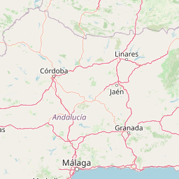
Why Sierra Nevada National Park stands out

Sierra Nevada is best known for its extraordinary endemic biodiversity, hosting over sixty plant species found nowhere else on Earth. The Snow Star (Plantago nivalis) stands as the most emblematic flower of these mountains, carpeting alpine meadows during the summer months. The park protects significant populations of Spanish ibex, a species that thrives on the steep rocky terrain. Its position as Europe's southernmost high mountain range creates a unique combination of Mediterranean and Alpine ecological characteristics, with species that survived glaciations in these southern refugia. The dramatic glaciated landscape, with its U-shaped valleys and glacial lakes, contrasts sharply with the Mediterranean climate of the surrounding lowlands.

Sierra Nevada National Park history and protected-area timeline

Sierra Nevada's protected area status evolved through two distinct phases. The Sierra Nevada Natural Park was established in 1989 through Andalusian regional legislation (Law 2/89), recognizing the need to protect the mountain range's exceptional natural values. This initial designation reflected growing awareness of the region's ecological significance, particularly its unique biodiversity and the threats posed by development pressures, particularly from the expanding ski resort infrastructure. Following this initial protection, the national park designation came in 1999 (Law 3/99), elevating the site's protection status and placing it within Spain's premier category of protected areas. The national park declaration responded to the exceptional concentrations of endemic species and the urgent need to safeguard these vulnerable populations. Subsequent recognition as a Biosphere Reserve under UNESCO's Man and the Biosphere Programme further reinforced the international significance of the Sierra Nevada's conservation values, while the designation of ZEPA (Special Protection Area for Birds) and ZEC (Special Conservation Area) under European Union nature legislation integrated the site into the Natura 2000 network. As of 2024, discussions continue regarding expansion of the Biosphere Reserve's buffer zone in response to UNESCO guidance.

Sierra Nevada National Park landscape and geographic character

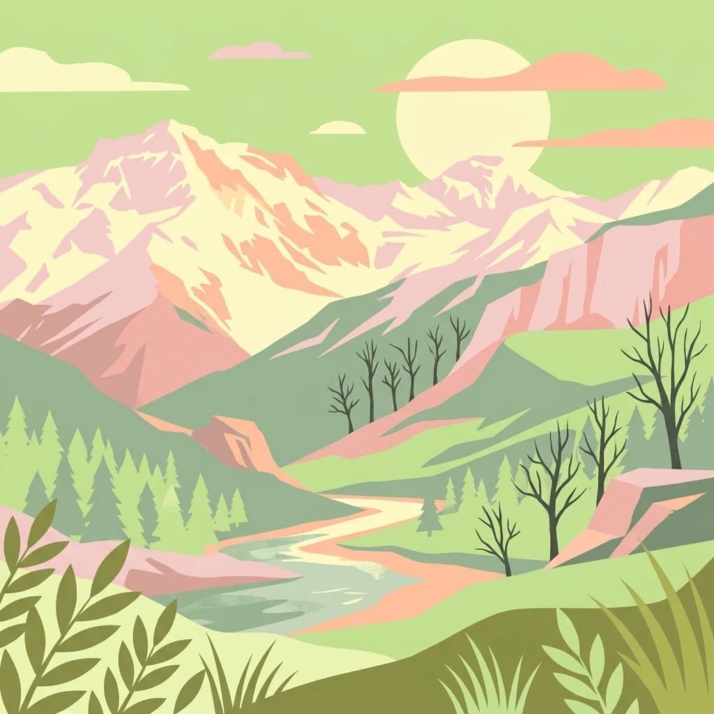
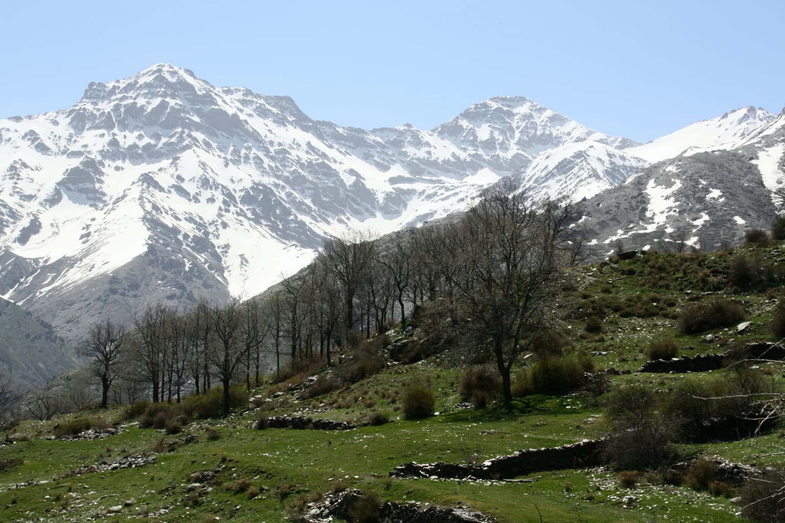
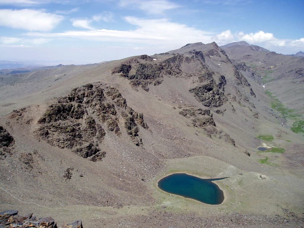
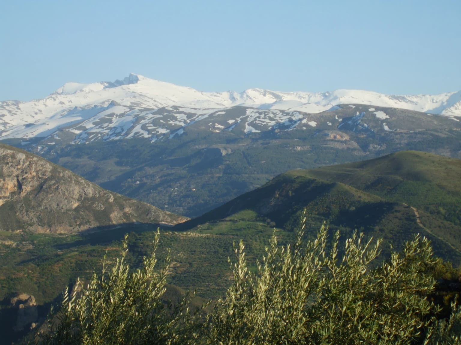
The Sierra Nevada presents a dramatic mountain landscape sculpted by glacial processes during the Quaternary period. Above approximately 2,400 meters, the terrain displays classic glacial morphology including U-shaped valleys carved by ice sheets, terminal and lateral moraines, and the characteristic steep-walled valleys that distinguish this range. The permanent snow line, which historically remained above 2,400 meters prior to the Holocene, has retreated significantly, though snow persists in sheltered gullies and on north-facing slopes throughout summer. Nearly fifty high-altitude lakes, known locally as lagunas, dot the landscape, many serving as the sources for the streams and rivers that cascade down the mountain flanks. The three highest peaks—Mulhacén, Veleta, and Alcazaba—form an imposing skyline visible from the Mediterranean coast, their stark granite ridgelines contrasting with the gentler slopes below. On the southern and western faces, the terrain descends through increasingly complex topography into the deeply incised valleys of the Alpujarra, where village perch on terraces and the landscape maintains its traditional agricultural character. Rivers originating on the north face flow into the Guadalquivir system, while those on the western and southern slopes drain directly to the Mediterranean.

Sierra Nevada National Park ecosystems, habitats, and plant life

The Sierra Nevada functions as a critical biodiversity refuge at the southern edge of Europe, where its isolated position and complex topography have produced extraordinary levels of endemism. The mountain range's significance stems from its role as a glacial refugium during the Pleistocene, when species from colder northern regions migrated south to escape advancing ice sheets. As climatic conditions warmed, these species survived by moving upslope, creating isolated populations that evolved in isolation over thousands of years. This historical process has resulted in approximately sixty endemic plant species found nowhere else on Earth, representing an extraordinary concentration for a relatively limited geographic area. The flora includes the iconic Snow Star (Plantago nivalis), which blooms on snow-melt fields during early summer, and Artemisia granatensis, a critically threatened member of the daisy family. The park's vegetation follows a clear altitudinal zonation: holm oak and kermes oak woodlands dominate the lower slopes, giving way to dense pine forests of Aleppo and maritime pine at middle elevations, then to subalpine shrubland and finally to alpine meadows above the tree line. The botanical research facilities at the Cortijuela Botanic Garden and Hoya de Pedraza Botanical Center, both operated by the Junta de Andalucía, play critical roles in studying and preserving these unique species.

Sierra Nevada National Park wildlife and species highlights

The Sierra Nevada supports a diverse fauna community adapted to the range's extreme environmental conditions. The Spanish ibex represents the park's most visible large mammal, with thriving populations navigating the steep rocky terrain with remarkable agility. Wild boar roam the forests and clearings, while the elusive European wildcat and marten occupy the denser woodland habitats. Badgers are widespread throughout the park, and the nocturnal European otter may be found along watercourses in the lower elevations. The bird community includes significant populations of raptors, with Golden Eagles and Bonelli's Eagles nesting on the cliff faces and hunting the open slopes. The Common Kestrel and Little Owl occupy more varied habitats, while the nocturnal Eurasian Eagle-owl occupies rocky outcrops. Smaller birds including the European Goldfinch, Serin, Ortolan Bunting, Dartford Warbler, and Wheatear populate the scrub and meadow habitats, with the Red-legged Partridge and Common Quail common in the lower agricultural zones. This avifauna is particularly significant given the park's position as a migration corridor and the presence of species at the southern edge of their European ranges.

Sierra Nevada National Park conservation status and protection priorities

Sierra Nevada's conservation significance is recognized through multiple overlapping protection frameworks at national, European, and international levels. The dual designation as both national park and natural park creates a zoned approach to protection, with the core national park area receiving the highest level of protection while the surrounding natural park permits carefully regulated uses compatible with conservation objectives. The EU Natura 2000 network designation includes both Special Protection Area (ZEPA) status for birds and Special Conservation Area (ZEC) status, requiring maintenance of favorable conservation status for key species and habitats. The Biosphere Reserve designation under UNESCO's Man and the Biosphere Programme acknowledges the region's combination of high biodiversity values and ongoing human presence, requiring balance between conservation and sustainable development. The park's participation in the GLORIA international research network, which monitors alpine flora response to climate change, reflects its scientific importance as a sentinel site for understanding climate impacts on Mediterranean mountain ecosystems.

Sierra Nevada National Park cultural meaning and human context

The Sierra Nevada has been inhabited for millennia, with archaeological evidence of human presence dating to prehistoric times. The most distinctive cultural element of the region is the Alpujarra, a traditional mountain territory characterized by its picturesque white villages clinging to steep slopes, intricate terrace agriculture, and distinctive regional identity. These villages—many of which fall within or adjacent to the park—maintain traditional building styles using local stone and wood, and the agricultural landscape of terraced fields and irrigation channels reflects centuries of adaptation to the mountainous terrain. The region was historically populated by Moriscos (Morish descendants) following the Reconquista, and this heritage is still visible in the architecture and place names of many villages. Traditional transhumance practices, though greatly reduced, once involved seasonal movement of livestock between high and low pastures, a practice that shaped both the cultural landscape and the ecological relationships between different elevations.

Top sights and standout views in Sierra Nevada National Park

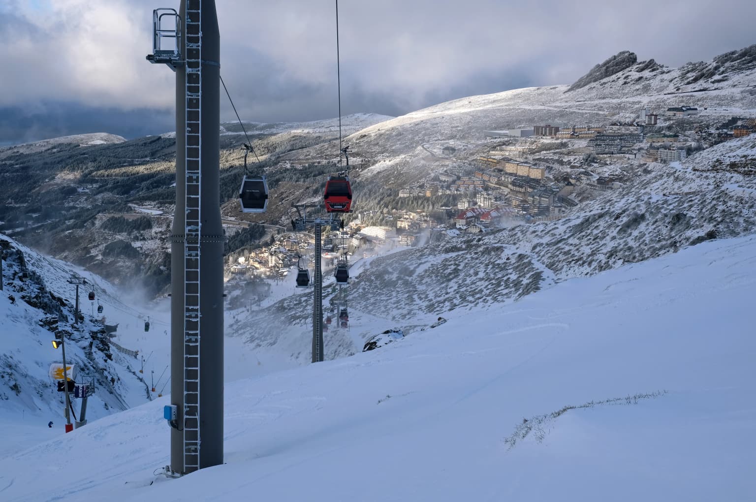
Sierra Nevada combines Spain's highest alpine terrain with extraordinary biodiversity concentrated in a latitude that places it at Europe's southernmost extreme for high mountain ecosystems. The range supports over sixty endemic plant species, remarkable for a mountain of this size, including the iconic Snow Star that colors alpine meadows in summer. The glaciated landscape features nearly fifty glacial lakes and classic U-shaped valleys sculpted during the Pleistocene. The Spanish ibex population thrives on the steep terrain, representing one of the best places to observe this distinctive species. The Sierra Nevada Ski Station at Pradollano offers Europe's southernmost ski experience, while the extensive network of mountain refugios enables hikers to explore the high terrain. The region's cultural heritage, particularly the Alpujarra villages with their traditional architecture and agricultural terraces, adds depth to the natural landscape.

Best time to visit Sierra Nevada National Park

The Sierra Nevada offers distinct visiting experiences across seasons, each with particular attractions and considerations. Summer (June through September) brings the most reliable access to high mountain trails, with wildflower displays at their peak in July and August. The alpine meadows burst into color as the Snow Star and other endemic flowers bloom, while wildlife is more active at higher elevations as the snow retreats. This period coincides with the ski station's closure, allowing hiking access to trails that cross ski runs and infrastructure. Spring (April through May) offers a transitional experience as snow thaws and water flows increase in streams and waterfalls, though some high-altitude routes remain snowbound. Autumn brings quieter trails and the opportunity to observe autumn colors in the pine forests, along with clear visibility after summer's thermal patterns settle. Winter transforms the experience dramatically, with the ski season running from late November through early May, though high-altitude hiking becomes impossible without specialized equipment and trail access is restricted around the ski infrastructure.

Park location guide

Geography guide, regional context, and park location map for Sierra Nevada National Park

Sierra Nevada National Park park geography, regions, and map view in Spain
Understand where Sierra Nevada National Park sits in Spain through a broader geographic reading of the surrounding landscape, nearby location context, and its mapped position within the national park landscape.

How Sierra Nevada National Park fits into Spain

Spain, officially the Kingdom of Spain, is a unitary parliamentary constitutional monarchy located in Southern and Western Europe. The country occupies most of the Iberian Peninsula and includes territories in the Mediterranean and Atlantic. With a population of approximately 49.6 million and an area of 506,030 km², Spain is a major European economy and cultural force. Its capital is Madrid, and the country is known for its diverse landscapes ranging from mountainous regions to coastal areas.

Wider geography shaping Sierra Nevada National Park in Spain

Spain occupies the Iberian Peninsula in Southern and Western Europe. Peninsular Spain is bordered to the north by France, Andorra, and the Bay of Biscay; to the east and south by the Mediterranean Sea and Gibraltar; and to the west by Portugal and the Atlantic Ocean. The territory includes the Canary Islands in the Atlantic Ocean, the Balearic Islands in the Mediterranean Sea, and the autonomous cities of Ceuta and Melilla in mainland Africa. Spain features diverse terrain including the Pyrenees in the northeast, the Sierra Nevada in the south, and the Meseta Central plateau.

Map view of Sierra Nevada National Park

Use this park location map to pinpoint Sierra Nevada National Park in Spain, understand its exact geographic position, and read its mapped placement within the surrounding landscape more clearly.

Pigeon | © OpenStreetMap contributors

Location context for Sierra Nevada National Park

AlmeríaAndalusiaGranada
Park atlas

Explore connected landscapes and compare protected areas across the dramatic high-mountain geography of Southern Spain.

Discover More Parks and Protected Areas Near Sierra Nevada National Park, Spain's Alpine Heart
Broaden your geographic exploration from Sierra Nevada National Park by discovering other high-altitude protected areas and unique Mediterranean-Alpine landscapes across Spain's southern region. Compare distinct glacial features, trace how surrounding conservation landscapes connect, and deepen your understanding of regional park geography through an atlas-style view.
National park

Sierra de las Nieves National Park: Ancient Fir Forests and Karst Geography in Andalusia

Mapped protected landscape and unique geologic features

Sierra de las Nieves National Park stands as a remarkable protected area in Andalusia, Spain, celebrated for its world-leading Spanish fir forests and intricate karst topography. This national park showcases significant geological diversity, from towering limestone formations and deep caves to the striking red peridotite mountains of Sierra Bermeja. Its elevation, reaching Pico Torrecilla at 1,919 meters, offers a unique alpine landscape context within southern Europe, mapped for detailed geographic discovery and protected area exploration.

Area
939.3 km²
Established
1989
IUCN
II
Visitors
100K annual
Watercolor illustration showing a wetland landscape with grasses, a body of water, and distant hills
National park

Tablas de Daimiel National Park: Spain's Inland Wetland National Park and Protected Area

Explore mapped boundaries and regional geographic context.

Tablas de Daimiel National Park represents one of the last remaining examples of floodplain wetland systems in Spain's interior. Located in Castilla-La Mancha, this protected area showcases a unique confluence of fresh and brackish waters, supporting a rich mosaic of emergent vegetation and serving as a critical habitat for migratory birds. Use MoriAtlas to explore its precise geographic setting, mapped terrain, and its role as a vital conservation landscape within the Iberian Peninsula.

Area
30.3 km²
Established
1973
IUCN
II
Relief
Lowland
Watercolor painting showing green fields, scattered trees, and distant mountains under a light sky
National parkToledo Province

Cabañeros National Park: Spain's Premier Iberian Oak Woodland Protected Landscape

Mapped Geography of Montes de Toledo Protected Area

Cabañeros National Park is celebrated as the most extensive and well-conserved example of Iberian Mediterranean forest in Spain. Situated within the Montes de Toledo, the park features a remarkable dichotomy between its unique raña flatlands and mountainous sierras, harboring ancient oak woodlands and significant biodiversity. This national park serves as a crucial component of the region's geographic context and a prime destination for atlas-based discovery of protected landscapes.

Area
409 km²
Established
1995
IUCN
II
Visitors
104.6K annual
National parkHuelva

Doñana National Park National Park: Mapped Geography and Protected Landscape Context

Explore Huelva's key protected area and its regional geographic setting.

Delve into the structured geographic data and mapped boundaries of Doñana National Park. This entry highlights its identity as a national park within the Huelva region, providing essential context for understanding its protected landscape. MoriAtlas offers this detail to facilitate a clear, atlas-driven exploration of its natural terrain and its place in the broader geographic framework of Spain.

Area
543 km²
Established
1969
IUCN
II
Visitors
376.3K annual
National park

Monfragüe National Park: Protected Landscape Atlas of Spanish Raptor Colonies

Explore mapped terrain and regional geography within this Spanish National Park.

As a national park in Spain's Extremadura region, Monfragüe National Park offers a distinct protected landscape shaped by the Tagus River and dramatic limestone cliffs. It is globally recognized for its exceptional birdlife, especially its large griffon vulture colonies and populations of Spanish imperial eagles, making it a significant site for ecological study and atlas-based exploration of protected areas. The park's landscape, characterized by Mediterranean woodlands and rugged terrain, provides crucial habitat and a unique geographic context for understanding Iberian Peninsula conservation.

Scope
Terrestrial
Watercolor illustration of rolling green hills, a winding river, and a distant horizon with a soft sun
National parkExtremadura

Monfragüe National Park: Dramatic Cliffs, Raptor Haven, and Extremadura's Protected Landscape

Discover its mapped terrain and unique geography in Spain.

Monfragüe National Park, situated in Extremadura, Spain, offers a compelling study in protected landscape geography. The park's identity is shaped by its formidable cliffs and river valleys carved by the Tagus, providing critical nesting grounds for European raptors. This MoriAtlas entry details the park's mapped boundaries and its significance as a vital protected area within the region. Users can explore the specific natural terrain and regional context that establish Monfragüe as a unique protected territory.

Area
179 km²
Established
2007
IUCN
II
Visitors
331.8K annual
Watercolor illustration showing a river flowing through a valley with hills and vegetation
Protected landscapeBeja District

Guadiana Valley Natural Park: Protected Landscape Discovery in Beja District

Explore its mapped geography and protected land context.

Guadiana Valley Natural Park is identified as a protected landscape, providing a specific focus for geographic study and map-based exploration. This entry details the park's unique protected-area status and its contextual placement within the expansive Beja District of southern Portugal. Understand the mapped boundaries and landscape features that define this area, serving as a key point for regional geographic understanding on MoriAtlas.

Area
697 km²
Established
1995
IUCN
V
Visitors
749 annual
Watercolor illustration depicting a mountain range, river, and green vegetation under a light sky
National park

Sierra de Guadarrama National Park: Protected Area Landscape and Geographic Context

Explore diverse high Mediterranean mountain terrain and ecosystems.

Sierra de Guadarrama National Park is a significant protected national park in central Spain, characterized by its extensive granite landscapes and eleven distinct ecosystems. This park protects crucial high Mediterranean mountain environments, ancient pine forests, and dramatic glacial formations. Its geographic position within the Sistema Central makes it essential for understanding the regional geography and mapped terrain of the Iberian Peninsula, offering a unique look at a vital protected landscape.

Area
339.6 km²
Established
2013
IUCN
II
Visitors
3M annual

Common questions about visiting, size, designation, and location context for Sierra Nevada National Park

Sierra Nevada National Park FAQs for park facts, access, geography, and protected area context
Find quick answers about Sierra Nevada National Park, including protected-area facts, park geography, trail and visitor context, and how the park fits into its surrounding country and regional landscape.
MoriAtlas Explorer

Continue Your Protected Areas Search Across the Global Atlas

Deepen your exploration by continuing the structured search for national parks and protected areas worldwide. Utilize the comprehensive filtering capabilities to compare different conservation landscapes and refine your understanding of global park geography. Discover more about the distribution and characteristics of protected natural areas.

Global natural geography