Peaks
국사봉
107.8 m

Detailed spatial analysis of coastal, marine, and island landforms within the park boundary.
Examine the geographic characteristics and spatial footprint of Taean Seaside National Park in South Korea. This profile outlines the park boundary covering 840 square kilometers of marine and terrestrial terrain, including identified peaks, islands, and dune systems within its temperate coastal environment.
Related tags
Korea's coastal sanctuary of beaches, islands, and marine biodiversity
Taean Seaside National Park is South Korea's 13th national park, established on October 20, 1978, and located in Taean County of South Chungcheong Province on the western coast of the Korean Peninsula. Spanning approximately 840 square kilometers, the park encompasses a remarkable diversity of coastal landscapes including 26 beaches, expansive sand dunes, dramatic rocky formations, and 72 islands distributed along a 230-kilometer coastline. What distinguishes Taean from Korea's mountainous national parks is its predominantly marine character, with roughly 90 percent of the protected area consisting of marine waters extending into the Yellow Sea. This coastal orientation creates a unique protected-area profile that preserves not only terrestrial coastal ecosystems but also the productive marine environments that support significant biodiversity. The park serves as a critical refuge for coastal ecosystems in a region where industrial and agricultural development has heavily modified the Korean western coastline.
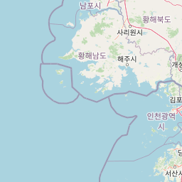
Coastal and island park geography in South Chungcheong Province
Interactive boundary geometry and calculated area metrics
Lowland relief profiles and coastal natural features within the park
Peaks
107.8 m
Peaks
55 m
Peaks
31.6 m
Beaches
Wetlands
Beaches
Temperate climate zones, dominant water presence, and lowland coastal relief
Beach · Dunes · Islands · Coast
Coastal habitat · Marine habitat · Dune habitat
Uncover the Regional Context of South Korea's National Parks, from Marine Sanctuaries to Inland Reserves
Southeast

Explore its national park designation and regional geography.
Gyeryongsan National Park is a formally protected national park in Chungcheongnam-do, South Korea. This page offers critical atlas context for understanding the park's geographic scope, mapped protected boundaries, and its significance as a natural landscape within the region. Examine the terrain and explore its regional context for a deeper appreciation of its protected status.
South
Explore mapped terrain and regional park geography.
This detail page provides an in-depth look at Byeonsan-bando National Park, a protected area located in South Korea's Jeollabuk-do region. Users can discover the park's specific geographic identity, understand its mapped boundaries, and explore its role within the broader regional landscape. The content is structured for atlas exploration, offering detailed insights into the park's natural terrain and its significance as a national park.
Northeast
Explore the landscape context of this national park.
Bukhansan National Park stands as a distinct protected area within Gyeonggi Province, offering a rich landscape for geographic exploration. This entry focuses on its identity as a national park, detailing its mapped boundaries and its contribution to the regional geography. Users can explore its protected landscape features and understand its significance through a structured, map-centric approach, enriching their atlas understanding of protected natural areas.
Southeast
Discover the park's protected boundaries and regional context.
Investigate Naejangsan National Park, a protected area within South Korea, through its mapped geography and landscape context. This detailed atlas entry provides insight into the park's specific geographic identity and its role as a national park, offering a structured understanding of its protected natural features for focused exploration and research.
East
Discover South Korea's Songnisan National Park and its protected terrain.
Delve into the protected landscape of Songnisan National Park, a key national park entity in South Korea. This atlas-focused view highlights its mapped geographic boundaries and natural terrain, providing essential context for understanding conservation areas. Explore Songnisan National Park as a distinct protected region contributing to the country's diverse geography and mapped natural heritage.
Southeast
Explore its protected land boundaries and regional landscape context.
Examine Deogyusan National Park, a designated national park situated in the Jeollabuk-do region of South Korea. This entry provides critical geographic context, focusing on the park's mapped boundaries and its role as a protected landscape. Users can gain a structured understanding of its natural terrain and regional significance, contributing to a broader atlas of protected areas.
Southeast
Explore Mudeungsan National Park's geographic setting in Jeollanam-do.
Mudeungsan National Park offers a distinct protected landscape within the Jeollanam-do region of South Korea. This atlas-focused page details its mapped geographic boundaries and the surrounding natural terrain, providing essential context for understanding its role as a national park. Explore the park's identity through its unique landscape and regional geography.
Southeast
Discover Protected Landscape and Regional Terrain
Gayasan National Park presents a distinct protected-area entity within South Gyeongsang Province, serving as a crucial point for atlas-driven geographic exploration. As a designated national park in South Korea, it offers insights into its specific mapped boundaries and the surrounding natural terrain. Understanding this park's role within the regional geography provides a foundational element for comprehending broader landscape patterns and protected land distribution across the country.
Delve deeper into the geographic specifics and atlas context of Taean Seaside National Park. Understanding this protected national park's mapped boundaries and its place within South Korea's natural terrain offers critical insight for regional landscape discovery and geographic analysis.