

Mori Atlas logo
National parkTregole National Park

Discover the mapped boundaries and ecological significance of this representative Australian national park.

Tregole National Park: Queensland's Unique Ooline Woodlands and Semi-Arid Protected Landscape

Tregole National Park represents a vital protected area within Queensland, Australia, offering a glimpse into unique semi-arid ecosystems. Situated approximately 603 kilometers west of Brisbane, this national park preserves a significant concentration of vulnerable Ooline trees, which form nearly pure stands in an unusually hot and dry climate. Its landscapes showcase the transitional zone where brigalow and mulga biospheres converge, providing a crucial example of eastern Australia's natural heritage and a valuable point for atlas-based geographic discovery.

semi-arid ecosystemsOoline treesQueensland national parksbrigalow woodlandmulga woodlandvulnerable species protection
Stylized illustration of a canyon with a waterfall, river, and surrounding forest

Tregole National Park

National park

Park overview

Structured park overview, official facts, and landscape profile for Tregole National Park

Tregole National Park park facts, protected area profile, and essential visitor context

Review the core facts for Tregole National Park, including designation, size, terrain, visitor scale, habitats, and operating context in one park-focused overview.

About Tregole National Park

Tregole National Park protects a distinctive slice of Queensland's inland landscape, located in the semi-arid interior of the state where the characteristic woodlands of the brigalow and mulga biomes converge. The park's setting on this ecological boundary gives it significance beyond its relatively modest area, as it contains representative examples of both vegetation communities and the transitional landscapes between them. The most visually striking feature of the park is the almost pure stands of Ooline trees that dominate large sections of the woodland, creating a somewhat unusual landscape for this vegetation type given the region's hot and dry conditions. The park is managed by the Queensland Parks and Wildlife Service and offers a limited but meaningful visitor experience through its day-use facilities and short walking trail. The absence of camping facilities helps preserve the park's relatively undeveloped character and focuses visitor activity on the designated recreational area near Morven.

Quick facts and research context for Tregole National Park

Tregole National Park covers an area of 75.79 square kilometers in South West Queensland. The park was formally gazetted in 1995, though the land had been set aside for protection since 1975. It is classified as an IUCN Category II protected area. The park features a day-use area located 10 kilometers south of Morven along the Morven-Bollon Road, where visitors can access a short 2.1-kilometer walking track. Unlike many national parks, Tregole does not offer camping facilities, limiting its use to day visitors. The park sits at the ecological junction of two distinct biomes, making it an important representative of semi-arid woodland ecosystems in the region.

Protection and recognition

Evaluating terrestrial protection framework and regional conservation status

Tregole National Park Protection Status and Conservation Designations

Researchers can analyze the documented terrestrial protection status, designation records, and administrative boundaries established for Tregole National Park. Understanding local management parameters and official status details helps map the broader network of semi-arid ecosystems within the Australian park system.

Protection details

Protection scope
Terrestrial
Transboundary protection
No
Park context

Deeper park guide and search-rich context for Tregole National Park

Tregole National Park history, landscape, wildlife, and travel context

Explore Tregole National Park through its history, landscape character, ecosystems, wildlife, conservation priorities, cultural context, and seasonal travel timing in a structured park guide built for atlas discovery and search intent.

Why Tregole National Park stands out

Tregole National Park is best known for its remarkable Ooline tree stands, which represent one of the most significant concentrations of this vulnerable species in Australia. The Ooline tree is a distinctive component of Queensland's inland woodlands, and the pure stands found within Tregole are considered unusual because they occur in a climate that is significantly hotter and drier than typical Ooline habitat. This makes the park particularly valuable for understanding the species' ecological tolerances and conservation requirements. The park also serves as a representative example of semi-arid ecosystem diversity, protecting the transitional zone where brigalow and mulga vegetation communities meet.
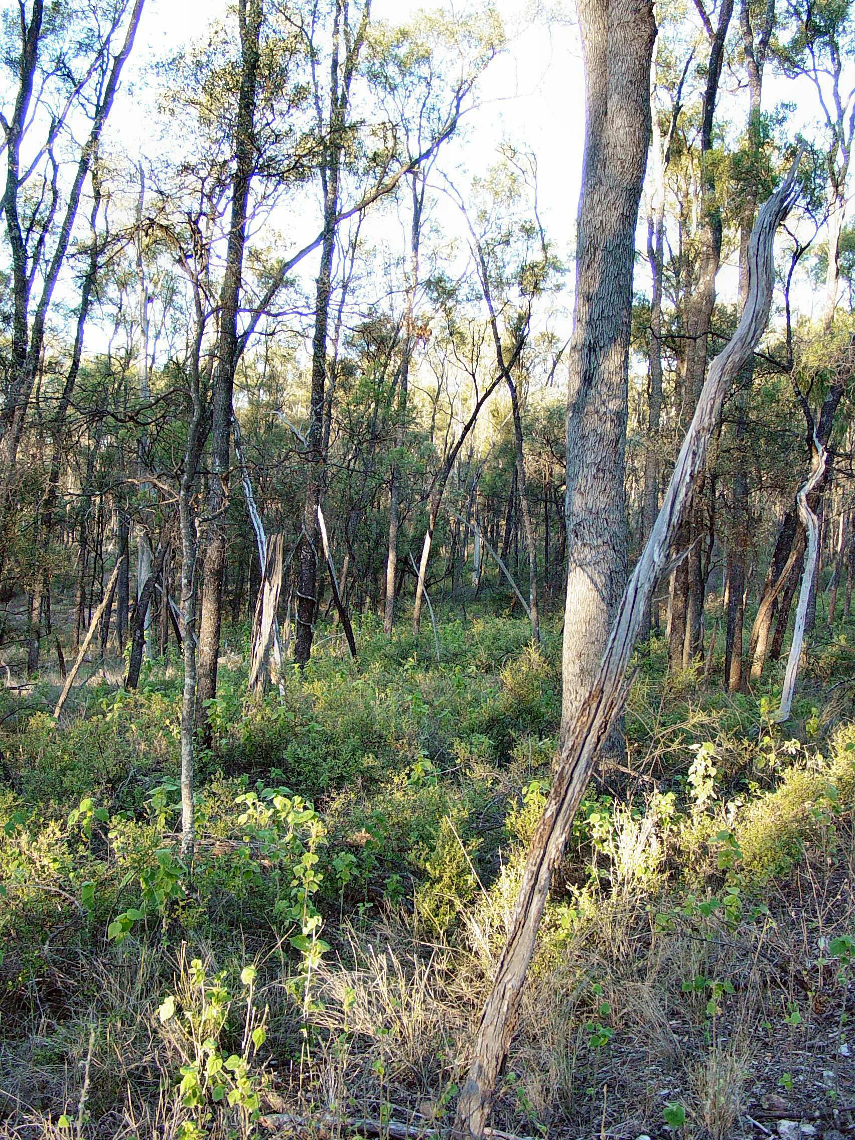
Tall trees and green underbrush in a natural forest setting.
Forest scene with tall trees and dense undergrowth in Tregole National Park.

Tregole National Park history and protected-area timeline

The land that now comprises Tregole National Park was historically used for grazing purposes prior to its protection. The area was gazetted for protection in 1975, marking its transition from a working pastoral property to a conservation reserve. In 1995, the park was formally established under national park legislation, granting it the higher level of protection that comes with IUCN Category II designation. This evolution from agricultural land to protected area reflects a broader shift in Queensland's approach to land conservation during the latter half of the twentieth century, as recognition grew for the ecological values of semi-arid woodland ecosystems. The Queensland Parks and Wildlife Service has maintained management oversight since the park's establishment, working to protect the Ooline stands and maintain the ecological integrity of the semi-arid woodland communities.

Tregole National Park landscape and geographic character

The landscape of Tregole National Park is characterized by semi-arid woodlands typical of South West Queensland, dominated by the dense, dark-green canopy of Ooline trees that create almost pure stands across much of the park's extent. The terrain is generally flat to gently undulating, consistent with the interior lowlands of the Murray-Darling Basin region. The vegetation structure alternates between the denser brigalow-dominated communities and the more open mulga woodlands, with the transition between these communities creating subtle variations in the park's visual character. The Ooline trees themselves are visually distinctive, with their dark foliage providing strong contrast against the lighter tones of the surrounding semi-arid landscape. The park lacks significant topographic drama, instead offering the quieter, more subtle beauty characteristic of Australia's inland woodland environments.

Tregole National Park ecosystems, habitats, and plant life

The ecological character of Tregole National Park is defined by its position at the intersection of two major vegetation biomes, the brigalow and mulga communities, both of which represent distinctive semi-arid woodland formations found throughout inland Queensland and New South Wales. The brigalow ecosystem is characterized by dense Acacia harpophylla woodlands, while mulga refers to the semi-arid woodlands dominated by Acacia aneura. Their convergence at Tregole creates a representative sample of semi-arid ecosystem diversity that would be difficult to find elsewhere in such a compact area. The Ooline tree, from the species Cadellia pentastylis, is the park's most notable botanical feature and is classified as a vulnerable species in Australia. The pure Ooline stands found at Tregole are particularly significant because they thrive in conditions that are hotter and drier than typical Ooline habitat, suggesting the species has ecological adaptations that allow it to survive in this challenging environment.

Tregole National Park wildlife and species highlights

While the Wikipedia source focuses primarily on the botanical features of Tregole National Park, the semi-arid woodland environment supports a range of wildlife adapted to the harsh interior conditions of Queensland. The brigalow and mulga woodlands provide habitat for various bird species, reptiles, and small mammals that have evolved to cope with the region's seasonal extremes and limited water availability. The dense canopy of the Ooline stands offers shelter and foraging opportunities for woodland bird species, while the ground layer supports reptiles adapted to the semi-arid conditions. The conservation of the Ooline stands is particularly important for wildlife, as these seemingly uniform forests actually provide microhabitats and resources that support biodiversity in an otherwise challenging landscape.

Tregole National Park conservation status and protection priorities

Tregole National Park holds significant conservation value primarily due to its protection of the vulnerable Ooline tree and its representative semi-arid ecosystems. The Ooline species, Cadellia pentastylis, is listed as vulnerable under Australian environmental legislation, and the nearly pure stands found at Tregole represent one of the most substantial populations of this species in existence. The park's location at the convergence of the brigalow and mulga biospheres adds further conservation significance, as it protects a representative sample of both ecosystems within a single protected area. This is particularly important given the extensive clearing of brigalow and mulga woodlands for agriculture across their former ranges. The transition from grazing land to protected area in 1975, followed by national park establishment in 1995, demonstrates a successful conservation outcome for this semi-arid woodland ecosystem.

Tregole National Park cultural meaning and human context

The Wikipedia source does not provide specific information about indigenous heritage or cultural history associated with Tregole National Park. The park is located in South West Queensland, a region with Aboriginal cultural heritage spanning many thousands of years, though detailed documentation of local cultural connections to this particular area is not included in the available source material. The pastoral history of the land prior to protection is briefly noted, with the area having been used for grazing before its establishment as a protected area.

Top sights and standout views in Tregole National Park

The defining highlight of Tregole National Park is its remarkable Ooline tree stands, which create an almost pure forest in an environment that is notably hotter and drier than typical Ooline habitat. This makes the park uniquely significant for this vulnerable species. The park also provides a compact but representative example of semi-arid ecosystem diversity, protecting the transitional zone where brigalow and mulga woodlands meet. Visitors can experience this distinctive landscape through a short 2.1-kilometer walking track at the day-use area, which offers an accessible introduction to the park's ecological character. The park's undeveloped nature, lacking camping facilities, adds to its appeal for those seeking a quieter, more contemplative natural experience.

Best time to visit Tregole National Park

The best time to visit Tregole National Park would be during the cooler months of autumn and spring in Queensland, when temperatures are more comfortable for outdoor exploration. Summer temperatures in South West Queensland can be extremely high, potentially making the day-use area and walking track less pleasant for visitors. Winter brings cooler conditions but can also see cold nights and mornings. As a day-use only park with no camping facilities, visitors should plan their trip accordingly and arrive with sufficient time to explore the walking track and enjoy the landscape before returning to larger centers. The lack of facilities means visitors should bring adequate water and supplies, regardless of the season.
Monthly climate preview

Analyzing thirty years of temperature fluctuations and seasonal precipitation cycles

Tregole National Park Climate Normals and Monthly Weather Averages

Measured coordinate data for Tregole National Park shows a notable temperature swing between hot summer maximums above forty degrees Celsius and cool, dry winter nights near freezing. Accessing the complete twelve-month profile provides detailed average precipitation and daily temperature cycles modeled over a thirty-year climatology period.
Annual mean21 °C
12 °C29 °C
Jan29°
Feb27°
Mar25°
Apr21°
May16°
Jun13°
Jul12°
Aug14°
Sep19°
Oct23°
Nov26°
Dec28°
Warmest month
January

28.8 °C

Coolest month
July

12.2 °C

Wettest month
February

2.7 mm/day

Driest month
August

0.6 mm/day

Park location guide

Geography guide, regional context, and park location map for Tregole National Park

Tregole National Park park geography, regions, and map view in Australia

Understand where Tregole National Park sits in Australia through a broader geographic reading of the surrounding landscape, nearby location context, and its mapped position within the national park landscape.

How Tregole National Park fits into Australia

Australia is a constitutional monarchy and federal parliamentary democracy comprising six states and ten territories. With a population of nearly 28 million, it is one of the world's most urbanised countries, with most people concentrated on the eastern seaboard. The country has a high Human Development Index and is known for its cultural diversity, ancient Aboriginal heritage, and unique wildlife.

Wider geography shaping Tregole National Park in Australia

Australia occupies the entire Australian continent, the island of Tasmania, and numerous smaller islands. It is the world's flattest and driest inhabited continent, featuring vast deserts in the interior (the Outback), tropical rainforests along the eastern coast, and a coastline bordering the Indian and Pacific Oceans.

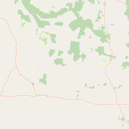
Map view of Tregole National Park

Use this park location map to pinpoint Tregole National Park in Australia, understand its exact geographic position, and read its mapped placement within the surrounding landscape more clearly.

Pigeon | © OpenStreetMap contributors

Location context for Tregole National Park

Queensland

Discover the unique visual identity of Queensland's Ooline tree woodlands, transitional brigalow and mulga habitats.

Tregole National Park Photos: Explore Semi-Arid Landscapes and Ooline Tree Stands

Browse photos of Tregole National Park to visually grasp its distinct semi-arid landscapes, characterized by expansive Ooline tree stands and transitional brigalow-mulga woodlands. Viewing these images offers crucial context for understanding the park's unique protected environment, revealing the ecological patterns and natural beauty of this Queensland national park.

Tall trees and green underbrush in a natural forest setting.

Park atlas

Trace the geographic spread of protected areas and semi-arid ecosystems surrounding Tregole National Park.

Explore Other National Parks and Protected Areas Near Tregole National Park in Queensland

After exploring Tregole National Park's unique Ooline tree stands and semi-arid woodlands, browse a curated list of other national parks and protected areas across South West Queensland. Compare regional conservation efforts, similar brigalow and mulga ecosystems, or discover diverse protected landscapes within Australia's inland regions.
National parkQueensland
28 km away#1 closest

Northeast

Chesterton Range National Park: Queensland National Park with Mapped Brigalow Belt Landscapes

Explore unique semi-arid woodlands and regional watershed geography.

Chesterton Range National Park offers a rich exploration of protected landscape identity within South West Queensland. This national park is crucial for conserving Brigalow Belt ecosystems, featuring diverse semi-arid woodlands across its ridgelines and valleys. Its role in protecting the headwaters for major waterways like the Warrego River and preserving habitats for threatened species makes it a significant site for understanding regional geography and conservation efforts in Australia. The park provides valuable insights into the mapped terrain and ecological importance of these unique natural landscapes.

Area
309.8 km²
Established
1992
IUCN
II
Relief
Upland
National parkQueensland
130 km away#2 closest

Southeast

Thrushton National Park: Queensland's Mulga Lands National Park and Protected Landscape

Explore the semi-arid terrain and mapped conservation boundaries.

Thrushton National Park represents a crucial protected landscape within Queensland's Mulga Lands, preserving vast expanses of dense mulga scrub, spinifex sandplains, and dry woodlands. As a National Park, it offers a unique window into the semi-arid ecology of inland Australia, characterized by its subtly undulating terrain and sandy soils. This atlas-focused exploration highlights the park's distinctive vegetation communities and its regional geographic significance, providing a factual base for understanding this vital conservation area.

Area
256.52 km²
Established
1990
IUCN
II
Scope
Terrestrial
National parkMaranoa Region
159 km away#3 closest

Northeast

Carnarvon National Park: Mapped Geography and Protected Landscape Identity

Explore the sandstone gorges and ancient sites of Queensland's natural heritage.

Carnarvon National Park represents a significant protected area within the Maranoa Region of Queensland, Australia. This national park encompasses a vast expanse of approximately 2,980 square kilometers, primarily celebrated for its dramatic sandstone gorges, particularly Carnarvon Gorge, and its globally significant Aboriginal rock art sites. Positioned across the Great Dividing Range, the park's landscape features a compelling mix of deep valleys, sandy plains, and basalt-capped tablelands, offering rich cartographic and geographic context. Its designation as a national park underscores its importance for preserving these unique natural and cultural landscapes for atlas-based discovery.

Area
2,980 km²
Established
1932
IUCN
II
Visitors
65K annual
National parkAustralia
163 km away#4 closest

South

Narkoola National Park: Understanding Its Protected Landscape and Australian Geography

Discover mapped boundaries and natural terrain context.

Narkoola National Park stands as a key protected area within Australia, providing valuable insights into its specific geography and natural landscape characteristics. This detailed view focuses on understanding the park's mapped boundaries, its terrain, and its role within the larger Australian geographic atlas. Explore the protected land's context and uncover its distinct landscape features for a deeper geographic appreciation.

Area
117.99 km²
Established
2010
IUCN
II
Climate
Arid
National parkQueensland
188 km away#5 closest

Northeast

Expedition National Park: A Dramatic Sandstone Mountain Landscape in Central Queensland

Explore protected areas, mapped ridgelines, and Robinson Gorge geography.

Expedition National Park represents a significant protected landscape in Queensland, distinguished by the striking Expedition Range. This mountainous terrain, characterized by rugged sandstone cliffs, deep gorges like Robinson Gorge, and dry eucalyptus forests, offers a unique geographic contrast to the surrounding plains. As a national park, it plays a crucial role in conserving biodiversity within the Brigalow Belt bioregion, providing an essential reference point for understanding regional protected areas and natural terrain.

Area
1,080 km²
Established
1991
IUCN
II
Relief
Mountain
National parkQueensland
195 km away#6 closest

West

Mariala National Park: Queensland's Premier Mulga Lands Protected Landscape

Explore mapped terrain and regional geography.

Mariala National Park stands as a landmark designation, preserving the extensive mulga woodlands and semi-arid plains characteristic of Queensland's Mulga Lands bioregion. As the first protected area of its kind, it offers a profound insight into the ecological distinctiveness of inland Australia. This park provides a unique opportunity to explore a largely unmodified landscape, understand its role in conserving rare bird habitats, and appreciate its geographic significance within the broader Queensland atlas.

Area
269.2 km²
Established
1992
IUCN
II
Relief
Lowland
Nature reserveQueensland
About 219 km away#7 closest

Southwest

Bowra Sanctuary: Mapping a Protected Nature Reserve in the Queensland Outback

Arid zone geography and Mulga Lands conservation

Bowra Sanctuary represents a significant conservation effort in the southern Queensland interior. This protected landscape contains a dense variety of woodland, gidgee, and coolabah plains intersected by river-fed creeklines. Examine the reserve through its diverse landforms, ranging from elevated ridges to temporary gilgai wetlands.

Area
140 km²
Established
2010
IUCN
VI
Relief
Upland
National parkQueensland
About 226 km away#8 closest

Northeast

Nuga Nuga National Park: Protected Landscape Exploration in Queensland

Mapped terrain and regional park geography.

Gain a structured understanding of Nuga Nuga National Park, a designated national park situated within Queensland. This detailed view focuses on its geographic setting, mapped boundaries, and the natural landscape context it offers for atlas-based exploration. Discover the park's identity as a protected area and its contribution to the regional geography of northeastern Australia.

Area
28.6 km²
Established
1993
IUCN
II
Access
Access unknown

Common questions about visiting, size, designation, and location context for Tregole National Park

Tregole National Park FAQs for park facts, access, geography, and protected area context

Find quick answers about Tregole National Park, including protected-area facts, park geography, trail and visitor context, and how the park fits into its surrounding country and regional landscape.
MoriAtlas Explorer

Continue Your Protected Areas Search Across the Global Atlas

Deepen your exploration by continuing the structured search for national parks and protected areas worldwide. Utilize the comprehensive filtering capabilities to compare different conservation landscapes and refine your understanding of global park geography. Discover more about the distribution and characteristics of protected natural areas.

Global natural geography