Mori Atlas logo
Nearby park discovery

Geographic analysis of protected terrain across the Nízký Jeseník highlands

Regional Protected Areas and Landscapes Surrounding the Uhlířský vrch Volcanic Hill

Examine the geographic distribution of protected natural areas situated near the geological monument of Uhlířský vrch. This regional overview highlights the spatial relationships and mapped landscape context of neighboring sites within the Nízký Jeseník range and wider Czech Silesia.

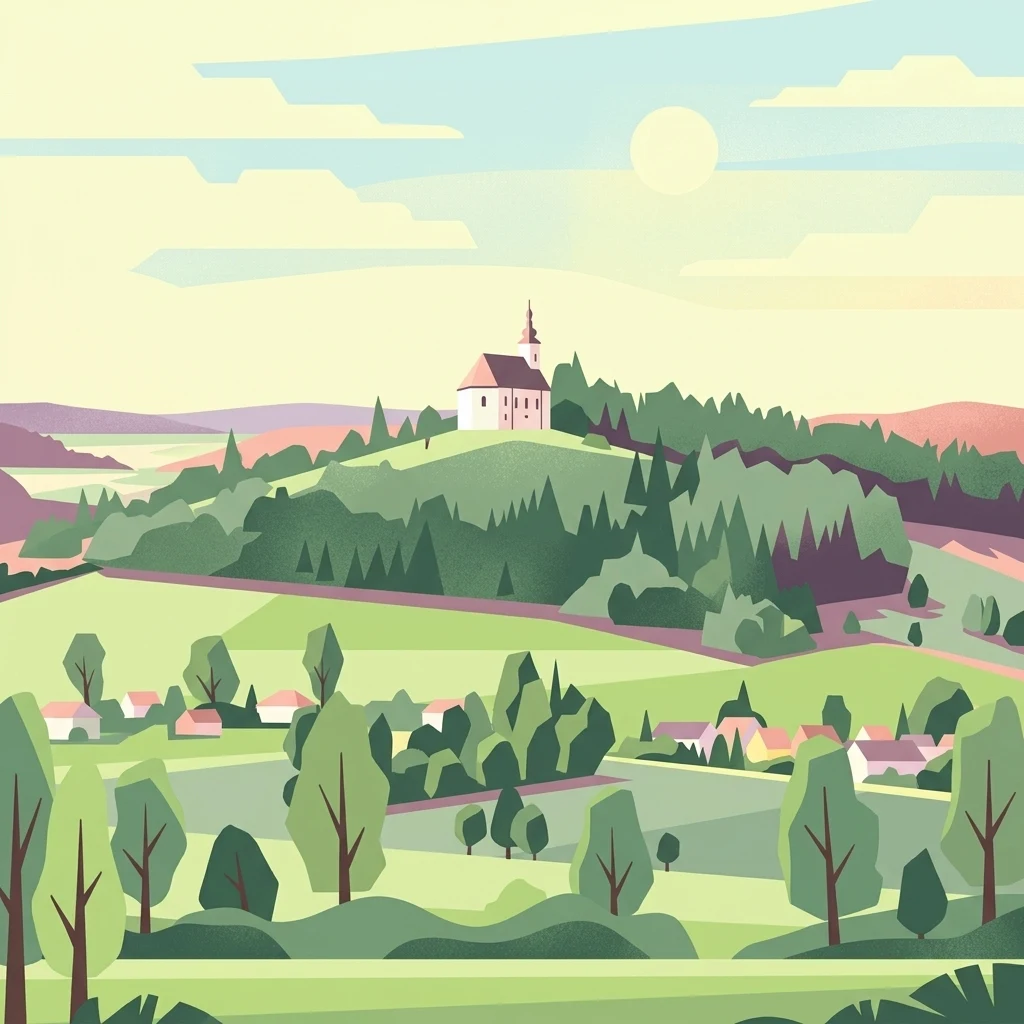
An illustrative depiction of a white church with a spire sitting on top of a green, forest-covered hill, overlooking a small village in the valley.

An extinct volcano near Bruntál crowned with a Baroque pilgrimage church and a linden avenue.

Uhlířský vrch

Uhlířský vrch is a small, geologically distinctive hill in the Bruntálská vrchovina, part of the Nízký Jeseník range in Czech Silesia. Rising to about 672 meters, it is one of the youngest extinct volcanoes on Czech territory, with a basaltic lava flow and an abandoned tuff quarry that has been protected as a natural monument since 1966. The hill's cultural identity is equally strong. On its summit stands a Baroque pilgrimage church dedicated to the Virgin Mary of Help, built in the mid-eighteenth century on the site of an earlier wooden chapel. A roughly one-kilometer-long four-row linden avenue planted in the 1760s leads up to the church and gives the approach its distinctive character. Together, the volcanic geology, the protected quarry exposures, and the pilgrimage landscape with its restored Stations of the Cross make Uhlířský vrch a compact hybrid of natural and cultural monument, just southwest of the town of Bruntál. It is also valued as a far-reaching viewpoint over the surrounding ridges of the Nízký Jeseník and, in the distance, the higher Hrubý Jeseník.

Location
Czechia
Park type
Natural monument
Established
1966
Area
0 km²
Highest point
672 m
Uhlířský vrch Natural Monument Atlas
Regional park map

See the ranked park cluster in its geographic setting

Nearby parks around Uhlířský vrch

This regional map shows the same 20 nearby parks ranked below around Uhlířský vrch. Select a ranked marker to highlight that park’s boundary where boundary data is available.
Reference park: Uhlířský vrchRanked nearby park20 nearby parks shown
20 nearby parks

Distance ranked collection and regional park geography for comparative analysis

Parks and Protected Areas Geographically Near Uhlířský Vrch

Spatial proximity measurements establish a ranked index of protected areas surrounding Uhlířský vrch based on direct geographic separation. Comparing recorded environmental characteristics across neighboring terrain reveals broader landscape patterns without assuming uniform habitats or shared geological origins.
Natural monumentOlomouc Region
About 27 km away#1 closest

West

Sobotín, domov důchodců Protected Natural Monument in the Czech Republic

A specialized Olomouc Region conservation site and habitat refuge

Examine the geographic and ecological boundaries of Sobotín, domov důchodců, a protected natural monument situated in the Olomouc Region. Learn how this site provides essential environmental stability within its broader regional setting, serving as a critical example of small scale habitat conservation in northern Moravia.

Area
0.001 km²
Established
2013
IUCN
III
Relief
Lowland
Natural monumentMoravskoslezský kraj
About 36 km away#2 closest

Southeast

Vrásový soubor v Klokočůvku: Geological Structure and Protected Monument Atlas

Regional rock exposures in the Moravian-Silesian landscape.

Vrásový soubor v Klokočůvku features an exceptional exposure of folded Culm sedimentary strata known as Dračí skála. This protected monument offers a clear view of complex fold geometries and tectonic deformation, serving as a primary site for understanding the geological history of the eastern Bohemian Massif landscape.

Area
0.013 km²
Established
1998
IUCN
III
Relief
Lowland
Protected landscapeDolnośląskie
About 41 km away#3 closest

Northwest

Śnieżnicki Park Krajobrazowy: Protected Landscape and Mountain Geography Atlas

Eastern Sudetes protected area in Dolnoslaskie, Poland

Located in the Dolnoslaskie region, Śnieżnicki Park Krajobrazowy protects a striking mosaic of primeval forest and varied mountain relief. This entry maps its core components, from the high peak of Śnieżnik to the intricate karst landforms and deep river valleys that define its regional geographic character.

Area
288 km²
Established
1981
Relief
Mountain
Climate
Alpine
Natural monumentOlomouc Region
About 44 km away#4 closest

Northwest

Vodopády Stříbrného potoka: Natural Monument and Mountain Stream Geography in Olomouc Region

Geomorphological landmark within the Rychlebské hory mountain range

Vodopády Stříbrného potoka is a protected natural monument in the Czech Republic, encompassing a narrow, steep-sided valley defined by bedrock cascades. This compact site highlights mountain stream geomorphology and serves as a significant feature in the Rychlebské hory, offering insight into the distinctive eroded terrain of the Jeseník District.

Area
0.017 km²
Established
1965
IUCN
III
Relief
Mountain
Protected areaOpole Voivodeship
About 48 km away#5 closest

North

Przyłęk nad Białą Głuchołaską: Protected Area and River Landscape Geography in Poland

Mapped riparian habitats within Opole Voivodeship

Focusing on the Biała Głuchołaska river valley, this area preserves a complex system of active river channels, gravel bars, and terrace forests. The landscape transitions from wet willow-poplar galleries to stable oak-hornbeam communities. As a Natura 2000 site in the Opole Voivodeship, the terrain provides a clear look at submontane river processes interacting with lowland forest habitats.

Area
3.193 km²
Relief
Lowland
Climate
Temperate
Scope
Terrestrial
Natural monumentOlomouc Region
About 49 km away#6 closest

South

Veselíčko Natural Monument: Geographic Profile of a Czech Protected Area

Concentrated conservation and habitat mapping in the Olomouc Region

Located in the Olomouc District, Veselíčko is a compact natural monument dedicated to specialized habitat protection. This site acts as a key component of the regional conservation network, offering insight into the intersection of cultural heritage and wildlife refuge management in the Czech Republic.

Area
0.001 km²
Established
2013
IUCN
III
Relief
Lowland
A horizontal watercolor illustration of a river landscape with lush green banks and rolling purple hills in the background against a white background.
Natural monumentMoravskoslezský kraj
About 52 km away#7 closest

Southeast

Meandry Staré Odry: Geography of a Protected Natural Monument in Moravian-Silesian Region

Historic river meanders and floodplain riparian ecosystems

Meandry Staré Odry represents a vital conservation fragment within the Czech Republic, preserving the original meandering path of the Odra River. This natural monument is defined by quiet oxbow pools, seasonally flooded meadows, and dense riparian forests. Its geographic profile highlights the contrast between historical water dynamics and the surrounding landscape of the Moravskoslezský kraj, providing a precise look at riparian terrain.

Area
0.278 km²
Established
1999
IUCN
IV
Relief
Lowland
A soft, artistic watercolor painting showing a stylized, rolling green landscape with forests, meadows, and a winding path.
Nature reserveOlomouc Region
About 54 km away#8 closest

Northwest

Račí údolí Nature Reserve: A Protected Forest Valley in the Olomouc Region

Geographic boundaries and metamorphic woodland terrain

Račí údolí serves as a vital protected area in the Jeseník foothills, showcasing remnants of oak and beech forests amidst rocky gneiss terrain. This valley map highlights the intersection of natural stream-cut geography and centuries of human cultural presence, providing a dense, immersive look at regional forest conservation and metamorphic geology.

Area
0.62 km²
Established
1998
IUCN
IV
Relief
Upland
A soft watercolor illustration of a rural landscape with green fields and distant purple-hued hills.
Nature reserveOlomouc Region
About 55 km away#9 closest

Southwest

Průchodnice Nature Reserve: Mapped Limestone Ridges and Highland Forest Geography

Protected karst landscape in the Olomouc Region of the Czech Republic

Průchodnice Nature Reserve is defined by its dramatic 120-meter limestone ridge rising from forested slopes. This protected area supports a rich mix of rock-loving flora, mature beech forest, and essential cave habitats for rare bat populations. It serves as a study in concentrated highland karst geography within the southern Zábřežská vrchovina.

Area
0.206 km²
Established
1985
IUCN
IV
Relief
Mountain
Watercolor painting of a soft landscape with rolling hills, meadows, and a small body of water under a light sky.
Protected landscapePardubice Region
About 55 km away#10 closest

Southwest

Přírodní park Bohdalov-Hartinkov: Protected Landscape and Geographic Atlas

Mapping the natural features and terrain of the Svitavy District

Located in the southwestern Zábřezh Highlands, this protected area features a complex mosaic of forests and meadows. Discover the geological diversity, from ancient shales to calcareous soils, that supports the unique flora and fauna of this significant Bohemian-Moravian borderland landscape.

Area
62.65 km²
Established
1996
Relief
Mountain
Climate
Temperate
A watercolor painting showing a stylized, rolling hilly landscape with green and light pink tones, featuring minimal foreground vegetation and soft, layered hills in the background.
Natural monumentOlomouc Region
About 58 km away#11 closest

Southwest

Na Kozénku Natural Monument: Protected Limestone Landscapes in the Olomouc Region

A localized refuge of dry grassland and thermophilic vegetation

Na Kozénku is a protected natural monument in the Czech Republic, notable for its limestone-rich soil and specialized plant communities. This site offers insight into the conservation of isolated habitats within the agricultural mosaic of the Zábřežská Highlands, providing essential shelter for sensitive anemone populations.

Area
0.01 km²
Established
1985
IUCN
IV
Relief
Upland
A soft watercolor illustration depicting a green, open floodplain with rows of trees under a pale, gentle sky.
Nature reserveMoravskoslezský kraj
About 59 km away#12 closest

East

Polanský les Nature Reserve: Mapped Protected Landscape and Floodplain Geography

A preserved hardwood forest relic in the Ostrava region

Polanský les maintains a critical status as a protected nature reserve, safeguarding a relic hardwood floodplain forest along the Oder River. This area is characterized by its significant botanical diversity, including established snowdrop populations and mature broadleaf woodland. Its location within the Moravskoslezský kraj highlights its role as a dense ecological fragment at the geological boundary between the Bohemian Massif and the Outer Western Carpathians.

Area
0.598 km²
Established
1970
IUCN
IV
Relief
Lowland
Watercolor painting of a lush green landscape with trees, rolling hills, and a water feature in a soft pastel palette.
Protected landscapeSilesian Voivodeship
About 59 km away#13 closest

East

Park Krajobrazowy Cysterskie Kompozycje Krajobrazowe Rud Wielkich: A Silesian Protected Area

Riverine landscapes, forest corridors, and historic Cistercian pond networks

Situated in the Silesian Voivodeship, this protected landscape encompasses a significant portion of the Upper Oder basin. Its geography is characterized by a balance of managed forest, agricultural fields, and an intricate lattice of fishponds. These features provide critical refuge for waterbirds and preserve riparian woodland patterns that reflect centuries of deliberate landscape transformation by the Cistercian order.

Area
493.87 km²
Established
1993
Relief
Lowland
Climate
Temperate
Watercolor painting of a soft, rolling landscape with green hills, a grassy foreground, and distant purple-hued ridgelines.
Natural monumentOlomouc Region
About 60 km away#14 closest

Southwest

Na hůrkách Natural Monument: Protected Grassland and Biodiversity Reserve in Olomouc Region

Central Moravian grassland habitat and protected terrain map

Na hůrkách preserves unique dry-grassland vegetation on former pastures in the Olomouc Region. This natural monument serves as an essential refuge for protected flowering plants and grassland-dependent butterfly species, illustrating the conservation value of traditional agricultural landscapes in the Czech Republic.

Area
0.041 km²
Established
1990
IUCN
IV
Relief
Upland
Natural monumentOlomouc Region
About 64 km away#15 closest

South

Vlkoš - statek Natural Monument: Geography and Protected Area Context in the Olomouc Region

Small-scale conservation in the Morava river floodplain

Vlkoš - statek is a significant natural monument comprising a single farmhouse attic that serves as a vital summer refuge for protected bat species. Situated within the flat alluvial terrain of the Olomouc Region, this site highlights the role of anthropogenic structures as key ecological components of the surrounding lowland landscape.

Established
2013
IUCN
III
Relief
Lowland
Climate
Temperate
Natural monumentMoravskoslezský kraj
About 65 km away#16 closest

Southeast

Váňův kámen: Natural Monument and Jurassic Limestone Landmark in the Moravian-Silesian Region

Geological outcrops and forest terrain in the Sub-Beskydy Hills

Váňův kámen presents a sharp, pyramid-shaped Jurassic limestone formation that breaks the rolling topography of the Sub-Beskydy Hills. This 0.78-hectare protected site preserves vital evidence of prehistoric coral reefs alongside significant archaeological layers and historical markers. Its unique position as a natural, historical, and geological feature makes it a focal point for understanding the diverse landscape composition of the Czech Moravian-Silesian Region.

Area
0.008 km²
Established
1993
IUCN
III
Relief
Upland
Natural monumentOlomouc Region
About 67 km away#17 closest

Southwest

V chaloupkách Natural Monument: Botanical Preservation and Highland Landscape in the Olomouc Region

A protected highland meadow within the Drahanská vrchovina

V chaloupkách is a protected natural monument located in the Olomouc Region of the Czech Republic. The site preserves an essential spring fed meadow and its distinct herbaceous flora. Situated within the hilly uplands of the Drahanská vrchovina, the area serves as a focal point for understanding the ecological diversity of traditional highland landscapes in Moravia.

Area
0.046 km²
Established
1990
IUCN
IV
Relief
Upland
A soft watercolor painting depicting a gentle, hazy landscape with rolling hills, scattered patches of trees, and a winding path, rendered in light green, yellow, and peach tones against a white background.
Protected landscapeCzechia
About 69 km away#18 closest

South

Hostýnské vrchy Nature Park: Protected Landscape and Carpathian Foothill Geography

Forested ridge terrain across Zlín and Kroměříž districts

Hostýnské vrchy Nature Park represents a significant protected unit in the eastern Czech Republic, characterized by its deep forested ridges and open meadow clearings. As part of the outer Western Carpathians, the area supports diverse habitats including ancient beech and mixed forest stands alongside rare orchid populations. The landscape provides a clear window into the natural geography of central Moravia, with its intricate network of small watercourses and slopes.

Area
204 km²
Established
1989
Water
Minor water
Season
Year-round
A watercolor illustration of a soft, rolling landscape featuring meadows, distant hills, and coniferous forest edges in pale greens and yellow tones.
Protected landscapeBlansko District
About 70 km away#19 closest

Southwest

Řehořkovo Kořenecko Protected Landscape: An Upland Mosaic in the Czech Republic

Geographic analysis of plateau ridges and wetland river corridors

Centered in the Blansko District, the Řehořkovo Kořenecko protected landscape offers a unique study of Czech upland geography. The area highlights the interplay between the Bělá river valley, peatland remnants of the Pavlovské mokřady, and the high-point vistas from the Paprč summit, illustrating a cohesive protected region defined by its geological substrate and forest composition.

Area
23.14 km²
Established
2000
Relief
Upland
Scope
Terrestrial
Natural monumentMoravskoslezský kraj
About 70 km away#20 closest

East

Věřňovice Natural Monument: Mapping Protected Floodplain Woodlands in the Moravian-Silesian Region

Geographic overview of the Olše river terrace habitat.

Located near the Czech-Polish border, Věřňovice serves as a vital protected natural monument featuring well-preserved floodplain forest communities. This compact site offers deep insights into river terrace geomorphology and local woodland distribution, characterized by a diverse mosaic of elm and oak-hornbeam stands that support distinct ecological communities.

Area
0.046 km²
Established
1989
IUCN
III
Relief
Lowland
Distance methodology

Geographic measurements, not driving distances

How nearby park distances are calculated

Distances use park boundaries whenever the available geometry allows it. When one or both boundaries are missing, the mapped park locations provide a clearly labelled estimate. Every value represents straight-line geographic separation and does not use roads or routing.

Boundary distance

Calculated between the nearest points of both park boundaries.

Location-to-boundary estimate

Estimated from one mapped park location to the nearest boundary of the other park.

Mapped-location estimate

Estimated between the mapped locations of both parks.

MoriAtlas Explorer

Explore the Volcanic and Cultural Geography of Uhlířský vrch

Continue discovering the geological and cultural significance of Uhlířský vrch through MoriAtlas. This detailed overview maps the protected boundaries, volcanic tuff deposits, and the historic summit landscape to provide a deeper understanding of this prominent feature within the Moravskoslezský kraj.