Mori Atlas logo
Protected landscapeVršac Mountains

Discover mapped park boundaries and rich ornithological diversity within Vojvodina's highest elevation.

Vršac Mountains Protected Landscape: Explore Serbia's Pannonian Island Mountain Geography

The Vršac Mountains represent a significant Protected Landscape, rising abruptly as a Pannonian island mountain range from the plains of Vojvodina, Serbia. This unique geological formation, characterized by gneiss and schist outcrops, reaches its apex at Gudurica peak, marking the highest point in the region. Explore the mapped geography, distinct hummock terrain, and the exceptional biodiversity, including over 120 bird species, that define this important protected area.

Mountain rangePannonian island mountainsBirdwatchingForestsGeological formationsProtected area
Stylized illustration of green rolling hills, a winding river forming a loop, and a small building on a hill with mountains and a sunset sky in the background.

Vršac Mountains

Protected landscape

Park overview

Structured park overview, official facts, and landscape profile for Vršac Mountains

Vršac Mountains park facts, protected area profile, and essential visitor context
Review the core facts for Vršac Mountains, including designation, size, terrain, visitor scale, habitats, and operating context in one park-focused overview.

About Vršac Mountains

The Vršac Mountains present a striking contrast to the flat agricultural landscape of the Pannonian basin, rising as an isolated geological island from the ancient seabed that once covered this region. This mountain range represents a unique natural feature in southeastern Europe—a remnant of ancient island mountains that保留了 their identity separate from the Carpathian mountain system to which they are sometimes erroneously connected. The mountains form an arch-shaped massif with the central mountain mass flanked by extending hills to the north and south. The geological foundation consists of ancient Paleozoic rocks dating back more than 260 million years, which are surrounded by Neogene sediments from approximately 60 million years ago, including deposits from the ancient Pannonian Sea that covered the region around 25 million years ago. The distinct geomorphological forms created by gneiss and schist appear as solitary or clustered hummocks across the landscape, creating visually striking terrain that draws both scientists and visitors. Beyond their geological significance, the mountains serve as a critical ecological corridor and habitat island in the otherwise flat agricultural landscape, supporting species and ecosystems found nowhere else in this part of Serbia.

Quick facts and research context for Vršac Mountains

The Vršac Mountains are located in the Banat region near the city of Vršac in southeastern Vojvodina, Serbia, with a smaller portion extending into Romania. The highest peak, Gudurica at 641 meters, is the highest point in Vojvodina. The mountains are built of Paleozoic rocks over 260 million years old, surrounded by Neogene sediments. The range is 19 kilometers long with a maximum width of 8 kilometers. Since 1982, the mountain has been protected as a Landscape of Outstanding Features in Serbia's Registry of Protected Natural Resources.

Park context

Deeper park guide and search-rich context for Vršac Mountains

Vršac Mountains history, landscape, wildlife, and travel context
Explore Vršac Mountains through its history, landscape character, ecosystems, wildlife, conservation priorities, cultural context, and seasonal travel timing in a structured park guide built for atlas discovery and search intent.

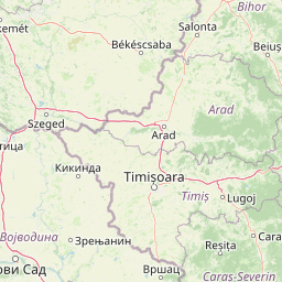
Why Vršac Mountains stands out

The Vršac Mountains are best known as the highest elevation in Vojvodina, with Gudurica peak standing at 641 meters. They are renowned for their exceptional ornithological diversity, supporting 120 bird species, making them one of the richest bird habitats in Serbia and Vojvodina. The distinctive geological character, with gneiss and schist formations creating dramatic hummocks and rock outcrops, sets them apart from the surrounding Pannonian plain. The iconic Vršac Tower, a 15th-century landmark, crowns one of the main peaks and serves as a symbol of the city below. The mountains also feature significant cultural heritage, including the Mesić monastery with traditions dating to 1225.

Rocky foreground with yellow wildflowers, winding river meanders through green hills, distant mountains under partly cloudy sky
Meanders of the Zapadna Morava river within the Ovčar-Kablar Gorge

Vršac Mountains history and protected-area timeline

The protection history of the Vršac Mountains dates to 1982 when they were classified as a "Landscape of Outstanding Features" in Serbia's Registry of Protected Natural Resources, recognizing their exceptional natural and cultural value. In the period from 2001 to 2005, a comprehensive revision study was conducted to reassess and strengthen the protection status. In December 2005, the Vršac Municipal Assembly made a decision to protect 4,408 hectares of the Vršac Mountains as a Landscape of Outstanding Features, of which 190 hectares received the highest level of protection. The management responsibility was assigned to the public utility "Drugi oktobar" from Vršac. This protected status reflects the mountains' dual significance—both as a natural heritage site and as a cultural landscape shaped by centuries of human presence, including the historic Vršac Tower from the 15th century and the Mesić monastery whose origins are traditionally traced to 1225.

Vršac Mountains landscape and geographic character

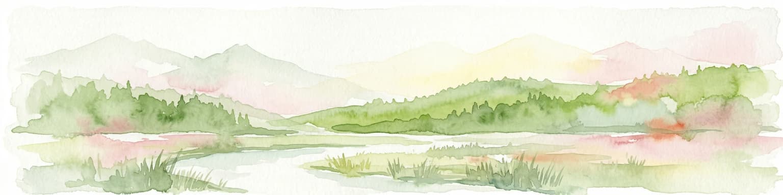
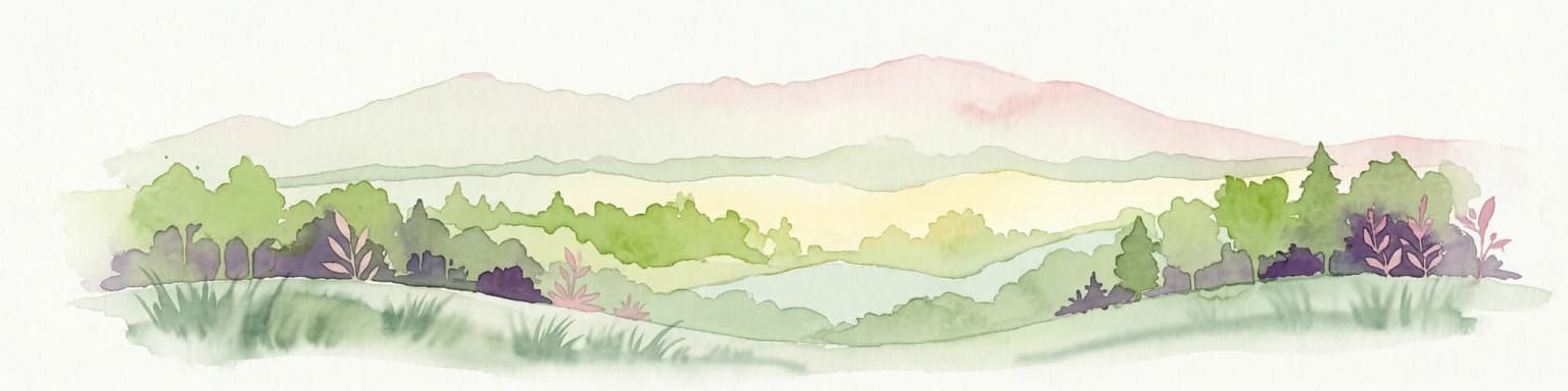
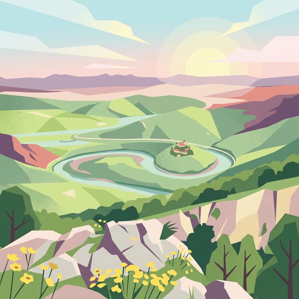
The Vršac Mountains display a characteristic arch shape with the main mountain mass occupying the central position while hills extend to both south and north. The landscape is marked by dramatic geological diversity, featuring distinctive rock formations sculpted from gneiss and schist that appear as both solitary peaks and clustered hummocks across the terrain. Four main peaks define the mountain silhouette: Vršac Tower at 399 meters, Gudurica peak at 641 meters (the highest point in Vojvodina), Fox's Head with its three peaks including Vršac Peak at 590 meters, and Vršišor at 463 meters. Between these peaks, vast rifts and valleys create a complex topographic character. The northern slopes are notably steep, while the southern slopes descend more gradually into foothills where productive vineyards thrive. The mountains rise abruptly from the surrounding Pannonian plain, creating a striking visual landmark visible across the flat agricultural lowlands of the Banat region.

Stone tower with metal staircase and small window under clear blue sky.
Vršac Fortress stone tower with metal staircase under clear blue sky.

Vršac Mountains ecosystems, habitats, and plant life

The ecological character of the Vršac Mountains is defined by their position as an island of diverse habitats within the otherwise flat Pannonian agricultural landscape. The protected forest ecosystems support significant tree species, with silver linden comprising approximately 37% of the forest volume and oak (kitnjak) representing about 25%, followed by black locust at roughly 8% and black ash at about 7%. The remaining forest composition includes hornbeam, white ash, and other species. The plant diversity is remarkable, with 1,017 species of higher plants recorded within the protected area, including seven species listed in the Red Book of Flora of Serbia as rare and endangered. The forests of linden and black locust create particularly distinctive seasonal experiences, as their flowering periods impart specific aromatic characteristics to the mountain environment during spring. The diverse forest communities, combined with the rocky outcrops, steep slopes, and changing elevations, create multiple microhabitats that support the exceptional biodiversity for which the mountains are renowned.

A landscape view of the Vršac Mountains with a large field in the foreground and distant hills under a clear blue sky
Vršac Mountains landscape with rolling fields and distant hills under clear sky

Vršac Mountains wildlife and species highlights

The Vršac Mountains support exceptional wildlife diversity, most notably in avian species where 120 registered bird species make this one of the richest ornithological habitats in Vojvodina and all of Serbia. The varied terrain—combining forested slopes, rocky outcrops, open meadows, and cultivated areas—supports diverse mammal populations including grey and red foxes, deer, wild boars, and occasional wolf sightings. The mountains serve as an important habitat island for species that require more varied terrain than the surrounding agricultural lowlands can provide, functioning as a critical refuge and corridor for wildlife movement through the Pannonian region. The combination of forest cover, rock formations, and diverse vegetation creates conditions suitable for both resident species and migratory visitors, contributing to the area's ornithological significance.

Vršac Mountains conservation status and protection priorities

The Vršac Mountains have been protected since 1982 as a Landscape of Outstanding Features, the highest category in Serbia's protected natural resources system for areas of exceptional natural value. The current protected area encompasses 4,408 hectares, with 190 hectares receiving first-level protection—the most restrictive category aimed at preserving pristine natural ecosystems. The conservation goals are directed toward preserving the unique natural values while also allowing for sustainable recreational and tourism use of the area. The protection framework recognizes the mountains' exceptional geological character, diverse flora and vegetation, rich forest ecosystems, significant landscapes and viewpoints, and the exceptional biodiversity that makes this area one of the most important conservation sites in the Pannonian region. The management approach balances natural preservation with sustainable tourism development, recognizing that the established protection does not restrict recreation and tourism but rather provides a framework for organized ecosystem management.

Vršac Mountains cultural meaning and human context

The cultural heritage of the Vršac Mountains reflects centuries of human presence in this distinctive landscape. The Vršac Tower, dating to the 15th century, stands as the most prominent cultural monument and has become the defining symbol of the city of Vršac itself, visible from the surrounding lowlands and representing a bridge between the natural and cultural identity of the region. The Mesić monastery, located in the village of the same name on the southern slopes of the mountains, holds particular significance with documented history from the 18th century indicating its 15th-century origins and local tradition claiming establishment in 1225. The mountain has long served as a recreation and pilgrimage destination for local communities, with the old Church of the Holy Cross on the first peak above the city being a particularly beloved excursion site. The southern foothills support productive vineyards that form part of the Vršac wine region, integrating agricultural tradition with the mountain landscape. The area known as Široko bilo, located 10 kilometers from the city center, features a mountaineering house with bungalows and a weekend settlement, demonstrating the long-standing role of these mountains as a recreation and nature escape for residents of the Pannonian plain.

Top sights and standout views in Vršac Mountains

The Vršac Mountains offer a unique combination of natural and cultural features that set them apart in the Pannonian region. As Vojvodina's highest elevation, Gudurica peak provides sweeping views across the flat agricultural plain toward Romania and the Banat region. The exceptional bird diversity with over 120 species makes this a prime destination for ornithological observation in Serbia. The dramatic gneiss and schist rock formations create distinctive climbing opportunities, while the Vršac Tower provides both historical interest and commanding views. The protected forest ecosystems, particularly the linden and oak communities, change dramatically through the seasons, with spring bloom creating memorable aromatic experiences. The mountain's position as a Pannonian island mountain—the geological remnant of islands in an ancient sea—gives it scientific significance beyond its recreational and aesthetic value.

Best time to visit Vršac Mountains

The Vršac Mountains can be visited throughout the year, with each season offering distinct experiences. Spring and early summer bring the forest flowering period when linden and black locust trees bloom, filling the mountain air with their distinctive fragrance and creating particularly pleasant conditions for hiking. Autumn offers another compelling season as the deciduous forests display fall coloration. The mountain's relative elevation makes it a welcome escape from the summer heat of the Pannonian plain, while winter visits provide stark contrasts between the snow-dusted peaks and the typically flat, often snow-free lowlands below. The best time for bird observation coincides with migration seasons when the diverse avian populations are most active.

Park location guide

Geography guide, regional context, and park location map for Vršac Mountains

Vršac Mountains park geography, regions, and map view in Serbia
Understand where Vršac Mountains sits in Serbia through a broader geographic reading of the surrounding landscape, nearby location context, and its mapped position within the national park landscape.

How Vršac Mountains fits into Serbia

Serbia is a landlocked country in Southeast and Central Europe, bordered by eight neighboring countries. With a population of approximately 6.6 million, it operates as a unitary parliamentary republic with Belgrade as its capital. The country has a rich history dating back to medieval statehood in the 7th century and has been independent since 2006 following the dissolution of Serbia and Montenegro.

Wider geography shaping Vršac Mountains in Serbia

Serbia is a landlocked country in the Balkans, spanning parts of Southeast and Central Europe. It occupies a strategic position in the heart of the Balkan Peninsula, bordered by Hungary to the north, Romania to the northeast, Bulgaria to the southeast, North Macedonia to the south, Croatia to the northwest, Bosnia and Herzegovina to the west, and Montenegro to the southwest. The terrain varies from rolling plains in the north to mountainous regions in the south and east.

Map view of Vršac Mountains

Use this park location map to pinpoint Vršac Mountains in Serbia, understand its exact geographic position, and read its mapped placement within the surrounding landscape more clearly.

Pigeon | © OpenStreetMap contributors

Location context for Vršac Mountains

Vojvodina

Explore the Vršac Mountains' unique geological character, rich avian habitats, and seasonal forest scenery.

Vršac Mountains Landscape Photography: Views of Serbia's Distinctive Protected Area Terrain
Visually understand the Vršac Mountains' unique geological formations, extensive forests, and diverse avian habitats through detailed imagery. Gaining visual context is crucial for appreciating the distinct character of this Pannonian island mountain range and its protected natural features.

Rocky foreground with yellow wildflowers, winding river meanders through green hills, distant mountains under partly cloudy sky

Dense forest-covered mountain peak under a clear sky

Stone tower with metal staircase and small window under clear blue sky.

A landscape view of the Vršac Mountains with a large field in the foreground and distant hills under a clear blue sky

Park atlas

Compare the diverse protected areas and their unique geographic features in the Banat region surrounding Vršac Mountains.

Explore Nearby Protected Areas, Mountain Ranges, and Pannonian Landscapes Related to Vršac Mountains
Browse a curated selection of other protected areas, national parks, and natural reserves that share geological characteristics or regional proximity with Vršac Mountains, including other Pannonian island mountains. Comparing these distinct landscapes helps users understand the wider conservation efforts and the varied terrain of the Banat region and broader Balkan peninsula.
Watercolor illustration of a river flowing through a valley with mountains in the background
Protected landscapeRomania

Iron Gates Natural Park: Explore Romania's Protected Landscape and Geographic Context

Detailed atlas view of a protected landscape in Romania.

Uncover the geographic dimensions of Iron Gates Natural Park, a protected landscape situated in Romania. This detailed entry offers an atlas-centric exploration of its mapped boundaries and regional setting, facilitating a deeper understanding of its protected status and landscape features within the national geography. Discover the park's intrinsic value through structured geographic data and visual map context.

Area
1,156.66 km²
Established
2000
Relief
Mixed relief
Climate
Mediterranean
Watercolor painting of a landscape featuring rolling hills, a lake, trees, and a sky with clouds
Natural monument

Avala Natural Monument: Iconic Protected Landscape and Regional Geography Near Belgrade

Explore Avala's mapped terrain and natural monument significance.

Avala Natural Monument offers a unique protected landscape and significant geographic context for the Belgrade metropolitan area. As one of Serbia's oldest protected natural sites, its distinct mountain terrain, geological composition, and panoramic views provide a rich subject for atlas-based discovery. Explore the mapped boundaries and natural features that define this prominent Serbian natural monument.

Area
5.01 km²
Established
1859
Relief
Mountain
Climate
Temperate
National park

Domogled-Valea Cernei National Park: National Park with Mapped Protected Landscape

Explore its protected boundaries and regional geography.

Domogled-Valea Cernei National Park is recognized as a National Park, offering a distinct protected landscape for atlas-based discovery. This page provides focused insights into its mapped geographic extent and the character of its natural terrain. Understand the park's role within Romania's protected areas network and its unique geographic identity. Utilize this structured view to navigate the park's features and its surrounding landscape context for informed exploration.

Area
612.11 km²
Established
2000
IUCN
II
Relief
Mountain
National park

Đerdap National Park: Europe's Grandest River Gorge and Protected Landscape

Explore Serbia's largest national park along the Danube River.

Đerdap National Park is defined by the Iron Gate, Europe's longest and most dramatic river gorge, a geological marvel carved through the Carpathian Mountains. This protected area showcases a complex karst landscape with towering cliffs, deep river sections, and rich biodiversity, including vital Tertiary relict species. The park's vastness and unique terrain offer a profound geographic context for understanding regional natural landscapes and conservation efforts. Explore its mapped boundaries and ecological significance.

Area
637.87 km²
Established
1974
IUCN
II
Relief
Mountain
Watercolor painting showing green forests, a river, and pink-hued mountains in the background
Protected landscape

Kosmaj Protected Landscape: Explore Serbia's Island Mountain Geography and Forests

Mapped terrain, historic monasteries, and biodiversity near Belgrade.

Kosmaj, a unique protected landscape and island mountain, presents a compelling study in regional geography and mapped terrain for atlas enthusiasts. Rising prominently near Belgrade, its landscape is characterized by dense deciduous forests of beech and oak blanketing its steeper slopes, along with distinct peaks like Mali Vis and Goli Vis. This area serves as a vital watershed source and boasts significant biodiversity, offering a rich context for understanding Serbia's natural and historic environments through structured geographic data and map exploration.

Area
0.035 km²
Established
2005
Relief
Lowland
Climate
Temperate
Watercolor illustration showing rolling hills, scattered trees, and a soft pink sky
Protected landscapeMehedinți County

Mehedinți Plateau Geopark Protected Landscape: Karst Geography and Regional Context

Explore Romania's unique limestone formations and karst landscapes.

The Mehedinți Plateau Geopark in Mehedinți County, Romania, is a significant protected landscape celebrated for its extensive karst features. This page offers detailed insights into the park's mapped boundaries, including its famous natural bridges like Podul lui Dumnezeu, vast limestone pavements, and cave systems. Understand its position within the broader regional geography of southwestern Romania, providing a solid foundation for atlas-driven exploration of this geologically rich area.

Area
1,065 km²
Established
2005
IUCN
V
Relief
Upland
Protected area

Jegrička Nature Park: Mapped Protected Area with Riverine Wetland Ecosystems

Explore the geography and protected landscape of Jegrička Nature Park.

Jegrička Nature Park is a designated protected area recognized for its significant riverine wetland character within the Pannonian Plain of northern Serbia. The park's landscape is defined by the meandering Jegrička river, extensive marshlands, and riparian vegetation, serving as crucial freshwater habitat for diverse waterfowl and migratory bird populations. This page offers detailed geographic context and atlas-level exploration of its protected boundaries and ecological importance within Eastern Europe's broader natural heritage.

Relief
Lowland
Scope
Mixed
Water
Major water bodies
Watercolor illustration of a mountain range with forests, a lake, and distant hills under a light sky
National parkHunedoara County

Retezat National Park National Park: Protected Landscape and Regional Geography

Mapped boundaries and landscape context in Hunedoara County.

Retezat National Park is a key protected area featured within MoriAtlas, offering structured geographic data and map-based insights. This national park's protected landscape is situated in Hunedoara County, Romania, contributing significantly to the regional topography and natural context of the Southern Carpathians. Explore its mapped boundaries and understand its role as a distinct natural entity.

Area
380.47 km²
Established
1935
IUCN
II
Relief
Mountain

Common questions about visiting, size, designation, and location context for Vršac Mountains

Vršac Mountains FAQs for park facts, access, geography, and protected area context
Find quick answers about Vršac Mountains, including protected-area facts, park geography, trail and visitor context, and how the park fits into its surrounding country and regional landscape.
MoriAtlas Explorer

Continue Your Protected Areas Search Across the Global Atlas

Deepen your exploration by continuing the structured search for national parks and protected areas worldwide. Utilize the comprehensive filtering capabilities to compare different conservation landscapes and refine your understanding of global park geography. Discover more about the distribution and characteristics of protected natural areas.

Global natural geography