

Mori Atlas logo
Nature reserveWular Lake

A tectonic freshwater basin serving as a vital ecological hub within the Himalayan foothills.

Wular Lake Nature Reserve: Mapped Geography and Protected Wetland Landscape in Jammu and Kashmir

Wular Lake functions as an essential freshwater nature reserve in the Kashmir Valley, defined by its massive tectonic basin and complex hydraulic connection to the Jhelum River system. This protected wetland environment supports endemic fish populations and diverse bird species across a fluctuating surface area. Analyzing the lake through an atlas lens reveals a landscape shaped by geological history, agricultural runoff, and critical ongoing conservation efforts for its shallow margins and marshy terrain.

freshwater laketectonic basinJhelum River systemRamsar wetlandKashmir Valleymigratory birds
A flat vector-style illustration of a river flowing through a valley surrounded by steep cliffs and distant mountains, with a row of cypress-like trees along the bank.

Wular Lake

Nature reserve

Park overview

Structured park overview, official facts, and landscape profile for Wular Lake

Wular Lake park facts, protected area profile, and essential visitor context

Review the core facts for Wular Lake, including designation, size, terrain, visitor scale, habitats, and operating context in one park-focused overview.

About Wular Lake

Wular Lake occupies a prominent place in the geography of the Kashmir Valley within Jammu and Kashmir, India. Its basin was created through tectonic activity, and the lake functions as both a feeder and a regulators within the Jhelum River system, receiving inflows from the Jhelum and from streams such as Madhumati and Arin. The lake's size fluctuates dramatically through the year as water levels rise and fall, giving it a dynamic character that defines the surrounding landscape and livelihoods.

Beyond its physical scale, Wular Lake is defined by its ecological richness. It supports a diverse fish community that includes commercially important species and several endemic snowtrout varieties, while also harboring aquatic plant species that communities harvest for food and fodder. Birdlife is extensive, with numerous terrestrial species observed around the lake's shores, reflecting the broader biodiversity of the Kashmir region. This ecological layer is tightly interwoven with human life: thousands of fishermen and many more households depend on the lake's resources for income, food, and animal feed.

The lake is also a landscape of cultural memory. Historical accounts describe the construction of an artificial island by the Kashmiri sultan Zayn al-Abidin in the 15th century, and traditional legends speak of a submerged city beneath its waters. Today, environmental pressures including catchment conversion for agriculture, fertilizer and animal waste pollution, hunting of waterfowl, weed infestation, and significant trash accumulation have reduced much of the lake, prompting restoration initiatives under India's National Lake Conservation Programme and ongoing efforts to revive lake health. At the same time, the lake is central to the long-running Tulbul Lock Project, a proposed navigation and water regulation structure at its outflow.

Quick facts and research context for Wular Lake

Wular Lake sits in north India in the disputed Kashmir region, near the town of Bandipora. It is a tectonic-origin freshwater lake fed and drained by the Jhelum River, with a surface elevation of around 1,580 meters above sea level. The lake has been formally recognized at both the national level under India's Wetlands Programme and internationally as a Ramsar site. Beyond its ecological value, Wular Lake is deeply integrated into the regional economy, supporting thousands of fishermen and aquatic plant harvesters across the Kashmir Valley.

Protection and recognition

Explore documented designation history and terrestrial conservation scope for Wular Lake

Wular Lake Protection Status and International Ramsar Recognition

Wular Lake holds formal protection status and international recognition records established since 1990. Review documented designation details, management scope, and official Ramsar wetland listings for this terrestrial protected area.

International recognition

Protection details

Protection scope
Terrestrial
Designated year
1990
Transboundary protection
No
Park context

Deeper park guide and search-rich context for Wular Lake

Wular Lake history, landscape, wildlife, and travel context

Explore Wular Lake through its history, landscape character, ecosystems, wildlife, conservation priorities, cultural context, and seasonal travel timing in a structured park guide built for atlas discovery and search intent.

Why Wular Lake stands out

Wular Lake is renowned as one of the largest freshwater lakes in South Asia and a key component of the Jhelum River system. It is especially noted for its rich fish populations, including endemic snowtrout species of the Schizothorax group, and for sustaining large flocks of resident and migratory birds in a major Himalayan foothill wetland. The lake also stands out for its tectonic origin, its role in regional livelihoods through fishing and aquatic plant gathering, and its Ramsar-recognized status as a wetland of international importance.
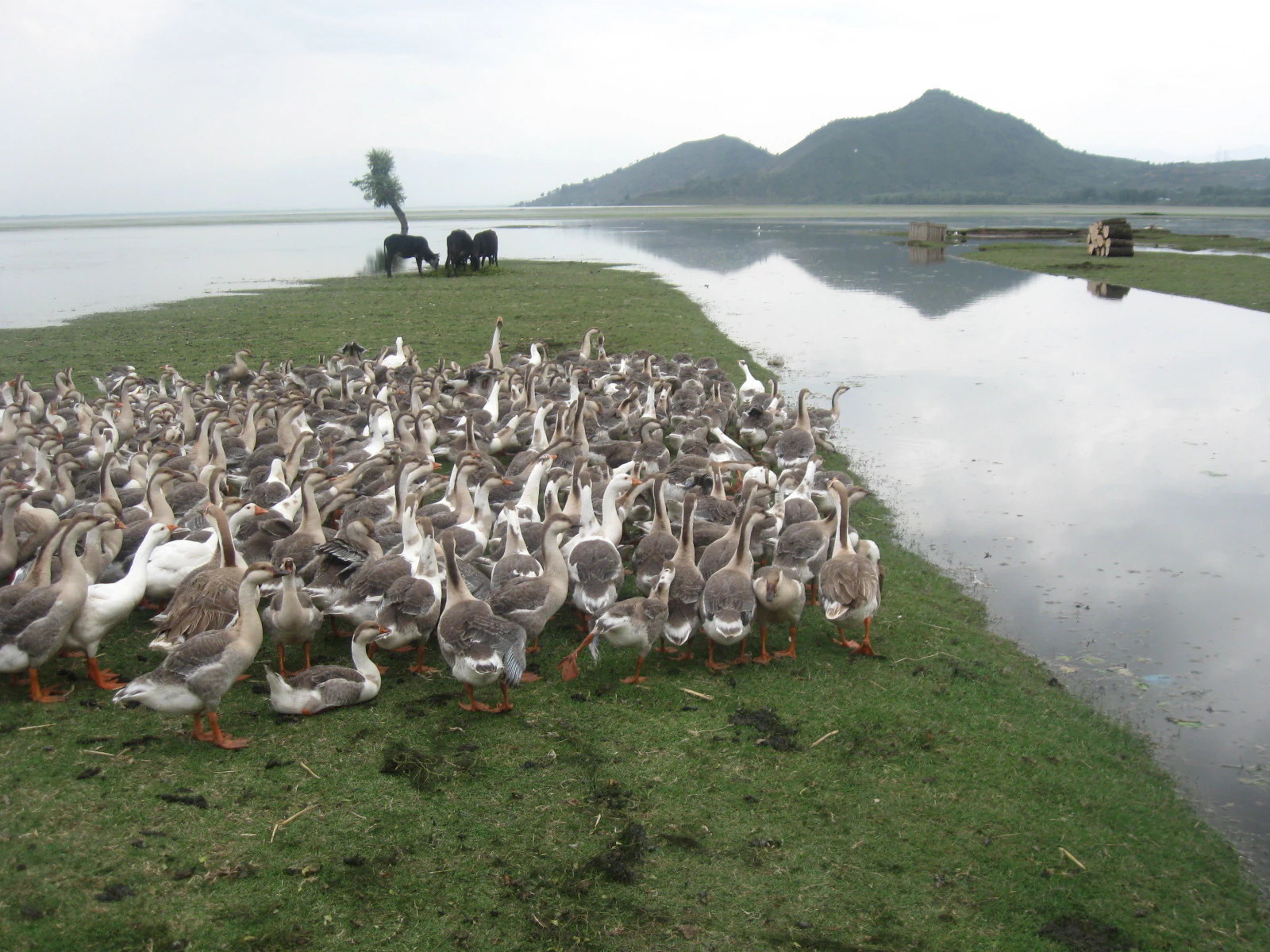
A large flock of geese congregated on the green grassy shoreline of Wular Lake, with a few cows grazing in the background near a single tree and distant mountains.
A large flock of geese grazing on the grassy banks of Wular Lake.

Wular Lake history and protected-area timeline

Wular Lake has deep historical and cultural references, stretching back to ancient Sanskrit literature. In classical texts such as the Nilamata Purana, the lake is referred to as Mahapadmasar or Mahapadmasaras. The name "Wular" is believed to derive either from the Sanskrit "Ullola," describing the high leaping waves the lake produces, or from the Kashmiri word "Wul," meaning a gap or fissure, a reference to the tectonic origin of the basin.

A defining moment in the lake's human history came in 1444, when the Kashmiri sultan Zain-ul-Abidin, also known as Zayn al-Abidin, is reputed to have ordered the construction of the artificial island of Zaina Lank in the middle of the lake. According to local traditions, the sultan built this island by sinking a large barge and establishing a foundation of bricks and stones on it, eventually constructing a mosque and other buildings. The work was reportedly financed by two golden idols recovered by divers from the lake. Folk traditions also speak of a once-prominent city in the lake area whose legendary rulers were said to have been submerged beneath rising waters, with ruins allegedly visible during low winter levels.

In the modern era, Wular Lake has been formally recognized through conservation designations. It was identified in 1986 as a Wetland of National Importance under India's Wetlands Programme, and in 1990 it was designated as a Wetland of International Importance under the Ramsar Convention. The late 20th and early 21st centuries brought serious environmental decline, leading to the approval of a multi-billion-rupee restoration project that was scheduled to begin in late 2011 under the National Lake Conservation Programme. The 1980s also marked the conception of the Tulbul Lock Project, a navigation and water regulation structure at the lake's outflow. Construction was halted in 1987 following objections from Pakistan under the Indus Waters Treaty and was eventually revived in 2025 after India suspended its participation in the treaty framework.

Wular Lake landscape and geographic character

Wular Lake is a large, shallow freshwater body set within the Kashmir Valley, at a relatively high surface elevation of around 1,580 meters above sea level. Its basin is tectonic in origin, shaped by geological activity that produced the natural depression the lake now fills. The lake's dimensions are unusually variable, with surface area fluctuating seasonally, and its profile is broad rather than deep, with maximum depths around 14 meters.

The surrounding landscape is shaped by the lake's fluctuating margins. Willow plantations established along the shoreline in the 1950s altered the hydrology and contributed to drained sections of the lake. In recent decades, accumulation of sediment, garbage, and weed growth has made portions of the lake shallower and reduced open water areas, transforming what was once broad expanse of water into a mosaic of muddy shallows, reed beds, and vegetated margins. The watershed feeding the lake, including agricultural land and hillslopes, continues to influence lake conditions through erosion and runoff.
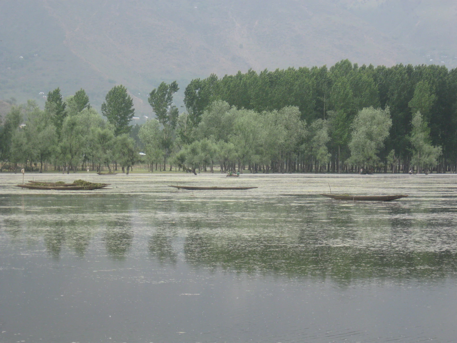
Several small traditional wooden boats sit on the calm surface of Wular Lake with a line of trees along the shoreline in the background.
Traditional boats on the calm waters of Wular Lake.

Wular Lake ecosystems, habitats, and plant life

The ecological character of Wular Lake is built around its freshwater wetland habitat and its position along the Jhelum River system. Its varying depths, aquatic vegetation, and surrounding marshy margins create a mosaic of habitats that supports fish populations and rich birdlife. Aquatic plant communities, including reed grasses of the genus Phragmites and waterlily-like Nymphoides species, play a significant ecological role, providing habitat structure as well as materials for human harvesting.

The lake is set within the Kashmir Himalaya environment, where surrounding riverine habitats and foothill woodlands create a transitional ecological zone. This broader landscape context contributes to the diversity of species recorded around the lake, linking aquatic habitats to terrestrial habitats across the valley. As a Ramsar site, Wular Lake represents a wetland of both national and international conservation significance, recognized for its hydrological function, biological richness, and socio-economic value for surrounding communities.
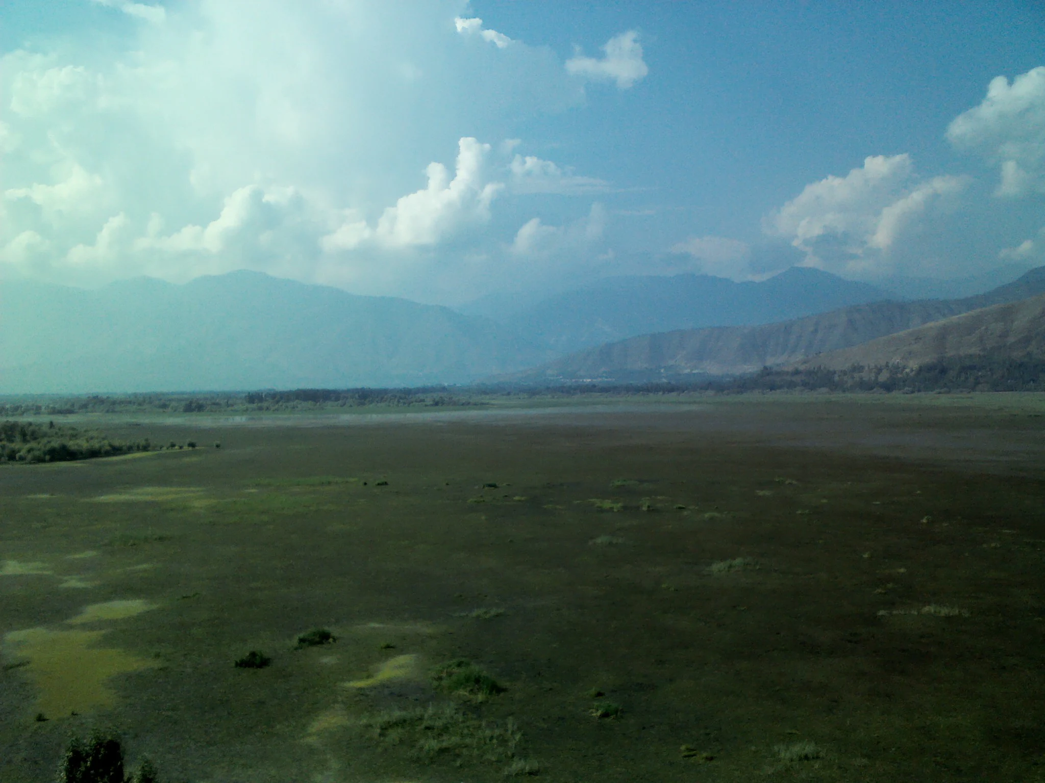
A wide, low-angle landscape view looking across a large, flat, marshy expanse toward distant rolling mountains under a blue sky with scattered clouds.
A wide view of the vast, flat landscape surrounding Wular Lake with distant mountain ranges under a cloudy sky.

Wular Lake wildlife and species highlights

Wular Lake is an important fish habitat, hosting a variety of species including the common carp, rosy barb, mosquitofish, and several snowtrout species in the genera Schizopyge and Schizothorax. Endemic snowtrout varieties such as the Sattar snowtrout, Chirruh snowtrout, and Chush snowtrout have been identified in the lake's waters, alongside other Schizothorax species. The lake also supports small bottom-dwelling fish such as Nemacheilus species and Crossocheilus latius.

Birdlife around the lake is diverse and reflects the broader Himalayan foothill avifauna. Reported terrestrial species include raptors such as the black-eared kite, Eurasian sparrowhawk, short-toed eagle, and Himalayan golden eagle; gamebirds and pheasants such as the Himalayan monal, chukar partridge, and koklass pheasant; and a mix of smaller birds including rock doves, common cuckoos, alpine swifts, Indian rollers, Himalayan woodpeckers, hoopoes, barn swallows, and golden orioles. The lake also traditionally attracts migratory and waterfowl species, though their populations are affected by hunting and habitat pressures in the wider area.

Wular Lake conservation status and protection priorities

Wular Lake holds a strong conservation profile as one of the 98 Indian wetlands formally designated under the Ramsar Convention. It was recognized in 1986 as a Wetland of National Importance under India's Wetlands Programme and subsequently designated in 1990 as a Wetland of International Importance, cited for its biological, hydrological, and socio-economic values. These designations reflect the lake's role in regional water systems, its ecological richness, and its importance to thousands of dependent livelihoods.

Despite this recognition, the lake faces serious environmental threats. Conversion of catchment areas into agricultural land has altered water and sediment flows, while fertilizers and animal waste contribute to pollution. Hunting of waterfowl and migratory birds, weed infestation within the lake, and the accumulation of waste along shorelines and within the water have all degraded the lake's condition. Restoration efforts under the National Lake Conservation Programme have been approved, including plans to cut approximately two million trees from shoreline willow plantations to restore lake extent, with substantial funding allocated for projects projected to span five to ten years.

Wular Lake cultural meaning and human context

Wular Lake is woven into the cultural memory of the Kashmir region. Ancient Sanskrit literature refers to the lake as Mahapadmasar, and local traditions speak of submerged cities, rulers, and idols beneath its waters. The 15th-century construction of the artificial island of Zaina Lank by the sultan Zain-ul-Abidin is a major historical landmark of the lake and gives the area a layered cultural heritage that blends legend and documented history.

The lake also plays a continuing role in the everyday cultural and economic life of its surroundings. Fishing families, aquatic plant harvesters, and wider communities across the Kashmir Valley have long relied on the lake, so much so that the lake's fish catch has historically represented a majority of total fish yield for the valley. This combination of deep historical narrative and present-day rural livelihoods gives Wular Lake a distinctive place in regional identity.

Top sights and standout views in Wular Lake

Wular Lake is one of South Asia's largest freshwater lakes, with a tectonic-origin basin in the Kashmir Valley fed and drained by the Jhelum River. It carries both national and international conservation recognition through India's Wetlands Programme and the Ramsar Convention, while continuing to support endemic snowtrout fish, diverse birdlife, and large-scale fishing and aquatic plant harvesting economies.

A defining feature of the lake is the contrast between its ecological significance and its present-day vulnerability. Long-running pressures including agricultural conversion in its catchment, pollution, hunting, weed infestation, and shoreline waste accumulation have reduced its water extent and depth. The lake is also at the center of the Tulbul Lock Project, a long-debated navigation and water regulation initiative at its outflow, reflecting how Wular Lake sits at the intersection of regional ecology, livelihoods, and transboundary water politics.

Best time to visit Wular Lake

Wular Lake is a strongly seasonal landscape, with surface area fluctuating significantly through the year. Winter brings lower water levels during which submerged features have historically been visible, while afternoons across the lake are known for high-leaping waves. For those interested in broader Himalayan scenery, the cooler months tend to bring crisper visibility in the Kashmir Valley, while warmer months support more active fishing operations and aquatic plant harvesting on the lake.

Monthly climate preview

Long-term representative averages tracking annual temperature and precipitation rhythm

Wular Lake Climate Normals and Measured Monthly Temperature Ranges

Representative coordinates document sustained temperature variation from sub-zero winter minimums to warm summer maximums alongside measured monthly precipitation. Detailed monthly climate records provide comprehensive twelve-month baseline datasets for tracking long-term environmental patterns.
Annual mean9 °C
-3 °C19 °C
Jan-3°
Feb-2°
Mar
Apr
May14°
Jun18°
Jul19°
Aug18°
Sep15°
Oct10°
Nov
Dec
Warmest month
July

19.4 °C

Coolest month
January

-3 °C

Wettest month
March

3.2 mm/day

Driest month
October

0.7 mm/day

Park location guide

Geography guide, regional context, and park location map for Wular Lake

Wular Lake park geography, regions, and map view in India

Understand where Wular Lake sits in India through a broader geographic reading of the surrounding landscape, nearby location context, and its mapped position within the national park landscape.

How Wular Lake fits into India

India is a South Asian country bordered by the Indian Ocean, Arabian Sea, and Bay of Bengal. It shares land borders with Pakistan, China, Nepal, Bhutan, Bangladesh, and Myanmar. The country has a population of over 1.4 billion people and operates as a federal parliamentary republic with its capital in New Delhi.

Wider geography shaping Wular Lake in India

India occupies the Indian subcontinent in South Asia, bordered by the Arabian Sea to the southwest, the Bay of Bengal to the southeast, and the Indian Ocean to the south. It shares land borders with Pakistan to the west, China, Nepal, and Bhutan to the north, and Bangladesh and Myanmar to the east. The territory also includes the Andaman and Nicobar Islands in the Indian Ocean.

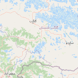
Map view of Wular Lake

Use this park location map to pinpoint Wular Lake in India, understand its exact geographic position, and read its mapped placement within the surrounding landscape more clearly.

Pigeon | © OpenStreetMap contributors

Location context for Wular Lake

Jammu and Kashmir

Explore high-elevation protected wetland habitats, seasonal water levels, and basin terrain.

Wular Lake Photos and Scenery: Visualizing the Kashmir Valley Wetland Landscape

Visual records capture the broad freshwater expanse, reed beds, and surrounding Himalayan foothill watershed of Wular Lake. Examining these protected wetland views reveals the environmental character and terrain fluctuations shaping the region.

A large flock of geese congregated on the green grassy shoreline of Wular Lake, with a few cows grazing in the background near a single tree and distant mountains.

A person on a narrow wooden boat uses a long pole to navigate through the shallow waters of Wular Lake, carrying a load of harvested aquatic plants.

Several small traditional wooden boats sit on the calm surface of Wular Lake with a line of trees along the shoreline in the background.

A wide, low-angle landscape view looking across a large, flat, marshy expanse toward distant rolling mountains under a blue sky with scattered clouds.

Park atlas

Discover related wetland reserves and regional sanctuaries across the surrounding Kashmir Valley terrain.

Explore Other Parks Near Wular Lake and Connected Protected Landscapes

Compare Wular Lake with other protected areas and wetland habitats located throughout the surrounding Himalayan foothills. Regional park browsing reveals contiguous conservation landscapes and connected river basins for comprehensive geographical exploration.
A horizontal watercolor illustration depicting a tranquil wetland landscape with soft green reeds in the foreground, trees in the midground, and purple hills in the distance.
Protected areaJammu and Kashmir
About 33 km away#1 closest

Southeast

Hokersar Protected Area: Wetland Geography and Map Context in Jammu and Kashmir

Migratory bird sanctuary and critical Jhelum basin wetland

Hokersar encompasses a distinct wetland landscape in northwestern India, characterized by shallow water, reed beds, and marshy pastures. As a key node for Palearctic waterbirds in the Kashmir Valley, the reserve provides essential flood-buffering services through its perennial stream network and seasonal snowmelt cycles, making it a focal point for regional ecological study.

Area
13.75 km²
Visitors
500K annual
Relief
Lowland
Climate
Temperate
National parkJammu and Kashmir
About 39 km away#2 closest

Southeast

Salim Ali National Park: Mapped Protected Landscape in Jammu and Kashmir

National Park with distinct geographic and regional atlas context.

Salim Ali National Park is a recognized national park situated in the Jammu and Kashmir region. This entry provides specific insights into its designation as a protected area, focusing on its mapped geographic footprint and its contribution to the regional atlas of conservation lands. Understand the park's landscape context and its place within the broader geography of northern India, offering a detailed perspective for geographic exploration.

Area
9.07 km²
Established
1986
IUCN
II
Climate
Temperate
National parkPakistan
About 45 km away#3 closest

Northeast

Gurez National Park: Pakistan's Alpine Protected Landscape and Wildlife Habitat

Explore its mapped terrain and regional geographic context.

Gurez National Park stands as a protected national park within Pakistan's breathtaking Himalayan mountain system. This park is crucial for conserving the endangered musk deer and safeguarding a fragile alpine ecosystem characterized by dramatic valleys, steep peaks, and the flowing Kishenganga River. Its relative isolation preserves a unique natural landscape and traditional cultural heritage, making it a point of interest for understanding remote wilderness and conservation efforts within the South Asian atlas.

IUCN
II
National parkSrinagar district
About 51 km away#4 closest

Southeast

Dachigam National Park: Protected Landscape Atlas and Geographic Context in Srinagar District

Mapped boundaries and natural terrain within India's national park system.

Gain insight into Dachigam National Park, a significant protected area located in the Srinagar district. This page provides detailed geographic context and an atlas-style view of its protected landscape. Understand its specific role as a national park and explore its mapped features, contributing to a comprehensive understanding of India's natural territories.

Area
141 km²
Established
1910
IUCN
II
Relief
Mountain
National parkBaramulla district
About 53 km away#5 closest

Southwest

Kazinag National Park: Protected Area Geography and Mapped Boundaries in Baramulla District

Explore the regional landscape and terrain of this national park.

Kazinag National Park represents a distinct protected area within India's Baramulla district. This entry provides structured geographic information, focusing on the park's mapped boundaries and its role as a national park. Users can explore its landscape context and understand its specific regional terrain, contributing to a comprehensive atlas view of protected lands.

Area
160 km²
Established
1992
IUCN
II
Relief
Mountain
National parkGilgit-Baltistan
About 67 km away#6 closest

Northeast

Himalaya National Park: Exploring Its Protected Boundaries and Mountainous Landscape in Gilgit-Baltistan

Mapped protected area within Pakistan's northern mountain region.

Himalaya National Park serves as a significant protected entity within the dramatic geography of Gilgit-Baltistan, Pakistan. This national park offers a focused view of its specific natural terrain and mapped boundaries, contributing to a broader atlas of conservation lands. Users can discover the park's role as a protected landscape, examining its integration within the regional context and understanding its unique geographic characteristics. The focus here is on the park's protected status and its place in the mapped natural environment of Northern Pakistan.

Area
2,263 km²
Established
2021
IUCN
II
Relief
Mountain
National parkAzad Kashmir
About 78 km away#7 closest

Northwest

Ghamot National Park: Pakistan National Park Atlas and Protected Landscape

Explore mapped boundaries and regional geography in Azad Kashmir.

Ghamot National Park represents a cornerstone for protected area exploration in Pakistan, situated within the dramatic mountainous terrain of Azad Kashmir. As a national park, it is recognized for its critical function as a wildlife corridor, especially for the survival of the Himalayan Brown Bear, and harbors diverse avian populations. This page offers detailed insight into its geographic context and its significance within a broader regional conservation strategy, providing rich data for atlas-based discovery.

Established
2004
IUCN
II
Relief
Mountain
Access
Remote access
National parkGilgit-Baltistan
About 81 km away#8 closest

Northeast

Deosai National Park: A Premier High-Altitude Alpine Wilderness and Protected Landscape in Pakistan

Mapped boundaries and unique terrain within Gilgit-Baltistan's geography.

Deosai National Park is a key protected area in Pakistan's Gilgit-Baltistan region, characterized by its high-altitude alpine meadows and expansive plateau terrain. As a national park, it offers crucial insights into mapped landscapes and regional geography, particularly for understanding conservation efforts in extreme environments. The park's setting provides a unique lens through which to explore the distribution and characteristics of protected lands within the broader atlas of natural landscapes.

Area
3,584 km²
Established
1993
IUCN
Ib
Relief
Highland

Common questions about visiting, size, designation, and location context for Wular Lake

Wular Lake FAQs for park facts, access, geography, and protected area context

Find quick answers about Wular Lake, including protected-area facts, park geography, trail and visitor context, and how the park fits into its surrounding country and regional landscape.
MoriAtlas Explorer

Continue Your Protected Areas Search Across the Global Atlas

Deepen your exploration by continuing the structured search for national parks and protected areas worldwide. Utilize the comprehensive filtering capabilities to compare different conservation landscapes and refine your understanding of global park geography. Discover more about the distribution and characteristics of protected natural areas.

Global natural geography
