
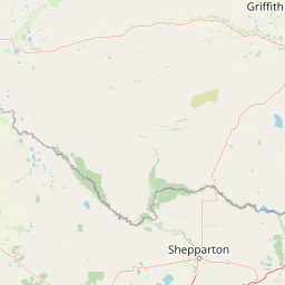
Rivers
Park geography
Detailed analysis of the lowland terrain, riparian ecosystems, and water-dominant landscapes.
Yanga National Park Geographic Profile: Boundaries, Terrain, and Natural Features in New South Wales
Examine the physical geography of Yanga National Park, a 667.34 square kilometer protected area in New South Wales, Australia. The region features a complex distribution of riverine systems, lacustrine wetlands, and temperate forests that define this lowland environment. This profile includes structured data on regional hydrology and landscape classifications.
Related tags
wetlandsriver red gum forestwaterbird habitatfloodplain ecosystemMurray-Darling Basin
Wetland sanctuary on the Lower Murrumbidgee Floodplain in semi-arid New South Wales
Yanga National Park
Yanga National Park is a protected area in southwestern New South Wales, Australia, established in 2007 on the former Yanga pastoral station. The park covers 66,734 hectares along 170 kilometres of the Murrumbidgee River, encompassing the northern portion of the Lowbidgee Floodplain. This extensive wetland system supports twelve distinct wetland types and is recognized as a Nationally Important Wetland within the Directory of Important Wetlands in Australia. The park protects one of the most significant waterbird habitats in eastern Australia, with colonial nesting colonies and critical breeding grounds when seasonal flooding occurs. The landscape features extensive river red gum forests, black box woodlands, and numerous lakes and waterways, creating a vital ecological corridor within the Murray-Darling Basin. Yanga was formally part of the Murrumbidgee Valley National Park, established in 2010, which now protects the largest continuous tract of river red gum forest in the world.
- Location
- Australia
- Park type
- National park
- Established
- 2007
- Area
- 667.3 km²
Location overview
National and regional placement of an inland Australian reserve
Geographic Placement of Yanga National Park in New South Wales
Yanga National Park is located within the state of New South Wales in Australia. Administrative records classify the park as an inland terrestrial reserve with no marine or coastal boundaries.
- Countries
- Australia
- Regions
- New South Wales
- Primary location
- New South Wales
- Geographic setting
- Inland
Boundary and coordinates
Yanga’s mapped boundary traces 667.34 km² of recorded land
Yanga National Park mapped boundary and 667.34 km² land area
Yanga National Park's stored geometry maps its substantial protected footprint. Overall and land measurements both equal 667.34 km², while no marine-area component or perimeter value is available.
- Boundary area
- 353.8 km²
- Boundary perimeter
- 651.5 km
- Northernmost point
- 34.3309° S
- Southernmost point
- 34.7667° S
- Easternmost point
- 143.9176° E
- Westernmost point
- 143.5036° E
- Geographic centre
- 34.5308° S, 143.7272° E
- North–south span
- 48.3 km
- East–west span
- 38 km
Terrain and natural features
Lowland relief classification and recorded landscape features
Yanga National Park Terrain and Named Natural Features
Recorded terrain classifications indicate a lowland setting containing multiple rivers, lakes, creeks, and wetlands. Linked feature cards supply official names, types, and spatial relationships for each recorded natural element.
Selected named natural features
Peaks
Lambing Down Hill
Streams
Woolshed Creek
Lakes
Yanga Lake
Streams
Breer Creek
Rivers
Uara Creek
Environmental setting
Arid lowland relief, dominant water presence, and seasonal forest cover
Yanga National Park Environmental Classifications and Physical Settings
Stored landscape features and habitat types provide complementary ways to read the physical setting across Yanga National Park. Recorded categories connect directly to relevant atlas destinations for structured environmental exploration.
- Relief
- Lowland
- Climate
- Arid
- Water
- Water-dominated
- Forest cover
- Dense forest cover
- Seasonality
- Strongly seasonal
Landscape features
Wetland · Lakes · Rivers · Forest · Grassland
Habitat types
Temperate broadleaf forest · Shrubland · Wetland · Riverine habitat · Lacustrine habitat · Grassland
Park atlas
Map adjacent protected landscapes, tracing wetland systems and river red gum forests across the Lowbidgee Floodplain.
Discover Other Protected Areas Near Yanga National Park in Australia's Murrumbidgee Floodplain
Continue your exploration from Yanga National Park by mapping other protected areas and national parks across Australia's Murray-Darling Basin. Compare diverse wetland habitats, extensive river red gum forests, and critical waterbird ecosystems within their regional geographic context.
National parkNew South Wales
48 km away#1 closest
Southeast

Murray Valley National Park: Explore its Mapped Boundaries and Regional Geography in New South Wales
Protected landscape identity and geographic context.
Gain a structured understanding of Murray Valley National Park, a designated national park within New South Wales. This detail page provides essential geographic context, highlighting the park's mapped boundaries and its significance as a protected natural landscape. Utilize this entry point for comprehensive atlas-based exploration of its unique regional setting and terrain.
- Area
- 416.01 km²
- Established
- 2010
- IUCN
- II
- Relief
- Lowland
National parkNew South Wales
83 km away#2 closest
Northwest
Mungo National Park: Protected Landscape Atlas and Geographic Context
Explore mapped boundaries and regional terrain within New South Wales.
Mungo National Park offers a distinct focus for atlas exploration, presenting itself as a key protected landscape within the state of New South Wales, Australia. This entry details the park's geographic positioning and mapped boundaries, allowing for a clear understanding of its terrain and regional context. Engage with the park's identity as a protected area, uncovering the specifics of its natural landscape for a richer geographic discovery experience.
- Area
- 1,109.67 km²
- Established
- 1979
- IUCN
- II
- Relief
- Lowland
National parkAustralia
90 km away#3 closest
West
Hattah-Kulkyne National Park: Victoria's Ramsar Wetland National Park & Mallee Landscape
Explore its mapped protected area and semi-arid regional geography.
Delve into Hattah-Kulkyne National Park, a substantial protected area in northwestern Victoria, Australia, defined by its striking red-earth terrain and sprawling mallee woodlands. This national park is renowned for its dynamic seasonal lake system, a key component of the Murray River basin's wetland geography. The park's status as a Ramsar-designated wetland highlights its ecological importance, providing critical habitat within a distinct semi-arid environment. Discover the unique atlas-scale landscape character and protected land context of this significant Australian natural area.
- Area
- 480 km²
- Established
- 1960
- IUCN
- II
- Relief
- Lowland
National parkNew South Wales
About 101 km away#4 closest
Northwest
Mallee Cliffs National Park: Protected Landscape and Geographic Atlas Entry
Explore its mapped boundaries and regional New South Wales context.
Mallee Cliffs National Park is presented here as a distinct protected landscape, offering specific insights for atlas and geographic discovery. This entry details the park's national park designation and its position within New South Wales, highlighting its mapped boundaries and the surrounding regional geography. It provides the foundational geographic context needed to understand Mallee Cliffs National Park's presence within the broader landscape of protected areas, inviting detailed exploration for those interested in mapped natural terrain.
- Area
- 579.69 km²
- Established
- 1977
- IUCN
- II
- Relief
- Lowland
National parkAustralia
112 km away#5 closest
West
Murray-Sunset National Park: Iconic Pink Lakes and Mallee Wilderness in Victoria's Semi-Arid Interior
Explore its unique landscape, mapped boundaries, and regional geography.
Murray-Sunset National Park offers a compelling glimpse into Australia's semi-arid heart, featuring a dramatic landscape of salt lakes, gypsum plains, extensive sand dunes, and dense mallee woodlands. This vast protected area is renowned for the vibrant pink hue of its salt lakes, a phenomenon created by microscopic algae that flourishes in the hypersaline conditions during warmer months. The park's rich biodiversity and unique ecosystem make it a significant conservation asset, providing crucial habitat for numerous species adapted to this challenging yet beautiful environment.
- Area
- 6,330 km²
- Established
- 1991
- IUCN
- II
- Relief
- Lowland
Biosphere reserveVictoria
About 114 km away#6 closest
West
Hattah-Kulkyne and Murray-Kulkyne Biosphere Reserve: Protected Geography and Mapped Landforms
An inland mosaic of river corridors and semi-arid mallee habitats.
Located in northwestern Victoria, this biosphere reserve encompasses a distinct ecological assembly of Hattah lakes, seasonal floodplains, and sand-ridge terrains. Understand the interplay between the Murray River system and the surrounding dryland vegetation through detailed geographic context.
- Area
- 515 km²
- Established
- 1981
- Visitors
- 99K annual
- Relief
- Lowland
National parkNew South Wales
122 km away#7 closest
East
Oolambeyan National Park National Park: Discover its Mapped Geography and Protected Landscape
Explore the protected area and regional context of New South Wales.
Delve into Oolambeyan National Park, a key national park within New South Wales, Australia. This entry provides essential geographic context, detailing the park's mapped boundaries and its identity as a protected landscape. It serves as a foundation for understanding the park's contribution to the regional atlas and offers a distinct perspective on the natural geography of the area.
- Area
- 222.31 km²
- Established
- 2001
- IUCN
- II
- Access
- Moderate access
National parkAustralia
123 km away#8 closest
Southeast
Gunbower National Park: A National Park Protecting River Red Gum Forests and Ramsar Wetlands
Explore its mapped riverine landscape and regional protected area context.
Gunbower National Park offers a unique glimpse into Victoria's vital floodplain ecosystems, prominently featuring extensive River Red Gum forests and Ramsar-designated wetlands. This protected national park, situated along the Murray River, serves as a crucial sanctuary for migratory bird species within the Murray-Darling Basin. Its landscape is defined by waterways like Gunbower Creek and a mosaic of aquatic habitats, representing an important conservation area for its ecological communities and geographic significance.
- Area
- 93.3 km²
- Established
- 2010
- IUCN
- II
- Relief
- Lowland
MoriAtlas Explorer
Continue Exploring Yanga National Park's Protected Landscape and Geographic Setting
Delve deeper into the atlas representation of Yanga National Park, investigating its precise mapped boundaries and its placement within the regional geography of New South Wales. Understanding the distinct character of this protected national park offers valuable insights for anyone exploring conservation landscapes and mapped natural terrain. Continue your structured discovery of protected areas and their geographic significance.
Browse next
Global natural geography
Explore related park routes
Explore MoriAtlas Global ParksBrowse All MoriAtlas ParksGlobal Park Map DiscoveryMoriAtlas: Browse All CountriesBrowse All MoriAtlas ContinentsNational Park Environment AtlasGrand Canyon National Park AtlasYellowstone National Park AtlasYosemite National Park Atlas and GeographySerengeti National Park AtlasGalápagos National Park Protected LandscapeBanff National Park Geography and AtlasKruger National Park Atlas EntryUluṟu-Kata Tjuṯa National Park AtlasExplore Uluru-Kata Tjuta National Park GeographyPlitvice Lakes National Park AtlasFiordland National Park Protected LandscapeGreat Smoky Mountains National Park AtlasAfghanistan National Parks and Protected AreasAlbania National Parks and Protected AreasAlgeria National Parks and Protected AreasAmerican Samoa National Parks and Protected AreasAndorra National Parks and Protected AreasAngola National Parks and Protected AreasAntarctica National Parks and Protected AreasAntigua and Barbuda Park List