Mori Atlas logo
Countries

Browse mapped protected lands and natural landscapes across Iceland's diverse geography.

Iceland National Parks and Protected Areas: A Geographic Atlas Explorer

MoriAtlas provides a structured geographic overview of Iceland's national parks and protected areas. Delve into the mapped boundaries and regional context of its volcanic terrain, glacial landscapes, and sparsely populated territories. Use this atlas to navigate Iceland's unique natural environments and understand the distribution of its conservation lands.

Iceland National Parks and Protected Areas: A Geographic Atlas Explorer
About

Discover the unique geographic spread of protected landscapes across Iceland's volcanic terrain and glacier regions.

Explore National Parks and Protected Areas in Iceland, a Nordic Island Nation
MoriAtlas offers a comprehensive atlas view of national parks and other notable protected areas across Iceland, providing detailed geographic context for each conservation landscape. This country-level perspective serves as an essential entry point for navigating the diverse natural terrain and understanding the distribution of Iceland's unique protected lands.

Iceland is a Nordic island nation located between Europe and North America on the Mid-Atlantic Ridge. With a population of approximately 394,000 and an area of 103,125 km², it is one of the world's most sparsely populated countries. The country features dramatic volcanic terrain, extensive glaciers, geysers, and geothermal activity, all while maintaining a temperate climate warmed by the Gulf Stream.

Iceland is a Nordic island country situated in the North Atlantic Ocean between the Arctic Ocean and the Atlantic, positioned on the Mid-Atlantic Ridge. It is culturally and politically linked to Europe while being geographically positioned between two continents. The country operates as a unitary parliamentary republic with Reykjavík as its capital and largest city, home to about 36% of the population. Iceland's official language is Icelandic, and the nation has a high human development index ranking first globally. The landscape is characterized by volcanic plateaus, sand and lava fields, mountains, glaciers, and glacial rivers flowing to the sea through lowland areas.

Largest city:Reykjavík
Currency code:ISK
ISO code:IS
Parks count
5
Capital
Reykjavík
Area
103,125 km²
Population
394,530 (2,025)

Coastal
Island
Mountainous
Landlocked
Park atlas5 parks

A MoriAtlas geographic view of Iceland's national parks, showcasing its unique volcanic, glacial, and geothermal protected landscapes.

Discover Iceland's National Parks and Protected Areas: A Geographic Atlas View
Explore the full list of national parks and protected areas across Iceland, an island nation known for its dramatic volcanic terrain, extensive glaciers, and geothermal activity. This country-level view provides a structured atlas perspective for understanding the distribution and characteristics of Iceland's significant conservation landscapes, aiding geographic discovery.
Watercolor illustration showing a landscape with green fields, a winding path, pink flowers, and mountains in the background
National park

Vatnajökull National Park: Iceland's Expansive Protected Glacier and Volcanic Terrain

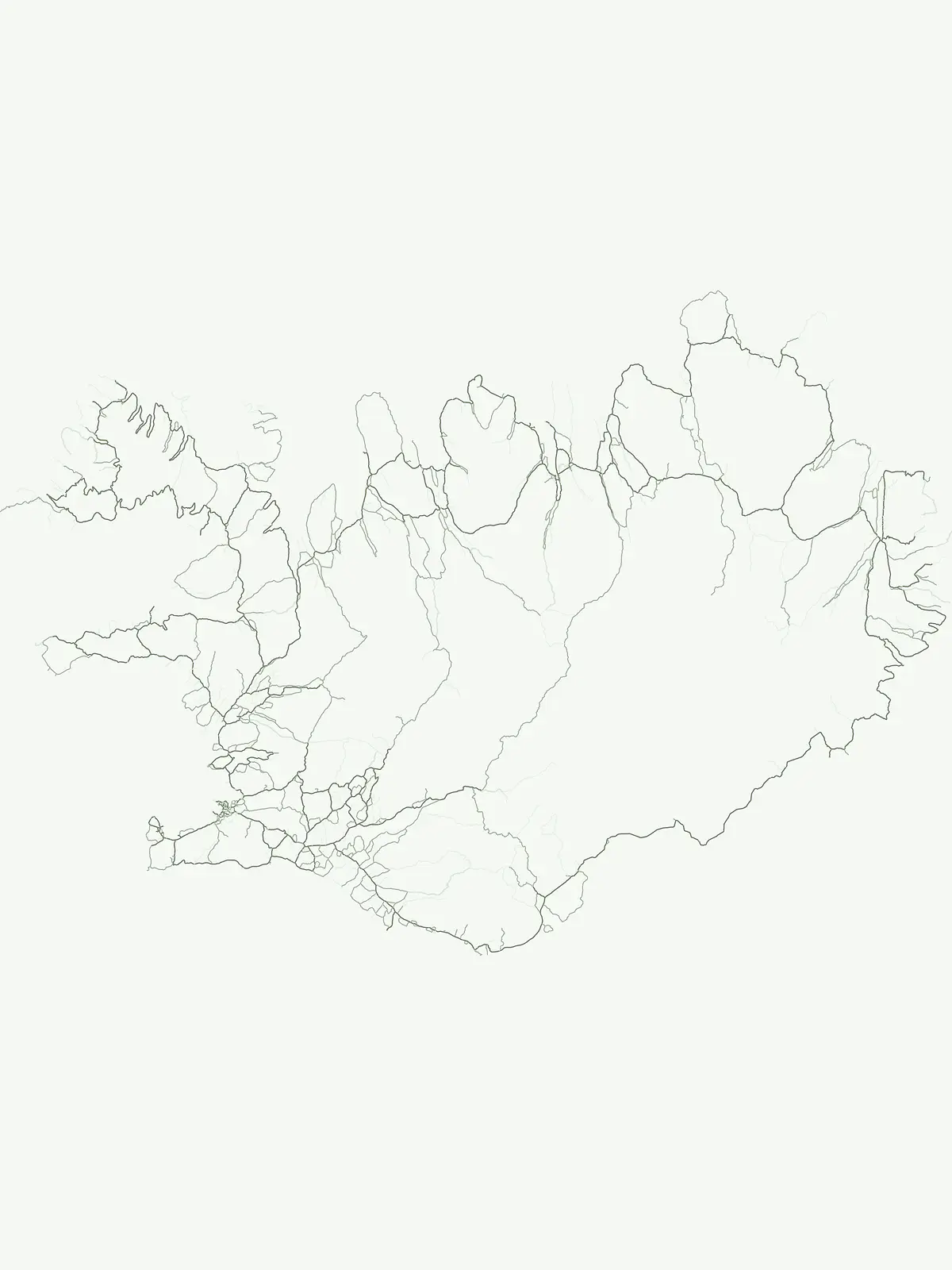
Mapped boundaries of a UNESCO World Heritage site dynamic with fire and ice.

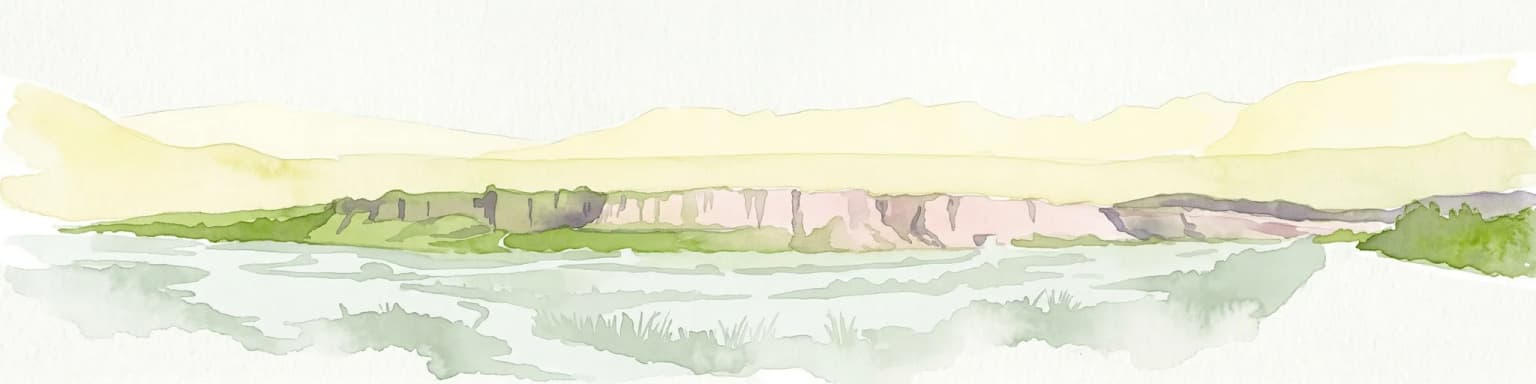
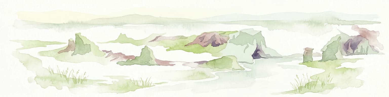
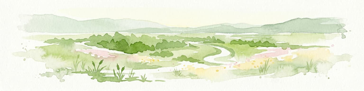
Vatnajökull National Park offers a profound exploration of one of Earth's most dynamic natural environments. This Icelandic national park protects the vast Vatnajökull ice cap, a landscape shaped by active volcanoes and powerful glacial forces, creating a region of extraordinary geographic diversity. Discover the mapped terrain, from subglacial mountain ranges to dramatic caldera systems, and understand the unique protected area context of this significant European natural heritage.

Area
14,967 km²
Established
2008
IUCN
II
Relief
Mountain
Watercolor painting depicting a landscape with cliffs, a body of water, and distant hills under a light sky
National parkSouthern Region

Þingvellir National Park: Witness Tectonic Plates and Ancient Icelandic Governance

Explore the rift valley and historic parliament site in Iceland's Southern Region.

Þingvellir National Park offers a singular opportunity for geographic discovery, situated in Iceland's Southern Region. This protected national park is globally recognized for its visible expression of the Mid-Atlantic Ridge, where the North American and Eurasian tectonic plates actively diverge, creating a dramatic rift valley. Moreover, Þingvellir served as the site of the Althing, Iceland's ancient parliament, making it a crucial historical landmark. Explore this landscape to understand both powerful geological processes and the foundations of Icelandic democratic history through its mapped terrain.

Area
92.7 km²
Established
1930
IUCN
II
Relief
Lowland
Watercolor illustration showing a mountain landscape with green valleys, pink mountains, and a winding river
National park

Skaftafell National Park: Iceland's Accessible Protected Landscape with Glacial Terrain and Basalt Columns

Discover glacial landscapes and volcanic geology.

Skaftafell National Park is a vital protected area in Southeast Iceland, offering a unique atlas-level view of dramatic glacial landscapes. Located at the base of Vatnajökull, Europe's largest glacier, the park features accessible hiking trails that traverse outwash plains, birch woodlands, and glacial tongues like Skaftafellsjökull. Explore the iconic Svartifoss waterfall, framed by striking basalt columns, and understand the park's dynamic terrain shaped by volcanic activity and glacial processes, providing rich geographic context for protected landscape discovery.

Established
1967
IUCN
II
Scope
Terrestrial
Watercolor illustration of a mountain landscape with a glacier-capped peak and surrounding green fields
National park

Snæfellsjökull National Park: Mapped Volcanic Terrain and Protected Landscape Identity

Discover the geographic context of Iceland's glacier volcano.

Snæfellsjökull National Park on the Snæfellsnes Peninsula is a prime example of Iceland's protected lands, defined by the iconic Snæfellsjökull glacier volcano. This page details the park's volcanic terrain, from expansive lava fields to dramatic sea cliffs, offering an atlas-driven exploration of its unique geographic features. Understand its significance as a protected area and its place within the broader landscape of western Iceland through detailed mapping and geographic data.

Established
2001
IUCN
II
Watercolor illustration showing a river valley with hills and tents.
National park

Jökulsárgljúfur National Park: Explore Iceland's Volcanic Canyon and Glacial River Protected Landscape

Mapped geography and terrain of a key northern Iceland protected area.

Jökulsárgljúfur National Park, located in northern Iceland, is celebrated for its striking volcanic canyon landscape carved by the powerful Jökulsá á Fjöllum glacial river. This protected area showcases a terrain shaped by ancient glacial outburst floods and volcanic forces, featuring notable geological formations like the Hljóðaklettar echo rocks and iron-colored hills. Understanding Jökulsárgljúfur National Park provides crucial insight into the unique regional geography and the atlas-driven exploration of Iceland's preserved natural heritage.

IUCN
II
Relief
Mountain
Access
Remote access
Scope
Terrestrial
Landscape and environment

Understand how Iceland is shaped by terrain, ecosystems, and seasonal conditions

Iceland geography, nature, climate, and landscape context for park-focused travel research
Explore the physical geography, natural setting, and climate patterns of Iceland through a location-first overview built for travel research, national park discovery, and broader regional context. This section helps explain how landscapes, habitats, and environmental conditions shape what people search for, where they travel, and how they experience protected areas in Iceland.

Iceland geography and landscape

Iceland is an island nation located in the North Atlantic Ocean between the Arctic Ocean and the Atlantic Ocean, situated on the Mid-Atlantic Ridge between Europe and North America. The interior consists of volcanic plateaus with sand and lava fields, while mountains and glaciers dominate the terrain. Numerous glacial rivers flow from the highlands through lowlands to the sea. The country sits at a latitude just south of the Arctic Circle.

Iceland nature and environment

Iceland's natural landscape is dominated by volcanic terrain including lava fields, volcanic plateaus, and numerous glaciers. The country experiences significant geothermal activity with geysers and hot springs. Glacial rivers flow across the island from glacier-fed sources to the ocean. The combination of volcanic geology and glacial coverage creates a distinctive and dramatic natural environment.

Iceland climate and seasonal conditions

Iceland has a temperate climate despite its high latitude just south of the Arctic Circle, largely due to the warming effect of the Gulf Stream. The marine influence keeps summers relatively cool, while coastal areas and islands in the north experience more extreme conditions, with some northern islands having polar climates.

Explore this place

Related topics and popular queries

Ways to explore Iceland
Useful phrases, related topics, and discovery prompts connected to Iceland.
where is icelandiceland country factsiceland geography and climateiceland nature and landscapeswhat is iceland known foriceland population and capitaliceland volcanic activityiceland countrynordic nationsnorth atlantic islandvolcanic icelandarctic circle附近glacier countryreykjavik capitalicelandic kronamid-atlantic ridgesparse population country
Park map

Explore the geographic distribution of Iceland's national parks and protected areas, mapped across its volcanic and glacial terrain.

Explore the National Parks Map of Iceland: Discover Protected Areas and Geographic Distribution
Preview the geographical locations of Iceland's national parks and other protected areas, seeing how they are situated across the island's volcanic and glacial landscapes. This map preview provides a foundational understanding of the country's conservation landscapes and invites deeper exploration into the full interactive atlas.

Key insights into Iceland's unique park geography, protected area distribution, and conservation efforts across its volcanic and glacial landscapes.

Exploring Iceland's National Parks: Frequently Asked Questions on Park Geography and Protected Landscapes
Explore frequently asked questions about Iceland's national parks and protected areas, focusing on their unique geography and conservation status. Gain essential insights into the distribution of protected landscapes across this island nation, understanding how its volcanic terrain and extensive glaciers shape its natural reserves for atlas-style discovery.
Other countries

Compare mapped protected landscapes and regional geographies within the broader MoriAtlas.

Discover National Parks and Protected Areas in Other Countries Beyond Iceland
Beyond Iceland, you can browse a structured atlas of national parks and protected areas across other countries, comparing diverse conservation landscapes. This cross-country view facilitates geographic discovery, allowing users to understand the regional context and distribution of protected terrain worldwide.

Norway Protected Areas and National Parks Geographic Atlas Explorer

Discover the breadth of Norway's protected natural areas with MoriAtlas. This country-level atlas entry point allows you to explore the geographic distribution of national parks and conservation landscapes. Understand the spatial context of protected areas across Norway's diverse terrains, from the mainland Scandinavian Peninsula to its arctic territories, all within a structured, map-aware framework.

47 parks

Finland National Parks and Protected Areas: Explore Geographic Distribution

Access a structured geographic atlas for Finland, detailing its national parks and protected areas. This resource facilitates exploration of the country's diverse natural landscapes, emphasizing mapped boundaries and regional context. Understand how protected lands are distributed across Finland, providing a clear overview for geographic discovery and atlas-based navigation of its natural terrain.

41 parks

Explore Sweden's National Parks and Protected Areas: A Geographic Atlas View

Navigate Sweden's rich collection of national parks and protected areas through MoriAtlas. This platform provides a structured overview of their geographic distribution, allowing for detailed map-based exploration of protected lands. Understand the landscape context and regional geography of Sweden's natural reserves, facilitating a comprehensive discovery of its conservation areas.

29 parks

Explore Netherlands National Parks and Protected Areas with the MoriAtlas Geographic Navigator

Navigate the rich tapestry of Netherlands' protected natural areas and national parks using a geography-first approach. This platform provides an atlas view of mapped landscapes, enabling detailed exploration of park boundaries and their regional significance. Understand the distribution and context of conservation lands within the Netherlands, offering a structured foundation for geographic discovery and analysis of natural terrains.

21 parks

United Kingdom National Parks and Protected Areas: A Geographic Atlas

MoriAtlas facilitates the geographic exploration of national parks and protected areas within the United Kingdom. Delve into the mapped boundaries of natural landscapes, understand their regional distribution, and navigate the country's protected land entities through a structured atlas perspective. Discover the diverse geographic context of conservation efforts across England, Scotland, Wales, and Northern Ireland.

15 parks

Explore Ireland's National Parks and Protected Areas on the MoriAtlas

This section of MoriAtlas offers a structured view of Ireland's national parks and protected areas. Use our platform to understand the geographic distribution of protected lands across the island. Each entity is presented with detailed mapping and geographic context, facilitating comprehensive atlas-style exploration of Ireland's diverse natural landscapes and conservation areas.

7 parks

Belgium National Parks and Protected Areas: An Atlas of Mapped Natural Landscapes

Delve into the structured geography of Belgium's protected natural areas with MoriAtlas. This country-level atlas entry point reveals the mapped distribution of national parks and other protected lands, providing essential geographic context. Understand the landscape patterns and navigate through Belgium's conservation areas, enabling a deeper appreciation of its natural terrain and protected regions.

6 parks

Denmark National Parks and Protected Landscapes: A Geographic Atlas Overview

This atlas entry for Denmark allows for the exploration of its national parks and protected areas, focusing on their geographic distribution and mapped boundaries. Understand the context of these protected lands within the broader landscape of Denmark, facilitating structured discovery of natural terrain and conservation areas through an intuitive, map-aware interface.

4 parks

Protected area types

Continue Exploring Iceland's Protected Area Classifications and National Parks

Deepen your understanding of Iceland's protected landscape by continuing to browse its classification categories. This route offers a structured path into the specific geography and atlas context of each represented designation, revealing how Iceland's natural terrain is organized for conservation.

Iceland Protected Area Designations
MoriAtlas Explorer

Continue Your Global Geographic Exploration with MoriAtlas Park Discovery

Dive deeper into the world's protected landscapes and national parks through MoriAtlas's structured atlas interface. Discover how continents and countries are organized, and how individual park geography fits into the broader map. Our platform is built for understanding the distribution and context of protected areas worldwide, facilitating your journey through global natural geography.

Global natural geography