

Mori Atlas logo
National parkTandooreh National Park

Explore the geographic extent and protected boundaries of this key national park in Iran.

Tandooreh National Park: Iran's National Park for Mapped Landscape and Protected Area Discovery

Tandooreh National Park stands as a significant protected area within Iran, offering a unique lens through which to understand the country's diverse geography and natural landscapes. This national park provides crucial context for exploring mapped terrain, tracing protected land boundaries, and appreciating the regional spread of conservation efforts across Iran. Engage with structured geographic data to uncover the specific landscape characteristics and atlas context that define Tandooreh National Park.

Juniper WoodlandsMountain Protected AreaIran National ParksKopet Dag RangeNorth KhorasanBorderland Parks
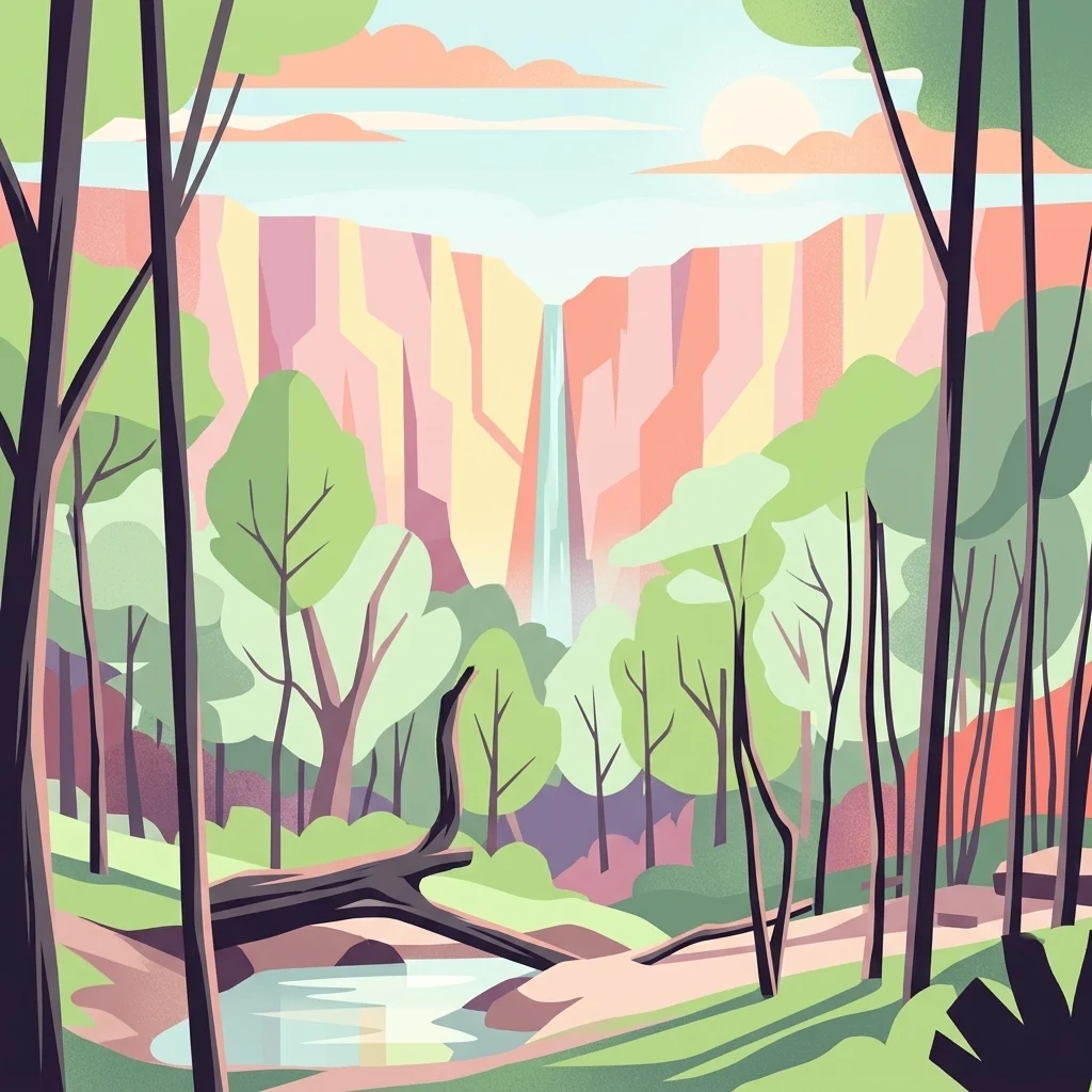
Colorful illustration of a forest scene with tall trees, a small river, and a waterfall in the background.

Tandooreh National Park

National park

Park overview

Structured park overview, official facts, and landscape profile for Tandooreh National Park

Tandooreh National Park park facts, protected area profile, and essential visitor context

Review the core facts for Tandooreh National Park, including designation, size, terrain, visitor scale, habitats, and operating context in one park-focused overview.

About Tandooreh National Park

Tandooreh National Park occupies a striking position in the mountainous northeast of Iran, within the southern foothills of the Kopet Dag range that extends from Turkmenistan into northern Iran. The park's terrain is characterized by dramatic elevation changes, with deep valleys cutting through the mountainous landscape and steep cliffs marking the boundaries between different ecological zones. The area has been protected since 1982, recognized as a nationally significant conservation priority within Iran's system of protected areas. The park's location near the city of Dargaz places it in a region where the influences of the Eurasian steppe meet the montane environments of the Zagros and Kopet Dag mountain systems. Beyond its ecological importance, the park serves as a refuge for biodiversity in a region where human activity and agricultural expansion have altered much of the original landscape. The combination of rugged topography, diverse habitats, and long-standing protection has allowed the park to maintain relatively intact ecological communities.

Quick facts and research context for Tandooreh National Park

Tandooreh National Park spans 355.4 square kilometers in northeastern Iran's North Khorasan Province, near the Turkmenistan border. The park was established in 1982 under the management of Iran's Department of the Environment and holds IUCN Category II protected area status. Elevation ranges from 980 to 2,600 meters, with the mountainous terrain featuring dramatic valleys and cliff systems. The park's vegetation is dominated by juniper woodlands on slopes, riparian thickets along valley rivers, and Artemisia steppe in open areas.

Protection and recognition

Exploring the official terrestrial conservation status and global database records for the reserve

Documented Protection Status and Designation of Tandooreh National Park

Tandooreh National Park operates under a dedicated terrestrial protection framework designed to safeguard its regional geographic features and ecological boundaries. Tracking documented management history and geographic boundaries provides essential context for analyzing the broader regional conservation network.

Protection details

Protection scope
Terrestrial
Transboundary protection
No
Park context

Deeper park guide and search-rich context for Tandooreh National Park

Tandooreh National Park history, landscape, wildlife, and travel context

Explore Tandooreh National Park through its history, landscape character, ecosystems, wildlife, conservation priorities, cultural context, and seasonal travel timing in a structured park guide built for atlas discovery and search intent.

Why Tandooreh National Park stands out

Tandooreh National Park is best known for its extensive juniper woodlands that clothe the mountain slopes of the Kopet Dag foothills in northeastern Iran. These ancient juniper forests represent one of the most significant and well-preserved juniper woodland ecosystems in the region, creating a distinctive landscape of aromatic, silver-green foliage against rugged cliff faces and deep valley corridors. The park's position at the edge of Iran's borderlands with Turkmenistan also gives it regional significance as a protected area preserving transitional Eurasian steppe and mountain forest habitats.
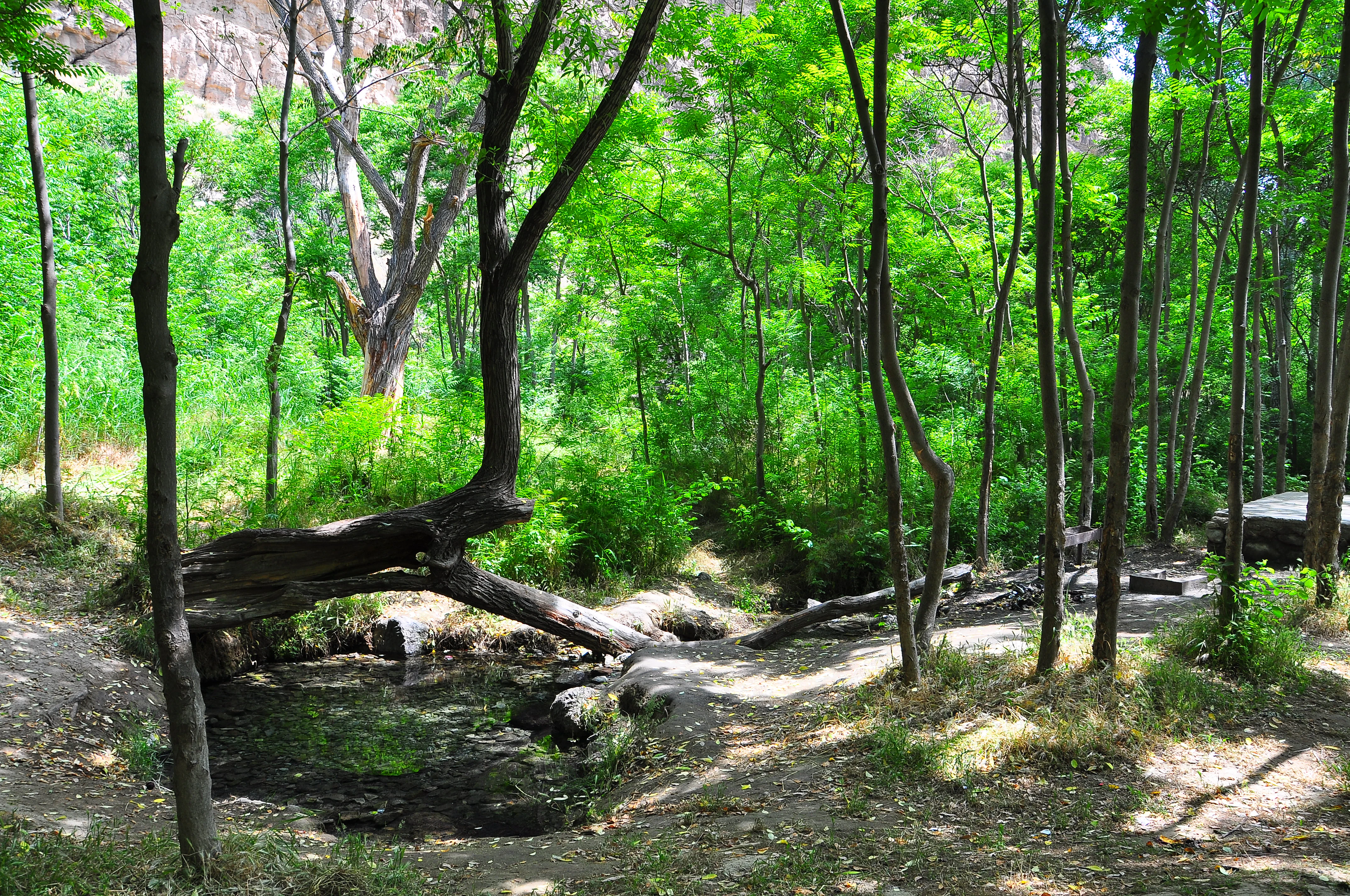
A forest with tall green trees, a small stream, and a fallen tree trunk in a natural setting
A forest scene with a small stream in Tandooreh National Park

Tandooreh National Park history and protected-area timeline

Tandooreh National Park was established in 1982 as part of Iran's expanding network of protected areas during a period of increased environmental conservation efforts in the country. The park was designated under the management authority of Iran's Department of the Environment, which oversees the nation's protected area system. The creation of the park reflected growing recognition of the ecological significance of the juniper woodlands and mountain steppe habitats found in the Kopet Dag region. Prior to formal protection, the area had long served as a traditional landscape where local communities interacted with the mountain environment, though the establishment of national park status brought formal conservation frameworks to regulate land use and protect the region's natural values.

Tandooreh National Park landscape and geographic character

The landscape of Tandooreh National Park is defined by its mountainous character and the dramatic topography of the Kopet Dag foothills. The terrain features deep, V-shaped valleys carved by seasonal watercourses, with steep cliff faces and rocky outcrops creating a rugged and visually distinctive environment. Elevation ranges from approximately 980 meters in the valley floors to around 2,600 meters at the higher points of the park, creating a vertical zonation of habitats and vegetation communities. The mountain slopes are primarily covered in juniper woodlands, while the valley bottoms support riparian vegetation and thicker shrub communities along the watercourses. Open areas between the woodland patches feature the characteristic Artemisia steppe that dominates much of the non-forested land in this region of Iran.

Tandooreh National Park ecosystems, habitats, and plant life

The ecological character of Tandooreh National Park centers on its juniper woodland ecosystems, which represent some of the most extensive and well-preserved examples of this habitat type in Iran. Juniper trees dominate the mountain slopes, forming open woodlands that create a characteristic landscape of gnarled trunks and aromatic foliage adapted to the semi-arid mountain conditions. The riparian corridors along valley streams support denser thicket vegetation, providing habitat diversity and serving as wildlife movement corridors. The Artemisia steppe that covers the more open areas represents the broader grassland and shrubland ecology of the northeastern Iranian plateau. This combination of woodland, thicket, and steppe habitats creates a mosaic of ecological communities that supports the park's biodiversity.

Tandooreh National Park wildlife and species highlights

The juniper woodlands and mountain steppe habitats of Tandooreh National Park support a range of wildlife adapted to the semi-arid conditions of northeastern Iran. The park's position at the edge of the Kopet Dag range places it within a zone where species from both the Eurasian steppe and the mountainous regions of western Asia may overlap. The juniper forest provides important habitat for bird species and small mammals, while the cliff and rocky terrain offers nesting sites and shelter for various species. While detailed species records are limited in the available source material, the protected status of the area has allowed the wildlife communities to persist in relatively intact condition.

Tandooreh National Park conservation status and protection priorities

Tandooreh National Park holds IUCN Category II status, reflecting its designation as a national park with primary conservation objectives focused on ecosystem protection and preservation. The park's protected status, established in 1982, has provided legal framework for safeguarding the juniper woodlands and mountain ecosystems within its boundaries. The conservation significance of the area stems from the relative rarity of well-preserved juniper woodland in the region, as much of the original forest cover in northeastern Iran has been altered by human activity over centuries. The park serves as a reservoir of biological diversity and ecological integrity within the broader landscape of the Iran-Turkmenistan border region.

Tandooreh National Park cultural meaning and human context

Tandooreh National Park is situated in a region with deep historical ties to the ancient routes linking Central Asia to Persia. The park's location near Dargaz and the Turkmenistan border places it at the intersection of Iranian and Turanian cultural spheres. The local communities in this part of northeastern Iran have maintained traditional relationships with the mountain landscape, though the formal protected area designation has influenced land use patterns since 1982. The park's borderland position gives it additional significance as part of a broader transboundary landscape that extends into Turkmenistan.

Top sights and standout views in Tandooreh National Park

The standout features of Tandooreh National Park include its extensive juniper woodlands covering mountain slopes, the dramatic valley and cliff terrain of the Kopet Dag foothills, and the blend of woodland and steppe habitats creating ecological diversity. The park represents one of the most significant protected juniper woodland areas in Iran, with trees adapted to the semi-arid mountain conditions forming a distinctive silvery-green landscape. The elevation gradient from 980 to 2,600 meters creates visible changes in vegetation as one moves from valley floors to higher slopes.

Best time to visit Tandooreh National Park

The best time to visit Tandooreh National Park would typically be during the spring and early summer months when temperatures are moderate and the juniper woodlands display their fresh foliage against the mountain landscape. Autumn also offers pleasant conditions for exploration of the park's terrain. The high-elevation location means that summers can be warm while winters bring cold conditions and potentially snow at higher elevations, so visitors should plan accordingly for the seasonal characteristics of this mountainous protected area.
Monthly climate preview

Long term average temperature ranges and precipitation rhythms in Northern Iran

Tandooreh National Park Climate Profile and Weather by Month Normals

Long-term measurements at the representative coordinate reveal substantial thermal variation, spanning average monthly minimums below minus nine degrees Celsius to maximums exceeding thirty-seven degrees. Exploring the complete twelve-month database reveals daily precipitation averages and monthly temperatures for comprehensive geographic research.
Annual mean13 °C
1 °C26 °C
Jan
Feb
Mar
Apr13°
May19°
Jun24°
Jul26°
Aug24°
Sep19°
Oct13°
Nov
Dec
Warmest month
July

25.6 °C

Coolest month
January

0.8 °C

Wettest month
March

1.1 mm/day

Driest month
August

0 mm/day

Park location guide

Geography guide, regional context, and park location map for Tandooreh National Park

Tandooreh National Park park geography, regions, and map view in Iran

Understand where Tandooreh National Park sits in Iran through a broader geographic reading of the surrounding landscape, nearby location context, and its mapped position within the national park landscape.

How Tandooreh National Park fits into Iran

Iran is a West Asian nation with a population exceeding 92 million, making it the 17th most populous country globally. It borders seven countries and has coastlines along the Caspian Sea, Persian Gulf, and Gulf of Oman. Tehran is the capital and largest city, while Persian is the official language.

Wider geography shaping Tandooreh National Park in Iran

Iran occupies a strategic position in West Asia, bordering Iraq to the west, Turkey, Azerbaijan, and Armenia to the northwest, Turkmenistan to the northeast, Afghanistan to the east, and Pakistan to the southeast. It has coastlines along the Caspian Sea to the north, the Persian Gulf to the south, and the Gulf of Oman to the southeast. The terrain includes mountain ranges such as the Zagros and Alborz, as well as arid desert areas.

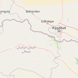
Map view of Tandooreh National Park

Use this park location map to pinpoint Tandooreh National Park in Iran, understand its exact geographic position, and read its mapped placement within the surrounding landscape more clearly.

Pigeon | © OpenStreetMap contributors
Recorded earthquake history

Browse the Historical Earthquake Catalogue for Tandooreh National Park

Access a detailed record of seismic activity identified in the vicinity of Tandooreh National Park through this MoriAtlas collection. Review historical event data including magnitudes, depths, and epicentre distances to understand the seismic landscape of this mountainous region in northeastern Iran.

Tandooreh National Park Earthquake History

Catalogued events

13 events

Strongest magnitude

Magnitude 5.6

Most recent event

May 3, 2024

This history includes earthquakes recorded inside the park or within 50 km of its borders

Browse high-altitude scenery, Kopet Dag terrain, and the distinctive juniper woodland habitats defining this significant protected area.

Explore Tandooreh National Park Photos: Visualizing Iran's Juniper Woodlands and Mountain Landscapes

Visually explore the rugged mountain landscapes, deep valleys, and extensive juniper woodlands that define Tandooreh National Park in northeastern Iran. These images offer essential insight into the park's unique protected area environment, revealing its high-altitude Kopet Dag terrain and diverse steppe-forest habitats.

A forest with tall green trees, a small stream, and a fallen tree trunk in a natural setting

Park atlas

Compare adjacent protected landscapes, tracing the regional spread of conservation areas across northeastern Iran's Kopet Dag mountain range.

Explore Related National Parks and Protected Areas Surrounding Tandooreh National Park

Browse other national parks and protected areas geographically relevant to Tandooreh National Park, extending your discovery across the rugged Kopet Dag foothills and the borderlands of northeastern Iran. This curated overview allows you to compare diverse mountain ecosystems, juniper woodlands, and steppe habitats, offering deeper geographic context within the region's conservation network.
National parkGolestan province
About 193 km away#1 closest

West

Golestan National Park: Mapped Protected Area in Golestan Province, Iran

Explore its geographic context and landscape identity.

Golestan National Park is a designated national park situated in Iran's Golestan province. This page details its protected landscape, offering insights into its geographic placement and mapped boundaries. Ideal for users seeking to understand the park's role within regional geography and its specific natural terrain features, this entry serves as a primary atlas point for Golestan National Park.

Area
918.95 km²
IUCN
II
Relief
Mountain
Climate
Temperate
National parkSemnan Province
272 km away#2 closest

Southwest

Khar Turan National Park: A Vast Protected Landscape and Critical Cheetah Habitat in Iran

Explore Semnan Province's premier national park, mapped desert terrain, and vital wildlife refuge.

Khar Turan National Park is a significant protected landscape in Iran's Semnan Province, renowned for its expansive arid and semi-desert terrain. As the country's second-largest national park and a UNESCO Biosphere Reserve, it plays a critical role in conserving biodiversity, notably as a last bastion for the critically endangered Asiatic cheetah and Persian onager. Its diverse geography, from mountains to salt pans, offers a compelling atlas of life adapted to harsh desert conditions.

Area
14,000 km²
IUCN
II
Relief
Mixed relief
Climate
Arid
National parkIran
577 km away#3 closest

Southwest

Kavir National Park: A Major Protected Desert Landscape in Iran

Explore its arid terrain, conservation significance, and mapped boundaries.

Kavir National Park stands as a significant protected area within Iran, encompassing a vast 4,000 square kilometer expanse of desert and steppe landscapes on the western flank of the Kavir Desert. Designated as a national park, it plays a crucial role in preserving one of the Middle East's most extensive arid ecosystems and serves as a critical sanctuary for endangered species, including the Asiatic cheetah and Persian leopard. Its stark, open terrain offers a profound example of Iran's natural heritage and provides essential data for understanding regional geography and protected land distribution.

Area
4,000 km²
Established
1982
IUCN
II
Relief
Lowland
National parkMazandaran Province
About 611 km away#4 closest

West

Lar National Park National Park: Mapped Protected Landscape and Alborz Geography

Alpine terrain and regional context within Mazandaran Province.

Lar National Park stands as a critical national park, encompassing approximately 30,000 hectares of alpine and sub-alpine wilderness in Mazandaran Province, Iran. Its protected landscape is characterized by steep mountain valleys and ridgelines, situated at the southern base of Mount Damavand. This atlas-focused view reveals the park's mapped boundaries and its significant geographic position within the Central Alborz mountain range, crucial for understanding Iran's protected natural areas.

Area
300 km²
Established
1976
IUCN
II
Relief
Mountain
National parkTehran Province
650 km away#5 closest

West

Sorkheh Hesar National Park: Protected Mountain Forest Landscape Near Tehran

Explore its mapped terrain and regional protected area context.

Sorkheh Hesar National Park stands as a significant protected forest area within Tehran Province, Iran. Spanning 9,380 hectares, this mountainous national park is characterized by its unique semi-arid climate and crucial role in conserving threatened species, including the Persian fallow deer and Persian leopard. The Jajrood River flows through its landscape, enhancing biodiversity and supporting a rich forest ecosystem. Its proximity to Tehran makes it a notable example of urban-adjacent conservation, offering valuable insights into protected land management and regional geography.

Area
93.8 km²
Established
1980
IUCN
II
Climate
Arid
Watercolor painting of rolling hills, a body of water, and vegetation
National parkBaku
About 777 km away#6 closest

Northwest

Absheron National Park: Coastal Azerbaijan National Park with Caspian Seal Habitats

Explore mapped geography and semi-desert terrain near Baku.

Absheron National Park, located near Baku on the Absheron Peninsula, is a significant national park safeguarding coastal Caspian Sea environments. Its protected landscapes feature semi-arid terrain and are vital for the conservation of Caspian seals and migratory waterbirds. MoriAtlas provides a structured overview of this unique protected area, focusing on its geographic features, ecological importance, and its role as a key national park within Azerbaijan's atlas of natural reserves.

Area
7.83 km²
Established
2005
IUCN
II
Relief
Lowland
National parkAfghanistan
About 801 km away#7 closest

East

Band-e Amir National Park: Afghanistan's National Park for Geographic and Landscape Discovery

Explore the unique terrain and mapped protected boundaries.

Band-e Amir National Park represents a core protected area within Afghanistan, offering a detailed geographic study for atlas exploration. Understand its significance as a national park, focusing on the mapped boundaries and the distinct natural landscapes it encompasses. This entry provides foundational context for appreciating the park's role within the broader regional geography and protected land network.

IUCN
II
Scope
Terrestrial
Nature reserveBamyan Province
About 823 km away#8 closest

Southeast

Ajar Valley Nature Reserve: Protected Area and Alpine Landscape Identity

Rugged terrain and ibex habitat within Bamyan Province geography.

Ajar Valley Nature Reserve is a cornerstone protected area in Bamyan Province, Afghanistan, recognized for its rugged alpine terrain and role as ibex habitat. Established as one of the nation's oldest nature reserves, it offers a profound insight into the geographic context of the Hindu Kush. This page details the reserve's landscape characteristics, protected boundaries, and its vital place in the country's conservation atlas, providing a factual basis for understanding its ecological significance.

IUCN
IV
Relief
Mountain
Access
Highly restricted
Scope
Terrestrial

Common questions about visiting, size, designation, and location context for Tandooreh National Park

Tandooreh National Park FAQs for park facts, access, geography, and protected area context

Find quick answers about Tandooreh National Park, including protected-area facts, park geography, trail and visitor context, and how the park fits into its surrounding country and regional landscape.
MoriAtlas Explorer

Continue Your Protected Areas Search Across the Global Atlas

Deepen your exploration by continuing the structured search for national parks and protected areas worldwide. Utilize the comprehensive filtering capabilities to compare different conservation landscapes and refine your understanding of global park geography. Discover more about the distribution and characteristics of protected natural areas.

Global natural geography

