Mori Atlas logo
Subpolar climate59 represented parks17 countries

Analyzing the influence of severe winters and cool summers on diverse park terrains

Subpolar Climate National Parks and Protected Landscapes: A Global Geographic Framework

Subpolar climate conditions define the seasonal rhythms, water availability, and ecological character of protected landscapes across northern regions. By connecting broad atmospheric patterns with observable features like snow persistence and vegetation growth, this framework provides a foundation for comparing parks globally. It allows for qualitative assessment of how local terrain and elevation interact with long-term climate cycles to produce distinct natural environments.

Related tags

subpolar climate parkspark climateclimate zonesprotected landscapes
Climate-zone profile

How compressed seasonal cycles and severe winters shape high-latitude protected areas

Understanding subpolar climate national parks and protected landscapes

Subpolar climate describes long, severe winters and short, cool summers occurring near the transition zone between boreal forest and tundra. Broad atmospheric patterns help clarify seasonal cycles in high-latitude reserves, although local elevation and coastal terrain introduce vital microclimate variations.

Climate-zone definition

Subpolar climate describes long severe winters and short cool summers near the transition between boreal forest and tundra. It is a broad park-scale category rather than a precise site forecast or a substitute for local climate records.

Here, subpolar climate identifies the broad climatic setting most helpful for understanding a park's ecology and seasonality. It is separate from habitat: one climate zone may support forests, wetlands, grasslands, or bare terrain depending on moisture, substrate, elevation, and disturbance.

The category should therefore support comparison and interpretation while preserving uncertainty wherever park-scale evidence is incomplete or transitional.

Global distribution

The zone occurs across Alaska, northern Canada, Icelandic interiors, Scandinavia, Siberia, and southern Arctic islands. Its park distribution follows both latitude and elevation.

Protected areas represent only part of the zone and are unevenly distributed between countries and ecosystems. Atlas comparisons should therefore describe geographic patterns without treating the park list as a complete measure of the climate zone's global area or conservation coverage.

The park examples consequently represent a climatic pattern expressed through geography, not a continuous or perfectly mapped global belt.

Observable park conditions

Snow, ice, mosquitoes, saturated thawed soils, and sudden storms strongly influence park conditions. Conditions within one park may differ sharply between valleys, slopes, coasts, and summits.

Conditions also vary internally: exposed ridges, sheltered valleys, water bodies, coasts, and different elevations can experience contrasting temperatures and moisture on the same day. The zone is most useful for anticipating broad seasonal character and interpreting why access patterns recur.

Long-term climate context is valuable for planning expectations, but current official information remains essential for any practical decision.

Temperature, moisture, and seasonality

Connecting severe winter freezing and rapid summer thaws with active soil erosion and river runoff

Subpolar climate national parks and protected landscapes: seasonal temperatures and snowpack

High annual temperature ranges combine with modest summer-peaking precipitation and deep winter snowpack across high-latitude protected landscapes. Compressing the vegetative cycle into a brief thaw period drives rapid runoff, shaping river channels, peatlands, and active permafrost terrain.
  1. 01

    Temperature pattern

    Annual temperature ranges are large, winters dominate, and summer warmth is sufficient for limited tree and shrub growth. Terrain, latitude, continental position, and nearby oceans can produce important local departures.

    The annual range must be read together with daily extremes and the timing of warm and cold periods. Maritime air can soften seasonal contrasts, continental interiors can amplify them, and cold-air drainage or exposed ridges can create local conditions unlike those suggested by a park-wide average.

    These temperature controls connect climate directly to observable boundaries such as treelines, persistent snow, seasonal water, and vegetation productivity.

  2. 02

    Precipitation pattern

    Precipitation is modest and often summer-peaking, with deep seasonal snow and extensive frozen periods. The form and timing of moisture often matter as much as the annual total.

    Water availability reflects precipitation timing together with evaporation, snow storage, soil infiltration, and runoff. A park may receive substantial moisture yet experience seasonal stress, while snowpack or groundwater can sustain streams and wetlands long after the main precipitation period has ended.

    Comparing timing, form, and effective moisture produces a more accurate ecological picture than comparing annual rainfall totals alone.

  3. 03

    Seasonal cycle

    Snow cover, spring thaw, insect emergence, nesting, autumn migration, and rapid freeze-up create a compressed cycle. This timing controls growth, wildlife activity, water, snow, fire, and landscape visibility.

    Seasonality synchronizes many park processes: water becomes available, plants grow or enter dormancy, animals breed or migrate, and visitor access expands or contracts. Climate change can alter this timing before a complete change in the park's broad climate-zone label becomes apparent.

    This temporal pattern is central to understanding when park landscapes are productive, accessible, stressed, or undergoing rapid visible change.

  4. 04

    Landscape effects

    Common landscape expressions include boreal woodland, open tundra, peatlands, lakes, permafrost features, and glacial terrain arranged in broad mosaics. Climate works with geology and water, so similar zones can still produce very different scenery.

    The landscape expression of subpolar climate is therefore best understood through active processes rather than a checklist of scenery. Water balance, temperature thresholds, wind exposure, and seasonal disturbance continually reshape slopes, channels, soils, shorelines, and vegetation mosaics.

    Separating climatic influence from geological inheritance keeps the explanation accurate while still showing how the two interact.

Ecological effects and adaptation

How compressed growing seasons and persistent snow cover constrain vegetation and animal survival.

Subpolar climate national parks and protected landscapes: climate adaptations and ecosystems

Extreme seasonal temperature swings and abbreviated growing seasons restrict plant growth and dictate nutrient availability in northern high-latitude zones. Environmental responses vary from frost-tolerant coniferous canopies on well-drained slopes to specialized wildlife migration corridors across peatlands and shrub tundra.

Typical habitats

Common habitats include taiga margins, forest-tundra, peatland, cold lakes, shrub tundra, and alpine-like uplands. Not every park contains all of them, and elevation can place several climate-linked habitats close together.

The habitat list describes likely ecological expressions of subpolar climate, not synonyms for the climate itself. Wetlands and dry slopes, closed forest and open ground, or lowland and alpine communities may coexist where terrain redistributes water, warmth, and exposure.

This distinction allows climate and habitat pages to complement one another instead of presenting duplicate classifications.

Vegetation adaptations

Typical plant responses include conical trees, flexible shrubs, frost tolerance, dormancy, and rapid summer photosynthesis. These strategies balance temperature, water, wind, light, and the length of the growing season.

Adaptation is visible at several scales, from leaf texture and root depth to canopy height, dormancy, flowering time, and post-fire regeneration. Local species also respond to soils and competition, so similar climates can support structurally different vegetation in different biogeographic regions.

Observing which strategies dominate can reveal both the prevailing climatic constraints and early signs that those constraints are shifting.

Wildlife adaptations

Wildlife strategies often include migration, winter coats, food caching, hibernation, and concentrated summer breeding. Species respond to seasonal resources rather than to the climate label alone.

Wildlife experiences climate indirectly through water, vegetation, prey, snow, fire, and access to refuges. Two species in the same subpolar climate park may therefore respond very differently, depending on mobility, life cycle, thermal tolerance, and reliance on specialized habitats.

Access to connected refuges and seasonal movement corridors often determines whether these responses remain possible as conditions change.

Climate-related pressures

Important climate-related pressures include warming, wildfire expansion, pest outbreaks, permafrost thaw, shrub expansion, and hydrological change. Effects vary by ecosystem and should be evaluated with local monitoring rather than assumed from the zone alone.

A climate-zone label identifies plausible pressures but cannot establish their severity at a particular park. Useful assessment requires local temperature and precipitation records, hydrological and ecological monitoring, and evidence of how key species, habitats, or physical processes are responding.

Presenting both the likely mechanism and the need for local evidence avoids turning broad climate concern into unsupported park-specific claims.

Global park examples

Representative examples include Denali, Sarek, Pallas-Yllästunturi, and Þingvellir national parks. They demonstrate geographic variety within the zone rather than a ranking of destinations.

Together, these parks illustrate how a shared climatic framework can produce different landscapes when combined with local geology, elevation, hydrology, and biogeographic history. They are starting points for comparison rather than a definitive inventory of all protected areas in the zone.

Future additions should broaden regional representation while keeping the relationship between each park and the climate category explicit.

Representative parks

Comparing seasonal patterns and high-latitude terrains across diverse geographic regions

Subpolar climate national parks and protected landscapes across the globe

Many high-latitude protected areas share a subpolar climate of long winters and short summers that fundamentally dictates their growing seasons, hydrology, and wildlife cycles. Cross-region comparisons reveal how a shared climatic framework interacts with local elevations and coastlines to create distinct microclimates within each park.
National parkCanadaMountain

Banff National Park

Mapped park boundaries and regional geographic context for Banff National Park.

Gain a structured understanding of Banff National Park as a key protected area within Canada. This resource details its identity as a national park, providing insights into its geographic setting and mapped landscape. It serves as a vital point for atlas-based discovery, helping to contextualize Banff National Park's significance within Canada's protected lands and natural terrain.

6,641 km²1885SubpolarEasy access
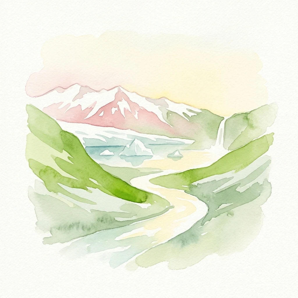
Watercolor illustration showing snow-capped mountains, green hills, a winding river, and a waterfall
National parkMountain

Vatnajökull National Park

Mapped boundaries of a UNESCO World Heritage site dynamic with fire and ice.

Vatnajökull National Park offers a profound exploration of one of Earth's most dynamic natural environments. This Icelandic national park protects the vast Vatnajökull ice cap, a landscape shaped by active volcanoes and powerful glacial forces, creating a region of extraordinary geographic diversity. Discover the mapped terrain, from subglacial mountain ranges to dramatic caldera systems, and understand the unique protected area context of this significant European natural heritage.

14,967 km²2008SubpolarRemote access
Watercolor illustration showing mountains, a river, and forest
National parkSouthern Region

Þingvellir National Park

Explore the rift valley and historic parliament site in Iceland's Southern Region.

Þingvellir National Park offers a singular opportunity for geographic discovery, situated in Iceland's Southern Region. This protected national park is globally recognized for its visible expression of the Mid-Atlantic Ridge, where the North American and Eurasian tectonic plates actively diverge, creating a dramatic rift valley. Moreover, Þingvellir served as the site of the Althing, Iceland's ancient parliament, making it a crucial historical landmark. Explore this landscape to understand both powerful geological processes and the foundations of Icelandic democratic history through its mapped terrain.

92.7 km²1930SubpolarModerate access
National parkMagallanes y la Antártica Chilena RegionMarine

Diego Ramírez Islands and Drake Passage National Park

Explore its remote island geography and vital Drake Passage marine ecosystems.

This national park protects one of the world's most remote and ecologically significant subantarctic environments, safeguarding the Diego Ramírez Islands and the legendary Drake Passage. It covers over 14 million hectares, representing Chile's southernmost contribution to global marine conservation and protecting unique pelagic bird habitats, marine mammal feeding grounds, and distinctive submarine geomorphology including Sars Seamount. The park's landscape is characterized by harsh subantarctic conditions, with vegetation adapted to cold, windy environments, and unique seafloor terrain beneath the powerful Antarctic Circumpolar Current.

144,391 km²2025SubpolarHighly restricted
National parkAysén del General Carlos Ibáñez del Campo Region

Bernardo O'Higgins National Park

Chile's largest protected area: a map of vast ice caps and fjords.

Bernardo O'Higgins National Park is a colossal protected landscape in Chile, safeguarding much of the Southern Patagonian Ice Field and its colossal glacial features like the Pío XI Glacier. Explore the dramatic terrain of towering granite peaks and intricate fjord systems that define this remote national park. This page provides essential context for understanding its geography, mapped boundaries, and significance as a vast wilderness preservation.

35,259 km²1969SubpolarRemote access
National parkAlaskaMarineMountain

Wrangell–St. Elias National Park and Preserve

Mapped protected lands and regional landscape context.

Dive into the detailed geography of Wrangell, St. Elias National Park and Preserve, a prominent national park located in Alaska. This resource focuses on its extensive mapped boundaries and its role as a protected landscape, offering insights valuable for understanding regional geography and the distribution of natural areas.

53,320.6 km²1980SubpolarModerate access
National parkYukonMountain

Kluane National Park and Reserve

Explore mapped boundaries and regional context for this Yukon national park.

Kluane National Park and Reserve represents a vital protected national park within Yukon. This detail page focuses on its geographic identity and mapped features, offering insight into its regional landscape context and its role within the broader Canadian protected areas atlas. Discover the park's specific topography and its location within Yukon.

22,013 km²1972SubpolarModerate access
Watercolor painting of green mountains reflecting in a calm lake under a soft pink and yellow sky
National parkMountain

Jotunheimen National Park

Explore mapped glacial terrain and alpine geography.

Jotunheimen National Park stands as a monument to Norway's alpine grandeur, protecting over 1,151 square kilometers of spectacular mountainous terrain. This protected area is defined by its dramatic glacial features, including sharp peaks exceeding 1,900 meters, U-shaped valleys, and pristine alpine lakes, making it a significant focus for geographic exploration and mapped landscape study. Delve into the core of Norway's mountain heartland, understanding the mapped boundaries and regional geological context that shape this iconic protected landscape.

1,151 km²1980SubpolarModerate access
Watercolor illustration of mountains with snow caps, green forest, and a body of water with a decorative branch border
National parkMountain

Tierra del Fuego National Park

Explore the mapped terrain and subantarctic geography of this vital protected area.

Tierra del Fuego National Park, located at the southern tip of South America, provides a crucial atlas perspective on subantarctic ecosystems. This protected national park encompasses dramatic glacial valleys, rugged mountain ranges, ancient beech forests, and a significant coastal area along the Beagle Channel. Its unique landscape, accessible from Ushuaia, offers rich opportunities for understanding regional geography and the distribution of protected lands at the continent's edge.

630 km²1960SubpolarModerate access
Watercolor painting of a mountain landscape with a lake and trees
National parkNorrbotten CountyMountain

Abisko National Park

Subarctic national park with unique landscapes

Abisko National Park in Swedish Lapland offers a glimpse into dramatic subarctic terrain. Explore its protected boundaries, river canyons, and alpine tundra through structured geographic data.

77 km²1909SubpolarModerate access
National parkUttarakhandMountain

Nanda Devi National Park

Explore mapped glacial basins and alpine terrain in Uttarakhand.

Nanda Devi National Park is a prime example of a high-altitude protected area, nestled in the Garhwal Himalayas of Uttarakhand, India. Established in 1982, this national park protects a vast glacial sanctuary, renowned for its dramatic peaks, including Nanda Devi, India's second-highest mountain. The park's landscape is defined by rugged terrain, extensive glaciers like the Uttari Rishi and Dakshini Rishi, and a striking ring of mountains over 6,000 meters, providing critical context for understanding protected land geography and Himalayan atlas exploration.

630.33 km²1982SubpolarRemote access
Watercolor illustration of tall rock formations by a body of water with green trees in the foreground
Nature reserveSakha Republic

Lena Pillars

Explore the regional landscape and park boundaries.

Discover Lena Pillars Nature Reserve, a key protected area located within the expansive Sakha Republic of Russia. This page offers focused atlas exploration, detailing the park's geographic setting and its mapped boundaries against the backdrop of Siberia's largest federal subject. Understand the unique natural landscape context and its significance within regional conservation efforts, providing structured geographic data for your exploration.

13,870 km²SubpolarModerate accessII
Related environmental topics

How continentality and ocean influence alter seasonal moisture and temperature gradients

Comparing climate zones related to Subpolar climate national parks and protected landscapes

Analyzing regional climate-zone transitions helps trace how subtle shifts in temperature and rainfall define the outer limits of vulnerable subpolar ecosystems. Local elevation gradients and marine influences mean these atmospheric boundaries are rarely sharp, creating overlapping habitat mosaics rather than rigid divisions.

Polar climate

Polar climate conditions shape the appearance, ecology, water, seasonality, and visitor-visible character of parks across several regions. The zone is interpreted qualitatively because local elevation, coastlines, and terrain create substantial variation.

15 represented parks

Boreal climate

Boreal climate conditions shape the appearance, ecology, water, seasonality, and visitor-visible character of parks across several regions. The zone is interpreted qualitatively because local elevation, coastlines, and terrain create substantial variation.

98 represented parks

Alpine climate

Alpine climate conditions shape the appearance, ecology, water, seasonality, and visitor-visible character of parks across several regions. The zone is interpreted qualitatively because local elevation, coastlines, and terrain create substantial variation.

117 represented parks

MoriAtlas Explorer

Trace Global Climate Zones Across National Parks and Protected Areas

Continue into the MoriAtlas climate taxonomy to distinguish between varied atmospheric settings. Compare how long-term environmental patterns and seasonal cycles define the character of diverse protected landscapes across every continent.

Global natural geography