Mori Atlas logo
National parkAg-Gel National Park

Mapped geography and vital habitat in Azerbaijan's Kur-Araz lowlands

Ag-Gel National Park: Protected Wetland Landscape

(Ağ göl Milli Parkı)

Ag-Gel National Park represents a crucial protected wetland area in southwestern Azerbaijan. This park encompasses a unique system of shallow lakes and marshlands on the Mil plain, providing essential nesting and wintering grounds for diverse bird species. Use MoriAtlas to explore its mapped boundaries and understand its geographic context within the broader Caspian region.

wetlandsbirdwatchingRamsar siteprotected arealake ecosystemmarshland

Ag-Gel National Park

National park

Park overview

Structured park overview, official facts, and landscape profile for Ag-Gel National Park

Ag-Gel National Park park facts, protected area profile, and essential visitor context
Review the core facts for Ag-Gel National Park, including designation, size, terrain, visitor scale, habitats, and operating context in one park-focused overview.

About Ag-Gel National Park

Ag-Gel National Park represents one of Azerbaijan's most important wetland conservation areas, situated in the heart of the Kur-Araz lowlands. The park was established on July 5, 2003, through presidential decree, expanding from the earlier Ag-Gol State Reserve and Ag-Gol State Game Reserve to encompass a total area of 17,924 hectares. The landscape centers on Lake Ağgöl, a complex of interconnected water bodies spanning roughly 50 hectares of open water, connected by channels through dense reed beds. Unlike a single uniform lake, the system comprises multiple basins and islands covering 2 to 10 hectares each, creating a labyrinthine wetland environment. The park's location in the Mil plain places it along the floodplain of the Kura River, an area shaped by millennia of seasonal flooding that created the shallow lake basins. The surrounding semi-desert and dry steppe climate, characterized by hot dry summers and cool dry winters, creates harsh conditions that make the wetland's ecological productivity all the more significant. The park is managed by Azerbaijan's Ministry of Ecology and Natural Resources, with the dual objectives of protecting biodiversity and maintaining the ecological functions of this vital wetland system.

Quick facts and research context for Ag-Gel National Park

Ag-Gel National Park occupies 17,924 hectares in the Ağcabədi and Beyləqan districts of Azerbaijan, situated below sea level in the Kur-Araz lowlands. The lake system extends approximately 25 kilometers in length and 1.4 to 5 kilometers in width, with an average depth of 0.8 meters and maximum depth of 2.5 meters. Water salinity ranges from 5 to 10 grams per liter. The surrounding landscape features semi-desert and dry steppe terrain with reeds covering over 2,000 hectares. The park provides habitat for more than 140 bird species, including 89 nesting species, and supports populations of 20 fish species and over 15 mammal species.

Park context

Deeper park guide and search-rich context for Ag-Gel National Park

Ag-Gel National Park history, landscape, wildlife, and travel context
Explore Ag-Gel National Park through its history, landscape character, ecosystems, wildlife, conservation priorities, cultural context, and seasonal travel timing in a structured park guide built for atlas discovery and search intent.

Why Ag-Gel National Park stands out

Ag-Gel National Park is renowned as a premier bird sanctuary in the Caucasus region, serving as the primary nesting site in Transcaucasia for colonies of species including the greylag goose, white-tailed eagle, great white pelican, and Dalmatian pelican. The park's extensive reed beds and shallow lake system create ideal conditions for waterfowl, with over 500,000 birds wintering here annually. The lake's distinctive white appearance, caused by salt deposits emerging as waters recede during hot summer months, gives the park its name meaning White Lake. Its Ramsar designation and inclusion in the Red Book of Azerbaijan underscore its international conservation significance.

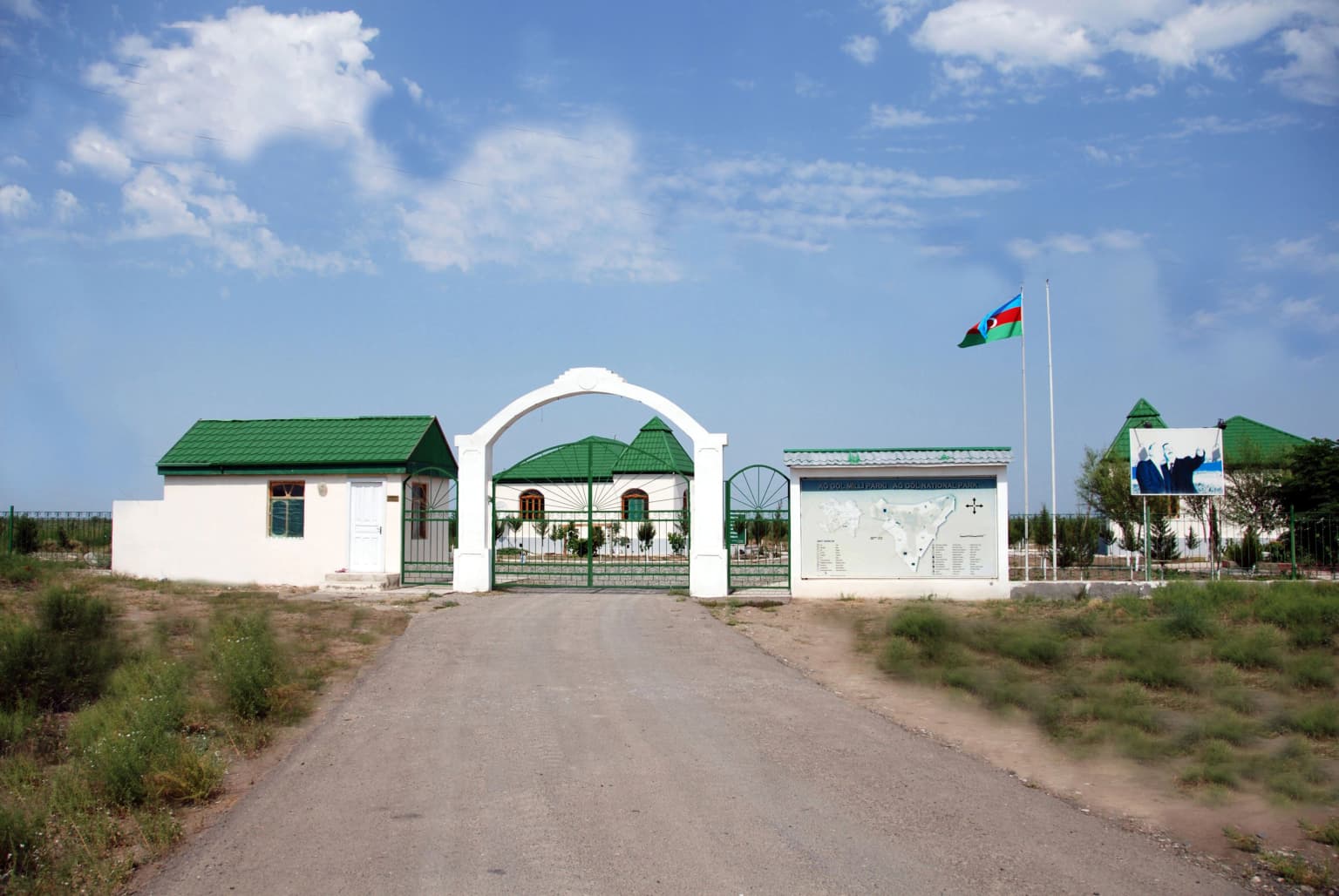
Ag-Gel National Park history and protected-area timeline

The protected area history at Ag-Gel traces back to 1964 when a wildlife reserve was first established on 9,173 hectares to protect birds and their habitats. Recognizing the need for stronger protection, authorities designated the lake's aquatic area as a strict nature reserve in 1978, covering 4,400 hectares. This protection was further expanded in 1987 with an additional 782 hectares added to the reserve. The critical transformation came in 2003 when the Ag-Gol State Nature Reserve was expanded to its current boundaries and elevated to national park status, unified with the former game reserve to create a comprehensive protected area. Simultaneously, Lake Ağgöl and the associated Kızılağac bay wetlands were designated as a Ramsar Convention site on May 25, 2001, recognizing their international importance as waterbird habitats. The park's creation aimed not only to preserve the significant wetland ecosystem and its endangered species but also to facilitate environmental monitoring, public ecological education, and sustainable ecotourism development.

Ag-Gel National Park landscape and geographic character

The physical landscape of Ag-Gel National Park centers on a complex lake system formed by the historical flooding of the Kura and Aras rivers. The lakes occupy a depression below sea level in the Mil plain, characterized by gently undulating terrain with irregular shoreline edges and small inlets. The lake system stretches approximately 25 kilometers from east to west, varying in width between 1.4 and 5 kilometers. The water bodies consist of multiple interconnected basins covering a total open water area of about 50 hectares, separated by extensive reed beds and connected by narrow channels. Numerous islands ranging from 2 to 10 hectares in size are scattered throughout the basins, covered in dense vegetation including common reeds, saltwort, and various grasses. The lake bottom consists of smooth gray silt with sticky groundwater conditions. Water flow is minimal, characteristic of stagnant lakes, with flow rates between 0.5 and 0.7 meters per second. The surrounding terrain consists of semi-desert and dry steppe, with soils ranging from meadow-swamp and gray-meadow soils to saline and alkalinized variations.

Ag-Gel National Park ecosystems, habitats, and plant life

The ecological character of Ag-Gel National Park is defined by its wetland habitats within an otherwise semi-desert landscape. The park supports a diverse array of vegetation communities adapted to varying moisture and salinity conditions. Common reeds dominate the aquatic vegetation, forming extensive beds covering over 2,000 hectares and accounting for approximately 92% of wetland plant coverage. These reed communities provide critical nesting habitat and shelter for waterbirds. Along the lake shores, vegetation transitions to salt-tolerant species including saltwort, various grasses, and drought-resistant plants characteristic of the surrounding steppe. The plant diversity includes around 40 identified species, with 18 classified as true wetland plants and 22 belonging to steppe and semi-desert plant communities. The semi-desert and dry steppe climate features a moderate warm temperature regime with average annual temperatures around 13-14°C, though extremes range from -24°C to 41°C. Annual precipitation averages 332 millimeters, with evaporation exceeding precipitation by roughly three times, creating the saline conditions that characterize the lake. The shallow depth and restricted water exchange contribute to the lake's hydrological uniqueness.

Ag-Gel National Park wildlife and species highlights

The wildlife of Ag-Gel National Park is exceptionally rich in avian species, making it a premier birdwatching destination in the Caucasus. Over 140 bird species have been recorded in the park, including 89 species that nest here. The wetland provides crucial habitat for charadriiformes and anseriformes species, with approximately 30 charadriiform and 24 anseriform species breeding in the reserve. Notable nesting colonies include the greylag goose, pochard, black-headed gull, whiskered tern, and various heron species. The park is considered the only site in Transcaucasia where large colonies of greylag geese, white-tailed gulls, whiskered terns, and herring gulls nest. Several species are protected under Azerbaijan's Red Book, including Francolinus, white-tailed eagle, great white pelican, and Dalmatian pelican. The fish population includes 20 species such as pike, erythroculter, and carp, though species diversity has declined since the lake lost its direct connection to the Kura River. Mammal species number over 22, including wild boar, coypu, and jungle cat. The reptile and amphibian fauna includes Caspian and marsh turtles, common and water snakes, green toads, and lake frogs.

Ag-Gel National Park conservation status and protection priorities

Ag-Gel National Park holds significant conservation importance at both national and international levels. The lake and surrounding wetlands were designated a Ramsar site in 2001, recognizing their global significance as wetlands supporting waterbird populations under the Convention on Wetlands of International Importance. The park is recognized as an Important Bird Area, qualifying under criteria for globally significant bird populations. Several species found in the park are listed in Azerbaijan's Red Book, including the white-tailed eagle, great white pelican, Dalmatian pelican, and Francolinus, providing legal protection for these threatened species. The park's designation as a national park in 2003 reflected Azerbaijan's commitment to integrating conservation with sustainable use, including objectives for environmental monitoring, ecological education, and ecotourism development. The conservation framework addresses the protection of the semi-desert landscape, endangered fauna species, and the critical wetland habitats that support hundreds of thousands of migratory waterbirds annually.

Ag-Gel National Park cultural meaning and human context

Ag-Gel National Park is situated in an area with historical human connections to the landscape. The park's name Ağgöl, meaning White Lake, derives from the distinctive visual character of the lake during summer months when high salinity and receding waters cause salt deposits to appear on the surface, creating a white sheen visible from a distance. Local communities traditionally harvested culinary salt from the area during summer months. The park lies near the cities of Ağcabədi and Beyləqan, both administrative centers with historical significance in the region. The wetland has served as a natural resource for local populations throughout history, with the reed beds providing materials and the waters supporting fishing. The establishment of the national park reflects a modern approach to balancing traditional land use with biodiversity conservation, though the surrounding agricultural landscape has been influenced by the broader development of the Kur-Araz plain.

Top sights and standout views in Ag-Gel National Park

Ag-Gel National Park stands as one of Azerbaijan's most important wetland ecosystems, providing sanctuary for over 500,000 migratory waterbirds during winter months. The park's Ramsar designation and Important Bird Area status reflect its international conservation significance. Its complex system of shallow lakes, reed beds, and islands creates a unique semi-desert wetland environment supporting exceptional bird biodiversity, including globally threatened pelican species and the only significant greylag goose nesting colony in Transcaucasia. The park's landscape, characterized by the white-appearing saline lake surrounded by extensive reed marshes, offers a distinctive visual character that has shaped local toponymy and cultural identity.

Best time to visit Ag-Gel National Park

The optimal time to experience Ag-Gel National Park depends on the type of wildlife viewing desired. Winter months attract large numbers of migratory waterfowl, with over 500,000 birds wintering in the park, making this season ideal for observing diverse waterbird congregations. The relatively mild winter conditions and abundant food resources create favorable circumstances for birdwatching. Summer months offer the distinctive visual character of the lake as salt deposits emerge on the drying margins, though extreme heat and minimal water make this a challenging period for extended visits. Spring provides the opportunity to witness active nesting activity among the breeding bird species, with numerous waterfowl establishing territories within the reed beds. The park's climate features hot dry summers and cool dry winters, with precipitation relatively low year-round.

Park location guide

Geography guide, regional context, and park location map for Ag-Gel National Park

Ag-Gel National Park park geography, regions, and map view in Azerbaijan
Understand where Ag-Gel National Park sits in Azerbaijan through a broader geographic reading of the surrounding landscape, nearby location context, and its mapped position within the national park landscape.

How Ag-Gel National Park fits into Azerbaijan

Azerbaijan is a unitary semi-presidential republic and one of six independent Turkic states. It declared independence from the Soviet Union in 1991 after nearly seven decades of Soviet rule. The country occupies 86,600 km² and has a population of approximately 10.3 million. It is known for its strategic location at the crossroads of Europe and Asia, its oil industry heritage, and its diverse cultural influences from Persian, Russian, and Turkic traditions.

Wider geography shaping Ag-Gel National Park in Azerbaijan

Azerbaijan occupies the eastern portion of the Caucasus region, situated between the Caspian Sea to the east and the Greater Caucasus mountains to the north. The terrain is diverse, featuring lowlands along the Caspian coast, mountainous areas in the north and west, and semi-desert plains in the central regions. The Kura and Aras rivers are major waterways draining into the Caspian Sea.

Map view of Ag-Gel National Park

Use this park location map to pinpoint Ag-Gel National Park in Azerbaijan, understand its exact geographic position, and read its mapped placement within the surrounding landscape more clearly.

Pigeon | © OpenStreetMap contributors

Location context for Ag-Gel National Park

Ağcabədi RayonBeyləqan Rayon
Park atlas

Expand your park exploration beyond Ag-Gel National Park, mapping other protected landscapes and wetland ecosystems across Azerbaijan's diverse terrain.

Explore Nearby National Parks and Protected Areas, Extending Your Discovery Beyond Ag-Gel National Park
After exploring Ag-Gel National Park's unique wetland habitats, continue your protected area discovery by browsing other national parks and conservation landscapes across Azerbaijan. Gain essential geographic context to compare diverse park types, regional terrain, and the broader distribution of protected ecosystems throughout the South Caucasus and Caspian region.
Watercolor painting of layered mountains with green, yellow, and pink hues.
National parkAzerbaijan

Shahdag National Park: Azerbaijan's Largest National Park and Highest Mountain Landscape

Explore the Greater Caucasus protected area and its unique ecosystems.

Shahdag National Park is the largest protected area in Azerbaijan, encompassing a significant portion of the Greater Caucasus mountain range. This national park is renowned for its dramatic elevation changes, creating diverse ecosystems that transition from dense, old-growth montane forests to high-alpine meadows and rugged, rocky summits. The park's landscape is defined by its towering peaks, including Mount Bazardüzü, the nation's highest point, and provides critical habitat for endemic species like the East Caucasian tur. Use this page to begin your atlas-based exploration of Shahdag National Park's protected geography and its distinctive natural terrain.

Area
1,305.08 km²
Established
2006
Relief
Mountain
Scope
Terrestrial
National parkAzerbaijan

Göygöl National Park: Iconic Alpine Lakes and Protected Caucasus Forest Landscape

Explore Azerbaijan's most visited national park and its rich geographic context.

Göygöl National Park is a key protected area in Azerbaijan, renowned for the crystal-clear alpine Lake Göygöl and its surrounding dense forests within the Lesser Caucasus mountains. This national park showcases over 420 plant species, significant wildlife populations, and dramatic mountainous terrain, making it a prime destination for understanding regional landscape diversity and protected land value. Use MoriAtlas to explore its mapped boundaries and connect it to the broader geographic context of Azerbaijan.

Area
127.55 km²
Established
2008
Relief
Mountain
Climate
Temperate
National parkAzerbaijan

Shirvan National Park: Azerbaijan's Unique Protected Semi-Desert Ecosystem and Geography

Discover the mapped landscape, gazelle habitats, and wetland geography.

Shirvan National Park, located in Azerbaijan's Shirvan Lowland, safeguards a remarkable semi-desert environment situated on a former Caspian Sea floor. This protected area is distinguished by its low-lying terrain, ancient coastal ridges, and dune formations, providing essential habitat for the world's largest concentration of goitered gazelles. Wetlands around Çala Lake also support significant migratory bird populations, making Shirvan a crucial protected landscape for both terrestrial and avian wildlife and a key site for regional geographic study.

Area
543.735 km²
Established
2003
Relief
Lowland
Climate
Arid
National parkAzerbaijan

Altyaghach National Park: Azerbaijan's Protected Natural Area & Forested Geography

Explore the mapped boundaries and temperate deciduous forests.

Altyaghach National Park is a key protected area in Azerbaijan, safeguarding a significant portion of the Greater Caucasus's temperate deciduous broadleaved forest ecosystems. Covering over 11,000 hectares, the park is instrumental in preserving biodiversity and restoring natural habitats, notably providing refuge for the rare East Caucasian tur and other protected species. Its landscape, characterized by rolling to steep terrain and diverse forest cover reaching approximately 941 meters in elevation, makes it a representative example of Caucasus mountain conservation within the country.

Area
110.35 km²
Established
2004
Relief
Mixed relief
Climate
Temperate
National parkSyunik Province

Arevik National Park: Syunik Province's Protected Mountain Landscape and Biodiversity Atlas

Explore mapped boundaries, terrain, and ecosystems.

Arevik National Park offers a detailed look into the geography and protected landscape of Armenia's Syunik Province. This park is defined by the rugged Zangezur mountains and its remarkable vertical ecological zoning, transitioning from semi-desert to alpine environments. Examine its mapped terrain, significant butterfly and bird habitats, and the presence of key mammal species, providing a comprehensive atlas-style understanding of this protected area's natural identity.

Area
344 km²
Established
2009
IUCN
II
Relief
Mountain
Watercolor painting showing green hills, a river, and distant purple and orange mountains
National parkDedoplistsqaro Municipality

Vashlovani National Park: Georgia's Unique Lowland Desert and Badland Protected Landscape

Discover distinct semi-arid terrain and rare forest ecosystems.

Vashlovani National Park in Dedoplistsqaro Municipality represents a significant protected area preserving Georgia's rare lowland desert and semi-arid steppe ecosystems. This national park is characterized by its striking badland topography, known as the "Sharp Walls," wild pistachio forests, and riparian habitats along the Alazani River. Its unique geographic setting, far removed from Georgia's typical mountainous landscapes, makes Vashlovani a crucial site for understanding regional biodiversity and conservation within the Caucasus.

Area
442.51 km²
Established
1935
IUCN
II
Relief
Lowland
National parkOrdubad District

Zangezur National Park: National Park and Protected Mountain Wilderness in Ordubad District

Explore dramatic glacial terrain and the highest Lesser Caucasus peaks.

Zangezur National Park encompasses a significant portion of the Zangezur mountain range, presenting a striking high-altitude protected landscape within Ordubad District, Azerbaijan. Its geography is characterized by rugged alpine features, extensive glacial formations, and dramatic elevation changes culminating in the Gemiqaya summit. This park serves as a vital refuge for diverse ecosystems and is distinguished by its role in preserving the highest mountain terrain in Azerbaijan's Lesser Caucasus, offering a unique focal point for geographic and protected-area exploration.

Area
427.97 km²
Established
2003
Relief
Mountain
Climate
Temperate
Watercolor painting showing rolling green hills, a body of water, and distant mountains
National parkLankaran Rayon

Hirkan National Park: Ancient Hyrcanian Forest Protected Area in Lankaran Rayon

Explore mapped boundaries and unique regional geography.

Hirkan National Park stands as a significant protected area in Azerbaijan, renowned for its extensive old-growth Hyrcanian forests. This national park offers a unique window into ancient temperate rainforest ecosystems, featuring remarkable vertical forest zonation and a high concentration of endemic species within the Talysh Mountains and Lankaran Lowland. Its designation as part of the UNESCO World Heritage Hyrcanian Forests underscores its global importance for conservation and atlas-based geographic exploration of unique, relic landscapes.

Area
403.58 km²
Established
2004
Relief
Mixed relief
Climate
Subtropical

Common questions about visiting, size, designation, and location context for Ag-Gel National Park

Ag-Gel National Park FAQs for park facts, access, geography, and protected area context
Find quick answers about Ag-Gel National Park, including protected-area facts, park geography, trail and visitor context, and how the park fits into its surrounding country and regional landscape.
MoriAtlas Explorer

Continue Your Protected Areas Search Across the Global Atlas

Deepen your exploration by continuing the structured search for national parks and protected areas worldwide. Utilize the comprehensive filtering capabilities to compare different conservation landscapes and refine your understanding of global park geography. Discover more about the distribution and characteristics of protected natural areas.

Global natural geography