Mori Atlas logo
Protected landscapeAire and Candeeiros Ranges Natural Park

Discover the mapped boundaries and regional geography of this protected natural landscape in Portugal.

Aire and Candeeiros Ranges Natural Park: Protected Landscape, Geographic Context, and Atlas Exploration

(Parque Natural das Serras de Aire e Candeeiros)

The Aire and Candeeiros Ranges Natural Park represents a significant protected landscape within Portugal, offering a unique opportunity for atlas-driven geographic discovery. This detailed page provides insight into the park's mapped boundaries and its place within the regional geography, allowing for a structured understanding of its protected area status and natural landscape context. Explore the contours of this significant natural area and its relation to the broader atlas of protected lands.

Karst landscapeLimestone terrainDinosaur tracksCave systemsMediterranean vegetationEndemic species
Stylized illustration of a landscape with hills, a lake, and vegetation under a sunny sky with clouds

Aire and Candeeiros Ranges Natural Park

Protected landscape

Park overview

Structured park overview, official facts, and landscape profile for Aire and Candeeiros Ranges Natural Park

Aire and Candeeiros Ranges Natural Park park facts, protected area profile, and essential visitor context
Review the core facts for Aire and Candeeiros Ranges Natural Park, including designation, size, terrain, visitor scale, habitats, and operating context in one park-focused overview.

About Aire and Candeeiros Ranges Natural Park

Aire and Candeeiros Ranges Natural Park occupies a transitional zone between Atlantic and Mediterranean climatic influences in central Portugal. The landscape is dominated by white Jurassic limestone that has been sculpted by karst processes over millions of years, creating a terrain where water flows predominantly underground rather than in surface rivers. Thepark's four main morphological units are the Santo António Plateau in the center and south, the Candeeiros Range to the west, the São Mamede Plateau to the north, and the Aire Range to the east. Human settlement has traditionally clustered on the fertile terra rossa plains where maize, potatoes, and vines are cultivated, forming a mosaic of agricultural land that contrasts with the stark limestone ridges. The park's geological heritage extends beyond surface features to include fossil sites such as the Vale Florido biostromes with fossilized coral and algae, the Barranco de Zambujal with ammonites and belemnites, and the São Bento Jurassic Beach site discovered in 2003. The region's ecological significance is further enhanced by its position within the Southwest Iberian Mediterranean sclerophyllous and mixed forests ecoregion.

Quick facts and research context for Aire and Candeeiros Ranges Natural Park

The park occupies roughly 384 square kilometers across nine municipalities including Alcanena, Alcobaça, Batalha, Leiria, Ourém, Porto de Mós, Rio Maior, Santarém, and Torres Novas. Its highest points are the Aire Range at 679 meters and the Candeeiros Range at 615 meters. The region contains over 1500 catalogued caves and more than 130 identified cave systems. The park falls under IUCN Category V, reflecting its status as a protected landscape. It hosts more than 600 plant species including 27 orchid varieties, representing approximately half of all orchid species native to Portugal. The area also contains the only inland salt pans in Portugal, located near Rio Maior and documented since 1177.

Park context

Deeper park guide and search-rich context for Aire and Candeeiros Ranges Natural Park

Aire and Candeeiros Ranges Natural Park history, landscape, wildlife, and travel context
Explore Aire and Candeeiros Ranges Natural Park through its history, landscape character, ecosystems, wildlife, conservation priorities, cultural context, and seasonal travel timing in a structured park guide built for atlas discovery and search intent.

Why Aire and Candeeiros Ranges Natural Park stands out

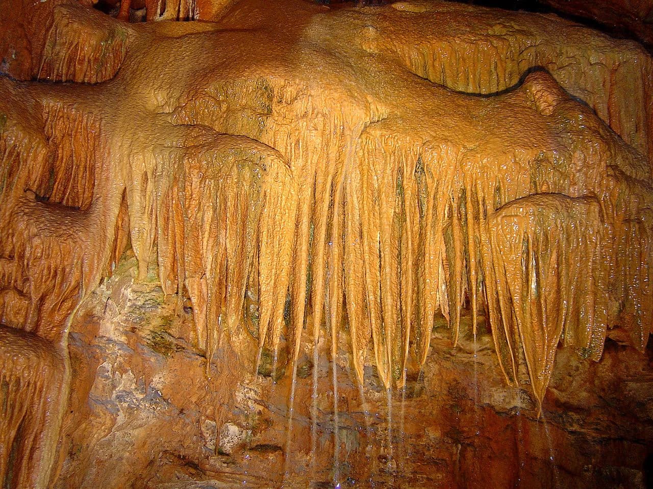
The park is renowned for its exceptional karst landscape and geological features. It contains some of the world's most significant Middle Jurassic sauropod dinosaur trackways, with the Aire Range Dinosaur Tracks Natural Monument preserving unusually well-preserved prints including claw and digit impressions that represent the oldest known dinosaur footprints on the Iberian Peninsula. The park also shelters the Mira de Aire cave system, one of Portugal's most spectacular underground chambers, and the Minde-Mira de Aire Polje, a vast karst depression that functions as a Ramsar-designated wetland. The underground freshwater network fed by rainfall infiltrating through the porous limestone supplies water to Lisbon through the Alviela springs, a relationship dating to 1880.

Serra de Aire Dinosaur Footprints
Dinosaur footprints in Serra de Aire

Aire and Candeeiros Ranges Natural Park history and protected-area timeline

The park was established on May 4, 1979 through Decree-Law 118/79 with the dual purpose of preserving natural aspects and protecting the architectural and cultural heritage of the Aire and Candeeiros mountain regions. A management plan and regulations were approved in January 1988 through Portaria 21/88, and construction regulations were adopted in June 1990 to control development within the park. In July 2000, the Serras de Aire e Candeeiros site was designated as a Community Interest Site for integration into the Natura 2000 network. The Aire Range Dinosaur Tracks Natural Monument was created in 1996, preserving fossil tracks discovered in 1994 at what was then an active quarry. The Minde-Mira de Aire Polje was added to the Ramsar List of Wetlands of International Importance in December 2005. The park continues to be managed by the Institute for Nature Conservation and Forests (ICNF), with visitor numbers averaging approximately 32,000 annually between 2015 and 2020.

Aire and Candeeiros Ranges Natural Park landscape and geographic character

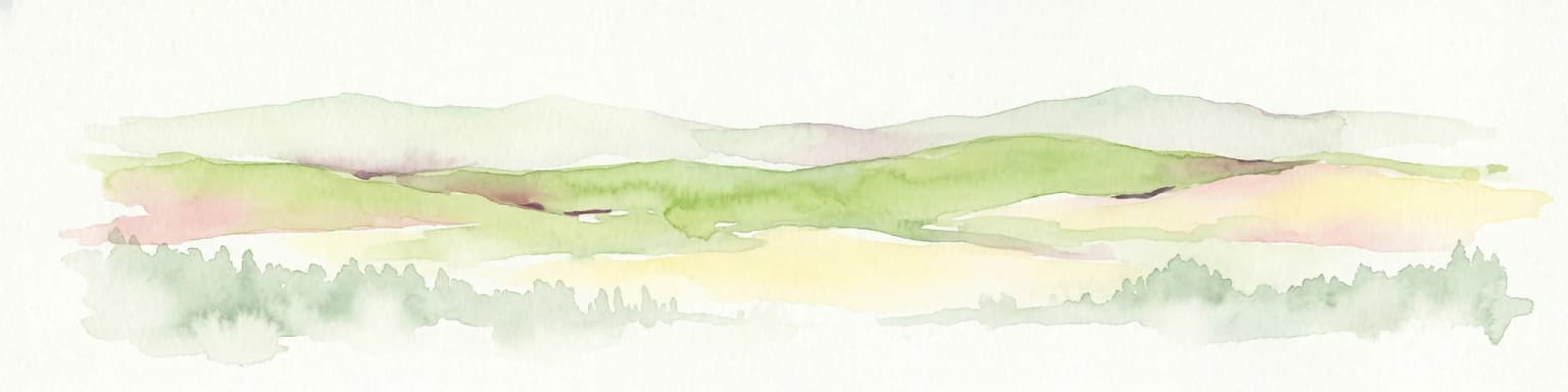
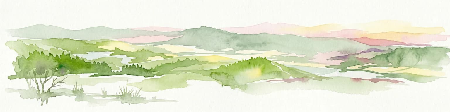
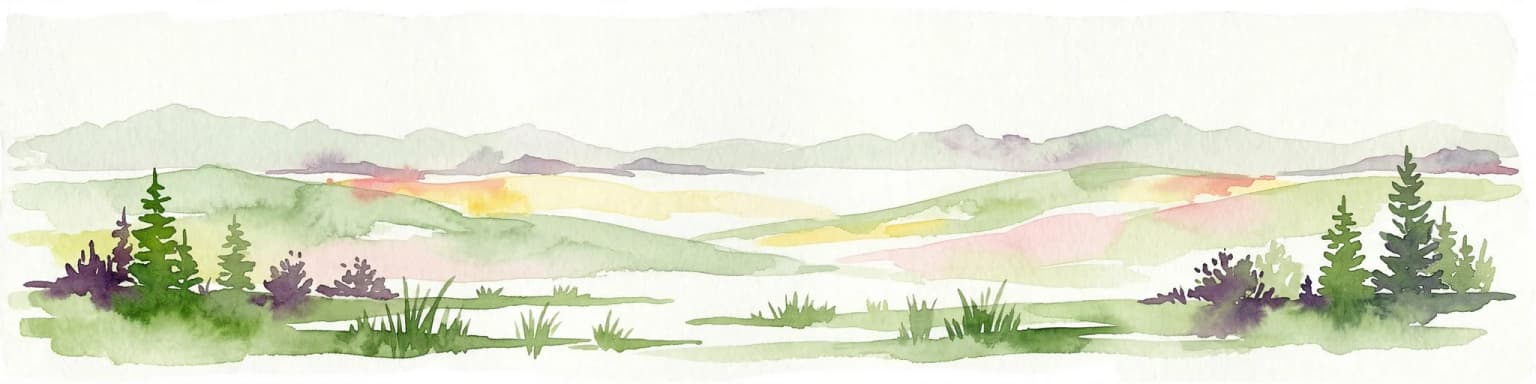
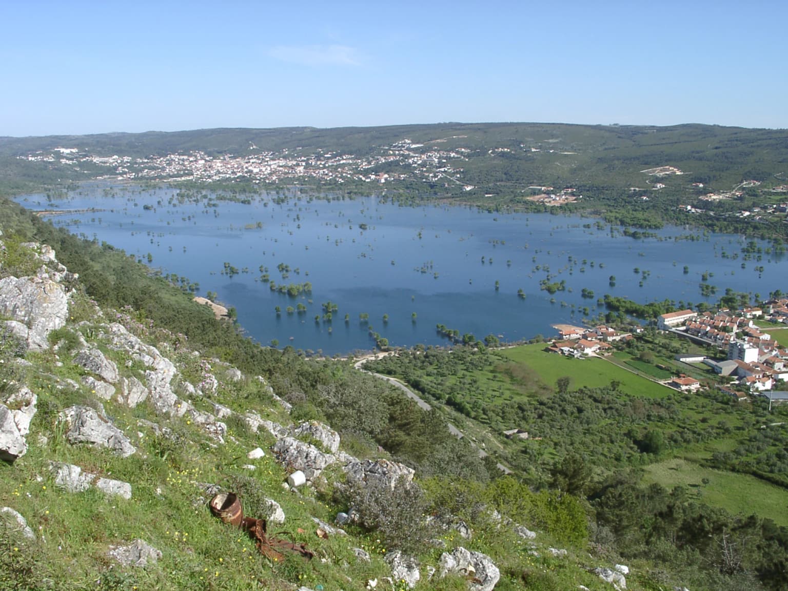
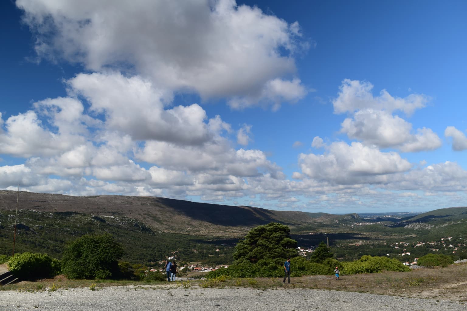
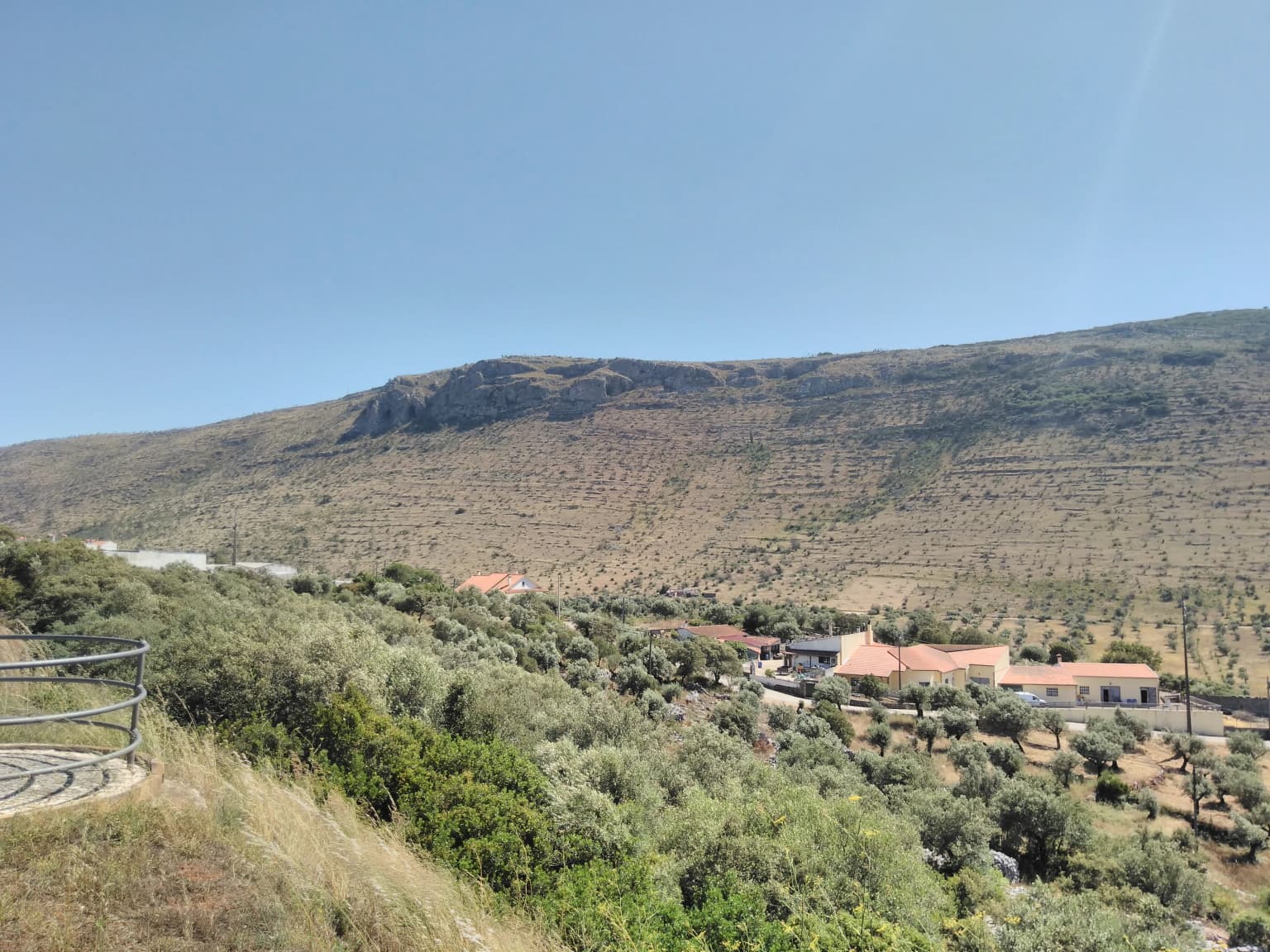
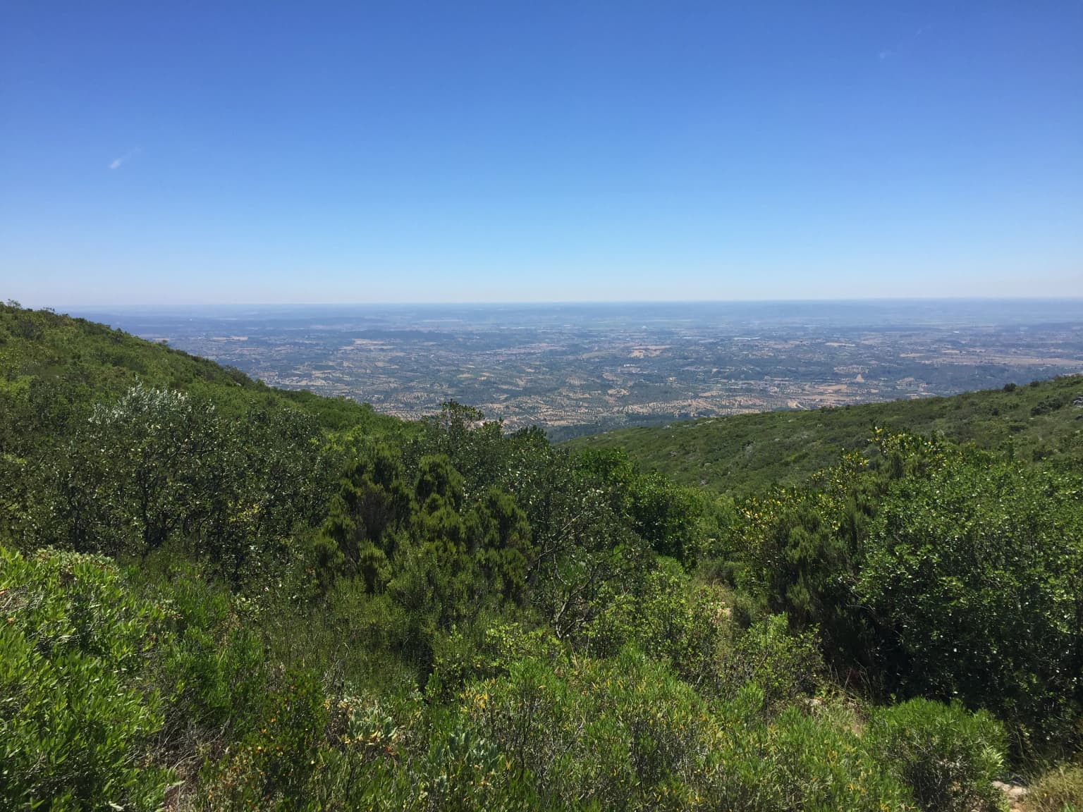
The park's landscape is defined by its karst limestone terrain, with prominent ridges and plateaus rising 200 meters above surrounding areas. The Aire Range reaches 679 meters at its highest point while the Candeeiros Range attains 615 meters. The white, jointed limestone strata are continuously dissolved by rainwater, which preferentially infiltrates through fractures rather than flowing on the surface. This process has created an extensive underground drainage system with galleries, caves, and springs. Surface depressions called poljes, such as the Minde-Mira de Aire Polje, collect water during wet seasons and drain seasonally, leaving behind fertile terra rossa soil. The landscape also includes limestone pavements, uvalas, sinkholes, and natural amphitheaters like Fórnea formed by temporary springs. The Arrimal Lagoons represent sinkholes with naturally waterproofed clay bottoms. The absence of surface watercourses is a defining characteristic, with water instead traveling through vast underground networks before emerging at karst springs.

Wide landscape view of rolling hills and valleys under a blue sky with scattered clouds, featuring two people walking on a gravel path with trees and distant settlements
Landscape view of the Aire and Candeeiros Ranges Natural Park

Aire and Candeeiros Ranges Natural Park ecosystems, habitats, and plant life

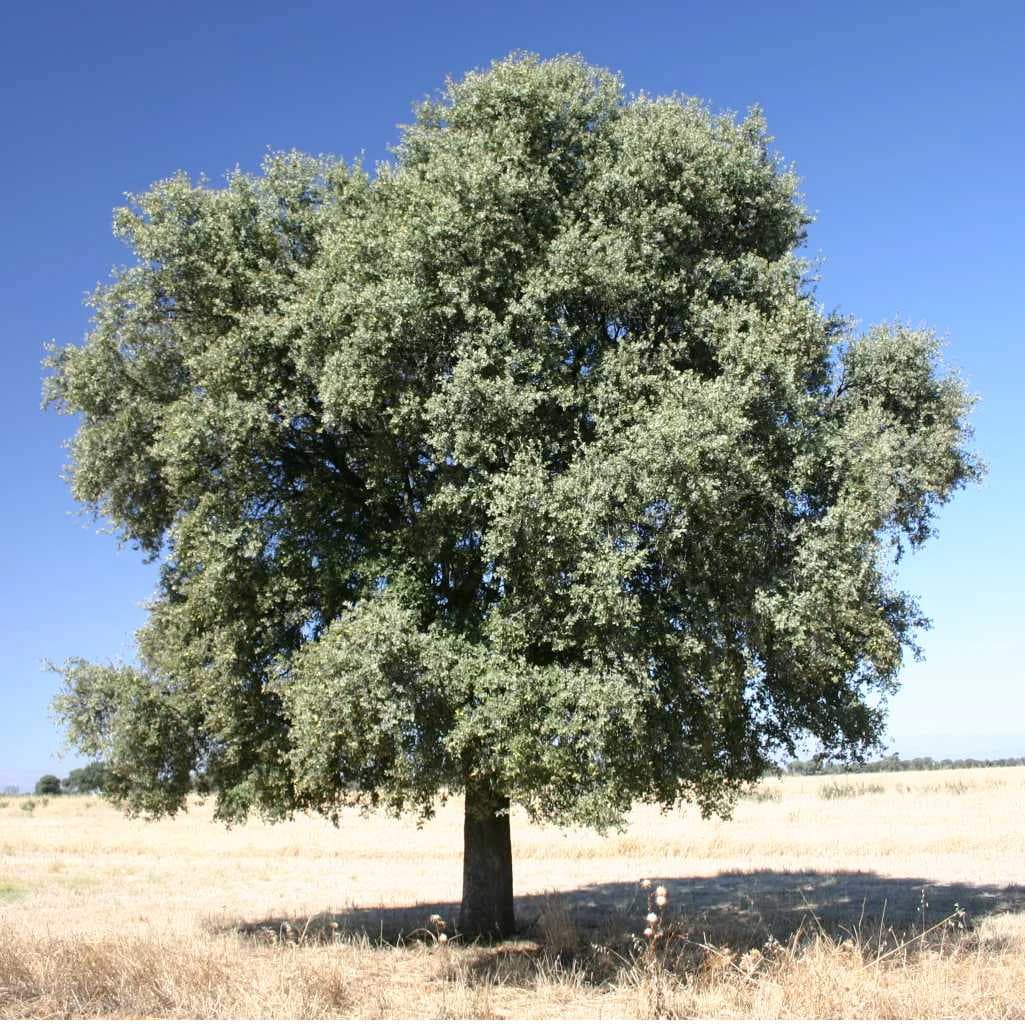
The park hosts more than 600 plant species representing about one-fifth of Portugal's total flora, including numerous endemics not found elsewhere. The vegetation reflects the blend of Atlantic and Mediterranean influences, with five main associated landscapes: Mediterranean shrublands with species like kermes oak, strawberry tree, and various heathers; humid oak and pine forests featuring Portuguese oak, cork oak, and maritime pine; lithophyte communities adapted to rock surfaces; human-introduced eucalyptus forests and olive groves; and riparian forests along underground water emergence zones. The park contains approximately 27 orchid species, representing roughly half of Portugal's native orchid diversity. Calcareous flora uncommonly found in Portugal thrives here, including Iris subbiflora, Paeonia broteri, and several endemic species such as Silene longicilia, Narcissus calcicola, and Saxifraga cintrana. The flora exhibits adaptations to fire, with some species including orchids showing enhanced flowering after burning events.

Wide landscape view of Serra de Santo António mountain range with a village, red-roofed houses, roads, and vegetation under clear blue sky
Serra de Santo António mountain range viewed from N243 road near Mira de Aire

Aire and Candeeiros Ranges Natural Park wildlife and species highlights

The park supports remarkable biodiversity despite centuries of human occupation that have transformed habitats. Vertebrate surveys have recorded 204 species, including 136 bird species. Mammals include 21 bat species representing nearly half of the park's mammal diversity, with species like Mehely's horseshoe bat and Geoffroy's bat. The micromammal community features European hedgehog, various shrews, and several mouse and vole species. Mesomammals include European rabbit and Granada hare, while large mammals include European badger, beech marten, Eurasian otter, red fox, common genet, Egyptian mongoose, Iberian lynx, and European wildcat. Bird species include short-toed snake eagle, common buzzard, Eurasian hoopoe, great spotted woodpecker, blue rock thrush, and the red-billed chough that nests exclusively in the park's rock cavities. The park supports 13 amphibian species despite lacking surface watercourses, utilizing temporary pools and lagoons like the Alvados Lagoon for reproduction. Underground galleries harbor endemic troglobiotic species including cave beetles of the genus Trechus and the spider Nesticus lusitanicus, known nowhere else on Earth.

Wide landscape view of exposed limestone hills under a cloudy sky with distant valleys
Panoramic view of Fórnea, a limestone hill within Aire and Candeeiros Ranges Natural Park

Aire and Candeeiros Ranges Natural Park conservation status and protection priorities

The park's conservation significance stems from its exceptional geological, ecological, and cultural values. Its designation as a Natura 2000 site reflects the presence of priority Mediterranean forest and scrub habitats considered unique in global terms. The underground aquifer represents a critical freshwater resource serving Lisbon's water supply since 1880. The dinosaur track sites are of international scientific importance, being among the world's few locations where Middle Jurassic sauropod tracks can be studied. The Ramsar designation of the Minde-Mira de Aire Polje recognizes its function as a wetland of international importance. However, the park faces significant ecological threats from open-pit limestone quarrying, urban sprawl, road mortality of reptiles and amphibians, wind turbine installations affecting birds and bats, and agricultural intensification including pesticide use and invasive species like Australian eucalyptus. Conservation measures focus on nature tourism, scientific research, and organic farming practices to balance protection with sustainable use.

Aire and Candeeiros Ranges Natural Park cultural meaning and human context

Human populations have inhabited the Aire and Candeeiros region for millennia, with the Cave of Aroeira nearby containing the earliest recorded human traces in Portugal along with remains of deer, equids, rhinoceros, bear, and tortoise. The landscape bears marks of Chalcolithic activity including a dolmen Christianized into a chapel near Alcobertas, and Roman remains such as a road at Alqueidão da Serra in Porto de Mós dating from the first century BC to AD. The terrain's porosity has shaped settlement patterns, with communities clustering on fertile terra rossa plains rather than the dry limestone uplands. Traditional agricultural practices created a mosaic of cropland, olive groves, and pasture that supports species dependent on agro-pastoral systems. The red-billed chough, for instance, depends on these traditional practices that are increasingly rare due to agricultural abandonment. Local communities developed water management systems adapted to the karst terrain, including cisterns constructed in rock crevices to capture rainfall since wells were impractical in the limestone. The Rio Maior salt pans represent a unique cultural feature, being Portugal's only inland salt operations dating to 1177 and fed by underground galleries passing through rock salt deposits.

A single large olive oak tree with dense green foliage standing in a dry grassy field under clear blue sky
A Quercus ilex rotundifolia tree in an open grassy field

Top sights and standout views in Aire and Candeeiros Ranges Natural Park

The park offers exceptional underground exploration through cave systems like Mira de Aire, Alvados, and the Almonda spring caves, with interpretation centers including the Centro Ciência Viva do Alviela - Carsoscópio. The Aire Range Dinosaur Tracks Natural Monument preserves one of the world's most significant Middle Jurassic sauropod trackway sites with over 1000 individual footprints at the Vale de Meios location. The Minde-Mira de Aire Polje transforms dramatically between seasons, flooding in winter to create a vast wetland before draining to reveal fertile soil. The park's 27 orchid species and more than 600 plant varieties support outstanding botanical interest, particularly for calcareous flora and Portuguese endemics. The underground water network feeding the Alviela springs has supplied Lisbon since 1880, representing one of the oldest continuous water supply relationships in Europe. The Rio Maior salt pans offer a rare glimpse of traditional inland salt production unique in Portugal.

Stalactites hanging from cave ceiling with orange-brown mineral deposits
Karst formation known as 'organ' in Grutas de Mira Daire cave

Best time to visit Aire and Candeeiros Ranges Natural Park

The park can be visited year-round though seasons significantly influence the experience. Winter brings substantial rainfall that fills the poljes and activates springs, though some cave access may be restricted. Spring and autumn offer moderate temperatures and the best conditions for observing orchids and other wildflowers, with the Mediterranean scrub in bloom during late spring. Summer brings hot, dry conditions with temperatures sometimes exceeding 28°C in eastern areas, though the park's caves provide naturally cool refuge. Fog is common in winter and can move inland from the Atlantic, usually clearing by midday. The summer months of July and August see minimal rainfall, making this the driest period. For wildlife observation, spring brings amphibian breeding activity at temporary pools while autumn sees bird migration. The dinosaur track sites are accessible throughout the year, though summer heat may make extended outdoor exploration uncomfortable.

Park location guide

Geography guide, regional context, and park location map for Aire and Candeeiros Ranges Natural Park

Aire and Candeeiros Ranges Natural Park park geography, regions, and map view in Portugal
Understand where Aire and Candeeiros Ranges Natural Park sits in Portugal through a broader geographic reading of the surrounding landscape, nearby location context, and its mapped position within the national park landscape.

How Aire and Candeeiros Ranges Natural Park fits into Portugal

Portugal is a developed European country on the western Iberian Peninsula. It features a coastline along the Atlantic Ocean, includes the autonomous regions of the Azores and Madeira, and is known for its maritime history during the Age of Discovery. The country has a population of over 10.7 million and operates as a semi-presidential republic with Portuguese as its official language.

Wider geography shaping Aire and Candeeiros Ranges Natural Park in Portugal

Portugal occupies the western portion of the Iberian Peninsula in Southwestern Europe. The mainland borders Spain to the north and east, while the autonomous regions of Madeira and the Azores are situated in the Atlantic Ocean. The country includes Cabo da Roca, the westernmost point in continental Europe. The terrain varies from plains in the south to mountainous regions in the north.

Map view of Aire and Candeeiros Ranges Natural Park

Use this park location map to pinpoint Aire and Candeeiros Ranges Natural Park in Portugal, understand its exact geographic position, and read its mapped placement within the surrounding landscape more clearly.

Pigeon | © OpenStreetMap contributors

Location context for Aire and Candeeiros Ranges Natural Park

Centro RegionLeiria DistrictSantarém District

Visualize Portugal's Distinctive Limestone Terrain, Ancient Dinosaur Trackways, and Unique Protected Area Scenery

Explore Aire and Candeeiros Ranges Natural Park: Photos of Karst Landscapes and Underground Caves
Browse comprehensive photography capturing the distinctive karst landscape of Aire and Candeeiros Ranges Natural Park, showcasing its prominent limestone terrain, ancient dinosaur trackways, and unique cave systems. These images offer visual insight into the park's geological formations, diverse habitats, and overall protected-area character, helping to understand its environmental significance and scenic appeal.

Serra de Aire Dinosaur Footprints

Large body of water surrounded by rocky hills and green vegetation with small settlement visible on right side

Wide landscape view of rolling hills and valleys under a blue sky with scattered clouds, featuring two people walking on a gravel path with trees and distant settlements

Wide landscape view of Serra de Santo António mountain range with a village, red-roofed houses, roads, and vegetation under clear blue sky

Wide landscape view of exposed limestone hills under a cloudy sky with distant valleys

Panoramic view of a town with red-roofed buildings and trees, with the Serras de Aire e Candeeiros mountain range visible in the distance under a clear blue sky

A single large olive oak tree with dense green foliage standing in a dry grassy field under clear blue sky

Stalactites hanging from cave ceiling with orange-brown mineral deposits

Cave interior featuring stalactites hanging from the ceiling and rock formations illuminated by artificial lighting

Lush green hills and valleys under a clear blue sky with distant plains visible.

Close-up view of fossilized sauropod footprints in light-colored limestone with visible cracks and sediment details

Multiple wind turbines standing on a hillside with dense green vegetation under a cloudy sky

Cave interior with hanging stalactites, rocky formations, and a green-lit water pool

Close-up of a sauropod manus footprint on light-colored rock surface with visible claw impressions and mud rim

Park atlas

Compare the karst landscapes and diverse conservation areas surrounding Aire and Candeeiros, tracing Portugal's unique protected geography.

Explore Adjacent Protected Areas: Beyond Aire and Candeeiros Ranges Natural Park in Portugal
Continue exploring Portugal's protected areas after discovering Aire and Candeeiros Ranges Natural Park, browsing additional national parks and regional landscapes in central-western regions. Map the geographic distribution of distinct conservation zones, compare diverse protected terrains, and gain a broader understanding of Iberian Peninsula park systems.
Watercolor painting showing rolling coastal hills with green vegetation, a body of water, and distant mountains under a light sky
Protected landscapeLisbon District

Sintra-Cascais Natural Park: Mapped Protected Landscape in Lisbon District, Portugal

Explore Atlantic coast geography and historic palatial terrain.

The Sintra-Cascais Natural Park is a designated protected landscape in Portugal's Lisbon District, renowned for its fusion of natural beauty and historical architecture. This page offers an atlas-style exploration of its mapped boundaries, showcasing the unique Serra de Sintra mountain range meeting the Atlantic coast. Discover the protected area's geographic features, from its lush forested slopes crowned with iconic palaces to the dramatic cliffs and beaches of Cabo da Roca, providing essential context for understanding this distinctive Portuguese natural landscape.

Area
144.51 km²
Established
1981
IUCN
V
Visitors
43.5K annual
Protected landscapePortugal

Arrábida Natural Park: Protected Landscape Atlas and Geographic Context in Portugal

Mapped boundaries of this key Portuguese protected area.

Arrábida Natural Park is presented here as a significant protected landscape, offering rich details for geographic exploration and atlas-based research. Users can investigate its specific mapped boundaries, understand its environmental setting within Portugal, and utilize this data for comparative analysis of protected areas. This resource focuses on the park's inherent geographic identity and its role as a defined natural landscape.

Area
176.41 km²
Established
1976
IUCN
V
Visitors
23.1K annual
Watercolor illustration of a landscape with green hills, scattered trees, and distant mountains under a pink and yellow sky
Protected landscapePortalegre District

Serra de São Mamede Natural Park: A Protected Landscape Defined by Ecological Transition

Explore the unique mountain terrain and ecosystems of Portalegre District.

Delve into the geographic and ecological identity of Serra de São Mamede Natural Park, a significant protected landscape situated in Portugal's Portalegre District. This area is renowned for its dramatic quartzite ridges and its role as a crucial meeting point for Atlantic and Mediterranean plant communities, offering a unique atlas perspective on regional biodiversity. Examining its mapped boundaries and diverse terrain provides essential context for understanding its ecological importance and its distinct position within the Alentejo region's geography.

Area
560.6 km²
Established
1989
IUCN
V
Visitors
4.5K annual
Watercolor illustration of a landscape with green mountains, a body of water, and colorful wildflowers in the foreground
Nature reservePortugal

Serra da Estrela Natural Park: Glacial Terrain and Highest Peaks in Portugal

Explore the dramatic geography of this nature reserve.

Serra da Estrela Natural Park is a significant protected landscape in Portugal, celebrated for containing the nation's highest peak and exceptional Quaternary glacial formations. The park's terrain includes dramatic valleys carved by ice, numerous glacial lakes, and a stark alpine plateau around Torre. This nature reserve preserves a unique environment shaped by both geological history and traditional pastoralism, offering rich mapped context for understanding Portugal's mountainous geography and protected areas.

Area
891.32 km²
Established
1976
IUCN
V
Visitors
7.6K annual
Watercolor landscape illustration featuring mountains, forests, fields, and trees
Protected areaNorte Region

Alvão Natural Park: Protected Area Discovery and Regional Geographic Context

Explore its mapped boundaries and landscape within the Norte Region.

Alvão Natural Park is recognized as a protected area offering unique opportunities for geographic study and atlas exploration. This detail page provides an in-depth look at its protected landscape, mapping its precise boundaries and situating it within the diverse geography of Portugal's Norte Region. Understand the park's intrinsic value as a mapped natural area and discover its contribution to the regional conservation landscape.

Area
72.03 km²
Established
1983
IUCN
V
Visitors
29.6K annual
Protected landscapeEsposende

Northern Littoral Natural Park Protected Landscape: Geographic Discovery and Atlas Context

Mapped protected areas and regional landscape discovery near Esposende.

Uncover the geographic identity of Northern Littoral Natural Park, a key protected landscape situated near Esposende. This MoriAtlas entry focuses on its mapped boundaries and regional significance, providing a factual basis for understanding its role within Portugal's network of protected areas. Explore the park's natural terrain and its context within the broader geography of the Norte region for comprehensive atlas-based discovery.

Area
87.62 km²
Established
1987
IUCN
V
Relief
Lowland
Protected landscapeAlentejo Litoral

Southwest Alentejo and Vicentine Coast Natural Park: A Protected Landscape in Alentejo Litoral

Explore its mapped boundaries and regional geographic context.

This detail page offers a deep dive into the Southwest Alentejo and Vicentine Coast Natural Park, a protected landscape situated in Portugal's Alentejo Litoral region. Understand the park's identity as a protected area through its geographic features and mapped extent. MoriAtlas facilitates a structured understanding of this natural landscape, enabling focused discovery of its protected boundaries and regional geographical significance.

Area
895.7 km²
Established
1988
IUCN
V
Visitors
12.7K annual
Watercolor illustration showing a river flowing through a valley with hills and vegetation
Protected landscapeBeja District

Guadiana Valley Natural Park: Protected Landscape Discovery in Beja District

Explore its mapped geography and protected land context.

Guadiana Valley Natural Park is identified as a protected landscape, providing a specific focus for geographic study and map-based exploration. This entry details the park's unique protected-area status and its contextual placement within the expansive Beja District of southern Portugal. Understand the mapped boundaries and landscape features that define this area, serving as a key point for regional geographic understanding on MoriAtlas.

Area
697 km²
Established
1995
IUCN
V
Visitors
749 annual

Common questions about visiting, size, designation, and location context for Aire and Candeeiros Ranges Natural Park

Aire and Candeeiros Ranges Natural Park FAQs for park facts, access, geography, and protected area context
Find quick answers about Aire and Candeeiros Ranges Natural Park, including protected-area facts, park geography, trail and visitor context, and how the park fits into its surrounding country and regional landscape.
MoriAtlas Explorer

Continue Your Protected Areas Search Across the Global Atlas

Deepen your exploration by continuing the structured search for national parks and protected areas worldwide. Utilize the comprehensive filtering capabilities to compare different conservation landscapes and refine your understanding of global park geography. Discover more about the distribution and characteristics of protected natural areas.

Global natural geography