
Capes
Park geography
A comprehensive analysis of protected land span, physical terrain, and island geography
Geographic Profile and Mapped Boundaries of Archipiélago de Juan Fernández National Park
This geographic profile details the physical characteristics of Archipiélago de Juan Fernández National Park located in the Valparaíso Region of Chile. Explore the recorded land area of 95.71 square kilometers, mapped perimeters, and the diverse landscape features that define this island territory. The data covers integrated natural features ranging from mountain peaks and viewpoints to coastal capes and beaches within the national park boundaries.
Remote Pacific archipelago protecting one of the world's most endemic-rich island ecosystems
Archipiélago de Juan Fernández National Park
Archipiélago de Juan Fernández National Park is a protected area encompassing three volcanic islands in the South Pacific Ocean, situated approximately 665 kilometers west of mainland Chile. The park covers the majority of Robinson Crusoe Island, the entirety of Alejandro Selkirk Island, and Santa Clara Island, along with numerous smaller islets within the Juan Fernández Archipelago. Established in 1935, this park protects one of Earth's most isolated and ecologically distinctive island environments, where extreme endemism has evolved due to millions of years of geographic isolation from the South American continent. The archipelago was designated a UNESCO Biosphere Reserve in 1977, recognizing its global significance for biodiversity conservation. The islands rise steeply from the ocean as volcanic peaks, creating dramatic mountainous terrain with elevations reaching over 900 meters, while the surrounding marine waters support rich coastal ecosystems including important seabird nesting colonies and marine mammal populations.
- Location
- Chile
- Park type
- National park
- Established
- 1935
- Area
- 96 km²
Location overview
Protected island and coastal geography within Chile's Valparaíso Region
Geographic Profile of Archipiélago de Juan Fernández National Park
Archipiélago de Juan Fernández National Park is located in Chile within the Valparaíso Region. The protected area is officially designated as a coastal, island park with no transboundary status.
- Countries
- Chile
- Regions
- Valparaíso Region
- Primary location
- Valparaíso Region
- Geographic setting
- Coastal · Island
Boundary and coordinates
Analyzing ninety six square kilometers of protected insular land area
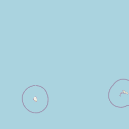
Archipiélago de Juan Fernández National Park Spatial Boundary and Mapped Extent
The mapped spatial outline provides clear visual context for the protected archipelago boundaries. Users can examine calculated geographic dimensions including land area, coordinate spans, and center points.
- Boundary area
- 100.6 km²
- Boundary perimeter
- 119.4 km
- Northernmost point
- 33.6055° S
- Southernmost point
- 33.8163° S
- Easternmost point
- 78.7697° W
- Westernmost point
- 80.8378° W
- Geographic centre
- 33.7133° S, 79.9002° W
- North–south span
- 23.4 km
- East–west span
- 191.7 km
Terrain and natural features
Explore recorded capes, streams, ridges, and peaks across the protected landscape
Archipiélago de Juan Fernández National Park Terrain and Named Features
This protected area features mixed relief types across various coastal and interior zones. Stored feature cards outline specific named capes, streams, ridges, and peaks located within the park boundaries.
Selected named natural features
Capes
Punta de Sánchez
Streams
Quebrada de Sánchez
Beaches
Las Moscas
Ridges
Cordón Chifladores
Viewpoints
Salsipuedes
Environmental setting
Subtropical forest and island relief classifications
Archipiélago de Juan Fernández National Park Environmental Classifications
Recorded landscape features, habitat types, and climate zones offer structured categories for reading the physical setting of Archipiélago de Juan Fernández National Park. These classifications link directly to relevant atlas destinations sharing corresponding environmental traits.
- Relief
- Mixed relief
- Climate
- Subtropical
- Water
- Minor water
- Forest cover
- Mostly forested
- Seasonality
- Seasonal
Landscape features
Mountains · Forest · Woodland · Grassland · Volcano · Islands · Reefs
Habitat types
Temperate broadleaf forest · Montane forest · Alpine meadow · Grassland
Park atlas
Explore the unique island geography and protected marine ecosystems surrounding the Juan Fernández Archipelago, tracing connected conservation landscapes.
Discover More Protected Areas Near Archipiélago de Juan Fernández National Park and Surrounding South Pacific Islands
Browse additional national parks and protected areas related to Archipiélago de Juan Fernández National Park, exploring other distinct island and coastal conservation landscapes across the South Pacific. Compare diverse geographic features, unique endemic species, and conservation efforts across these significant protected regions, gaining valuable atlas insights into remote oceanic ecosystems.
National parkLa Araucanía Region
687 km away#1 closest
Southeast

Nahuelbuta National Park: Ancient Araucaria Forests and Protected Highland Geography
Discover its mapped boundaries atop the Cordillera de Nahuelbuta.
Nahuelbuta National Park is a significant national park in Chile's La Araucanía Region, celebrated for its ancient monkey puzzle tree forests atop the Cordillera de Nahuelbuta. This protected area showcases a unique highland landscape with rugged terrain and exposed rocky outcrops, preserving species more typical of Andean and Patagonian environments. Understanding its mapped geography and protected landscape identity is key to appreciating its ecological importance and distinct position within South America's natural atlas.
- Area
- 68 km²
- Established
- 1939
- IUCN
- II
- Relief
- Mountain
National parkLibertador General Bernardo O'Higgins Region
704 km away#2 closest
East
Las Palmas de Cocalán National Park: Chile's National Park Protected Landscape Atlas
Explore geographic boundaries and regional context.
Delve into the protected landscape identity of Las Palmas de Cocalán National Park, situated within the Libertador General Bernardo O'Higgins Region. This page provides detailed atlas-style information, focusing on the park's geographic features and its role as a national park. Understand the mapped natural terrain and the regional importance of this conserved area for comprehensive geographic discovery.
- Area
- 3.709 km²
- Established
- 1971
- IUCN
- II
- Relief
- Mixed relief
National parkValparaíso Region
713 km away#3 closest
East
La Campana National Park: Protected Landscape of Chilean Wine Palms
Explore its mapped terrain and regional geographic context.
La Campana National Park represents a significant protected landscape within Chile, celebrated for its exceptional concentration of Chilean Wine Palms (Jubaea chilensis). As a national park situated in the Valparaíso Region, it showcases a diverse range of Mediterranean ecosystems and dramatic coastal mountain terrain. This page provides detailed atlas-style context, highlighting the park's unique botanical heritage, its distinct geographic setting, and its importance as a mapped natural area for regional landscape studies.
- Area
- 80 km²
- Established
- 1967
- IUCN
- II
- Visitors
- 39.6K annual
National parkMaule Region
734 km away#4 closest
East
Radal Siete Tazas National Park: Iconic Seven Cups Waterfall System and Pre-Andean Terrain Exploration
Mapped protected landscape in Maule Region, Chile.
Radal Siete Tazas National Park showcases a remarkable cascade of seven natural rock pools and waterfalls along the Claro River, a defining feature within its steep pre-Andean topography. This national park in Chile's Maule Region offers a landscape rich with volcanic influences and dramatic riverine erosion. Users can explore its distinct terrain, mapped boundaries, and the striking visual geography that makes this protected area a significant natural landmark for atlas-based discovery.
- Area
- 41.4 km²
- Established
- 2008
- IUCN
- II
- Relief
- Mountain
National parkCoquimbo Region
741 km away#5 closest
East
Bosque de Fray Jorge National Park: National Park Protected Landscape & Geographic Atlas
Explore mapped boundaries and regional natural landscape context.
Bosque de Fray Jorge National Park is a key protected area offering unique insights into Chile's natural landscapes. This entry provides detailed geographic context, focusing on its status as a national park and its mapped boundaries within the Coquimbo Region. Discover its place in the regional atlas and understand its protected landscape identity for focused geographic exploration.
- Area
- 100 km²
- Established
- 1941
- IUCN
- II
- Visitors
- 13.1K annual
National parkSantiago Metropolitan Region
767 km away#6 closest
East
Río Clarillo National Park: National Park Boundaries and Geographic Atlas Context
Mapped protected landscape in Santiago Metropolitan Region.
Discover the distinct protected landscape of Río Clarillo National Park, a national park situated within Chile's Santiago Metropolitan Region. This entry is designed for atlas-style exploration, focusing on the park's mapped boundaries, its integration into the regional geography, and its significance as a protected natural area. Understand the geographic context and landscape characteristics that define Río Clarillo National Park, enabling a deeper appreciation of its role within the broader conservation map.
- Area
- 101.85 km²
- Established
- 1982
- IUCN
- IV
- Relief
- Upland
National parkBío Bío Region
781 km away#7 closest
Southeast
Laguna del Laja National Park: Mapped Protected Area in Chile's Bío Bío Region
Explore regional park geography and landscape context.
Laguna del Laja National Park represents a key protected area with distinct geographic attributes within the Bío Bío Region. This profile focuses on its identity as a national park, providing context for its mapped boundaries and natural landscape. Discover its place in regional geography, offering valuable insights for any atlas-focused exploration of Chile's protected lands.
- Area
- 119 km²
- Established
- 1958
- IUCN
- II
- Visitors
- 48.8K annual
National parkChile
795 km away#8 closest
Southeast
Tolhuaca National Park National Park: Mapped Boundaries and Chilean Geography
Explore the protected landscape and regional context of this park.
Tolhuaca National Park is a protected national park located in Chile, offering a distinct point for geographic and landscape discovery. This detailed view focuses on the park's mapped boundaries, its environmental setting within Chile, and its overall protected-area identity. Engage with structured data that clarifies its position in the broader atlas of natural landscapes, providing context for regional geography and conservation efforts.
- Area
- 64.74 km²
- Established
- 1935
- IUCN
- II
- Visitors
- 6.5K annual
MoriAtlas Explorer
Continue Exploring Archipiélago de Juan Fernández National Park's Unique Geography and Protected Boundaries
Deepen your understanding of Archipiélago de Juan Fernández National Park by examining its specific mapped boundaries, volcanic terrain, and the geographic factors contributing to its extreme endemism. This site offers a detailed look at one of the world's most isolated protected landscapes, providing valuable context for regional geography and island conservation studies. Continue your exploration to appreciate the full scope of this remarkable national park's ecological and geographical significance.
Browse next
Global natural geography
Explore related park routes
Explore MoriAtlas Global ParksBrowse All MoriAtlas ParksGlobal Park Map DiscoveryMoriAtlas: Browse All CountriesBrowse All MoriAtlas ContinentsNational Park Environment AtlasGrand Canyon National Park AtlasYellowstone National Park AtlasYosemite National Park Atlas and GeographySerengeti National Park AtlasGalápagos National Park Protected LandscapeBanff National Park Geography and AtlasKruger National Park Atlas EntryUluṟu-Kata Tjuṯa National Park AtlasExplore Uluru-Kata Tjuta National Park GeographyPlitvice Lakes National Park AtlasFiordland National Park Protected LandscapeGreat Smoky Mountains National Park AtlasAfghanistan National Parks and Protected AreasAlbania National Parks and Protected AreasAlgeria National Parks and Protected AreasAmerican Samoa National Parks and Protected AreasAndorra National Parks and Protected AreasAngola National Parks and Protected AreasAntarctica National Parks and Protected AreasAntigua and Barbuda Park List