Mori Atlas logo
National parkBeydağları Coastal National Park

Discover the mapped geographic extent and natural terrain of this significant national park in Antalya Province.

Beydağları Coastal National Park: A Protected Landscape on Turkey's Mediterranean Coast

(Beydağları Sahil Milli Parkı)

Beydağları Coastal National Park, situated in Turkey's Antalya Province, is a vast protected area where the dramatic Beydağları mountain range meets the Mediterranean Sea. Established to conserve its unique ecological and archaeological heritage, the park spans approximately 34,000 hectares. This page offers a detailed view of its protected landscape, including mapped terrain, key geographic features, and its significance as a site of natural beauty and historical depth for atlas-based exploration.

Mediterranean coastlineAncient ruinsLycian heritageForest protectionEndemic speciesMountain hiking
Stylized illustration of a coastal landscape with rocky cliffs, pine trees, a winding river, sandy beach, and a setting sun over the sea

Beydağları Coastal National Park

National park

Park overview

Structured park overview, official facts, and landscape profile for Beydağları Coastal National Park

Beydağları Coastal National Park park facts, protected area profile, and essential visitor context
Review the core facts for Beydağları Coastal National Park, including designation, size, terrain, visitor scale, habitats, and operating context in one park-focused overview.

About Beydağları Coastal National Park

Beydağları Coastal National Park represents one of Turkey's most important protected areas where natural and cultural heritage converge along the Mediterranean coast. The park stretches across a landscape of extraordinary diversity, where dense pine and cedar forestsclimb the slopes of the Beydağları mountains before giving way to rocky headlands, secluded coves, and long crescent beaches that have drawn visitors since antiquity. The park lies between the ancient regions of Pamphylia and Lycia, a transitional zone that has seen the rise and fall of many civilizations. Within its boundaries lie the ruins of three significant ancient cities: Olympos, a major port of the Lycian League that dates to at least the 2nd century BCE; Phaselis, known for its three harbor basins and strategic position along ancient trade routes; and Idyros, another classical settlement whose remains speak to the region's long history of human occupation. The landscape is dominated by Tahtalı Dağı, the park's highest summit, whose foothills contain the famous Yanartaş burning gas field where natural flames have emerged from the rock for thousands of years, a phenomenon that held religious significance in ancient times and continues to captivate visitors today. The park offers remarkable environmental diversity within a relatively compact area, with coastal ecosystems, forest habitats, and rocky mountain zones all protected together.

Quick facts and research context for Beydağları Coastal National Park

Located along Turkey's Mediterranean coast in Antalya Province, the park covers roughly 34,000 hectares of coastal and mountainous terrain. Established in 1972 under IUCN Category II, the park features Tahtalı Dağı as its highest peak and includes the famous Yanartaş burning gas field. The area is renowned for its exceptional plant diversity with over 865 documented species, including 25 endemic varieties. Rare mammals including mountain goats, lynx, caracals, and wolves inhabit the park's diverse ecosystems.

Park context

Deeper park guide and search-rich context for Beydağları Coastal National Park

Beydağları Coastal National Park history, landscape, wildlife, and travel context
Explore Beydağları Coastal National Park through its history, landscape character, ecosystems, wildlife, conservation priorities, cultural context, and seasonal travel timing in a structured park guide built for atlas discovery and search intent.

Why Beydağları Coastal National Park stands out

Beydağları is best known for its dramatic combination of pristine Mediterranean coastline and exceptional archaeological significance. The park contains the ancient cities of Olympos and Phaselis, major centers of the classical Lycian civilization, along with the mysterious Yanartaş eternal flames that have burned for millennia on the mountainside. The park also stands out for its ecological diversity, protecting 865 plant species in a coastal forest ecosystem where tahtalı mountain provides a dramatic backdrop to pebble and sand beaches below.

Rocky coastal bay with clear blue water, people swimming, forested cliffs, and a clear blue sky
Scenic coastal bay with clear turquoise water, rocky cliffs, and forested hills in Beydağları Coastal National Park

Beydağları Coastal National Park history and protected-area timeline

Beydağları Coastal National Park was established on March 16, 1972, through a government decree that recognized the exceptional combination of natural beauty and cultural significance found along this stretch of the Turkish Mediterranean coast. The creation of the park reflected a growing awareness in Turkey during the 1970s of the need to protect both ecological treasures and archaeological heritage, as the region faced increasing development pressure. The park's boundaries were drawn to encompass not only the dramatic coastal scenery and mountain forests but also the ancient settlements that had defined the region for millennia. The establishment came at a time when appreciation for Turkey's Lycian heritage was growing, and protecting the archaeological sites within their natural context became a priority. The park's management under the Directorate-General of Nature Protection and National Parks has balanced conservation with public access, recognizing that the area's value lies in both its natural ecosystems and its role as an open-air museum of Mediterranean history.

Beydağları Coastal National Park landscape and geographic character

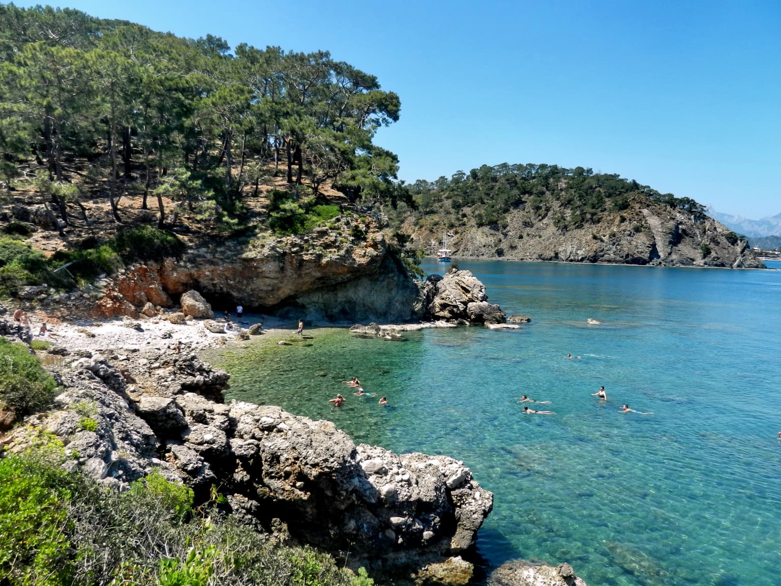
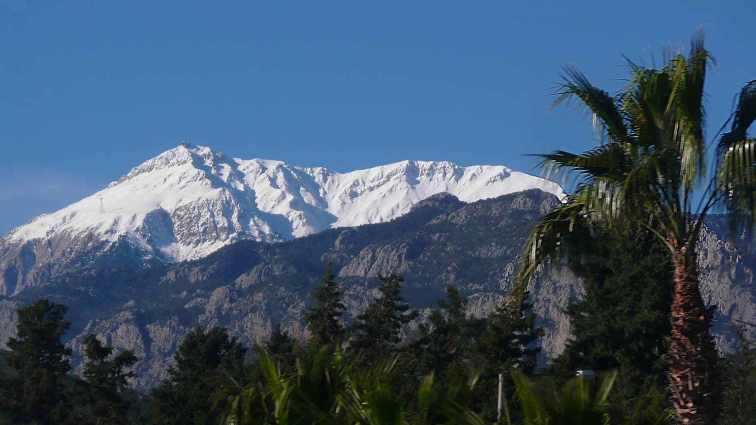
The park presents a spectacular Mediterranean landscape where the Beydağları mountain range rises sharply from the coast, creating a dramatic backdrop of forested slopes and rocky peaks. The coastline alternates between long pebble and sand beaches tucked into coves and dramatic rocky headlands that jut into the Mediterranean. The most prominent feature is Tahtalı Dağı, whose summit can be seen from much of the park and provides an iconic landmark for orientation. Along the lower slopes, the terrain is characterized by maquis shrubland and pine forests, while higher elevations feature mixed forest with cedar elements. The coastline itself includes famous beaches such as Çıralı and Adrasan, among the longest and most beautiful along this section of the Mediterranean. Inland, the mountain valleys contain small streams and the remnants of ancient water management systems built by Lycian and Roman engineers. The landscape creates a sense of dramatic contrast between the vertical mountain and the horizontal sea, with the green forests providing a lush transition zone between them.

Snow-covered mountain peak with forested slopes and palm trees in foreground under clear blue sky.
Snow-capped Mount Tahtali rises above Mediterranean coastal vegetation with palm trees and evergreen forests in the foreground.

Beydağları Coastal National Park ecosystems, habitats, and plant life

The park supports remarkably rich biodiversity for its Mediterranean setting, with over 865 plant species documented within its boundaries. Twenty-five of these species are endemic, found nowhere else on Earth, reflecting the region's status as a significant center of plant diversity. The park's ecosystems range from coastal dune and beach communities through maquis shrubland to forested slopes of pine, cedar, and mixed deciduous species. The transition from sea to mountain creates a complex mosaic of habitats that supports this exceptional plant diversity. The forest communities are particularly significant, representing some of the best-preserved Mediterranean coastal forests in Turkey. These forests provide habitat for the park's diverse wildlife and also play an important role in protecting watersheds and preventing erosion along this steep coastline. The Mediterranean climate with its warm, dry summers and mild, wet winters shapes the seasonal rhythm of the park's natural communities.

Stone ruins in water with forested mountains and trees
Ancient stone ruins standing in calm water with forested mountains in the background

Beydağları Coastal National Park wildlife and species highlights

The park is home to several rare and notable mammal species that find refuge in its diverse habitats. The mountain goat thrives on the rocky slopes and high terrain, perfectly adapted to the steep cliffs and rugged terrain of the Beydağları range. The lynx, a secretive and elusive feline, hunts in the forest and scrubland areas, though sightings are rare due to the animal's shy nature. The caracal, with its distinctive tufted ears and powerful build, hunts in the park's more open areas and is one of the more unusual predators in the region. Wolves maintain territories in the more remote sections of the park, particularly in the mountain forests where prey species are abundant. The combination of forest, scrub, and rocky habitats creates diverse hunting grounds and shelter for these predators, while the Mediterranean coastline provides additional habitat for marine birds and occasional marine mammals in the offshore waters.

Ancient stone ruin with barred entrance surrounded by trees and vegetation, with a signboard on the left
Ancient stone structure with barred entrance at Olympos within Beydağları Coastal National Park

Beydağları Coastal National Park conservation status and protection priorities

Beydağları Coastal National Park represents an important conservation priority in the Mediterranean region, protecting both significant natural ecosystems and irreplaceable cultural heritage within a single protected area. The park's establishment recognized that the coastal forests, marine environments, and archaeological sites all form an interconnected whole that must be managed holistically. The exceptional plant diversity, with its high concentration of endemic species, makes the park botanically significant at both national and international levels. The protection of habitat for rare mammals including lynx, caracal, and wolf reflects Turkey's commitment to conserving its larger predators, which require extensive territories and intact ecosystems. The park also serves as a buffer against development pressure along one of Turkey's most attractive coastlines, ensuring that future generations can experience both the natural beauty and historical significance of this remarkable landscape.

Beydağları Coastal National Park cultural meaning and human context

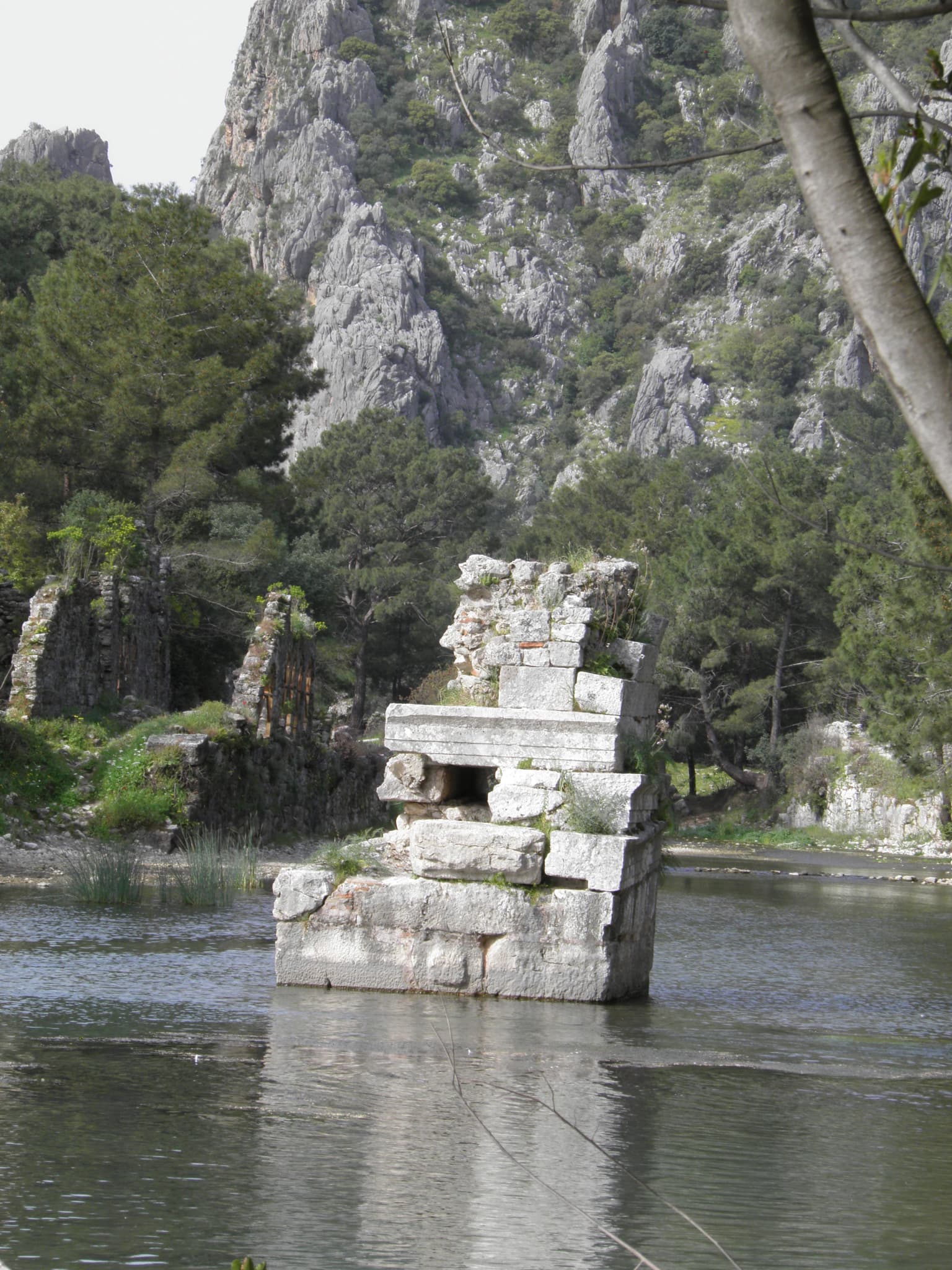
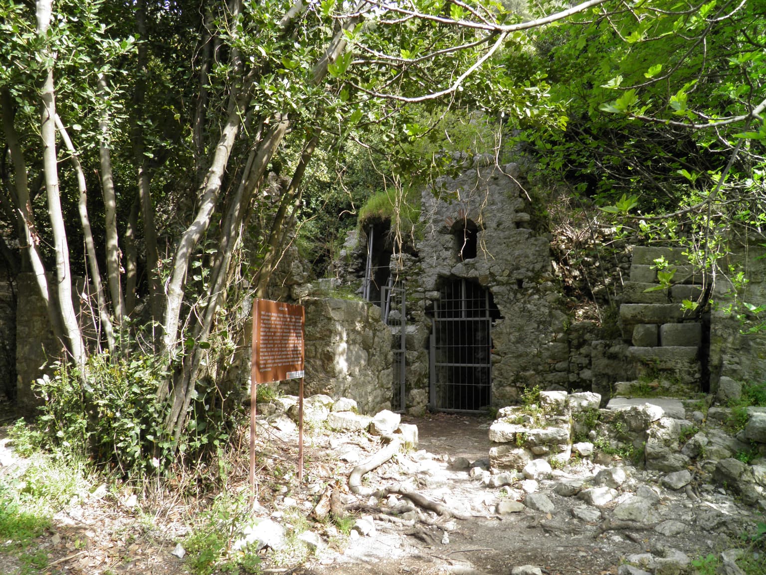
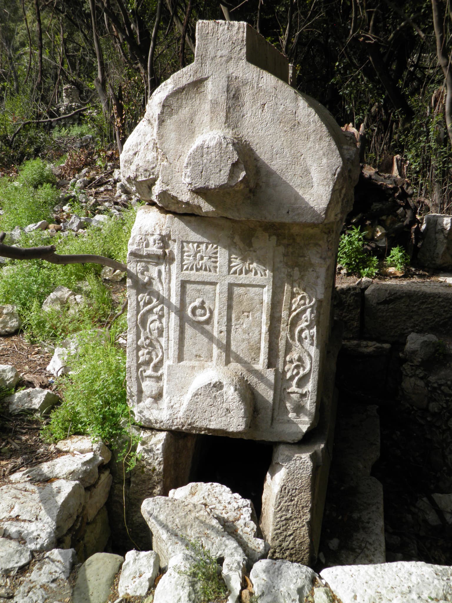
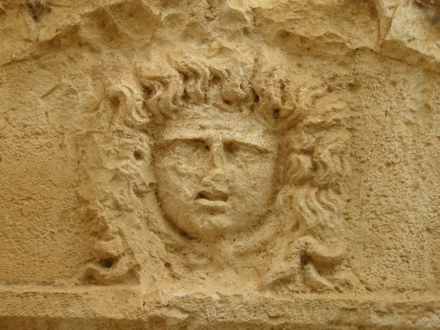
The park occupies a landscape that has been inhabited continuously for millennia, with human settlement and activity shaping both the land and its cultural character. The ancient city of Olympos, situated within the park, was a major member of the Lycian League, the confederation of cities that defined political life in this region during the classical period. The city's name derives from ancient Anatolian languages, likely meaning "high mountain" or "great mountain," reflecting the prominence of Tahtalı Dağı in the local landscape. Olympos was not merely a political entity but a center of religious significance, with cults of Hephaistos, Zeus, and Apollo worshipped within its bounds. The park also contains the ruins of Phaselis, whose three harbor basins speak to its importance in ancient maritime trade. The presence of these ancient cities, combined with the eternal flames of Yanartaş, creates a cultural landscape where natural and human history are deeply intertwined.

Stone monument with intricate carvings surrounded by rocks and greenery
Ancient stone structure with carvings in Beydağları Coastal National Park

Top sights and standout views in Beydağları Coastal National Park

The park offers an exceptional combination of experiences that distinguish it from other Mediterranean protected areas. The archaeological sites of Olympos and Phaselis provide a direct connection to ancient Mediterranean civilization, with ruins that can be explored in their natural setting. The Yanartaş eternal flames represent a natural phenomenon that has held cultural and religious significance for millennia and remains visually striking today. The hiking trails up Tahtalı Dağı reward visitors with panoramic views across the Mediterranean and the dramatic mountain landscape. The beaches of Çıralı and Adrasan offer relatively unspoiled coastal experiences along one of Turkey's most beautiful coastlines. The park's ecological richness, with over 865 plant species and significant wildlife, provides excellent opportunities for nature observation in a Mediterranean forest setting.

Stone relief sculpture of a human face with curly hair on a weathered stone surface
Ancient stone relief carving at Olympos within Beydağları Coastal National Park

Best time to visit Beydağları Coastal National Park

The park can be visited year-round, though the ideal time for most activities is during the spring and autumn months when temperatures are comfortable for hiking and outdoor exploration. Summer brings peak temperatures and the highest visitor numbers, particularly at the beaches, while still offering the advantage of year-round access to archaeological sites. Spring brings wildflower displays in the forests and lower elevations, while autumn offers pleasant hiking conditions and the continuation of beach weather into September and October. The winter months see fewer visitors and can be suitable for those seeking solitude, though some facilities may have reduced operating hours.

Park location guide

Geography guide, regional context, and park location map for Beydağları Coastal National Park

Beydağları Coastal National Park park geography, regions, and map view in Turkey
Understand where Beydağları Coastal National Park sits in Turkey through a broader geographic reading of the surrounding landscape, nearby location context, and its mapped position within the national park landscape.

How Beydağları Coastal National Park fits into Turkey

Turkey, officially the Republic of Türkiye, is a transcontinental country located mainly in Anatolia (West Asia) with a smaller portion in East Thrace (Southeast Europe). It borders the Black Sea to the north, several countries to the east and south, and the Aegean Sea and European countries to the west. The country has a population of over 86 million and operates as a secular, Muslim-majority presidential republic with Ankara as capital and Istanbul as its largest city.

Wider geography shaping Beydağları Coastal National Park in Turkey

Turkey is a transcontinental country with the majority of its territory (about 97%) located in Anatolia (West Asia) and a smaller portion called East Thrace in Southeast Europe. It borders the Black Sea to the north, Georgia, Armenia, Azerbaijan, and Iran to the east, Iraq and Syria to the south, and the Mediterranean Sea to the southwest. To the west, Turkey borders the Aegean Sea, Greece, and Bulgaria. The terrain includes mountains, plateaus, and coastal plains, with the Taurus Mountains running along the southern coast.

Map view of Beydağları Coastal National Park

Use this park location map to pinpoint Beydağları Coastal National Park in Turkey, understand its exact geographic position, and read its mapped placement within the surrounding landscape more clearly.

Pigeon | © OpenStreetMap contributors

Location context for Beydağları Coastal National Park

Antalya Province

Explore the dramatic coastal mountains, ancient ruins, and diverse habitats of this Turkish protected area through compelling imagery.

Beydağları Coastal National Park Photos: Visualizing Mediterranean Landscapes and Ancient Scenery
Visually explore Beydağları Coastal National Park's stunning Mediterranean landscapes, where forested mountains meet pristine beaches and ancient ruins. These images offer an essential perspective on the park's diverse terrain, rich ecological habitats, and the unique historical protected-area character that defines Turkey's southern coast.

Rocky coastal bay with clear blue water, people swimming, forested cliffs, and a clear blue sky

Aerial photograph of a coastal landscape featuring a sandy beach, clear blue water, rocky cliffs, and dense green forest along the shoreline.

Snow-covered mountain peak with forested slopes and palm trees in foreground under clear blue sky.

Stone ruins in water with forested mountains and trees

Ancient stone ruin with barred entrance surrounded by trees and vegetation, with a signboard on the left

Close-up of ancient mosaic pavement on moss-covered stone surrounded by green foliage and dry leaves

Stone monument with intricate carvings surrounded by rocks and greenery

Stone relief sculpture of a human face with curly hair on a weathered stone surface

Ancient Roman bath ruins near a calm body of water with tall reeds and trees in the background

Stone archway structure with a dirt path surrounded by trees and rocks

Hikers on a rocky trail with a mountain peak in the background, partially obscured by clouds.

Park atlas

Explore the rich tapestry of protected landscapes across Antalya Province, comparing coastal and mountain parks.

Compare Beydağları Coastal National Park with Nearby Protected Areas and Regional Parks
Browse a curated list of national parks and protected areas near Beydağları Coastal National Park, encompassing coastal regions, mountain terrain, and ancient sites across Antalya Province. This geographic context allows for detailed comparison of diverse protected landscapes, revealing patterns of conservation and natural heritage throughout the Mediterranean coast of Turkey.
National parkAntalya Province

Mount Güllük-Termessos National Park: An Atlas View of Protected Mediterranean Landscapes

Protected national park with ancient ruins and diverse ecosystems.

Discover Mount Güllük-Termessos National Park, a key protected area within Antalya Province, Turkey. This national park is notable for its integrated cultural and natural heritage, featuring the extensive ruins of ancient Termessos and a diverse Mediterranean ecosystem supporting endangered wildlife. Its varied terrain, from lower shrublands to higher pine forests, alongside dramatic geological features like the Mecene Strait canyon, provides rich geographic context for atlas-based discovery.

Area
67.02 km²
Established
1970
IUCN
II
Relief
Mountain
Watercolor illustration of a mountainous landscape with a river, trees, and a colorful sky
National park

Köprülü Canyon National Park: Protected Landscape Atlas and Geographic Context

Discover unique geological formations and river canyon terrain.

Köprülü Canyon National Park represents a vital protected natural area, showcasing remarkable geological formations and a dramatic river canyon landscape. This entry provides a structured exploration of its mapped boundaries, regional geographic setting, and the unique terrain that defines this significant natural reserve, ideal for atlas-based discovery.

IUCN
II
Watercolor painting of a river flowing through green hills and mountains under a soft sky.
National parkMuğla Province

Saklıkent National Park: Explore Turkey's Deepest Gorge, Limestone Formations, and Protected Terrain

A remarkable national park showcasing dramatic canyon geography and karst landscapes.

Saklıkent National Park presents an extraordinary example of a protected landscape dominated by a deep limestone canyon in Muğla Province, Turkey. This national park invites exploration of its striking geological features, including towering cliffs and flowing karstic springs that form a spectacular gorge. Users engaging with Saklıkent National Park gain insight into the mapped boundaries of protected areas and the unique natural terrain sculpted by water over millennia, offering a rich geographic context for atlas discovery.

Area
16.43 km²
Established
1996
IUCN
II
Visitors
200K annual
Watercolor illustration showing a mountainous landscape with a lake and greenery
National parkAntalya Province

Altınbeşik Cave National Park: A Karst Landscape with Turkey's Largest Subterranean Lake

Protected lands and mapped geological formations in Antalya Province.

Altınbeşik Cave National Park represents a significant protected karst landscape within Antalya Province, Turkey. The park's primary feature is the renowned Altınbeşik Cave, home to Turkey's largest subterranean lake and exceptional travertine formations. Explore the mapped geography of this unique national park, understanding its role as a critical discharge point for one of the world's longest karst aquifer systems.

Area
11.47 km²
Established
1994
IUCN
II
Relief
Mixed relief
Watercolor painting showing a lake, mountains, trees, and grassy shoreline
National parkIsparta Province

Lake Kovada National Park: Mapped Protected Landscape in Isparta Province

Discover the geography and lake ecosystem of this Turkish national park.

Lake Kovada National Park offers a detailed look at a protected natural area within Turkey's Isparta Province. This page provides insights into the park's protected landscape, focusing on the central freshwater lake and its surrounding montane terrain. Explore its geographic context, mapped boundaries, and status as a significant protected area within the Taurus Mountain region, ideal for atlas-based discovery of Anatolian natural environments.

Area
65.51 km²
Established
1970
IUCN
II
Scope
Terrestrial
National parkTurkey

Derebucak Çamlık Caves National Park: Turkey's Protected Karst Caves and Landscape

Explore Konya Province's longest cave system and its unique geological context.

Derebucak Çamlık Caves National Park is a vital protected landscape in central Turkey, celebrated for its extensive karst topography and significant cave formations. This national park encompasses thirteen unique caves and sinkholes, with Balatini Cave holding the distinction of being Konya Province's longest. The park's rugged terrain, characterized by pine forests and the Balat Stream feeding its underground systems, offers a profound look into Turkey's geological heritage and the conservation of its unique subterranean environments. MoriAtlas helps you navigate this mapped protected area.

Area
11.47 km²
Established
2022
IUCN
II
Relief
Upland
Watercolor painting of colorful rowboats on a lake with distant mountains
National parkKonya Province

Lake Beyşehir National Park: Protected Landscape Geography and Mapped Boundaries

Discover the geography and mapped context of this national park in Konya.

Lake Beyşehir National Park is a major protected area in Turkey's Central Anatolia region, celebrated for its immense freshwater lake and diverse wetland habitats. The park's identity is strongly tied to its mapped boundaries that protect critical ecosystems, islands, and surrounding forested terrain. This page provides a detailed look at the park's geographic setting within Konya Province, serving as a valuable resource for atlas-based discovery of its unique natural and cultural landscape.

Area
868.55 km²
Established
1993
IUCN
II
Relief
Lowland
Watercolor painting showing a lake with hills and forest in the background
National parkTurkey

Mount Honaz National Park: Turkey's National Park Protected Area Detail

Explore mapped protected landscape and regional geography.

Mount Honaz National Park is a designated national park in Turkey, offering valuable insights into the country's protected areas and natural landscapes. This page provides a focused view of its mapped boundaries and geographic significance, enabling detailed atlas-style exploration. Understand how this protected area contributes to the regional geography of Western Anatolia and complements the broader network of natural reserves within Turkey.

IUCN
II
Scope
Terrestrial

Common questions about visiting, size, designation, and location context for Beydağları Coastal National Park

Beydağları Coastal National Park FAQs for park facts, access, geography, and protected area context
Find quick answers about Beydağları Coastal National Park, including protected-area facts, park geography, trail and visitor context, and how the park fits into its surrounding country and regional landscape.
MoriAtlas Explorer

Continue Your Protected Areas Search Across the Global Atlas

Deepen your exploration by continuing the structured search for national parks and protected areas worldwide. Utilize the comprehensive filtering capabilities to compare different conservation landscapes and refine your understanding of global park geography. Discover more about the distribution and characteristics of protected natural areas.

Global natural geography