Mori Atlas logo
National parkEifel National Park

Discover the mapped boundaries and geographic context of this German national park.

Eifel National Park: Protected Landscape & Regional Geography in North Rhine-Westphalia

(Nationalpark Eifel)

MoriAtlas provides a detailed geographic perspective on Eifel National Park, a designated national park within the populous German state of North Rhine-Westphalia. Understand the park's protected landscape, its specific mapped boundaries, and how it fits into the broader regional geography. This page serves as a gateway to exploring the park's atlas-driven context, offering insights into its terrain and its place within Germany's protected areas network.

national parkGermanybeech forestAtlantic forestNorth Rhine-Westphaliaprotected forest
Illustration showing a river valley, hills, forest, yellow flowers in foreground, and a building on a hillside with the sun and clouds in the sky

Eifel National Park

National park

Park overview

Structured park overview, official facts, and landscape profile for Eifel National Park

Eifel National Park park facts, protected area profile, and essential visitor context
Review the core facts for Eifel National Park, including designation, size, terrain, visitor scale, habitats, and operating context in one park-focused overview.

About Eifel National Park

Eifel National Park occupies a distinctive position in Germany's network of protected areas as the first national park in North Rhine-Westphalia and one of the most recent additions to the national park system. The park lies in the northern Eifel between the towns of Nideggen, Gemünd, and the Belgian border, encompassing approximately 10,700 hectares of forested highlands and reservoir landscapes. The terrain includes the prominent Kermeter ridge, which rises between the Rur Reservoir to the northwest and the Urft Reservoir to the south, forming one of the most scenic interior zones of the park. The integration of the former Vogelsang Military Training Area in 2006 added roughly 3,300 hectares to the park, creating a unique blend of natural recovery and military heritage. The park's management follows IUCN guidelines requiring that at least 75 percent of the area be left to develop naturally within 30 years of establishment, a target to be achieved by 2034. The landscape comprises about 110 square kilometers of mixed deciduous and coniferous woodland, lakes, streams, and open grassland, representing a transition zone between the Atlantic-influenced climate of western Germany and the more continental conditions of the Eifel highlands.

Quick facts and research context for Eifel National Park

Eifel National Park spans roughly 10,700 hectares in North Rhine-Westphalia, Germany, making it the first national park in the state and one of the newest in Germany's protected area network. The park is embedded within the High Fens-Eifel Nature Park, a transboundary nature reserve shared with Belgium. The landscape features the Kermeter ridge, a large contiguous forest area with significant beech coverage, as well as two major reservoirs that frame the park's northern and southern boundaries. The park encompasses the former Belgian NATO military training area known as the Dreiborn Plateau, which opened to the public in 2006. A notable feature is the ongoing recovery from decades of spruce plantation forestry, with natural processes such as bark beetle dynamics now reshaping the forest composition. The park has been recognized as an International Dark Sky Park for its exceptional nighttime darkness.

Park context

Deeper park guide and search-rich context for Eifel National Park

Eifel National Park history, landscape, wildlife, and travel context
Explore Eifel National Park through its history, landscape character, ecosystems, wildlife, conservation priorities, cultural context, and seasonal travel timing in a structured park guide built for atlas discovery and search intent.

Why Eifel National Park stands out

Eifel National Park is best known for its transformation from a heavily managed commercial forest landscape to a developing wilderness area, with extensive beech forest restoration underway. The park contains one of the largest contiguous forest areas in the region through the Kermeter, which offers accessible walking trails through mature woodland. The former military training area around Vogelsang provides a unique historical dimension, with the Nazi-era Ordensburg building standing as a landmark above the Urft Reservoir. The park is recognized for its remarkable biodiversity, with over 7,100 recorded species including the European wildcat, black stork, middle spotted woodpecker, and a notable population of 1,300 beetle species. The Wilderness Trail, an 85-kilometer four-day route, allows visitors to traverse the entire park's varied landscapes. The park's designation as an International Dark Sky Park in 2019 also distinguishes it as a destination for astronomy and natural night-sky preservation.

Panoramic landscape view of forested hills, a lake, and distant mountains from Vogelsang Castle with buildings in the foreground.
Panoramic view from Vogelsang Castle overlooking the Eifel Valley with forested hills and a lake under a partly cloudy sky.

Eifel National Park history and protected-area timeline

Eifel National Park was established on January 1, 2004, through a state regulation that transferred management to the Nationalparkforstamt Eifel based in Schleiden-Gemünd. Henning Walter was appointed as the first director of the park's administration. The park was created in an area that had undergone centuries of intensive forest use, including widespread clearing for charcoal production in the early 19th century that left much of the Eifel deforested. The Prussian forest administration in the 19th century大规模种植云杉以加速重新造林,这一做法在二战后得到进一步推广。由于大量引进针叶林,该地区容易遭受树皮甲虫的侵害,特别是在降水较少的Kermeter山脉。从2004年起的十年间,公园58%的区域已实现自然发展目标。公园还包含前军事训练区沃ELSANG,该区于2006年向公众开放,但在某些区域仍存在二战时期的地雷危险。

Eifel National Park landscape and geographic character

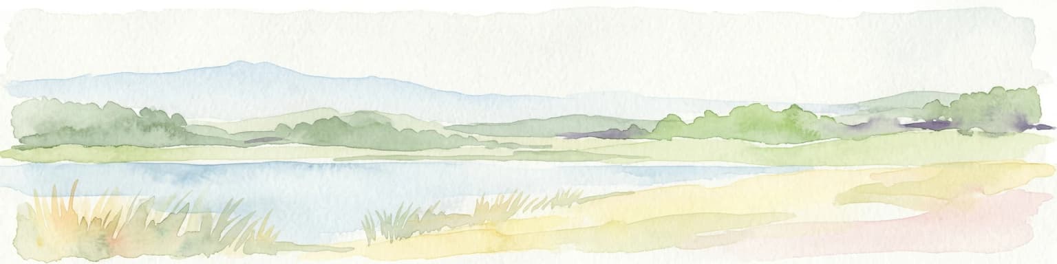
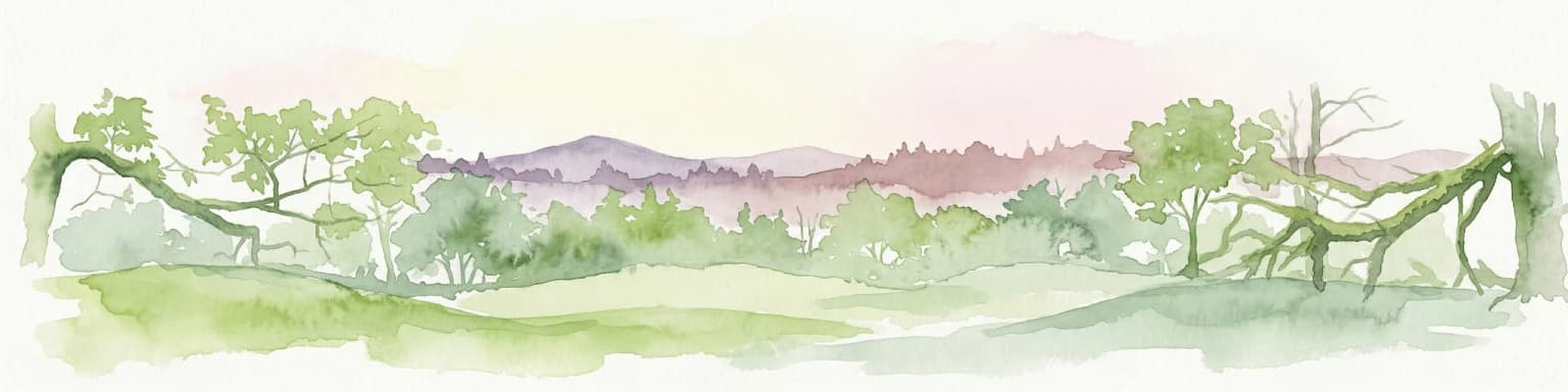
The landscape of Eifel National Park is defined by rolling forested highlands, reservoir basins, and the distinctive geology of the northern Eifel. The Kermeter ridge forms a prominent backbone through the central park area, rising between two major reservoir impoundments and supporting extensive beech woodland. The Rur Reservoir to the northwest and the Urft Reservoir to the south create scenic waterfront boundaries that shape the park's northern and southern edges. The former Vogelsang Military Training Area on the Dreiborn Plateau contributes a more open character with heathland and grassland recovering on former drill grounds. The terrain supports a network of streams and small valleys that drain toward the reservoirs, creating varied microhabitats throughout the forest. The landscape encompasses approximately 110 square kilometers of mixed woodland, with the Kermeter region representing the largest contiguous forest block offering accessible exploration for visitors.

Wooden signpost with directional arrows displaying distances to Wahlerscheid, Hirschott, Schneeseiffen, and Oiefalsperre, set against a snowy forest with evergreen and bare trees
Signpost in Eifel National Park showing distances to nearby locations with snow-covered forest background

Eifel National Park ecosystems, habitats, and plant life

Eifel National Park protects a representative sample of the Atlantic-influenced beech forests that originally covered much of the Eifel region and extensive areas of Central Europe before centuries of human modification. The wood-rush and beech communities flourish in the maritime climate that characterizes this western portion of Germany, with the park preserving what remains of these woodland types that survive in fragments throughout the North Eifel. The forest composition reflects a transition from historical spruce plantation dominance toward natural beech dominance as the park allows natural processes to operate. The park's habitats include deciduous and coniferous woodlands, lake environments, flowing streams, and open grassland areas that together support remarkable ecological diversity. The integration of the former military training area has added heath and open terrain that provides different ecological conditions from the closed forest.

A forest trail with fallen leaves, wooden railings, and trees with autumn foliage
Wilderness Trail section through oak forest in Eifel National Park, Germany

Eifel National Park wildlife and species highlights

The park is home to over 7,100 animal and plant species, with approximately 1,800 classified as endangered on the red list of North Rhine-Westphalia. Beetle diversity is particularly remarkable, with over 1,300 species recorded in the park's forests. Notable wildlife species present include the European wildcat, a secretive predator that has recolonized parts of the park, the black stork which nests in mature woodland near water bodies, the middle spotted woodpecker which requires old-growth forest structure, and the wall lizard which reaches the northern limit of its range in this part of Germany. The German page documents even more extensive species records, with 10,549 species currently documented including 2,098 beetle species, 1,379 butterfly species, and significant populations of other invertebrates, fungi, and plants. Wolf presence has been confirmed in the broader Eifel-Hohes Venn region since 2019, with the park forming part of designated wolf territory in North Rhine-Westphalia.

Grassy field with yellow flowering bushes and rolling hills under a partly cloudy sky
Yellow flowering shrubs on a grassy hillside in Eifel National Park

Eifel National Park conservation status and protection priorities

Eifel National Park operates under the IUCN framework requiring that at least 75 percent of its area develop naturally without human intervention within 30 years of establishment. The National Park Regulation establishes the management objectives, mechanisms, and administrative structure for achieving this wilderness development target. Process protection has been applied to 38 percent of the park's area at establishment, with plans to extend this to 87 percent of the total area by 2034 and beyond. The park conducts active management to convert exotic species plantations back toward native beech dominance, including removal of non-native spruce, Douglasie, and other conifers. Bark beetle outbreaks are accepted as natural processes that help transition the forest away from artificial conifer plantations. The park was recognized as an International Dark Sky Park by the International Dark-Sky Association in 2019, acknowledging the exceptional darkness of its night skies and commitment to reducing artificial light pollution.

Eifel National Park cultural meaning and human context

The park contains significant cultural heritage from its military history, most notably the former Vogelsang Military Training Area used by Belgian armed forces and NATO troops before becoming part of the protected landscape. The Nazi-era Ordensburg Vogelsang, a training facility built during the Third Reich, stands on a hill overlooking the Urft Reservoir just outside the park boundary but within the surrounding cultural landscape. Some areas of the former military training ground remain inaccessible due to unexploded ordnance and glass mines dating from World War II, particularly near the Urft Reservoir dam. The park lies within the traditional cultural region of the Eifel, an area with deep roots in rural German history, and incorporates landscapes shaped by centuries of forest use, charcoal production, and agricultural activity.

Top sights and standout views in Eifel National Park

The park offers the Wilderness Trail, an 85-kilometer route traversable in four challenging day stages that showcases the diversity of the park's landscapes from Monschau-Höfen in the southwest to Hürtgenwald-Zerkall in the north. Five park gates provide visitor information with themed exhibitions covering water themes at Rurberg, forest history at Gemünd, forest secrets at Heimbach, narcissus meadows at Höfen, and human-nature relationships at Nideggen. The Kermeter region contains the largest contiguous forest area with high beech percentage and is accessible via well-maintained walking trails. The park's Dark Sky Park status makes it particularly notable for stargazing and nocturnal nature experience. Approximately 240 kilometers of marked paths serve hikers, with additional cycling and riding routes available.

Best time to visit Eifel National Park

The park can be enjoyed throughout the year, with each season offering distinct experiences. Spring brings the flowering of wild narcissus meadows, particularly around the Höfen area where the largest occurrence of yellow wild narcissi in Germany creates a notable display. Summer offers full leaf cover in the forests and warm conditions for hiking the extended trail network. Autumn provides the opportunity to observe forest transition as beech foliage colors the woodland and the ongoing natural processes of the developing park. Winter, when snow conditions permit, opens cross-country skiing opportunities on marked trails in the southern portion of the park. The park gates operate seasonally, with extended hours from April through October and shorter hours during the winter months.

Park location guide

Geography guide, regional context, and park location map for Eifel National Park

Eifel National Park park geography, regions, and map view in Germany
Understand where Eifel National Park sits in Germany through a broader geographic reading of the surrounding landscape, nearby location context, and its mapped position within the national park landscape.

How Eifel National Park fits into Germany

Germany is a federal republic in Western and Central Europe with a population of over 83 million across sixteen constituent states. It is Europe's largest economy by nominal GDP and a major global exporter and importer. The capital is Berlin, and the country borders Denmark, Poland, Czech Republic, Austria, Switzerland, France, Luxembourg, Belgium, and the Netherlands.

Wider geography shaping Eifel National Park in Germany

Germany is located in Western and Central Europe, spanning 357,022 km². It borders Denmark to the north, Poland and the Czech Republic to the east, Austria and Switzerland to the south, and France, Luxembourg, Belgium, and the Netherlands to the west. The country has coastlines on the Baltic Sea and North Sea to the north, with the Alps located in the southern region.

Map view of Eifel National Park

Use this park location map to pinpoint Eifel National Park in Germany, understand its exact geographic position, and read its mapped placement within the surrounding landscape more clearly.

Pigeon | © OpenStreetMap contributors

Location context for Eifel National Park

North Rhine-Westphalia

Explore the forested highlands, reservoir basins, and recovering wilderness areas that define this German national park's unique visual identity.

Eifel National Park Photos: Visualizing the Landscapes, Habitats, and Protected Area Character
Explore compelling Eifel National Park photography to visualize its characteristic rolling forested highlands, expansive beech woodlands, and scenic reservoir landscapes. These images provide essential context for understanding the park's developing wilderness, unique habitats, and the distinct protected-area environment of this significant German national park.

Panoramic landscape view of forested hills, a lake, and distant mountains from Vogelsang Castle with buildings in the foreground.

River flowing through dense forested hills with rolling terrain in Eifel National Park

Wooden signpost with directional arrows displaying distances to Wahlerscheid, Hirschott, Schneeseiffen, and Oiefalsperre, set against a snowy forest with evergreen and bare trees

A forest trail with fallen leaves, wooden railings, and trees with autumn foliage

Grassy field with yellow flowering bushes and rolling hills under a partly cloudy sky

Map of Eifel National Park boundary with labeled regions including Roetgen, Simmerath, Monschau, Dreiborn, and Hellenthal

Park atlas

Compare other protected landscapes, tracing their geographic spread across North Rhine-Westphalia.

Explore National Parks and Protected Areas Beyond Eifel National Park in Germany
After exploring Eifel National Park, browse a curated list of other national parks and protected areas across North Rhine-Westphalia and adjacent German regions. Compare these diverse protected landscapes to understand their unique geographic features, conservation profiles, and regional distribution for expanded atlas discovery.
Watercolor painting of a landscape featuring a stream, trees, and rolling hills
National parkLimburg

De Meinweg National Park: Unique Terraced Landscape and Protected Area in Limburg

National Park with exceptional reptile and amphibian biodiversity.

De Meinweg National Park is a remarkable protected landscape located in the Dutch province of Limburg, distinguished by its rare terraced topography unlike any other in the Netherlands. This national park, covering 1,800 hectares, is a key component of the transboundary Grenspark Maas-Swalm-Nette, bordering Germany. Its ecological significance is underscored by its status as a Natura 2000 site, with notable biodiversity, particularly among reptiles and amphibians, and regenerating raised bogs. MoriAtlas offers a map-centric view of this unique protected area, detailing its geographic context and landscape features for structured discovery.

Area
18 km²
Established
1995
IUCN
II
Relief
Upland
National parkLimburg

Hoge Kempen National Park: National Park Protected Landscape and Limburg Geographic Context

Explore mapped boundaries within the Limburg region.

Gain a comprehensive understanding of Hoge Kempen National Park as a distinct protected national park. This resource provides critical insights into its geographic setting within the Limburg region, detailing its mapped boundaries and overall landscape context. It serves as an essential point for atlas exploration, allowing users to appreciate the park's role as a protected natural area and its place within the regional geography of Belgium.

Area
67 km²
Established
2006
IUCN
II
Protected areaBelgium

Burdinale Protected Area: Explore its Mapped Landscape and Geographic Context in Belgium

Mapped protected area discovery within Belgium's geography.

Burdinale Protected Area serves as a key point for understanding Belgium's protected lands from an atlas perspective. This page details the park's specific geographic setting and mapped natural landscape, providing essential context for regional geography exploration. Discover the protected boundaries and terrain features that define Burdinale, contributing to a structured overview of conservation areas.

Scope
Mixed
Water
Major water bodies
Watercolor painting of a peat bog ecosystem featuring green trees, pink and yellow vegetation, a body of water, and distant mountains
National park

De Groote Peel National Park: Mapped Boundaries of a Unique Raised Bog & Wetland

Protected area with exceptional birdlife and peat landscape.

De Groote Peel National Park represents a crucial protected landscape in the Netherlands, renowned as one of the last substantial raised bogs in Western Europe. Its terrain is characterized by a distinct blend of open lakes formed by historical peat extraction, heathland expanses, and sensitive peat swamps. This Ramsar-designated wetland is a vital habitat for numerous bird species, offering unique opportunities for landscape context and atlas exploration of its ecological significance and mapped geographic features.

Area
13.4 km²
Established
1993
IUCN
II
Relief
Lowland
National parkLimburg

De Maasduinen National Park: Mapping the Longest River Dune System in the Netherlands

Protected Landscape and Dune Terrain in Limburg

Delve into the geographic identity of De Maasduinen National Park, a vital protected area in Limburg. This page offers detailed insights into its remarkable dune landscape, heathlands, and forests, emphasizing its role within the Dutch natural atlas and its connections to surrounding conservation areas.

Area
45 km²
Established
1996
IUCN
II
Watercolor illustration of a landscape with rolling hills, a river, and green vegetation
Protected areaProvince of Luxembourg

Gaume Natural Park: A Protected Area Defining the Landscape of Province of Luxembourg

Explore its mapped natural landscape and geographic context.

Gaume Natural Park is a protected area offering a unique perspective on the natural landscapes found within Belgium's Province of Luxembourg. As a key geographic entity, it provides a vital component for atlas exploration, showcasing distinct mapped boundaries and regional terrain. Understand its significance as a protected natural space contributing to the Ardennes region's extensive geography, making it an essential point for structured discovery of protected lands.

Area
581.04 km²
Established
2014
Relief
Lowland
Scope
Terrestrial
Watercolor illustration of rolling hills, a winding river, and fields with distant mountains
National parkNorth Brabant

Van Gogh National Park: National Park in North Brabant with Dune Landscapes

Explore mapped protected areas and regional geography.

Van Gogh National Park is a significant protected landscape in North Brabant, Netherlands, covering approximately 1,200 square kilometers. This national park is distinguished by its extensive drift sand dune systems, notable heathlands, and wooded valleys, offering a diverse terrain within the Dutch context. Named in tribute to Vincent van Gogh, it merges rich natural landscapes with cultural heritage, serving as a model for collaborative conservation and regional development, all mapped for detailed atlas exploration.

Area
1,200 km²
Established
2024
IUCN
II
Relief
Lowland
Watercolor artwork showing sand dunes, scattered trees, distant mountains, and soft sky
National park

De Loonse en Drunense Duinen National Park: Explore Dutch Protected Sand Drift Landscapes and Heathlands

National Park with unique living sand drift and dune terrain.

Navigate the geographic contours and protected land boundaries of De Loonse en Drunense Duinen National Park, a premier Dutch natural area. This national park is celebrated for its extensive living sand drift, one of the largest in Northern Europe, alongside significant heathlands and coniferous forests. Gain a structured understanding of its landscape character and its role within regional geography through detailed map context and atlas exploration tools.

Area
35 km²
Established
2002
IUCN
II
Relief
Lowland

Common questions about visiting, size, designation, and location context for Eifel National Park

Eifel National Park FAQs for park facts, access, geography, and protected area context
Find quick answers about Eifel National Park, including protected-area facts, park geography, trail and visitor context, and how the park fits into its surrounding country and regional landscape.
MoriAtlas Explorer

Continue Your Protected Areas Search Across the Global Atlas

Deepen your exploration by continuing the structured search for national parks and protected areas worldwide. Utilize the comprehensive filtering capabilities to compare different conservation landscapes and refine your understanding of global park geography. Discover more about the distribution and characteristics of protected natural areas.

Global natural geography