Mori Atlas logo
National parkFærder National Park

Discover the mapped boundaries and geographic identity of this unique Norwegian national park.

Færder National Park: Norway's Coastal Archipelago & Protected Marine Landscape

(Færder nasjonalpark)

Færder National Park offers an exceptional exploration of Norway's southeastern coast, centered around a sprawling marine protected area and a distinctive archipelago. Located primarily in Færder Municipality, this national park preserves a landscape where over 95% of its area is comprised of coastal waters and numerous islands. Its granite bedrock, heathland vegetation, and iconic lighthouses contribute to a unique regional geography, serving as a vital component of the Norwegian atlas for understanding coastal conservation and mapped natural landscapes.

marine national parkarchipelagocoastal NorwayislandsOslofjordVestfold
Stylized illustration of a lighthouse on a rocky cliff overlooking a coastal archipelago with small islands, pine trees, and a circular structure

Færder National Park

National park

Park overview

Structured park overview, official facts, and landscape profile for Færder National Park

Færder National Park park facts, protected area profile, and essential visitor context
Review the core facts for Færder National Park, including designation, size, terrain, visitor scale, habitats, and operating context in one park-focused overview.

About Færder National Park

Færder National Park represents Norway's commitment to protecting its coastal and marine environments alongside its more famous mountain and forest landscapes. The park's creation in 2013 reflected a growing recognition that Norway's archipelago regions, with their unique blend of terrestrial and marine ecosystems, deserved national-level protection. The park spans a distinctive coastal zone where the sheltered waters of the Oslofjord meet the more open conditions of the Skagerrak, creating a transitional marine environment with complex currents, diverse habitats, and rich biological communities. Visitors to the park experience a landscape characterized by bare granite islands, heath-covered hillsides, narrow straits, and expansive views across open water. The islands themselves are relatively low-lying by Norwegian standards, with smooth rounded bedrock typical of the region's glaciated terrain. Several islands support small traditional settlements and historic land use, adding cultural depth to the natural landscape.

Quick facts and research context for Færder National Park

Færder National Park is located in Vestfold county, eastern Norway, with its administrative center near the historic city of Tønsberg. The park is predominantly marine, with over 95% of its 340 km² area consisting of seawater. It encompasses the Bolærne archipelago, a cluster of islands known for their distinctive coastal landscapes. The park includes the famous Færder Lighthouse, a navigational landmark dating to the 19th century, as well as the ruins of Store Færder Lighthouse and associated protected buildings. The protected area was established in 2013 and is managed by the Norwegian Environment Agency.

Park context

Deeper park guide and search-rich context for Færder National Park

Færder National Park history, landscape, wildlife, and travel context
Explore Færder National Park through its history, landscape character, ecosystems, wildlife, conservation priorities, cultural context, and seasonal travel timing in a structured park guide built for atlas discovery and search intent.

Why Færder National Park stands out

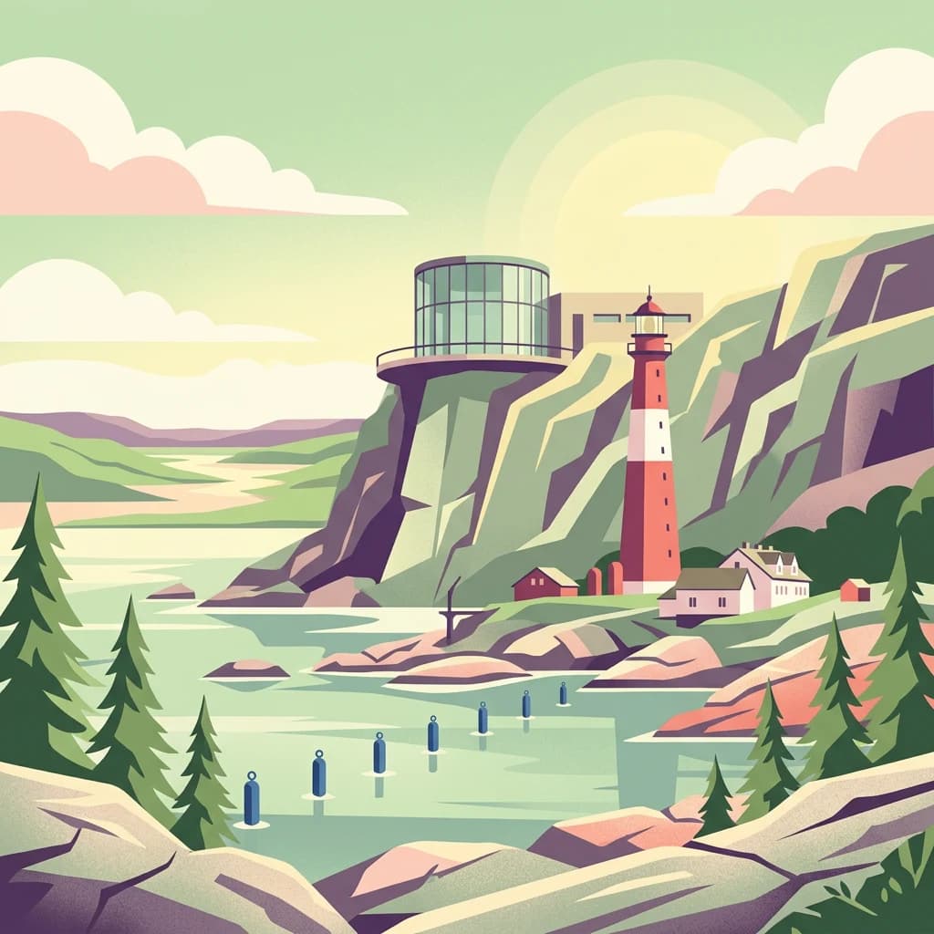
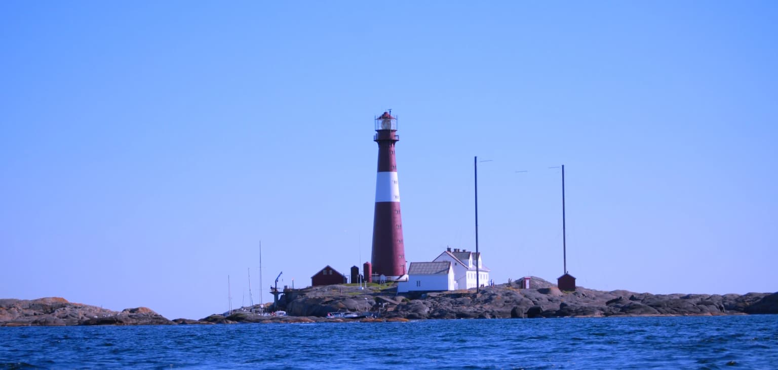
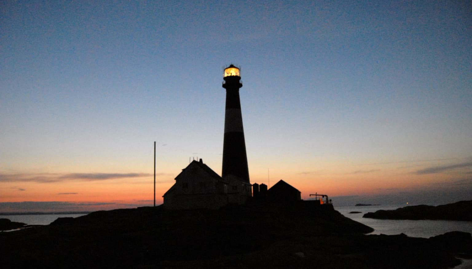
Færder National Park is best known for its dramatic archipelago landscape where granite islands rise from the waters of the Oslofjord and Skagerrak. The park protects one of Norway's most significant coastal marine environments, with its network of islands, sheltered bays, and open waters supporting rich biodiversity. The iconic Færder Lighthouse, standing at the edge of the park, has guided sailors through these treacherous waters for generations and remains one of Norway's most recognized lighthouses. The combination of cultural heritage, historic lighthouses and coastal settlements, and the raw natural beauty of the island-studded seascape defines the park's identity.

Snow-covered mountains, turquoise lakes, and rocky terrain under a partly cloudy sky
Mountainous landscape with turquoise lakes and snow-capped peaks

Færder National Park history and protected-area timeline

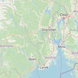
Færder National Park was established on 23 August 2013, making it one of Norway's younger national parks. Its creation followed an extensive process of identification and designation aimed at preserving the outstanding coastal and archipelago values of the Vestfold region. The park was carved from existing protected areas and newly designated territory to create a coherent protected zone spanning both terrestrial and marine environments. The establishment reflected growing environmental awareness in Norway regarding the need to protect coastal ecosystems and the cultural landscapes associated with centuries of maritime activity. The area has a long human history tied to fishing, shipping, and coastal navigation, with the Færder Lighthouse serving as a critical navigation aid since the mid-19th century. The park's management falls under the Norwegian Environment Agency, which oversees both the natural protection and the sustainable visitor use of the area.

Færder National Park landscape and geographic character

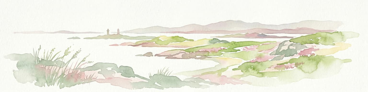
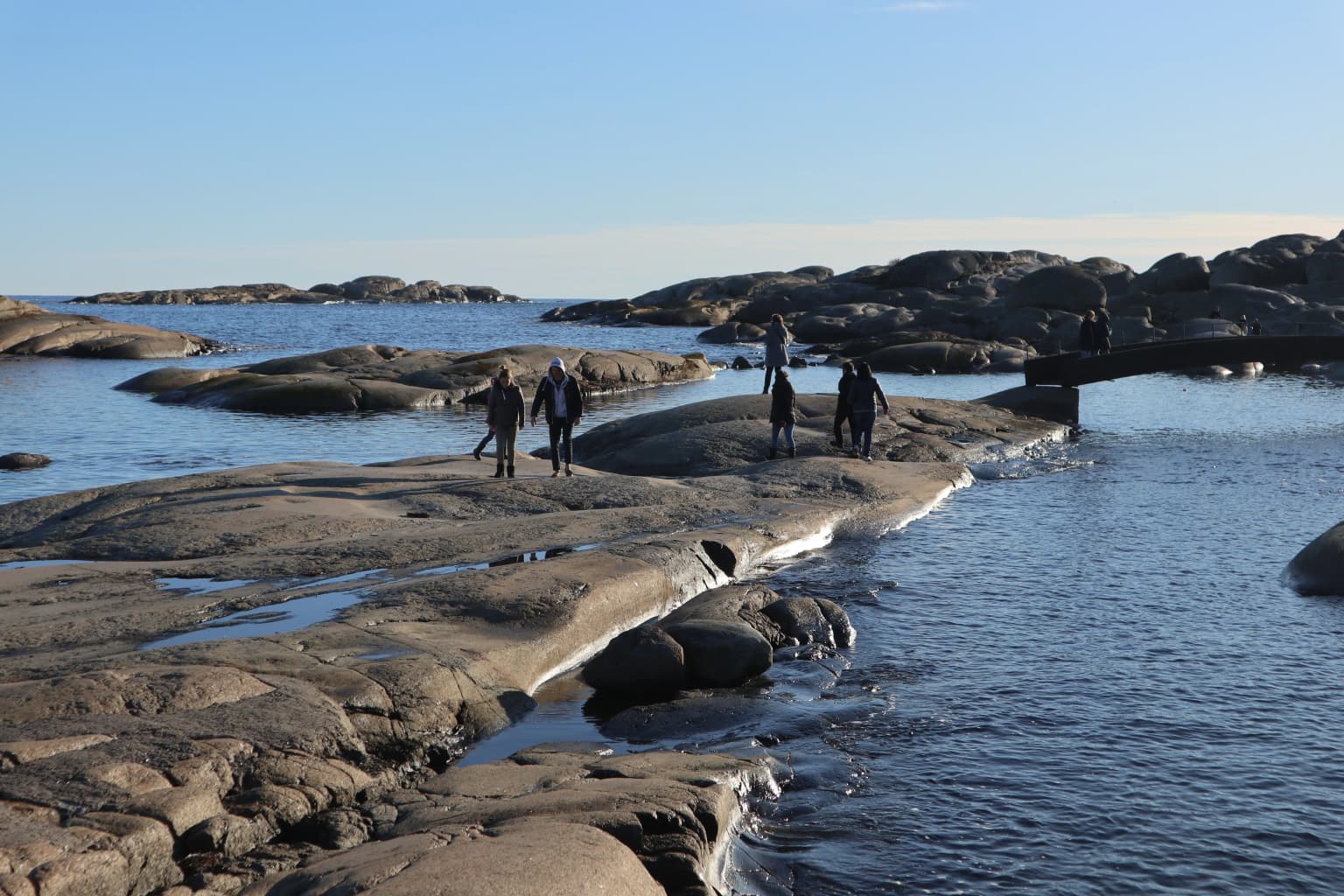
The landscape of Færder National Park is fundamentally defined by water, with the marine environment comprising over 95% of the total area. The park encompasses a scattered archipelago of islands ranging from tiny skerries barely above water level to larger islands with significant terrestrial area. The islands feature characteristic Norwegian coastal geology—smooth glaciated bedrock of gneiss and granite, often covered in thin soils that support heath and scrub vegetation. Shorelines vary from gently sloping rocky shores to more dramatic cliffs and steep-sided islands. The Bolærne archipelago within the park represents one of the most distinctive island groups in the region, with its chain of islands creating sheltered waters and complex coastal scenery. Between the islands, narrow straits and broader sounds create diverse marine conditions, from calm sheltered coves to more wind-exposed channels. The visual character combines the raw minimalist beauty of bare rock with the deeper greens of coastal vegetation and the ever-changing blues of the sea.

Stone tower with a wooden pole holding a metal basket, adjacent to a multi-story building by the water, under a blue sky with scattered clouds
Stone tower with crane arm and basket, adjacent to a building by the water

Færder National Park ecosystems, habitats, and plant life

Færder National Park protects a complex coastal marine ecosystem where the brackish waters of the Oslofjord mix with the more saline conditions of the Skagerrak. This transitional marine environment supports a diverse community of fish, invertebrates, and marine plants adapted to varying salinity levels. The seabed ranges from rocky substrates with kelp forests to softer sediments in deeper waters. The islands support terrestrial habitats including coastal heath, rocky grassland, and scrub, with vegetation adapted to the salt-laden winds and relatively mild maritime climate of southeastern Norway. Birdlife is particularly notable, with the islands and coastal waters supporting significant populations of seabirds and waterfowl. The marine protected status helps conserve not just the visible islands but the entire ecosystem beneath the water's surface, including important spawning and nursery areas for fish species.

Red and white lighthouse on a rocky island surrounded by blue water under a clear blue sky
Red and white striped lighthouse on a rocky island with calm blue water under a clear sky

Færder National Park wildlife and species highlights

The wildlife of Færder National Park reflects its dual marine-terrestrial nature. Marine mammals including seals may be found in the waters around the islands, while the diverse fish communities of the Oslofjord and Skagerrak include species adapted to both coastal and more open waters. The bird populations are particularly significant, with the islands providing important nesting habitat for seabirds and serving as staging areas for migratory species. The rocky shores support specialized invertebrates adapted to the intertidal zone, while the surrounding waters contain rich communities of fish, crustaceans, and other marine organisms. The transitional nature of the marine environment, where fresh and salt water mix, creates unique ecological conditions that support species from both brackish and fully marine environments.

Rocky coastal shoreline with people walking on flat rocks near the water in Færder National Park
People walking along rocky shoreline at Verdens Ende, Færder National Park

Færder National Park conservation status and protection priorities

Færder National Park represents Norway's coastal conservation legacy, protecting an ecosystem that was historically heavily used for fishing, shipping, and maritime activities. The marine component of the park is particularly significant, as coastal waters were often the last ecosystem type to receive formal protection in Norway's otherwise comprehensive protected areas network. The park protects important spawning and nursery areas for commercial and ecological fish species, helps maintain water quality in the Oslofjord region, and preserves the natural character of a coastline that might otherwise have been heavily developed. The combination of terrestrial and marine protection ensures that the interconnected ecological processes that sustain the archipelago's biodiversity are maintained. The historic lighthouses within the park are also protected as cultural heritage, adding a dimension of cultural conservation to the natural protection.

Færder National Park cultural meaning and human context

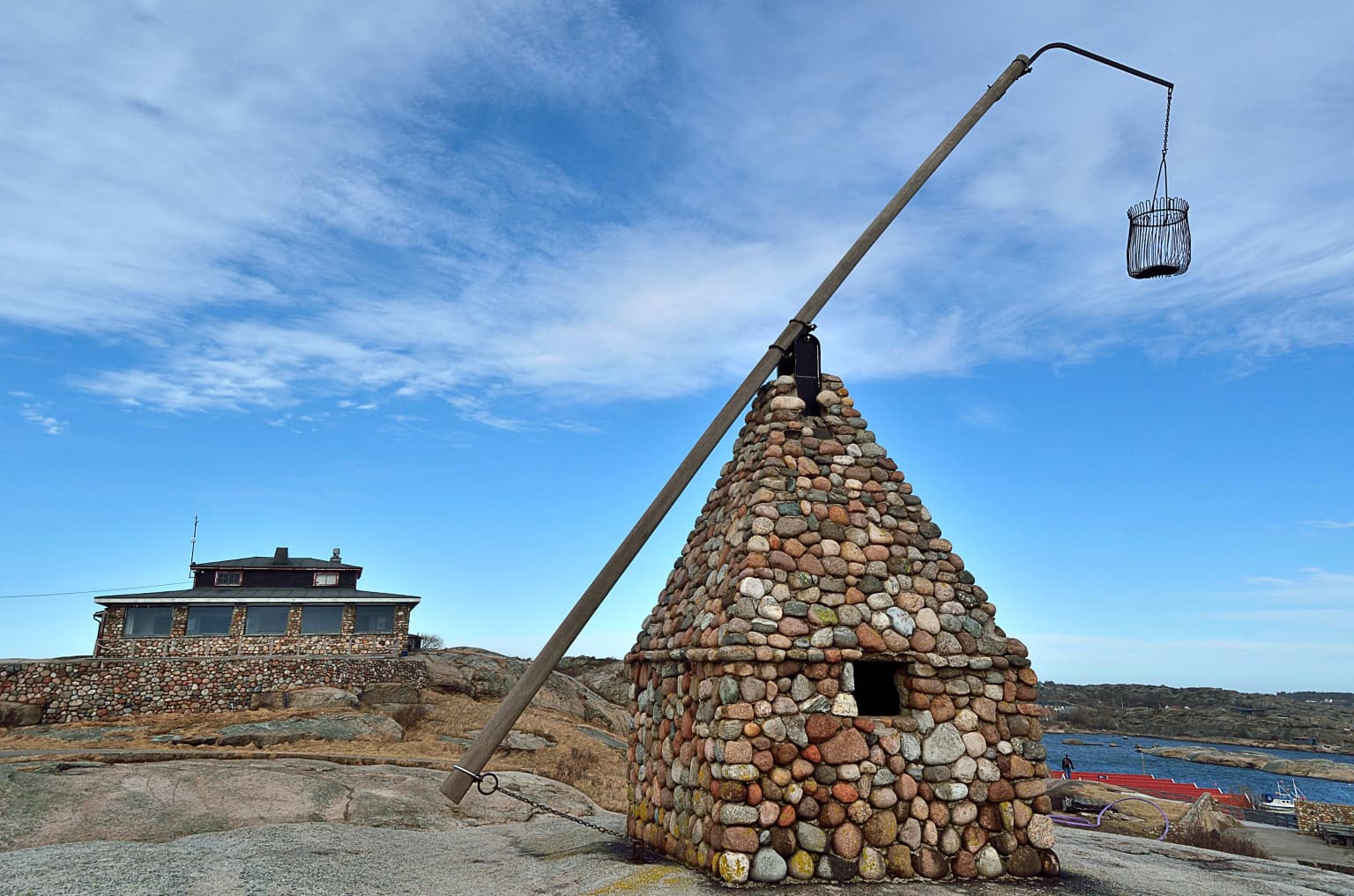
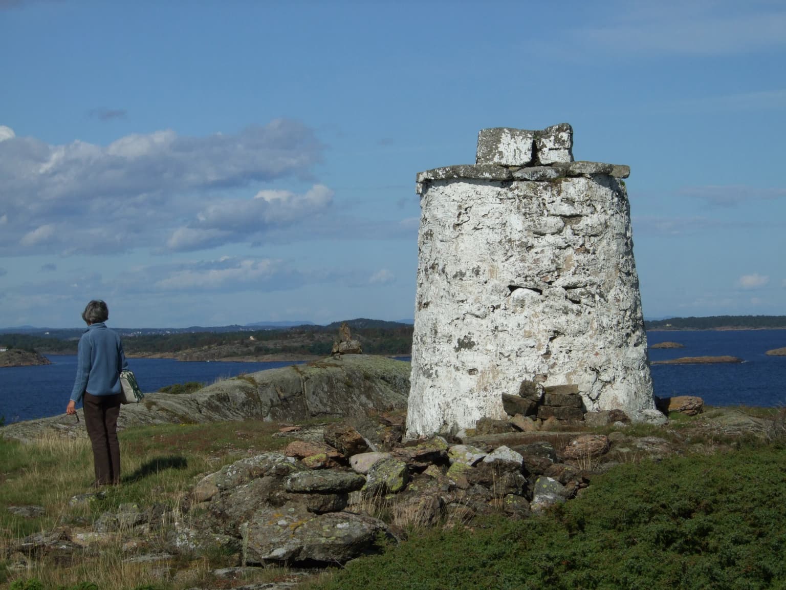
The Færder area has been an important maritime navigation zone for centuries, with the dangerous waters around the islands requiring aids to navigation from early times. The Færder Lighthouse, built in the 19th century, represents the region's long relationship with seafaring and coastal trade. The surrounding islands have supported small communities engaged in fishing and agriculture, creating a cultural landscape that, while modest in scale, reflects traditional Norwegian coastal life. The park includes historic structures beyond the lighthouses, with the ruins of Store Færder Lighthouse and associated buildings protected as part of the park's cultural heritage. This blend of natural and cultural values—the dramatic coastal scenery alongside centuries of human maritime activity—gives the park a distinctive character that goes beyond purely ecological protection.

A person in a blue jacket standing on rocky terrain next to a tall white stone tower with water and islands in the background
A person stands near a historic stone tower overlooking Oslofjorden within Færder National Park

Top sights and standout views in Færder National Park

Færder National Park offers visitors a rare opportunity to experience Norway's coastal and marine environments in a protected setting. The iconic Færder Lighthouse stands as both a functional navigation aid and a symbol of the area's maritime heritage. The archipelago scenery, with its scattering of bare islands rising from blue waters, represents a distinctive Norwegian coastal landscape that differs from the mountain and fjord scenery more typically associated with Norway's national parks. The park's predominantly marine character makes it particularly valuable as a protected area, preserving not just visible islands but the underwater ecosystems that sustain the region's biodiversity. Visitors can explore the islands, learn about the area's navigation history at the visitor center, and experience the timeless quality of a landscape where land and sea meet.

Silhouette of Færder Lighthouse with illuminated beacon at dusk, adjacent structures, and coastal waters under a gradient sky
Færder Lighthouse illuminated at twilight, located in Færder National Park

Best time to visit Færder National Park

Færder National Park can be visited throughout the year, though the summer months from June through August offer the most reliable weather and longest days for exploring the islands and coastal areas. The maritime climate means that weather can change rapidly, and visitors should be prepared for variable conditions regardless of season. Autumn can bring dramatic skies and good birdwatching opportunities as migratory species pass through the area. Winter visits offer a more stark and solitary experience of the archipelago, though shorter days and potentially harsh weather limit opportunities for extended outdoor activity. The park's marine focus means that boat access is often necessary to fully experience its islands and waters, and ferry services and boat tours operate during the main visitor season.

Park location guide

Geography guide, regional context, and park location map for Færder National Park

Færder National Park park geography, regions, and map view in Norway
Understand where Færder National Park sits in Norway through a broader geographic reading of the surrounding landscape, nearby location context, and its mapped position within the national park landscape.

How Færder National Park fits into Norway

Norway, officially the Kingdom of Norway, is a Nordic country in Northern Europe located on the Scandinavian Peninsula. It encompasses mainland Norway, the Arctic islands of Svalbard and Jan Mayen, and maintains dependencies including Bouvet Island and Antarctic claims. The country has a population of about 5.6 million and is bordered by Sweden, Finland, and Russia. Norway is a unitary parliamentary constitutional monarchy with Oslo as its capital and largest city.

Wider geography shaping Færder National Park in Norway

Norway occupies the western and northern portions of the Scandinavian Peninsula in Northern Europe. The country shares a long eastern border with Sweden, and borders Finland and Russia to the northeast. Norway has an extensive coastline facing the Skagerrak, North Sea, Norwegian Sea, and Barents Sea. The terrain is predominantly mountainous with numerous fjords along the coastline.

Map view of Færder National Park

Use this park location map to pinpoint Færder National Park in Norway, understand its exact geographic position, and read its mapped placement within the surrounding landscape more clearly.

Pigeon | © OpenStreetMap contributors

Location context for Færder National Park

Færder MunicipalityVestfold

Visual Guide to Færder's Protected Archipelago: Discover its Unique Coastal Geography, Islands, and Marine Environment through Detailed Imagery

Færder National Park Photos: Explore Coastal Archipelago Landscapes and Marine Protected Area Scenery
Visually explore the distinct marine and island landscapes of Færder National Park, uncovering its rugged coastal terrain, scattered archipelagos, and the character of its protected waters. Comprehend the park's environment through photography, gaining insight into its unique blend of terrestrial islands, vital marine ecosystems, and historic lighthouses, essential for understanding this Norwegian coastal gem.

Snow-covered mountains, turquoise lakes, and rocky terrain under a partly cloudy sky

Waterfront view of a visitor center building on rocky terrain with calm water reflecting the structure

Stone tower with a wooden pole holding a metal basket, adjacent to a multi-story building by the water, under a blue sky with scattered clouds

Red and white lighthouse on a rocky island surrounded by blue water under a clear blue sky

Rocky coastal shoreline with people walking on flat rocks near the water in Færder National Park

Calm blue water with rocky islets under a clear blue sky

A person in a blue jacket standing on rocky terrain next to a tall white stone tower with water and islands in the background

Silhouette of Færder Lighthouse with illuminated beacon at dusk, adjacent structures, and coastal waters under a gradient sky

Rocky shoreline with multiple small islands in open water under clear sky

Visitors' center building with circular upper section on coastal cliff overlooking ocean, paved road with guardrail in foreground

Stone building with a long arm holding a basket, two people standing nearby, on a rocky hill overlooking water under a clear blue sky

A metal sign for Færder National Park visitor centre mounted on a stone structure, with a building and rocky landscape in the background under a clear blue sky

Rocky islands and calm water in Færder National Park, Norway

Sandy beach with people sunbathing, small boats anchored in calm water, grassy areas, and islands in the distance.

A gravel trail on a rocky shoreline with the ocean in the background

Park atlas

Trace connected protected landscapes across Norway's Vestfold county, from marine archipelagos to coastal reserves.

Explore Coastal National Parks and Protected Areas Near Færder National Park, Norway
Continue your exploration from Færder National Park to browse other national parks and protected areas across the Vestfold coastline and nearby Norwegian regions. This geographic context helps you trace the spread of marine conservation landscapes and compare diverse protected areas within a broader atlas view.
National parkØstfold

Ytre Hvaler National Park: Norway's Coastal Marine Protected Landscape Atlas

Explore protected archipelago geography and unique cold water coral reefs.

Discover Ytre Hvaler National Park, a pivotal marine protected area on Norway's Østfold coast. This atlas entry provides detailed insight into its defining skerry landscape, the significant Tisler cold water coral reef, and its role as a protected marine ecosystem. Understand the mapped boundaries and geographic context of this unique Norwegian coastal wilderness, crucial for understanding the region's natural and maritime heritage.

Area
354 km²
Established
2009
IUCN
II
National parkVästra Götaland County

Kosterhavet National Park: A Marine National Park Exploring Unique Archipelago Geography

Discover its mapped underwater terrain and rich marine biodiversity.

Kosterhavet National Park, located in Västra Götaland County, is Sweden's first marine national park, dedicated to protecting the unique aquatic environment of the Koster Islands. This protected area is renowned for its exceptional marine biodiversity, including rare cold-water coral reefs and the country's largest seal colony, all situated within a dramatic underwater geography characterized by deep fjords. Use MoriAtlas to explore the mapped extent of this vital marine protected landscape and understand its significant place in regional and national conservation efforts.

Area
388.78 km²
Established
2009
IUCN
II
Visitors
90K annual
National parkTelemark

Jomfruland National Park: Coastal Archipelago and Skagerrak Marine Atlas

Norway's unique marine-focused national park landscape.

Jomfruland National Park is a significant protected landscape in Telemark, Norway, renowned for its coastal island geography and a landscape predominantly composed of marine waters. Covering 117 square kilometers, this national park emphasizes the conservation of both terrestrial island habitats and the surrounding Skagerrak coastal ecosystem. Explore the park's mapped boundaries and discover its regional geographic context, offering a unique perspective on Norway's protected areas and maritime natural heritage through MoriAtlas.

Area
117 km²
Established
2016
IUCN
II
Scope
Mixed
National parkVästra Götaland County

Tresticklan National Park: Preserved Old-Growth Forest on Rocky Heathland

Explore the geographic context and mapped boundaries of this vital protected area.

Tresticklan National Park is a vital protected landscape in Västra Götaland County, Sweden, safeguarding one of southern Scandinavia's most significant old-growth forest ecosystems. The park's terrain is defined by exposed granite bedrock, sparse heath pine forests, and a wild, remote character. MoriAtlas provides a structured overview of Tresticklan National Park, detailing its geographic setting and protected area status for explorers and cartographers.

Area
28.97 km²
Established
1996
IUCN
II
Relief
Upland
Watercolor painting of coastal waters, islands, rocky shore, and distant hills
National parkAgder

Raet National Park: A Coastal National Park Defined by Glacial Moraine Landscape in Agder

Explore Norway's southern coast geography and protected marine area.

Raet National Park offers a profound exploration of Norway's post-glacial landscape, anchored by its namesake 12,000-year-old glacial moraine. This unique protected area, predominantly marine, reveals a striking combination of terrestrial moraine features, extensive pebble beaches, and submerged geological formations. Understanding its mapped boundaries within Agder provides critical context for appreciating this significant coastal protected landscape, its marine ecosystems, and its role in the regional geography.

Area
607 km²
Established
2016
IUCN
II
Relief
Lowland
National parkVästra Götaland County

Djurö National Park: Sweden's Lake Archipelago National Park in Västra Götaland County

Mapped island geography and protected aquatic landscapes.

Djurö National Park stands as a singular example of Sweden's protected natural areas, characterized by its unique position as a national park comprising a complete archipelago within Lake Vänern. This page focuses on the geographic identity of Djurö National Park, detailing its island distribution, protected land status, and the distinct landscape it preserves. Users will find context for its place within Västra Götaland County, facilitating an atlas-based understanding of this exceptional aquatic environment and its mapped boundaries.

Area
24 km²
Established
1991
IUCN
II
Relief
Mixed relief
National parkVestland

Hardangervidda National Park: Vast Arctic Plateau and European Peneplain Discovery

Explore Norway's largest national park and its unique tundra ecosystem.

Delve into the geography of Hardangervidda National Park, Norway's largest national park, featuring the expansive Arctic plateau and Europe's largest peneplain. This protected landscape offers a unique mapped environment characterized by treeless moorland, numerous lakes, and important wildlife habitats, including significant wild reindeer populations. Understand its position within the Vestland region and its value as a key protected area for geographic exploration and landscape context.

Area
3,422 km²
Established
1981
IUCN
II
Relief
Highland
Abstract watercolor landscape with soft pastel hues of green, pink, yellow, and purple
National park

Hallingskarvet National Park: Norway's High Mountain Plateau and Protected Wilderness

Mapping glacial terrain, alpine environments, and wild reindeer habitat.

Hallingskarvet National Park offers a unique window into Norway's geological history and alpine ecology. This protected landscape encompasses the striking Hallingskarvet plateau and the Vargebreen glacier, along with deep valleys carved by ancient ice. Users can explore the park's mapped boundaries, understand its regional geographic setting in Scandinavia, and appreciate its conservation value as a habitat for wild reindeer. The park's terrain provides a concrete example of glacial shaping and high-altitude ecosystems within the Nordic context.

Area
450 km²
Established
2006
IUCN
II
Relief
Mountain

Common questions about visiting, size, designation, and location context for Færder National Park

Færder National Park FAQs for park facts, access, geography, and protected area context
Find quick answers about Færder National Park, including protected-area facts, park geography, trail and visitor context, and how the park fits into its surrounding country and regional landscape.
MoriAtlas Explorer

Continue Your Protected Areas Search Across the Global Atlas

Deepen your exploration by continuing the structured search for national parks and protected areas worldwide. Utilize the comprehensive filtering capabilities to compare different conservation landscapes and refine your understanding of global park geography. Discover more about the distribution and characteristics of protected natural areas.

Global natural geography