Mori Atlas logo
National parkGarphyttan National Park

Explore the rolling hills, flower-rich meadows, and ancient forests of this historic national park.

Garphyttan National Park: Discover Sweden's Pioneer Protected Landscape and Mapped Terrain

Garphyttan National Park stands as a foundational protected area in Sweden's conservation history, established in 1909. This national park showcases a unique rolling forested landscape with historically maintained, flower-rich meadows nestled within the Kilsbergen hills of Örebro County. Its designation represents a significant step in landscape preservation, offering a glimpse into traditional Swedish land use and the evolution of protected areas through its mapped terrain and geographic context.

National ParkSwedenOld-Growth ForestMeadowsCultural LandscapeKilsbergen

Garphyttan National Park

National park

Park overview

Structured park overview, official facts, and landscape profile for Garphyttan National Park

Garphyttan National Park park facts, protected area profile, and essential visitor context
Review the core facts for Garphyttan National Park, including designation, size, terrain, visitor scale, habitats, and operating context in one park-focused overview.

About Garphyttan National Park

Garphyttan National Park occupies a modest but significant place in European conservation history as the first of Sweden's national parks. Located in the Kilsbergen hills, the park sits on the eastern slope of this notable ridge system that traverses eastern-central Sweden. The landscape is characterized by a blend of forested hillsides and open meadows, representing a cultural landscape that evolved over centuries of traditional land use. The area was historically part of the ironworks community of Svenshyttan, with the park encompassing the former Östra gården, one of four bergsmansgårdar (ironworks farms) that once operated in the vicinity. The meadows within the park, known as ängsmark in Swedish, represent some of the most species-rich habitats in the region, maintained through regular mowing rather than grazing. Following the establishment of the national park, these meadows were left undisturbed for a period, leading to some overgrowth of the valuable cultural landscape before restoration efforts resumed the traditional mowing regime. The forest areas, while affected by clear-cutting in the 1870s prior to protection, have been allowed to develop naturally since the park's formation, creating a mosaic of successional forest stages.

Quick facts and research context for Garphyttan National Park

Garphyttan National Park is located in Örebro County, eastern-central Sweden, situated in the Kilsbergen hills near the small settlement of Svenshyttan. The park encompasses 111 hectares of mixed forest and meadow terrain. It was established in 1909 as Sweden's inaugural national park, though informal protection dates to 1857. The area represents a traditional Swedish cultural landscape with species-rich meadows and surrounding natural forest. The park is managed by Naturvårdsverket (Swedish Environmental Protection Agency) and is categorized as IUCN protected area II.

Park context

Deeper park guide and search-rich context for Garphyttan National Park

Garphyttan National Park history, landscape, wildlife, and travel context
Explore Garphyttan National Park through its history, landscape character, ecosystems, wildlife, conservation priorities, cultural context, and seasonal travel timing in a structured park guide built for atlas discovery and search intent.

Why Garphyttan National Park stands out

Garphyttan is best known as Sweden's first national park, representing the birthplace of Swedish nature conservation. The park is celebrated for its flower-rich meadows that have been maintained through traditional slåtter (mowing) practices, supporting diverse flora including many meadow species. The area features notable birdlife and offers panoramic views from Svensbodaberget, a rocky outcrop within the park. The combination of ancient forests, traditional meadows, and historical bergsmansgård (ironworks farm) heritage makes Garphyttan distinctive among Swedish protected areas.

Garphyttan National Park history and protected-area timeline

Garphyttan National Park traces its formal origins to 1909 when the Swedish Riksdag (parliament) established nine national parks, the first such designation in Europe. However, the area had been protected since 1857, making it one of the oldest continuously protected landscapes in Sweden. The establishment in 1909 came during a period of growing environmental awareness in Sweden, and Garphyttan was selected as a representative of the country's natural heritage. The park was created from land that had been part of the Östra gården bergsmansgård, part of the historic ironworks community centered on Svenshyttan. Following national park designation, the meadow areas were initially left unmanaged, which led to the valuable cultural landscape beginning to overgrow. This period of neglect was eventually addressed through the resumption of traditional mowing practices, allowing the species-rich meadows to be restored. The forest within the park had been subject to clear-cutting in the 1870s, and at the time of park establishment, the heavily used forest was not considered ideal for national park status. However, the calcareous soils were expected to support rapid regeneration, and the forest has since developed naturally under protection.

Garphyttan National Park landscape and geographic character

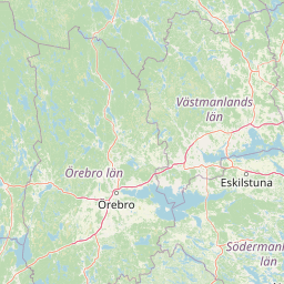
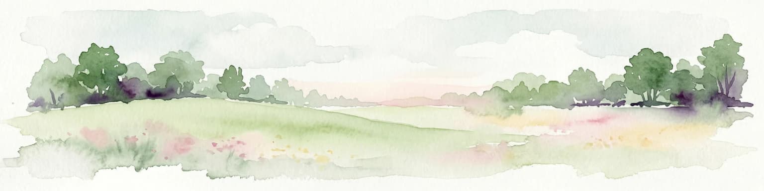
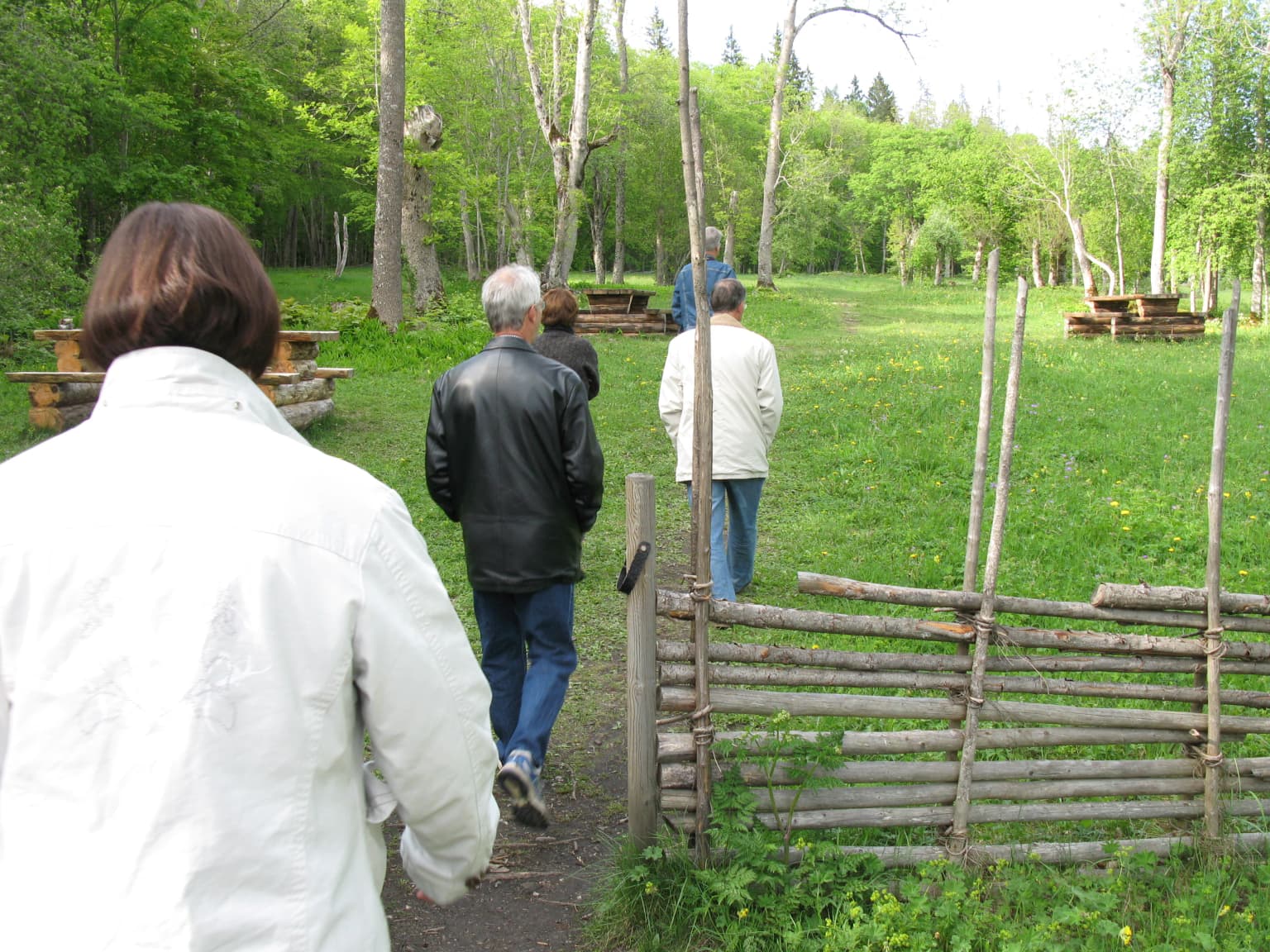
The landscape of Garphyttan National Park consists of rolling hills within the Kilsbergen range, a northeast-southwest trending ridge of ancient crystalline rocks that forms a natural boundary between the historical provinces. The terrain rises from the surrounding lowlands to form a hilly backdrop west of Örebro. The park combines forested slopes with open meadow areas, the latter representing the traditional Swedish ängsmark system of managed grasslands. Rocky outcrops punctuate the landscape, with Svensbodaberget providing elevated viewpoints over the surrounding countryside. The soil in the area is calcareous, rich in nutrients from limestone bedrock, which supports the diverse flora found in the meadows. The combination of forest and open land, along with the historical land use patterns, creates a landscape of considerable ecological and cultural value.

Garphyttan National Park ecosystems, habitats, and plant life

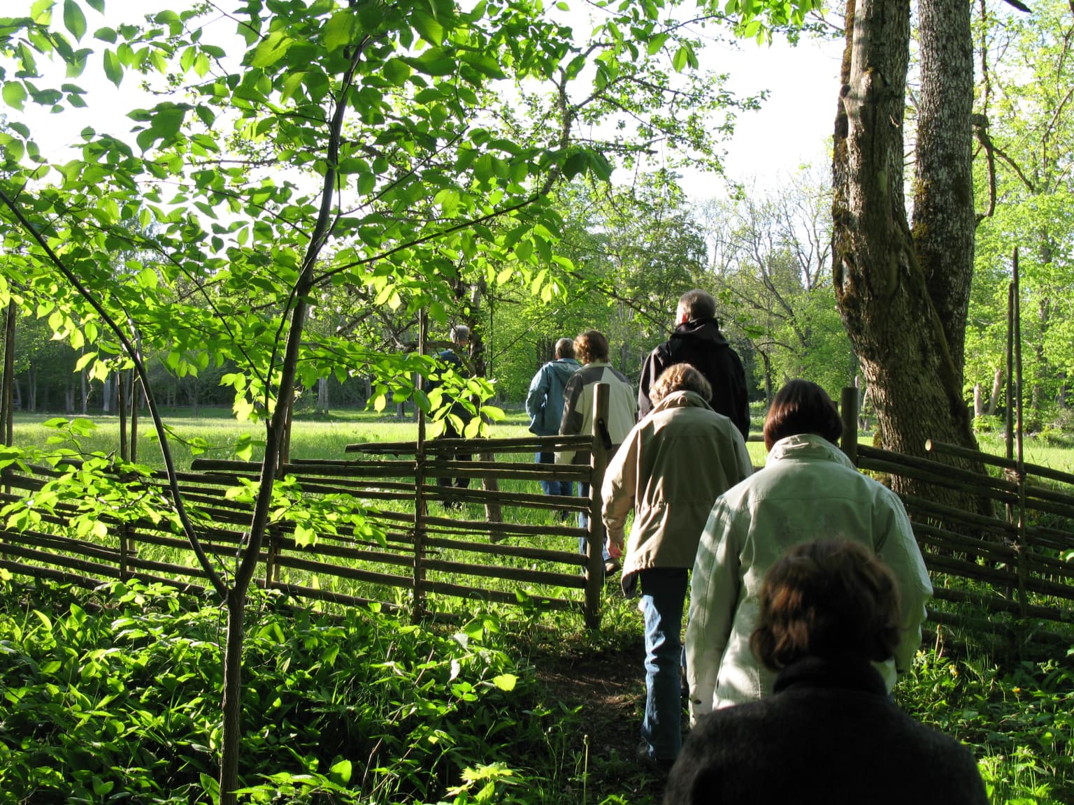
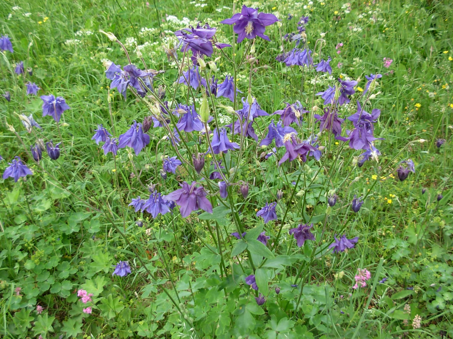
Garphyttan National Park supports a rich variety of habitats that contribute to its ecological significance. The flower-rich meadows represent some of the most botanically diverse areas in the region, maintained through centuries of traditional management involving annual mowing. These meadows support a wide array of flowering plants typical of traditional Swedish cultural landscapes. The surrounding forest areas, although affected by historical logging, have been allowed to develop naturally since the early twentieth century, creating a maturing woodland environment. The calcareous soils derived from the local bedrock influence the vegetation patterns, supporting plant communities that differ from surrounding areas. The park thus represents a refuge for meadow species that have declined across much of Sweden as traditional land use practices have been abandoned, making it an important conservation site for cultural landscape flora.

Garphyttan National Park wildlife and species highlights

The park is noted for its rich birdlife, which benefits from the combination of forest and open meadow habitats. The diverse structure of the landscape, with forest edges, old trees, and flowering meadows, supports a variety of bird species. The meadows provide foraging habitat for species associated with open grassland, while the maturing forests offer nesting opportunities for woodland birds. The presence of old trees and deadwood in the developing forest supports species dependent on veteran trees and decaying wood. While specific species lists are not detailed in available sources, the park's varied habitat structure suggests it supports a representative sample of Swedish woodland and meadow bird communities.

Garphyttan National Park conservation status and protection priorities

Garphyttan National Park holds significance as the first of Sweden's national parks, representing the origins of formal nature protection in the country. The park protects a representative example of traditional Swedish cultural landscape, a habitat type that has become increasingly rare as agricultural modernization has reduced the extent of managed meadows. The continuation of traditional mowing practices within the park is essential for maintaining the species-rich meadow flora that defines much of the park's ecological value. The forest, while not representing old-growth in the strict sense, has been developing naturally since protection and provides a contrasting habitat element. The park demonstrates how traditional cultural landscapes can be maintained within a national park framework, balancing historical land use patterns with contemporary conservation objectives.

Garphyttan National Park cultural meaning and human context

Garphyttan's landscape has been shaped by centuries of human activity, particularly the ironworks industry that was central to the region's economy. The park encompasses land from the former Östra gården, one of four bergsmansgårdar associated with the Svenshyttan ironworks community. These ironworks farms represented a distinctive element of Swedish industrial history, combining agriculture with iron production. The meadows within the park are products of traditional land management, maintained through the slåtter system of seasonal mowing rather than grazing. This cultural landscape represents a historical approach to land use that supported high biodiversity, contrasting with modern agricultural practices. The local name for the viewpoint at Svensbodaberget, "ättestupa" (ancestral cliff), reflects the place's significance in local tradition and folklore.

Top sights and standout views in Garphyttan National Park

As Sweden's oldest national park, Garphyttan represents a foundational site in Scandinavian conservation history. The flower-rich meadows, maintained through traditional mowing, showcase the biodiversity of Sweden's cultural landscapes. The park's location in the Kilsbergen hills provides scenic views and access to rolling forested terrain near the city of Örebro. The combination of historical ironworks heritage, traditional meadow management, and long-term protection creates a distinctive conservation site that demonstrates the evolution of Swedish nature protection from its earliest formal expressions to present-day management approaches.

Best time to visit Garphyttan National Park

The optimal time to experience Garphyttan National Park is during the summer months when the meadows are in full flower and the birdlife is most active. June and July typically offer the best display of flowering plants in the meadow areas. The park can be visited year-round, though spring and autumn offer different characters, with spring bringing new foliage and autumn displaying forest color. Winter visits provide a different perspective on the landscape, though the park's small size and accessible terrain make it suitable primarily for walking in the warmer months. The best viewing from Svensbodaberget is likely during clear weather when the panoramic outlook can be fully appreciated.

Park location guide

Geography guide, regional context, and park location map for Garphyttan National Park

Garphyttan National Park park geography, regions, and map view in Sweden
Understand where Garphyttan National Park sits in Sweden through a broader geographic reading of the surrounding landscape, nearby location context, and its mapped position within the national park landscape.

How Garphyttan National Park fits into Sweden

Sweden, formally the Kingdom of Sweden, is a highly developed Nordic country on the Scandinavian Peninsula in Northern Europe. With a population of 10.6 million and an area of 450,295 km², it is the largest Nordic country by both area and population. Sweden is a constitutional monarchy with Stockholm as its capital and largest city, known for its advanced economy, social welfare system, and membership in the European Union and NATO.

Wider geography shaping Garphyttan National Park in Sweden

Sweden occupies the eastern portion of the Scandinavian Peninsula in Northern Europe. It borders Norway to the west and north, Finland to the east, and shares a maritime border with Denmark to the southwest across the Øresund. The country has an extensive coastline along the Baltic Sea and Gulf of Bothnia, dotted with thousands of islands. The terrain varies from mountainous regions in the northwest to low-lying coastal areas and inland lakes in the south and central parts.

Map view of Garphyttan National Park

Use this park location map to pinpoint Garphyttan National Park in Sweden, understand its exact geographic position, and read its mapped placement within the surrounding landscape more clearly.

Pigeon | © OpenStreetMap contributors

Location context for Garphyttan National Park

Lekeberg MunicipalityÖrebro County
Park atlas

Compare regional park geography and diverse protected landscapes across Örebro County, tracing connections to Garphyttan's Kilsbergen hills.

Explore Other National Parks and Protected Areas Near Garphyttan National Park
From Garphyttan National Park, continue your discovery by browsing other national parks and protected areas across Örebro County, tracing Sweden's varied protected landscapes. This expanded geographic view facilitates comparing conservation landscapes, diverse terrain, and regional park distribution across central Sweden for comprehensive atlas discovery.
Watercolor illustration of a forest landscape with rocks, trees, and distant hills
National park

Tiveden National Park: Sweden's Protected Granite Landscape and Ancient Forest

Explore protected wilderness, fracture valleys, and geological heritage.

Tiveden National Park is a protected area in southern Sweden renowned for its ancient forests and rugged granite landscape. The park's terrain features deep fracture valleys, formed by ancient geological events, and stands as one of the last large remnants of older forest in the region. Discover the park's unique topography, mapped boundaries, and its significance as a protected natural landscape for atlas-based exploration.

Area
20.3 km²
Established
1983
IUCN
II
Relief
Mixed relief
National parkVästra Götaland County

Djurö National Park: Sweden's Lake Archipelago National Park in Västra Götaland County

Mapped island geography and protected aquatic landscapes.

Djurö National Park stands as a singular example of Sweden's protected natural areas, characterized by its unique position as a national park comprising a complete archipelago within Lake Vänern. This page focuses on the geographic identity of Djurö National Park, detailing its island distribution, protected land status, and the distinct landscape it preserves. Users will find context for its place within Västra Götaland County, facilitating an atlas-based understanding of this exceptional aquatic environment and its mapped boundaries.

Area
24 km²
Established
1991
IUCN
II
Relief
Mixed relief
National parkVästmanland County

Färnebofjärden National Park: Protected River Landscape and Birdlife Atlas

Explore Västmanland County's unique riverine protected area and mapped terrain.

Färnebofjärden National Park offers a unique geographic perspective as a protected national park situated in Sweden's Västmanland County. This page details the park's distinct riverine landscape, characterized by the Dalälven River's intricate network of channels, wetlands, and islands, and its position at a critical ecological frontier. Discover the mapped boundaries and regional context of this important protected area, renowned for its exceptional bird populations and diverse natural habitats.

Area
101 km²
Established
1998
IUCN
II
Relief
Lowland
Watercolor illustration of a lake surrounded by trees and hills
National parkKalmar County

Norra Kvill National Park: Ancient Coniferous Forest Protected Landscape in Kalmar County

Discover its unique mapped terrain and natural forest heritage.

Norra Kvill National Park safeguards a remarkable old-growth coniferous forest ecosystem, a rarity in southern Sweden. This park is characterized by ancient pines, some dating back over 350 years, thriving on steep fault-formed terrain and amid boulder fields. Its protected status ensures the preservation of this unique natural landscape, providing invaluable insight into forest ecology and regional geography within Kalmar County. MoriAtlas offers a structured approach to understanding its mapped boundaries and ecological significance.

Area
1.14 km²
Established
1927
IUCN
II
Relief
Highland
National parkVästra Götaland County

Tresticklan National Park: Preserved Old-Growth Forest on Rocky Heathland

Explore the geographic context and mapped boundaries of this vital protected area.

Tresticklan National Park is a vital protected landscape in Västra Götaland County, Sweden, safeguarding one of southern Scandinavia's most significant old-growth forest ecosystems. The park's terrain is defined by exposed granite bedrock, sparse heath pine forests, and a wild, remote character. MoriAtlas provides a structured overview of Tresticklan National Park, detailing its geographic setting and protected area status for explorers and cartographers.

Area
28.97 km²
Established
1996
IUCN
II
Relief
Upland
National parkStockholm County

Tyresta National Park: Explore Protected Old-Growth Forest and Rift Valley Landscape

Stockholm County National Park, Sweden

Tyresta National Park stands as a crucial protected area, showcasing one of southern Sweden's largest expanses of old-growth coniferous forest, featuring trees up to 400 years old. Its distinctive rift valley terrain, lakes, and post-fire recovery zones offer a rich geographic profile for atlas exploration. Within Stockholm County, this national park provides essential context for understanding the preservation of ancient forest ecosystems and unique geological formations.

Area
20 km²
Established
1993
IUCN
II
Relief
Mixed relief
Watercolor painting of a grassy field with trees and a soft sky
National parkStockholm County

Ängsö National Park: Flower-Rich Cultural Landscape in Stockholm County's Archipelago

Mapped protected area and historic island geography

Ängsö National Park, a protected national park in Stockholm County, offers a rare glimpse into a flower-rich cultural landscape shaped by history and nature. The island's mapped boundaries encompass idyllic meadows, mature deciduous forests, and a unique archipelago setting. MoriAtlas highlights its significance as one of Sweden's earliest national parks, providing context for its distinctive natural terrain and protected landscape identity within the Roslagen region.

Area
1.68 km²
Established
1909
IUCN
II
Relief
Lowland
National parkØstfold

Ytre Hvaler National Park: Norway's Coastal Marine Protected Landscape Atlas

Explore protected archipelago geography and unique cold water coral reefs.

Discover Ytre Hvaler National Park, a pivotal marine protected area on Norway's Østfold coast. This atlas entry provides detailed insight into its defining skerry landscape, the significant Tisler cold water coral reef, and its role as a protected marine ecosystem. Understand the mapped boundaries and geographic context of this unique Norwegian coastal wilderness, crucial for understanding the region's natural and maritime heritage.

Area
354 km²
Established
2009
IUCN
II

Common questions about visiting, size, designation, and location context for Garphyttan National Park

Garphyttan National Park FAQs for park facts, access, geography, and protected area context
Find quick answers about Garphyttan National Park, including protected-area facts, park geography, trail and visitor context, and how the park fits into its surrounding country and regional landscape.
MoriAtlas Explorer

Continue Your Protected Areas Search Across the Global Atlas

Deepen your exploration by continuing the structured search for national parks and protected areas worldwide. Utilize the comprehensive filtering capabilities to compare different conservation landscapes and refine your understanding of global park geography. Discover more about the distribution and characteristics of protected natural areas.

Global natural geography