Mori Atlas logo
Nearby park discovery

Mapping regional park boundaries and nearby protected environments in central Spain

Geographic Discovery of Protected Landscapes Near Sierra de Guadarrama National Park

Identify protected areas and mountain landscapes situated within the geographic reach of Sierra de Guadarrama National Park. This regional overview provides a spatial perspective on park distribution across the Iberian Peninsula, helping to visualize the proximity and relationship between neighboring protected sites and the central mountain systems.

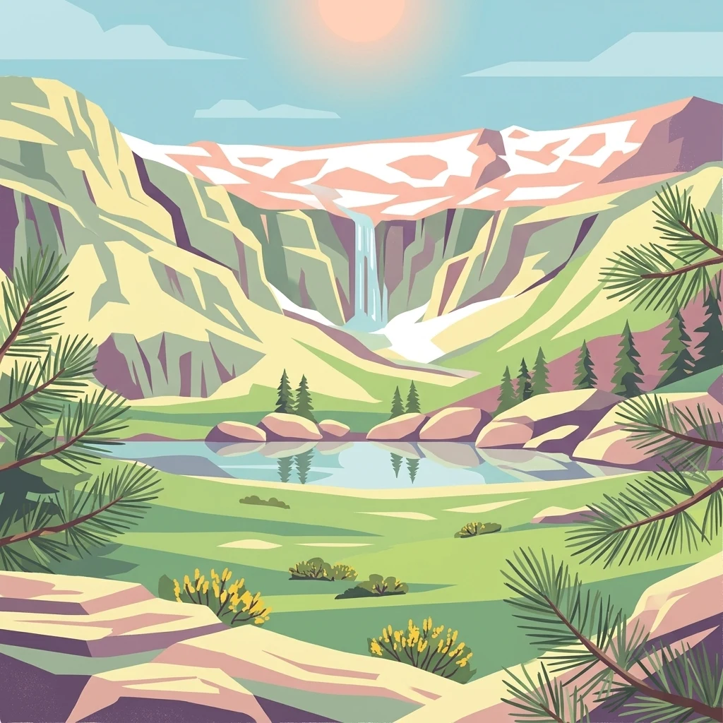
Illustration of a mountainous landscape featuring a waterfall, lake, pine trees, and rocky terrain

Spain's Alpine Heartland: Mountain Peaks, Ancient Pine Forests, and Glacial Lagoons

Sierra de Guadarrama National Park

Sierra de Guadarrama National Park is a recently established protected area in central Spain, declared in June 2013 and now representing the fifth-largest national park in the country. The park encompasses the granite peaks and forested slopes of the Sierra de Guadarrama, a mountain range forming part of the Sistema Central that divides the northern and southern mesetas of the Iberian Peninsula. The protected area spans approximately 34,000 hectares across the Community of Madrid and the provinces of Segovia and Ávila in Castile and León, protecting a remarkable diversity of eleven distinct ecosystems that include the only Iberian examples of high Mediterranean mountain environments. The range serves as a critical watershed, feeding rivers that flow to both the Tagus and Duero basins. Peñalara, at 2,428 meters, stands as the park's highest summit, while the landscape features dramatic glacial cirques, pristine lagoons, and some of Spain's finest natural pine forests.

Location
Spain
Park type
National park
Established
2013
Area
339.6 km²
Highest point
2,428 m
Sierra de Guadarrama National Park Atlas
Regional park map

See the ranked park cluster in its geographic setting

Nearby parks around Sierra de Guadarrama National Park

This regional map shows the same 20 nearby parks ranked below around Sierra de Guadarrama National Park. Select a ranked marker to highlight that park’s boundary where boundary data is available.
Reference park: Sierra de Guadarrama National ParkRanked nearby parkSelected boundary: Sierra de Guadarrama National Park20 nearby parks shown
20 nearby parks

Ranked distance relationships and surrounding regional park geography in central Spain

Parks and Protected Areas Geographically Near Sierra de Guadarrama National Park

Examine the ranked collection of protected areas situated geographically close to Sierra de Guadarrama National Park by boundary separation and spatial direction. These surrounding landscapes provide structured environmental comparison signals across the broader regional terrain.
Biosphere reserveMadrid
12 km away#1 closest

Northeast

Sierra del Rincón Biosphere Reserve: Mountain Geography and Protected Landscape Analysis

Transitional mountain terrain in the Sierra Norte region of Madrid

Sierra del Rincón provides a unique study of ecological compression, where Atlantic-flavored beech groves meet Mediterranean oak and highland shrublands. This protected mountain territory in Madrid integrates rich forest habitats with traditional agro-silvopastoral village life, making it a critical reference for understanding the transitional geography of the Iberian Central System.

Area
152.31 km²
Established
2005
Relief
Mountain
Climate
Alpine
Protected landscapeCastilla y León
97 km away#2 closest

North

Sabinares del Arlanza-La Yecla: A Detailed Protected Landscape and Map of Burgos

Ancient juniper woodlands and deep limestone ravines in Castilla y León.

This protected area centers on the remarkable juniper forests and the narrow, vertical walls of the La Yecla gorge. The landscape serves as an essential habitat for cliff-nesting raptors while bridging the terrain between the Sierra de la Demanda foothills and the Arlanza River basin. The map captures the geological diversity of these limestone structures and the expansive botanical value found within this significant Spanish natural entity.

Area
391.74 km²
Established
2020
IUCN
V
Relief
Upland
Watercolor painting showing green fields, scattered trees, and distant mountains under a light sky
National parkToledo Province
137 km away#3 closest

South

Cabañeros National Park: Spain's Premier Iberian Oak Woodland Protected Landscape

Mapped Geography of Montes de Toledo Protected Area

Cabañeros National Park is celebrated as the most extensive and well-conserved example of Iberian Mediterranean forest in Spain. Situated within the Montes de Toledo, the park features a remarkable dichotomy between its unique raña flatlands and mountainous sierras, harboring ancient oak woodlands and significant biodiversity. This national park serves as a crucial component of the region's geographic context and a prime destination for atlas-based discovery of protected landscapes.

Area
409 km²
Established
1995
IUCN
II
Visitors
104.6K annual
Biosphere reserveLa Rioja
156 km away#4 closest

Northeast

Valles del Jubera, Leza, Cidacos y Alhama: Protected Landscapes in La Rioja, Spain

A biosphere reserve featuring limestone gorges and dinosaur fossil sites

Valles del Jubera, Leza, Cidacos y Alhama forms a distinct mid-mountain region in northern Spain where four river valleys have carved deep passages into the earth. The area serves as a vital protected landscape containing rich paleontological history, thermal springs, and traditional Mediterranean forests. This atlas entry details the natural boundaries and geographic character of one of Spain's significant biosphere reserves.

Area
1,196.69 km²
Established
2003
Watercolor illustration showing a wetland landscape with grasses, a body of water, and distant hills
National parkSpain
173 km away#5 closest

South

Tablas de Daimiel National Park: Spain's Inland Wetland National Park and Protected Area

Explore mapped boundaries and regional geographic context.

Tablas de Daimiel National Park represents one of the last remaining examples of floodplain wetland systems in Spain's interior. Located in Castilla-La Mancha, this protected area showcases a unique confluence of fresh and brackish waters, supporting a rich mosaic of emergent vegetation and serving as a critical habitat for migratory birds. Use MoriAtlas to explore its precise geographic setting, mapped terrain, and its role as a vital conservation landscape within the Iberian Peninsula.

Area
30.3 km²
Established
1973
IUCN
II
Relief
Lowland
Watercolor illustration of rolling green hills, a winding river, and a distant horizon with a soft sun
National parkExtremadura
178 km away#6 closest

Southwest

Monfragüe National Park: Dramatic Cliffs, Raptor Haven, and Extremadura's Protected Landscape

Discover its mapped terrain and unique geography in Spain.

Monfragüe National Park, situated in Extremadura, Spain, offers a compelling study in protected landscape geography. The park's identity is shaped by its formidable cliffs and river valleys carved by the Tagus, providing critical nesting grounds for European raptors. This MoriAtlas entry details the park's mapped boundaries and its significance as a vital protected area within the region. Users can explore the specific natural terrain and regional context that establish Monfragüe as a unique protected territory.

Area
179 km²
Established
2007
IUCN
II
Visitors
331.8K annual
Watercolor painting of a river flowing through rolling hills with green fields and trees
National parkSpain
About 192 km away#7 closest

Southwest

Monfragüe National Park: Protected Landscape Atlas of Spanish Raptor Colonies

Explore mapped terrain and regional geography within this Spanish National Park.

As a national park in Spain's Extremadura region, Monfragüe National Park offers a distinct protected landscape shaped by the Tagus River and dramatic limestone cliffs. It is globally recognized for its exceptional birdlife, especially its large griffon vulture colonies and populations of Spanish imperial eagles, making it a significant site for ecological study and atlas-based exploration of protected areas. The park's landscape, characterized by Mediterranean woodlands and rugged terrain, provides crucial habitat and a unique geographic context for understanding Iberian Peninsula conservation.

IUCN
II
Scope
Terrestrial
Biosphere reserveExtremadura
About 195 km away#8 closest

Southwest

La Siberia Biosphere Reserve: Mapped Geography and Protected Lands of Extremadura

A study of reservoir coastlines and Mediterranean serranías

La Siberia Biosphere Reserve offers a deep look into the rural landscape of Extremadura, Spain. Characterized by five major reservoirs and vast Mediterranean oak dehesas, the area provides essential habitat for raptors and preserves significant prehistoric rock art within its complex serranía topography. Explore the geographic boundaries and water-dominated landscape of this distinct inland region.

Area
2,836.7 km²
Established
2019
Relief
Mountain
Climate
Mediterranean
Watercolor depiction of green hills, a small pond, and distant mountains under a soft sky.
Protected landscapeBragança District
229 km away#9 closest

Northwest

Montesinho Natural Park: Protected Landscape in Bragança District, Portugal

Explore mapped boundaries and regional landscape context.

Montesinho Natural Park is designated as a protected landscape in northeastern Portugal, located within the administrative region of Bragança District. This page serves as an entry point to understanding the park's protected area characteristics, its mapped geographic footprint, and its role in the broader natural landscape of the Trás-os-Montes region. Discover the atlas value of this significant protected territory and its relation to surrounding geography.

Area
742.25 km²
Established
1979
IUCN
V
Relief
Mountain
Watercolor illustration of a mountain landscape with green forests and a body of water.
National parkSpain
237 km away#10 closest

North

Picos de Europa National Park: Dramatic Limestone Peaks and Protected Landscape Atlas

Explore Spain's historic national park and UNESCO Biosphere Reserve.

Picos de Europa National Park offers an unparalleled exploration of dramatic limestone peaks, deep glacial valleys, and extensive Atlantic forests. As Spain's oldest national park and a UNESCO Biosphere Reserve, it presents a remarkable study in karst landscape evolution and biodiversity conservation. This protected area, spanning significant territory across northern Spain, provides a rich geographic context for understanding regional natural heritage and mapped natural features.

Area
671.27 km²
Established
1918
IUCN
II
Relief
Mountain
Biosphere reserveBasque Country
259 km away#11 closest

North

Reserva de la biosfera de Urdaibai: Protected Coastal and Estuarine Geographic Atlas

Mapping wetlands, forests, and cliffs in the Basque Country

Explore the complex terrain of Reserva de la biosfera de Urdaibai, spanning the tidal Oka estuary to the peaks of Mount Oiz. This protected landscape is defined by its vast saltmarshes, Cantabrian oak forests, and dramatic coastal cliffs that anchor the natural geography of the Basque Country.

Area
224.52 km²
Established
1984
Relief
Mixed relief
Climate
Temperate
Watercolor illustration of a landscape with green mountains, a body of water, and colorful wildflowers in the foreground
Nature reservePortugal
267 km away#12 closest

West

Serra da Estrela Natural Park: Glacial Terrain and Highest Peaks in Portugal

Explore the dramatic geography of this nature reserve.

Serra da Estrela Natural Park is a significant protected landscape in Portugal, celebrated for containing the nation's highest peak and exceptional Quaternary glacial formations. The park's terrain includes dramatic valleys carved by ice, numerous glacial lakes, and a stark alpine plateau around Torre. This nature reserve preserves a unique environment shaped by both geological history and traditional pastoralism, offering rich mapped context for understanding Portugal's mountainous geography and protected areas.

Area
891.32 km²
Established
1976
IUCN
V
Visitors
7.6K annual
Biosphere reserveProvincia de León
292 km away#13 closest

Northwest

Reserva de la biosfera de los Ancares Leoneses: Protected Mountain Terrain and Atlas

Mapping the Sierra de Ancares river valleys in Provincia de León

Examine the geographic layout and protected boundaries of the Reserva de la biosfera de los Ancares Leoneses. This biosphere reserve serves as a critical mountain corridor, featuring complex river basins and diverse forest cover that highlight the region's environmental and cultural history across the Spanish highlands.

Area
567.86 km²
Established
2006
Relief
Mountain
Scope
Terrestrial
Watercolor illustration of a landscape with green hills, scattered trees, and distant mountains under a pink and yellow sky
Protected landscapePortalegre District
307 km away#14 closest

Southwest

Serra de São Mamede Natural Park: A Protected Landscape Defined by Ecological Transition

Explore the unique mountain terrain and ecosystems of Portalegre District.

Delve into the geographic and ecological identity of Serra de São Mamede Natural Park, a significant protected landscape situated in Portugal's Portalegre District. This area is renowned for its dramatic quartzite ridges and its role as a crucial meeting point for Atlantic and Mediterranean plant communities, offering a unique atlas perspective on regional biodiversity. Examining its mapped boundaries and diverse terrain provides essential context for understanding its ecological importance and its distinct position within the Alentejo region's geography.

Area
560.6 km²
Established
1989
IUCN
V
Visitors
4.5K annual
Watercolor landscape illustration featuring mountains, forests, fields, and trees
Protected areaPortugal
310 km away#15 closest

West

Alvão Natural Park Protected Area: Atlas Exploration of Northern Portugal's Mountain Geography

Discover dramatic landscapes and mapped terrain.

Alvão Natural Park is a protected area in northern Portugal distinguished by its stark geological contrasts: upper granite plateaus and steep schist lowlands. This unique geography supports diverse ecosystems and features the impressive Fisgas de Ermelo waterfall. Explore the park's mapped boundaries and its role as a significant protected landscape within the region, offering rich context for any geographic exploration.

Area
72.03 km²
Established
1983
IUCN
V
Visitors
29.6K annual
Biosphere reserveLugo
314 km away#16 closest

Northwest

Reserva de la Biosfera de Los Ancares Lucenses y Montes de Cervantes, Navia y Becerreá Protected Area Map

Mountainous terrain and river valley geography in Lugo, Spain

This protected area covers the dramatic Sierra de Ancares, featuring steep mountain slopes and deep river valleys that define the geography of Galicia. The reserve spans a significant vertical relief, providing essential habitats for brown bears and capercaillie while preserving traditional rural mountain land use systems and ancient forest ecosystems.

Area
536.64 km²
Established
2006
Relief
Mountain
Climate
Temperate
Marine protected areaAsturias
319 km away#17 closest

North

El Cachucho Marine Protected Area: Submarine Seamount and Cantabrian Sea Geography

Offshore protected landscapes and deep sea terrain mapping

El Cachucho represents a critical offshore protected area, defined by its massive seamount structure and proximity to the Asturian coastline. This marine habitat encompasses a complex array of geomorphological features, including rocky escarpments and submarine canyons that channel sediment across the narrow northern Iberian shelf, offering a detailed perspective on deep sea environmental architecture.

Area
57 km²
Relief
Upland
Climate
Temperate
Access
Remote access
Nature reserveNouvelle-Aquitaine
About 322 km away#18 closest

Northeast

Réserve naturelle régionale d'Errota Handia: Protected Wetland and Basque Geographic Atlas

Examining the ecological terrain of a historic French millpond reserve

Explore the structured geography of Réserve naturelle régionale d'Errota Handia, a compact but ecologically significant nature reserve in the Pyrénées-Atlantiques. This resource provides a detailed look at the park boundaries, wetland-woodland mosaic, and the historic hydraulic infrastructure that defines this unique Basque landscape, offering an essential perspective for understanding regional conservation in southwestern France.

Area
0.095 km²
Established
2001
IUCN
IV
National parkHautes-Pyrénées
325 km away#19 closest

Northeast

Pyrénées National Park: Protected Landscape & Transboundary Protected Area Atlas

Discover Hautes-Pyrénées' dramatic glacial terrain and alpine environments.

Pyrénées National Park is a significant protected area in France's Hautes-Pyrénées department, renowned for its dramatic glacial cirques, high-altitude lakes, and extensive mountain landscapes. Established as a national park, it offers rich geographic context for atlas exploration, showcasing millions of years of geological formation shaped by tectonic uplift and glacial carving. This park is also notable for its transboundary conservation efforts with Spain, contributing to a broader protected region. Explore its unique terrain, from towering limestone formations to alpine meadows, and understand its place within the Pyrenean mountain range.

Area
458 km²
Established
1967
IUCN
II
Relief
Mountain
Watercolor illustration of a river winding through a valley with mountains, forests, and pink flowering trees.
National parkPortugal
333 km away#20 closest

West

Peneda-Gerês National Park: A Distinct Protected Landscape in Northern Portugal

Granite peaks, glacial valleys, and cultural heritage mapped.

Peneda-Gerês National Park represents a cornerstone of protected landscapes in Portugal, celebrated for its rugged granite mountains and deep glacial valleys sculpted over millennia. This national park showcases a rare ecological transition zone with unique endemic species and features dramatic waterfalls and pristine river systems. The park's rich cultural tapestry, interwoven with its natural environment, offers a compelling subject for atlas-based geographic discovery and landscape exploration.

Area
695.93 km²
Established
1971
IUCN
II
Visitors
92.8K annual
Distance methodology

Geographic measurements, not driving distances

How nearby park distances are calculated

Distances use park boundaries whenever the available geometry allows it. When one or both boundaries are missing, the mapped park locations provide a clearly labelled estimate. Every value represents straight-line geographic separation and does not use roads or routing.

Boundary distance

Calculated between the nearest points of both park boundaries.

Location-to-boundary estimate

Estimated from one mapped park location to the nearest boundary of the other park.

Mapped-location estimate

Estimated between the mapped locations of both parks.

MoriAtlas Explorer

Continue Exploring Sierra de Guadarrama National Park's Protected Landscape and Geography

Deepen your understanding of Sierra de Guadarrama National Park by exploring its specific mapped boundaries and regional geographic context within the Iberian Peninsula. Discover the unique protected landscape features, diverse ecosystems, and detailed terrain that define this significant national park. MoriAtlas provides the structured data to navigate and comprehend such vital natural areas.