Mori Atlas logo
National parkHaparanda Archipelago National Park

Discover the geologically dynamic landscape and unique sand dune formations of this northern Baltic national park.

Haparanda Archipelago National Park: Coastal Dunes and Emerging Islands in Norrbotten County

(Haparanda skärgårds nationalpark)

Haparanda Archipelago National Park, situated in Norrbotten County, presents a rare coastal environment where islands are actively emerging from the Baltic Sea due to post-glacial rebound. This national park showcases extensive sandy beaches and remarkable dune landscapes, a distinctive feature for its northern latitude. As a protected landscape, it offers users a unique point of discovery within the MoriAtlas, highlighting the interplay of geology, coastal processes, and protected area designation in this remote corner of Sweden.

archipelagocoastal landscapesand dunesBaltic Seabirdwatchingnorthern Sweden

Haparanda Archipelago National Park

National park

Park overview

Structured park overview, official facts, and landscape profile for Haparanda Archipelago National Park

Haparanda Archipelago National Park park facts, protected area profile, and essential visitor context
Review the core facts for Haparanda Archipelago National Park, including designation, size, terrain, visitor scale, habitats, and operating context in one park-focused overview.

About Haparanda Archipelago National Park

Haparanda Archipelago National Park protects one of Sweden's most northerly coastal island systems in the Baltic Sea. The park occupies a strategic position at the mouth of the Bothnian Bay, where Sweden's coastline curves eastward toward Finland. Unlike the rocky granitic archipelagos more typical of the Baltic, Haparanda's islands feature remarkable sandy shores and dune formations—a testament to the shallow, depositional character of this northern bay. The islands have formed relatively recently as the land has rebounded from the weight of glacial ice, emerging from the sea within the past millennium and a half. This ongoing geological process continues to reshape the park's coastline, with new land appearing each year.

The park's two principal islands, Sandskär and Seskar Furö, anchor the protected area. Sandskär, the larger of the two, contains the notable Sandskär Chapel and serves as a focal point for visitors. The surrounding waters are shallow and dotted with submerged reefs, creating challenging navigation but also productive fishing grounds. The archipelago sits within a broader network of protected areas that includes Finland's Perämeri National Park to the east, recognizing that migratory birds and marine ecosystems do not respect national boundaries.

Access to the park is seasonal, reflecting the harsh northern climate. During the summer months, boat services connect the main islands to the mainland, while winter transforms the archipelago into a snow-covered wilderness accessible by ski or snowmobile across the frozen Baltic. This dramatic contrast between the ice-bound winter landscape and the accessible summer archipelago gives the park two distinct characters throughout the year.

Quick facts and research context for Haparanda Archipelago National Park

Haparanda Archipelago National Park covers approximately 60 square kilometers of islands and surrounding waters in Norrbotten County, Sweden's northernmost county. Established in 1995, the park is managed by Naturvårdsverket (Swedish Environmental Protection Agency). The archipelago lies in the Bothnian Bay, part of the Baltic Sea, near the town of Haparanda and just across the border from the Finnish city of Tornio. The islands feature unusual dune systems for this latitude, and the surrounding waters are notably shallow, making landings difficult in places. The land emergence rate of 8.5 mm per year is among the fastest post-glacial rebound rates in Scandinavia, continuously reshaping the coastline.

Park context

Deeper park guide and search-rich context for Haparanda Archipelago National Park

Haparanda Archipelago National Park history, landscape, wildlife, and travel context
Explore Haparanda Archipelago National Park through its history, landscape character, ecosystems, wildlife, conservation priorities, cultural context, and seasonal travel timing in a structured park guide built for atlas discovery and search intent.

Why Haparanda Archipelago National Park stands out

The park is especially notable for its remarkable sand dune landscapes, which are unusual in northern Baltic coastal environments. The extensive sandy beaches and dune systems on islands like Sandskär represent a distinctive geomorphological feature within the Bothnian Bay region. The archipelago is also recognized for its rich birdlife, with diverse species inhabiting the coastal marshes, shoreline habitats, and forested sections of the islands. The combination of emerging islands, shallow waters, dune formations, and productive wetland habitats creates a distinctive ecological character that sets this park apart from Sweden's mountainous or forested national parks.

Haparanda Archipelago National Park history and protected-area timeline

Haparanda Archipelago National Park was established in 1995 as part of Sweden's expanding network of protected areas during the 1990s. The creation of the park reflected growing recognition of the ecological and geological significance of the Bothnian Bay archipelago, particularly its unusual dune formations and importance as a bird habitat. The timing coincided with Sweden's broader commitment to biodiversity conservation and the establishment of ecological corridors throughout the country.

Prior to national park designation, the islands had been subject to various forms of local use and management. The establishment formalized protection while maintaining traditional activities where compatible with conservation objectives. The park's governing body, Naturvårdsverket, oversees management in coordination with local authorities in Haparanda Municipality. The area has also gained visibility beyond Sweden through its selection as a filming location for the popular Swedish television program Expedition Robinson, which recorded its 2021 season in the archipelago.

Haparanda Archipelago National Park landscape and geographic character

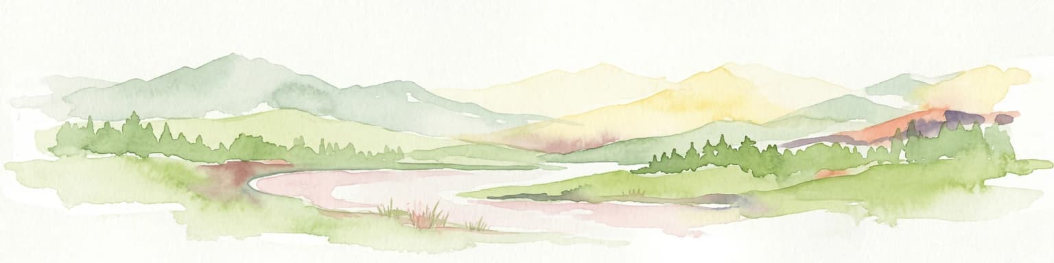
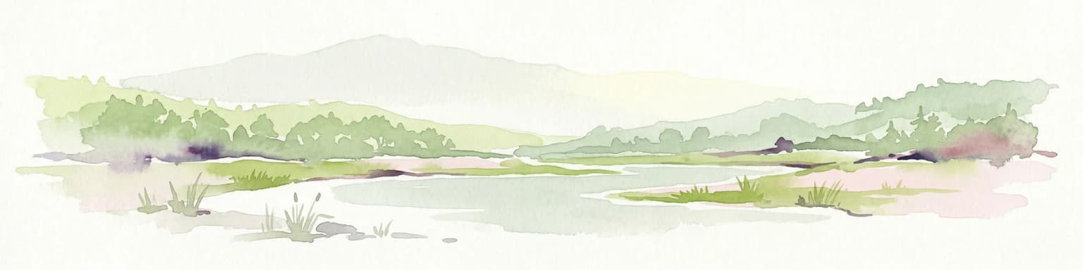
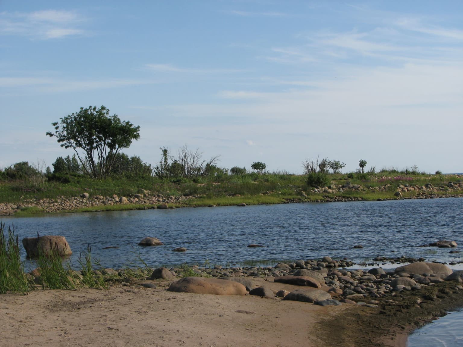
The physical landscape of Haparanda Archipelago National Park is defined by its position in the shallow, northern reaches of the Bothnian Bay. The islands display a distinctive character quite different from the rocky, cliff-bound archipelagos found further south in the Baltic. Here, sandy beaches predominate, and prominent dune formations rise behind the shorelines, shaped by winds blowing across the open bay. These dunes represent an unusual landscape feature in this latitude, more commonly associated with temperate or subtropical coasts.

The terrain is generally low-lying, with the highest points barely above sea level. As the land continues to rise through post-glacial rebound, new areas emerge from the sea each year, gradually expanding the islands' land area. The surrounding waters are extremely shallow, often requiring careful navigation and making landing by boat difficult in many locations. This shallow, gently sloping seabed characterizes much of the Bothnian Bay and contributes to the islands' depositional rather than erosional character. Between the islands, narrow sounds and shallow bays create a complex marine landscape that changes with the seasons and the gradual geological transformation of the coastline.

Haparanda Archipelago National Park ecosystems, habitats, and plant life

The ecological character of Haparanda Archipelago National Park reflects its position at the interface between marine and terrestrial environments in northern Europe. The islands support a mosaic of habitats including sandy shores, dune grasslands, coastal marshes, and mixed forest on the more sheltered parts of the larger islands. The dynamic nature of the landscape—continuously reshaped by land rise, wave action, and wind—creates a succession of habitats at different stages of development.

The vegetation of the dunes and beaches includes specialized species adapted to sandy, nutrient-poor conditions and the harsh maritime climate. These plants must tolerate salt spray, strong winds, and the extreme temperature ranges characteristic of northern Sweden. Further inland, the islands support birch woodlands and mixed coniferous forest that provide additional habitat diversity. The surrounding shallow waters support productive marine ecosystems, with extensive beds of aquatic vegetation and invertebrate communities that form the base of the coastal food web.

Haparanda Archipelago National Park wildlife and species highlights

Haparanda Archipelago National Park is particularly notable for its birdlife, with the shallow waters, shoreline habitats, and island environments supporting diverse avian communities. The archipelago serves as important nesting habitat for several species, while the surrounding waters provide feeding grounds for migratory birds during both the spring and autumn passage periods. The mix of coastal marsh, dune, and forest habitats creates conditions suitable for a range of bird species.

The park's position on the Bothnian Bay flyway means it lies along major migratory routes for waterfowl and other coastal birds moving between northern breeding grounds and more southerly wintering areas. The shallow, productive waters support diving ducks, swans, and geese, while the islands provide nesting sites for terns, gulls, and waders. The forest sections of the larger islands offer habitat for songbirds and birds of prey. While detailed species lists would require specific survey data, the park's ornithological significance is well recognized within the broader context of Baltic coastal bird conservation.

Haparanda Archipelago National Park conservation status and protection priorities

The conservation significance of Haparanda Archipelago National Park derives from its representation of a rare habitat type within Sweden's protected area network. The extensive dune systems of the archipelago are uncommon in the northern Baltic, making this park important for the preservation of coastal dune ecosystems at their northernmost extent. The ongoing geological processes of land emergence create conditions for natural habitat succession that is rare in more stable landscapes.

As part of the cross-border ecological network with Finland's Perämeri National Park, the park contributes to broader conservation objectives for the Bothnian Bay region. This marine and coastal ecosystem supports internationally important bird populations, and coordinated protection across the national boundary acknowledges that migratory species and ecological processes do not conform to political borders. The park's designation as IUCN Category II reflects its primary objective of protecting natural ecosystems while allowing for sustainable visitor use and enjoyment of the landscape.

Haparanda Archipelago National Park cultural meaning and human context

The Haparanda Archipelago has served as a setting for human activity for centuries, with the islands providing resources for fishing, shipping, and seasonal settlement. The presence of Sandskär Chapel reflects the historical importance of the islands to local communities, serving as a place of worship for island residents and a landmark for maritime navigation. The chapel represents the cultural connection between the islands and the surrounding coastal communities of both Sweden and Finland.

More recently, the archipelago gained broader cultural visibility through its selection as a filming location for the Swedish television program Expedition Robinson. The 2021 season was recorded in the Haparanda archipelago after pandemic-related travel restrictions prevented filming abroad. This modern media connection has brought attention to the landscape's dramatic character and remote quality, though it represents a brief moment in the longer human history of the islands.

Top sights and standout views in Haparanda Archipelago National Park

Haparanda Archipelago National Park offers a distinctive combination of features uncommon among Sweden's national parks: coastal dune landscapes in a northern Baltic setting, dynamic geological processes visible through ongoing land emergence, and rich birdlife within a cross-border protected area network. The largest island, Sandskär, provides the main visitor focus with its chapel, beaches, and trail network. The shallow, challenging waters surrounding the islands contribute to a sense of remoteness and wildness despite the park's proximity to the Swedish-Finnish border. The dramatic seasonal contrast between accessible summer archipelago and frozen winter landscape adds a further dimension to the park's character.

Best time to visit Haparanda Archipelago National Park

The optimal time to visit Haparanda Archipelago National Park depends on the type of experience sought. The summer months of July and early August offer the most accessible period, with regular boat services operating from Nikkala on the mainland to Sandskär. During this time, the islands are fully accessible, the weather is generally mild, and the long northern days provide extended opportunities for exploration. The warm season coincides with peak bird activity and the full development of coastal vegetation.

Winter presents a dramatically different park, transformed by snow and ice. The frozen Baltic provides access across the sea ice, allowing visitors to reach the islands on skis or snowmobiles. This quiet, stark season offers a completely different perspective on the archipelago, though it requires appropriate equipment and preparation for northern winter conditions. The transition seasons of spring and autumn offer intermediate conditions but may have more limited access options. The park's remote character means that visitors should check current access arrangements and be prepared for the variable conditions typical of this northern coastal environment.

Park location guide

Geography guide, regional context, and park location map for Haparanda Archipelago National Park

Haparanda Archipelago National Park park geography, regions, and map view in Sweden
Understand where Haparanda Archipelago National Park sits in Sweden through a broader geographic reading of the surrounding landscape, nearby location context, and its mapped position within the national park landscape.

How Haparanda Archipelago National Park fits into Sweden

Sweden, formally the Kingdom of Sweden, is a highly developed Nordic country on the Scandinavian Peninsula in Northern Europe. With a population of 10.6 million and an area of 450,295 km², it is the largest Nordic country by both area and population. Sweden is a constitutional monarchy with Stockholm as its capital and largest city, known for its advanced economy, social welfare system, and membership in the European Union and NATO.

Wider geography shaping Haparanda Archipelago National Park in Sweden

Sweden occupies the eastern portion of the Scandinavian Peninsula in Northern Europe. It borders Norway to the west and north, Finland to the east, and shares a maritime border with Denmark to the southwest across the Øresund. The country has an extensive coastline along the Baltic Sea and Gulf of Bothnia, dotted with thousands of islands. The terrain varies from mountainous regions in the northwest to low-lying coastal areas and inland lakes in the south and central parts.

Map view of Haparanda Archipelago National Park

Use this park location map to pinpoint Haparanda Archipelago National Park in Sweden, understand its exact geographic position, and read its mapped placement within the surrounding landscape more clearly.

Pigeon | © OpenStreetMap contributors

Location context for Haparanda Archipelago National Park

Norrbotten County
Park atlas

Explore the diverse coastal landscapes and regional protected areas across Norrbotten County.

Discover Other Protected Areas and National Parks Near Haparanda Archipelago National Park
Continue your geographic exploration from Haparanda Archipelago National Park by tracing other national parks and protected areas within Sweden's Norrbotten County. Map nearby coastal landscapes, compare distinct island formations, and understand the broader protected-area network in this northern Baltic Sea region.
National parkLapland

Bothnian Bay National Park: A National Park in Lapland's Geographic Atlas

Protected landscape and mapped terrain in northern Finland.

Delve into Bothnian Bay National Park, a key protected area situated in the Lapland region of Finland. This page serves as an atlas gateway to understanding the park's specific geographic features, its mapped boundaries as a national park, and its role within the broader context of Finland's protected natural landscapes.

Area
157 km²
Established
1991
IUCN
II
Visitors
6.3K annual
Watercolor illustration of a landscape with hills, a lake, trees, and a sunset
National parkNorthern Ostrobothnia

Rokua National Park: Mapping Finland's Glacial Heritage and Protected Landscapes

Discover unique geological formations and ancient boreal forests.

Rokua National Park in Northern Ostrobothnia offers a unparalleled glimpse into glacial history, designated as a UNESCO Global Geopark. Explore its mapped esker ridges, dramatic kettle holes like Syvyydenkaivo, and the ancient pine forests that thrive on its nutrient-poor soils. This protected landscape provides a rich context for understanding Quaternary geology and the development of northern Finnish natural environments, ideal for atlas-based geographic discovery.

Area
8.8 km²
Established
1956
IUCN
II
Visitors
50.7K annual
Watercolor landscape featuring green hills, pine trees, and a yellowish field
National parkFinland

Syöte National Park: Mapped Protected Landscape and Fell Geography in Finland

Explore Finland's southernmost fell and diverse northern wilderness.

Delve into the protected territory of Syöte National Park, a key national park in northern Finland. This page highlights the park's distinct geographic features, including its southernmost fell, Iso-Syöte, alongside expansive mire systems and old-growth boreal forests. Understand the mapped boundaries and the unique ecological transition zone it represents within the Finnish atlas, offering a comprehensive view of its landscape context and protected area status.

Area
299 km²
Established
2000
IUCN
II
Visitors
88.2K annual
National parkNorrbotten County

Muddus National Park: Explore Sweden's Largest Old-Growth Protected Forest Landscape

Mapped boreal terrain with ancient pines and dramatic ravines.

Muddus National Park is a landmark protected area in Norrbotten County, celebrated for its immense scale and preserved old-growth forest character. This national park features a unique geography defined by ancient coniferous forests, including Sweden's oldest pine tree, alongside striking ravines and extensive mire systems. As part of the Laponian Area UNESCO World Heritage Site, Muddus offers an unparalleled opportunity for atlas-based discovery of an undisturbed boreal ecosystem accessible solely by foot, highlighting its profound natural and mapped landscape significance.

Area
493.4 km²
Established
1942
IUCN
II
Relief
Upland
Watercolor illustration showing a lake, rolling hills, and vegetation.
National parkLapland

Pyhä-Luosto National Park: Ancient Geological Heritage and Fell Landscape

Explore Lapland's southernmost large fell system and deep gorges.

Pyhä-Luosto National Park offers a unique window into Finland's deep geological past and its boreal ecosystems. As a protected area, it encompasses a prominent chain of twelve fells composed of two-billion-year-old quartzite, showcasing the southernmost large fell system in the country. The park's landscape is further defined by features like Isokuru, Finland's deepest gorge, and extensive old-growth forests, providing rich context for map-based discovery and regional geographic understanding within Lapland.

Area
142 km²
Established
2005
IUCN
II
Visitors
198.9K annual
National parkLapland

Riisitunturi National Park: Explore Protected Landscape and Lapland Geography

Mapped boundaries of a national park in northern Finland.

Delve into the protected landscape of Riisitunturi National Park, a key national park situated in the expansive region of Lapland, Finland. This MoriAtlas entry provides detailed geographic context, focusing on the park's mapped boundaries and its role within the natural terrain of northern Finland. Understand its identity as a protected area and its significance within a broader atlas of natural landscapes.

Area
77 km²
Established
1982
IUCN
II
Visitors
58.8K annual
National parkFinland

Salamajärvi National Park: Explore Finland's Premier Mired Wilderness and Protected Landscape

Mapped boundaries and wetland ecosystems of this Finnish National Park.

Salamajärvi National Park is a critical protected area in Finland, celebrated for its unparalleled mire ecosystems, which represent some of the country's most extensive and intact peatland environments. The park's landscape is shaped by the Suomenselkä watershed, featuring a mosaic of old-growth forests, forest lakes, and rugged terrain, providing a vital sanctuary for forest reindeer. MoriAtlas details its geographic context and protected landscape features, offering users a structured way to explore its natural identity and mapped boundaries within Finland.

Area
62 km²
Established
1982
IUCN
II
Visitors
24.5K annual
National parkLapland

Salla National Park: Mapped Protected Landscape in Lapland, Finland

Explore its geographic context and protected area identity.

Understand Salla National Park as a distinct protected landscape situated within the expansive northern Finnish region of Lapland. This MoriAtlas entry focuses on its identity as a national park, detailing its mapped boundaries and geographic setting. Discover how Salla National Park contributes to the atlas of protected areas, offering a specific point of reference for exploring the natural terrain and regional geography of this subarctic territory.

Area
99.83 km²
Established
2022
IUCN
II
Visitors
55.9K annual

Common questions about visiting, size, designation, and location context for Haparanda Archipelago National Park

Haparanda Archipelago National Park FAQs for park facts, access, geography, and protected area context
Find quick answers about Haparanda Archipelago National Park, including protected-area facts, park geography, trail and visitor context, and how the park fits into its surrounding country and regional landscape.
MoriAtlas Explorer

Continue Your Protected Areas Search Across the Global Atlas

Deepen your exploration by continuing the structured search for national parks and protected areas worldwide. Utilize the comprehensive filtering capabilities to compare different conservation landscapes and refine your understanding of global park geography. Discover more about the distribution and characteristics of protected natural areas.

Global natural geography