
Mori Atlas logo
State or regional parkIschigualasto Provincial Park

Tracing the geological evolution and wind-sculpted terrain across the arid desert basins of San Juan Province

Ischigualasto Provincial Park: An Atlas Exploration of Argentina's Triassic Fossil Landscapes and Badlands

(Parque Provincial Ischigualasto)

Ischigualasto Provincial Park represents a premier destination for understanding the Late Triassic geological record, where exposed rock layers contain the world's most significant sequence of early dinosaur evolution. This protected landscape in northwestern Argentina offers a stark, lunar-like geography characterized by wind-eroded badlands and vibrant sedimentary cliffs. From the iconic formations of the Valley of the Moon to the ancient volcanic remnants of Cerro Morado, the park provides an essential mapped context for paleontological study and arid-region geomorphology.

badlandstriassic fossilsearly dinosaursworld heritage sitedesert landscapewind-eroded formations
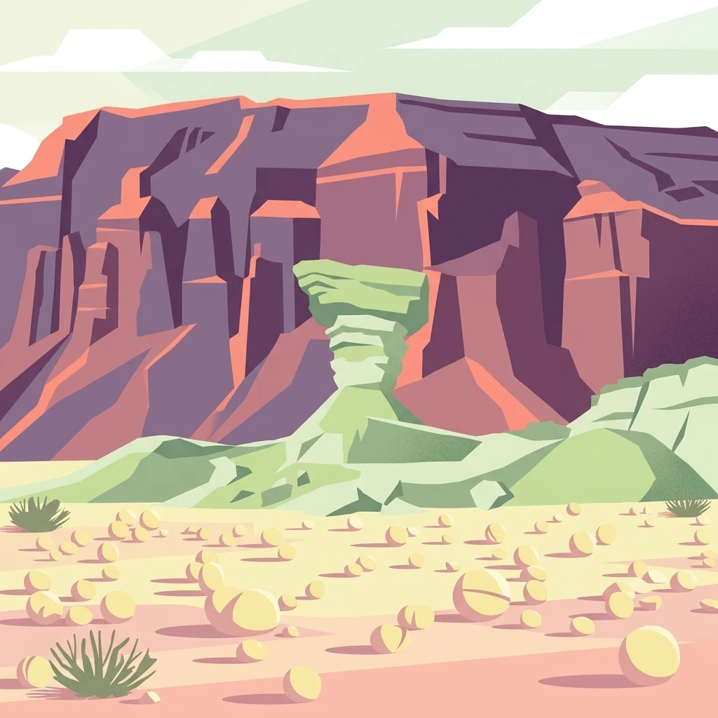
A digital illustration of a desert landscape featuring a prominent mushroom-shaped rock formation in the center, set against a background of stratified canyon cliffs under a pale sky.

Ischigualasto Provincial Park

State or regional park

Park overview

Structured park overview, official facts, and landscape profile for Ischigualasto Provincial Park

Ischigualasto Provincial Park park facts, protected area profile, and essential visitor context

Review the core facts for Ischigualasto Provincial Park, including designation, size, terrain, visitor scale, habitats, and operating context in one park-focused overview.

About Ischigualasto Provincial Park

Ischigualasto Provincial Park sits in the far northeast of San Juan Province, near the border with La Rioja Province, where it meets Talampaya National Park. The two protected areas cover closely related geological terrain and together form one of the most important Triassic fossil regions on the planet. Ischigualasto's surface spans tens of thousands of hectares of dry badlands, plateau, and foothill landscapes shaped by roughly 230 million years of deposition, volcanic activity, and erosion.

The park's identity rests on two pillars that reinforce each other. One is its visual drama: a near-barren terrain dotted with isolated mesas, mushroom-shaped hoodoos, sweeping red and white cliffs, and broad dry basins whose colors shift with the angle of the sun. The other is its scientific value. Because the local rock layers preserve an unusually complete and well-exposed Triassic sequence, paleontologists have been able to study the transition from earlier reptile-dominated faunas to the earliest dinosaurs with a level of detail found almost nowhere else.

Modern Ischigualasto is also organized as a heritage and visitor site. A network of marked circuits connects the most photogenic formations, while the on-site natural history museum and guided programs translate decades of research into explanations visitors can follow without a geology background. The combination of stark scenery, easy accessibility from protected routes, and singular paleontological significance gives the park a profile that is unusually distinctive among Argentina's protected areas.

Quick facts and research context for Ischigualasto Provincial Park

Ischigualasto is a provincial protected area in San Juan Province, Argentina, established on 3 November 1971 by provincial law and later jointly declared a National Historic Site with Talampaya. In 2000, UNESCO listed Ischigualasto and Talampaya together as a Natural World Heritage Site under criterion viii, recognizing the geological and paleontological significance of the area.

The park lies within the Monte ecoregion, a dry shrubland of western Argentina, and falls within the western border of the Central Sierras. Its Triassic formations, especially the Ischigualasto Formation, are world famous for preserving early dinosaurs alongside rhynchosaurs, cynodonts, and other vertebrate faunas from the dawn of the dinosaur era.

Protection and recognition

Documented terrestrial protection scope, designation history, and international status

Ischigualasto Provincial Park Protection Status and UNESCO Recognition

Ischigualasto Provincial Park maintains a documented terrestrial protection scope established in the year 2000. Official records incorporate international recognition through UNESCO World Heritage status for the Ischigualasto and Talampaya Natural Parks.

International recognition

Protection details

Protection scope
Terrestrial
Designated year
2000
Transboundary protection
No
Park context

Deeper park guide and search-rich context for Ischigualasto Provincial Park

Ischigualasto Provincial Park history, landscape, wildlife, and travel context

Explore Ischigualasto Provincial Park through its history, landscape character, ecosystems, wildlife, conservation priorities, cultural context, and seasonal travel timing in a structured park guide built for atlas discovery and search intent.

Why Ischigualasto Provincial Park stands out

Ischigualasto is best known as the world's leading window into the Late Triassic, the period when dinosaurs first appeared and began to diversify. The Ischigualasto Formation has yielded some of the oldest and best-preserved dinosaur fossils known anywhere, including Herrerasaurus and Eoraptor, species that sit near the base of the dinosaur family tree. Equally iconic is the park's surreal eroded landscape. Defended from dense vegetation by its arid climate, formations like The Mushroom, The Submarine, The Sphynx, and Las Coloradas cliffs have become signatures of Valle de la Luna and a major reason the site draws both scientists and travelers.
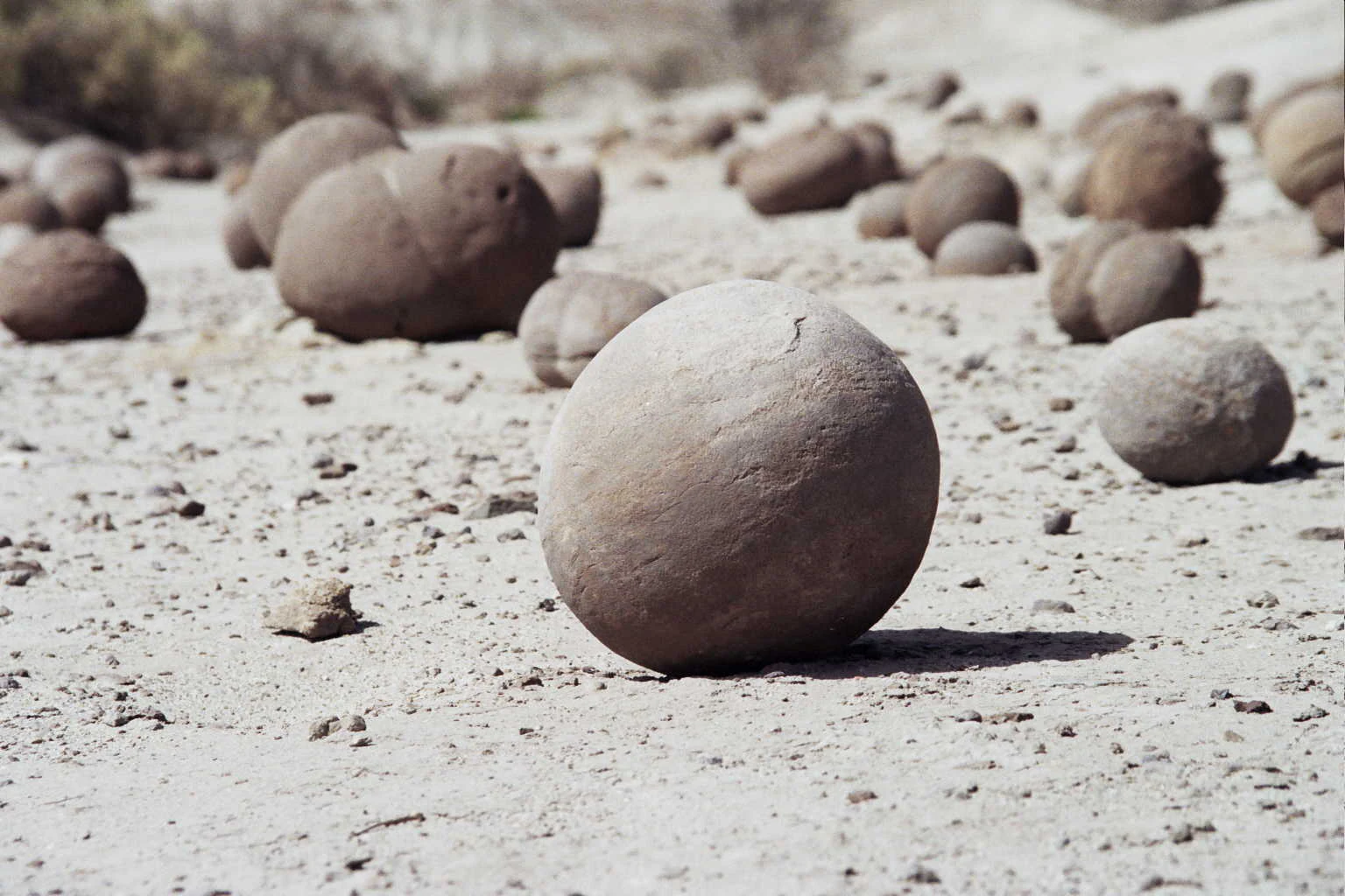
Multiple smooth, spherical rock formations resting on a flat, sandy, arid landscape under bright daylight.
Spherical rock formations scattered across the arid desert terrain of Ischigualasto Provincial Park.

Ischigualasto Provincial Park history and protected-area timeline

The name Ischigualasto is usually traced to the extinct Cacán language of the Diaguita people of western Argentina, with scholars offering different interpretations ranging from "place where the moon alights" to "place where there is no life" or "dead land." Before becoming a park, the area was used on a small scale by miners prospecting for coal between roughly 1920 and 1954, and the remains of their workings still dot the landscape.

Scientific interest in the region began in the early twentieth century. The first paleontological descriptions date back to the 1930s, and in 1941 Argentine geologist Joaquín Frenguelli collected fossils that were studied by Ángel Cabrera, leading to the first scientific publication on the site. The evocative name Valle de la Luna appeared in print in the 1940s and was popularized for a wider audience by Argentine journalist Federico B. Kirbus and photographer Antonio Legarreta in 1967.

Ischigualasto's modern significance took shape in 1958, when Harvard paleontologist Alfred Sherwood Romer explored the area and described it as an extraordinary fossil site, prompting a sustained program of international research. The park itself was formally created in 1971 under provincial law and jointly declared a National Historic Site with Talampaya in 1995. In 2000, UNESCO inscribed both parks as a single World Heritage Site in recognition of their shared geological and paleontological value.

Ischigualasto Provincial Park landscape and geographic character

The landscape of Ischigualasto is a textbook example of badlands scenery shaped by extreme aridity. Elevation across the park runs from roughly 1,200 meters up to about 1,800 meters at the highest points, perched along the western edge of the Central Sierras. Annual rainfall is low and concentrated in the summer, while strong southerly winds and occasional bouts of the Zonda wind scour the terrain, leaving polished, blade-like shapes behind.

The surface is a patchwork of differently colored rock units. Bright red, purple, and whitish sediments form horizons that tilt gently into the distance, weathered into isolated mesas, sloped ridges, and the famous mushroom-like hoodoos. Among the most recognized landforms are The Mushroom, The Submarine, The Sphynx, the Las Coloradas cliffs, the Bocce Court, and the painted slopes of Valle Pintado. Inland basins of clay and sand add smooth, almost lunar floors to the rougher ridges.

Volcanic history also shaped the scenery: Cerro Morado, within the park, is interpreted as the ancient vent of an extinct volcano and offers a higher vantage point over the surrounding basins. With vegetation covering only a small fraction of the surface, the bones of the landscape are exposed almost continuously, giving visitors a rare sense of walking on raw geology.
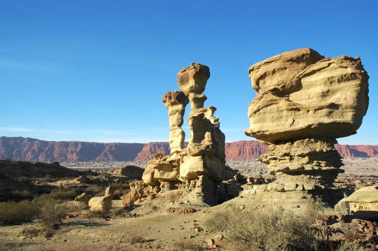
A desert landscape at Ischigualasto Provincial Park featuring towering, uniquely eroded sandstone rock formations under a clear blue sky, with a long red mountain ridge in the background.
Eroded sandstone rock formations at Ischigualasto Provincial Park, known for their unique moon-like appearance.

Ischigualasto Provincial Park ecosystems, habitats, and plant life

Ischigualasto lies within the Monte ecoregion, one of the arid shrubland belts that runs along the western flank of Argentina. Vegetation is sparse and discontinuous, typically covering somewhere between roughly ten and twenty percent of the ground. Plants that do survive here are drought specialists: low, hard-leaved shrubs, scattered cacti, and a few small trees that cling to slightly more sheltered draws.

Common woody plants of the park include jarilla shrubs (Larrea species), false jarilla (Zuccagnia punctata), the chamaephyte Plectrocarpa tetracantha, the cushion-like Halophytum ameghinoi, and the columnar cactus Echinopsis leucantha. Beyond these, hardy species such as Atriplex, Baccharis, Cortaderia, and the localized Ramorinoa girolae contribute to a thin but characteristic scrub flora. The limited plant cover leaves the geological structures as the dominant visual element of the ecosystem.

Although the ecosystems are arid and fragile, they support a recognizable set of animals adapted to the desert environment. Large stretches of bare rock and soil alternate with small pockets of denser vegetation where wildlife can find shade, food, and refuge, producing a sparse but ecologically coherent desert landscape.
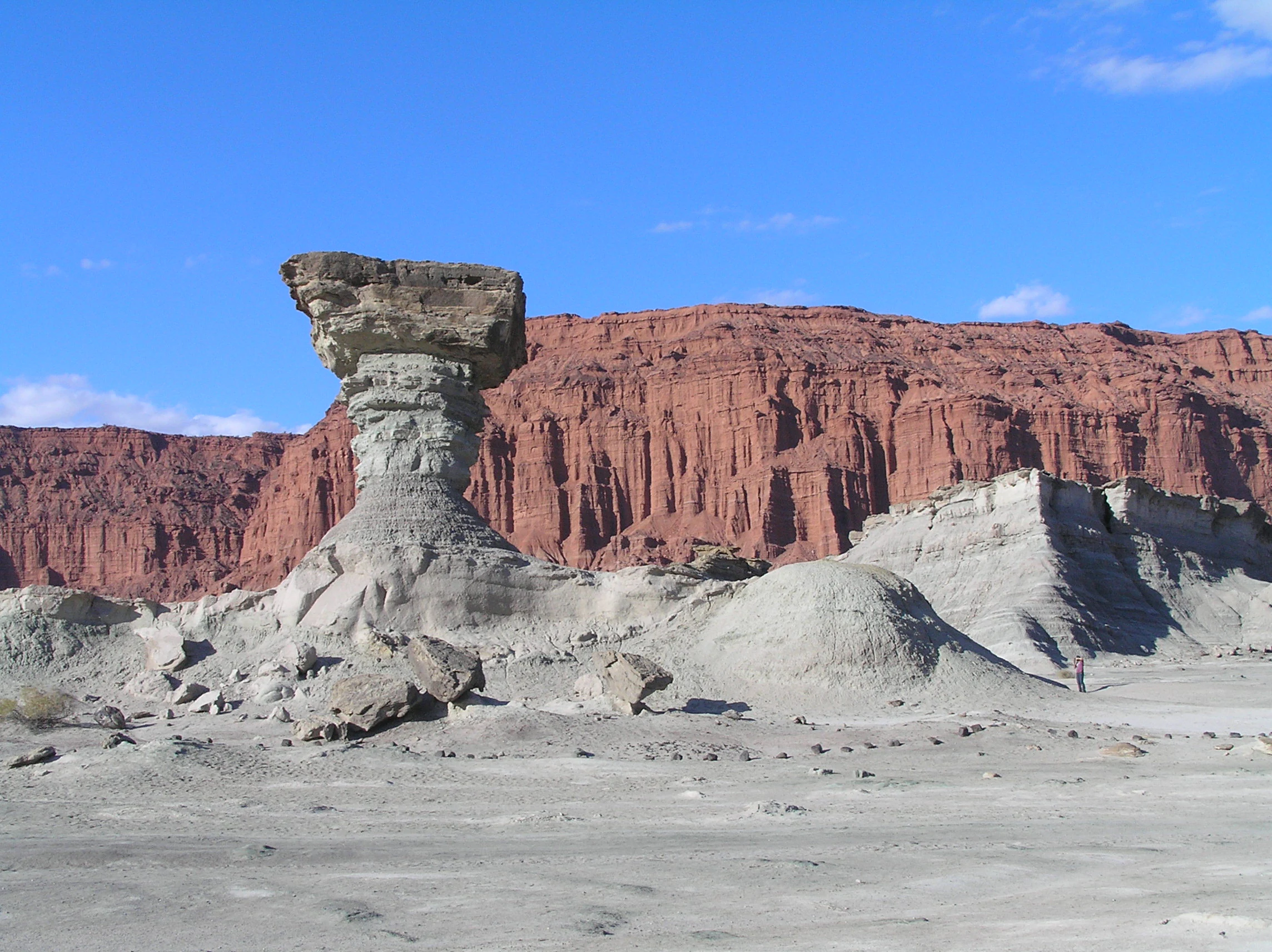
A large, weathered, mushroom-shaped rock formation stands in a desolate, pale grey desert landscape, with a towering, layered red canyon cliff in the background under a clear blue sky.
The iconic Mushroom rock formation in the arid landscape of Ischigualasto Provincial Park.

Ischigualasto Provincial Park wildlife and species highlights

Wildlife in Ischigualasto is typical of the Monte and open Andean foothill deserts of western Argentina. The most visible large mammal is the guanaco (Lama guanicoe), which moves through the basins and slopes in small groups. Other characteristic mammals include the Patagonian mara (Dolichotis patagonum), a large hare-like rodent, and the gray fox or zorro gris (Lycalopex gymnocercus), which hunts across the same open terrain.

Reptiles are an important part of the fauna. Visitors may encounter terrestrial tortoises (Chelonoidis chilensis), Patagonian lizards such as Liolaemus chacoensis, geckos including Homonota fasciata, and rodent-eating snakes like Philodryas trilineata, which together reflect the park's hot summers and cool winters.

The bird community mixes large South American walkers with raptors and a wide variety of smaller passerines. Both the greater rhea (Rhea americana) and the lesser rhea or choique (Rhea pennata) are recorded, alongside high-profile raptors like the Andean condor (Vultur gryphus), the crowned eagle (Buteogallus coronatus), and the variable hawk (Geranoaetus polyosoma). A long list of smaller songbirds rounds out a bird fauna that benefits from the open sightlines and varied rock habitats of the basin.
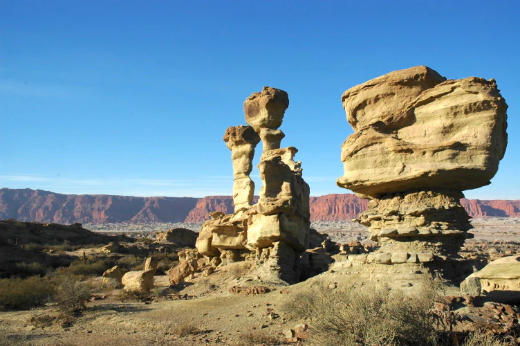
Two prominent, naturally sculpted rock pillars stand in a barren, arid landscape under a clear blue sky, with a long red cliff range visible in the background.
Eroded sandstone rock formations known as the Mushroom, or El Hongo, in the moon-like landscape of Ischigualasto Provincial Park.

Ischigualasto Provincial Park conservation status and protection priorities

Ischigualasto's conservation significance is rooted in the fact that its rock layers preserve, in a single continuous section, the full sweep of the Triassic Period, including the critical interval when dinosaurs first appeared. This combination of completeness, exposure, and fossil richness is exceptionally rare globally and is the core reason UNESCO inscribed the site.

Protection is layered. The park was established as a provincial reserve in 1971; in 1995 it was declared a National Historic Site of Argentina together with Talampaya; and in 2000 it received World Heritage recognition. The province has worked through an autonomous Ischigualasto authority to keep scientific collecting regulated, control tourism access, manage a corps of park rangers, and develop a long-term management plan that addresses surface limits, mineral resources, and the protection of fossil-bearing strata.

For visitors, the same protections that shield the fossils also shape how the landscape is experienced. Foot and vehicle traffic is funnelled along designated circuits, viewpoints, and museum spaces, preserving both the paleontological resources and the visual integrity of the formations that give Ischigualasto its global reputation.

Ischigualasto Provincial Park cultural meaning and human context

The cultural dimension of Ischigualasto blends indigenous toponymy, frontier-era mining, and modern scientific media. The name itself preserves a memory of the Diaguita, and possibly Huarpe, peoples who lived in or passed through this part of western Argentina before Spanish colonization. Their language left behind the place-name that still defines the park and the basin around it.

In the early and mid-twentieth century, small-scale coal mining left its own quiet imprint. Hand-cut workings and modest ruins scattered across the park are reminders of a brief industrial chapter that ended as the land's scientific value became clear.

From the late 1950s onward, popular media played a large role in turning Valle de la Luna into a household name in Argentina. Magazine and newspaper features by writers like Rogelio Díaz Costa and Federico B. Kirbus, combined with widely circulated photography, framed the area as both a national geological treasure and a place of striking visual beauty. That cultural framing continues to shape how the park is presented to visitors today.
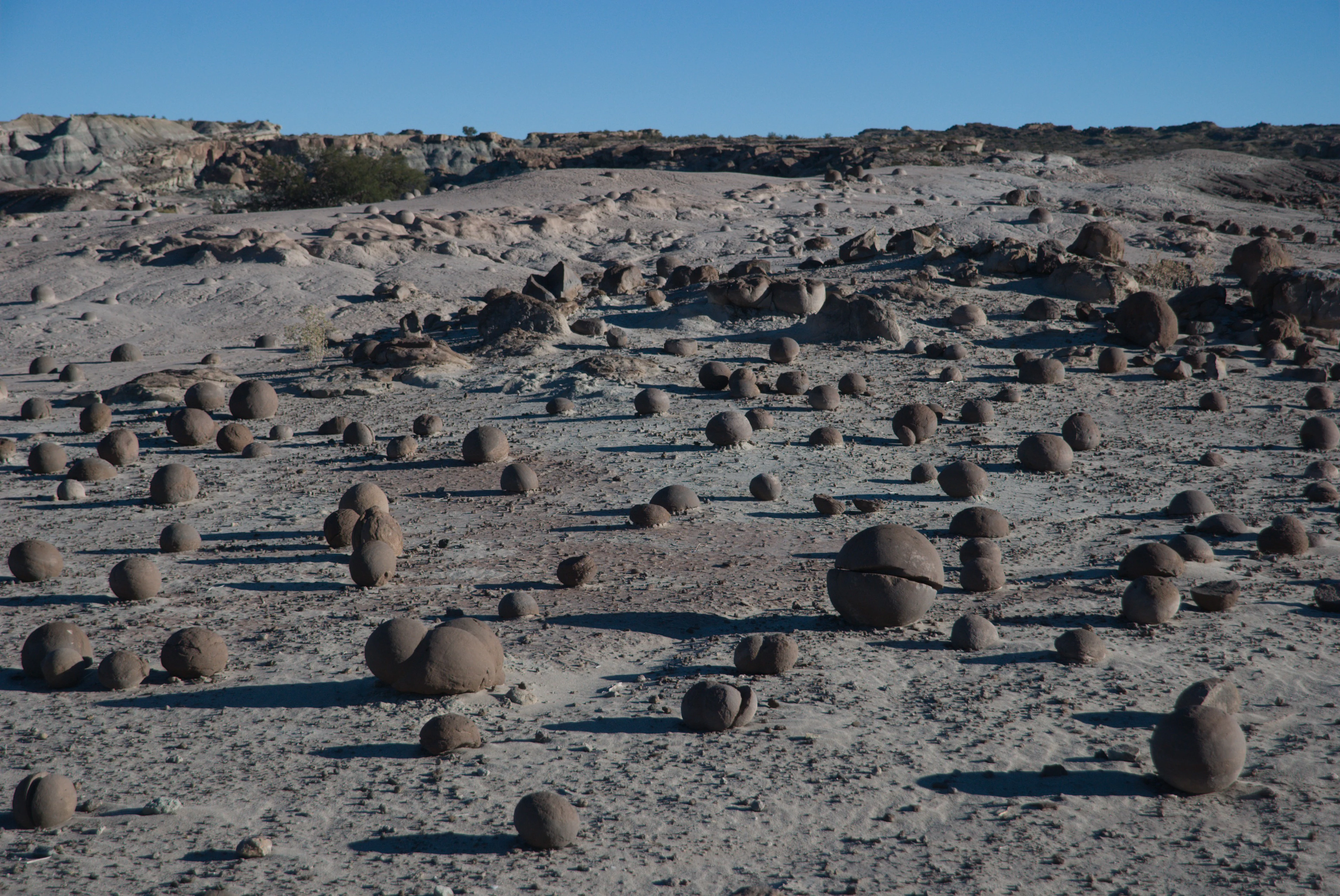
A wide, arid, desert landscape scattered with dozens of natural, smooth, spherical sandstone concretions covering the pale, dry ground under a clear blue sky.
The unique spherical rock formations of the Cancha de Bochas field in Ischigualasto Provincial Park.

Top sights and standout views in Ischigualasto Provincial Park

The two defining highlights of Ischigualasto are its Triassic fossil record and its eroded badlands scenery. Together with Talampaya, the park holds the most complete exposed sequence of Triassic rocks anywhere in the world, including fossil-bearing layers that have produced some of the earliest known dinosaurs, among them Herrerasaurus and Eoraptor.

Equally memorable are the visual landmarks of Valle de la Luna. The Mushroom, The Submarine, The Sphynx, the painted slopes of Valle Pintado, and the red cliffs of Las Coloradas together form a tightly grouped set of easily recognizable formations that make even a short visit feel visually distinctive. The on-site natural history museum and its dinosaur skeleton mounts connect these scenic highlights directly to the deeper scientific importance of the terrain beneath them.
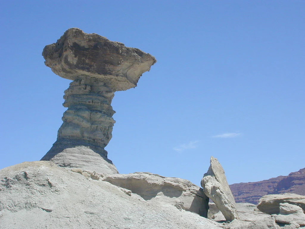
A large, mushroom-shaped sandstone rock formation stands in a desolate, arid landscape against a clear blue sky.
The iconic El Hongo rock formation in Ischigualasto Provincial Park, showcasing the unique erosion patterns of the area.

Best time to visit Ischigualasto Provincial Park

Seasons strongly shape the experience of Ischigualasto. Summers are very hot and dry, with strong afternoon sun and occasional intense storms, while winters bring cold nights and lower daytime temperatures but clearer skies and softer light on the colored sediments. Because the park is exposed and windy much of the year, layering clothing is useful even in warmer months.

Spring and autumn are generally the most comfortable windows for visiting. Temperatures are milder than in summer, the wind and Zonda episodes tend to be less aggressive, and the slanted light brings out the layered colors of formations like Las Coloradas and Valle Pintado. Wildlife is hardest to see in the heat of midday in summer; cooler parts of the day, and the quieter winter and shoulder seasons, are more rewarding for observing guanacos, maras, and birdlife across the basins.
Monthly climate preview

Examine long-term representative temperature ranges and monthly precipitation records across the protected terrain.

Ischigualasto Provincial Park Climate Normals and Annual Weather Patterns

Ischigualasto Provincial Park experiences wide thermal variations with recorded mean monthly temperatures spanning from mild winter lows to high summer peaks alongside low daily precipitation rates. Reviewing the complete twelve-month climatology profile provides deeper analytical insight into the long-term regional weather rhythm.
Annual mean19 °C
11 °C26 °C
Jan26°
Feb25°
Mar23°
Apr19°
May14°
Jun12°
Jul11°
Aug13°
Sep16°
Oct20°
Nov24°
Dec26°
Warmest month
January

26.5 °C

Coolest month
July

10.5 °C

Wettest month
January

1.6 mm/day

Driest month
July

0.1 mm/day

Park location guide

Geography guide, regional context, and park location map for Ischigualasto Provincial Park

Ischigualasto Provincial Park park geography, regions, and map view in Argentina

Understand where Ischigualasto Provincial Park sits in Argentina through a broader geographic reading of the surrounding landscape, nearby location context, and its mapped position within the national park landscape.

How Ischigualasto Provincial Park fits into Argentina

Argentina is a federal republic located in the southern cone of South America, bordering Chile, Bolivia, Paraguay, Brazil, Uruguay, and the Atlantic Ocean. With an area of 2,780,085 km², it is the second-largest country in South America and the eighth-largest globally. The capital and largest city is Buenos Aires, and the official language is Spanish. The country claims sovereignty over the Falkland Islands, South Georgia and the South Sandwich Islands, and a portion of Antarctica.

Wider geography shaping Ischigualasto Provincial Park in Argentina

Argentina occupies the southern portion of South America, sharing the Southern Cone region with Chile to the west. The country borders Bolivia and Paraguay to the north, Brazil to the northeast, Uruguay and the South Atlantic Ocean to the east, and the Drake Passage to the south. The Andes mountain range runs along the western border, while the Pampas plains dominate the central region. Argentina also claims territories in Antarctica.

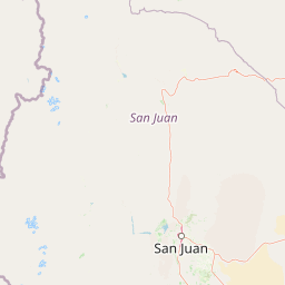
Map view of Ischigualasto Provincial Park

Use this park location map to pinpoint Ischigualasto Provincial Park in Argentina, understand its exact geographic position, and read its mapped placement within the surrounding landscape more clearly.

Pigeon | © OpenStreetMap contributors

Location context for Ischigualasto Provincial Park

San Juan Province

Visualizing badlands scenery, colorful cliffs, and wind-sculpted terrain

Ischigualasto Provincial Park Photos and Landscapes

Photographic records reveal the stark badlands terrain and wind-eroded rock formations that define Ischigualasto Provincial Park. Visual documentation highlights the exposed geological layers and sparse shrub habitats characteristic of this protected desert landscape.

Multiple smooth, spherical rock formations resting on a flat, sandy, arid landscape under bright daylight.

A large, weathered, light-colored rock formation known as The Sphinx, surrounded by arid, sandy terrain under a clear sky.

A desert landscape at Ischigualasto Provincial Park featuring towering, uniquely eroded sandstone rock formations under a clear blue sky, with a long red mountain ridge in the background.

A large, weathered, mushroom-shaped rock formation stands in a desolate, pale grey desert landscape, with a towering, layered red canyon cliff in the background under a clear blue sky.

Two prominent, naturally sculpted rock pillars stand in a barren, arid landscape under a clear blue sky, with a long red cliff range visible in the background.

A wide, eye-level shot of the iconic mushroom-shaped rock formation in the foreground, with the massive, stratified red rock cliffs of the Red Ravines in the background.

A wide, arid, desert landscape scattered with dozens of natural, smooth, spherical sandstone concretions covering the pale, dry ground under a clear blue sky.

A large, mushroom-shaped sandstone rock formation stands in a desolate, arid landscape against a clear blue sky.

A lone guanaco stands in the foreground of a sparse, arid desert landscape with rocky, undulating hills in the background.

A close-up view of a large, blocky piece of petrified wood resting on a rocky, desert ground surface in a bright, arid environment.

A group of tourists standing on a metal observation deck with a sign reading Punto Panoramico, looking out over a dry, hilly desert landscape.

Wide panoramic view of Valle Pintado, showing multi-layered, barren earth formations with distinct bands of gray, reddish, and tan sediment under a clear sky.

A night landscape view showing the silhouettes of unusual rock formations against a bright moon and dark sky in Ischigualasto Provincial Park.

A pale, wind-eroded sandstone rock formation shaped like a resting cat, set against a cloudy, overcast sky in a desert landscape.

A close up view of fossilized skeletal remains partially embedded in dry, sandy ground.

A wide, arid landscape of layered grey and tan sedimentary hills with sparse green shrubs in the foreground, under a clear sky.

Park atlas

Compare regional protected areas and adjacent geological terrain across northwestern Argentina

Explore Parks Near Ischigualasto Provincial Park And Surrounding Protected Landscapes

Browse other parks near Ischigualasto Provincial Park to examine neighboring badlands and regional desert topography. Comparing these adjacent protected landscapes reveals the broader geological spread of the surrounding region.
National parkLa Rioja Province
About 7.1 km away#1 closest

Northeast

Talampaya National Park: Argentinian National Park with Dramatic Desert Canyons

Explore protected landscape and mapped geography in La Rioja Province.

Talampaya National Park, a significant national park in Argentina's La Rioja Province, offers a profound exploration of a dramatic desert canyon environment. This protected area is renowned for its rich paleontological sites, yielding crucial dinosaur fossils, and for its well-preserved indigenous petroglyphs carved into ancient rock formations. Understanding Talampaya National Park provides vital context for the region's geography and its place within Argentinian protected lands and mapped natural landscapes.

Area
2,150 km²
Established
1997
IUCN
II
Relief
Mountain
Watercolor illustration of mountain ranges with green and yellow hills, a central dark peak, and pinkish foreground
National parkArgentina
About 128 km away#2 closest

Northwest

San Guillermo National Park: High Andes Protected Landscape & Vicuña Conservation Area

Explore its rugged terrain and arid mountain ecosystem.

San Guillermo National Park, a key national park in Argentina's San Juan Province, protects over 166,000 hectares of high-altitude Andean wilderness. Its landscape is defined by arid mountain ranges and expansive puna grasslands, serving as a critical sanctuary for vicuñas and other high-Andean wildlife. This page offers detailed geographic context for understanding the park's protected boundaries, unique terrain, and its importance as a mapped conservation area.

Area
1,660 km²
Established
1998
IUCN
II
Relief
Mountain
National parkArgentina
About 215 km away#3 closest

Southwest

El Leoncito National Park: High-Altitude Andean Puna and Steppe Protected Landscape

Explore mapped boundaries and unique geographic context in San Juan Province.

El Leoncito National Park in Argentina's San Juan Province preserves critical high-altitude ecosystems, including the Central Andean Puna and Southern Andean steppe. This protected landscape spans dramatic mountain terrain, with elevations reaching over 6,000 meters, providing a unique geographic setting. The park's conservation value is underscored by its representative ecological samples and stark natural beauty, offering a distinct regional geography for exploration.

Area
897.06 km²
Established
2002
IUCN
II
Relief
Mountain
National parkArgentina
About 269 km away#4 closest

South

Sierra de las Quijadas National Park: Protected Landscape & Geographic Atlas in Argentina

Explore the unique Chaco-Monte ecotone and dramatic sandstone terrain.

Sierra de las Quijadas National Park in San Luis Province, Argentina, is a protected area recognized for its critical role as a biodiversity bridge between the Semiarid Chaco and High Monte ecoregions. Its landscape is marked by rugged mountains, vivid red sandstone cliffs, and significant paleontological sites, offering a unique look at Cretaceous-era geology. This park provides a rich opportunity for atlas exploration, allowing discovery of its distinctive protected landscape and the regional geography it inhabits.

Area
735.33 km²
Established
1991
IUCN
II
Relief
Mountain
National parkAtacama Region
About 305 km away#5 closest

North

Nevado Tres Cruces National Park: National Park in Atacama Region's Mapped Geography

Explore protected landscapes and regional park context.

Nevado Tres Cruces National Park is a significant protected national park situated within the Atacama Region of Chile. This entry provides essential geographic context, detailing the park's mapped boundaries and its contribution to the region's conservation landscape. Understand its place within the broader atlas of protected areas, focusing on the natural terrain and the distinct geography that characterize this important national park.

Area
591 km²
IUCN
II
Relief
Mountain
Climate
Alpine
National parkTucumán Province
About 339 km away#6 closest

Northeast

Aconquija National Park: Southern Andean Yungas Protected Landscape in Tucumán Province

Explore its montane forest and mapped geographic context.

Aconquija National Park is a significant federal protected area located in Tucumán Province, Argentina. This national park is dedicated to conserving the diverse Southern Andean Yungas montane forest ecosystem, characterized by a dramatic elevational gradient. Its landscapes transition from cloud forest to high alpine terrain, offering a unique opportunity to study and appreciate a well-preserved montane environment within a critical geographic region. Discover the mapped extent and ecological importance of this protected area.

Area
700 km²
Established
1995
IUCN
II
Relief
Mountain
National parkAtacama Region
About 349 km away#7 closest

Northwest

Llanos de Challe National Park: Unique Coastal Desert and Lomas Ecosystem

Atacama Region National Park with Dramatic Terrain and Wildlife

Llanos de Challe National Park presents a rare protected coastal desert environment within the Atacama Region. Its unique lomas ecosystem, sustained by coastal fog, supports a surprising diversity of life. The park encompasses striking geographic features, from unspoiled white-sand beaches to rugged mountainous terrain, offering a clear example of a vital protected landscape with significant guanaco populations and unique flora, all mapped within its regional context.

IUCN
II
Relief
Mixed relief
Climate
Arid
Scope
Mixed
Watercolor illustration of a river winding through a valley with rolling hills and green vegetation in the foreground.
National parkCoquimbo Region
About 352 km away#8 closest

West

Bosque de Fray Jorge National Park: National Park Protected Landscape & Geographic Atlas

Explore mapped boundaries and regional natural landscape context.

Bosque de Fray Jorge National Park is a key protected area offering unique insights into Chile's natural landscapes. This entry provides detailed geographic context, focusing on its status as a national park and its mapped boundaries within the Coquimbo Region. Discover its place in the regional atlas and understand its protected landscape identity for focused geographic exploration.

Area
100 km²
Established
1941
IUCN
II
Visitors
13.1K annual

Common questions about visiting, size, designation, and location context for Ischigualasto Provincial Park

Ischigualasto Provincial Park FAQs for park facts, access, geography, and protected area context

Find quick answers about Ischigualasto Provincial Park, including protected-area facts, park geography, trail and visitor context, and how the park fits into its surrounding country and regional landscape.
MoriAtlas Explorer

Continue Your Protected Areas Search Across the Global Atlas

Deepen your exploration by continuing the structured search for national parks and protected areas worldwide. Utilize the comprehensive filtering capabilities to compare different conservation landscapes and refine your understanding of global park geography. Discover more about the distribution and characteristics of protected natural areas.

Global natural geography