Why Jostedalsbreen National Park stands out
Jostedalsbreen National Park is renowned for protecting the largest glacier on the European mainland, a singular distinction that makes it one of the most significant glacial protected areas in Europe. The park's namesake glacier, Jostedalsbreen, is a massive ice sheet that dominates the landscape and serves as a living laboratory for understanding glacial dynamics, climate change impacts, and mountain ecology. The Briksdalsbreen arm of the glacier, accessible from Briksdal valley, is particularly famous and attracts over 300,000 visitors annually with its dramatic ice wall and spectacular glacial valley setting. The park offers visitors the rare opportunity to witness a major glacier system up close, walk alongside glacial moraines, and observe the ongoing retreat of ice that has reshaped the landscape for centuries.
Jostedalsbreen National Park history and protected-area timeline
Jostedalsbreen National Park was established on 25 October 1991 by royal decree, creating formal protection for Norway's largest glacier and the surrounding mountain landscape. The establishment reflected a growing awareness in the late 20th century of the need to preserve significant natural areas and the particular vulnerability of glacial environments to climate change and human disturbance. Prior to national park status, parts of the area had received various levels of protection, but the national park designation provided comprehensive management and ensured coordination across the five municipalities that the park spans. In 1998, the park was significantly enlarged toward the northwest, expanding the protected area to its current extent of 1,310 square kilometres. This expansion improved the ecological coherence of the park by including more of the glacial watershed and additional alpine terrain. The history of the Jostedalsbreen glacier itself is written in the landscape—the park contains ruins of farms that were overtaken by the glacier in 1750, a stark reminder of the glacier's dynamic nature and its capacity to advance dramatically. This historical note also connects the park to the human history of the region, where communities have lived alongside the glacier for generations, adapting to its presence and respecting its power.
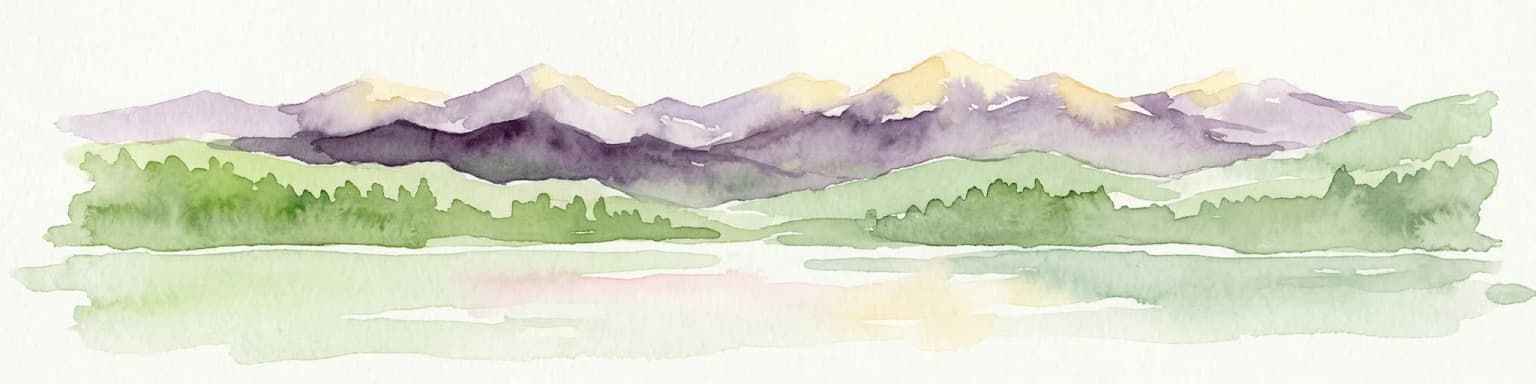
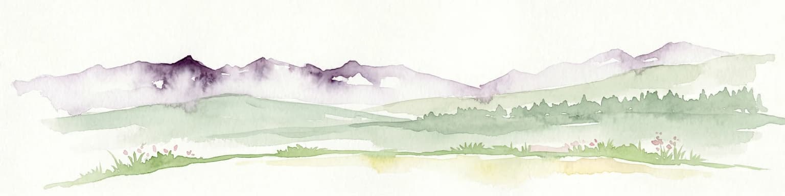
Jostedalsbreen National Park landscape and geographic character
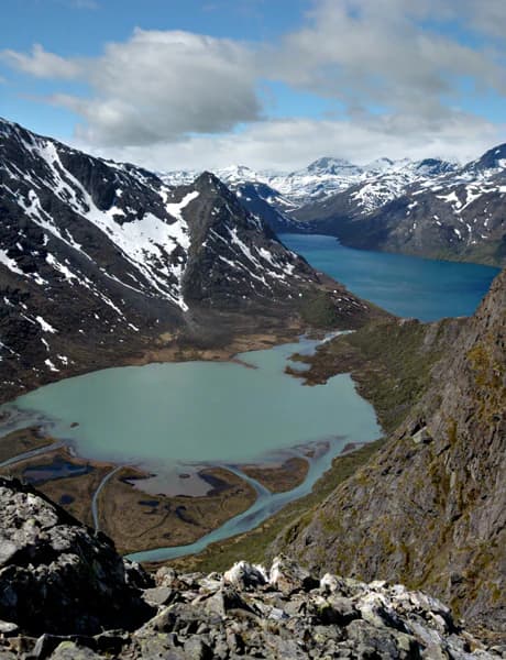
The landscape of Jostedalsbreen National Park is defined by the interplay between massive glacial ice and the steep mountain terrain of western Norway. The park occupies a high-alpine setting within the Scandinavian mountain range, where deep valleys have been carved by glacial erosion over thousands of years. Jostedalsbreen itself is a plateau glacier, a broad ice field that spills down into numerous glacial tongues that extend into the surrounding valleys. The highest peaks within the park reach over 2,000 metres, with Lodalskåpa standing at 2,083 metres as the park's highest point. The glacier's surface rises to 2,018 metres at Brenibba, while its lowest edges descend to approximately 350 metres above sea level. The terrain surrounding the glacier includes dramatic valley walls, moraine deposits, glacial lakes, and the characteristic U-shaped valleys that result from glacial erosion. The landscape changes dramatically with the seasons, from winter snow cover to the exposed rock and ice of summer. The ongoing retreat of the glacier has exposed new terrain and created fresh glacial moraines, making the landscape an active site of geological change.
Jostedalsbreen National Park ecosystems, habitats, and plant life
The nature of Jostedalsbreen National Park centres on its unique glacial and alpine ecosystems. The glacier itself is the dominant feature, hosting environments that exist nowhere else in Norway's protected area network. While the ice-covered terrain offers limited ecological diversity, the margins of the glacier and the surrounding alpine zones support distinctive communities adapted to cold, harsh conditions. The park's elevation range—from valley floors at around 350 metres to peaks exceeding 2,000 metres—creates a vertical zonation of habitats, from birch woodland in the lower valleys to alpine heath and exposed rock at higher elevations. The glacial meltwater streams and rivers that flow from the glacier's edges support aquatic ecosystems and contribute to the broader watershed of the region. Birdlife in the park includes species typical of Norwegian mountain environments, and the surrounding non-glaciated areas support vegetation communities that have adapted to the local climate and topography.
Jostedalsbreen National Park wildlife and species highlights
The wildlife of Jostedalsbreen National Park reflects the alpine and glacial character of the protected area. The park's high-elevation terrain and extensive ice cover limit the habitat available for larger mammals, but the surrounding valleys and mountain slopes support populations of species adapted to Norway's mountain environments. The park lies within a region where species such as reindeer roam the alpine meadows, though the glacier itself does not provide significant habitat for most wildlife. The birdlife in the park's lower valleys and surrounding areas includes species common to western Norway's mountain regions, with raptors and ptarmigan among the species that can be observed in the area. The glacial rivers and streams support fish populations, and the park's various elevations create opportunities to observe species moving between different habitat zones. While Jostedalsbreen is not primarily known for wildlife, the broader protected area network in this region of Norway supports significant populations of mountain species.
Jostedalsbreen National Park conservation status and protection priorities
Jostedalsbreen National Park represents one of Norway's most significant conservation designations, protecting a landscape of national and European importance. The park's IUCN Category II status reflects its primary purpose of ecosystem conservation while allowing for sustainable public use and environmental education. The conservation of Jostedalsbreen is particularly important given the glacier's status as the largest on the European mainland—protecting this ice mass means preserving a reference point for understanding glacial ecology and the processes that shape mountain landscapes. The park also contributes to the protection of Norway's alpine biodiversity, preserving the ecological connections between the glacier and the surrounding mountain environments. Climate change poses a significant challenge to the glacier's future, making the protected area increasingly valuable as a site for monitoring and research. The long-term conservation of the park depends on continued management that balances public access with the need to minimise disturbance to sensitive glacial and alpine environments.
Jostedalsbreen National Park cultural meaning and human context
The cultural context of Jostedalsbreen National Park is rooted in the history of the communities that have lived in the shadow of Norway's largest glacier for generations. The park's name derives from Jostedalsbreen, with "Jostedal" referring to the old municipality and "bre" meaning glacier in Norwegian—a direct connection between the landscape and the language of the people who have inhabited this region. The presence of farm ruins overtaken by the glacier in 1750 provides a tangible link between human settlement and the glacial landscape, showing how communities have been shaped by, and have respected, the ice that flows through the valley. The development of visitor infrastructure, including the Norwegian Glacier Museum in Fjærland, reflects a longer tradition of interest in the glacier as a subject of scientific study and public fascination. The five municipalities that share the park—Luster, Sogndal, Gloppen, Sunnfjord, and Stryn—each have their own relationship to the landscape, with local histories intertwined with the seasonal rhythms of the glacier and the mountain environment.
Top sights and standout views in Jostedalsbreen National Park
Jostedalsbreen National Park's defining highlight is unquestionably the glacier itself—Europe's largest mainland ice field, a powerful presence that has shaped the landscape for millennia and continues to change before our eyes. The accessibility of the glacier through glacial tongues like Briksdalsbreen makes this one of the most impressive glacial landscapes available for public viewing in Europe. The visitor centres provide exceptional educational opportunities, helping visitors understand the science of glaciers and the changes occurring in this environment. The dramatic mountain terrain that surrounds the glacier offers spectacular scenery, with peaks rising to over 2,000 metres and deep valleys carved by glacial erosion. The park provides a rare opportunity to witness a major glacier system up close, to walk among glacial moraines, and to understand the ongoing processes of glacial advance and retreat that continue to shape this remarkable landscape.
Best time to visit Jostedalsbreen National Park
The best time to visit Jostedalsbreen National Park depends on what visitors hope to experience, but the summer months of June through September offer the most accessible conditions for exploring the park and viewing the glacier. During this period, the glacial tongues are most visible and the hiking routes are generally open, allowing visitors to approach the ice and explore the surrounding terrain. The summer months also coincide with the peak visitor season at popular sites like Briksdalsbreen. Autumn can offer beautiful mountain scenery with autumn colours in the lower valleys, while the winter season transforms the landscape but limits access to many areas. The experience of visiting the glacier changes substantially with the seasons—summer provides the most direct access to the ice, while the winter landscape offers a different perspective on this glacial environment. Visitors interested in seeing the glacier with minimal crowding may find the shoulder seasons of late spring or early autumn offer a good balance of accessibility and fewer visitors.